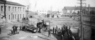
Yoshkar-Ola was founded in the 16th century as a military fortification. The city is the capital of the Republic of Mari El. With a satellite map of Yoshkar-Ola you can see that the urban area runs along the banks of the Malaya River.
Currently, the city is an important industrial and scientific center of the country.
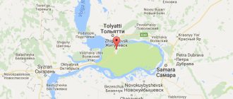
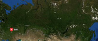
The city has common borders with Chuvashia, the Kirov region, as well as with the Tatar Republic and the Nizhny Novgorod region. This is clearly demonstrated by the Yoshkar-Ola map diagram.
The Volga River flows at a distance of 50 km from the city limits.
There are railway lines running through the city, leading to Kazan and Moscow.
Where is Yoshkar-Ola?
Yoshkar-Ola is a Russian city located in the center of the Volga-Vyatka region and is the capital of the Mari El Republic.
Yoshkar-Ola is also the administrative center of the Yoshkar-Ola urban district, which is located on a flat area, in the central part of the Mari Lowland, on the right and left banks of the Malaya Kokshaga River. The distance to the Volga River is 50 km to the north. The approximate population is 268 thousand people, the territory area is 100 square kilometers. Yoshkar-Ola is surrounded by the lands of the Medvedevsky district of the Mari El Republic. In the northern part there are water meadows in the floodplain of the Bolshaya Oshla River, forests; from the west - farmland; in the south there are forested areas. The climate in the city is temperate continental, characterized by long, cold winters and warm summers. The annual precipitation rate is 548 mm. The height of the city above sea level is 100 m. The terrain is flat, with a general slope towards the floodplain of the Malaya Kokshaga River. The elevation differences within Yoshkar-Ola are about 5 m.
Yoshkar-Ola is located in the same time zone as Moscow, the offset relative to Coordinated Universal Time (UTC) is +3.
Location and geography of Yoshkar-Ola
On the map of Russia, Yoshkar-Ola occupies 101.8 km2 and is located in the central part of the republic. The internal administrative division of the city territory was abolished under Soviet rule. The settlement is surrounded on all sides by the Medvedevsky district. The map scale is adjusted by the “+” and “-” symbols on the side.
Natural objects
The republican center is located on the Mari Lowland in its part called the Orshano-Kokshag Plain. The height from sea level is from 87 to 110 m. The increase goes from west to east.
The Malaya Kokshaga River flows through the city. In the central part of the settlement it forms a reservoir; dams are located in the center and the Shiryaykovo microdistrict. In addition to the main river, its tributaries flow through Yoshkar-Ola: Shoika, Bolshaya Oshla and Nolka. All of them belong to the Volga water basin.
Lake Chikhaidarovo is located on the southern outskirts.
Protected natural areas include:
- Botanical Garden of PSTU.
- Pine grove with preserved centuries-old trees (22 specimens).
- Oak grove with naturally growing oak trees, artificial plantings of Prussian poplar, Manchurian walnut and Siberian larch.
Climate
The climate of Yoshkar-Ola is temperate continental with distinct seasons. The natural zone is transitional from taiga to mixed forests.
The average temperature of the summer months is +17.2º C. The warmest of them is July – 24.5º C. In some years the maximum reaches +35º C.
Winter is cold and with little snow with an average temperature of -12º C. The coldest month is January - up to -18º C. Minimum values are -47º C.
Precipitation per year is 550 mm, of which 130 mm is in the form of snow.
Using our map, you can find the nearest rivers, lakes and forests yourself. Routes passing through the city.
Yoshkar-Ola Airport
There is an airport in Yoshkar-Ola, which has the status of an airport of federal significance. Airfield type: civil. The distance from the city center to the airport is 7 km. The airfield is equipped with an asphalt concrete runway. The width of the runway is 45 meters, length is 2.4 km.
Popular flights from Yoshkar-Ola airport: Kaliningrad, Anapa, Moscow, Rostov-on-Don, Astrakhan, St. Petersburg, Krasnodar, Volgograd, Sochi, Saratov, Surgut. The airport accepts regular and charter flights. In one hour it is capable of serving up to 5 aircraft and up to 100 passengers. The airport's annual passenger traffic is more than 700 thousand people.
Map of Yoshkar-Ola with streets and house numbers
Using the Yoshkar-Ola map you can find any address, district, house, street. The map has several modes. If you need a schematic map with addresses, then choose “Scheme” or “People’s Map”. In the “Satellite” mode, you can admire high-quality satellite images of the selected area, find your home and see interesting places.
If necessary, you can move the Yoshkar-Ola map, zoom in and out. Zooming out on the map you will see the location of the city on the map of Russia and the main roads leading to it.
Train Station
The Yoshkar-Ola railway station is a station in the Kazan region of the Gorky Russian Railways, which is located on the 106th km of the Zeleny Dol - Yaransk section. The number of platforms is 2, the number of departure tracks is 10. The railway station is located at st. Yanalova, 3. The railway station building houses a spacious waiting room, ticket offices, and storage room for luggage and personal belongings. There is also a medical center and a cafe at the station.
A long-distance train departs from the Yoshkar-Ola railway station in the direction Yoshkar-Ola - Moscow. Suburban trains that go to Kazan and Tabashino are also serviced.
Transport infrastructure of Yoshkar-Ola
If some object is not on the Yandex map, turn on the 2GIS or OSM map.
The Republican Center has land and air transport connections with Moscow and neighboring regions.
To see the city of Yoshkar-Ola from a satellite with an overlay of roads, streets and house numbers, click the “layers” button and select “hybrid”.
Railway connection
The city is located on the branch Zelenodolsk (Tatarstan) - Yaransk (Kirov region). The main line belongs to the Gorky Railway. Diesel locomotives are used as locomotives. Railway station address: st. Yanalova, 3.
It runs from Yoshkar-Ola to Moscow and back. Suburban service is organized in the summer - to Kazan, Yaransk and Tabashino (local station).
Air transportation
Flights from the local airport, located 7 km north of the city, operate only to Moscow 5 times a week.
Bus stations of Yoshkar-Ola
The bus station in Yoshkar-Ola is located at Kokshaysky proezd, 19, next to the station square and the railway station. There is also a Pyaterochka grocery store near the main bus station building. The bus station is open every day from 6:00 to 19:30, without long technical breaks.
Popular routes of regular buses from the Yoshkar-Ola bus station: Vyatskie Polyany, Zvenigovo, Kazan, Kirov, Morki, Nizhny Novgorod, Kanash, Novy Toryal, Penza, Syktyvkar, Ulyanovsk, Ukhta, Cheboksary, Yaransk.
Map of Yoshkar-Ola with houses
Yoshkar-Ola is considered a city with rich vegetation and magnificent natural attractions. In the vicinity of the city there are forest areas and beautiful lakes. Many sanatoriums and various holiday homes are being built on the banks of reservoirs.
A map of Yoshkar-Ola with houses will help you find the most interesting sights of the city:
- For outdoor recreation, the city has well-equipped park areas. The best places include Chavaina Boulevard, as well as the cultural park and Victory park area. There are beautiful fountains in the park areas. One of them is cascading.
- The embankment is a great place to relax. All buildings on it are made in the Venetian style. There are unusual monuments on it: Peter and Fevronia, as well as the Prince of Monaco and Queen Elizabeth.
- A map of Yoshkar-Ola with streets in good quality will help you find the national gallery on Obolensky-Nogotkov Square. The Tsar Cannon and other monuments are located on this square.
- There are many unusual structures in the city. These are ancient buildings that once belonged to merchants. These include the Naumov mansion, created in the 19th century. As well as a library building or a house of unions.
- There are theaters and cinemas in the city.
- One of the important attractions of the city is the botanical garden. It can be found using a map of Yoshkar-Ola by district. It is located on an area of 70 hectares.
- A unique collection of century-old pines can be viewed in the pine grove. This natural complex is located in the eastern part of the country.
- The most beautiful plants and trees can be seen in the oak grove. Not only mighty oaks grow on its territory, but also Manchurian walnut and even Siberian larch.
- On the most beautiful street in the city, Voznesenskaya, you can find a history museum. This will allow you to make a map of Yoshkar-Ola with house numbers. The museum is located in an old mansion. More than 20 thousand interesting exhibits are stored in its premises.
- The halls of the national museum contain jewelry, weapons and costumes from the 19th century. It also stores ancient printed publications.
There are many old churches in the city. The Trinity Church is considered one of the first buildings made of stone. It is a monument of Russian architecture of the 17th century.
The Yoshkar-Ola routes on the map will not allow you to get lost on unfamiliar streets and will help you find all the religious buildings.
Automobile highways
Federal highways pass through Yoshkar-Ola:
- P176 “Vyatka” is a federal highway. The total length of the route is 872 km. The road originates in Cheboksary and passes through Yaransk, Kotelnich, Yoshkar-Ola. The final point of route P176 is the city of Syktyvkar. The road surface of the route is asphalt concrete.
- A295 is a federal highway with a total length of 126 km. The road starts in Yoshkar-Ola and passes through Zelenodolsk and Volzhsk. The end of route A-295 is the M-7 Volga highway.
Economy and industry
A detailed map of Yoshkar-Ola will allow you to find more than 80 enterprises that belong to industry. The largest organizations include Stroykeramika, Vodokanal, a meat processing plant and some manufacturing enterprises.
There are many construction companies in the city. There are many firms involved in small business. These are organizations that produce plastic structures, furniture, and bakery products.
Yandex maps of Yoshkar-Ola will help you find organizations related to the trade sector.
What is Yoshkar-Ola known for?
- In the central part of Yoshkar-Ola there is Obolensky-Nogotkov Square. In the very center of the square there is a monument to the Russian military leader I. A. Nogotkov-Obolensky. The entire space of the square is laid with stone tiles. The territory of the square is decorated with forged lanterns. Also on the square is the building of the National Art Gallery, which is made in the Venetian style.
- An unusual place for Russian cities is the Bruges embankment, which is designed with reference to the architecture of Northern Europe. On the embankment there are houses with colorful facades and decorative turrets that are reminiscent of buildings in Belgium.
- In 2009, the Tsarevokokshay Kremlin was built in Yoshkar-Ola. The Kremlin was built on the site of a wooden fortress. At the current time, this is the youngest defensive building in Russia.
- Also in Yoshkar-Ola there is a sculptural composition “12 Apostles”, which is based on the biblical story telling about the arrival of Christ in Jerusalem. The height of each figure in the complex is 1.5 m.
Avenues and streets of the city
The city is crossed by various avenues, highways and beautiful squares.
A map of Yoshkar-Ola with streets will allow you to find the following streets and highways:
- Leninsky Prospekt runs from Lebedev and ends with the Mashinostroiteley highway.
- More recently, Tsargradsky Avenue was formed.
- At the intersection of Pervomaiskaya and Pushkin streets you can find Pushkin Square.
- On the territory of the central park there is a square of military glory.
- Gogol Square is located on the embankment called Amsterdam.
- A map of Yoshkar-Ola with streets and houses will help you find Victory Boulevard. It reaches Sverdlov Street.
- The Belinsky highway runs between Pavlova and Koltsova streets.
There are three embankments in the city. On the right bank of the river there is Voskresenskaya embankment. The Amsterdam embankment stretches from Pushkinskaya Street to Gogol. The Bruges embankment runs along the left bank.
The city includes more than 20 different villages. The map of Yoshkar-Ola will help you find them.
The city is geographically divided into many microdistricts. In addition, some settlements belong to the city territory.