This term has other meanings, see White.
Coat of arms
| City | |
| White | |
Moscow
Tver
White
Media files on Wikimedia CommonsWhite
- a city in the Tver region of Russia.
The administrative center of the Belsky district, in which the municipality of the city of Bely
with the status of an urban settlement as the only settlement in its composition[3].
Population - 3057[4] people. (2021).
History[ | ]
Coat of arms (1780)
See also: Trinity Cathedral in Bely
White Fortress
known since the 13th century as a fortified city of the Smolensk principality, later as the center of an appanage principality.
In 1355 Belaya was occupied by Lithuania; one hundred and fifty years later it went to Russia. But the period of Moscow jurisdiction lasted relatively short.
A hundred years later, in 1610, after a 4-month siege, it was taken by Polish-Lithuanian troops. White becomes a bargaining chip in trades between Russian and Polish-Lithuanian rulers.
In 1613, the fortress, due to the futility of further resistance, capitulated, that is, it was surrendered to the Russian troops of Prince Dmitry Pozharsky without a fight. The garrison consisted mainly of Scottish and Irish mercenaries in Polish service, a significant part of whom, having been captured, went into the service of the Moscow sovereign and formed a separate company of the “foreign system”, known as the “Bieł Germans”.
In 1618, the city, by agreement, was again ceded to the Polish-Lithuanian Commonwealth. On May 2, 1625, the city received from the Polish king Sigismund III the privilege of Magdeburg Law[k 1]. Bely also became the center of one of the parishes of the Catholic bishopric of Smolensk[9]; Due to the small number of such parishes, the division of the diocese into deaneries was not carried out.
At the beginning of the Smolensk War of 1632-1634, the city of Belaya was occupied by Russian troops. In 1634, at the last stage of the war, the city experienced a two-month siege by the Polish-Lithuanian Commonwealth troops led by King Władysław IV himself. As a result of a successful foray from the fortress, the king was wounded. The heroic defense of the city by a small garrison of Russian troops (just over 1000 people) had a favorable effect on peace negotiations. According to the Peace of Polyanovsky on June 4, 1634, the city was returned to the Polish-Lithuanian Commonwealth. Soon after this, Vladislav IV confirmed Bely's city privileges. In 1654, the city of Belaya again became part of the Russian state.
From 1708 to 1929 the city was the center of the Belsky district of the Smolensk province.
In 1806, the construction of the Trinity Cathedral was completed in the city (destroyed during Soviet times). In 1807, the Resurrection Church was built (also not preserved)[10].
During the Great Patriotic War, the city was occupied by the troops of Nazi Germany. On March 10, 1943, the city was liberated by the 119th Rifle Division of the Red Army.
On July 5, 1944, the city was transferred from the Smolensk region to Velikolukskaya[11].
Since 1963, as part of the Kalinin region (since 1990 called Tver)[12].
- Pre-revolutionary photographs of the city
Economics [edit]
The area has potential for the development of local history tourism; a tourist passport of the area has been drawn up. The main tourist routes are connected with the events of the Great Patriotic War. [16]
Industry[edit]
Timber and food industry enterprises are located in Bely. [16]
Transport[edit]
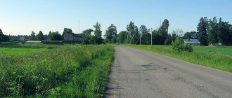
The asphalt road connecting Nelidovo and Smolensk through Dukhovshchina passes through Bely. There are local roads. The nearest railway stations are at Nelidovo (on the railway connecting Moscow and Riga via Velikiye Luki) and Vladimirsky Tupik (the terminus of the railway leaving at Safonovo from the line connecting Moscow and Smolensk.
Population[ | ]
| Population | ||||||||
| 1856[13] | 1897 | 1913[13] | 1931[13] | 1959[14] | 1970[15] | 1979[16] | 1989[17] | 1992[13] |
| 6200 | ↗7000 | ↗13 600 | ↘5800 | ↘4126 | ↗4846 | ↗4945 | ↗5228 | ↗5300 |
| 1996[13] | 1998[13] | 2001[13] | 2002[18] | 2003[13] | 2005[13] | 2006[13] | 2007 | 2008[19] |
| →5300 | ↘5200 | ↘4900 | ↘4350 | ↗4400 | ↘4100 | ↘4000 | ↘3900 | ↘3800 |
| 2009[20] | 2010[21] | 2011[13] | 2012[22] | 2013[23] | 2014[24] | 2015[25] | 2016[26] | 2017[27] |
| ↘3691 | ↗3772 | ↗3800 | ↘3655 | ↘3558 | ↘3432 | ↘3393 | ↘3311 | ↘3268 |
| 2018[28] | 2019[29] | 2020[30] | 2021[31] | |||||
| ↘3197 | ↘3154 | ↘3090 | ↘3057 | |||||
As of January 1, 2022, in terms of population, the city was in 1101st place out of 1116[32]cities of the Russian Federation[33].
Attractions[ | ]
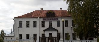
Exhibition hall of the Belsk Local Lore Museum.
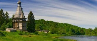
- Orthodox Church of Peter and Paul. Wooden, two-story, built in 1989. The only functioning temple in the city[34].
- Ruins of the historical Church of Peter and Paul (1817).
- Chapel at the Ilyinsky cemetery (55°51′04″ N 32°56′13″ E HGЯO). Stone quadrangle with a green roof. Built in the second half of the 2000s[35].
- Belsky Local Lore Museum. Founded in 1919 by collecting belongings of nobles from nationalized estates. Located at: Lenina Street, building 27.
- Monument to the T-34 tank[36].
- Obelisk to the fallen Beljians and partisans[36].
Notes[ | ]
- 2021AA
- Database “Ethno-linguistic composition of settlements in Russia” (undefined)
. - Law of the Tver Region of February 28, 2005 N 19-zo “On establishing the boundaries of municipalities that are part of the territory of the municipal formation of the Tver Region “Belsky District”, and granting them the status of urban and rural settlements”
- 2021AA
- The distance between settlements is given according to the Yandex.Maps service.
- History of the city of Bely (undefined)
.
tver.bezformata.com
. Access date: January 19, 2022. - Shestakov N.A.
The centuries-old litigation of Belsky citizens. (Essay from the history of the city of Bely, Smolensk province). - Smolensk, 1886. - P. 5-12. - Rogatschewski A.
Zur Rezeptionsgeschichte des Magdeburger Rechts in Rußland: Die Stadt Belyj (17.-18. Jh.) // Von Sachsen-Anhalt in die Welt. Der Sachsenspiegel als europäische Rechtsquelle. Internationale Konferenz aus Anlass des 800. Jubiläums von Anhalt vom 1.-3. Oktober 2012 in Köthen/Anhalt/Hrsg. von H. Lück unter Mitarb. von M. Olejnicki und A.-M. Heil (= SIGNA IVRIS. Beiträge zur Rechtsikonographie, Rechtsarchäologie und Rechtlichen Volkskunde. Bd. 14). - Halle an der Saale, 2015. - S. 198-202. - Relations status dioecesium in Magno Ducatu Lituaniae / Red. P. Rabikauskas (Fontes Historiae Lituaniae, II). Vol. II. Romae, 1978. P. 298-333.
- WHITE (undefined)
.
hram-tver.ru
. Access date: January 19, 2022. - State Archive in Velikiye Luki\\"Pskov Region" official website Archival copy dated November 17, 2012 on the Wayback Machine.
- Bely // Great Russian Encyclopedia: [in 35 volumes] / ch. ed. Yu. S. Osipov. — M.: Great Russian Encyclopedia, 2004—2017.
- ↑ 1 2 3 4 5 6 7 8 9 10 11
People's encyclopedia “My City”.
Bely (city) (undefined)
. Access date: June 25, 2014. Archived June 25, 2014. - All-Union Population Census of 1959. The size of the urban population of the RSFSR, its territorial units, urban settlements and urban areas by gender (Russian). Demoscope Weekly. Access date: September 25, 2013. Archived April 28, 2013.
- All-Union Population Census of 1970 The size of the urban population of the RSFSR, its territorial units, urban settlements and urban areas by gender. (Russian). Demoscope Weekly. Access date: September 25, 2013. Archived April 28, 2013.
- All-Union Population Census of 1979 The size of the urban population of the RSFSR, its territorial units, urban settlements and urban areas by gender. (Russian). Demoscope Weekly. Access date: September 25, 2013. Archived April 28, 2013.
- All-Union population census of 1989. Urban population (undefined)
. Archived from the original on August 22, 2011. - All-Russian population census 2002. Volume. 1, table 4. Population of Russia, federal districts, constituent entities of the Russian Federation, districts, urban settlements, rural settlements - regional centers and rural settlements with a population of 3 thousand or more (unspecified)
. Archived from the original on February 3, 2012. - Cities of the Tver region. Population estimate as of January 1, 2008 (thousands of people) (unspecified)
. Retrieved May 21, 2016. Archived May 21, 2016. - The size of the permanent population of the Russian Federation by cities, urban-type settlements and regions as of January 1, 2009 (unspecified)
. Retrieved January 2, 2014. Archived January 2, 2014. - All-Russian population census 2010. Populated areas of the Tver region
- Population of the Russian Federation by municipalities. Table 35. Estimated resident population as of January 1, 2012 (unspecified)
. Retrieved May 31, 2014. Archived May 31, 2014. - Population of the Russian Federation by municipalities as of January 1, 2013. - M.: Federal State Statistics Service Rosstat, 2013. - 528 p. (Table 33. Population of urban districts, municipal districts, urban and rural settlements, urban settlements, rural settlements) (undefined)
. Retrieved November 16, 2013. Archived November 16, 2013. - Table 33. Population of the Russian Federation by municipalities as of January 1, 2014 (unspecified)
. Access date: August 2, 2014. Archived August 2, 2014. - Population of the Russian Federation by municipalities as of January 1, 2015 (unspecified)
. Access date: August 6, 2015. Archived August 6, 2015. - Population of the Russian Federation by municipalities as of January 1, 2016 (Russian) (October 5, 2018). Retrieved May 15, 2022. Archived May 8, 2022.
- Population of the Russian Federation by municipalities as of January 1, 2022 (Russian) (July 31, 2017). Retrieved July 31, 2022. Archived July 31, 2022.
- Population of the Russian Federation by municipalities as of January 1, 2022 (Russian). Retrieved July 25, 2018. Archived July 26, 2022.
- Population of the Russian Federation by municipalities as of January 1, 2022 (Russian). Retrieved July 31, 2019. Archived May 2, 2022.
- Population of the Russian Federation by municipalities as of January 1, 2022 (Russian). Date accessed: October 17, 2022. Archived October 17, 2022.
- 2021AA
- taking into account the cities of Crimea
- https://rosstat.gov.ru/storage/mediabank/bul_Chislen_nasel_MO-01-01-2021.rar Population of the Russian Federation by municipalities as of January 1, 2022 (1.85 Mb, 07/30/2021)
- Bely, Church of Peter and Paul (undefined)
.
sobory.ru
. Access date: January 18, 2022. - Bely - Chapel at the Ilyinsky Cemetery (unspecified)
.
hram-tver.ru
. Access date: January 18, 2022. - ↑ 1 2
Monuments and obelisks of the city of Bely
(unspecified)
.
voina-bely.narod.ru
. Access date: January 18, 2022. - Directory of the Tver region (unspecified)
.
History of the settlement
Our city, as you know, belongs to the number of ancient cities of the Smolensk lands, which only in 1963. became part of the Kalinin (now Tver) region. Founded in 1350. It is picturesquely located on both banks of the winding Obsha River. The river divides its territory into two parts - the elevated and hilly left bank (southern) and the low-lying right bank (north) with a flat topography. After the turn, Obsha also serves as the western border of the city in its right-bank half. This part of the city is divided in two by the Vvedensky stream flowing into the river.
The pre-regular layout of the city (known from two plans of the 1760s) was determined by a number of factors: the direction of the main roads connecting Bely with large neighboring cities; the location of the ancient fortress and settlement with trading; natural and topographical features of the area. On the western outskirts of Bely stood the ramparts of the former fortress, then called the Zemlyanoy Gorod, which encompassed both ancient fortifications - the Upper and Lower Towns. There were also wooden buildings of public places and houses of the church clergy. This was typical for the first half of the 18th century. Church and administrative city center.
To the east of the rampart there was a long trading area with wooden rows of shops. The earthen city and the trading area created the main transverse axis of the left bank, reaching almost to the very bank of the Obsha. Visually, this axis was oriented towards the center of the bend of the river, which here bends strongly in an easterly direction, forming a vast cape. Probably, it was in this place that there was a crossing over the Obsha, connecting the two parts of the city. The main street of the left bank ran perpendicular to the axis of the shopping area in a southern direction, which after turning turned into the Smolensky tract.
Small in size, irregular in outline, the building blocks created a complex network of streets and alleys of different and uneven widths. The general arrangement of the blocks was largely subordinate to the shorelines of Lake Veseloye and the Obsha River, which limited the territory of this part of the city. The winding river bed determined the complex shape of most of the blocks, and the straight line of the lake shore predetermined the regular rectangular configuration of the blocks located along it.
In the right bank part of the city, the territory was divided into much larger blocks of a rather simple, although also irregular shape. Their location was completely subordinated to the winding banks of the river and the Vvedensky stream flowing into it.
The streets here were wider, the trajectories were less broken, the red lines were straighter. These features were obviously explained by the smooth, flat topography of the northern part of the city. The direction of the two main streets on the right bank was determined by the roads to Toropets (to the north) and to Rzhev (to the east). A significant territory along the right bank of the Obsha was occupied by the courtyard of the Vyazma merchant Gaidukov.
In 1748 and 1762 In Bely there were severe fires that destroyed a significant part of the city's buildings, incl. and wooden churches.
The wooden buildings of the city before its regular redevelopment consisted of one-story thatched huts with fiberglass windows. In the depths of the courtyards there were barns or forges. Vast areas were occupied by gardens and vegetable gardens. On the right bank side they were significantly larger in size than the area of the building itself.
In 1769, Bely became a district town of the Kyiv governorship, and in 1776 - of Smolensk. In 1780, the city’s coat of arms was approved: “Two white bags with coarse flour, tied with gold cords, in a green field, letting you know that at this noble pier a great trade is carried out with this product.”
A regular city plan was approved in 1769, the first in Russia. The reason for its compilation was the severe fires of 1766-1767, which destroyed almost the entire building of the city. The first project was completed in the fall of 1767 by the architect Obukhov. This plan served as the basis for the final project for the regular reconstruction of Bely. For the stone construction of the city at the beginning of 1768, it was planned to use the same five projects (known from copies by A. Kvasov). which were approved by Catherine the Second as exemplary for Tver, and for the wooden one - the exemplary project of M.F. Kazakov, also “following the example of the Tver structure.”
However, during the implementation of the regular plan, approximately after 1776, when Bely became part of the Smolensk province, the project underwent significant changes. Some important city structures were also located differently. Of all the planned squares, only the diamond-shaped square on the left bank (now K. Marx Square) was realized. The second (not included in the project) Horse Square occupied the cape of the left bank of the Obsha, approximately opposite the site of the unrealized trading area. One of the longitudinal streets of the city (now Yaroslavskaya Street) is oriented towards it, on the axis of which St. Nicholas Church stood two blocks to the south.
At the same time, the implemented layout takes into account the direction of the roads passing through the city: the trajectory of the Smolensk highway is continued by the main street of Bely - Bolshaya Smolenskaya, currently Lenin Street.
In the right-bank part, the trajectory of the widest and longest Toropetskaya street was determined by the Toropetsk tract, and one of the main transverse streets (now Svobody Street) was continued by the road to Rzhev. On the northern outskirts of Bely, on the right bank of the Obsha, there was a pier, so important for the well-being of the city in the late 18th and 19th centuries.
In the first quarter of the 19th century. The first stone residential buildings appeared. In 1825 there were three of them (wooden - 772). Only in the second quarter and mid-19th century. stone residential construction in Bely received some development. In 1858, there were 12 stone and 5 semi-stone houses (with a total number of slightly more than 1000 buildings).
By the second quarter of the 19th century. includes a number of measures to improve the city. In 1838, a city garden was laid out along the perimeter of the ramparts of the ancient fortress.
By 1861, thirteen streets had stone pavement, and the city was illuminated by 48 lanterns. There was a floating bridge across the Obsha, which was replaced by a cast iron bridge in 1905.
The stone St. Nicholas Church was erected in 1754 by order of P.Yu. Bogdanovich and M.G. and Yu.G. Pensky.
In 1769, at the expense of the merchants Pirozhkov, a new Trinity Cathedral began on the site of the wooden one (completed in 1804 -1806).
Particularly important for the architectural appearance of the city was the construction of three new stone churches on the site of the previous wooden ones: Resurrection (1807) and two cemetery churches - Ilyinskaya (Blagoveshchenskaya) in 1814. and Petropavlovskaya in 1817
Obviously, in 1810 -1820. On Horse Square, in front of the government buildings, stone shopping arcades (not preserved) were built, replacing wooden ones.
In the second half of the 19th century. and the beginning of the 20th century. Bely was built up with a large number of stone public and residential buildings of one or two floors. A significant proportion of them were two-story, rather large buildings. This greatly changed the architectural appearance of Bely, giving it a truly urban look.
Despite the severe destruction of the city during the Great Patriotic War of 1941 -1945. and the almost complete demolition of churches, Bely retained a number of features of its historical appearance.
The post-war development of Bely generally does not violate the historical layout of the city. However, its historical silhouette suffered irreparable losses due to the destruction of the Trinity Cathedral, St. Nicholas and Resurrection churches.
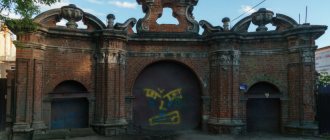
Along with the regular layout and historical civil development, Bely is currently valuable for the well-preserved ramparts of the ancient fortress and the rich, picturesque landscape.
Before moving on to an overview of the streets of our city, I would like to give a list of street names in 1921. It is possible that it is not complete. Unfortunately, this is all we have been able to find so far.
List of streets in Bely (1921): Streets Arestnaya, Bazarnaya (Torgovaya), Bolotnaya, Bolnichnaya, Bolshaya Motorinskaya, Vvedenskaya, Voskresenskaya embankment, Vyazemskaya, Guseva, Dumskaya, Ilyinskaya Sloboda, Kirpikova, Kleimenkova, Kolodeznaya, Krivaya, Levchenkova, Bolshaya Smolenskaya, Malaya Smolenskaya, Malaya Motorinskaya, Nikolaevskaya, Ozernaya, Ostrovok, Podgornaya, Puzyreva (Puzyrevskaya), Petropavlovskaya Sloboda, Rzhevskaya, Sentyurin lane, Skladskaya, Sobornaya, Soborny impasse, Spiridenkova, Toropetskaya, Sharonova, Sherkova, Green. As we can see, only a few streets reached us without being renamed - Bazarnaya, Ozernaya.
The Birch Grove Park was planted on the site of the former street. Podgornaya, which ceased to exist somewhere in the mid-60s of the 20th century. But even now in conversation we often mention the old name of this place.
St. Arrestnaya st. now. Smirnova. Apparently, it was on it that the arrest house was located, whose trustee at the beginning of the 20th century. was Anatoly Vitoldovich Dovgyalo-Khmorovich, and the caretaker was the nobleman Sergei Ivanovich Dubovsky.
Bazarnaya Street was formerly called Torgovaya Street. There was a square at the bazaar, which was located in the place where the covered market and other buildings are now.
There was also a paid carousel with beautiful painted horses. It was set in motion manually by three hefty men assigned specifically for this purpose.
Nearby there was a teahouse, where everyone who came to the market or fair certainly tried to dine. In 1898, the county Committee of Trusteeship for National Sobriety opened a free library-reading room at the teahouse.
In house No. 5 on the street. Bazarnaya (modern numbering) housed the rooms of the Karabanovs' hotel. In the same building before the Great Patriotic War there was a private photograph (entrance from the courtyard), and after the war there was a regional library for some time.
Where the water pump is now, opposite the Bistro, there was Lyubavin’s hairdressing salon. The owner himself lived opposite (now house No. 14).
The landmark of the city was the metal bridge over the Obsha River. Single-span, 50 - 60 meters long, it was remarkable in that it was built according to the design of the famous E.O. Paton. In Professor Paton’s course “Sketches of Bridges”, in which more than one generation of students at railway universities studied, the Belsky Bridge is described and its diagram is given.
Near the bridge, in the area of the current savings bank, there was a federal protective organization and a store with various accessories for horses, as well as the “Red Sewing Worker” artel. Next to the clinic, where there is now a small square, there was a two-story courthouse.
For a long time, the old name remained with Bolnichnaya Street. Relatively recently it was renamed the street of the 1st Mechanized Corps. And it was called that in connection with the place located on it at the end of the 19th century. an entire hospital town. The building of the hospital itself stood approximately on the site where the territory of the former communal services is now. It was built in 1888 – 1890. and was a huge two-story stone house with basements and outbuildings: two wooden barracks, a stable, a brick kitchen and laundry room, a wooden chapel, a gazebo for the sick, a water pump, and a wooden bathhouse. There was a small park in front of the main building. A supply of dry firewood (approximately 600 horse-drawn carts) was stored in the yard. The hospital had 6 rooms, each for 12 people, and a maternity ward.
During the Great Patriotic War, the Germans set up a stronghold in the hospital building. When liberating the city, our troops had to blow up the house. As a result of this, the city forever lost a beautiful ancient building. And in the red brick building preserved on the corner of modern K. Marx and 1st Mechanized Corps streets, before the war there was a two-year medical school (similar to a modern medical school), and there was a dormitory nearby.
On Bolnichnaya Street, near the suspension bridge, medical personnel lived in a stone two-story house. It is also known that where house number 17 is now, there was a residential building of A.V. Anisimov. Let me remind you that Alexander Vasilievich Anisimov was in charge of the Belsk regional hospital from 1921 to 1929. Subsequently, he became a famous doctor - Doctor of Medical Sciences, head of the department of the Ivano-Frankivsk Medical Institute.
Pugachevskaya Sloboda is the former Ilyinskaya Sloboda (next to it is the Ilyinskaya Cemetery Church), and Krasnogvardeyskaya Street was formerly called Petropavlovskaya Sloboda, because there was a cemetery with the church of St. Peter and Paul.
Bolshaya Motorinskaya and Malaya Motorinskaya streets were adjacent to the Belskaya pier. According to legend, they received their names in honor of their founder, the Belsk merchant Motorin, the owner of one of the city’s private marinas located in the area of these streets. In the old days, they were inhabited mainly by working people, the poor, and small artisans who ensured the operation of the pier.
After the October Revolution of 1917, Motorinsky streets were renamed Bolshaya Proletarskaya and Malaya Proletarskaya. At that time, there were 26 houses on Bolshaya Proletarskaya, and 13 on Malaya. Unfortunately, during the Great Patriotic War they were burned. And subsequently, due to their flooding during spring floods, by decision of the City Council, the restoration of the streets was considered inappropriate.
Skladskaya Street in the 70s was renamed Berezina, in honor of General Dmitry Berezin, commander of the 119th Infantry Division, which fought continuous battles throughout the city and region throughout the year. And the street received its first name - Skladskaya - for the warehouses located on it. For example, the procurement office occupies the building of a former wine warehouse. After the revolution there were military barracks here, and before the war there were garages of an agricultural technical school, and Gagarin Street was called Ogorodnyaya.
Modern Yurkova Embankment used to be called Voskresenskaya, because The Church of the Resurrection stood on it. Now on that site there is a former food industry office.
Modern Pravda Street is the former Nikolaevskaya Street (above, on the mountain, stood the Nikolskaya (or Nikolaevskaya) Church. The people's court building on it is located in the former house of the merchant V.V. Grekov. Trade was carried out on the first floor, and living rooms were on the second. The entrance to the store was from the corner of B. Smolenskaya Street. The store sold, among other things, Singer sewing machines. In the 20s, the house was occupied by the district party committee. From the openwork balcony (now removed due to disrepair) the district leadership welcomed demonstrators on holidays days May 1 and November 7. Then, until 1991, the district executive committee was located here, then the people's court moved in, which is still located in this building.
1st May Street is the former Cathedral Street leading to the Trinity Cathedral, which was located in the area of the modern city stadium (to the left of the entrance). Pine trees are now planted there. At the beginning of Cathedral Street (opposite the modern pharmacy) stood the architecturally magnificent building of the Noble Assembly.
In 1918, a club was opened there - the city People's House named after Lenin, which was the center of cultural work in the city of Bely. Many circles worked under Nardom, and a folk theater was created under the leadership of a professional actress from St. Petersburg, Nina Alekseevna Kazbich. The city choir was directed by Nikolai Vasilyevich Morskoy. There was a wonderful brass band at the club. For some time, the building housed the city library on the ground floor. During the years of German occupation, the premises of the Nardom were occupied by the fascist Gestapo. The building was heavily guarded, and no one knew what was happening within its walls - one could only guess. Before retreating, the Germans blew up the house along with captured Red Army soldiers, partisans and civilians.
The Cathedral Dead End is an alley next to the entrance to the city rampart, in which house number 6a stands.
Taken together, the modern streets of K. Marx, Krasnoarmeyskaya and the middle part of the 1st Mekhkorpus street used to make up Vyazemskaya street. The Zhegalov family lived on Vyazemskaya and moved to Moscow in the 1920s. Their son Nikolai Nikolaevich Zhegalov was a candidate of philological sciences, an employee of the Institute of World Foreign Literature named after. Gorky. In the 80s, he came to visit his hometown, then carried on active correspondence with the central library, which to this day stores books donated by N.N. Zhegalov, with the author's autograph.
K. Marx Square - former Sennaya Square. There was a religious school on it, which occupied one of its diamond-shaped sides. In 1889-1890 at the expense of the merchant M.F. Reznikov, the house church of Alexander Nevsky was added to the school building.
Oktyabrskaya Street was formerly called Toropetskaya. It was the widest and longest street in the city; the Toropetssky tract ran along it. On it, in the area of the modern bus station, there was a prison building, or rather, the Belsky Prison Castle, built around 1848. The collegiate registrar Arkady Brown was then appointed keeper of the castle.
On Toropetskaya Street, approximately where the central library building now stands, only a little closer to store No. 11, before the revolution there was a Kobylinsky confectionery factory. After the revolution, before the war, the Collective Farmer's House was built on its premises. During the war the building was destroyed and could not be restored. Where there was a cafe in Soviet times, there used to be Goncharov’s beer hall.
Not far from the Ilyinsky cemetery there was an architecturally interesting building of the Zenbitsky shelter, destroyed during the Great Patriotic War. Now only a photo in the regional local history museum reminds of him.
On Toropetskaya Street, in a house opposite the bridge over the Obsha (former glove factory), a women's vocational school was located. It taught girls needlework, cutting, sewing, and lace-making. The school existed for 5 years, opening in 1912 and closing in 1917. Its premises later housed a teachers' seminary, transformed into pedagogical courses in 1919, and in 1924-1925. - to the pedagogical college.
On Rzhevskaya Street (now Svoboda Street), the Klevitsky merchants kept a large store.
Before the revolution, Kirov Street was Malaya Smolenskaya Street.
Until the war of 1941-1945. On the territory of the modern district hospital there was a tuberculosis dispensary, which for many years was headed by the doctor Vladimir Vladimirovich Schmidt. Then the dispensary bore his name.
Old-timers well remember the sign above the entrance to the dispensary building (now there is a therapeutic department of the Central District Hospital) “Tuberculosis dispensary named after V.V. Schmidt.”
The doctor himself lived on his estate not far from the city. It was located on a mountain between the villages of Popovka and Filyukino. There was also a Schmidt family cemetery there.
Before the war, on the site of the Raipo hardware store there was a residential building. In the 60s of the 20th century there was a bakery that operated until a new bakery was put into operation (late 70s). And the vast territory up to Vyazemskaya Street (now K. Marks Street) was occupied by a warehouse for recyclable materials. In addition, they accepted animal skins from the population. Opposite, across the road, where house number 20 is now, there was a wooden store from “Vtorosyrya”, in which residents of the area, having handed over recyclable materials, could shop and purchase some goods in return. For example, ribbons, bone combs, etc.
Opposite the hardware store is house number 22. This stone two-story house was much longer in the old days. The entrance to the courtyard was decorated with a stone arch. The first floor was occupied by a tavern, and on the second there were two residential apartments, one of which was occupied by the director of the men's gymnasium, Adam Khristoforovich Allazh.
Above this house stood the building of a kindergarten, which occupied the territory, including the one where the forestry industry garages are now located. The two-story house on the opposite side of M. Smolenskaya Street (now it is Kirova Street, No. 21) belonged to the wealthy merchant family of the Krutelevs.
A lower agricultural school was opened on Malaya Smolenskaya Street in 1912. It was located in a building that is now occupied by a special school. Then an agricultural technical school was opened at its base. The technical school's subsidiary farm was located in Alexandrina (about two kilometers from the city) on the former Kraevsky estate.
Until about 1929, the Kraevsky brothers Konstantin and Alexander Genrikhovich taught mathematics and physics at the technical school. Before the war, the technical school was moved to the building where Lyceum No. 20 is now.
Before the revolution, Socialist Street was called Green.
In the old days, the streets of Engels and Kuibyshev were called Pryadilnaya and Verevochnaya. It was these crafts that its inhabitants were engaged in.
Nila Petrov Street is the former Kolodeznaya, and Dovator Street is Bolotnaya, because behind it began marshy lands. By the way, on the corner of this street and Bolshaya Smolenskaya (now Lenin Street, no. 38) there was a solid house of Stanovenko, whose granddaughter Elena Andreeva became a famous writer. Opposite Stanovenko’s house on the other side of Bolotnaya Street there were “V.E. Morsky’s Furnished Rooms.”
Trofimova street was previously called st. Gusev, named after the wealthy landowner who lived on it.
Gorky Lane behind the Snake Bridge is the former Vvedenskaya Street, which got its name from the Vvedensky Stream flowing here. Now for some reason it has been renamed Zmeiny, perhaps having forgotten the old name. Most likely, it was in this place that the Vvedensky Monastery stood in ancient times. His further fate is unknown. Perhaps it burned down during one of the strongest fires, which in the old days almost completely destroyed the city more than once.
Krivaya Street began at the Lykoshins’ house (now the district’s canteen is located on this site), then it went into an alley leading to Lake Vesely and ended at the intersection with the street. Sobornaya (now it is 1 May Street) near the house where the treasury is now located.
The island is a place near the Obsha River, where there used to be a garden plot for a high school. Previously, houses stood on it and people lived there.
City streets were renamed several times. In 1927, the Presidium of the Belsky District Executive Committee decided to rename Arestnaya Street to Smirnova Street. Voskresenskaya embankment was named Yurkova embankment, Voskresenskaya street became Yurkova street. And Gusev Street and Puzyrevsky Lane were merged into Trofimova Street. Eleven years later, a new decision was made: Sentyurin Lane was renamed Oktyabrsky, Kozhevenny - Voykova Street, Kalpachnikov - Kolodezny Lane, Kustarnaya Street - Chkalova. Novopryadilnaya street - to Kuibysheva street. Spiridenkova and Pryadilnaya streets are united into Engels Street.
I would like to say a few words about the resting place of Belt residents - the city rampart, on which a park was laid out in 1838. The entrance to the shaft before the war was in the same place as it is now. Immediately to the right of the entrance there was a ticket office where entrance tickets were sold. About 5-6 meters from the cash register there is a beautiful low fence with a gate where the controller stood. Further upward there was a path, along the edges of which lindens, oaks, and yellow acacia grew. On the hill to the left stood a mighty oak tree, three girths long, near which dances took place. The brass band was located nearby in a gazebo.
In place of the modern dance floor there was an open theater with a stage and wooden benches for spectators. There was a restaurant to the left. Where there used to be a children's carousel with horses, on weekends there was a visiting reading room from the city library.
The trees on the rampart were planted in alleys, each of which had a name: waiting alley, dating alley, love alley. In the evening the gorwal was well lit. It opened in May and closed in September. It was the favorite and only vacation spot of the Belize residents.
The main street of our city is Bolshaya Smolenskaya (Lenin Street).
It began on the embankment of the Obsha River, where there was a horse market and a parking lot for horse carts. The largest and most beautiful buildings decorated this street. This can be judged from old photographs and from those buildings that survived the Great Patriotic War.
The red brick building of the former people's court belonged to the Romadins before the revolution. Advertisements have been preserved in the “Calendar - Yearbook of the Belsk Zemstvo” for 1914. One of them reads:
“Rooms of Ivan Pavlovich Romadin, Bely, Smolensk province, Bolshaya Smolenskaya street, own house. Always warm, dry, conveniently located. Kitchen. Nice stables. Warning attitude. Cheap. Trade: Flax, flaxseed, clover, vetch, timothy and flaxseed for sowing, raw and made leather goods.”
On the site of house No. 10 there was a two-story house in which there were two shops of the merchant Ivan Ivanovich Bogomolov, an honorary trustee of the higher primary school, a hereditary honorary citizen, a member of the board of trustees of the women's gymnasium.
Before the war, on the site of the KBO there was a restaurant of the regional consumer union. Nearby there was a dining room where ordinary people could have an inexpensive and tasty lunch.
The building, which is now occupied by the police department, before the revolution belonged to the German Vladimir Ivanovich Grenberger, who was engaged in baking bakery products.
There was a large metal pretzel hanging over the front porch of the house. The range of products was very diverse, and the quality was the highest. The bakery was in the basement, there was a store on the first floor, and the Grenberger family lived on the second. After the NEP, the bakery was requisitioned. The former owners moved to a house that stood on the site where house number 3 on Kirova Street is now. In the 30s, the Grenbergers moved to Moscow, where Vladimir Ivanovich got a job in his specialty and even rose to the rank of head of a confectionery shop.
Opposite the building of the police department on the other side of Lenin Street there is house No. 12, built in pre-revolutionary times by the merchant Zenbitsky. Only it was not two-story, as it is now, but had a height of one and a half floors.
The women's gymnasium was located higher up in a building specially built at the expense of the merchant Zenbitsky. Vera Kapitonovna Tsyzyreva, mother-in-law of Mikhail Nikolaevich Zenbitsky, was the head of the girls’ gymnasium for twenty-five years. Since then, the building has always been used for its intended purpose.
During the Soviet years, it housed a secondary school, then primary schools.
On the other side of the street stood two solidly built houses with outbuildings of the merchants Reznikovs - father and son, hereditary Honorary Citizens of the city of Bely.
On the site of the department store building stood the son’s house (destroyed during the war), and the surviving father’s house now houses the post office and telegraph office. Before the war, its premises were occupied by the city library and museum.
The Reznikovs also owned a two-story house, which currently houses the editorial office of the regional newspaper Belskaya Pravda. In the post-war years, at various times there was a Pioneer House and a library here. Above this house stood the building of St. Nicholas Church.
Where Lenin Square is now, in the old days there were two two-story houses close to each other. The first one, next to the women's gymnasium, belonged to the merchant Golovlev (1st floor - store, 2nd - family lived).
After the revolution, it was first occupied by a library, then by the city council and the district store. In another house (the first floor is stone, the second floor is wooden) the Suslov family lived. Its head, Sergei Vasilyevich Suslov, was a notary by occupation.
Approximately in the place where the Oktyabr cinema is now, there was another two-story building that belonged to the Golovlevs. Before the war, there was a regional consumer union store on the ground floor and a pharmacy on the second. But who was the owner of the building in which the pharmacy is currently located has not yet been established. It is only known that before the war it housed a two-year school for tractor drivers.
Where the playground is now, stood the house of the German merchant Nikolai Pavlovich Steckle, who, after the requisition, moved with his family to live on Bolshaya Motorinskaya Street. In 1937, N.P. Shtekle was repressed.
On the site of the hotel, a merchant Yatskovsky lived in a one-story stone house, and next to the local history museum lived a military man named Nazarov.
The older generation remembers well that the cinema (until a new modern building was built) occupied the entire right wing of the Central Children's Theater building. In the old pre-war years there was also a sound cinema here, owned by an Estonian named Pekka.
There was no square opposite the modern hotel before the war. On the corner (where the bus stop) lived the Jewish artisan Lipkind, then there were the houses of tailors Krutelev and Sukhotin.
The house in which the employment service is now located belonged to the Surzhaninov merchants (1st floor - store, 2nd - residential). The Surzhaninov brothers traded at the end of the 19th century. very prosperous. They had two rented distilleries and one of their own in Nikiši, were engaged in logging and rafting of timber to Riga, and ran a grocery store and a wholesale wine warehouse.
The store was open from 7:00 am to 9:00 pm. The elder brother Nikolai Ivanovich Surzhaninov was also the cathedral church elder. In the post-war period, the merchant's house was occupied by the city council (2nd floor), a children's library (1st floor) and energy sales; later there was a bar on the 1st floor for some time.
Next on the corner stood the Straumberg Pharmacy building. Therefore, apparently, the nearby lane is called Pharmacy. The house next to it belonged to the Mazurovs. Below was the two-story house of Alexander Vasilyevich Chervyakov, then the store and apartments of the Vinogradovs.
Where the building of the regional state seed laboratory is now, stood the house of the wealthy Razuev family.
On the opposite side of the street, where house number 25 and below is now, there were three houses whose owners were Jews. One of them, by the name of Piro -
zhok, was engaged in sewing fur hats. Igolkin owned a private hairdressing salon.
Where house number 33 is now, a large merchant Polevoy lived in a two-story stone house, and at the turn to Krivaya Street (now the canteen of the district), on the shore of Lake Vesely there was a beautiful mansion that belonged to the nobles Lykoshin. In 1917, having confiscated it from its owners, the Bolsheviks made a prison here - the House of Preliminary Detention (DPZ). For some time (it is unknown only when) there was Kozheurov’s store in this building (Kozheurov’s nickname is “Murakha”).
Further along this side were the houses of Cheslavsky and the flax merchant Gaidukov. On the site of house No. 36 there was a two-story house of Kuzmin, and where the house
No. 38 used to be the house of the clergyman of the Church of Peter and Paul, Father Leonid (Pleshkevich), exiled from Bely in 1937. After the departure of Father Leonid, the temple ceased to function.
Morskoy lived at the corner of Bolshaya Smolenskaya and Bolotnaya streets; above that stood the houses of the veterinarian Novikov, the Emelyantsevs, and the butcher Morgunov. Now there are houses No. 40, 42. Nearby were the Suedovs’ warehouses. In Soviet times, it was an ORS warehouse. Next is the Bobrovs’ house.
It was not possible to establish what was in the creamery building before the revolution. It is only known that the Cheka subsequently met there.
House No. 50 with a stone arch above the entrance to the courtyard in the old days belonged to the flax merchant Khoroshkeev, and on the opposite side of B. Smolenskaya Street there were his flax warehouses.
The house of the burghers Chervyakov stood approximately in the place where house No. 49 of A.N. Volkov is now. Alexey Vasilyevich Chervyakov was a bourgeois elder in the city government, a clerk in the orphan's court.
Raipo store No. 1 is located in the former warehouse of the Gorokhovs. And the two-story house nearby was once the property of the Cezerevich nobles. Below lived the merchant Suedov. Next door was a hardware store that he owned.
Approximately where house number 45 is now, there was a town house of the Kraevsky nobles (the estate is in Alexandrino). Nearby, on the corner of B. Smolenskaya and Vyazemskaya streets (now house number 45) is the mansion of the major military commander Vilboa, who was buried with great honors in 1920. at the Ilyinsky cemetery.
Probably, judging by the memoirs of E.K. Kraevskaya, the two families living next door were related.
Alexander Genrikhovich Kraevsky was married to Vilboa’s daughter Maria Rafailovna, and his brother Konstantin Genrikhovich was married to Maria’s cousin, Elena Ivanovna Amshinskaya.
There was a synagogue on the site of house number 41. Below were the houses of the Noskovs, Silchenkovs and the merchant Khoroshkeev.
The half-destroyed two-story house opposite the district cafeteria belonged to the tradesman Alexei Yegorovich Kolesnikov, a member of the Orphans' Court.
A few words about the building in which the men's gymnasium was located. The gymnasium had a large courtyard with outbuildings and a platform for physical education lessons and games. Adjacent to the building on the south side was a fenced-in fruit and berry garden with flower beds. Behind the fence, a meteorological station was set up, the work of which was led by Alexey Alexandrovich Lyubvin. Senior high school students were involved in working at the weather station.
Bely was a merchant city. Early in the morning, the Andreevs’ “Baranochnaya” was intoxicating with its smell. And not far from the Cathedral there was a smokehouse of the German Ochs. Most of the townspeople kept pigs, and two hams were always smoked for Easter at Ox.
The houses of Chervyakov, Shiryaev, and Ksyunin were also famous for groceries, and the houses of Markelov for textiles. The Dmitriev brothers (Toropetskaya St.) traded groceries and bread and were engaged in intermediary business.
Ivan Petrovich Dolgashov from Krivaya Street conducted a wholesale and retail trade in flaxseed, flax, hemp, rye and oats. Pyotr Andreevich Koretsky from Vyazemskaya Street was engaged in the sale of flaxseed, oats, flax, tow, hemp, leather, bristles and other things.
Alexey Yakovlevich Borodkin had a tannery and a brick factory, traded in leather and saddlery goods and finished footwear, and was engaged in the purchase of raw leather. He had a store in the living rooms on Market Square.
Fyodor Ivanovich Golotin lived near the iron bridge, had a wholesale beer warehouse and a tavern establishment (restaurant).
in Bely, she was engaged in the production of fruit and berry waters and kvass brewing, and conducted a wide retail sale of these products. The company was awarded gold and silver medals in the cities of Lemsal and Panevezys.
View of the city from Cathedral Hill
Literature[ | ]
- Bely, city of Smolensk province // Encyclopedic Dictionary of Brockhaus and Efron: in 86 volumes (82 volumes and 4 additional). - St. Petersburg, 1890-1907.
- Shestakov N.A.
The centuries-old litigation of Belsky citizens. (Essay from the history of the city of Bely, Smolensk province). Smolensk, 1886. - Polyakov I. Ya., Kalenichenko A. S.
Bely // Cities and areas of the Kalinin region. (Brief essays) / Comp. M. A. Ilyin. M., 1978. S. 113-132. - Feinsod M.
Smolensk under Soviet rule / Transl. from English Smolensk, 1995. - Manning R. T.
Belsky district, 1937 / Trans. from English Smolensk, 1998. - Smirnov G.K.
Bely // Code of monuments of architecture and monumental art of Russia. Tver region. At 6 p.m. Part 2 / Answer. ed. G. K. Smirnov. M., 2006. - Chistyakova T. A.
I won’t get tired of leafing through the chronicle... A collection of articles about the history of the Belsky region. Staritsa, 2007. - Krom M. M.
Between Russia and Lithuania. Western Russian lands in the system of Russian-Lithuanian relations of the late XV-first third of the XVI century. Ed. 2nd, add. M., 2010. - Rogatschewski A.
Zur Rezeptionsgeschichte des Magdeburger Rechts in Rußland: Die Stadt Belyj (17.-18. Jh.) // Von Sachsen-Anhalt in die Welt. Der Sachsenspiegel als europäische Rechtsquelle. Internationale Konferenz aus Anlass des 800. Jubiläums von Anhalt vom 1.-3. Oktober 2012 in Köthen/Anhalt/Hrsg. von H. Lück unter Mitarb. von M. Olejnicki und A.-M. Heil (= SIGNA IVRIS. Beiträge zur Rechtsikonographie, Rechtsarchäologie und Rechtlichen Volkskunde. Bd. 14). Halle an der Saale, 2015. S. 123-209. ISBN 978-3-941226-36-4 (the article includes the publication of archival documents on the history of the city under Polish rule for 1623-1625). - Rogachevsky A. L.
City law as a tool of colonization (on the example of the Smolensk voivodeship of the Polish-Lithuanian Commonwealth in the 17th century) // Scientific notes of the Faculty of Law of the St. Petersburg State Economic University. Vol. 44-45 (54-55). SPb., 2022. pp. 141-143 (the article published the universal of Sigismund III dated April 5, 1623 with a call for residents of the Polish-Lithuanian Commonwealth to move to Bely, in Polish with Russian translation).
White
(Tver region)
OKATO code:
28206501
Founded:
1350
City since:
1350 City of district subordination (Belsky district, Tver region)
Center:
Belsky district
Telephone code (reference phone)
| 48250***** | — |
Deviation from Moscow time, hours:
0
Geographic latitude:
55°50′
Geographic longitude:
32°56′
Altitude above sea level, meters:
185 Sunrise and sunset times in the city of Bely