Geography
Area - 124 thousand km2 (0.7% of the area of Russia). The length of the region from west to east is 760 km, from north to south - 445 km. The total length of the borders is 3,700 km.
It borders in the west with the Samara region, in the north-west - with the Republic of Tatarstan, in the north - with the Republic of Bashkortostan, in the north-east - with the Chelyabinsk region, in the east and south - with Kazakhstan. Thus, it is a border region. The length of the border with Kazakhstan is an impressive 1876 km. Transit freight and passenger traffic between Russia and Central Asia passes through the Orenburg region.
Geographically, the Orenburg region is located on the southeastern edge of the East European Plain, in the Southern Urals and in the Southern Trans-Urals. The border between two parts of the world – Europe and Asia – passes through its territory.
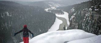
Absolute heights range from 40 to 668 m. The highest point is Mount Nakas on the ridge of the same name. Part of the region is mountainous. The Guberlinsky Mountains are especially impressive. The chalk deposits found here are also interesting.
Main rivers: Ural, Sakmara, Ilek, Samara. The main river of the Orenburg region, crossing most of the region's territory from east to west, is the Ural River. Its length within the region is 1164 km. It is worth noting that due to the arid climate, the rivers here have little water.
The largest reservoir in the Orenburg region is Iriklinskoye on the Ural River. Its area is 235 km2, volume is 3257 million m³. It was created to operate the powerful Iriklinskaya State District Power Plant. Krasnochabanskoye (54.6 million m³), Chernovskoye (52.7 million m³), Kumakskoye (48.0 million m³), Elshanskoye (23.6 million m³) and Ushkottinskoye (10.0 million m³) reservoirs were also created. The largest natural reservoir is Lake Shalkar-Ega-Kara (9600 hectares).
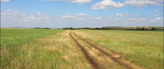
The territory is located in the steppe zones of the Trans-Volga and Turgai regions, the forested Southern Urals, and the pine-birch forest-steppe of Western Siberia. But steppes still predominate. In summer, the rich smell of steppe grasses heated by the sun reigns here.
To preserve the steppe landscapes located at the junction of the Russian Plain, the Ural Mountains and the Turgai Plateau, the Orenburg Nature Reserve was created in 1989. Its area is 216.53 km2.
There are few forests in the region - 697.4 thousand hectares, or 5.6% of its territory. The most famous and valuable is the Buzuluksky pine forest. It has the status of a national park.
The salt lakes of Sol-Iletsk with reserves of healing mud are extremely popular. They have great health value.
The climate is sharply continental, which is due to the distance from the oceans and seas. Winters are cold and long, and summers are warm. The differences between day and night temperatures are significant. The annual precipitation rate is less than 350 mm, only in mountainous areas (the vicinity of Kuvandyk) - up to 480 mm.
Area of territories of the Russian Federation by constituent entity (Table)
- Territory area of the Russian Federation by constituent entities of the Russian Federation as of January 1, 2022
- To find out the area of a subject of the Russian Federation in hectares (ha), you need to multiply the value in the table by 1000 (since the values are indicated in thousands of square kilometers) and then multiply by 100.
- 1 km2 = 100 ha
| The subject of the Russian Federation | Territory area, thousand square meters. km*) | Share of the subject’s territory in the total territory (%): | Rank of the subject's territory in relation to the territories: | ||
| Russia | federal district | all subjects of Russia | subjects included in the federal district | ||
| Russian Federation | 17125,2 | 100,0 | |||
| Central Federal District | 650,2 | 3,8 | 100,0 | 6 | |
| Belgorod region | 27,1 | 0,2 | 4,2 | 67 | 13 |
| Bryansk region | 34,9 | 0,2 | 5,4 | 62 | 8 |
| Vladimir region | 29,1 | 0,2 | 4,5 | 66 | 12 |
| Voronezh region | 52,2 | 0,3 | 8,0 | 51 | 3 |
| Ivanovo region | 21,4 | 0,1 | 3,3 | 74 | 17 |
| Kaluga region | 29,8 | 0,2 | 4,6 | 65 | 11 |
| Kostroma region | 60,2 | 0,4 | 9,3 | 47 | 2 |
| Kursk region | 30,0 | 0,2 | 4,6 | 64 | 10 |
| Lipetsk region | 24,0 | 0,1 | 3,7 | 72 | 16 |
| Moscow region | 44,3 | 0,3 | 6,8 | 55 | 5 |
| Oryol Region | 24,7 | 0,1 | 3,8 | 71 | 15 |
| Ryazan Oblast | 39,6 | 0,2 | 6,1 | 58 | 6 |
| Smolensk region | 49,8 | 0,3 | 7,7 | 53 | 4 |
| Tambov Region | 34,5 | 0,2 | 5,3 | 63 | 9 |
| Tver region | 84,2 | 0,5 | 12,9 | 38 | 1 |
| Tula region | 25,7 | 0,1 | 3,9 | 70 | 14 |
| Yaroslavl region | 36,2 | 0,2 | 5,6 | 61 | 7 |
| Moscow | 2,6 | 0,01 | 0,4 | 83 | 18 |
| Northwestern Federal District | 1687,0 | 9,9 | 100,0 | 4 | |
| Republic of Karelia | 180,5 | 1,1 | 10,7 | 17 | 3 |
| Komi Republic | 416,8 | 2,4 | 24,7 | 11 | 1 |
| Arkhangelsk region including Nenets Autonomous Okrug | 589,9 | 3,4 | 35,0 | ||
| Nenets Autonomous Okrug | 176,8 | 1,0 | 10,5 | 19 | 4 |
| Arkhangelsk region without Nenets Autonomous Okrug | 413,1 | 2,4 | 24,5 | 12 | 2 |
| Vologda Region | 144,5 | 0,8 | 8,6 | 26 | 6 |
| Kaliningrad region | 15,1 | 0,1 | 0,9 | 77 | 10 |
| Leningrad region | 83,9 | 0,5 | 5,0 | 39 | 7 |
| Murmansk region | 144,9 | 0,8 | 8,6 | 25 | 5 |
| Novgorod region | 54,5 | 0,3 | 3,2 | 49 | 9 |
| Pskov region | 55,4 | 0,3 | 3,3 | 48 | 8 |
| Saint Petersburg | 1,4 | 0,01 | 0,1 | 84 | 11 |
| Southern Federal District | 447,8 | 2,6 | 100,0 | 7 | |
| Republic of Adygea | 7,8 | 0,05 | 1,7 | 81 | 7 |
| Republic of Kalmykia | 74,7 | 0,4 | 16,7 | 42 | 4 |
| Republic of Crimea | 26,1 | 0,2 | 5,8 | 69 | 6 |
| Krasnodar region | 75,5 | 0,4 | 16,9 | 41 | 3 |
| Astrakhan region | 49,0 | 0,3 | 10,9 | 54 | 5 |
| Volgograd region | 112,9 | 0,7 | 25,2 | 31 | 1 |
| Rostov region | 101,0 | 0,6 | 22,5 | 33 | 2 |
| Sevastopol | 0,9 | 0,005 | 0,2 | 85 | 8 |
| North Caucasus Federal District | 170,4 | 1,0 | 100,0 | 8 | |
| The Republic of Dagestan | 50,3 | 0,3 | 29,5 | 52 | 2 |
| The Republic of Ingushetia | 3,6 | 0,02 | 2,1 | 82 | 7 |
| Kabardino-Balkarian Republic | 12,5 | 0,1 | 7,3 | 79 | 5 |
| Karachay-Cherkess Republic | 14,3 | 0,1 | 8,4 | 78 | 4 |
| Republic of North Ossetia-Alania | 8,0 | 0,05 | 4,7 | 80 | 6 |
| Chechen Republic | 15,6 | 0,1 | 9,2 | 76 | 3 |
| Stavropol region | 66,2 | 0,4 | 38,8 | 45 | 1 |
| Volga Federal District | 1037,0 | 6,1 | 100,0 | 5 | |
| Republic of Bashkortostan | 142,9 | 0,8 | 13,8 | 27 | 2 |
| Mari El Republic | 23,4 | 0,1 | 2,3 | 73 | 13 |
| The Republic of Mordovia | 26,1 | 0,2 | 2,5 | 68 | 12 |
| Republic of Tatarstan | 67,8 | 0,4 | 6,5 | 44 | 7 |
| Udmurt republic | 42,1 | 0,2 | 4,1 | 57 | 10 |
| Chuvash Republic | 18,3 | 0,1 | 1,8 | 75 | 14 |
| Perm region | 160,2 | 0,9 | 15,5 | 23 | 1 |
| Kirov region | 120,4 | 0,7 | 11,6 | 30 | 4 |
| Nizhny Novgorod Region | 76,6 | 0,4 | 7,4 | 40 | 6 |
| Orenburg region | 123,7 | 0,7 | 11,9 | 29 | 3 |
| Penza region | 43,4 | 0,3 | 4,2 | 56 | 9 |
| Samara Region | 53,6 | 0,3 | 5,2 | 50 | 8 |
| Saratov region | 101,2 | 0,6 | 9,8 | 32 | 5 |
| Ulyanovsk region | 37,2 | 0,2 | 3,6 | 59 | 11 |
| Ural federal district | 1818,5 | 10,6 | 100,0 | 3 | |
| Kurgan region | 71,5 | 0,4 | 3,9 | 43 | 6 |
| Sverdlovsk region | 194,3 | 1,1 | 10,7 | 16 | 3 |
| Tyumen region including autonomous okrugs | 1464,2 | 8,5 | 80,5 | ||
| Khanty-Mansiysk Autonomous Okrug | 534,8 | 3,1 | 29,4 | 7 | 2 |
| Yamalo-Nenets Autonomous Okrug | 769,3 | 4,5 | 42,3 | 5 | 1 |
| Tyumen region without autonomous okrugs | 160,1 | 0,9 | 8,8 | 24 | 4 |
| Chelyabinsk region | 88,5 | 0,5 | 4,9 | 36 | 5 |
| Siberian Federal District | 5145,0 | 30,0 | 100,0 | 2 | |
| Altai Republic | 92,9 | 0,5 | 1,8 | 35 | 11 |
| The Republic of Buryatia | 351,3 | 2,1 | 6,8 | 14 | 4 |
| Tyva Republic | 168,6 | 1,0 | 3,3 | 20 | 7 |
| The Republic of Khakassia | 61,6 | 0,4 | 1,2 | 46 | 12 |
| Altai region | 168,0 | 1,0 | 3,3 | 21 | 8 |
| Transbaikal region | 431,9 | 2,5 | 8,4 | 10 | 3 |
| Krasnoyarsk region | 2366,8 | 13,8 | 46,0 | 2 | 1 |
| Irkutsk region | 774,8 | 4,5 | 15,1 | 4 | 2 |
| Kemerovo region | 95,7 | 0,6 | 1,9 | 34 | 10 |
| Novosibirsk region | 177,8 | 1,0 | 3,5 | 18 | 6 |
| Omsk region | 141,1 | 0,8 | 2,7 | 28 | 9 |
| Tomsk region | 314,4 | 1,8 | 6,1 | 15 | 5 |
| Far Eastern Federal District | 6169,3 | 36,0 | 100,0 | 1 | |
| The Republic of Sakha (Yakutia) | 3083,5 | 18,0 | 50,0 | 1 | 1 |
| Kamchatka Krai | 464,3 | 2,7 | 7,5 | 8 | 4 |
| Primorsky Krai | 164,7 | 1,0 | 2,7 | 22 | 7 |
| Khabarovsk region | 787,6 | 4,6 | 12,8 | 3 | 2 |
| Amur region | 361,9 | 2,1 | 5,9 | 13 | 6 |
| Magadan Region | 462,5 | 2,7 | 7,5 | 9 | 5 |
| Sakhalin region | 87,1 | 0,5 | 1,4 | 37 | 8 |
| Jewish Autonomous Region | 36,3 | 0,2 | 0,6 | 60 | 9 |
| Chukotka Autonomous Okrug | 721,5 | 4,2 | 11,7 | 6 | 3 |
- *) The sum of the area of the territories of the Russian Federation for the constituent entities of the Russian Federation that are part of the federal district may not coincide with the data for the federal district due to rounding.
- _______________
- Source of information: Rosstat (gks.ru)
Source: https://infotables.ru/strany-i-goroda/909-ploshchad-territorij-rf
Economy
During the Great Patriotic War, many enterprises in the Orenburg region were evacuated, which gave impetus to the development of industry. The discovery of the Orenburg gas condensate field (the largest in Russia) in the 1960s provided great economic prospects. In the 1950s, the virgin steppe lands were actively plowed and agriculture developed.
Currently, gas, oil, energy, metallurgical, and machine-building industries are developed here. The subsoil is rich in hydrocarbon raw materials, ores of ferrous and non-ferrous metals, gold, non-metallic minerals (asbestos, coal, rock salt, raw materials for the construction industry). Every year, the region produces over 3% of oil, gas and gas condensate from the all-Russian level, and produces over 16% of copper and 24% of zinc concentrate.
The largest enterprises: OJSC Orenburgneft, OJSC Orenburggazprom, OJSC Orsk-nefteorgsintez, OJSC Orenburg Minerals, OJSC Ural Steel (Novotroitsk), OJSC Yuzhuralnickel (Orsk), LLC Orsk Light Metal Structures Plant , Mednogorsk Copper and Sulfur Plant LLC, Gaisky GOK OJSC.
The Orenburg region also makes a significant contribution to Russian agriculture. 4.9% of all Russian agricultural land is located here. More than 3 million tons of grain crops are grown annually, including more than 1.5 million tons of wheat.
One of the brands in the region is Orenburg down scarves. They owe their fame to the quality of the source material - the down of Orenburg goats. It is elastic, lightweight, and has low thermal conductivity. Orenburg Cossack women adopted the experience of knitting scarves and shawls from the Kazakhs and Kalmyks. The local down knitting craft became widely known after the World Exhibition of 1862, where the medal-winning products of the Orenburg Cossack woman Marya Uskova were presented.
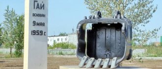
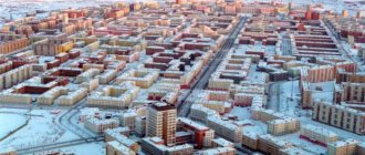
The administrative center of the region is the city of Orenburg. The Orenburg region includes 489 municipalities: 13 urban districts, 29 municipal districts, 447 rural settlements. The largest cities: Orenburg, Orsk, Novotroitsk, Buzuluk, Buguruslan, Gai.
The population of the Orenburg region, according to Rosstat, is 1,963,000 people. Population density is 15.87 people/km2. The share of the urban population is 60.57%.
The annual budget of the Orenburg region for 2022 is 106 billion rubles.
Cities of the Orenburg region
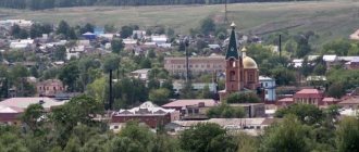
Orenburg is a city where down scarves are made. In total, just over half a million residents live in the regional capital. Basically, the population of Orenburg is increasing due to visitors from villages, but in recent years the birth rate has also been increasing. There are no problems finding work in Orenburg, but real estate is quite expensive.
Orsk is a city with 234 thousand inhabitants. In terms of all indicators, it ranks second in the region, right behind the regional center. Orenburg and Orsk are separated by 286 km, which is a lot. The city has a sufficient number of large industrial enterprises in the field of heavy engineering and petrochemicals. Orsk is not poor, but young people here are bored.
Story
The oldest traces of human habitation on the territory of the modern Orenburg region date back to the Upper Paleolithic era: the sites of Labazy I and Labazy II in the lower reaches of the Buzuluk River in the north of the Kurmanaevsky region, the Idelbaevskaya site in the Mednogorsk region, the location of flint tools on the outskirts of the village of Novouzeli and in a ravine near the village of Internatsionalny in Matveevsky district, “Donguz plate” with an image of a deer on the Ilek plateau. The Starotokskaya site near the village of Ivanovka in the Krasnogvardeysky district belongs to the Mesolithic. The Staroyelshanskaya and Ivanovo sites date back to the Neolithic era. By the second half of the 5th - beginning of the 4th millennium BC. e. include monuments of the Khvalynsk-Berezhnovskaya cultural group (Turganikskaya, Ivanovskaya sites, Ivanovo dune burial ground).
The settlements of sedentary pastoralists of the Srubna and Alakul archaeological cultures and metallurgists in the Kargaly mines date back to the Bronze Age.
In the XVII-XVI centuries BC. in the Trans-Urals, a whole network of fortified settlements with mound necropolises of the Sintashta type was created. Kurgans belong to the Sarmatian culture. The anthropomorphic “stone women” sculptures left on the territory of the Orenburg region by Turkic-speaking nomads in the 9th-12th centuries date back to the Middle Ages.
In the steppes of the Orenburg region, burial mounds of the Sarmatians and Scythians have been preserved. Archaeologists have also found gold items in them. The Filippovsky burial mound in the Ilek region became especially famous. Unique finds have been in museums in the USA, Italy, and Russia. In Orenburg, based on the find, a popular art object “Sarmatian Deer” was created.
Russians appeared in these places in the 1730s, when a decision was made to voluntarily incorporate the Bashkir and Kazakh tribes into the Russian state. To protect the southeastern borders of the country, a line of defensive structures - fortresses - was built. The Orenburg expedition, which set off from St. Petersburg in the summer of 1734, was led by I.K. Kirilov. P.I. participated in it. Rychkov was later a prominent scientist, the first corresponding member of the St. Petersburg Academy of Sciences. Near the mouth of the Or River a fortress was founded, called Orenburg.
In the fall of 1736, Kirilov founded a whole chain of fortified settlements along Yaik, Samara and Sakmara (Borskaya, Buzulukskaya, Totskaya, Sorochinskaya, Tatishcheva, Berdskaya, Verkhneozernaya, Guberlinskaya, Verkhneuralskaya and others), which were supposed to protect the newly annexed lands from the raids of nomads.
After Kirilov’s death in 1737, V.N. took his place. Tatishchev. He did not approve of the choice of the site for the founding of Orenburg and ordered the fortress to be moved to Red Mountain (now the village of Krasnogor is located here). However, the new boss I.I. Neplyuev in 1743 moved the city to where the historical center of Orenburg is currently located.
Orenburg became a major administrative center, and the vast Orenburg province was created. The province included the lands of modern Northern, Central and Western Kazakhstan, Bashkiria, Chelyabinsk region, part of Tatarstan and Kurgan, Samara, Tyumen, Sverdlovsk regions, Perm region. Its area was 1525 thousand sq. km.
To develop the territory, settlers and exiles were sent, and the Orenburg Cossack Army was created. In the 1750s, the Iletsk salt mine arose, using the labor of exiles. In the 1750-60s, the Orenburg lands began to be developed by nobles who moved their serfs here from other estates.
In 1773-75, the Orenburg province found itself at the epicenter of the Peasant War. The rebels led by Emelyan Pugachev captured many fortresses, but were unable to take Orenburg, the siege of which lasted about six months. After the suppression of the rebellion, Catherine II ordered the Yaik River to be renamed the Ural in order to erase the memory of what happened.
The borders have changed several times. Since 1781, the Orenburg province was called the Ufa district with its center in the city of Ufa. In 1797, the Orenburg province was again formed. In 1865, the Ufa province was separated from the Orenburg province.
In 1917, the Orenburg province was a territory stretching from southwest to northeast from the headwaters of Samara to the middle reaches of the Tobol, and included Orenburg, Orsk, Verkhneuralsk, Troitsk and Chelyabinsk districts. Buzuluksky district in these years was part of the Samara province.
In 1920, Orenburg became the administrative center of the newly created Kyrgyz Autonomous Socialist Soviet Republic. At that time, the Kazakhs were officially called the Kyrgyz. In April 1925, the Kirghiz ASSR was renamed the Kazakh ASSR, and its capital was moved from Orenburg to Ak-Mechet, renamed Kzyl-Orda.
In 1928, as a result of the unification of the abolished Orenburg, as well as Samara, Ulyanovsk, Penza and part of the Saratov provinces, the Middle Volga region was formed with the administrative center in Samara. At the same time, the Orenburg district was formed, which included the former Orenburg and Orsk districts. Since 1929, the Orenburg district was part of the Middle Volga region. In 1930, the Orenburg district, along with others, was abolished and directly subordinated to the Middle Volga region.
On December 7, 1934, the Presidium of the All-Russian Central Executive Committee adopted a resolution on the formation of the Orenburg region by separating it from the Middle Volga region.
From 1938 to 1957, Orenburg bore the name of the pilot Valery Chkalov, and the region was called Chkalovskaya.
The names of many famous people are associated with the Orenburg region. I will list just a few people who were born or lived here: historian, geographer, economist, first corresponding member of the St. Petersburg Academy of Sciences P.I. Rychkov, writer S.T. Aksakov, writer, lexicographer, ethnographer V.I. Dahl, writer A.S. Pushkin, poet, playwright, translator G.R. Derzhavin, poet and artist T.G. Shevchenko, Tatar poet Musa Jalil, statesman V.A. Perovsky, musician and conductor M.L. Rostropovich, statesman V.S. Chernomyrdin and others. The first cosmonaut Yu.A. studied in Orenburg. Gagarin, here he found his family.
Sources:
Wikipedia Portal of the government of the Orenburg region Rundkvist N.A., Zadorina O.V. Ural. Illustrated encyclopedia of local history
Pavel Raspopov
UraloVed.ru
Springs and waterfalls of the Orenburg region
The Orenburg land is fed by dozens of springs. Local mineral and hydrogen sulfide springs are of great importance for health tourism, and the especially revered consecrated springs attract hundreds of pilgrims.
Hanging springs of Rodnikovka
- Coordinates: 53.982143, 53.491824.
In the vicinity of the village of Nikolkino you can see unusual springs. Countless water springs make their way out of the steep slope of a high red hill and run down in cheerful streams into the Rodnikovka River.
Other streams fall from the steep wall and form small waterfalls. In some places, water flows have washed out small niches in the mountainous banks.
Kondurovsky hydrogen sulfide spring
- Address: s. Kondurovka, Saraktashsky district.
The cold spring near the village of Kondurovka has healing properties due to its high content of hydrogen sulfide. Water has an unpleasant taste and smell, but helps in the treatment of many diseases.
The spring comes out at the foot of the hill, the area around it is practically undeveloped. In 2011, believers consecrated the spring in honor of the icon of the Mother of God “Quick to Hear” and erected a wooden cross of worship next to the stream.
Dmitrievsky hydrogen sulfide spring
- Coordinates: 53.382083, 54.155889.
Another famous hydrogen sulfide mineral spring is located near the village of Dmitrievka, Ponomarevsky district. The spring forms a small round lake with amazingly clear blue water. Local residents surrounded the pond with a fence and organized several descents into the water.
The source remains cold even in hot weather, but neither the temperature nor the specific smell stops tourists who want to take healing baths. Swimming in the lake is good for health, but you must remember the contraindications: for some diseases, such a procedure can only cause harm.
Spring "Kainar"
- Coordinates: 51.229194, 56.671694.
The Belyaevsky district is famous for its springs, perhaps the most visited of them is the mineral spring on the territory of the Burtinskaya Steppe nature reserve. The Turkic name “Kainar” is translated into Russian as “source”.
Mineral water hardly heats up in summer and does not freeze in winter. A stream of the same name flows from the spring, which forms a tiny round pond. Several years ago, the lake was surrounded by wooden sides, and a neat gazebo for relaxation appeared nearby.
"Holy Key"
- Coordinates: 53.441246, 53.311949.
In a gully 5 kilometers from the village of Kuzkino there flows a revered holy spring. The key is located away from the roads, with endless fields stretching around it. The spring is well equipped; it is enclosed in a concrete well, over which a small wooden chapel is erected. The water in the holy spring is always cool and remains fresh for a long time; some believers consider it healing.
The key is sometimes called “Revealed”, as there are legends that saints have appeared in the beam more than once. The spring has been known for more than a hundred years; even in Soviet atheistic times, pilgrims from all over the Orenburg region and neighboring regions came to it. In 1998, the spring was recognized as a hydrological natural monument of regional significance.
Springs village Kiryushkino
- Coordinates: 53.560993, 52.288036.
The springs in the village of Kiryushkino, Buguruslanovsky district, are also considered sacred, but they are revered not by Christians, but by pagan Erzya. The three springs were nicknamed “Vishka Lisma”, “Poksh Lisma” and “Baban Kasha”.
The last source is especially important; its name translated from Erzya means “Babya porridge” - a ritual dish for a pagan holiday. The Erzya used spring water to treat diseases and protect against evil spirits; they sprinkled it on their homes, outbuildings, people and livestock.
Today, residents of surrounding villages still come to the source. A small wooden house is erected above the spring, and life-giving moisture is supplied through a metal pipe.
Silver Spring
- Coordinates: 52.569546, 56.102710.
It is also a fairly well-known spring in the region, where hundreds of vacationers flock. It is located in the Tyulgansky district, near the village of Tugustemir. There is a place to relax next to the source where you can barbecue. The spring water itself here is very cold, icy and, according to unverified sources, it actually contains silver.
[edit] Indicators
[edit] Production indices
Production index in mining in the Orenburg region (% compared to the previous year):
- 2005: 102.9%[58]
- 2010: 107.6%[59]
- 2012: 99.5%[60]
- 2013: 99.6%[61]
- 2014: 99.5%[62]
- 2015: 96.3%[63]
- 2016: 96.1%[64]
- 2017: 98.9%[65]
- 2018: 101.4%[66]
- 2019: 103.9%[67]
[edit] Investments
Investments in fixed capital in mining in the Orenburg region (billion rubles):[68]
- 2017: 62.2457
- 2018: 75.7842
Share of mining in the distribution of investments in fixed assets in the Orenburg region:[69]
- 2017: 45.8%
- 2018: 48.0%