| district[1] / municipal district[2] | |
| Urensky district Urensky municipal district | |
| Flag | Coat of arms |
- (0,88 %)
Urensky district
- administrative-territorial formation (district) and abolished municipal formation (municipal district) as part of the Nizhny Novgorod region of Russia.
The administrative center is the city of Uren.
In May 2022, the Urensky district was transformed into a municipal district, the corresponding administrative unit retains the status of a district[5].
Content
- 1 Geography
- 2 History
- 3 Population
- 4 Administrative and municipal structure 4.1 Settlements
- 5.1 Industry
- 6.1 Culture and sports
Geography
Urensky district is located in the northern part of the Nizhny Novgorod region. From the west it borders on the Varnavinsky and Vetluzhsky districts, from the north - on the Tonkinsky district and the Shakhunya urban district, from the south - on the Krasnobakovsky district.
The area of the district is 2102.71[6] km².
The district contains 1 city, an urban-type settlement called Arya, and 124 settlements. The administrative structure includes 1 city, 1 village and 13 rural administrations.
The administrative center is the city of Uren. The city is 183 km away from the regional center by rail and 210 km by highway. The length of paved roads in the area is 380 km.
Sights of Urenya Nizhny Novgorod region, museums, monuments
The settlement of Ureni appeared, judging by written sources, by the beginning of the 18th century. The settlement of these lands proceeded in accordance with the royal permission, since the harvests obtained here provided the treasury with a good income.
February 13, 2013 | | comments: 0
“The Union of Entrepreneurs of the Nizhny Novgorod Region, Urensky District” began its activities in 2005.
February 13, 2013 | | comments: 0
In 2008, a Monument to Soldiers-Liberators was erected in Uren. Its opening was timed to coincide with the great anniversary - the 65th anniversary of the Great Victory.
February 13, 2013 | | comments: 0
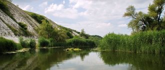
The Urensky district is the owner of such a natural attraction as Kocheshkovskoye Lake.
February 13, 2013 | | comments: 0
City historical monuments include: the building where Nikolaeva G.E. lived. - a well-known writer in the Nizhny Novgorod region.
February 13, 2013 | | comments: 0
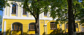
The cultural center of the city of Uren is a historical museum founded in 1962. Over the course of 50 years, museum workers have collected more than 5,000 exhibits.
February 13, 2013 | | comments: 0
In the suburb of Uren in the village of Temta there is an interesting museum exhibition “Russian Upper Room”. “Russian Upper Room” is decorated like an old village log hut.
February 13, 2013 | | comments: 0
The city has an interesting museum of the scientific educator Karatygin F.I. Its main exhibitions are “Russian Karatygin Days” and “Name in Russian Librarianship.”
February 13, 2013 | | comments: 0
The People's Historical Museum of the city of Uren has collected an extensive collection. Its main fund consists of more than 5,000 exhibits.
February 13, 2013 | | comments: 0
On this page you will find information about what is worth visiting for visitors to Ureña. Sights, museums, monuments and other interesting places in Ureni.
uren.etowns.ru
Story
| The section lacks links to sources. Information must be verifiable or it may be deleted. You can edit the article to add links to authoritative sources. This mark was set on October 24, 2022 . |
The most ancient inhabitants of the Urensky region were the Mari.
The emergence of Uren as a village dates back to the beginning of the 18th century. At that time, the royal court was interested in its lands beyond the Volga being populated and generating income. The settlers were given benefits. And those who wanted to live freely and believe in the old way rushed beyond the Volga. Officially and secretly, thousands of families of schismatics moved to these lands in Prikerzhenye, Zavetlugye and the swampy banks of the Usta. “The newly populated village of Tresvyatskoe, Uren also” was mentioned for the first time in 1719. Documents from the first census and audit of the male population, preserved to this day, say that in 1719 there were 168 “male souls” living in Urena. Uren - the name received from the Mari, who have long lived in this region, Tresvyatskoye - from a wooden church built here at the beginning of the 18th century and rebuilt in stone in 1829.
The population gradually increased due to newcomer peasants from different cities and counties and Old Believers who lived in cells in the forests near that village of Urene. This happened because, compared to other central districts, the peasants in the Uren region lived more freely. Annual fees here did not exceed one ruble per head. In addition, in villages scattered throughout deep forests, it was possible to more freely perform religious rituals. In connection with this, the population of Uren noticeably decreased, but new settlements arose around it - Pochinki, Nikitino, Gorevo, Emelyanovo and many others.
The main occupation of the Urens was agriculture. They observed correct three-field crop rotation and practiced shifting land use, in which sowing was carried out for 2-3 years, and then this land rested for 15-20 years. Animal husbandry provided subsistence farming with food, hides, and sheepskin for shoes and clothing. Many lived by hunting and beekeeping. The entire life of the Urens was connected with the forest. He provided housing, warmth, fishing, and income. Thick oaks and pines were cut down and floated for the treasury and the fleet. The linden tree produced bast and bast, bast and soft white wood. In 1778, the Kostroma province was formed. Varnavinsky district appeared on its map, and within it the Urenskaya volost. At that time, there were 445 residents in Uren, there were 2 dyehouses and one salo factory, and once a year a fair was held in the village.
The first quarter of the 19th century brought the Urensky volost the loss of many freedoms and liberties - unauthorized cutting of forests, tearing of bast and sponge, and unauthorized relocation from village to village were strictly prohibited. It was also forbidden to clear swathes for crops. With the abolition of serfdom, the majority of the population of the Uren region began to experience double oppression from the kulaks and the authorities. The Urens earned money to buy bread in the forests. Various crafts became increasingly widespread. In the middle of the 19th century, handicraft dyehouses, salo-melters, tar mills, sheepskin, leather, fulling and other workshops appeared, in which hundreds of farm laborers worked. Tailors, saddlers, tinsmiths, carpenters, and sawmills walked from village to village alone and in teams. In 1905, 454 households were engaged in fishing.
From August 19 to September 15, 1918, part of the population of the Urensk region participated in an unsuccessful rebellion, the reason for which was the shootout of delegates of a peasant gathering of 6 volosts beyond the river with a district armed detachment that closed this gathering. The rebellion was caused by dissatisfaction with the requisition of surplus grain from the peasants, the imposition of monetary indemnity on Uren, and the desire to become an independent district.
In 1929, as a result of territorial reforms, Uren became the administrative center of the newly formed Urensky district as part of the Nizhny Novgorod region. And after 30 years, the village of Ureni was transformed into an urban-type settlement. On December 27, 1973, by decree of the Presidium of the Supreme Council of the RSFSR, Uren was transformed into a city of district subordination.
Currently, the Urensky district, in terms of its level of socio-economic development, occupies one of the leading places among the rural areas of the Nizhny Novgorod region.
The main attractions of Uren
Every traveler, when planning a trip, creates for himself a list of attractions in Uren that are a must-see. Some plan independent routes to explore the city, others prefer a variety of walking or bus excursions. Usually they cover the main attractions of Uren and introduce tourists to the historical and cultural heritage of the city.
Art lovers always mark sculptural attractions on the map of Uren. In the central squares of the city you can often see classical sculptures, against which all travelers take traditional photos. But in public gardens beloved by the local population, you can see exhibitions of conceptual sculptural compositions and installations. They are made from the most unexpected materials and come in incredible variations of different shapes that you will have to think about.
Among the main attractions of Uren, religious buildings should be especially highlighted. They are an integral part of the appearance of the Russian city, some of them keep important historical secrets within their walls. In Urena and outside the city, you can visit famous monasteries, admire the elegant appearance of large Christian churches, or go to modest and small chapels, which are a favorite place of spiritual retreat for local residents.
While traveling around the area, you can also come across interesting religious sites. These could be national religious buildings, ancient religious buildings, or even mystical places of power.
A great idea is pedestrian promenades along Uren. You can buy a Uren map in advance with attractions and routes, or even go wherever you want. Then it's even more exciting. Give yourself the chance to get lost in ancient alleys or wander through parks. And if you get tired, you can refresh yourself or drink coffee in some nice cafeteria. By the way, in Urena there are several places of worship that every traveler wants to visit.
If you want to get the most complete picture of the city and its history, go to the museums of Uren. They contain rich exhibitions on folklore, art, folk art and everyday life, and archaeology. Most often, such attractions are located in the center.
At the same time, open museums dedicated to a specific topic can often be visited outside the city. They organize fascinating exhibitions telling about national traditions and folk art. In addition, this could be a museum reconstruction of historical settlements or military fortresses. Similar sights of Uren will be interesting for children.
For family travelers, the question always arises: where to go with children. The most popular option is to go to one of the aquatic complexes in Uren. There are often discounted rates available when you purchase a family day pass.
If you are planning a trip in winter or spring, we recommend that you look at the Urenya ski resorts as an option for active leisure. There are a lot of activities for children and parents: a variety of ski and snowboard slopes, snow tubing, interesting snow parks for the pros. Often these resorts are located several tens of kilometers from the city. In this regard, it is easier to arrive at the place by personal vehicle or book a car from rental offices.
An excellent option for a trip with the whole family – active outdoor recreation. Such attractions are located near Uren. These could be lakes, canyons, famous nature reserves. Where better to go is always up to you. You can get to these natural attractions either independently or by public transport. Look in advance at the routes of regular buses departing from city bus stations in the direction you need. In such an adventure you will get a lot of vivid memories from communicating with nature, replenish your health and good spirits.
If you came to the city on work matters, then you have little time for long excursions. In such circumstances, it would be a good idea to choose a condensed index of Uren sights with photos and descriptions.
You can always look for such a guide after arriving in the city at souvenir kiosks at railway stations or at the airport. There is a list of the best places to go in Urena, with names and photos of attractions. Admittedly, this greatly simplifies the task of what to see in Urena if you are short on time.
But, if the printed catalog contains the most popular corners of Uren, then online you can see the rating of new, but no less interesting attractions with reviews of tourists who visited them. Idle mines, mysterious quarries, unusual narrow-gauge railways, viaducts - such attractions attract adventure lovers.
When planning a trip to Uren, you should study information not only about the attractions, but also about other important city sites. For the convenience of moving around the city, it is worthwhile to imagine the public transport traffic pattern, the location of the main railway and bus terminals or river stations, metro stations. At the same time, such large public buildings in Uren can become objects of tourist interest. Often they are the ones who form the first impression of a locality for a visitor.
Show more
akuaku.ru
Population
| Population | ||||||||
| 1939[7] | 1959[8] | 1970[9] | 1979[10] | 1989[11] | 2002[12] | 2003 | 2008[13] | 2009[13] |
| 45 471 | ↗51 334 | ↘43 096 | ↘38 205 | ↘36 847 | ↘32 045 | ↗32 700 | ↘30 174 | ↘29 790 |
| 2010[12] | 2011[13] | 2012[14] | 2013[15] | 2014[16] | 2015[17] | 2016[18] | 2017[19] | 2018[20] |
| ↗30 106 | ↘29 979 | ↘29 568 | ↘29 252 | ↘29 084 | ↘28 842 | ↘28 788 | ↘28 736 | ↘28 512 |
| 2019[21] | 2020[4] | |||||||
| ↘28 204 | ↘28 055 | |||||||
Urbanization
60.4% of the district's population live in urban areas (the city of Uren and the working village of Arya).
Religious composition of the population
There are two main religious Christian movements in the region: Orthodox (Nikonian) and Orthodox Old Believers, historically determined by the settlement of Trans-Volga forests by Old Believers during the time of church reforms of Patriarch Nikon. In total, there are 3 operating churches in the Urensky district - 1 Nikonian parish and 2 Old Believers.
Administrative and municipal structure
The Urensky district, within the administrative-territorial structure of the region, includes 15 administrative-territorial entities, including 1 city of regional significance, 1 workers' village and 13 village councils[6][22][23].
The Urensky municipal district, within the framework of the organization of local self-government, included, respectively, 15 municipalities, including 2 urban settlements and 13 rural settlements[24].
| № | Administrative-territorial (municipal) entity | Administrative center | Number of settlements | Population (persons) | Area (km²) |
| 1 | Uren city | Uren city | 3 | ↗12 361[4] | 100,15[3] |
| 2 | working village of Arya | working village of Arya | 2 | ↘4768[4] | 193,23[3] |
| 3 | Bolshearyevsky village council | Big Arya village | 10 | ↘693[4] | 69,61[3] |
| 4 | Bolshepesochninsky village council | Bolshoye Pesochnoe village | 11 | ↘740[4] | 68,00[3] |
| 5 | Voroshilovsky village council | Bolshoi Tersen village | 19 | ↘1442[4] | 108,91[3] |
| 6 | Vyazovsky village council | Vyazovaya village | 6 | ↘413[4] | 66,77[3] |
| 7 | Gorevsky village council | village of Bolshoye Gorevo | 14 | ↘1086[4] | 304,70[3] |
| 8 | Karpovsky village council | village of Bolshoye Karpovo | 4 | ↗611[4] | 143,87[3] |
| 9 | Karpunikha village council | village of Karpunikha | 12 | ↗734[4] | 126,16[3] |
| 10 | Krasnogorsk village council | village of Bolshoi Krasnogor | 7 | ↘110[4] | 62,91[3] |
| 11 | Mineevsky village council | Mineevo village | 4 | ↘351[4] | 74,41[3] |
| 12 | Obkhodsky village council | Obkhod village | 8 | ↘468[4] | 185,64[3] |
| 13 | Semenovsky village council | Semenovo village | 11 | ↘662[4] | 230,11[3] |
| 14 | Temtovsky village council | Temta village | 4 | →916[4] | 65,68[3] |
| 15 | Ustansky village council | Usta village | 7 | ↗2700[4] | 304,14[3] |
Settlements
There are 122 settlements in the Urensky district.
| List of settlements in the region | ||||
| № | Locality | Type | Population | Administrative-territorial (municipal) entity |
| 1 | Aksyonovo | village | ↘0[12] | Semenovsky village council |
| 2 | Artamonovo | village | ↗135[12] | Uren city |
| 3 | Arya | workers' village | ↘4694[4] | working village of Arya |
| 4 | Atazik | village | ↘74[4] | working village of Arya |
| 5 | Scarlet | village | →0[12] | Bolshearyevsky village council |
| 6 | Bazhenovo | village | ↘5[12] | Karpunikha village council |
| 7 | Bezborodovo | village | ↘57[12] | Voroshilovsky village council |
| 8 | Anhydrous | village | ↘45[12] | Bolshepesochninsky village council |
| 9 | Berezovka | village | ↘2[12] | Mineevsky village council |
| 10 | Bobylevka | village | ↘224[12] | Bolshearyevsky village council |
| 11 | Bogdanovo | village | ↘3[12] | Karpunikha village council |
| 12 | Big Arya | village | ↘419[12] | Bolshearyevsky village council |
| 13 | Bolshaya Voroshilovka | village | →9[12] | Voroshilovsky village council |
| 14 | Bolshaya Elkhovka | village | ↗111[12] | Bolshepesochninsky village council |
| 15 | Big Kozlyana | village | ↘340[12] | Karpunikha village council |
| 16 | Bolshaya Malinovka | village | ↘0[12] | Temtovsky village council |
| 17 | Big Orlikha | village | ↗15[12] | Voroshilovsky village council |
| 18 | Bolshaya Shalega | village | ↘26[12] | Bolshepesochninsky village council |
| 19 | Big Grief | village | ↘475[12] | Gorevsky village council |
| 20 | Bolshoye Karpovo | village | ↘647[12] | Karpovsky village council |
| 21 | Bolshoye Kirillovo | village | ↘13[12] | Voroshilovsky village council |
| 22 | Bolshoye Lopatino | village | ↘95[12] | Semenovsky village council |
| 23 | Bolshoye Nepryakhino | village | ↘219[12] | Voroshilovsky village council |
| 24 | Bolshoye Nikitino | village | ↘286[12] | Voroshilovsky village council |
| 25 | Bolshoye Panfilovo | village | ↘104[12] | Gorevsky village council |
| 26 | Bolshoye Pesochnoye | village | ↘287[12] | Bolshepesochninsky village council |
| 27 | Bolshoi Krasnogor | village | ↘214[12] | Krasnogorsk village council |
| 28 | Bolshoi Tersen | village | ↘368[12] | Voroshilovsky village council |
| 29 | Burenino | village | ↘45[12] | Temtovsky village council |
| 30 | Bykovo | village | ↘0[12] | Krasnogorsk village council |
| 31 | Vedenino | village | ↘200[12] | Voroshilovsky village council |
| 32 | Elm | village | ↘268[12] | Vyazovsky village council |
| 33 | Devushkino | village | ↘46[12] | Vyazovsky village council |
| 34 | Demidovsky | repairs | ↘4[12] | Gorevsky village council |
| 35 | Derino | village | ↘1[12] | Krasnogorsk village council |
| 36 | Dianovo | village | →0[12] | Voroshilovsky village council |
| 37 | Zabegaikha | village | ↘21[12] | Semenovsky village council |
| 38 | Bay Estate | village | ↘32[12] | Voroshilovsky village council |
| 39 | Zubovo | village | ↘7[12] | Karpunikha village council |
| 40 | Karpunikha | village | ↘487[12] | Karpunikha village council |
| 41 | Kondobaevo | village | →0[12] | Semenovsky village council |
| 42 | Kopylikha | village | ↘48[12] | Vyazovsky village council |
| 43 | Kosolapovo | village | ↘5[12] | Gorevsky village council |
| 44 | Kocheshkovo | village | ↘26[12] | Bolshearyevsky village council |
| 45 | Red October | village | ↘12[12] | Obkhodsky village council |
| 46 | Krasny Yar | village | ↘99[12] | Semenovsky village council |
| 47 | Kudryashino | village | ↗38[12] | Karpovsky village council |
| 48 | Timber mill | village | ↘21[12] | Mineevsky village council |
| 49 | Lipovka | village | ↘0[12] | Vyazovsky village council |
| 50 | Elbow | village | ↘0[12] | Krasnogorsk village council |
| 51 | Crowbars | village | ↘224[12] | Ustansky village council |
| 52 | Maksimovka | village | ↘9[12] | Bolshearyevsky village council |
| 53 | Malafeevo | village | ↘9[12] | Semenovsky village council |
| 54 | Little Arya | village | ↘35[12] | Bolshearyevsky village council |
| 55 | Malaya Elkhovka | village | ↘1[12] | Bolshepesochninsky village council |
| 56 | Malaya Karpunikha | village | ↘0[12] | Karpunikha village council |
| 57 | Malaya Malinovka | village | ↘5[12] | Bolshearyevsky village council |
| 58 | Maloe Gorevo | village | ↘14[12] | Gorevsky village council |
| 59 | Maloe Kirillovo | village | ↘94[12] | Voroshilovsky village council |
| 60 | Maloe Klimovo | village | →0[12] | Ustansky village council |
| 61 | Maloe Lopatino | village | →0[12] | Semenovsky village council |
| 62 | Maloe Nepryakhino | village | ↘13[12] | Voroshilovsky village council |
| 63 | Maloe Pesochnoe | village | ↘0[12] | Obkhodsky village council |
| 64 | Maly Tersen | village | ↘21[12] | Voroshilovsky village council |
| 65 | Malkovo | village | ↘29[12] | Obkhodsky village council |
| 66 | Mineevo | village | ↘383[12] | Mineevsky village council |
| 67 | Mikhailovo | village | ↘94[12] | Ustansky village council |
| 68 | Mokronosovo | village | ↗120[12] | Temtovsky village council |
| 69 | Bypass | village | ↘462[12] | Obkhodsky village council |
| 70 | Opushkino | village | ↘84[12] | Gorevsky village council |
| 71 | Pavlovo | village | ↘4[12] | Bolshepesochninsky village council |
| 72 | Pavlovsky | repairs | ↘10[12] | Karpunikha village council |
| 73 | Palashino | village | ↘28[12] | Voroshilovsky village council |
| 74 | Paramonovsky | repairs | ↗10[12] | Gorevsky village council |
| 75 | Petrovo | village | →0[12] | Ustansky village council |
| 76 | Petryaevo | village | ↘42[12] | Karpunikha village council |
| 77 | Squeakers | village | ↘0[12] | Voroshilovsky village council |
| 78 | Plaksovo | village | ↘5[12] | Krasnogorsk village council |
| 79 | Podguzkovo | village | ↘2[12] | Semenovsky village council |
| 80 | Half | repairs | ↘93[12] | Gorevsky village council |
| 81 | Poles | village | ↗8[12] | Voroshilovsky village council |
| 82 | Ponurovsky | repairs | →0[12] | Gorevsky village council |
| 83 | Ponds | village | ↘9[12] | Obkhodsky village council |
| 84 | Rameshinsky | repairs | →0[12] | Gorevsky village council |
| 85 | Rogovo | village | ↘49[12] | Gorevsky village council |
| 86 | Ryabkovo | village | →0[12] | Gorevsky village council |
| 87 | Savino | village | ↗25[12] | Obkhodsky village council |
| 88 | Svishchevo | village | ↘0[12] | Bolshearyevsky village council |
| 89 | Semenovo | village | ↗581[12] | Semenovsky village council |
| 90 | Semenovo-Shuran | village | ↘2[12] | Vyazovsky village council |
| 91 | Serovo | village | ↘118[12] | Voroshilovsky village council |
| 92 | Skryabino | village | ↘12[12] | Krasnogorsk village council |
| 93 | Sodomovo | village | ↘48[12] | Karpunikha village council |
| 94 | Sosnovka | village | →0[12] | Uren city |
| 95 | Spiridonovo | village | ↗19[12] | Voroshilovsky village council |
| 96 | Stafeevo | village | →0[12] | Obkhodsky village council |
| 97 | Shooting | village | ↘0[12] | Krasnogorsk village council |
| 98 | Sukhodol | village | ↘6[12] | Bolshepesochninsky village council |
| 99 | Tarbeevo | village | ↘25[12] | Bolshearyevsky village council |
| 100 | Temta | village | ↗759[12] | Temtovsky village council |
| 101 | Titkovo | village | ↗317[12] | Bolshepesochninsky village council |
| 102 | Tikhovodovsky | repairs | →0[12] | Gorevsky village council |
| 103 | Tulaga | village | ↘429[12] | Gorevsky village council |
| 104 | Tulazhka | village | ↘0[12] | Karpunikha village council |
| 105 | Uren | city | ↗12 251[4] | Uren city |
| 106 | Mouth | village | ↘2531[12] | Ustansky village council |
| 107 | Fedotovo | village | ↘30[12] | Semenovsky village council |
| 108 | Fitilevo | village | ↘7[12] | Karpunikha village council |
| 109 | Fominskoye | village | ↘29[12] | Bolshearyevsky village council |
| 110 | Khmelevo | village | ↘12[12] | Semenovsky village council |
| 111 | Kholkino | village | ↗81[12] | Voroshilovsky village council |
| 112 | Tselegorodka | village | ↘0[12] | Karpunikha village council |
| 113 | Black | village | ↘4[12] | Mineevsky village council |
| 114 | Shalega | railway village patrol | ↘6[12] | Bolshepesochninsky village council |
| 115 | Shamino | village | ↘11[12] | Ustansky village council |
| 116 | Sharonovka | village | ↘11[12] | Karpovsky village council |
| 117 | Wool woman | village | ↘7[12] | Ustansky village council |
| 118 | Shirokovo | village | ↘32[12] | Obkhodsky village council |
| 119 | Shitovo | village | ↗9[12] | Karpovsky village council |
| 120 | Shishkino | village | ↗22[12] | Bolshepesochninsky village council |
| 121 | Alkali | village | ↘201[12] | Vyazovsky village council |
| 122 | Yakutino | village | ↘30[12] | Bolshepesochninsky village council |
Economy
| The section lacks links to sources. Information must be verifiable or it may be deleted. You can edit the article to add links to authoritative sources. This mark was set on October 24, 2022 . |
Industry
The industry of the Urensky district is represented by the following enterprises:
- CJSC "Arevsky Concrete Products Plant" - production of building materials,
- CJSC "PA "Orgkhim" - petrochemical and forest chemical industry, (Emulsifiers, rosin products, turpentine, disinfectants, oil filler Norman-346, pinane hydroperoxide)
- Forest LLC - plywood production,
- LLC "Wood Granules" - production of solid fuel (pellets),
- LLC "Molochny Mir" - dairy industry,
- LLC "Fishchekombinat" - Salted, smoked fish, bread and bakery products, soft drinks, confectionery
- MUP Urenskaya "typography" - printing industry,
- IP M.I. Repina - light industry,
- SE NO "Urensky Forestry" - forestry industry,
- LLC "Urensky LPH" - forestry industry,
- LLC "Urensky LPH-PM" - ((timber processing industry)),
- LLC "Urengrazhdanstroy" - general construction, finishing works,
- LLC "Dorozhnik" - construction, repair, maintenance of roads,
- OJSC "Urenskaya PMK "Inzhselstroy" - construction, repair, maintenance of roads,
- Urenskoe DRSP OJSC "Nizhegorodavtodor" - construction, repair, maintenance of roads.
Agriculture
There are 20 large and medium-sized agricultural enterprises operating in the region. Their main specialization is livestock farming, which accounts for about 60% of gross agricultural output. Only one large agricultural enterprise in the region is engaged exclusively in crop production - the Elkhovsky collective farm.
- KLH "Im. Abramov"
- KHL "Lenin's Way"
- LLC "Prozhektor"
- KHLH "Name of Gorky"
- SEC "Niva"
- KHLH "Name of the XX Party Congress"
- KHL "Dawn of Communism"
- SEC "Rodina"
- KHL "Mineevsky"
- SEC "Name after Sverdlov"
- SEC "Semenovsky"
- SEC "Arevsky"
- KHL "Name after Kalinin"
- KHL "Karpovsky"
- KHL "Elkhovsky"
- LLC "Malkovskoe"
- SEC "Mayak"
- Urenskaya MTS LLC
To develop joint decisions on the further development of small businesses, the “Union of Entrepreneurs of the Urensky District” has been operating since 2005,
Since 2008, the Urensky Business Development Center has been operating, where entrepreneurs receive all the necessary information about the methods and methods of government support, as well as a full range of accounting, personnel, legal and office services.
Trade
In the area there are 4 large shopping centers, the Duet shopping center, the Victoria shopping center, the Empire shopping center), Pyaterochka, Magnit, 326 stores of various types (including 153 selling food products and 173 sale of non-food products), 186 retail outlets owned by individual entrepreneurs (including 48 for the sale of food products and 138 for the sale of non-food products). In addition, there are 3 organizations engaged in wholesale and retail trade (including FNOPO Urenskoye ORP, VKT LLC).
There are 12 public catering establishments in the district, operated by Urenskoye Raipo.
Resources
Land resources
The Urensky district is located in the very center of the Vetluzhsky plain taiga-forest region (Northern Trans-Volga region), a forest natural zone of the Nizhny Novgorod region. Soddy-podzolic soils predominate in the area; in some places (in the floodplain of the Usta River) podzolic-bog and bog soils are found. In terms of mechanical composition, the podzolic soils of the Volga region are mostly sandy and sandy loam.
In the overall structure of the region's land fund, forests and agricultural land have the largest share. Their share is about 94% of all land resources.
Mineral resources
Among the mineral resources in the area, there are reserves of clay for building ceramics (more than 2,000,000 m³), construction sand (20,000 m³) and peat. Moreover, if sand is mined and used for industrial purposes - for the construction of roads, buildings and structures, improvement of populated areas, then clay and peat today are used only by the population (clay) and agricultural enterprises (peat) in small quantities. Peat reserves in the region amount to 16,200,000 m³. In addition, on the border of the Urensky and Vetluzhsky districts there is a large peat deposit Bolshoi Mokryai with peat reserves of over 50,000,000 m³. The deposit belongs to the industrial peat fund with a degree of decomposition of 45% and an ash content of 9.5%, suitable for the production of peat briquettes, as well as concentrated peat fertilizers.
Forest resources
The total forest area is 135,000 hectares, the forest cover of the region (the ratio of the area of forest land to the total area of the district) is 64.3%, timber reserves for the main forest-forming species are 20,507,800 m³, including coniferous species - 9,489,500 m³ (46 .3%). Forests of group I occupy 9.2% of the area of forest land, forests of group II - 90.8%.
In terms of age, middle-aged forests predominate in the Urensky district - 49.3% of the forested area, young forests - 23.7%, ripening forests - 14.8%, mature and overmature forests - 7.7%.
Water resources
The area is covered by a network of small lakes, rivers and swamps. The main rivers flowing through the region are the Usta, Vaya, Temta, and Chernaya rivers. The need for drinking water is met to a large extent by artesian wells, characterized by high quality fresh water.
Transport
The Urensky district occupies key positions on transport routes for all northern districts of the Nizhny Novgorod region. Regional highways pass through the Urensky district: Nizhny Novgorod - Kirov, Uren - Vetluga - Sharya - Nikolsk - Veliky Ustyug - Kotlas and Uren - Tonkino (K-83). The length of paved roads is 319 kilometers. The district roads are the only way to access the railway for the Vetluzhsky, Tonkinsky and Sharangsky districts.
The railway connects Uren itself and the region with regional centers - Nizhny Novgorod and Kirov. The Uren railway station receives passenger trains from various directions. The length of the railway track across the district is 58 km. Passenger electric trains transport passengers from the regional center to Uren and further to neighboring areas. There are 5 railway stations in the district: Uren, Usta, Mineevka, Arya, Obhod. Uren station is a large loading and unloading site.
The largest river, Usta, is not navigable.
Sights and interesting facts about Uren
Uren is located in the west of the Asian part of Russia (Urensky, Nizhegorodskaya), 188 kilometers north of the city of Nizhegorodskaya. In the vicinity in the east, 10 kilometers away is Kocheshkovskoe Lake in the Nizhny Novgorod region.
We invite you to visit the most interesting sights that we found around:
Posilannya in the image The Temple of the Three SaintsUren is a city (since 1973) in the Nizhny Novgorod region of Russia, the administrative center of the Urensky districtSettlements…
Posilannya in the image The Temple of the Three Saints Uren is a city (since 1973) in the Nizhny Novgorod region of Russia, the administrative center of the Urensky district. Settlements of the Urensky district. The name of the city by origin is Mari, associated with the personal name Ur (translated as “squirrel”). Population - people. ().Posylannya on the image Monument to those who fell in the Great Patriotic War Zmіst1 Geography2 History3 Population4 Economy4.1 Transport5 Famous people associated with the city6 Notes7 LinksGeographyThe city is located 190 km north of Nizhny Novgorod on the Nizhny Novgorod-Kirov highway, a new direction of the Trans-Siberian Railway. It stands on the right, elevated bank of the Usta River. History Known since 1719 as the village of Trekhsvyatskoye. The population initially consisted of Old Believers, engaged in shifting agriculture and cattle breeding. In the 19th century it was a artisanal trading village. Since the mid-1920s, regular passenger service by rail has been opened. A workers' settlement since 1959, a city since 1973. Population Economy The city has a biochemical plant, an industrial plant that produces furniture, a clothing factory, a creamery, a bakery. Transport Uren is a highway junction where The Uren-Kotlas highway begins. The Uren railway station is located in the city. Famous people associated with the city Pavel Melnikov-Pechersky, Alexey Pisemsky, Mikhail Prishvin, Galina Nikolaeva visited the city. Near Uren in the village of Klimov Pochinok lived the famous Russian storyteller Mikhail Skazkin (Lebedev). Notes Links Website of the administration of the Urensky district Category :Cities of the Nizhny Novgorod region Category:Settlements of the Urensky district Category:District centers of the Nizhny Novgorod region
www.keeptravel.com
Culture and education
The number of preschool educational institutions is 22, with 1,345 places. An orphanage for 30 people operates in the district. The number of general education schools is 21, of which the number of daytime general education schools with 1 shift is 17. The number of institutions of primary vocational education: 1 lyceum.
Culture and sports
In the region there are 22 rural houses of culture, 22 libraries, a district house of culture, children's music and art schools with branches in the villages of Usta and the village of Arie, a historical museum, an exhibition hall, a house of crafts, a park of culture and recreation.
In 2009, the Sparta sports and recreation complex was opened.
Uren - Cities and towns of Russia
A city in the north of the Nizhny Novgorod region, 12 thousand inhabitants.
Known since 1719 as the village of Trekhsvyatskoye, a city since 1973. Guests of the city are greeted by a new, comfortable station.
Typical development of the private sector, of which Uren for the most part consists.
Built in the early 1990s, the Spasskaya Old Believer Church is the traditional place of residence for Old Believers.
House of Crafts.
We went to the main square - Revolution, where trade is mainly concentrated.
It looks like a pre-revolutionary shop.
Historical Museum.
Lenin Street is the main city thoroughfare.
A two-story building a little away from Lenin Street.
Also on the outskirts is a monument to the communists who died in 1918.
The Usta River (or some oxbow of it? It’s not exactly clear from the map).
We return to the street. Lenin. Palace of Culture, administration and memorial.
The honor board is not about people, but about enterprises. There is a squirrel on the Uren coat of arms.
In the city park there are stands with old photographs of Uren. Good idea, if only they had written it more correctly.
The only city attraction is the Church of the Three Saints (1829).
Mail.
More building samples.
On the eastern outskirts of the city there is a chemical plant that fills the local budget with money and the air with a fair stench. I had a runny nose at the time, and in general my sense of smell was not strong, but I could still feel it.
Finally, we looked into the off-line part. This is Uren.
russiantowns.livejournal.com
Medical institutions
Medical institutions of the Urensky district are represented by the State Budgetary Healthcare Institution “Urensky Central District Hospital”, a local hospital in the urban village of Arya, a local hospital in the village of Usta and a local hospital in the village. Karpunikha, a network of medical and obstetric stations.
In the city of Urene there is a Dental Clinic "Servis-Dent" (unspecified)
(2010). Access date: April 12, 2010. Archived August 23, 2011. and a network of private dental offices.
Notes
- from the point of view of the administrative-territorial structure
- from the point of view of the municipal structure
- ↑ 12345678910111213141516
Nizhny Novgorod Region. Total land area of the municipality - ↑ 1234567891011121314151617181920
Population of the Russian Federation by municipalities as of January 1, 2022 (Russian). Date accessed: October 17, 2022. Archived October 17, 2022. - Law of the Nizhny Novgorod Region No. 41-Z dated April 29, 2020 “On the transformation of municipalities of the Urenskoye municipal district of the Nizhny Novgorod Region”
- ↑ 12
Register of administrative-territorial entities, urban and rural settlements of the Nizhny Novgorod region dated January 15, 2019 - All-Union Population Census of 1939. The current population of the USSR by regions and cities (unspecified)
. Retrieved November 20, 2013. Archived November 16, 2013. - All-Union Population Census of 1959. The actual population of cities and other settlements, districts, regional centers and large rural settlements as of January 15, 1959 by republics, territories and regions of the RSFSR (unspecified)
. Retrieved October 10, 2013. Archived October 10, 2013. - All-Union population census of 1970. The actual population of cities, urban-type settlements, districts and regional centers of the USSR according to census data as of January 15, 1970 by republic, territory and region (unspecified)
. Retrieved October 14, 2013. Archived October 14, 2013. - All-Union Population Census of 1979. The current population of the RSFSR, autonomous republics, autonomous regions and districts, territories, regions, districts, urban settlements, village-district centers and rural settlements with a population of over 5,000 people (unspecified)
. - All-Union population census of 1989. Population of the USSR, RSFSR and its territorial units by gender (undefined)
. Archived from the original on August 23, 2011. - ↑ 1 2 3 4 5 6 7 8 9 10 11 12 13 14 15 16 17 18 19 20 21 22 23 24 25 26 27 28 29 30 31 32 33 34 35 36 37 38 39 40 41 42 43 44 45 46 47 48 49 50 51 52 53 54 55 56 57 58 59 60 61 62 63 64 65 66 67 68 69 70 71 72 73 74 75 76 77 78 79 80 81 82 83 84 85 86 87 88 89 90 91 92 93 94 95 96 97 98 99 100 101 102 103 104 105 106 107 108 109 110 111 112 113 114 115 116 117 118 119 120 121 All - Russian population census
2010
. Number and distribution of the population of the Nizhny Novgorod region (unspecified)
. Retrieved July 30, 2014. Archived July 30, 2014. - ↑ 123
Nizhny Novgorod Region. Estimated resident population as of January 1, 2008-2016 - Population of the Russian Federation by municipalities. Table 35. Estimated resident population as of January 1, 2012 (unspecified)
. Retrieved May 31, 2014. Archived May 31, 2014. - Population of the Russian Federation by municipalities as of January 1, 2013. - M.: Federal State Statistics Service Rosstat, 2013. - 528 p. (Table 33. Population of urban districts, municipal districts, urban and rural settlements, urban settlements, rural settlements) (undefined)
. Retrieved November 16, 2013. Archived November 16, 2013. - Table 33. Population of the Russian Federation by municipalities as of January 1, 2014 (unspecified)
. Access date: August 2, 2014. Archived August 2, 2014. - Population of the Russian Federation by municipalities as of January 1, 2015 (unspecified)
. Access date: August 6, 2015. Archived August 6, 2015. - Population of the Russian Federation by municipalities as of January 1, 2016 (Russian) (October 5, 2018). Retrieved May 15, 2022. Archived May 8, 2022.
- Population of the Russian Federation by municipalities as of January 1, 2022 (Russian) (July 31, 2017). Retrieved July 31, 2022. Archived July 31, 2022.
- Population of the Russian Federation by municipalities as of January 1, 2022 (Russian). Retrieved July 25, 2018. Archived July 26, 2022.
- Population of the Russian Federation by municipalities as of January 1, 2022 (Russian). Retrieved July 31, 2019. Archived May 2, 2022.
- Register of administrative-territorial entities, urban and rural settlements of the Nizhny Novgorod region
- Law of the Nizhny Novgorod Region “On the administrative-territorial structure of the Nizhny Novgorod Region” (undefined)
. Access date: December 2, 2016. Archived December 9, 2016. - Law of the Nizhny Novgorod Region of June 15, 2004 No. 60-Z “On granting municipalities - cities, workers' settlements and village councils of the Nizhny Novgorod Region the status of urban and rural settlements"
Map
| Uren: maps |
Uren: photo from space (Google Maps) Uren: photo from space (Microsoft Virtual Earth)
| Uren. Nearest cities. Distances in km. on the map (in brackets along roads) + direction. Using the hyperlink in the distance , you can get the route (information courtesy of the AutoTransInfo website) | |||
| 1 | Tonkino | 41 (47) | IN |
| 2 | Vetluga | 42 (45) | Z |
| 3 | Varnavino | 42 (95) | Z |
| 4 | Red Buckies | 52 (58) | SW |
| 5 | Vetluzhsky | 52 (64) | SW |
| 6 | Shakhunya | 54 (53) | NE |
| 7 | Sharanga | 56 (73) | SE |
| 8 | Dry waterless | 70 (132) | SW |
| 9 | Voskresenskoye | 73 (100) | YU |
| 10 | Tonshaevo | 79 (81) | IN |
| 11 | Kiknur (Kirov region) | 87 (110) | IN |
| 12 | Kilemary (Republic of Mari El) | 99 (290) | SE |
| 13 | Sharya | 101 (113) | WITH |
| 14 | Vetluzhsky (Kostroma region) | 103 (115) | WITH |
| 15 | Ponazirevo (Kostroma region) | 104 (161) | WITH |
| 16 | Sanchursk (Kirov region) | 106 (210) | SE |
| 17 | Semyonov | 107 (117) | SW |
| 18 | Manturovo | 113 (180) | NW |
a brief description of
Located in the Volga region, on the right bank of the river. Usta (Volga basin), 183 km northeast of Nizhny Novgorod. Railway station. Road junction.
Territory (sq. km): 99
Information about the city of Uren on the Russian Wikipedia site
Historical sketch
It was first mentioned in 1719 as the newly settled village of Trekhsvyatskoye, Uren also. The first name is from the church consecrated in the name of the Three Saints, and the second, apparently, was moved by settlers from their old place of residence. The toponym Uren is repeatedly found in the Volga region; it is explained from the Turkic ur, or “ditch, ravine, valley.”
The settlement was founded by Old Believers hiding from persecution in the Trans-Volga forests.
PGT since 1959 City since 1973
Economy
Factories: wood chemical, flax processing, auto repair. Forest industry enterprises, clothing factories. Production of building materials.
In the Urensky district, barley, oats, rye, wheat, flax, potatoes, beets, and corn are grown. They raise cattle and pigs.
Deposits of clay and sand.
Architecture, sights
Krasnoyarsk monastery, mentioned in the novel by P.I. Melnikov-Pechersky "In the forests".
| Population by year (thousands of inhabitants) | |||||||
| 1939 | 5.0 | 1998 | 13.2 | 2008 | 11.8 | 2016 | 12.3 |
| 1959 | 10.8 | 2000 | 13.2 | 2010 | 11.6 | 2017 | 12.4 |
| 1970 | 10.6 | 2001 | 13.1 | 2011 | 12.3 | 2018 | 12.3 |
| 1979 | 13.1 | 2003 | 12.6 | 2012 | 12.1 | 2019 | 12.2 |
| 1989 | 13.6 | 2005 | 12.2 | 2013 | 12.1 | 2020 | 12.3 |
| 1992 | 13.5 | 2006 | 12.0 | 2014 | 12.1 | 2021 | 12.3 |
| 1996 | 13.4 | 2007 | 11.8 | 2015 | 12.1 | ||
