The Central Federal District (CFD) is a specific zone belonging to the Russian Federation, which is located in the west of the country. This territory was allocated as a separate district on May 13, 2000 by decree of the President of the Russian Federation. A characteristic feature of the district is that it does not have a single republic. It consists exclusively of cities and regions, as well as a city of federal significance - Moscow. It is also the main administrative center of the district, its “brain”.
The Central Federal District is a district that does not have access to the country’s waters. Despite this, it is considered one of the largest in the Russian Federation in terms of the number of cities and population included in its composition.
Geography
The area of the Central Federal District is 650,205 km2, which is 3.8% of the entire area of Russia. If we compare this district with European countries, it is larger than Ukraine, which is considered the largest among the western neighbors of the Russian Federation. Located entirely on the East European Plain. Includes such hills as Valdai, Central Russian, Smolensk-Moscow. There are also lowlands: Oksko-Donskaya, Meshcherskaya.
Rice.
1. Central Federal District The highest point is considered to be the top of Valdai, which is 347 meters above sea level.
In the west, the Central Federal District borders on Belarus, in the southwest - on Ukraine. This applies to external borders. If we consider the internal border territories, then the southern part borders on the Southern Federal District, in the eastern part - on the Volga District, on the northern side - on the Northwestern Federal District. The number of people living here at the beginning of 2022 is 39,318.0 thousand people, which is 26.77% of the total population of the country. With a density of 60.5 people. km2. The largest rivers in Russia - the Volga, Oka, Don, Western Dvina - flow through the territory of the Central Federal District. There are such natural areas as:
- Mixed forests
- Forests with broadleaf trees
- Steppe zones
- Forest-steppe territories
Rice. 2. Red Square
Climate
Due to the distance from the oceans, the climate in Central Russia is temperate continental. Throughout the district, winter is long, summer is short and warm (at times very hot), spring is dry, and autumn is rainy.
As a rule, the winter months are very snowy and frosty, and the thermometer rarely drops below -20°C. But sometimes, under the influence of an anticyclone (Asian maximum), the center of which moves to the center of the East European Plain, the wind direction changes from south to north, and very frosty, dry weather sets in - in some regions down to -45°C.
Changeable summers with short thunderstorms are mostly warm - the average air temperature is +20°C. Anticyclones often bring hot and windless weather. In this case, the temperature can rise to +37°C, which increases the risk of forest fires and other emergencies.
The hottest months are July and August, gradually flowing into September (the so-called “Indian summer”). But then the temperature begins to drop and prolonged rains appear. By the beginning of November, the first snow falls, which develops into a stable snow cover within a month.
In general, the climate of Central Russia is mild, with an average annual precipitation of 700 mm, and atmospheric pressure rarely drops above or below 745-755 mm. Hg Art.
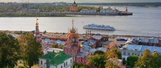
Don't miss the most popular article in the section: Metro Nizhny Novgorod. Diagram, map, description.
Natural resources
This federal district has the most iron ore minerals. Their main deposits are located in the Kursk magnetic anomaly. According to statistics, this anomaly ranks first in the world ranking in terms of geological reserves.
However, iron ore is not the only thing the Central Federal District is rich in. Large deposits of such resources as:
- Chalk
- Limestone
- Fireproof clay
- Marl
- Glass and molding sand
If we consider the resources intended for use as fuel (fuel and energy complex), then most of them are expressed in the form of brown coal in the Moscow region. It even spreads in areas such as:
- Tverskaya
- Kaluzhskaya
- Ryazan
- Smolenskaya
There are peat deposits in the Kostroma and Yaroslavl regions.
Rice. 3. Yaroslavl tire plant
What areas are included in the Central Federal District
The list of regions belonging to the Central Federal District is as follows:
- The Belgorod region is one of the border regions: in the south and west of the region there is the border between Russia and Ukraine. The largest cities in the region - Belgorod and Stary Oskol - have been mentioned in chronicles since the 16th century. The Belgorod region belongs to the industrial-agrarian region: it is famous for its fertile chernozems and iron ore deposits located in the Kursk magnetic anomaly.
- The Bryansk region is another border territory, and it “adjacents” to two states at once, bordering Ukraine in the south and the Republic of Belarus in the west. The regional capital, Bryansk, was founded in the 10th-11th centuries, and its name originally sounded like “Debryansk” (from the dense forest wilds surrounding the city). One of the brightest natural attractions of the region is the Bryansk Forest biosphere reserve.
- Vladimir region , the center of attractions of the famous Golden Ring of Russia. On its territory are located the famous ancient cities of Russia - this is not only the center of the region, Vladimir, but also Suzdal, Gus-Khrustalny, Murom, Alexandrov and many others.
- Voronezh region . The administrative center of the district, the city of Voronezh, is the second most populous city in the Central Federal District: just over a million people live here.
- Ivanovo region is the most “compact” of all the regions that make up the district, its area is 21,437 km2. This is the recognized “textile capital” of Russia, the birthplace of the famous Ivanovo and Shuya chintz, and two cities in the region - Ivanovo and Plyos - are part of the Golden Ring.
- The Kaluga region is small both in area (about 30 thousand km2) and in population (slightly more than a million), but is considered one of the most economically developed regions of the country, leading in terms of industrial growth and population income.
- The Kostroma region is the second largest among the constituent entities of the Siberian Federal District, and at the same time the most sparsely populated, about 650 thousand people live here. Ancient Kostroma, founded in the 12th century, is considered the official birthplace of the Snow Maiden. It is also included in the Golden Ring routes.
- Kursk region , the “nightingale land of Russia”, is known for its fertile black soils and a unique iron ore deposit - the Kursk magnetic anomaly. The region's economy is based on agriculture and iron mining. Tourists are attracted here by military-historical routes passing through the sites of battles on the Kursk Bulge.
- The Lipetsk region is small in territory (about 24 thousand km2). This is the most “miniature” of all the black earth regions of Russia, and it is here that almost a third of domestic canned fruits and vegetables are produced. Culture and industry are actively developing here; a special federal economic zone has been created in the region, recognized as one of the best investment sites in Europe.
- The Moscow region (also sometimes called the “capital region”) is in second place in terms of population both in the Central Federal District and in Russia as a whole, second only to the capital. Its population is about 7.5 million people. The “semi-official” administrative center of the region is Krasnogorsk, where the Regional Government House is located.
- The Oryol region is an industrial-agrarian region, many of whose settlements are included in the list of historical settlements. Among them is the capital of the region, the city of Orel - it began with a fortress founded by Ivan the Terrible to protect the southern borders of the country.
- The Ryazan region is an old industrial region with a rich history. The number of cultural, architectural and archeological monuments in the region amounts to thousands. These places are also famous for their natural monuments, the most famous of which are the Oksky Nature Reserve and the Meshchersky National Park.
- The Smolensk region , bordering Belarus, is located in western Russia. Its administrative center, Smolensk, is considered one of the oldest cities in the country - it was first mentioned in chronicles in 863. The Smolensk region is famous for its cheeses and dairy products, and in terms of production volume of these products it ranks first in the federal district.
- The Tambov region is one of the black earth regions famous for its natural resources. Agriculture and the food industry are developed here. This is an area with rich cultural traditions: on its territory there are more than 1,300 cultural and historical monuments, a prominent place among which is occupied by Orthodox churches and monasteries.
- The Tver region ranks first in the Central Federal District in terms of area (84,201 km2). This is one of the most famous tourist regions of the country, attracting both with its natural beauty (Seliger, the sources of the Volga and the system of Upper Volga lakes, the so-called Moscow Sea - Ivankovo Reservoir), and ancient Russian cities such as Tver, Tozhok or Vyshny Volochyok.
- The Tula region is considered one of the most economically developed regions of the central part of the country. Among the most famous industrial enterprises in the region are the Tula Arms Factory (operating for more than three hundred years) and the Yasnaya Polyana confectionery factory, where the legendary Tula gingerbread cookies are baked.
- The Yaroslavl region is also one of the most industrially developed regions of Russia (more than 300 federal-scale enterprises operate here); it is also known for its cultural and natural attractions. The historical center of Yaroslavl is included in the UNESCO cultural heritage list, and along with two other cities in the region, Rostov the Great and Pereslavl-Zalessky, is included in the Golden Ring.
Agro-industrial complex (AIC)
More than 33 thousand hectares are provided for agriculture in the Central Federal District. Thanks to the fertile soils, most of which are podzolic and sod-podzolic, crops such as:
- Wheat
- Rye
- Oats
- Barley
- Buckwheat
The livestock sector of the agro-industrial complex is no less well developed. In particular, these are meat and dairy animals, pig farming, poultry farms, and sheep farms. Honey production and fish farming occupy a special position.
Rice. 4. Main building of Voronezh State University
Transport network
The Central Federal District is one of the districts in which there are absolutely all types of transport routes: railway, road, underground, aviation, water and others. In total, the structure of the transport network is as follows:
- 70 main railway junctions
. The most important among them and throughout Russia is the Moscow Transport Hub (MTU). - 28 airports of various aviation types
. This does not take into account especially large ones, such as Sheremetyevo, because they are located in the zone of direct influence of Moscow. - More than 17,000 km of railway lines
. - The total length of
paved highways is more than 227,000 kilometers. - The length of waterways
within the district is 5.5 thousand km. Although the district does not have direct access to the waters of the seas and oceans, thanks to several river networks, ships from the Central Federal District can go to both the Baltic and the Caspian, White, Azov, and Black Seas.
The Central Federal District has international transport routes, such as the Trans-Siberian Railway, which goes straight to Vladivostok.
Important! The Central Federal District also has several oil pipelines, oil product pipelines, and a main gas pipeline.
Market infrastructure
The development of the market system in the Central Federal District is 5 steps ahead of all other districts and regions. In this regard, it accounts for 14.6% of all-Russian indicators. In the Central Federal District, according to the latest statistics from Russian analysts, there is a high rate of development, reaching 25%. As for taxes that are paid directly to the federal budget, then the mark crosses the threshold of 45%.
Rice. 5. Moscow Refinery
The Central Federal District ( CFD ) united two economic regions: Central and Central Black Earth. Its area is 650.7 thousand square meters. km. The Central Federal District includes 18 subjects of the Russian Federation (Bryansk, Vladimir, Ivanovo, Kaluga, Kostroma, Moscow, Oryol, Ryazan, Smolensk, Tver, Tula, Yaroslavl, Belgorod, Voronezh, Lipetsk, Kursk and Tambov regions. The center of the district is the city of Moscow. ). The Central Federal District ( CFD ) continues to be one of the most prosperous districts in Russia from an economic point of view. On the territory of the Central Federal District there is the largest economic, political, scientific and cultural center of Russia - its capital, the city of Moscow with a population of over 8.6 million people. This is the largest financial center in Russia, the most important transport hub, providing a wide range of transport services. The country's highest level of development of the service sector, wholesale and retail trade, focused on the area of concentration of consumer demand, has been achieved here. The city's information and communications services sector is rapidly developing. The Central Federal District is a leader among federal districts in all major indicators of socio-economic development. Only in terms of the total volume of industrial production is it somewhat inferior to the Volga Federal District.
Large cities of the district are Moscow, Voronezh, Yaroslavl, Lipetsk, Ryazan, Tula, Kursk, Tver, Bryansk, Ivanovo, Belgorod, Vladimir, Kaluga, Orel, Stary Oskol, Smolensk, Tambov, Kostroma.
Due to its extremely advantageous and important economic and geographical location, the Central Federal District has the most developed transport network in Russia. The density of railway transport is the highest in Russia. The Central Federal District also has the most developed road transport. There are 15 highways leaving Moscow. River transport is important only for Moscow and the Moscow region when transporting large cargo. Moscow is the largest international and domestic air transportation center. There are 4 airports in Moscow: Sheremetyevo, Domodedovo, Vnukovo and Bykovo.
On the territory of the Central Federal District there are Nezhegolsky Natural Park, Rovensky Natural Park, Khotmyzhsky Natural Park , 13 reserves:
Belogorye - main city 1925, total. area 2131 Ha. Bryansk Forest - main city 1987, total. area 12186 ha. Voronezh - main city 1923, total. area 31053 Ha. Voroninsky - city main. 1994, total area 10,320 hectares. Galichya Mountain - main city 1925, total. area 231 Ha. Darwinsky - g. main. 1945, total. area 112,673 hectares. Kaluga Zaseki - city main. 1992, total area 18533 Ha. Kologrivsky Forest - main city 2006, total area 59,000 hectares. Oksky - main city 1935, total. area 55728 Ha. Prioksko-Terrasny - main city 1945, total. area 4,945 hectares. Khopersky - main city 1935, total. area 16,200 hectares. Central-Lesnoy - main city 1930, total. area 24447 Ha. Central Chernozem - main city. 1935, total. area 5287.4 ha.
8 National Parks: Zavidovo - main city. 1929, total. area 125,400 Ha. Smolensk Poozerie - main city. 1992, total area 146,237 Ha. Meshchera - main city 1992, total area 118,700 hectares. Meshchersky - main city 1992, total area 103,000 hectares. Oryol Polesie - main city 1994, total area 77,700 Ha. Pereslavsky ( Pleshcheyevo Lake ) - main city. 1998, total area 23,790 hectares. Losiny Island - main city 1983, total area 12,900 hectares. Ugra - main city 1997, total area 98,623 Ha.
As well as Federal reserves:
Bezborodovskoye GOOX Bryansk GOOX Voronezh State Complex "Tarusa" Kamennaya Steppe Kletnyansky Klyazminsky Kostromskoye GOOX Bear, GOOX Meshchera, GOOX Muromsky Ryazan Seliger GOOX Sobinskoye GOOX Suzdal GOOX Sumarokovsky Yaroslavl
***
Industry
All industries are highly developed in the Central Federal District. Based on this, the following statistics were made, reflecting the general indicators and level of academic performance in relation to other constituent entities of the Russian Federation. Let's look at specific data using the example of the Moscow region:
- Metal processing accounts for almost 39% of all-Russian indicators
- Electric power industry - 11%
- Construction production - 11.3%
- Food industry - 9.1%
- Light industry - 10%
- Khimprom - almost 8%
- The woodworking industry accounts for - 5%
- Non-ferrous metallurgy about 3.5%
- Ferrous metallurgy - 2.3%
Mechanical engineering
Mechanical engineering occupies a major position in the Central Federal District. Recently, the machine tool industry, aircraft manufacturing, electrical power equipment, electrical appliances and carriage building have become particularly widespread. The main center of this field of activity is the capital of the Russian Federation - Moscow. The main ZIL enterprise, which produces trucks, is located here. There are numerous enterprises producing machine tools for all types of industries: food, textile, woodworking and others.
Moscow is a multimillionaire city
In Russia, only two cities deserve multimillionaire status (that is, cities with a population of more than five million people) - Moscow and St. Petersburg. Moreover, the capital crossed this milestone already in 1959.
Starting from the second half of the 19th century, when the population of Moscow was 800,000 people, the number of its inhabitants only increased. And due to the newly acquired status of the capital, the growth rate has rapidly increased.
Thus, already in 2000 the population of the capital exceeded the mark of ten million people. To what extent such rapid growth is beneficial for the urban environment and the people already living in it is an open question, however, experts note that in terms of the method of reproduction and growth rate, Moscow is close to European capitals, but in terms of population density it is more likely to approach overpopulated Asian centers demonstrating explosive growth in the last two decades.
Population
Of the total population of almost 39 million people, there are many different nationalities in the Central Federal District - there are about 28 of them. Let's look at the nations that make up the bulk:
- Russians make up the bulk of the population - 89.10%
- Representatives of Ukraine - 1.34%
- Armenian citizens - 0.71%
- Tatars - 0.69%
Due to such a wide national composition, there are 9 language groups, which are united into 7 families:
- Indo-European family consisting of Slavs, Armenians, Iranians, Romanians, Indo-European Jews and Indo-Aryans. The main part, naturally, is occupied by representatives of the Slavic family - more than 90%.
- The Altai family includes the Turks and Mongols.
- Ural family consisting of a Finno-Ugric group.
- North Caucasian family.
- Kartvelian family.
- Korean family.
- Semitic-Hamitic family.