Krasnoyarsk, which is part of the Siberian Federal District, played a great role in the development of the eastern and central Trans-Ural lands. What factor predetermined the development of Krasnoyarsk, what contributed to its emergence as the largest industrial, scientific and cultural center not only in Siberia, but also in Russia? Today it is a million-plus city, which is the capital of the Krasnoyarsk Territory and the economic center of Eastern Siberia.
History of education
And it all started quite ordinary for most Russian cities, formed during the development of Siberian lands in the 16th-18th centuries. It was a wooden fort founded on the Yenisei, at the confluence of the Kachi River. In 1628, from the moment the Cossacks under the leadership of the nobleman A. Dubensky founded a wooden fortress, the history of one of the largest cities in the Siberian Federal District - Krasnoyarsk - began. What was the history of this wonderful city, one of the ancient and beautiful cities of Siberia? It is full of significant events related to the history of Russia.
The fortress had five observation towers, which were connected by walls. It was surrounded by a rampart and a ditch filled with water. Not far away, on the Kum-Tigey hill (the modern name is Karaulnaya Mountain), an observation tower was erected to monitor the area. If the enemy approached, the guards lit a fire, which warned of the enemy, preventing the Cossacks from being taken by surprise.
The gates of the fort were closed, and he was preparing to repel the raid of the Turkic and Mongol tribes. The fort served as protection for the cities of Yeniseisk and Tomsk, and over time, the villages of settlers located in the district and located in the zone protected by the Cossacks.
Data by year
Krasnoyarsk entered the list of million-plus cities only in 2012. Previously, there was a significant increase in population: due to migration and natural increase.
- 2004: The city's population was 912,800.
- 2005: 917 200.
- 2006: the population in Krasnoyarsk was already 920,900.
- 2007: population was 927,200.
- 2008: exceeded 936,400.
- 2009: the number of inhabitants became 947,801.
- 2010: 973 826.
- 2011: 973 900.
- 2012: 997 316.
- 2013: 1 016 385.
- 2014: 1 035 528.
- 2015: 1 052 218.
- 2016: 1 066 934.
- 2017: 1 082 933.
- 2018: 1 090 811.
- 2019: 1 095 286.
- 2020: 1 093 771.
In just 16 years, Krasnoyarsk has grown by 200,000. At the moment, the growth trend continues; experts say that if the situation is stable by 2030, the number of residents could exceed 1.5 million.
City location and climate
One of the beautiful cities in the Siberian Federal District is Krasnoyarsk. What other city can boast such an amazing location? First of all, it is located on one of the most beautiful rivers - the Yenisei, dividing Siberia into Eastern and Western. The city stretches on both sides of the river. It divides it into equal parts, one of which is located in Western and the other in Eastern Siberia. Nevertheless, Krasnoyarsk is the center of the economic region of the East Siberian region.
The terrain of the city is also unusual. It is located in a basin formed at the junction of the Central Siberian Plateau, the West Siberian Plain with the northern spurs of the Sayan Range, located within the city. The terrain is hilly. The city is surrounded by mountains and the amazing Stolby nature reserve. The climate of Krasnoyarsk is moderate continental and soft. This is due to the non-freezing Yenisei, reservoir and mountains.
Coat of arms
Krasnoyarsk lion
The first version was approved on March 12, 1804. The coat of arms was divided horizontally into two parts: in the upper part the coat of arms of the Tomsk province was depicted, and in the lower part there was an image of the Krasny Yar cliff on a silver background. The revised coat of arms, approved on November 23, 1851, featured a golden figure of a lion on a red heraldic shield with a spade in the right front paw and a sickle in the left front paw, both of which were made of the same metal. The shield crowned the golden crown of the Russian Empire. The current coat of arms (pictured here) was approved on November 28, 2004. It contains the same red shield as in 1851, but with a slightly modified lion figure in the officially approved image. The shield is crowned with the shape of a wall crown, which represents the golden five-tower administrative center of the federal subject.
Krasnoyarsk city
The sovereign's people, together with their families, remained for a long time the majority of the city's residents. These were service people and Cossacks. In 1690, by the highest sovereign decree, Krasnoyarsk became a city. This event led to a sharp increase in residents, mainly due to employees. The city began to develop; according to the 1713 census, it was home to more than 2,500 residents engaged in farming, which allows for the moderate continental climate of Krasnoyarsk.
The fire of 1773 burned down almost all residential buildings. But this did not stop the existence of the city; it was rebuilt. In 1822, the city received the title of provincial and the status of the center of the Yenisei province. It began to grow rapidly after the construction of the Siberian Highway, which connected it with Achinsk and Kansk.
An ironworks was built not far from the city, and a little later - a glass factory and a faience factory. A school was opened where they received complete primary education. From the remaining part of the uncut taiga, a park was organized, today it is Central Park. The public library has opened its doors.
The city of Krasnoyarsk in Tsarist Russia has always been a place of exile. The Decembrists, Petrashevites and many other political prisoners were sent here, who made a significant contribution to the development of culture and education of the city.
Forecast
The total number of citizens is growing rapidly, even despite the epidemiological situation in the country. Due to the large influx of population from other regions of the Russian Federation, as well as from different countries, including the Middle East, the number of residents continues to grow. At the same time, the annual outflow is 10-15 thousand, 7 times less than the increase over the period.
According to statistics, over 8 years the number of residents has increased by 100 thousand. If the trend continues in the future, in 2030-35 the administrative center of the region could grow to 1.5 million. This is facilitated by the constant expansion of industry in the Krasnoyarsk Territory, which opens up a large number of jobs and opportunities for residents of not only the cities of the region, the country, but also many countries. Most of the visitors formally register their permanent place of residence.
Krasnoyarsk is a rapidly developing locality with a colossal number of unique employment opportunities. Students from provincial settlements tend to move to a larger region. This opens up opportunities for them to realize themselves as specialists in a narrow, profitable field, and gives them the opportunity to study further, choosing from an impressive number of educational institutions.
Golden fever
Gold mining in the Yenisei province began in the 30s of the 19th century. The discovery of mines took place along the rivers Upper and Lower Tunguska, Biryusa, Mana and their tributaries. Gold was found even in Krasnoyarsk itself on the Bugach River, on Afontovaya Mountain, prospectors panned for gold on Stolby. A lot of people worked in the mines, for example, almost 6,000 people were hired at Mariinsky in 1840, 90% of whom were exiled settlers.
There was a leap in manufacturing and agriculture. In 1859, 2 million poods of grain and 15 thousand heads of cattle were supplied to the mines of the Yenisei province alone, and the production and sale of fish increased threefold. What was needed were horses, their harness, carts and equipment, which were manufactured in the city.
The construction of houses, which to this day serve as the decoration of the city, increased sharply; new squares and churches appeared in Krasnoyarsk. In 1863 a telegraph station was opened. In the same year, steamships started sailing along the Yenisei. A men's gymnasium was built in 1868, and 10 years later a women's gymnasium. A paramedic school was opened. Primary schools started working.
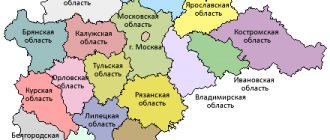
Regions
| 1 | Amurskaya | 361 900 | 829 200 | Blagoveshchensk | 10 | |
| 2 | Arkhangelskaya | 589 900 | 1 228 100 | Arkhangelsk | 11 | 19 municipal districts, 7 urban districts |
| 3 | Astrakhan | 49 000 | 1 010 700 | Astrakhan | 12 | 11 municipal districts, 2 city districts |
| 4 | Belgorodskaya | 27 100 | 1 532 700 | Belgorod | 14 | 19 municipal districts, 3 urban districts |
| 5 | Bryansk | 34 900 | 1 278 100 | Bryansk | 15 | 27 municipal districts, 7 urban districts |
| 6 | Vladimirskaya | 29 100 | 1 444 600 | Vladimir | 17 | 16 municipal districts, 5 city districts |
| 7 | Volgogradskaya | 112 900 | 2 611 200 | Volgograd | 18 | 33 municipal districts, 6 urban districts |
| 8 | Vologda | 144 500 | 1 202 300 | Vologda | 19 | 26 municipal districts, 2 city districts |
| 9 | Voronezh | 52 200 | 2 335 800 | Voronezh | 20 | 31 municipal districts, 3 urban districts |
| 10 | Ivanovskaya | 21 400 | 1 062 600 | Ivanovo | 24 | 21 municipal districts, 6 urban districts |
| 11 | Irkutsk | 775 300 | 2 428 700 | Irkutsk | 25 | 27 municipal districts, 9 urban districts |
| 12 | Kaliningradskaya | 15 100 | 941 500 | Kaliningrad | 27 | 15 municipal districts, 6 urban districts |
| 13 | Kaluzhskaya | 29 800 | 1 011 600 | Kaluga | 29 | 24 municipal districts, 2 city districts |
| 14 | Kemerovo | 95 700 | 2 763 400 | Kemerovo | 32 | 28 municipal districts, 16 urban districts |
| 15 | Kirovskaya | 120 400 | 1 341 300 | Kirov | 33 | 39 municipal districts, 6 urban districts |
| 16 | Kostromskaya | 60 200 | 667 500 | Kostroma | 34 | 24 municipal districts, 6 city districts |
| 17 | Kurganskaya | 71 500 | 910 900 | Mound | 37 | 24 municipal districts, 2 city districts |
| 18 | Kursk | 30 000 | 1 126 500 | Kursk | 38 | 28 municipal districts, 5 city districts |
| 19 | Leningradskaya | 83 900 | 1 712 700 | Saint Petersburg | 41 | 17 municipal districts, 1 city district |
| 20 | Lipetskaya | 24 000 | 1 172 800 | Lipetsk | 42 | 18 municipal districts, 2 city districts |
| 21 | Magadan | 462 500 | 157 000 | Magadan | 44 | 8 municipal districts, 1 city district |
| 22 | Moscow | 45 800 | 7 092 900 | Moscow | 46 | 36 municipal districts, 36 urban districts |
| 23 | Murmansk | 144 900 | 796 100 | Murmansk | 47 | 5 municipal districts, 14 urban districts |
| 24 | Nizhny Novgorod | 76 600 | 3 310 600 | Nizhny Novgorod | 22 | 48 municipal districts, 4 city districts |
| 25 | Novgorodskaya | 54 500 | 634 100 | Velikiy Novgorod | 49 | 21 municipal districts, 1 urban district |
| 26 | Novosibirsk | 177 800 | 2 665 900 | Novosibirsk | 50 | 30 municipal districts, 5 urban districts |
| 27 | Omsk | 141 100 | 1 977 500 | Omsk | 52 | 32 municipal districts, 1 city district |
| 28 | Orenburgskaya | 123 700 | 2 032 900 | Orenburg | 53 | 35 municipal districts, 13 city districts |
| 29 | Orlovskaya | 24 700 | 787 200 | Eagle | 54 | 24 municipal districts, 3 city districts |
| 30 | Penza | 43 400 | 1 386 200 | Penza | 56 | 28 municipal districts, 5 city districts |
| 31 | Pskovskaya | 55 400 | 673 500 | Pskov | 58 | 24 municipal districts, 2 city districts |
| 32 | Rostov | 101 000 | 4 279 200 | Rostov-on-Don | 60 | 43 municipal districts, 12 city districts |
| 33 | Ryazan | 39 600 | 1 154 200 | Ryazan | 61 | 25 municipal districts, 4 city districts |
| 34 | Samara | 53 600 | 3 215 700 | Samara | 36 | 27 municipal districts, 10 city districts |
| 35 | Saratovskaya | 101 200 | 2 521 800 | Saratov | 63 | 38 municipal districts, 4 city districts |
| 36 | Sakhalinskaya | 87 100 | 497 900 | Yuzhno-Sakhalinsk | 64 | 2 municipal districts, 17 urban districts |
| 37 | Sverdlovskaya | 194 300 | 4 298 000 | Ekaterinburg | 65 | 5 municipal districts, 67 urban districts |
| 38 | Smolenskaya | 49 800 | 985 500 | Smolensk | 66 | 25 municipal districts, 2 city districts |
| 39 | Tambovskaya | 34 500 | 1 092 400 | Tambov | 68 | 23 municipal districts, 7 urban districts |
| 40 | Tverskaya | 84 200 | 1 353 500 | Tver | 28 | 36 municipal districts, 7 urban districts |
| 41 | Tomsk | 314 400 | 1 045 500 | Tomsk | 69 | 16 municipal districts, 4 urban districts |
| 42 | Tula | 25 700 | 1 553 900 | Tula | 70 | 23 municipal districts, 3 urban districts |
| 43 | Tyumen | 1 464 200 | 3 395 200 | Tyumen | 71 | 21 municipal districts, 5 urban districts (without Khanty-Mansi Autonomous Okrug and Yamal-Nenets Autonomous Okrug) |
| 44 | Ulyanovskaya | 37 200 | 1 292 200 | Ulyanovsk | 73 | 21 municipal districts, 4 urban districts |
| 45 | Chelyabinsk | 88 500 | 3 478 600 | Chelyabinsk | 75 | 27 municipal districts, 16 city districts |
| 46 | Yaroslavskaya | 36 200 | 1 272 500 | Yaroslavl | 78 | 17 municipal districts, 3 city districts |
City development
The passage of the railway through it played a huge role in the development of the city as an industrial center of Siberia. This served to further development, subsequently making Krasnoyarsk the industrial leader in the Siberian Federal District that Krasnoyarsk has become today. An interesting fact is that the rails for its construction were delivered from Scotland. The ships loaded with them passed through the Arctic Ocean, the Kara Sea to the mouth of the Yenisei River. Further along the Yenisei they were taken to Krasnoyarsk.
In 1899, a railway bridge connecting the banks of the Yenisei came into operation; it was built in 3 years and connected Eastern and Western Siberia. A water supply system is being built in the city, and the first power plant came into operation at the beginning of the 20th century. At this time, 27 thousand people lived in the city, which by Siberian standards corresponded to a large city, in which 27 industrial enterprises operated.
Railway
Founded in 1979 as a result of the division of the Oktyabrsky district. Almost 95 thousand people live here. Its territory mainly lies along the railway tracks. But it is here that the calling card of the entire city is located - the railway station.
It is believed that the Zheleznodorozhny district of the city of Krasnoyarsk is well-maintained, with many parks and alleys and squares. Utility problems rarely arise here, since the area is quite young, although almost the entire housing stock is represented by Khrushchev-era buildings. New construction is being carried out locally. There are 16 industrial enterprises in the region, as well as design and scientific institutions.
5 kilometers from the area is the village of Udachny, where the active construction of townhouses and cottages is underway. It is in this village that the governor's residence is located. It is clear that the cost of housing in Udachny is very high; on average, they ask for a cottage from 15 million rubles.
Soviet period and present
The development and formation of the modern city of the Siberian Federal District of Krasnoyarsk was predetermined by the Soviet years. It was at this time that its rapid industrial and cultural development took place. During the war years, enterprises from the central part of the country were evacuated here, which created a strong industrial basis for the city. Hospitals and schools were built, transport was developed. In 1934, the Krasnoyarsk Territory was formed with its center in the city of Krasnoyarsk.
The Krasnoyarsk and Sayano-Shushenskaya hydroelectric power stations and the Krasnoyarsk airport were built, connecting it with the cities of Russia and the world. Sports facilities, theaters, and cultural institutions opened. In 2015, the 4th road bridge was built across the Yenisei. Today the city has a population of about 1,830,000 people.
Culture
A number of local holidays are celebrated in Krasnoyarsk every year. The most significant holiday is City Day, which is celebrated in June, usually with a carnival. Other holidays and cultural events are the Mana Festival (Russian: Mansky festival. Celebrations take place outside the city, on the banks of the Mana River), usually held on the last weekend of June along with the traditional bard competition, the International Museum Biennale. traditionally held at the Krasnoyarsk Cultural/Historical Center, the avant-garde Night Museum
festival dedicated to International Museum Day (May 18), Jazz on the Yenisei festival, Stolbist Day held many times a year celebrating the tradition of mountaineering in the Stolby National Reserve and biker rally.
Krasnoyarsk has a number of local television companies and highly developed telecommunications; many areas of the city have broadband Internet access.
The city is also home to the Krasnoyarsk Children's Choir, a world-famous choir that tours many countries as the Eaglets of Siberia.
see also
| Federal structure of Russia | |
| Republic | Adygea • Altai • Bashkortostan • Buryatia • Dagestan • Ingushetia • Kabardino-Balkaria • Kalmykia • Karachay-Cherkessia • Karelia • Komi • Mari El • Mordovia • Sakha (Yakutia) • North Ossetia • Tatarstan • Tyva • Udmurtia • Khakassia • Chechnya • Chuvashia |
| The edges | Altai • Transbaikal • Kamchatka • Krasnodar • Krasnoyarsk • Perm • Primorsky • Stavropol • Khabarovsk |
| Regions | Amur • Arkhangelsk • Astrakhan • Belgorod • Bryansk • Vladimir • Volgograd • Vologda • Voronezh • Ivanovo • Irkutsk • Kaliningrad • Kaluga • Kemerovo • Kirov • Kostroma • Kurgan • Kursk • Leningrad • Lipetsk • Magadan • Moscow • Murmansk • Nizhny Novgorod • Novgorod • Novosibirsk • Omsk • Orenburg • Oryol • Penza • Pskov • Rostov • Ryazan • Samara • Saratov • Sakhalin • Sverdlovsk • Smolensk • Tambov • Tver • Tomsk • Tula • Tyumen • Ulyanovsk • Chelyabinsk • Yaroslavl |
| Federal cities | Moscow, Saint Petersburg |
| Autonomous region | Jewish |
| Autonomous okrugs | Nenets 1 • Khanty-Mansiysk - Yugra 2 • Chukotka • Yamalo-Nenets 2 |
| 1 Part of the Arkhangelsk region 2 Part of the Tyumen region |
Wikimedia Foundation. 2010.
See what “Regions of Russia” are in other dictionaries:
Earthquakes. Dangerous and safe regions of Russia - 20% of the territory of Russia belongs to seismically active areas (including 5% of the territory subject to extremely dangerous earthquakes of 8-10 magnitude). Over the past quarter of a century, about 30 significant events have occurred in Russia, that is, with a force of more than seven points... Encyclopedia of Newsmakers
Regions of the Russian Federation - Politics Portal: Politics Russia This article is part of the series: Politics and the government of Russia State system Constitution of Russia Amendments President of Russia Dmitry Medvedev Presidential Administration ... Wikipedia
Regions of the Russian Federation - Politics Portal: Politics Russia This article is part of the series: Politics and the government of Russia Political system Constitution of Russia Amendments President of Russia Dmitry Medvedev Presidential Administration ... Wikipedia
Areas of application of satellite navigation systems - The development of the transportation market, primarily of expensive and dangerous goods, objectively dictates the need for positioning systems using satellite navigation, radio communications and electronic maps. The first systems of this kind were extremely ... ... Wikipedia
Regions of Kazakhstan - The Republic of Kazakhstan is administratively divided into 14 regions and 3 cities of republican significance. the city of Astana, the capital of the state, the city of Alma Ata, a city of republican significance, the city of Baikonur, a city of republican significance, located together with ... Wikipedia
Regions of Darkness - This article is about the film. For the book, see Regions of Darkness (book). Without Limit Limitless ... Wikipedia
Serpukhovsky district of the Moscow region - Serpukhovsky district Coat of Arms Flag (description) ... Wikipedia
List of archaeological cultures of Russia - Contents 1 European part of Russia 1.1 Paleolithic 1.1.1 Lower Paleolithic ... Wikipedia
Administration of the Bryansk Region - Administration of the Bryansk Region ... Wikipedia
Sharypovo
Sharypovo, in the Krasnoyarsk Territory, regional subordination, regional center, 414 km west of Krasnoyarsk. Located in the foothills of the Kuznetsk Alatau, on the river. Beresh (Chulym basin). Railway station on the branch from Achinsk on the Trans-Siberian Railway. Airport. Population 41.8 thousand people (1992; 6.0 thousand in 1979). On the site of the modern city there was a village (after 1760 - a village) Sh. (Sharypovskoye). At the end of the 19th century. There was a hospital, a 2-class school, a library, and a bank in the village. The city - since 1981, in 1985-88 was called Chernenko in honor of the General Secretary of the CPSU Central Committee K. U. Chernenko, a native of the Krasnoyarsk Territory. Sh. is growing in connection with the formation of the Kansk-Achinsk fuel and energy complex (KATEK). The city is built up with multi-storey buildings, individual cottages with garden plots are being built. Berezovskaya GRES-I and Berezovsky coal mine (19 km north of Sh.).
