Tambov is the administrative and industrial center of the Tambov region. The city has existed since 1636. A satellite map of Tambov shows that this settlement is located on the territory of the Russian Plain and borders the Ryazan and Penza regions.
The city belongs to the Central Black Earth region. The distance from it to Moscow is 500 km.
The city has a convenient location, which has a beneficial effect on economic development. Its territory is crossed by the most important highways that connect the city with the Volga region and the south of the country.
The map of Tambov allows you to see all the water resources of a given locality. Among the large rivers, the Vorona, Tsna and Voronezh stand out.
There is a station in Tambov that belongs to the South-Eastern Railway. Branches from it go to Kamyshin, Saratov and other cities.
Where is Tambov located?
Tambov is the administrative and economic center of the Tambov region and Tambov district.
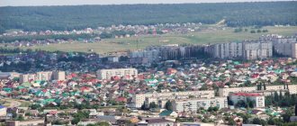
It is an administrative-territorial unit and a city of regional significance. The city of Tambov is located in the central part of the Oka-Don Plain, on the canal of the Tsna River. The approximate population of the city is 293 thousand people, the total area of the territory is 96 square kilometers. The climate in Tambov is temperate continental: winters are moderately cold, summers are long and warm. The average annual air humidity is 75%, the annual precipitation rate is 520 mm.
Tambov is located in the same time zone as Moscow, the offset relative to Coordinated Universal Time (UTC) is +3.
See location on the map
The center of the region and district of the same name - Tambov on the map of Russia is located almost equidistant from the regional borders, not far from which are located the economically important regions of the Volga region, the Center, and the North Caucasus. Located in the Oka River basin, the city of Tambov, Tambov region, is distant from the nearest large settlements along roads at a distance of:
- 131 km from Lipetsk, located a little to the west.
- 220 km from Voronezh, located in the southwest.
- 258 km from Ryazan and 460 km from Moscow in the north-west direction.
Train Station
Railway station "Tambov-I" is a station in the Michurinsky region of the South-Eastern Railway. The station is located in the Sovetsky district at Privokzalnaya Square, 1A.
Popular long-distance train destinations: Astrakhan, Moscow, Saratov, Novosibirsk, Belgorod, Balakovo, Balashov, Kamyshin, St. Petersburg. In the summer season there are routes to Adler, Anapa and Novorossiysk. Also at the Tambov-I railway station there is service for commuter trains that go to Michurinsk, Kirsanov, Tamala and Oblovka.
Tambov bus stations
Tambov bus station is located in the Soviet district at the address: st. Kikvidze, 77, next to the Toyota Tambov car showroom. The bus station's operating hours are from 6:00 to 19:30, every day. Popular routes of regular buses: Nikiforovka, Tula, Michurinsk, Znamenka, Orel, Lipetsk, Zherdevka, Staroyuryevo, Mordovo, Sosnovka, Volgograd, Saratov, Voronezh, Pervomaisky, Penza, Kursk.
The bus station building houses a spacious waiting room, a buffet, a storage room for luggage and personal belongings, and a medical center.
Map of Tambov with streets
Among the most famous and largest streets of the city are the following:
- .Tambovskaya Street was one of the first in the city. Its first name was Kuzminskaya, and the road to the nearest village stretched along it. In the 80s, the MZhK microdistrict appeared on it.
- A map of Tambov with streets will allow you to find International Street, which is one of the central highways. It houses the city administration, banking institutions, a hospital, as well as the Rodina cinema and the wedding palace. Its construction began in the 18th century.
- Sovetskaya is considered one of the longest streets. Its first name was Bolshaya Astrakhnskaya. Its length is 7.1 thousand meters. On the street there is Pervomaiskaya Square, as well as park areas and a theater for young spectators.
- A map of Tambov with streets and houses shows where Naberezhnaya Street is located. This is one of the most beautiful highways. It is located on the coast of the Tsna River. The total length of the street is 2.6 thousand meters. Nearby there are beautiful fountains, as well as monuments of religious architecture: the Spaso-Preobrazhensky and Kazan Cathedrals.
- The largest streets include Karl Marx Street. It is an important transport artery. There are many ancient buildings on it.
A map of Tambov by district will allow you to find any district in the city. The most prestigious are the city center and the southern region.
Large hypermarkets are located in the northern part of the city. These are shopping centers such as Auchan and Europe.
In the vicinity of Tambov there are many different villages. On the south side there is Bokino, as well as the villages of Novy and Stroitel.
On the north side you can find the villages of Solnechny and Raduzhnoe.
There are trolleybus and bus routes in the city. There are two bus stations in Tambov. One serves suburban and intercity flights, and the second serves interregional and intercity flights.
A map of Tambov with streets in good quality shows where the airport is located in the city.
Automobile highways
Federal highways pass through Tambov:
- P22 "Caspian" is a federal highway "Caspian", with a total length of 1,381 km. It is part of the European routes E119, E40 and the Asian route AH8. The P-22 highway passes through the following regions of Russia: Kalmykia, Moscow region, Ryazan region, Astrakhan region, Voronezh region, Volgograd region. Road surface - concrete and asphalt.
- P119 is a federal highway with a total length of 395 km. The route originates in the city of Orel and passes through Lipetsk, Yelets, Livny. The end of route P-119 is the M6 Caspian highway in the Tambov region. The road surface of the route is asphalt.
- P208 is a highway that has the status of an object of federal significance. The total length of the route is 280 km. The road starts in Tambov and passes through Kamenka, Rasskazovo, Kirsanov, Belinsky. The final point of the route is Penza. The road surface of the P-208 highway is asphalt.
- E119 is a European route that connects Iran, Russia and Azerbaijan. The total length of the highway is 1,730 km. The beginning of the route is the city of Moscow, the final point of the route is the city in the north-west of Iran, Astara.
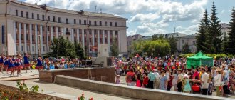
What is Tambov famous for?
- Tambov is home to the Aseev Estate, a mansion that was built at the beginning of the 20th century for the industrialist M.V. Aseev. Today the estate is a museum complex, which includes a house, a fountain and a park.
- In the central part of the city there is Communal Street with a pedestrian zone. The street is also known as “Tambov Arbat”. Along the walking alley there are buildings of the 19th and 20th centuries, decorative flower beds, benches, and forged lanterns.
- In the 18th century, the Tambov Drama Theater was opened in Tambov. The stage was founded by the famous poet and public figure G.R. Derzhavin, at that time he was the governor of the city.
- In 1987, the House-Museum of G. V. Chicherin was opened in the city. To date, the museum has collected more than 3 thousand of Chicherin’s personal belongings, furniture, interior items of that time, letters, books.
- On the Tambov embankment there is a sculpture “Tambov Man”, installed in 2007. The monument shows a poor Tambov peasant of the 20th century, looking towards the Intercession Cathedral, leaning on a plow and clutching a pectoral cross in his hand.
Tambov (Tambov region)
Tambov:| Pokrovo-Prigorodnoye | 3 () | YU | |
| 2 | Builder | 7 () | IN |
| 3 | Novaya Lyada | 15 (14) | IN |
| 4 | Kotovsk | 15 (15) | YU |
| 5 | Rasskazovo | 30 (30) | IN |
| 6 | Znamenka | 33 (42) | IN |
| 7 | Satinka | 41 (58) | SE |
| 8 | Dmitrievka | 47 (55) | NW |
| 9 | Bondari | 49 (61) | NE |
| 10 | Sosnovka | 57 (62) | WITH |
| 11 | Zavoronezhskoe | 62 (67) | Z |
| 12 | Michurinsk | 67 (73) | Z |
| 13 | Rzhaksa | 75 (86) | SE |
| 14 | Pichaevo | 77 (98) | NE |
| 15 | Petrovskoe | 80 (103) | Z |
| 16 | Staroyurevo | 82 (110) | NW |
| 17 | Tokarevka | 82 (112) | YU |
| 18 | Inzhavino | 83 (106) | SE |
| 19 | Mordovo | 83 (91) | SW |
| 20 | Morshansk | 85 (82) | WITH |
| 21 | Kirsanov | 87 (93) | IN |
| 22 | Dobrinka (Lipetsk region) | 89 (119) | SW |
| 23 | Gavrilovka Second | 91 (116) | IN |
| 24 | Pervomaisky | 97 (115) | NW |
| 25 | Zherdevka | 98 (112) | YU |
| 26 | Uvarovo | 99 (109) | SE |
| 27 | Mud | 104 (106) | Z |
| 28 | Umet | 104 (115) | IN |
| 29 | Ertil | 107 (149) | SW |
| 30 | Dobroye (Lipetsk region) | 110 () | Z |
a brief description of
Located in the central part of the Oka-Don (Tambov) plain, on the left bank of the river. Tsna (Volga basin), at the confluence of the river. Studenets, in the southern zone of the Central Russian forest-steppe, 480 km southeast of Moscow. Railway junction lines and highways.
The climate is moderate continental. Winter is moderately cold, with stable snow cover. The average January temperature is -11. Summer is warm, the average temperature in July is +20. Precipitation is about 500 mm per year. Droughts are common.
Territory (sq. km): 91
Historical sketch
In 1636 (considered the year of the founding of Tambov), steward Roman Boborykin was instructed to build a fortress near the crossing on the river. Tsna opposite the mouth of the river. Tambov (now Lesnoy Tambov), on the ancient Ordabazarnaya road that connected Moscow with the Lower Volga region. The charter of Tsar Mikhail Fedorovich prescribed: “... in the field on the Tsna River at the mouth of the Lipovitsa River, establish the city of Tonbov, and arrange all sorts of service people in it.”
However, this place turned out to be inconvenient and the city was built 20 versts down the Tsna, but retaining the name according to the original landmark of the Tambov River. The name of the river is pre-Russian, it is explained from the Mordovian tombaks “swampy” or the ancient Finnish tamb “oak”.
In 1647, a system of complex fortifications was built - the Tambov Wall, which became part of the Simbirsk abatis line. Tambov successfully repelled many attacks by steppe nomads: Nogai Tatars and Kalmyks in 1656 and 1660, an attack by the troops of S.T. Razin in 1670, the siege of L. Khokhlach (ataman of the troops of K.A. Bulavin) in 1706. In the mid-18th century. Tambov is losing its significance as a military fortress and is developing as the center of an agricultural region.
In 1667, Elder Joseph founded the Kazan Monastery in Tambov. In 1685, near Tambov, Bishop Pitirim of the Tambov diocese founded the Tregulyaev Predtechensky Monastery, and in 1690, the Ascension Convent.
In 1708 it was assigned to the Azov province (since 1725 - Voronezh province), since 1719 the center of the Tambov province. Since 1779 - the center of the Tambov governorship (since 1796 Tambov province).
In the 18th century Tambov was a major cultural center. In 1786-88. the head of the Tambov governorship was the poet G.R. Derzhavin. He founded a theater, a printing house, a public school, and laid the foundation for the improvement of the city. A theological seminary was opened in 1787, a gymnasium in 1825, and a public library in 1830. In 1900, a music school was founded.
Since the 1860s There was street lighting and, since 1885, water supply.
In 1856, in the provincial city of Tambov, Tambov province, there were 13 churches, 2553 houses, 143 shops.
In 1870, the Ryazan-Ural Railway passed through Tambov. The city becomes a major center of grain trade, enterprises for processing agricultural products, as well as small metalworking factories, appear. In 1913, about 2.4 thousand workers were employed at industrial enterprises in Tambov.
In 1920-21 in the city there was a headquarters for suppressing the uprising of peasants of the Tambov province under the leadership of A.S. Antonov.
Since 1928, Tambov has been part of the Central Chernozem Region, since 1934 - the Voronezh Region, since 1937 - the center of the Tambov Region.
In 1938, 3 districts were formed: Leninsky, Industrial and Central. 04/16/1940 The industrial district of Tambov was transformed into the independent city of Kotovsk. In 1953, the Industrial District was again formed - from parts of the Central and Leninsky districts. In 1959, the Central District of Tambov was abolished. In 1963, the Sovetsky district of Tambov was created.
In the 1960s Intensive industrial development of Tambov began.
Some numbers
| Index | 1990 | 1999 | 2001 | 2003 | 2005 |
| Demography | |||||
| Number of births, per 1000 population | 12.6 | 6.7 | 7.1 | 8.4 | 8.4 |
| Number of deaths, per 1000 population | 11 | 14.2 | 14.8 | 16.1 | 15.9 |
| Natural increase (decrease), per 1000 population | 1.6 | -7.5 | -7.7 | -7.7 | -7.5 |
| Standard of living of the population and social sphere | |||||
| Average monthly nominal accrued wages, rub. | 0.263 | 1107.8 | 2197.4 | 4136.9 | 6249.4 |
| Average housing area per inhabitant (at the end of the year), sq.m. | 14.1 | 17.3 | 18.2 | 19.6 | 20.5 |
| Number of preschool institutions, pcs. | 88 | 61 | 59 | 59 | 55 |
| Number of children in preschool institutions, thousand people | 17.6 | 8.3 | 8.2 | 8.3 | 8.7 |
| Enrollment of children in preschool educational institutions (at the end of the year), as a percentage of the number of children of the corresponding age, % | 69.1 | 67.9 | |||
| Number of daytime educational institutions (at the beginning of the school year), pcs. | 37 | 53 | 54 | 54 | 54 |
| Number of students in daytime educational institutions, thousand people | 35.9 | 39.6 | 36.4 | 32.1 | 27.5 |
| Number of doctors, people. | 1912 | 2075 | 2011 | 2019 | 2036 |
| Number of nursing staff, people. | 5343 | 5030 | 4735 | 4961 | 4929 |
| Number of hospital institutions, pcs. | 19 | 18 | 16 | 16 | 14 |
| Number of hospital beds, thousand units | 6.8 | 6.6 | 6.3 | 6.1 | 6 |
| Number of medical outpatient clinics, pcs. | 30 | 34 | 33 | 32 | 32 |
| Capacity of medical outpatient clinics, visits per shift, thousand units. | 10.4 | 11 | 10.7 | 10.7 | |
| Number of registered crimes, pcs. | 2902 | 4316 | 4515 | 3847 | 7126 |
| Persons who committed crimes were identified, persons. | 1422 | 3111 | 2758 | 2441 | 2142 |
| Economy, industry | |||||
| Number of enterprises and organizations (at the end of the year), pcs. | 6563 | 6788 | 20837 | 13746 | |
| Number of operating enterprises by type of activity: mining (at the end of the year), pcs. | 2 | ||||
| Number of operating enterprises by type of activity: manufacturing (at the end of the year), pcs. | 209 | ||||
| Number of operating enterprises by type of activity production and distribution of electricity, gas and water (at the end of the year), pcs. | 59 | ||||
| Volume of shipped goods of own production by type of mining (in actual prices), million rubles. | 0 | ||||
| Volume of shipped goods of own production by type of manufacturing (in actual prices), million rubles. | 11676.5 | ||||
| Volume of shipped goods of own production by type of production and distribution of electricity, gas and water (in actual current prices), million rubles. | 2244.7 | ||||
| Construction | |||||
| Volume of work performed by type of activity “Construction” (before 2004 - volume of work performed under construction contracts), million rubles. | 473.5 | 802.9 | 1777.5 | 2740.9 | |
| Commissioning of residential buildings, thousand sq.m. of total area | 113.5 | 78.1 | 96.7 | 126.1 | 162.7 |
| Commissioning of residential buildings, apartments | 2244 | 925 | 1119 | 1490 | 1774 |
| Commissioning of preschool institutions, places | 426 | — | — | — | — |
| Commissioning of educational institutions, places | 700 | — | 300 | 180 | 50 |
| Commissioning of hospital facilities, beds | — | — | — | 112 | 54 |
| Commissioning of outpatient clinics, visits per shift | 800 | 240 | 750 | — | — |
| Transport | |||||
| Number of bus routes (in intracity traffic), pcs. | 25 | 29 | 39 | 39 | |
| Number of trolleybus routes, pcs. | 15 | 15 | 15 | 15 | |
| Length of operational trolleybus lines (at the end of the year), km | 43.2 | 42.7 | 42.7 | ||
| Number of passengers transported by buses per year (in intracity traffic), million people. | 57.8 | 33.3 | 23.8 | 19.9 | 9.1 |
| Number of passengers transported by trolleybuses per year, million people. | 68.3 | 54.9 | 47.9 | 40.7 | 15 |
| Connection | |||||
| Number of telephone sets of the city public telephone network, thousand units. | 51.5 | 91.2 | 97.2 | 97 | 103.3 |
| Number of residential telephone sets of the city public telephone network, thousand units. | 37.4 | 78 | 83.5 | 84.8 | 89.7 |
| Number of payphones of the city telephone network (including universal ones), pcs. | 547 | 535 | |||
| Trade and services to the population | |||||
| Retail trade turnover (in actual prices), million rubles. | 0.6 | 5318 | 8226.1 | 11049.9 | 16753.7 |
| Retail trade turnover (in actual prices), per capita, rub. | 2.2 | 16958 | 26743 | 37933 | 58599.8 |
| Index of physical volume of retail trade turnover, % compared to the previous year | 104.7 | 113 | |||
| Index of physical volume of public catering turnover, % compared to the previous year | 113 | 105.1 | |||
| Number of stores, pavilions (at the end of the year), pcs. | 137 | 85 | |||
| Sales area of shops, pavilions (at the end of the year), sq.m. | 33.5 | 23255.1 | |||
| Volume of paid services to the population (in actual prices), million rubles. | 0.092 | 795.3 | 1806.2 | 3155.9 | 5236.1 |
| Volume of paid services to the population (in actual prices), per capita, rub. | 0.3 | 2535.9 | 5871.9 | 10833.8 | 18314.6 |
| Volume of household services to the population (in actual prices), million rubles. | 0.03 | 154.3 | 352.4 | 623.5 | 817.8 |
| Volume of household services to the population (in actual prices), per capita, rub. | 0.098 | 492 | 1145.5 | 2140.5 | 2860.4 |
| Investments | |||||
| Investments in fixed assets (in actual prices), million rubles. | 0.159 | 471.8 | 734.5 | 2026.9 | 2762.1 |
| Share of investments in fixed assets financed from budgetary funds in the total volume of investments, % | 19.4 | 22.7 | 30.3 | 36.9 |
Data sources:
Regions of Russia. Main characteristics of the constituent entities of the Russian Federation: statistical collection. Goskomstat of Russia. – M:, 2003. Regions of Russia. Basic socio-economic indicators of cities. Statistical collection. Rosstat. – M:, 2005. p. 78 Transport in Russia: Statistical collection. Goskomstat. – M:, 2003. pp. 112, 122 Transport in Russia: Statistical collection. Rosstat. – M:, 2005. pp. 119, 129 Regions of Russia. Basic socio-economic indicators of cities. 2006. Statistical collection. Rosstat. – M:, 2006. p. 78
Culture, science, education
Research Institute of Chemicals for Polymer Materials, Research Institute of Organic Intermediates and Dyes, All-Russian Research Institute of Rubber Engineering.
Institutes: chemical engineering, pedagogical, culture.
Theatres: drama, puppet theaters. Philharmonic.
Museum of Local Lore. Art Gallery. Museum-Estate of the Chicherins.
Museums, galleries, exhibition halls
House-Museum of G.V. Chicherina 392000, Tambov, st. Sovetskaya, 63 Phone(s): (4752) 72-4400, 72-6008 Tambov Regional Museum of Local Lore 392000, Tambov, st. Derzhavinskaya, 3 Telephone(s): (4752) 72-6313, 72-0669 fax: (4752) 72-0655 Tambov Regional Museum of the History of Medicine 392023, Tambov, st. Gogol, 6 Telephone(s): (4752) 75-1695 Tambov regional state cultural institution “Tambov Regional Art Gallery” 392000, Tambov, st. Sovetskaya, 97 Phone(s), 72-46-27
Architecture, sights
The city is located on the banks of the Tsna. Its historical center was formed on the left bank of the river. The right bank has almost no urban development and is occupied by forest parks, meadows and garden plots.
In 1781, a general plan with a radial street system was approved.
Church of the Intercession (1763-69), Kazan Church (1791), former Bishop's House (1791), Summer Church (1818), Transfiguration Cathedral (founded in 1694, rebuilt in 1797, expanded in 1839-40), main post office ( 1786), former theological seminary (1785-1805) with a new building (1825, now the Institute of Chemical Engineering), gymnasium (2 buildings, the first - 1825), Gostiny Dvor (1836-37), public library (1842), Alexander Institute of Nobles maidens (1843, in 1878 a new building was added; now the Pedagogical Institute), an orphanage (first half of the 19th century), a real school (second half of the 19th century, now a secondary school), a women's gymnasium (now the Institute for Advanced Medical Studies), a stable ( mid-19th century, in the courtyard there is a round arena), the Assembly of the Nobility (1897), the Naryshkin Reading Room (1892, now the Art Gallery), etc.
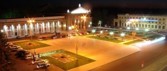
City Garden (founded in 1870, now the Park of Culture and Leisure).