Year founded: 1955
City Day is celebrated
on December 12
.
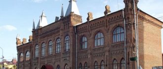
Hotel "Taiga" (Photo: S. Anisimov)
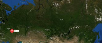
Bratsk
- a city in the Irkutsk region of Russia, located 490 km north of Irkutsk, in the center of the Angarsk Ridge, on the shore of the Bratsk Reservoir.
Historical reference
. A small fortress on the Angara River at the mouth of the Oka River was founded by Cossack explorers in 1631 and called it the Bratsk fortress. The origin of the name is explained by the Russian reinterpretation of the Buryat ethnonym into “brothers” - “brothers”.
After losing its military significance, the fort turned first into the village of Bratsko-Ostrozhnoe, then simply into Bratskoye and, finally, into Bratsk.
Bratsk Hydroelectric Power Station (Photo: www.bratsk-city.ru) In 1927, the Bratsk fort became the center of the Bratsk district of the Tulun district. In 1946, the Council of People's Commissars adopted the “Resolution on the organization of the Angarsk construction management.” In the fall of 1954, a resolution was adopted on the construction of the Bratsk hydroelectric power station. Thus began the construction of the Bratsk hydroelectric power station and the city of Bratsk. The site soon becomes an all-Union construction site.
In March 1957, the first closure of the Angara was completed, and in the summer of 1961 the filling of the Bratsk Reservoir began. Finally, on September 1, 1961, a historical event occurred - the birth of the Brotherly Sea. The village of Bratsk is flooded along with many other villages - in the Bratsk region alone, 119 settlements were resettled and went under water.
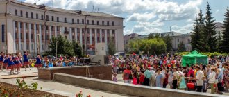
Near the drama theater (Photo: G. Taraskov)
The village of Bratsk itself was moved to a new location and, back in 1951, transformed into a workers’ village. In 1955, it was merged with a number of other villages and transformed into the city of Bratsk on December 12, 1955.
Today
Bratsk is one of the largest industrial centers of the Irkutsk region and Eastern Siberia. And although the city is located in harsh climatic conditions, its economic and geographical position is relatively favorable and is characterized by developed infrastructure.
Railway (Baikal-Amur Mainline), roads, power lines, an airport with international status, high resource and economic potential, electric power resources of the Bratsk Hydroelectric Power Station, unlimited water resources, shipping and timber rafting routes - Bratsk functions as an important support base for the development of the northern regions of Eastern Siberia and the Far East.
Night city (Photo: G. Taraskov)
The permanent population of Bratsk is more than 225 thousand people (2021). Mostly young people live here. The average age of city residents is 36 years, and children under 16 make up about 18%.
Not far from Bratsk, 60 km to the east, there is the Bratsk Seaside, a climatic resort area on the coast of the Bratsk Reservoir, where patients with diseases of the circulatory system and nervous system are treated. This is also facilitated by sodium sulfate-chloride water, found here in 1976.
Day of the city
dedicated to the day of its foundation and celebrated on December 12.
Characteristics of the city of Bratsk, Irkutsk region
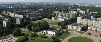
Today, Bratsk on the map of Russia is a city in the north-west of the Irkutsk region in the central part of the Angara Ridge , the districts and sections of which are located at large distances, separated by forest plantations and water spaces. It forms the administrative center, the urban district. This unique shape of the city is explained by its origin - Bratsk was a union of villages and towns located near the Angara River .
The current population is about 230,000 inhabitants. Bratsk is located in the center of the East Siberian economic region of the Russian Federation, near the Bratsk reservoir , and this allowed it to become the intersection of automobile, railway, air, and waterways leading to Europe and Asia, as well as Siberia and Yakutia. Thanks to these factors, Bratsk has become a strategically important, economically developed city.
Angarsk - located on the main river of the region
Angarsk is the third largest and second largest settlement in the Irkutsk region: 294 km² and 226,374 inhabitants. It owes its appearance to the active development of industry in Siberia, and specifically to the construction of a plant for the production of liquid fuel. Equipment for it was received as reparations after the victory in the Great Patriotic War. These two facts gave rise to the unofficial but telling names of the settlement: “city of petrochemists” or “born of Victory.”
From the beginning of the construction of the first temporary houses for workers who came to the construction site in 1945 and until 1959, the number of residents increased from zero to 134,000: in a short time, about 70,000 m² of housing was built for them. Today's Angarsk is one of the most modern and comfortable settlements in Transbaikalia. It has been repeatedly recognized as the most comfortable and clean at all-Russian competitions.
As at the beginning of development, industry is the basis of the economy: it accounts for about 13% of the total regional volume. Angarsk is one of the largest industrial zones in Asia, stretching along the Angarsk coast for a record 30 km. If previously the city-forming enterprise was the petrochemical plant, which ensured the emergence of the city, today the budget is formed thanks to hundreds of other enterprises. More than 6,000 companies in various fields of activity are registered here, including 4 large industrial complexes.
Historical facts of the city
- From 1630 to 1648, the Bratsk fort was built, which served to gather troops, had a defensive function, and was a place for the exchange of goods.
- The entire 17th century belonged to the Yenisei fort, gradually changing the name to the modern one. There is a confident development of trade routes and the economy.
- In 1917, Soviet power was established in the city.
- The most important point is the construction of the Bratsk hydroelectric power station in 1955, which became the point of uniting nearby settlements under one name, blocking the Angara, and creating a reservoir.
Popular message topics
- Duck
belongs to the class of birds, order - Anseriformes, family Anatidae, genus - waterfowl. Ducks are one of the largest families of waterfowl. There are more than 150 varieties of them, - Earth's magnetic field
Probably everyone knows that the earth is a huge magnet, with the help of which a magnetic field is formed. And scientists have proven that it really exists. In addition, the magnetic field is around our planet and protects - Indian culture
Indian culture is one of the oldest in the world and dates back about 4,500 years. The country has made significant achievements in architecture, mathematics and medicine. Language, religion, food and art are some of the components of Indian culture.
Bratsk on the map of Russia: geography, nature and climate
When looking at a map of Bratsk from a satellite, it becomes clear why, with a territory of about 428 square kilometers, the city’s population is only 230,000 people - the area consists of “islands” of settlements. On the shore of the reservoir, the length of Bratsk is about 65 km, and to the regional center - Irkutsk - 460 km.
The climate in this area is quite harsh - long winters, in which the thermometer often drops below -35°C, and in the summer - rather hot short periods, when the temperature is about +30°C.
Bratsk belongs to the Far North, here the climate is sharply continental, the usual amount of annual precipitation is about 370 mm.
Maximum historical temperatures and precipitation:
- Minimum temperature - -51°C
- Maximum temperature +36°C
The city is surrounded and even divided into sections by mountain ranges, due to which the entire area is located on a hill. The most important role is played by water areas - in addition to the Bratsk reservoir, there is the Ust-Ilimskoye, the Angara and Vikhoreva .
Routes on the map of Bratsk. Transport infrastructure
The city is a major transport hub, connecting all types of routes. Bratsk is connected by important highways:
- Federal highway A-331 "Vilyuy" starts in Tulun from the highway R-255 "Siberia" and passes through Bratsk, Ust-Kut, Mirny to Yakutsk,
- public highway 25N-124 Taishet - Chuna - Bratsk ,
- intermunicipal road 25N-126 Bratsk - Ust-Ilimsk .
The city has its own Bratsk airport , which has international status, but is not very conveniently located - 8 kilometers north of the city limits.
The railway tracks are aimed at connecting with the largest cities in Russia and abroad and are united by stations, each of which is located in one of three districts of the city:
- Central district - Anzebi railway station , address Dorozhnaya, 23a. Long-distance trains to Moscow, Neryungri, Ulan-Ude, Irkutsk, Ust-Ilyimsk, Severobaikalsk pass through the station. Suburban electric trains: Vikhorevka, Rechushka, Kezhemskaya.
- Novobratsk railway station is located in the Central region between the bus station and the Central market. Receives electric trains in the direction of Vikhorevka, Bagulnaya-2, Kezhemskaya
- Stroitel village - Bratsk railway station . Receives commuter trains in the direction of Novobratsk, Bagulnaya-2, Vikhorevka, Kezhemskaya.
- Padunsky district - station complex Padunskie Porogi , address Energetik village, Mechtateley street 30. Receives long-distance trains to Moscow, Neryungri, Anapa, Tynda, Ulan-Ude, Ust-Ilyimsk, Severobaikalsk. Suburban trains: Vikhorevka, Kezhemskaya, Rechushka
- Pravoberezhny district - Gidrostroitel railway station , address Osinovka village, Zheleznodorozhnaya street 8. Suburban trains: Vikhorevka, Kezhemskaya, Rechushka
Social transport in Bratsk is represented by buses, minibuses and trolleybuses, served by three private and three municipal organizations. This area is in a state of constant modernization due to the needs of local residents, but does not keep pace with the growth of the city - about 80% of the entire vehicle fleet is in a state of wear and tear.
In the southern part of the Central district, at st. River Port, 1, the Bratsk River Port is located, carrying passengers from June 2 to September 22 on the route Balagansk - Bratsk and back (Stops: Balagansk, Ust-Uda, Anosovo, Chisty, Shumilovo, Bratsk).
Sights of the city of Bratsk
- The Museum of the History of Political Exile on Parkovaya Street - 3 is a former church house, the theme of the museum is the history of exile and political prisoners.
- Architectural and Ethnographic Museum "Angarsk Village" on the street. Komsomolskaya-38 has exhibitions and reconstructions of the life of the indigenous inhabitants of the area - the Evenks, as well as historical elements of the development of the city.
- Catholic Church on the street. Kurchatov is a religious landmark of the city.
- Museum of the History of Bratskgesstroy on the street. Hydrostroiteley - 54 contains authentic samples of photographs, documents, materials telling about the construction of a local hydroelectric power station.
- At the Bratsk hydroelectric power station in the village of Energetik there are special observation platforms that offer views of the area and the Angara River.
- United Museum of the History of the Development of the Angara on the street. Komsomolskaya-38 consists of four branches, contains historical samples and materials about the past of local towns and settlements.
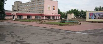
- The Drama Theater on Mira Street-37 is a historical landmark of the city.
Main streets of Bratsk
Let's take a look at the map of Bratsk with houses and streets, here we can see the following large objects:
- Komsomolskaya Street - has a length of 3.1 km, originates from Yuzhnaya Street and heads northeast, crossing the street along the way. Yangel, Gagarin, Krupskaya. It houses the city administration, courthouse, market, and shopping center.
- st. Yangelya - has a curved shape, a total length of approximately 3.12 km. It starts and ends from Komsomolskaya Street, forming a semicircle to the west. Has an intersection with the street. Barkova, Ryabikova. A city hospital, several shopping malls, a police building, the Ministry of Emergency Situations, and a pre-trial detention center were built on it.
- Proletarskaya Street - has an approximate length of 2.1 km. It starts from Gidrostroiteley Street and is separated from it by a railway bridge, then it runs to the northwest, flowing into the A-331 highway. It has an intersection in the direction of Polevaya Street, Svoboda Street and smaller ones. It houses a bank, kindergarten, school and residential buildings.
- Yeniseiskaya Street is one of the longest streets in the city and has a gap, making its parts 5.17 km and 1.14 km respectively. The general direction is northwest, starting from Radishchev Street. It has an intersection with Vokzalnaya Street, Sosnovaya Street, Sholokhov Street, Manezhnaya Street and others, less significant. It houses a technical school building, kindergartens, an art and general education school, and industrial facilities.
- Mira Street - has a northern direction and a length of 5.04 km and is located in the city center. It has an intersection with South Street, Podbelsky, Obruchev, Gagarin. There is a market, a drama theater, schools, and a shopping center on it.
- St. Kurchatova - has a western direction, starting from Lomonosov Street, in the direction it intersects with Deputatskaya, Mira, Komsomolskaya, Ryabikova, ending with the A-331 highway. It has a total length of 4.1 km. It houses industrial facilities, a hospital, and a technical school.
METALLURGIST PARK
Although I have lived in Bratsk since 1985, I somehow never had the opportunity to visit the park in central Bratsk. I even thought he wasn't there. And when I got ready to write about cultural and entertainment centers, I was surprised to read that they still exist. And I went in search of him. I took a trolleybus to the Baikal shopping center, walked forward a little and turned right. Then I had to walk half a kilometer along the street past individual houses and, finally, behind a small, unkempt public garden, I saw the iron lattice fence of a park with the proud name “Metallurgists’ Park.”
But this park didn't look like a park at all. For the most part, this is a long wide asphalt strip along which children rode scooters. Along this asphalt road there were carousels and similar private attractions for small children, as well as gazebos and kiosks. A park primarily implies trees, but there were almost none there.
True, there was one single alley along the fence, which attracted my attention: there were many sculptures of fairy-tale characters on it. The sculptures are made very well, with imagination and are very recognizable. There were Cheburashka with the crocodile Gena, and Pinocchio with Karabas Barabas, and the Little Mermaid, and Funtik, and Baba Yaga, and Bogatyr, and Kuzya the Brownie, and even the inseparable trinity Vitsin, Morgunov and Nikulin and many other characters. Here's everything you can see in the park.