This term has other meanings, see Borsky district.
Coat of arms
| city of regional significance[1] / urban district[2] | |
| city of Bor urban district city of Bor | |
- (2nd place)
- (3,69 %)
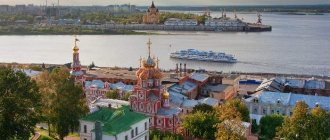
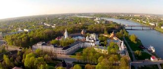
Meadows and forests of the urban district of the city of Bor are visible from the center of Nizhny Novgorod
City of Bor
or
the urban district of the city of Bor
is an administrative-territorial entity (city of regional significance) and a municipal entity with the status of an urban district in the Nizhny Novgorod region of Russia.
Until 2010 it was Borsky district
.
The administrative center is the city of Bor.
Content
- 1 Geography
- 2 History
- 3 Population
- 4 Administrative-territorial structure
- 5 Settlements
- 6 Economy 6.1 Industry
- 6.2 Agriculture
- 8.1 Educational institutions
History[ | ]
In the fall of 1942, the Abwehr developed the sabotage operation "Volga Wall". On the territory of the Borsky district of the Gorky region, a local fighter battalion and NKVD officers fought with a large group of German paratroopers trying to break through to the bridge over the Volga[6].
On May 17, 1962, part of the territory of the abolished Rabotkinsky district was annexed to the Borsky district[7].
On September 12, 2000, the Law of the Nizhny Novgorod Region abolished municipal entities in the territories of villages and village councils in the Borsky district: the village of Bolshoye Pikino, the village of Kerzhenets, the village of Neklyudovo, the village of Oktyabrsky, the village of Memory of the Paris Commune, the village of Sitniki, Bolsheorlovsky village council, Gorodishchinsky village council, Ivanovo village council, Ivonkinsky village soviet, Kalikinsky village soviet, Kantaurovsky village soviet, Kovrovsky village soviet, Krasnoslobodsky village soviet, Lindovsky village soviet, Ostankino village soviet, Redkinsky village soviet, Rozhnovsky village soviet, Rustaisky village soviet, Spassky village soviet, Chistoborsky village soviet, Chistopolsky village soviet, Yamnovsky village soviet et[8]
According to the laws of the Nizhny Novgorod region dated October 11, 2004 No. 110-Z[9] and February 25, 2005 No. 10-Z[10], 1 urban and 8 rural settlements were formed as part of the municipal formation Borsky district.
By Law of the Nizhny Novgorod Region dated February 25, 2005 No. 11-Z[11], the municipal formation of Borsky District was given the status of a municipal district.
In 2010, the administrative-territorial formation of Borsky district was transformed into the city of regional significance of Bor, and the municipal formation of Borsky district was transformed into the urban district of the city of Bor.[12][13] At the same time, all municipal formations - the urban settlement of the city of Bor and the rural settlements of the Kantaurovsky village council, Krasnoslobodsky village council, Lindovsky village council, Ostankino village council, Memory of the Paris Commune village council, Redkinsky village council, Sitnikovsky village council, Yamnovsky village council were abolished by merging them into the urban district of the city of Bor .
Neighborhoods of Bora
The surroundings of this city are very picturesque and surrounded by forests, lakes, and flooded meadows. 25 km. from Bor, on the banks of the Linda River, the village of Filippovskoye is located on a small hill. This ancient village has a stone building built by the merchant Bugrov, which is currently being restored. During World War II, it housed a hospital for the military. After the war it served as a rest home for workers. Before the days of perestroika, it was an excellent sanatorium “Filippovsky”, where wonderful doctors worked. It was a cultural center for the nearby villages: Vasilkovo, Belkino, Popovo, Tyurino. All the young people gathered on the territory of the sanatorium, as movies were shown three times a week, dances were constantly held to the radio and button accordion, and artists from the Gorky Philharmonic often came. This sanatorium played a huge role for young people of the 50-70s in the field of cultural awareness, especially in those years when there were no televisions. And the territory itself is a park. What wonderful flowers grew! 800 meters from the sanatorium there is a beautiful church on the place of execution, also built at the expense of Bugrov. Its domes are 7 km away. glowed and served as a landmark for the surrounding villages. The windows had colored stained glass windows that sparkled in the rays of the setting sun. And the building itself is made of red brick. But during the years of Soviet power, it became damaged, as it served as a grain storage facility for more than 50 years. The frescoes have been erased, the glass has been broken, the stucco on the walls has been torn off. Today the church is operational, but it is unlikely to return to its former form. And what a cozy corner of the Nizhny Novgorod region this is! The village of Filippovskoye itself is surrounded by greenery. It is especially good in spring. There are so many lilacs, bird cherry trees, blooming viburnum planted in the front gardens, the smell of which is carried by the wind throughout the village.
Population[ | ]
| Population | ||||||||
| 2010[14] | 2011[15] | 2012[16] | 2013[17] | 2014[18] | 2015[19] | 2016[20] | 2017[21] | 2018[22] |
| 121 023 | ↘120 877 | ↗121 879 | ↗122 523 | ↗122 724 | ↘121 972 | ↗121 994 | ↘121 843 | ↘120 926 |
| 2019[23] | 2020[24] | 2021[5] | ||||||
| ↘119 383 | ↘118 156 | ↘117 326 | ||||||
Administrative-territorial structure[ | ]
The city of regional significance includes the following administrative-territorial entities:[25]
- Bor city
- Kantaurovo territorial department (administrative center - Kantaurovo village)
- Krasnoslobodsky territorial department (administrative center - the village of Krasnaya Sloboda)
- Lindovsky territorial department (administrative center - Linda village)
- Ostankino territorial department (administrative center - Ostankino village)
- Memory of the Paris Commune territorial department (administrative center - village Memory of the Paris Commune)
- Redkinsky territorial department (administrative center - the village of Redkino)
- Sitnikovsky territorial department (administrative center - Sitniki village)
- Yamnovsky territorial department (administrative center - the village of Yamnovo)
The urban district was formed within the boundaries of the administrative-territorial entity of the regional city of Bor.
The functions of managing administrative-territorial entities are performed by the territorial departments of the city district administration. Also, territorial departments were formed in the villages of Bolshoye Pikino, Neklyudovo and Oktyabrsky.[26]
Unusual projects associated with Bor
The attraction to Nizhny Novgorod and the presence of a significant obstacle in the form of the Volga, which is quite wide in this place, made Bor a noteworthy experimental site for attempts to connect it with the metropolis - or resettle residents of the urban agglomeration there. These projects were:
- Funicular to Bor
- Metro tunnel to Bor
- Rastalkovsky's acceleration plane
- String transport
- Borskaya Poyma
- Globe Town
Settlements[ | ]
The city of regional significance and urban district includes 301 settlements:[25]
| List of settlements | |||
| № | Locality | Type of settlement | Population |
| 1 | Alexandrovka | village | ↘0[14] |
| 2 | Apraksino | village | ↗12[14] |
| 3 | Arkhipovo | village | ↘13[14] |
| 4 | Afanasovka | village | ↘4[14] |
| 5 | Afanasovo | village | ↘106[14] |
| 6 | Belkino | village | ↘49[14] |
| 7 | Belkino | village | ↗78[14] |
| 8 | Belousovo | village | ↘26[14] |
| 9 | Berezovka | village | ↘6[14] |
| 10 | Berezovka | village | ↘43[14] |
| 11 | Berezovka | village | ↘7[14] |
| 12 | Berezovsky | village | ↘5[14] |
| 13 | Pancakes | village | ↗8[14] |
| 14 | Blokhino | village | →3[14] |
| 15 | Bogdashevo | village | ↘0[14] |
| 16 | Big Grab | village | ↘19[14] |
| 17 | Bolsheorlovskoe | village | ↗836[14] |
| 18 | Big Litvinki | village | ↘0[14] |
| 19 | Bolshoye Pokrovskoye | village | ↘22[14] |
| 20 | Bolshoye Sodomovo | village | ↘71[14] |
| 21 | Bolshoye Utkino | village | ↘14[14] |
| 22 | Bor | city, administrative center | ↘76 732[5] |
| 23 | Borisovka | village | ↘39[14] |
| 24 | Borisovo | village | ↘12[14] |
| 25 | Borovitsa | village | ↘10[14] |
| 26 | Botalovo, Botalovo-2, Botalovo-3, Botalovo-4 | residential areas | ↗262[14] |
| 27 | Botusino | village | ↘3[14] |
| 28 | Boyarskoe | village | ↗73[14] |
| 29 | Bubnovo | village | ↘13[14] |
| 30 | Buzuyki | village | →45[14] |
| 31 | Burnakovo | village | ↗37[14] |
| 32 | Bykovo | village | ↗7[14] |
| 33 | Fast | village | ↘7[14] |
| 34 | Vagankovo | village | ↘49[14] |
| 35 | Rolls | village | ↗34[14] |
| 36 | Varnachevo | village | ↗33[14] |
| 37 | Vasilkovo | village | ↘169[14] |
| 38 | Vatoma | village | ↘47[14] |
| 39 | Vatomsky | village | ↘5[14] |
| 40 | Vernyagovo | village | ↘33[14] |
| 41 | Upper | village | ↗11[14] |
| 42 | Vladimirovo | village | ↗450[14] |
| 43 | Vlasovo | village | ↗63[14] |
| 44 | Wolf | village | ↗8[14] |
| 45 | Voronino | village | ↘11[14] |
| 46 | Voronovo | village | →3[14] |
| 47 | Sunrise | village | ↘8[14] |
| 48 | Vypolzovo | village | ↗4[14] |
| 49 | Vysokovo | village | ↘29[14] |
| 50 | Vysokovo | village | ↘3[14] |
| 51 | Elm | village | ↗64[14] |
| 52 | Knitting | village | ↘47[14] |
| 53 | Vyazovka | village | ↗36[14] |
| 54 | Vyazovoe | village | →0[14] |
| 55 | Vyalovskoe | village | ↗8[14] |
| 56 | Ganino | village | ↘1[14] |
| 57 | Glazkovo | village | ↗29[14] |
| 58 | Glazovka | village | ↘2[14] |
| 59 | Deep | village | ↗19[14] |
| 60 | Gorelovo | village | ↗215[14] |
| 61 | Gorodishchi | village | ↘375[14] |
| 62 | Gorodnoe | village | ↗74[14] |
| 63 | Gryaznovo | village | ↗28[14] |
| 64 | Gusevo | village | ↘17[14] |
| 65 | Deryabino | village | ↘17[14] |
| 66 | Doenki | village | ↘27[14] |
| 67 | Dolgovo | village | ↘1[14] |
| 68 | Dolgovo | village | ↘4[14] |
| 69 | Dolgovo | village | ↘61[14] |
| 70 | Dresvino | village | ↘3[14] |
| 71 | Drozdovo | village | ↘51[14] |
| 72 | Dryukovo | village | ↗37[14] |
| 73 | Dubenki | village | ↘21[14] |
| 74 | Dubenki | village | ↘0[14] |
| 75 | Duplevo | village | ↘13[14] |
| 76 | Yezhovo | village | ↘2[14] |
| 77 | Yezhovo | village | →35[14] |
| 78 | Spruce | village | ↘227[14] |
| 79 | Elisino | village | ↘23[14] |
| 80 | Elkino | village | ↘0[14] |
| 81 | Railway | village | ↘2332[14] |
| 82 | Zhukovka | village | ↘96[14] |
| 83 | Cranes | village | ↘5[14] |
| 84 | Zaborie | village | ↗327[14] |
| 85 | Zavrazhnoe | village | ↗28[14] |
| 86 | Zavrazhnoe | village | ↘205[14] |
| 87 | Zalesnaya | village | ↘2[14] |
| 88 | Zaprudnoye | village | ↗165[14] |
| 89 | Zaprudnoye | village | ↘15[14] |
| 90 | Zarechny | village | →53[14] |
| 91 | Drop by | village | ↗98[14] |
| 92 | Zakharovo | village | ↘3[14] |
| 93 | Zimenki | village | ↘15[14] |
| 94 | Zimenki | village | ↘74[14] |
| 95 | Zinkino | village | →0[14] |
| 96 | Zolotovo | village | ↗146[14] |
| 97 | Zorenki | village | ↘7[14] |
| 98 | Zrilki | village | ↘7[14] |
| 99 | Zubovo | village | ↘4[14] |
| 100 | Zuevo | village | ↘248[14] |
| 101 | Zykovo | village | ↘86[14] |
| 102 | Ivanovskoe | village | ↗21[14] |
| 103 | Ivanovskoe | village | ↘2[14] |
| 104 | Ivanovskoe | village | ↘373[14] |
| 105 | Ivonkino | village | ↗168[14] |
| 106 | Ilyinskoe | village | ↘74[14] |
| 107 | Kalikino | village | ↘1769[14] |
| 108 | Kantaurovo | village | ↘2169[14] |
| 109 | Kvasovo | village | ↗161[14] |
| 110 | Kerzhenets | village | ↘520[14] |
| 111 | Kiselikha | village station | ↘77[14] |
| 112 | Kleevo | village | ↘0[14] |
| 113 | Klintsovo | village | ↘1[14] |
| 114 | Klyukino | village | ↗73[14] |
| 115 | Knyazhevo | village | ↗31[14] |
| 116 | Kovrovo | village | ↗20[14] |
| 117 | Kolobovo | village | ↗112[14] |
| 118 | Koltsovo | village | ↘67[14] |
| 119 | Komarovo | village | ↘6[14] |
| 120 | Korelka | village | ↘19[14] |
| 121 | Currant | village | ↗75[14] |
| 122 | Korovino | village | ↘19[14] |
| 123 | Korolevo | village | ↘46[14] |
| 124 | Kosarevo | village | ↗1[14] |
| 125 | Kostino | village | ↗146[14] |
| 126 | Krasnaya Sloboda | village | ↘870[14] |
| 127 | Krasnogorka | village | →19[14] |
| 128 | Krasnoyarsk | village | ↘8[14] |
| 129 | Crosses | village | ↘13[14] |
| 130 | Krivtsovo | village | →0[14] |
| 131 | Kruglovo | village | ↘25[14] |
| 132 | Round | village | ↘2[14] |
| 133 | Krutets | village | ↘25[14] |
| 134 | Krutets | village | ↘0[14] |
| 135 | Kuzemino | village | ↗88[14] |
| 136 | Blacksmith | village | ↘4[14] |
| 137 | Kunavino | village | ↘0[14] |
| 138 | Kurochkino | village | ↘6[14] |
| 139 | Lapino | village | ↗73[14] |
| 140 | Lebyazhye | village | →0[14] |
| 141 | Linda | village | ↘5383[14] |
| 142 | Lindo-Pustyn | village | ↘152[14] |
| 143 | Lindo-Usad | village | ↗3[14] |
| 144 | Liskino | village | ↗2[14] |
| 145 | Likhachevo | village | ↘18[14] |
| 146 | Lunino | village | ↘14[14] |
| 147 | Makarovo | village | ↘8[14] |
| 148 | Malaya Zhvatikha | village | ↘4[14] |
| 149 | Maloe Pokrovskoe | village | ↘16[14] |
| 150 | Maloe Sitnikovo | village | ↘13[14] |
| 151 | Maloe Sodomovo | village | ↘0[14] |
| 152 | Maloe Utkino | village | ↗3[14] |
| 153 | Malye Litvinki | village | ↘0[14] |
| 154 | Mamakino | village | ↘44[14] |
| 155 | Markovo | village | ↗66[14] |
| 156 | Matveevka | village | ↘10[14] |
| 157 | Matyushki | village | →2[14] |
| 158 | Medvedkovo | village | ↗163[14] |
| 159 | Intersections | village | ↘30[14] |
| 160 | Meshkovo | village | ↗29[14] |
| 161 | Milutino | village | →0[14] |
| 162 | Minino | village | ↗26[14] |
| 163 | Mityushino | village | ↘10[14] |
| 164 | Molostovo | village | →25[14] |
| 165 | Mordvinka | village | ↗20[14] |
| 166 | Morozovo | village | →0[14] |
| 167 | Cape | village | ↘24[14] |
| 168 | Myakotinskoe | village | ↗15[14] |
| 169 | Nagaevo | village | ↘5[14] |
| 170 | Upland | village | ↘19[14] |
| 171 | Naumovo | village | ↘10[14] |
| 172 | Nekrasovo | village | →0[14] |
| 173 | Nechaevo | village | ↗27[14] |
| 174 | Nikitkino | village | ↗12[14] |
| 175 | Nikolino-Kuliga | village | ↘112[14] |
| 176 | Nikolskoye | village | ↘1[14] |
| 177 | Nikolskoye | village | →0[14] |
| 178 | Nozhovo | village | ↘1[14] |
| 179 | Omelyukhino | village | ↗5[14] |
| 180 | Ovechkino | village | ↘600[14] |
| 181 | Ogolikhino | village | ↗6[14] |
| 182 | Odintsy | village | ↘15[14] |
| 183 | Ozerki | village | ↗8[14] |
| 184 | Omanovo | village | ↗512[14] |
| 185 | Opalikha | village | ↘9[14] |
| 186 | Orekhovo | village | ↗36[14] |
| 187 | Nuts | village | ↗14[14] |
| 188 | Orlovo | village | ↘69[14] |
| 189 | Orlovsky | village | →0[14] |
| 190 | Osinki | village | ↘0[14] |
| 191 | Ostankino | village | ↘2[14] |
| 192 | Ostankino | village | ↘1467[14] |
| 193 | Ostreyevo | village | ↘160[14] |
| 194 | Okhlobystino | village | ↘3[14] |
| 195 | Okhotino | village | ↘1[14] |
| 196 | Memory of the Paris Commune | village | ↘3761[14] |
| 197 | May Day | village | ↘10[14] |
| 198 | Pershino | village | ↘28[14] |
| 199 | Petrovo | village | ↗24[14] |
| 200 | Petukhovo | village | ↗25[14] |
| 201 | Pikino | village | ↗38[14] |
| 202 | Pikinskie Griva | village | ↗39[14] |
| 203 | Pionersky | village | ↘49[14] |
| 204 | Pionerskoe | village | ↘99[14] |
| 205 | Pirogovo | village | ↘1[14] |
| 206 | Pichugino | village | ↗204[14] |
| 207 | Plakhino | village | ↘0[14] |
| 208 | Dam | village | ↗653[14] |
| 209 | Runners | village | ↘29[14] |
| 210 | Undermining | village | ↘10[14] |
| 211 | Podluzhki | village | ↘7[14] |
| 212 | Podrezovo | village | ↘138[14] |
| 213 | Field | village | ↗54[14] |
| 214 | Popovo | village | ↘128[14] |
| 215 | Popovo | village | ↗48[14] |
| 216 | The village of Shpalozavod | village | ↘874[14] |
| 217 | Potemino | village | →26[14] |
| 218 | Priklonnoe | village | ↘0[14] |
| 219 | Prirechny | village | ↘11[14] |
| 220 | Pumra | village | ↘20[14] |
| 221 | Putkovo | village | ↘33[14] |
| 222 | Razvilye | village | ↘34[14] |
| 223 | Revelers | village | ↘6[14] |
| 224 | Spillers | village | ↗41[14] |
| 225 | Redkino | village | ↗1423[14] |
| 226 | Rekshino | village | ↘417[14] |
| 227 | Rodimikha | village | →5[14] |
| 228 | Rozhnovo | village | ↗52[14] |
| 229 | Rustai | village | ↘399[14] |
| 230 | Mountain ash | village | ↗7[14] |
| 231 | Ryabchikovo | village | ↘0[14] |
| 232 | Savino | village | ↘44[14] |
| 233 | Sadovaya | village | ↘3[14] |
| 234 | Sanda | village | ↘0[14] |
| 235 | Sverchkovo | village | ↘3[14] |
| 236 | Free | village | ↘4[14] |
| 237 | Svyatitsa | village | ↘2[14] |
| 238 | Selishchi | village | ↘17[14] |
| 239 | Selishchi | village | ↘430[14] |
| 240 | Sintsovo | village | ↘18[14] |
| 241 | Sitniki | village | ↗1401[14] |
| 242 | Sitnikovo | village | ↘116[14] |
| 243 | Skorodumki | village | ↘1[14] |
| 244 | Skorodumki | village | ↘5[14] |
| 245 | Slobodskoe | village | ↗137[14] |
| 246 | Smyshlyayki | village | ↘0[14] |
| 247 | State farm "Sormovsky Proletary" | village | ↘934[14] |
| 248 | Sokolovo | village | ↘2[14] |
| 249 | Solovkovo | village | ↗21[14] |
| 250 | Solovyovo | village | ↗3[14] |
| 251 | Straws | village | ↗3[14] |
| 252 | Sosnovka | village | ↗6[14] |
| 253 | Pinery | village | →0[14] |
| 254 | Sofronovo | village | ↘100[14] |
| 255 | Openers | village | ↗54[14] |
| 256 | Spasskoye | village | ↘591[14] |
| 257 | Insurance | village | ↘7[14] |
| 258 | Sungurovo | village | ↘15[14] |
| 259 | Syrokhvatovo | village | ↗107[14] |
| 260 | Sysaikha | village | →0[14] |
| 261 | Tainovo | village | ↗488[14] |
| 262 | Secret | village | ↗9[14] |
| 263 | Tarasovo | village | ↘31[14] |
| 264 | Telyatyevo | village | ↗75[14] |
| 265 | Temryashino | village | ↗187[14] |
| 266 | Torchilovo | village | ↘17[14] |
| 267 | Trubnikovo | village | ↘55[14] |
| 268 | Trutnevo | village | ↘46[14] |
| 269 | Tugarino | village | ↘125[14] |
| 270 | Tuzeevo | village | ↘60[14] |
| 271 | Tushnino | village | ↘30[14] |
| 272 | Seals | village | →0[14] |
| 273 | Tyurino | village | ↗47[14] |
| 274 | Uzlovo | village | ↘12[14] |
| 275 | Ulyanikha | village | ↘6[14] |
| 276 | Ulyanovo | village | ↗61[14] |
| 277 | Utkino | village | ↗64[14] |
| 278 | Utkino | village | ↘37[14] |
| 279 | Ushenino | village | ↗6[14] |
| 280 | Filimontsevo | village | ↘15[14] |
| 281 | Filippovskoe | village | ↘151[14] |
| 282 | Khvalynki | village | →5[14] |
| 283 | Khmelevo | village | →0[14] |
| 284 | Khripunovo | village | ↘18[14] |
| 285 | Khrushchevo | village | ↗81[14] |
| 286 | Chernozerye | village | →1[14] |
| 287 | Chernoleskaya Pustyn | village | ↘93[14] |
| 288 | Chernoramenye | village | →6[14] |
| 289 | Chernukha | village | ↗3[14] |
| 290 | Clean Borskoye | village | ↗1249[14] |
| 291 | Clean Field | village | ↗852[14] |
| 292 | Chistyaky | village | ↗105[14] |
| 293 | Sherstnevo | village | ↗65[14] |
| 294 | Shekhonka | village | ↗21[14] |
| 295 | Shlykovo | village | ↗43[14] |
| 296 | Shubino | village | ↘145[14] |
| 297 | Yurasovo | village | ↘29[14] |
| 298 | Yurino | village | ↘1[14] |
| 299 | Yablonnoe | village | ↗67[14] |
| 300 | Ulcers | village | ↘17[14] |
| 301 | Yamnovo | village | ↗1525[14] |
In 2004, the village named after M. I. Kalinin was abolished[27]
Economics[ | ]
Industry[ | ]
The district's industry is represented by 31 enterprises. Main industries: glass, mechanical engineering and metalworking, building materials, ferrous metallurgy, fuel, forestry and woodworking, light, food.
The largest enterprise is Bor Glass Factory OJSC, the volume of commercial output of which is about 60% of the citywide total. Other large enterprises are OJSC Nizhny Novgorod Motor Ship, OJSC Borsky Pipe, OJSC Borkhleb. At the end of 2007, shipments of industrial products by large and medium-sized enterprises reached 14,300.4 million rubles.
- JSC "AGC Bor Glass Factory" (45.7% of the total production volume of the city district);
- CJSC "European Foods" GB - 7.5%;
- LLC "Posuda" - 5.1%;
- LLC "Bericap" - 4.5%;
- Branch of Tubor LLC - 4.3%;
- CJSC "Bor Silicate Plant" - 3.2%;
- LLC "New Industrial Technologies" - 3.0%;
- Trosifol LLC - 2.4%;
- OJSC "Nizhny Novgorod Motor Ship" 1.9%;
- Metmash LLC 1.8%;
- OJSC "Bor Felt Factory" - 1.4%;
- LLC "Lesotaraservis" - 1.3%.
The main types of products: building glass, polished, triplex, stalinite, double glazed windows, welding electrodes, cast iron and steel castings, electric welded pipes, sand-lime brick, washed wool, felt, felted shoes, trade equipment, lumber, bakery confectionery products, dairy products, dry dehydrated products.
Agriculture[ | ]
In the city district there are 11 partnerships of agricultural producers, as well as the largest poultry farm in the region - a breeding plant.
| Agricultural production cooperative "Borsky" | 606458, Bor, Krasnaya Sloboda village |
| JSC "Vozrozhdenie" | 606481, Bor, p. Redkino |
| LLC "Ivanovskoe" | 606489, Bor, p. Ivanovskoe |
| Agricultural enterprise "Kalikino" | 606473, Bor, Kalikino village |
| JSC "Kantaurovo" | 606472, Bor, p. Kantaurovo |
| SEC "Krasnaya Ramen" | 606487, Bor, p. Yamnovo |
| Breeding farm "Lindovsky" | 606495, Bor, p. Linda |
| CJSC "Vympel" | 606466, Bor, p. Spasskoye |
| Agricultural OJSC "Ostankino-S" | 606484, Bor, p. Ostankino |
| SEC "Plotinkovsky" | 606499, Bor, Plotinka village |
| SEC "Redkinsky" | 606481, Bor, p. Redkino |
| SHC "LiS" LLC | 606462, Bor, p. Kovrovo |
| SPK "Chistopolsky" | 606465, Bor, p. Clean Field |
| JLLC "Bolsheorlovskoye" | 606490, Bor, Bolsheorlovskoye village |
| OJSC Lindovskaya poultry farm-breeding plant | 606495, Bor, p. Linda |
Borsky district
Historical reference
The first human settlements on the territory of Bor appeared 2-3 thousand years BC.
Archaeologists not only established the sites of Neolithic settlements on the territory of Bor, but at the same time, while examining the dunes on the Moss Mountains, they discovered fragments of pottery dating back to the Early Iron Age. Archaeological excavations and chronicle materials indicate that Finno-Ugric tribes (in particular, the Meshchera) lived along the banks of the Vezloma River. The name of this river literally means “river flowing through the lake.” The first Slavic settlements at the mouth of the Oka River appeared in the 12th century. They were composed mainly of Suzdal peasants who fled here to escape unbearable feudal oppression. The first mention of the beginning of the settlement of the territory of the present Borsky district by Russian people dates back to the period of the formation of Nizhny Novgorod as the capital of the independent Nizhny Novgorod Grand Duchy.
At the place where the Vezloma River flows into the Volga, a group of buildings was formed - the Vezlomskaya, Kopytovskaya and Nikolskaya settlements, considered the ancestral home of Bor. For various reasons, the settlements Vezlomskaya and Kopytovskaya gradually moved to Nikolsko-Borovskaya, which was never flooded with spring water and which, due to its advantageous location, “acquired primary importance among the three settlements” and in all documents began to be called Borovskaya. In the 14th century, the settlement of Borovskaya, located at the beginning of the Trans-Volga trade road, transformed into a large settlement - the village of Bor, surrounded by dense, sometimes impenetrable forest.
Bor stands on the left bank of the Volga, on the edge of a sandy sub-meadow terrace. This terrace retreats 3-4 kilometers from the shore at one end of Bor (upstream of the Volga) and comes close to the city at the other. Then it gives way to sands from 20 to 30 meters in height, covered with pine and called the Moss Mountains, from which Bor was clearly visible. Bor looked even better from Nizhny Novgorod - from the Dyatlov Mountains an attractive and enchanting picture of an immense meadow lowland, cut through by many rivers and lakes, and a dark border of forested Trans-Volga distances on the horizon opened up.
Residents of the Trans-Volga village and its environs led different lifestyles: some hunted and fished; others were engaged in various crafts: carpentry, excellent use of carpentry tools and making various items of peasant household utensils (carved cabinets, slides, ladles, salt shakers), weaving bast shoes, burning charcoal, weaving coolies and matting from bast. There were also forest dwellers who lived without power and law, engaging in robbery and robbery.
The beginning of the 17th century is associated with the most intensive settlement of the territory of the future Borsky district . Among the settlers were immigrants from Moscow, schismatics and participants in peasant wars under the leadership of Bolotnikov, Razin, and Pugachev were hiding in the Kerzhen forests. Fugitive serfs settled on these lands. Since 1619, the Borovsk lands were owned by different owners: the Duma clerk I. Gramotin, then (late 17th century - early 18th century) these were palace sovereign lands, i.e. property of the king's family. At the very end of the 17th century, the Borovsk lands were owned by Major General A.A. Borozdina, and since 1799, the Bor society had to deal with the guardians of Borozdina’s children.
The serfdom of the Borovites lasted only nine years. In 1806, in accordance with the Highest permission of Alexander I, the peasants of the village of Bor could redeem themselves and their families for 160,230 rubles in state notes. Freedom for the residents of Bor was not easy - the ransom was difficult and long to pay.
The abolition of serfdom in Russia had a beneficial effect on the development of Bor as a large trading village. The water road - the Volga - conveniently connected it with Nizhny Novgorod. In the second half of the 19th century, Bor was a large trading village. By 1887, Bor's population was more than 1,400 inhabitants (293 households). The village had one school, a hospital, a dozen trading shops, a mill and an iron cutting plant. The center of the village was a market square with shopping arcades, warehouses, taverns, where weekly markets were noisy, and twice a year - on May 9 and September 15 - one-day fairs were held. Thousands of people from surrounding villages brought bread, butter, lard, livestock, furs, and leather for sale, purchasing fabrics, haberdashery and industrial goods from merchants.
The economy of the south and southwest of Semenovsky district, where the Borsky district is currently located, was determined primarily by handicrafts, the most significant of which were fulling - wool processing - and metal crafts - the production of nails, anchors and chains.
The products of the blacksmith's trade, the development of which in the Borsky district was carried out by the former burgomasters of the landowner, sold well on a powerful market for the sale of finished products - the All-Russian Nizhny Novgorod Fair. The center of blacksmith production in the region was the so-called Krasnaya Ramen - an area that included about 19 villages, and in which in 1875 there were 497 forges, and in them - more than a thousand blacksmiths. On the outskirts of the village of Bor itself there were up to 25 forges.
Several dozen villages were engaged in fulling production in the region. Thousands of people made felt, felt, hats, felted shoes, and insoles. Sales of finished products as well as delivery of raw materials were carried out through Nizhny Novgorod and its fair.
Since ancient times, part of the population of Bor and its environs has been engaged in carting. The crossing of the Volga opposite Nizhny Novgorod dates back hundreds of years. At all times, the Borsky transport served as the “main gate” of Nizhny Novgorod to the Volga region and back. In the 19th century, its importance increased many times due to the transfer of the All-Russian Fair to the Volga capital in 1817. Up to 200 thousand people traveled back and forth through Perevoz and up to 150 thousand pounds of cargo were transported per year. All transport routes and trade flows of the Bor Volga region went to Perevoz.
At the very end of the 19th and beginning of the 20th centuries, the Bor left bank was marked by a large population. Firstly, the neighboring Mochalny Island every year by the beginning of the fair (July 15) turned into a kind of warehouse for huge masses of all kinds of goods and, in addition to the constantly scurrying longboats, tugboats pulling barges, on the shore there was a concentration of all sorts of working people: hookmen and loaders, salesmen - traders, wholesalers-buyers, accountants, proxies and simply dubious personalities. Secondly, after the unprecedented devastating fire of 1893, which almost destroyed Bor, many laborers and artisans engaged in construction arrived.
With the development of shipping in the second half of the 19th century in Nizhny Novgorod, the transport and blacksmithing industries continued to develop on Bor. Blacksmiths mainly produced fastening materials, chains and other products for barges. In 1984, a forging-mechanical and iron-copper-foundry plant was built on Bor on Popova Griva, which supplied ship anchors, hooks and one steam engine for steamships per year. Brick factories, a sawmill, and fulling and shoemaking workshops also operated on Bor land. In 1911, at the shipyard located on the Fofanovy Mountains, which at that time represented sand dunes that were not flooded with Volga water in the spring, the longboat “Kashevar” was laid down. Thus began the birth of the Teplokhod plant. Over all the years of its existence, the word “Motor Ship” has never disappeared or changed in the name of the enterprise.
In the first years of Soviet power, the economy of the Bor region experienced some difficulties. Due to the lack of military orders, the only large one was closed for a year in 1922. Handicraftsmen also found themselves in a difficult situation. Handicraft workshops closed due to lack of raw materials. Handicrafts, especially for the manufacture of metal products, also fell into almost complete decline.
As a result of socialist construction, during the first five-year plans, a powerful new industry was created in the Bor region. In 1923, the Krasnaya Ramen plant was founded in the village of Zavrazhnoe, which produced chains and subsequently became one of the main suppliers of its products for the whole country. In 1927, the Nizhny Novgorod-Kotelnich railway line came into operation, which connected the Nizhny Novgorod industrial region with the Urals, Siberia, the east and north of the country. During this construction, the Tolokontsevo-Mokhovye Gory railway line was built, which played a primary role in the industrialization of the entire Borsky region. In the same year, the village of Bor became a workers' settlement, which included the villages of Kononovo, Mukhino, Makarovo, and the backwater named after. K. Marx, Borsky transportation, Mokhovye Gory village. In 1928, the first transformer booth to receive electricity from Balakhna appeared on Bor.
In October 1929, a preliminary design for a future mechanized glass factory in the Mokhovy Gory was approved. The plant was intended to produce large-sized glass and triplex for the needs of the rapidly developing automotive and other heavy industries. The glass giant of the entire Soviet industry was launched on February 1, 1934. Simultaneously with the glass factory, a lumber factory was put into operation. By this period, the Bor silicate plant and the first stage of felt factory No. 6 were successfully operating in the Bor region, the reconstruction of the Teplokhod plant was underway, and the construction of a high-voltage line at the ship repair plant (the former Sobchinsky backwater) was completed. During these same years, capital construction was carried out at the Sitnikovsky peat enterprise and in Krasnaya Ramen.
From the commercial and industrial village of Bor, with production serving Volga shipping, it became the largest manufacturer of automotive glass - an inter-district specialized industrial center with a number of enterprises.
Culture and education[ | ]
Educational institutions[ | ]
The education system of the Bor urban district includes:
- 51 preschool institutions,
- 49 educational institutions,
- 2 art schools,
- regional college of culture,
- specialized college at the glass factory,
- branch of Nizhny Novgorod State University named after. N.I. Lobachevsky.
Culture and sports[ | ]
The system of organizing cultural and sports leisure includes:
- sports and recreation complex "Krasnaya Gorka",
- 40 libraries,
- 26 club institutions,
- municipal theater of pop and musical comedy,
- 3 stadiums,
- 4 swimming pools.
The Kerzhensky State Nature Reserve is located in the city district.
Bohr in literature
| The town was so colorful in all respects and mysterious that it caused the Soviet government a lot of trouble. Here every resident had a house with bolts and bolts, it was easy for dark people to hide, in this city there was the most theft, robbery and murder. The police tried their best to establish legal order here, but they did not succeed. To top it all off, former prisoners were allowed to settle in the town, who chose shelters where it was easier to find food, hide from the authorities, where it was closer to the regional center, piers and, finally, to the taiga. Rarely was there a night without casualties. Nikolay Kochin Ripe ears , page 354) |
Notes[ | ]
- from the point of view of the administrative-territorial structure
- from the point of view of the municipal structure
- Management of the urban district administration of the city of Bor
- Nizhny Novgorod Region. Total land area of the municipality
- ↑ 123
The permanent population of the Russian Federation by municipalities as of January 1, 2022 (Russian). Retrieved April 27, 2022. Archived May 2, 2022. - M. V. Zefirov, D. M. Degtev, N. N. Bazhenov.
Swastika over the Volga. Luftwaffe against Stalin's air defense. - Moscow: AST Moscow, Guardian, 2007. - ISBN 5-17-041913-9, 5-9713-4525-7, 5-9762-2434-2. - Gazette of the Supreme Soviet of the USSR. No. 22 (1109), 1962
- LAW of September 12, 2000 N 135-3 “On the abolition of municipalities in the Borsky and Vetluzhsky districts of the Nizhny Novgorod region”
- On the formation of municipalities in the Nizhny Novgorod region
- Law of the Nizhny Novgorod Region No. 10-Z dated February 25, 2005 “On the formation of municipalities in the Borsky district of the Nizhny Novgorod Region
- Law of the Nizhny Novgorod Region No. 11-Z dated February 25, 2005 “On granting the municipal formation Borsky District the status of a municipal district”
- Law of the Nizhny Novgorod Region dated 03/09/2010 No. 33-Z “On changing the administrative-territorial division of the Borsky District of the Nizhny Novgorod Region and on amending Article 11 of the Law of the Nizhny Novgorod Region “On the administrative-territorial structure of the Nizhny Novgorod Region””
- Law of the Nizhny Novgorod Region dated March 2, 2010 No. 21-Z “On the transformation of municipalities of the Borsky municipal district of the Nizhny Novgorod Region”
- ↑ 1 2 3 4 5 6 7 8 9 10 11 12 13 14 15 16 17 18 19 20 21 22 23 24 25 26 27 28 29 30 31 32 33 34 35 36 37 38 39 40 41 42 43 44 45 46 47 48 49 50 51 52 53 54 55 56 57 58 59 60 61 62 63 64 65 66 67 68 69 70 71 72 73 74 75 76 77 78 79 80 81 82 83 84 85 86 87 88 89 90 91 92 93 94 95 96 97 98 99 100 101 102 103 104 105 106 107 108 109 110 111 112 113 114 115 116 117 118 119 120 121 122 123 124 125 126 127 128 129 130 131 132 133 134 135 136 137 138 139 140 141 142 143 144 145 146 147 148 149 150 151 152 153 154 155 156 157 158 159 160 161 162 163 164 165 166 167 168 169 170 171 172 173 174 175 176 177 178 179 180 181 182 183 184 185 186 187 188 189 190 191 192 193 194 195 196 197 198 199 200 201 202 203 204 205 206 207 208 209 210 211 212 213 214 215 216 217 218 219 220 221 222 223 224 225 226 227 228 229 230 231 232 233 234 235 236 237 238 239 240 241 242 243 244 245 246 247 248 249 250 251 252 253 254 255 256 257 258 259 260 261 262 263 264 265 266 267 268 269 270 271 272 273 274 275 276 277 278 279 280 281 282 283 284 285 286 287 288 289 290 291 292 293 294 295 296 297 298 299 300 301
All-Russian population census 2010.
Number and distribution of the population of the Nizhny Novgorod region (unspecified)
. Retrieved July 30, 2014. Archived July 30, 2014. - Nizhny Novgorod Region. Estimated resident population as of January 1, 2008-2016
- Population of the Russian Federation by municipalities. Table 35. Estimated resident population as of January 1, 2012 (unspecified)
. Retrieved May 31, 2014. Archived May 31, 2014. - Population of the Russian Federation by municipalities as of January 1, 2013. - M.: Federal State Statistics Service Rosstat, 2013. - 528 p. (Table 33. Population of urban districts, municipal districts, urban and rural settlements, urban settlements, rural settlements) (undefined)
. Retrieved November 16, 2013. Archived November 16, 2013. - Table 33. Population of the Russian Federation by municipalities as of January 1, 2014 (unspecified)
. Access date: August 2, 2014. Archived August 2, 2014. - Population of the Russian Federation by municipalities as of January 1, 2015 (unspecified)
. Access date: August 6, 2015. Archived August 6, 2015. - Population of the Russian Federation by municipalities as of January 1, 2016 (Russian) (October 5, 2018). Retrieved May 15, 2022. Archived May 8, 2022.
- Population of the Russian Federation by municipalities as of January 1, 2022 (Russian) (July 31, 2017). Retrieved July 31, 2022. Archived July 31, 2022.
- Population of the Russian Federation by municipalities as of January 1, 2022 (Russian). Retrieved July 25, 2018. Archived July 26, 2022.
- Population of the Russian Federation by municipalities as of January 1, 2022 (Russian). Retrieved July 31, 2019. Archived May 2, 2022.
- Population of the Russian Federation by municipalities as of January 1, 2022 (Russian). Date accessed: October 17, 2022. Archived October 17, 2022.
- ↑ 1 2
Settlements of the city of regional significance Bor
(unspecified)
. Date accessed: May 8, 2022. - Territorial departments of the administration of the urban district of Bor
- On the abolition of the rural settlement named after M.I. Kalinin on the territory of the administrative-territorial formation of the working village of Oktyabrsky in the Borsky district, Law of the Nizhny Novgorod Region of November 29, 2004 No. 138-Z (unspecified)
.
docs.cntd.ru.
_ Access date: March 31, 2022.
