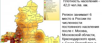
The Rostov region is the homeland of the Cossacks and the land of the steppes, stretching along the banks of the mighty Don. The region, from which the hot southern territories of Russia begin, is in sixth place in the country in terms of population: according to 2022 information, 4,203,634 live here. In terms of size, the region is “in the middle”: the area is 100,967 km², which puts it at 33 position of the all-Russian rating. The Saratov region has approximately the same area, 23 times more in the Krasnoyarsk Territory and 27 times less in the Republic of Ingushetia. Since 1998, the population of the region has been steadily decreasing: over 20 years the drop was 285,000 people.
Taganrog
Coat of arms of Taganrog
The coat of arms of Taganrog was approved on April 15, 1808 and again adopted on February 25, 1994 and in 2002. The shield is divided into four parts. The first silver field has two azure (blue) horizontal stripes; in a purple field is the monogram of Peter I and the date of the founding of the city; in an azure (blue) field there is a silver sturgeon; in the fourth silver field there is a golden caduceus on top of two gold river anchors (with two claws) placed crosswise. In the golden field of the heart shield there is a scarlet cross.
Benefits of regional cities
All cities of the Rostov region bring great benefits to the Russian Federation, since agriculture and land cultivation are still carried out here. This can be confirmed by statistics, which tell us that over the past 20 years, in terms of the volume of exports of iron, timber, and grain, the Rostov port has been one of the first places in the south of the Russian Federation. The total trade turnover of Rostov alone, not taking into account other cities of the Rostov region, reaches 5 billion rubles per year.
Also, we should not forget that the cities of the Rostov region are a great opportunity to relax, since there are many resort places here, and the Rostov region is also very close to the Azov and Black Seas. The Rostov region is a wonderful industrial and at the same time provincial region that has a good and worthy history.
About the city
Taganrog. Marina | Taganrog , a city in the Russian Federation, Rostov region, is located on the northeastern shore of the Taganrog Bay of the Sea of Azov, 67 km west of Rostov-on-Don. Sea port. Railroad station. Population 282.1 thousand people (2001). Founded in 1698. City since 1775. | Taganrog. Panorama of the city |
The largest cities in the Rostov region
There are only 23 cities in the Rostov region, but unlike many other regions, a significant part are quite large. Seven have a population of 100,000 people or more; less than 20,000 inhabitants are recorded in only four cities. Their area is also quite significant: 9 settlements have an area of more than 100 km².
The ratio of the size and number of inhabitants of cities is approximately the same: 8 are in the top 10 for both indicators. The undisputed leader of the ratings is the capital of the region, the largest settlement in the region and the real metropolis of Rostov-on-Don with indicators of 348.5 km² and 1,130,305 people. However, there are also surprises: Taganrog, which is in second place in terms of population, is only in tenth place in terms of area. And Konstantinovsk, which is in second place among the smallest in terms of the number of residents, is again in second position, but already in the category of largest in size.
The largest cities in the Rostov region include (value in km²):
- Rostov-on-Don - 348.5.
- Konstantinovsk - 298.
- Volgodonsk - 182.3.
- Kamensk-Shakhtinsky - 160.
- Mines - 158.2.
- Semikarakorsk - 140.
- Novoshakhtinsk - 136.
- Novocherkassk - 128.
- Donetsk - 112.
- Taganrog - 95.
Economy
Main industries : mechanical engineering (JSC Krasny Kotelshchik, Pressmash; combine harvester, ship repair plants); instrument making (PO "Vibropribor", factories: commercial equipment, electrothermal equipment, "Pribor"); ferrous metallurgy (OJSC Taganrog Metallurgical Plant - production of steel, rolled sheets, pipes for the oil and gas industry); chemical (paint and varnish), light (including leather and footwear), food and flavoring (fish processing plant, meat, confectionery, flour and cereal factories).
Login to the site
Real Estate Information
List of settlements in the Rostov region.
Aksai district Aglos Aksai Aleksandrovka Alitub Bolshoi Log Bolshoy Mishkin Cheryumkin Shchepkino Marvelous Road Elite Grushevskaya Istomino Kamyshevakha Kirov Kovalevka Krasnodvorsk Red Red Spike Lenin Makhin Maly Mishkin (administrative territory of Novocherkassk) Mayakovsky Muscat Nizhnepodpolny Obukhov Oktyabrsky Olginskaya Experienced Ostrovsky Beekeeper Dawn Reconstructor Glory of Labor Starocherkasskaya Vesyoliy Vozrozhdeniy Azov district Agrafenovka Aleksandrovka Aleksandrovsky Azov Azov Biryuchiy Bolshevik Burkhanovka Gypsy Donskoy Dugino Elbuzd Elizavetovka Eremeevka Galaganovka Settlement Grachev Grigoryevka Gusareva Balka Kharkovsky Khristichevo Kalinovka Kochevanchik Koisug Koluzaevo Spit Krasnaya Polyana Krasnaya Zarya Kugey Kulbakin Kuleshov ka Lagutnik Levoberezhny Margaritovo Markov Mechetka Mechetny Metelev Mezhevoy Milo-Yakovlevka Nizhnyaya Kozinka Novomargaritovo Novomirsky Novonikolaevka Novotroitskoe New Orlovka Otradovka Pavlo-Ochakovo Sandy Peshkovo Platono-Petrovka Pobeda Poltava 1st Poltava 2nd Port Katon Primorsky Rogozhkino Rovny Samara Semibalki Shmat Solnechny Sonino Sovetsky Dar Stepnyansky Timiryazevo Ust-Koysug Uzyak Vodyany Vysochino Yushkin Yuzhny Zaimo- Cliff Zelenkov Green Green Cape Znamenka Bagaevsky district Arpachin Azhinov Bagaevsky Dacha Elkin Fedulov Bare Hillocks Kalinin Karpovka Krasnodonsky Red Banner Red Kudinov Manychskaya Otradny Pervomaisky Privolny Pustoshkin Reznikov Garden Sheds Tuzlukov Usman Verkhneyanchenkov Yasny Zadonsky Belokalitv. Ilyinka district Belokalitvinsky district Apanasovka Belaya Kalitva Berezovo-Fedorovka Bobrov Bogatov Boguraev Bogurayevo Bondarny Borodinov Chapaev Chernyshev Shchebzavod Dorogovsky Dyadin Golovka Golubinka Gornyatsky Rooks Grushevka Gusynka Kakichev Kalinovka Kalinovka Kazminka Koksovy Kononov Korsunka Krasnodonetskaya Krasnovodsky Krasny Oktyabr Krut Insky Kurnakovka Lagutyevsky Litvinovka Marevka Mechetny Miroshnikovsky Anthill Nasontov Naumov Nizhnepopov Nizhneserebryakovsky Novopokrovsky Olkhovchik Pavlov Potseluev Pogorelov Razdolye Romanov Semimayachny Sharkovka Sinegorsky Talovka Titov Ust-Bystry Vasilievsky Verkhnepopov Yanov Living Keys Bokovsky district Astakhov Belavin Bokovskaya Bolshenapolovsky Dubov Dulenkov Yeysky Fomin Gorbatov Grushinsky Ilyichevka Ilyin Illarionov Kamenka Karginskaya Klimovka Konkov Krasnokutskaya Kras ny October Latyshev Likhovidovsky Malakhovsky Orekhov Ponomarevka Popov Rogozhkin Semenovka Sviridov Talovka Ushakov Recruitment Verkhneastakhov Verkhnechirsky Visloguzov Tselinsky district Andropov Grateful Blagodatny Bochkovoy Bogdanovka Tselina Chicherin Dachny Dubovka Golovanivka Khlebodarnoye Grain-growing Ivanovka Kalinin Karl Marx Red South Kugulta Lopanka Melnikov Mikhailovka Novaya Derevnya New Life Novodonskoy Abundant Exemplary Odintsovka Olshanka Ordzhonikidze Partizan Pervomaisky Petrovka Fertile Privolny Pushkin Dawn Rodionovka Samarsky Selim Severny Sladkaya Balka Slavyanka Smidovicha Middle Yegorlyk Starchensky Stepnoe Svobodny Tambovka Vasilyevka Vesyoly Vladikars Yulovsky Green Beam Zhuravlevka Znamenka Chertkovsky district Alekseevo-Lozovskoye Anno-Rebrikovo Arbuzovka Artamoshkin Ayutinsky Belaya Balka Bohuny Botanovsky Chertkovo Chuevsky Shchedrovka Dud nikovsky Fedorovka Filippovsky Galdin Geraskin Grekovo-Stepanovka Gusev Khodakov Khodakovsky Kadamov Kamennaya Balka Karpovka Kasyanovka Krinichny 2nd Krutoy Kutsaevsky Kuteynikovo Lazarev Likhovskoy Lozova Malaya Lozovka Mankovo Mankovsky Mankovsky Passage Maryevo-Kamyshensky Maryany Mogilyansky Nagibin Novaya Poltava Novoselovka Novostepanovsky Olkhovchik Osinovo Pavlovka Petrovsky Semeno-Kamyshenskaya Setraki Sheptukh ovka Shipilov Sidorovsky Preservation Tarasovo-Melovskoe Ternovsky Quiet Crane Veselovsky Vinogradovsky Yasinovaty Yastrebinovsky Zubrilinsky Tsimlyansky district Aksenov Antonov Bogatyrev Cherkasskaya Cherkassky Tsimlyansk Dubravny Khoroshevskaya Kalininskaya Kamyshevskaya Karnaukhovsky Karpov Karpovsky Krasnoyarsk Krutoy Lomovtsev Loznoy Markinskaya Morozovskaya Novotsimlyanskaya Parshikov Remizov Market-Kargalsky Market- Romanovsky Sarkel Blue Mound Sosenki Ternovskaya Tourist Base Zheleznodorozhny Dubovsky District Adyanov Agronomov Aldabulsky Andreevskaya Baklanovskaya Shcheglov Dalny Donskoy Dubovskoe Erketinovskaya Gureev Holostonur Ivanovka Kalinin Korolev Kravtsov Kryukov Kudinov Kuropatkin Lenina Lesnoy Malaya Luchka Minaev Peaceful Moiseev Nazarov Novogashunsky Novosalsky Podgorenskaya Prisalsky Five-Year Plan Romanov Sal-Adyanov Semichny Orphaned Snowy Soviet Tulip Willow Log Verkhniy Zhirov Vesyoly Cherry Yablochny Zhukovskaya Egorlyksky district Balabanov Berezovsky Boldinov Dudukalov Yegorlykskaya Gaydamachka Girin Gruzskaya Balka Ilinsky Izobilny Kalmykov Kavalersky Kugeysky Limanny Lisichkin Matrossky Mirny Moscow New Village Novorogovskaya United Farewell Progress Dawn Repyakhovka Ryasnoy Shaumyanovsky Soviet Taganrog Tavrichanka Ternovsky Ukrainian Vinogradny Voynov Zarya Zerkalny Kagalnitsky district Chernigovsky Dachny Druzhny Khomutovskaya Ivanovo-Shamshevo Kagalnichek Kagalnitskaya Kagalnik Kamyshevakha Kirovskaya Krasnoarmeysky Red Yar Kut Wet Batai Nikolaevsky Novobataysk Pervomaisky Sandy Ford Rakovo-Tavrichesky Springs Seredin Svoi Labor Timoshenko Vasilyevo-Shamshevo Zavetny Green Grove Zhukovo-Tatarsky Kamensky district Akatnovka Diamond Anikin Arkhipovka Astakhov Belgorodtsev White Well Berezovy Bogdanov Danilov Dichensky Oak Fedortsov Glubok y Grutsinov Gundorovsky (admin. territory of Donetsk) Gusev Kharkovka Hobotok Ilyukhin Isaev Kalitvenskaya Kamensk-Shakhtinsky Karaichev Kochetovka Krasnovka Krasny Yar Kudinov Lavrov Tree nursery Lipov Lopukhovaty Malaya Kamenka Masalovka Mikhailovka Molodezhny Muravlev Nikishin Nizhneerokhin Nizhnesazonov Nizhneyasinovsky Nizhny Grachiki Nizhny Pikhovkin Nizh Nya Orekhovka Novonikolayevka Oreshkin Pereboyny Pervomaisky Pleshakov Pleshakovo Popovka Repnaya Rubezhny Samburov Sibilev Srednegoveyny Old Stanitsa Stepnoy Svetly Tishin Ulyashkin Uryvsk Vasilyevsky Verkhnegovey Verkhnekrasny Verkhnerepny Verkhneyasinovsky Vishnevetsky Volchensky Vyazovka Yurov Zavodskoy Zhirnov Kasharsky district Anisimovka Annovka Baklanov Budanovka Butkov Chernigovka Egoro-Chernoyarovsky Fedorovka Fomino-Svechnikovo Gavril ovka Kalashnikov Kamenka Kashary Komsomolsky Krasina Krasnoshchekov Krasnoyarovka Krasny Kolos Krivoshlykov Kryukov Leninsky Lipyagi Lysogorka Mikhailovka Mirgorodsky Morozovsky 2nd Nizhnekalinovka Nizhny Astakhov Novochigirinovsky Novomoskovka Novoolkhovka Novopavlovka Novopokrovsky Novoselovka Novoyablonovsky Alder Pervomaisky Pervomaiskoe Sandy Platov Postal Ponomarev Popovka River Rossosh Rozhok Sarinovka Sergeevka Svetly Sychev ka Talloverov Ust-Mechetka Verkhnegrekovo Verkhnekalinovka Verkhnemakeevka Verkhnesvechnikovo Verkhnevodyany Vishnevka Vostochny Vyazha Zhirov Konstantinovsky district Avilov Belokovylny Belyansky Bogoyavlenskaya Ermilov Gapkin Gorsky Hilly Khryashchevsky Kamenno-Brodsky Kamyshny Kastyrsky Kondakov Konstantinovsk Kremenskoy Kryukov Lisichkin Mariinskaya Mikhailov Nikolaevskaya Nizhnekalinov Nizhnepotapov Nizhnezhuravsky New Life Novostretny Otnozhensky Pravda Savelyev Starovyazovsky Starozolotovsky Stychnovsky Suvorov Trofimov Abolition-Ka Galnitsky Vedernikov Verkhnekalinov Verkhnepotapov Viflyantsev Krasnosulinsky district Bobrov Bognenko Bolshaya Fedorovka Bolshoye Zverevo Bozhkovka Burgusta Chekunov Cherevkovo Chernetsov Chernikov Dolotinka Donleskhoz Dudkino Mountain Hryvnia Hryvnia Gryaznovka Gukovo Cold Ples Kadamivka Kalinina Kalinovka Kiselevo Column Comintern Komissarovka Krasny Sulin Crimea Personal Labor Malaya Fedorovka Malaya Gnilusha Mikhailovka Nizhnyaya Kovalevka Novorovenetsky Obukhov N4 Obukhov N7 Oktya brsky Pavlovka Petrovsky Platovo Pochtovaya Popovka Porokhovaya Pravda Suburban Prokhorovka Proletarka Pushkin Rebrikovka Rosa Luxemburg Russko-Prokhorovsky Ryabinovka Zadki Mine Dalnyaya Shakhtenki Tabunshchikovo Talovy Trudovoy Uglerodovsky Ukrainian Vasetsky Verbinsky Verkhnyaya Kovalevka Vladimirovskaya Vodin Volodarsky Yasny Zaytsevka Zamchalovo Kuibyshevsky district Berestovo Denisovo-Alekseevka Denisovo-Nikolaevka Kamenno-Tuzlovka Kartashovo Krinich no-Lugskoye Kryukovo Kuibyshevo Kumshatskoye Leninsky Lysogorka Millerovo Nikolaevsky New Nadezhda Novikovka Novoaleksandrovsky Novobakhmutsky Novoivanovsky Novospasovka Olkhovchik Primiussky Ravnopol Reshetovka Russko-Lyutino Russko-Sidorovka Russkoye Skelyansky Svobodny Vlasovo-Burtovka Yasinovsky Zaitsevo Martynovsky district Apricot Arbuzov Bolshaya Orlovka Bratsky Bystry Cheremukhi Chetyarsky Tsimlyansky Denisov Dol gy Ilyinov Kalinin Karpovka Brick Factory Komarov Commune Krasnoarmeisky Red Sal Krepyanka Krivoy Liman Krutoberezhny Krutoyarsky Lesnoy Malaya Gorka Malaya Martynovka Malaya Orlovka Mironov Young Garden Moskovsky Nagorny Nesmeyanovka Niva Novonikolaevsky Novosadkovsky Novoselovka New Oblivny October Awakening River Rubashkin Garden Salsky Kagalnik Steppe Steppe Lighthouse Swifts Cheerful Sunrise South Zasalsky Zelenolugsky Matveevo -Kurgan district Aleksandrovka Alekseevka Anastasievka Avilo-Fedorovka Avilo-Uspenka Beam Bolshaya Kirsanovka Bondarenko Demidovka Denisovka Efremovsky Ekaterinivka Grekovo-Timofeevka Grigorievka Kharkovsky Kamenno-Andrianovo Kamyshevka Kislitsky Kolesnikovo Krasnaya Gorka Krasnodarovsky Red Wallet Red Kotelshchik Krinichny Kucherovka Kulbakovo Latonovo Leninsky Lesnoy Levchenko Maloekaterinivka Malokirsanovka Marevka Mar Finnish Matveev Kurgan Nadezhda Novoaleksandrovsky Novoandrianovka Novonikolaevka Novopavlovsky Novoselovka Novospasovsky Paliy Perevodovoy Pervomaisky Petropole Petrovka Podgorny Politotdelskoye Rozhdestvensky Ryasnoye Ryazhenoe Samarsky Samoilovo Seleznev Shaposhnikovo Skorokhod Sokolovka Starorotovka Stepanov Stepanovsky Ternovoy Trudo-Ponomarevka Verkhne-Shirokinsky Vishnyansky Zakadychnoe Millerovsky district Afanasievsky Alexandrovsky Antonovka Anufrievka Bannikovo-Aleksandrovsky Belogorovka Belyaevsk De gtevo Dolotinka Donetsk Forestry Ekaterinivka Yeritovka Fominka Frolovka Gerner Getmanov Gornovatovka Gotalsky Gray-Voronets Grekovo Grekovo-Petrovsky Grekovo-Stanichny Gremuy Khmyzov Illiodorovka Ivanovka Kalinovka Kalmykovka Kamenka Kasyanovka Klyuchkovka Wells Trumps Red Zarya Red Star Krinichny Krivorozhye Kudinovka Kumshatsky Kuzmichevka Lenina Liman Loktev Luki Malakhov Malchevskaya Malchevsko-Polnenskaya Marinchensky Mashlykino Mechanizer Ski Mill Millerovo Nikanorovskaya Nikolaevka Nikolskaya Nizhnegolnaya Nizhnyaya Talovka Novaya Village Novoaleksandrovka Novoaleksandrovsky Novoandreevka Novoefanovka Novoivanovka Novonikolayevka Novospasovka Novotalovka Novoukolovka Obukhovka Oktyabrsky Olkhovy Rog Orekhovka Panteleevka Pervoyarsky Petrovsky Podgaevka Polosachi Popovka Pozdneevka Redkodub Rogalik Samsonovka Sergeevka Shilovka Spartak Stanichny (admin. territory of Donetsk) Sulin Surovsky Taradinka Teplitsky Ternovaya Titovka Training Turilovka Turoverov Turoverovo-Glubokinsky Vendeleyevka Verkhnekamyshinsky Verkhnetalovka Voloshino Yamovka Yarsky Zakosnov Green Grove Zhuravka Zintseva Balka Milyutinsky district Agrarian Agroproletarsky Antonovka Bogachev Borisov Dolinny Gogolevsky Ivan ovka Ivanovsky Kirov Konkov Kuteynikov Forestry Mankovo-Berezovskaya Milyutinskaya Nikolovka Nizhnepetrovsky Novodmitrievsky Novodonetsky Novokuznetsov Novonikolaevsky Orlov Otradno-Kurnosovsky Pavlovka Petrovsky Pokrovsky Landings Prikhodko-Pridchensky Reshetnyakov Selivanovskaya Semenovka Sevostyanov Shiroky Log Shirokov Stepano-Savchensky Sulinsky Svetoch Ternovoy Varlamovka Verkhnepetrovsky Volotskov Vyacheslav Morozovsky district Alexandrov Belyaev Without name Big Khlopovaya Bystry Chapura Chekalov Chertkovskaya Donskoy Gruzinov Gurin Komsomolsky Basket Kostino- Bystryansky Lenina Malaya Khlopovaya Morozovsk Nifontov Nikolaev Novoprotsikov General Paramonov Pavlov Pervomaisky Pokrovsky Prishib Razlatny Russian-Vlasovsky Ryazankin Semyonovka Sevastyanov Shiroko-Atamansky Siberian Staropetrovsky Tabunny Trofimenkov Troitsky Valkovo Velikanov Verbochki Vishnevka Vladimirov Vlasov Volno-Donskaya Voznesensky Sign menka Zolotoy Myasnikovsky district Baevo Bolshie Saly Chaltyr Chkalovo Khapri Kalmykovo Karpo-Nikolaevka Red Crimea Kuzminka Leninakan Leninavan Nedvigovka Nesvetay Petrovka Polushkin Savchenko Stoyanovo Valuevo Vesely Neklinovsky district Alexandrova Kosa Alexandrovka Alexandrovo-Markovo Beglitsa Bessergenovka Blagodatno-Egorovsky Borkin Butenki Chapaevo Chekilev Shcherbakovo Daraganovka Derkachev Efremovka Fedorovka Fedoseevka Gaevka Gerasimovka Golovinka Gorskaya Porada Halybo-Adabashev Ivanovka Klyuchnikova Balka Kopani Koshkino Red Red Plowman Kundelekino Kurlatskoye Lakedemonovka Lomakin Lotoshniki Lunacharsky Lyubovka Maximov Malaya Neklinovka Malofedorovka Malokomarovsky Marevka Merzhanovo Mikhailovka Morskaya Morskoy Chulek Natalevka Nekrasovka Nikitin Nikolaevka Nikolaevo-Ilovaisky Nikolaevo-Kozlovsky Nikolaevo-Otradnoye Nikolskoye Nosovo Novobessergenovka Novofedorovsky Otradnoye Paliy Petropavlovsky Petrovsky Pimenovsky Pokrovskoye Primorka Shelter Strands of Pudova Pyatikhatki Raskity Rozhok Russkaya Slobodka Russian Well Zadki Sambek Sedykh Sinyavskoye Sofievka Sotnikov Sovetka Narrowed Taganrog Talalaevsky Tavrichesky Troitskoye Ulyanovsky Varenovka Vasilyevo-Khanzhonovka Vesyo-Voznesenka Vesyo-voznesenka Vesyolo Harvest Zolotaya Kosa Zolotki Oblivsky district Aleksandrovsky Alekseevsky Artemov Bokachevka Frolov Glukhmanov skiy Karaichev Kashtanovsky Kireev Kovylensky Leonov Lobachev Mashinsky Nesterkin Oblivskaya Parshin Popov Pukhov Ryabov Senshin Serebryakovsky Northern Shapovalovka Sinyapkin Sivolobov Solonetsky Sosnovy Sredny Chir Zaprudny Oktyabrsky District Alekseevka Atlantovo Atyukhta Ayuta Bessergenevskaya Donskoy Ilyichevka International Kachkan Kadamovsky Kalinin Kalinovka Quarries Cossack Camps Kerchik Kerchik-Savrov Kireyevka Krasnoyarsk sky (admin. territory of Volgodonsk) Krasny Krasny Luch Krivyanskaya Maysky Makaryev (administrative territory of Donetsk) Malaya Sopka Marevka Markin Millerovo Wet Kerchik Wet Log Nesvetay Nikolaevka Nizhnedonskoy Novaya Bakhmutovka Novoshcherbakov Novopersianovka Novozaryansky Ozerki Pervomayka Privolny Proletarsky Svetoch Plain Shevchenko Mines Starokovyl ny Susol Verkhnegrushevsky Verkhnyaya Kadamovka Veselaya Bakhmutovka Vesyoly Yagodinka Yanovo-Grushevsky Zaluzhny Zaozerye Zaplavskaya Oryol district Bolshevik Bystryansky Thymes Cherkessky Chernozubov Donskoy Ermakov Grekov Gundorovsky Stone Beam Kamyshevka Komarkov Krasnoarmeysky Red Banner Red October Kundryuchensky Kurganny Kurmoyarsky Camp Lenin Leninsky Lugansky Lvov Mayorsky Malaya Kamenka Manych Nikolaevsky Nizhneantonovsky Nizhnezundov Novoyegorlyksky Order of Lenin Orlovsky Ostrovyansky Right Bank Proletarsky Razdorsky Rebrichansky Romanovsky Runny Russian Garden Shalgakov Shirok Sovetsky Staropeschany Strepetov Talovy Tarasov Troitsky Ukrainian Uspensky Verkhnetavrichansky Verkhnevodyanoy Verkhnezundov Vesyoly Volochaevsky Zhuravlev Peschanokopsky district Bogoroditskoye Double Gok Krasnaya Polyana Letnik Mukhin Nikolaevka Novaya Palestina Peschanokopskoye Polivyanka Rassypnoye Razdelny Razvilnoye Soldatsky Ternovoy Volgo-Don Vozdvizhensky Zhukovskoye Proletarsky District Bolshaya Burgusta Bolshaya Martynovka Budennovskaya Chernigovsky Far Denisovsky Children's Town Dolny Ganchukov Gudilo Kharkovsky 2nd Khirny Kovrino Red Lighthouse Red Cattleman Malaya Burgusta Manychstroy Maslovka Wet Elmuta Naumovsky Nikolaevsky 2nd Novomoiseyevsky Pervomaisky Privolny Proletarsk Proletarsky Russian Duckweed Salty St epnoy Sukhaya Elmuta Sukhoi Tatninov Cozy Valuysky Verbny Remontnensky district Bogorodskoe Bolshoye Repair Tsvetnoy Denisovsky Kievka Feed Krasnopartizansky Pervomayskoe Podgornoye Privolny Pyatiletka Razdolny Repair Valuevka Vesyoly Vinogradny Volny Rodionovo-Nesvetaysky district Avilov Bolshekrepinskaya Bunako-Sokolovets Daryevka Generalskoye Glinka Grekovo-Ulyanovka Kamenny Brod Kuteynikovo Oktyabrsky Rodionovo-Nesvetayskaya Sambek Ta virical Vesely Voloshino Vydel Salsky district Agarensky Aleksandrovsky Baraniki Berezovka Bolshevik Brovki Chapaevskoe Ekaterinivka Giant named after. Budyonny Ivanovka Red Valley Red Dawn Twisted Balka Kuznetsovsky Manyach Lighthouse Sailor New Yegorlyk Pervomaisky Progress Romanovka Sadovy Salsk Sandata Sendata Severnaya Shablievka Sweet Sysoyevo-Aleksandrovskoye Semi-Karakor district Bolshemechey Bugrs Chebachi Kostyotovskaya bony Crimean Kuznetsovka Liman Little Democratic Novomanovsky Novozolotovskaya Pavlov Semikarakorsk Shaminka Slobodskaya Old village Starokuznetsovsky Susat Titov Topilin Visky Visky Green Gorlet Zhukov Zolotarevka Sholokhovsky district Alshansky Antipovsky Antipovsky Baskovo Baskovsky Chernivski Chukarinsky Schebuna Dudarovsky Dudarovsky Frolovsky Grokhovsky Glastovsky Glaz Sky of Gryaznovsky Kalininsky Kalinovsky Kobyzevsky Kochetaevsky Krasnoyarovsky Kriushinsky Krivskaya Kruzhilinsky Lavrova Balka Lebyazhensky Losevsky Maksaevsky Matveevsky Merkhovsky Mokhovsky Nizhnekrivskaya Pigarevsky Popovsky Popovsky Rybinsky Sholokhovsky Solokhovsky Soldatovsky Soltan Sultan-Salovsky Vashakovsky Verkhvnetokinsky Varvinsky Vodsansky Zakharovsky Zatonsky Sovetsky district Arzhanovsky Chiri Chistyki Klachi-Kurtla Krasnaya Dubrany Small lakes Medvetia Naumov Nizova Novomoskovka Novoyabukhin Osinovsky Paramonov Petrovo Pichugin Ryabukhin Sovetskaya Sovetnyansky Ust-Gryaznovsky Varlamov Tatsinsky district Alifanov Andreev Arakantsev Babovnya Borisovka Borisovka Zastrechenskaya Zamomakov Dymkov Ermakovskaya Fominka Gremumiy Ignatenko Kacherikov Kashcheykov Kashmykov Karpovo-Osko Komintern Kovelkin Krasnoye Kryukov Kryukov Kryukov Kryukov Kryukov Kryukov Kryukov Kryukov Kryukov Kryukov Kryukov Kryukov Kryukov Kryukov Kryukov Kryukov Kryukov Kryukov Kryukov Kryukov Kryukov Kryukov Kryukov Kryukov Kryukov Kryukov Kryukov Kryukov Kryukov Kryukov Kryukov Kryukov Kryukov Kryukov Kryukov Kryukov Kryukov Kryukov Kryukov Kryukov Kryuk Stovatov Leskhoz Forest Luby meadow Mayoro-Belashovka Malokachalin Maslov Mikhailov Mikhailovka Nevsky Novomaryevka Novonikolaevsky Novopavlovka Novorossoshansky Novososukhoviy Platov Polyakov Polichevsky Pulichev Skosyrskaya Balka Free Tatsinsky Ust-Khalan Verkhnekoltsovsky Yanovo-Petrovsky Zakaro-Bolivsky Zarubovsky district Aleksandrovka Archipovka Belie ka big, Chebotovka Donetsk Don Niva Duba Dyachkino Efremovo-Stepanovka Egoro -Kalitvinsky Elan Erofeevka Girino Ruki hills hop an emerald Kalinovsky Kashirovka Kayukovka Kolushkin Kolushkinovka Kulushkin Culture Kurno Lipovka Lipovka Logovka Martynovka Mytyakinskaya Sputalovka Mojaevka Nizhnemakeevsky Nizhneytyakin first lower rooks Novonikolaevka Pavlovka Pavlovka Positovsky Polotina Foreign Sy market of the cage Sergeyevka Sharpaevka Smelyovka Tarasovsky Ushakovka Verkhnetarasovsky Upper Grachikov Spring Vlasovka Zakharovka Zakharovka Zelenovka Ust-Donetsk District Aparinsky Bronnitsky ink Dubrava Yevseevsky Isaevsky Kanygin Kerchin Kerchinaya Krimsky Luka Melikhovskaya Mostovaya Nizhnekundryuchenskaya Pykhlyakovsky Puklyakovsky Terekhovskoye Topilinsky Ustystryanskaya Verkhnekinandrychenskaya Verkhnendrychenskaya grapes DNI of the Verkhnedon district Alekseevsky Batalshchikovsky Bazkovsky Biryukovsky Bykovsky quadruple Chiganaksky Demidovsky Dubrovsky Yereminsky Gornomilovsky Gorkilovsky Glybennikovsky Kamenny Kazan Kazan-Lopatina Konovalovsky Konovalovsky Konovalovsky Makarovsky Matyushensky Meshcheyakovsky Mereshkovskaya Migulovsky Morozovsky Morozhovsky Mutilovsky Nizarovsky Novonikolaevsky October Parisovsky Potorsky Poskovka Parisovsky Potorskoye Parisovsky Potorsk DAYAKOVSKY PODOnsky Povalsky Puhlyakovsky Puzanovsky Cross Ruzelnskoye Shumilinsky Skelnovsky Solonovsky Solonovsky Stogovsky Sukhoi Log Surovsky Svidovsky Verkhnyakovsky Zaikinsky Veselovsky district Zucheikin Kamyshevakha (admin. территория г. Ростов-на-Дону) Каракашев Казачий Кирпичный Красный Кут Красный Маныч Красный Октябрь Ленинский Малая Балабинка Малая Западенка Маныч-Балабинка Нижнесоленый Новопавловка Новоселовка Новый Показатель Полевой Позднеевка Проциков Прогресс Рассвет Северный Спорный Свобода Верхнесоленый Верхний-Хомутец Веселый Волгодонской район Большовская Центральный Донской Дубенцовская Egorov Frolov Head Cold Kalinin Kargalinskaya Kazinka Krasnodon Lagutniki Michurinsky Wormy Morozov Potage Potapov Progress Romanovskaya Ryabichev Savelyevsky Sibirki Stepnaya Stepnaya Balka Freedom Vinogradny Volgodonsk Yasyrevsky district Alekseevka Fedoseevka Frunze Kichkino Krylov Krylov NI Losky Novobelyaevsky Novoilovlinovsky Potapenko Savdy Shebalin disputed free tulips Vorotilov High Zaitsev Treasoned Golden Runo Baku Bakinsky Big Talovaya Big Elbuzdovskiy Bulchkin Tselinskiy Tsolnoshevka Color Don Dubka Experimental Glebovka Golubovka Golya-Borisovka Kluyevka Komsomol Komsomol Kosenko Red Army Red Pogar Krasnyukov Kagoisky Kagoisky Kagoisky Kagoisky Kagoisky Kagoisky Kagoisky Kagoisky Kagoisky Kagoisky Kagoiskaya Leninskaya Kagoisky Kagoisky Kagoya Lexandra Novoivanovka Novokuznetsovka new building Oktyabrskoye Pishvanov Popov Pond Way of Truth Fifth Rakitnaya River Revolutionary Rossoshinsky 1st Rossoshinsky 2nd High Shss of High School of Hoorary Verkhny Khoroli Vishnevka Water Water Zarenaya Zerinogradovsky District Amta Baykov Big Gashun Bolshalyansky Bruyl Donets Donetskiy Grushev Grushevka Kharkovsky Kharkovsky Kharkovsky Kharkovsky Kharkovsky Kharkovsky Kharkovsky Ilyichev Ilovaysky Ivanovsky Kalinin Kamyshev Kopansky Kopansky Kovalevsky Kovalevsky Krasnospeznaya Red October October Kryalovy Kuteikovskaya Lagunin Leninsky Macinin Maly Maly Maly Marki Marki Narimanov Nizhnekuminsky Nizhnezhirovsky Novogashunsky Novogashkin Novorobashki Novo -Besky Penchukov Peniolnikov Polotkhov Polotkhov Polotukhov Polotukhov Polotukhov. Lynnaya attorney Praskovay Russian-Sadovsky Sadovsky Sal Salovskin secretov Sevsky Starobashkin Labor Ulan Ulyanovsk Verkhnyakovka Verkholomov Vesny Gai Vladimirovsky Vlasovsky Zhirny Zimovniki
Story
Taganrog. Monument to Peter I | Founded by Peter I like the Trinity fortress and port in the Taganrog tract, which served as the base of the Russian Azov military fleet. From the middle of the 18th century. The name Taganrog was assigned to the city. In February 1712, under the terms of the peace treaty with Turkey, concluded as a result of the unsuccessful Prut campaign of Russian troops (1711), the fortress was destroyed. In 1769, during the Russian-Turkish War of 1768-1774, the northeastern part of the Azov Sea coast was occupied by Russian troops and, according to the Kuchuk-Kainardzhi Peace Treaty (1774), was finally annexed to Russia. The restored Taganrog in 1775 was officially approved as a city in the Azov province. After the founding of Sevastopol (1783), Taganrog lost its significance as a naval base and from the 1780s became a major foreign trade port in southern Russia. In 1869 it was connected by railway with Kharkov and Rostov-on-Don. In the 1890s, metallurgical, mechanical, boiler and other plants were built in Taganrog. During the Civil War, power in Taganrog changed several times, and there were fierce battles. During the Great Patriotic War it was occupied by Nazi troops. Taganrog is known as the birthplace of the great Russian writer A.P. Chekhov, the Itinerant artist K.A. Savitsky, actress F.G. Ranevskaya ; songwriter M. Tanich, actor Z. Vysokovsky. |
Rostov-on-Don is the main metropolis of southern Russia
“Rostov-Papa” is the largest settlement not only in the Rostov region, but also in the entire south of the country, the tenth largest city in the Russian Federation by population and the only million-plus region with a population of 1,130,305. If we take into account the Rostov-Shakhtinsk urban agglomeration, the numbers are even more impressive: 2.16 million people and fourth place in the all-Russian ranking. The city crossed the million barrier back in 1987, but then, until 2008, the number fell steadily: in 2001 it even reached the figure of 997,800 people. However, in the last decade the figure has been increasing: it has grown by almost 100,000. The main role is played by migration from other regions and small settlements in the region. In this regard, housing construction has been actively carried out in recent years.
The area of the southern capital is also quite significant: 348.5 km². For comparison, St. Petersburg is 4 times larger, Moscow is 7 times larger, and Ekaterinburg is only 120 km² ahead. The population density is high - 3243.34: almost the same as in St. Petersburg with an indicator of 3835.88. This situation provokes problems typical for any metropolis. The main problem is traffic jams, which are especially serious in the historical and business districts. In the summer, when the hot climate makes itself felt, the suffocating exhaust of automobile gases increases: 94% of the total level of air pollution comes from them. Rail transport and the activities of industrial enterprises also cause harm to the environment: the latter pollute not only the air, but also water bodies and soil. The problem is outdated treatment equipment, as well as ongoing utility problems. For example, about 13% of the city's territory is not equipped with sewerage communications.
At the same time, about 35% of Rostov is covered with green spaces, amounting to as much as 244% of the minimum share recommended for large cities. The city authorities and residents try to keep the streets clean and the facades updated in a timely manner, so it’s pleasant to walk along the central streets at any time of the year. The majestic Don also flows here, and within the city limits there are about 15 reservoirs, near which it is pleasant to cool off and spend time on hot summer days.
Rostov is one of the most important economic and industrial centers. There are about 30 large enterprises, many of which are known throughout Russia:
- "Gloria Jeans" - production of youth clothing;
- Donskoy Tabak is one of the largest tobacco factories in the country;
- “Rostselmash” - thanks to the company, Rostov-on-Don is known as the “capital of combine harvesters”, since it is here that they and other agricultural equipment are produced;
- "Rostvertol" - the highest significance is determined by the fact that it is the only company of its kind producing helicopters in the Russian Federation.
It is also not for nothing that Rostov is called the “Gateway of the Caucasus”: its logistical significance is great, since the city connects the south, the Caucasus and the center of Russia.
F. G. Ranevskaya
| Ranevskaya Faina Grigorievna (1896-1984), Russian actress, People's Artist of the USSR (1961). On stage since 1915. In 1949-55 and from 1963 at the Moscow Theater. Mossovet. A brilliant character actress with a penchant for eccentricity and the grotesque; the merciless sobriety of her outlook on life was softened by wise irony, the images acquired dramatic and even tragic depth: Birdie (“Little Chanterelles” by L. Helman, 1945), Speculator (“Storm” by V. N. Bill-Belotserkovsky, 1951), Lucy Cooper (“ Further - silence" V. Delmar, 1969), Felitsata ("Truth is good, but happiness is better" by A. N. Ostrovsky, 1980), etc. She acted in films (films: "Foundling", 1940; "Dream", 1943 ; “Wedding”, 1944, etc.). USSR State Prize (1949, 1951). |
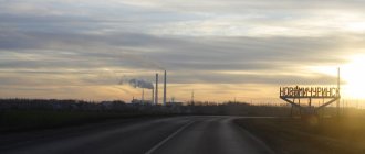
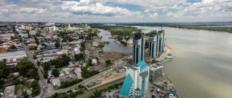
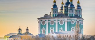
Taganrog is the sea gate of the Rostov region
Taganrog has the status of an urban district. It is located on the coast of the Azov Sea. This is an important port; there is a Russian naval base here. The number of citizens is estimated at 250,000. The predecessor of Taganrog was the Italian port of Porto Pisano (13th century). Later, a fortress was founded on this site. Its favorable location made the port a center of maritime trade. Italian and Greek merchants flocked here. With the beginning of the development of industry in Taganrog, metallurgical and machine-building complexes and power plants began to be built.
Nowadays there are automobile, aircraft, ship repair, and manufacturing industries here. Enterprises and port docks provide work for the entire working population. Taganrog is also important as a transport hub. It is connected to other cities through rail, road, and air networks. The seaport carries out cargo transportation and cruises on the Black and Azov Seas.
Science and culture
| Educational, scientific and cultural institutions : Taganrog State Radio Engineering University; institutes: state pedagogical, business and information technology, management and economics. Design, Engineering and Technological Institute of Forging and Press Robotics. Drama Theater. Art gallery (exhibition includes paintings by S. F. Shchedrin, F. S. Rokotov, A. K. Savrasov, I. K. Aivazovsky, A. I. Kuindzhi, I. E. Repin, I. I. Shishkin, I. I. Levitan, K. A. Korovin, Z. E. Serebryakova, etc.). Museums: local history, urban planning and everyday life, literary and historical-architectural museum-reserve of A.P. Chekhov. | Taganrog. Museum "Chekhov's Shop". |
Rostov-on-Don is the region's leader in population
Rostov-on-Don is the capital of the Rostov region, its scientific, educational, financial and industrial center. It is also a major transport hub. This is the only metropolis in the region, which is far ahead of all other settlements. With a population of 1,130,305 people, it ranks 10th in Russia. In terms of agglomeration composition, it is 4th in the country (2,160,000 citizens). Rostov-on-Don is very important in the economic and cultural life of the country. Its unofficial names: Rostov-papa, Gates of the Caucasus, Don capital.
Geographically, Rostov is located on the banks of the large Don River, flowing through the European part of the Russian Federation. It divides the metropolis into two parts. Not far from it are Aksai (135,000 inhabitants) and Bataysk (about 250,000). At the moment, the situation is such that they are almost merging into a single conglomerate. The cities have strong economic and transport connections. The distance between them has been reduced to walking distance. The shortest distance between the buildings of Rostov and Aksay is 34 meters. After the metropolis absorbs its satellites and the legal recognition of this fact, the metropolis will take 3rd place in the country.
Rostov-on-Don was founded as a customs point by imperial decree (1749). The favorable geographical position contributed to the creation of trade routes through Rostov. Its port was important; trade with the Mediterranean countries was carried out from here. The city began to grow rapidly and become richer. In addition to merchants, many people flocked here to work in the port and in factories. Now Rostov-on-Don is one of the richest and economically prosperous settlements located in the south of the country. The largest production facilities in various fields are concentrated here. The most important of them:
- Rostselmash is a well-known manufacturer of grain harvesting equipment. He owns up to 60% of the Russian market;
- "Rostvertol" - an aircraft manufacturer - is the largest cigarette manufacturer in the Russian Federation;
- Gloria Jeans is the largest clothing factory, a federal chain of retail stores;
- TagAZ - automobile - manufacturer, supplier of sunflower oil.
There are many Russian and foreign banks operating in Rostov. Federal retail chains are concentrated here, generating huge trade turnover (Magnit, Sportmaster, Tekhnosila and others). Enterprises provide jobs to the entire population of the metropolis. The unemployment rate here is extremely low. The average salary is higher than in Russia as a whole. Rostov-on-Don has sea and river ports, an international airport, and a network of railways and buses. There are trolleybus, tram and electric train routes. Due to the large number of vehicles, traffic congestion occurs periodically. The city authorities are planning the construction of a metro and a high-speed tram system in order to relieve congestion on transport networks.
Architectural monuments. Attractions
Taganrog. House of A.P. Chekhov | Among the architectural monuments is the Alferaki Palace (1848, designed by the architect Stackenschneider). The owner of the palace was the merchant N.D. Alferaki, one of the richest people in Taganrog. In July 1863, the great actor M. S. Shchepkin stayed in Alferaki's house. At the end of the 1870s, Alferaki went bankrupt, and the palace and garden became a merchant club. Concerts with the participation of visiting celebrities were often held in the large hall. Tchaikovsky and Chekhov visited the club, who depicted it in the stories “Ionych”, “Mask” and “My Life”. |
| Alexander I stayed at the Taganrozh Imperial Palace more than once, whose mysterious death in Taganrog served as the basis for various versions and rumors. Nicholas I, V.A. Zhukovsky, N.N. Raevsky, M.N. Volkonskaya, A.S. Pushkin, I.K. Aivazovsky stayed in the same palace. Another landmark of the city is the Stone Staircase, built in 1823. During the Crimean War, the landing of the Anglo-French troops was repulsed on its steps. Next to the Stone Staircase is the House of Tchaikovsky, brother of P.I. Tchaikovsky. In the Taganrog region there is a climatic resort area (Taganrog Bay). | Taganrog. St. Nicholas Church |
Map of the Rostov region with cities and districts
| 1. Rostov-on-Don | 15. Proletarsk city (Proletarsky district) | 29. Kashary sl. (Kashar district) | 43. Belaya Kalitva city (Belokalitvinsky district) |
| 2. Pokrovskoye village (Neklinovsky district) | 16. Tselina pst (Tselinsky district) | 30. Taganrog | 44. Zernograd city (Zernogradsky district) |
| 3. Chaltyr village. (Myasnikovsky district) | 17. Ust-Donetsk rp (Ust-Donetsk region) | 31. Novoshakhtinsk | 45. Cherished p. (Zavetinsky district) |
| 4. Oblivskaya st. (Oblivsky district) | 18. Tsimlyansk city (Tsimlyansky district) | 32. Mines | 46. Zimovniki pst (Zimovnikovsky district) |
| 5. Quarries rp (Oktyabrsky district) | 19. Chertkovo pst (Chertkovsky district) | 33. Azov city (Azov region) | 47. Kagalnitskaya st. (Kagalnitsky district) |
| 6. Oryol Pst (Oryol District) | 20. Veshenskaya st. (Sholokhovsky district) | 34. Aksai city (Aksai district) | 48. Gluboky rp (Kamensky district) |
| 7. Morozovsk city (Morozovsky district) | 21. Zhirnov rp (Tatsinsky district) | 35. Novocherkassk | 49. Egorlykskaya station. (Egorlyksky district) |
| 8. Millerovo city (Millerovsky district) | 22. Tarasovsky pst (Tarasovsky district) | 36. Kamensk-Shakhtinsky | 50. Dubovskoye village (Dubovsky district) |
| 9. Kuibyshevo village (Kuibyshevsky district) | 23. Rodionovo-Nesvetaiskaya village. (Rodionovo-Nesvetaysky district) | 37. Volgodonsk | 51. Bokovskaya st. (Bokovsky district) |
| 10. Uglerodovsky district (Krasnosulinsky district) | 24. Repair village. (Remontnensky district) | 38. Bataysk city | 52. Sholokhovsky district (Belokalitvinsky district) |
| 11. Bolshaya Martynovka sl. (Martynovsky district) | 25. Salsk city (Salsky district) | 39. Gukovo city | 53. Kazan st. (Verkhnedonsky district) |
| 12. Matveev Kurgan pst (Matveevo-Kurgan district) | 26. Semikarakorsk city (Semikarakorsk district) | 40. Donetsk | 54. Vesely pst (Veselovsky district) |
| 13. Peschanokopskoe village. (Peschanokopsky district) | 27. Soviet Art. (Sovetsky district) | 41. Zverevo city | 55. Romanovskaya st. (Volgodonsk region) |
| 14. Milyutinskaya station (Milyutinsky district) | 28. Krasny Sulin city (Krasnosulinsky district) | 42. Bagaevskaya st. (Bagaevsky district) | 56. Konstantinovsk city (Konstantinovsky district) |
Satellite map of the Rostov region
Switching between the satellite map of the Rostov region and the schematic one is done in the lower left corner of the interactive map.
Rostov region - Wikipedia:
Date of formation of the Rostov region:
September 13, 1937
Population of the Rostov region:
4,181,486 people.
(January 1, 2022) Telephone code of the Rostov region:
863
Area of the Rostov region:
100,800 km²
Vehicle codes of the Rostov region:
61,161, 761
Districts of the Rostov region
Azov • Aksai • Bagaevsky • Belokalitvinsky • Bokovsky • Verkhnedonsky • Veselovsky • Volgodonsk • Dubovsky • Egorlyksky • Zavetinsky • Zernogradsky • Zimovnikovsky • Kagalnitsky • Kamensky • Kasharsky • Konstantinovsky • Krasnosulinsky • Kuibyshevsky • Martynovsky • Matveevo-Kurgansky • Millerovsky • Milyutinsky • Morozovsky • Myasnikovsky • Neklinovsky • Oblivsky • Oktyabrsky • Orlovsky • Peschanokopsky • Proletarsky • Remontnensky • Rodionovo-Nesvetaysky • Salsky • Semikarakorsky • Sovetsky • Tarasovsky • Tatsinsky • Ust-Donetsk • Tselinsky • Tsimlyansky • Chertkovsky • Sholokhovsky.
Cities of the Rostov region - list of cities in alphabetical order
Population of cities in the Rostov region in 2017.
Azov city
— City population: 81,335 people.
Aksai city
- City population: 44828 people.
City of Bataysk
- City population: 124,705 people.
City of Belaya Kalitva
- City population: 40,831 people.
City of Volgodonsk
- City population: 171,471 people.
City of Gukovo
- City population: 66,332 people.
City of Donetsk
- City population: 48,428 people.
City of Zverevo
- City population: 21,126 people.
City of Zernograd
- City population: 24886 people.
City of Kamensk-Shakhtinsky
- City population: 89,657 people.
City of Konstantinovsk
- City population: 17,317 people.
City of Krasny Sulin
- City population: 38,567 people.
City of Millerovo
- City population: 35,540 people.
City of Morozovsk
- City population: 25,467 people.
City of Novocherkassk
- City population: 168,766 people.
City of Novoshakhtinsk
- City population: 108,782 people.
City of Proletarsk
- City population: 19,290 people.
City of Rostov-on-Don
- City population: 1125299 people.
City of Salsk
- City population: 58,179 people.
City of Semikarakorsk
- City population: 22118 people.
Taganrog city
- City population: 250,287 people.
City of Tsimlyansk
- City population: 14463 people.
City of Shakhty
- City population: 235,492 people.
Rostov region
located in the south of Russia in the area of the Don River delta on the coast of the Azov Sea. The Rostov region borders the Volgograd and Voronezh regions, the Krasnodar and Stavropol territories and the Republic of Kalmykia. It also shares a common state border with Ukraine. The Don and several other smaller rivers flow through the region.
The Rostov region is considered the land of the Don Cossacks and the main Russian gateway to the Caucasus. The administrative center is the large port city of Rostov-on-Don, which should not be confused with the ancient city of Rostov, located between Moscow and Yaroslavl. The confusion is compounded by the fact that Rostov-on-Don is usually referred to simply as Rostov, while Rostov is usually called the Great Rostov.
Rostov-on-Don
is closely associated with the Cossacks and is also referred to as the "Gateway to the Caucasus". In 2022, the city served as the venue for the 2022 FIFA World Cup.
A popular tourist destination in the Rostov region is the city of Taganrog
, founded by Peter the Great as a naval base. The most famous landmark of Taganrog is the birthplace of the writer Anton Chekhov, which has now been turned into a museum. Author Mikhail Sholokhov is also associated with the region and the village of Veshenskaya, where the Sholokhov Spring Festival is held annually, dedicated to Sholokhov’s masterpiece “Quiet Flows the Don,” which earned the author the Nobel Prize in Literature.
This port city on the Taganrog Bay of the Sea of Azov can trace its centuries-old history back to the days when it was an ancient Greek outpost mentioned by the historian Herodotus. However, the modern city called Taganrog can be given a specific founding date - September 12, 1698. On this day, Peter the Great issued a decree on the creation of a naval base for the Azov flotilla of the Black Sea Fleet. The port's focus later shifted from a military to a commercial function, especially in terms of exporting Russian grain.
What to see in the Rostov region
To see the main attractions of the region, you should first go to the regional center. There, in the center of the city, the Rostov Cathedral of the Nativity of the Blessed Virgin Mary rises. Another interesting temple is the church of an Armenian monastery, built at the end of the 18th century.
There are also noteworthy historical and architectural monuments in other cities in the region. For example, in Taganrog there is one of the largest historical and architectural reserves in Russia. No less interesting is the nature reserve in Veshenskaya - Sholokhov’s place of residence.
Sights of the Rostov region
Sarkel, Tanais, Old Station, Tchaikovsky House, Alexander Garden, Kobyakovo Settlement, Tachanka, Church of the Intercession of the Blessed Virgin Mary, Matveev Kurgan, Monument to Ermak, Azov Fortress, Provalskaya Steppe, Church of St. George the Victorious, Alexander Column, Donskoy Starocherkassky Monastery, Trinity Church, Aksai customs outpost, Iversky Convent, Church of the Life-Giving Trinity, Church of All Saints, Church of the Nativity, Alekseevsky Gate, Lutheran Church, Church of the Ascension, Church of the Intercession, Postal station of the 19th century.
Mines
Shakhty , in the Rostov region, regional subordination, 96 km northeast of Rostov-on-Don. Located on the southeastern spurs of the Donetsk Ridge. Railway station (Shakhtnaya) on the Likhaya - Rostov-on-Don line. A highway junction (the Moscow-Voronezh-Rostov-on-Don highway runs near the Sh.). Population 227.5 thousand people (1992; 16.3 thousand in 1897; 49 thousand in 1926; 135 thousand in 1939; 196 thousand in 1959; 205 thousand in 1970; 209 thousand in 1979). The settlement on the steppe river Grushevka, on the site of modern Sh., was founded at the end of the 17th - beginning of the 18th centuries. Don Cossacks. Near the settlement, the development of the outcropping seams of coal began, which was used for local needs. Later, underground developments appeared and production volumes increased. In 1790, the Cossack Dvuhzhennov contracted to deliver up to 3 thousand pounds of coal to the Taganrog port annually. By the middle of the 19th century. There were 57 mines around the village of Grushevskaya. In 1867, the village received city rights with the name Gornoe Grushevskoye Settlement. In 1881 the city was renamed Aleksandrovsk-Grushevsky. By the end of the 19th century. - one of the large centers of the coal industry in the South of Russia. In 1920 the city was renamed Sh. Sh. included many surrounding mining villages. During the Great Patriotic War of 1941-45, the city was occupied from June 21, 1942 to February 12, 1943 by Nazi troops, who, during their retreat, blew up and flooded coal mines and destroyed many public buildings. Modern Sh. is the main industrial, organizational and economic center of Eastern Donbass. Coal mining. Mechanical engineering and metalworking (plants - electric transport engineering, mechanical engineering, etc.), production of building materials (including reinforced concrete structures, ceramic products). Enterprises of light (cotton mill, 2 shoe factories, linen, clothing factories, etc.) and food (meat, dairy, etc.) industries. Branch of the Rostov Design Institute Giprougleavtomatizatsiya. Technological Institute of Consumer Services, branch of the Novocherkassk Polytechnic Institute. Drama Theater. Museum of Local Lore. The main part of multi-storey public buildings is located in the central part of the city. Arrays of multi-storey residential buildings are located in the north and south of the city; in most other areas, single-story irregular buildings predominate. Residential areas are intersected in different directions by railway and tram lines and access roads. Large areas are occupied by mine sites and waste rock dumps, and on the outskirts of the city - quarries for the extraction of building materials.
Volgodonsk is the capital of the nuclear industry
Volgodonsk is a fairly large city in terms of basic indicators: it is in fourth place in terms of population and third in size. Its geographical position is unique: in close proximity there are two million-plus people: the hero city of Volgograd and the city of military glory Rostov-on-Don. A little further, but still quite close, there are other large cities: Kalmyk Elista, as well as Stavropol and Krasnodar. The location and subsequent numerous all-Union construction projects included Volgodonsk among the most multinational cities in Russia: representatives of 87 nationalities live here.
The settlement owes its appearance, development and even name to one of the most ambitious Soviet construction projects: the connection of the Volga and Don. In the post-war period, thousands of people began to flock to the small village of Tsimlyanskaya, which gave its name to the future reservoir, for whom a workers’ settlement was founded. The construction did not end: one after another, a chemical plant, a thermal power plant, residential areas appeared, and in the seventies, one of the main enterprises of the region - Atommash and the Rostov Nuclear Power Plant. The dynamically developing city shows good economic indicators: the quality of life of citizens, the state of public utilities, the social sphere, and the provision of retail space are increasing annually.
Tsimlyansk
Tsimlyansk , in the Rostov region, a regional center, 236 km northeast of Rostov-on-Don. Located on the right bank of the Tsimlyansk Reservoir (Don River). Railway station (Tsimlyanskaya) on the Morozovsk - Kuberle line. River port. Population 15.5 thousand people (1992; 15 thousand in 1979). Founded in the 17th century. Don Cossacks as the Cossack town of Tsimla, until 1950 - the village of Tsimlyanskaya; in 1950-52 it was moved from the flood zone of the Tsimlyanskaya hydroelectric power station reservoir and transformed into the working village of Ts. The city - since 1961. A significant transport hub in the lower Don basin (transshipment of grain, coal, timber and timber, mineral construction raw materials, etc. from river vessels to trains and vice versa). The center of the agricultural region (cereal crops, viticulture, dairy and meat animal husbandry). Enterprises for processing agricultural raw materials [factories: sparkling wines (produces “Tsimlyanskoe sparkling wine”), butter factory, brewery, etc.]. Carpet factory, ship mechanical plant. Production of building materials (reinforced concrete products, bricks). Most of the city was built up in the 1950s. according to the general plan, one-story manor-type houses. The wide streets and squares of the central part of the city have numerous green spaces. In the Tsimlyanskaya hydroelectric power station.
Semikarakorsk , a regional center in the Rostov region, 137 km northeast of Rostov-on-Don. Located on the left bank of the river. Don (pier), 26 km south of the terminal railway station of the Ust-Donetskaya line from the Likhaya - Rostov-on-Don line. Population 23.2 thousand people (1992; 20.2 thousand in 1979). The village of Semikarakorskaya, founded by the Don Cossacks, has been known since 1672. Due to frequent floods caused by floods of the river. Don, the village has been moved several times; in its current location since 1845. In 1959 it was transformed into an urban-type settlement; city - since 1972. The center of an agricultural region with irrigated agriculture (crops of grain and vegetables, sunflowers; horticulture and viticulture, dairy and meat farming, poultry farming, pond fishing). Enterprises for processing agricultural raw materials (canning, cheese-making factories, meat processing plants and food processing plants). Brickworks. Production of artistic ceramics, etc. Tourist base. Near the north is the Semikarakorsk settlement on the site of a Khazar fortified city.
SALSK , in the Rostov region, regional subordination, district center, 180 km southeast of Rostov-on-Don. Located in the north of the Ciscaucasia, in the Salsky steppes, on the river. Middle Egorlyk (left tributary of the Manych river, Don basin). A junction of railway lines (to Rostov-on-Don, Tikhoretsk, Volgograd) and highways. Population 62.2 thousand people (1992; 7 thousand in 1926; 11 thousand in 1939; 35 thousand in 1959; 50 thousand in 1970; 57 thousand in 1979). Founded in 1830, in 1926 it was transformed into the city of S. from a village near the Torgovaya railway station. An industrial center, the center of a large agricultural region (cultivation of grains, including strong and durum wheat, sunflowers, rice, corn; livestock farming, including transhumance) in the southeast of the region. Enterprises for processing agricultural raw materials (mill plant, meat processing plant; dairy, winemaking, fruit canning, feed mills); factories - forging and pressing equipment, brick; furniture factory; factories - fur, shoe, textile and haberdashery, clothing. The modern regular layout of a well-greened city is based on 5 microdistricts with mixed buildings of 1-9 storey buildings.
PROLETARSK , a regional center in the Rostov region, 206 km southeast of Rostov-on-Don. Located in the north of the Ciscaucasia, in the Salsky steppes, on the right bank of the river. Western Manych (Proletarskoye Reservoir). Railway station on the Volgograd - Novorossiysk line. Road junction. Population 19.6 thousand people (1992). Known since the end of the 18th century. like the village of Velikoknyazheskaya. From 1806 - the administrative center of the Kalmyk, in 1884-1920 - the Salsky district of the Region (until 1870 of the Land) of the Don Army. In the XIX - early XX centuries. The majority of the district's population were Kalmyks, who were classified as military class and carried out military service on a par with the Don Cossacks. The main occupations of the Kalmyks were transhumance sheep and horse breeding. In the 1920s The village of Velikoknyazheskaya was renamed Proletarskaya. City - since 1970. Modern Petrograd is the center of an agricultural region (cereal crops, including rice on irrigated lands; livestock raising, mainly sheep breeding; fishing). Enterprises for processing agricultural raw materials (factories - rice cleaning, butter, fish). Production of building materials.
NOVOSHAHTINSK , in the Rostov region, regional subordination, 105 km north of Rostov-on-Don. Located at the south-eastern spurs of the Donetsk Ridge, near the Mikhailo-Leontyevskaya railway station on the Gornaya - Dolzhanskaya line, on the Kharkov - Rostov-on-Don highway. Population 107.1 thousand people (1992; 7 thousand in 1926; 48 thousand in 1939; 104 thousand in 1959; 102 thousand in 1970; 104 thousand in 1979). Formed in 1939 from several mining villages. Industrial center of Eastern Donbass. Coal mining. In modern N.: factories - mechanical, for the production of lamps; light and food industry enterprises; production of building materials.
List of cities in the Rostov region by population
23 cities are part of the region, of which 7 cities have a population of more than 100 thousand people, 5 cities have a population of more than 50 thousand. The remaining settlements are home to between 15 and 50 thousand people:
- Rostov-on-Don.
- Taganrog.
- Salsk.
- Konstantinovsk.
- Millerovo.
- Bataysk.
- Mines.
- Volgodonsk.
- Belaya Kalitva.
- Aksai.
- Red Sulin.
- Novoshakhtinsk.
- Morozovsk.
- Tsimlyansk.
- Zernograd.
- Azov.
- Proletarsk
- Gukovo.
- Donetsk.
- Novocherkassk.
- Semikarakorsk
- Zverevo.
- Kamensk-Shakhtinsky.
Novocherkassk
NOVOCHERKASSK, in the Rostov region, regional subordination, 51 km northeast of Rostov-on-Don. Located on the right elevated bank of the river. Aksai (the right branch of the Don), at the confluence of the river. Tuzlov. Railway station on the Likhaya - Rostov-on-Don line. Highway junction; The Moscow-Voronezh-Rostov-on-Don highway runs near N. Population 188.3 thousand people (1992; 52 thousand in 1897; 62 thousand in 1926; 81 thousand in 1939; 123 thousand in 1959; 162 thousand in 1970; 183 thousand in 1979). Founded in 1805 by military ataman M.I. Platov as the new administrative center of the Land (from 1870 - Region) of the Don Army instead of Cherkassk (now the village of Starocherkasskaya), which was flooded by the annual spring floods of the Don. The development of a regular plan for N. and the management of the construction of the city was carried out by military engineer F. P. Devolan; straight, wide streets and large squares fit well into the terrain. In the 19th century N. was the center of the political life of the Don Cossacks. The development of trade and industry in the city was hampered by the “highest decree” (1840), which prohibited the “non-service” population from buying real estate and land in Nizhny Novgorod; military rule prohibited the construction of industrial enterprises closer than 20 miles from the city. At the end of the 1860s. these restrictions have been lifted. By the end of the 19th century. in N. there were 28 small enterprises (iron foundries, sawmills, brick factories, breweries, distilleries, etc.). In the 1870s, with the construction of the Millerovo-Rostov-on-Don railway lines, Nizhny Novgorod was connected to the Russian railway network. In 1908, the city's population reached 51.3 thousand people (including 24.6 thousand people of the Cossack class). At the beginning of the 20th century. N. becomes an important center of education and culture of the Don. In the city, an ataman technical school, theological and teacher's seminaries, a cadet Cossack school, a cadet corps, an institute for noble maidens, a military paramedic school, 3 men's, 4 women's gymnasiums and other secondary educational institutions were opened, in 1907 - the Don Polytechnic Institute (the first higher educational institution on the Don), in 1915 - the Don Veterinary Institute. During the Civil War, Nizhny Novgorod was the center of the anti-Bolshevik Cossacks and repeatedly served as a battle arena. At the end of the 1920s. N. becomes a city of students. In the early 1930s. There were 14 universities and technical schools here, with about 10 thousand students studying. In the 1930s In Nizhny Novgorod, a locomotive-building plant and a machine-tool plant were built; a mining and drilling equipment plant and a shot foundry were being reconstructed. The city suffered greatly during the Great Patriotic War of 1941-45; was occupied by fascist German troops from July 25, 1942 to February 13, 1943. The life of the Don historian V.D. Sukhorukov is connected with N.; geologist and geographer I.V. Mushketov studied at the Novocherkassk gymnasium; The battle painter M. B. Grekov lived in N. Modern Nizhny Novgorod is a large industrial center of the Rostov region. The main industries are mechanical engineering and chemicals. A software for the production of electric locomotives was created on the basis of a former steam locomotive plant. PA "Magnit" (production of permanent magnets); factories - mechanical engineering named after. Nikolsky (production of mining equipment), petroleum engineering, machine tool, electrode, synthetic products (the feedstock is natural gas), chemical, etc. Enterprises of the food-flavoring (meat, flour-grinding, wine-making, etc.) industry. Sand-lime brick plant, etc. Near N. - Novocherkasskaya State District Power Plant (power 2400 kW). Research and design institutions, including the Research Design and Technological Institute of Electric Locomotive Engineering. State Design Institute of Electrical Engineering Industry. North Caucasus Zonal Veterinary Institute. Polytechnic Institute, Don Engineering and Reclamation Institute (Persianovka station), Higher Military School of Communications. Drama Theater named after. V. F. Komissarzhevskaya (since 1825). Museum of the History of the Don Cossacks (opened in 1899; history of the Don region, relics of the Don Cossacks, works of Russian and Western European artists, House-Museum of the battle painter M. B. Grekov, House-Museum of the artist I. I. Krylov (born in N. and spent most of his life in it.) The central part of N. is located on an elevated place (Biryuchiy Kut tract) and was built according to the regular plan of the early 19th century (3 wide avenues with boulevards, connected by squares, from which the streets diverge radially). the planning complex is united by the high-rise dominant of the Ascension Cathedral (1805-1905, architect A. A. Yashchenko), located on Ermak Square with a monument to Ermak (1904, sculptor V. A. Beklemishev, designed by M. O. Mikeshin) and a monument to the march ataman Ya. P. Baklanov (1911). At the entrances to the city in 1816-17, 2 triumphal arches were built in memory of the Patriotic War of 1812 and the foreign campaigns of Russian troops in 1813-14. On Azov Square - St. Michael the Archangel Church (1870) in the spirit eclecticism. Ordinary buildings of the 19th century. - stone and wooden mansions in the Empire style, often with a complex of manor buildings (stables, food warehouses, carriage houses, etc.). Among the architectural monuments of the second half of the 19th century: the military guardhouse (1856), the Ataman Palace (1863), the buildings of the cadet corps (1889), the Mariinsky Women's Gymnasium (1885), the Theological Seminary (1883), the Don Museum (1899), the Alexander Nevsky church in the Russian-Byzantine style (1891-96). At the beginning of the 20th century. numerous mansions were built in the Art Nouveau style (“House with an Owl”, 1910). Near N. is the Maly Mishkin farm, the family estate of Ataman M. I. Platov (1751-1818).
MOROZOVSK , a regional center in the Rostov region, 265 km northeast of Rostov-on-Don. Located in the upper reaches of the river. Bystraya (left tributary of the Seversky Donets river, Don basin). Junction (Morozovskaya) of railway lines (to Volgograd, Likhaya, Kuberle) and highways, including the Volgograd-Chisinau highway. Population 26.9 thousand people (1992). It arose in the second half of the 19th century. like a station village. At the beginning of the 20th century. The village of Morozovskaya was formed from the village and nearby Cossack farms - Morozov, Lyubimov and Basov. The city has been since 1941. During the Great Patriotic War of 1941-45, it was occupied from July 15, 1942 to January 5, 1943 by Nazi troops. Modern Moscow is the center of an agricultural region (cultivation of grains and sunflowers; dairy and meat animal husbandry). Agricultural Engineering Plant. Enterprises for processing agricultural raw materials (meat processing plant; dairy, feed mills, etc.). Elevator. Railway transport enterprises.
MILLEROVO , in the Rostov region, regional subordination, district center, 218 km north of Rostov-on-Don. Located on the southeastern edge of the Central Russian Upland, on the river. Glubokaya (left tributary of the Seversky Donets, Don basin). A large junction of railway lines (to Moscow, Rostov-on-Don, Lugansk), highways (including the highway M. - the village of Veshenskaya); The Moscow-Voronezh-Rostov-on-Don highway runs near Moscow. Population 38.1 thousand people (1992; 38.3 thousand in 1979). It was founded in 1786 by military foreman Ivan Abramovich Miller as an estate and the village of M. Until 1920, the village of M. (Millerovo-Glubokinsky) was part of the Region (until 1870 of the Land) of the Don Army. In 1872, the Rostov-Voronezh-Kozlovskaya railway passed through Moscow. After the construction of the railway to Lugansk (1898), Moscow became an important railway junction. A significant part of the agricultural products coming from the Upper Don and Ukraine regions for shipment to the central provinces of Russia was processed here. In the XIX - early XX centuries. steam mills, oil churns, and an elevator are being built in Moscow; oil-processing and iron-smelting factories (for the production of agricultural implements), etc. During the Civil War, Moscow repeatedly passed from hand to hand of the warring parties; in 1918 it was the center of the Donetsk district of the Don Soviet Republic. The city - since 1926. During the Great Patriotic War of 1941-45 it was occupied from July 15, 1942 to January 17, 1943 by Nazi troops; On the territory of the city there was a concentration camp for Soviet prisoners of war “Dulag-125” (“Millerovskaya Yama”). Modern Moscow is the center of an agricultural region (crops of grain, industrial crops, including sunflower, and fodder crops; cattle breeding, poultry farming, and fruit growing), the industrial center of the Rostov region: factories for agricultural engineering, metallurgy, equipment, and rubber products; enterprises of the food-flavoring (flour-grinding, meat, dairy, wine-making, etc.) industries; clothing and furniture factories. M. is the birthplace of the writer K. A. Trenev. The years of life of twice Hero of the Soviet Union, Air Marshal A. N. Efimov, are connected with M.
KRASNY SULIN , in the Rostov region, regional subordination, 100 km northeast of Rostov-on-Don. Located on the eastern spurs of the Donetsk Ridge, on the river. Kundryuchya (Don basin). Railway station (Sulin) on the Millerovo - Rostov-on-Don line. 5 km from the Moscow-Rostov-on-Don highway. Population 43.2 thousand people (1992). Founded in 1797 by Cossack Colonel Andrei Sulin as a farm. In the 70s XIX century merged with the village of an iron foundry, built on the basis of local iron ore deposits. In 1926, the village of Sulin received the status of a city and a new name - K.S. During the Great Patriotic War of 1941-45, it was occupied by Nazi troops from July 21, 1942 to February 14, 1943. In modern K.S.: a metallurgical plant, food enterprises industry, production of building materials, etc. Nesvetay State District Power Plant.
KONSTANTINOVSK , a regional center in the Rostov region, 169 km northeast of Rostov-on-Don. Located on the right bank of the river. Don (pier), 25 km southeast of the terminal railway station of the Ust-Donetskaya branch from the Likhaya - Rostov-on-Don line. Population 18.4 thousand people (1992; 16.4 thousand in 1979). Originated in the 17th century. like the Cossack town of Babey (Babsky), from the beginning of the 18th century. - the village of Babskaya, in 1864 united with the village of Vedernikovskaya under the common name Konstantinovskaya (named in honor of Grand Duke Konstantin Nikolaevich); since 1941 - an urban-type settlement, a city - since 1967. Modern K. is the center of an agricultural region (cultivation of grain and industrial crops, including sunflowers; dairy and meat animal husbandry); factories - fisheries, butter and cheese factories; production of building materials, etc. School of Arts. The city basically retains the appearance of a large Don village. Cossack traditions and everyday culture are being revived.
KAMENSK-SHAKHTINSKY , in the Rostov region, regional subordination, the center of the Kamensky district, 145 km northeast of Rostov-on-Don. Located at the northeastern spurs of the Donetsk Ridge, on the river. Seversky Donets (right tributary of the Don). Railway station (Kamenskaya) on the Millerovo - Rostov-on-Don line. A junction of highways, including the Moscow - Rostov-on-Don, Volgograd - Chisinau highways. Population 73.3 thousand people (1992; 17 thousand in 1926; 43 thousand in 1939; 58 thousand in 1959; 68 thousand in 1970; 72.1 thousand in 1979). It arose in 1686 as a Cossack settlement, and from 1817 - the village of Kamenskaya. From the middle of the 19th century. On the outskirts of the village, coal mines and factories (potash, distillery, mechanical repair) were built. In January 1918, a congress of representatives of front-line Cossack regiments was held in Kamenskaya, at which the Don Cossack Military Revolutionary Committee was elected, headed by F. G. Podtyolkov and M. V. Krivoshlykov. In 1927 the village received the status of a city and a new name - K.-Sh. During the Great Patriotic War of 1941-45 it was occupied by Nazi troops from July 18, 1942 to February 13, 1943. Modern K.-S. - a large industrial center of the Rostov region. In the city there is a machine-building plant (production of mining equipment), a chemical plant "Russia" (PO "Khimvolokno"), an experimental mechanical plant, a glass container plant; enterprises of the woodworking, food industries, production of building materials, etc. Thermal power plants. Museum of Local Lore. Historical center of K.-S. preserves the rectangular street network of the ancient Cossack village; on the western and southern outskirts of the city there are areas of multi-storey buildings built in the 1980s and 90s. On the central square of K.-Sh., the former village Maidan, there are two mass graves: Red Army soldiers who died during the Civil War, and Soviet soldiers who died during the Great Patriotic War. In the area of K.-Sh. — coal mines and agricultural land (wheat, sunflower crops; dairy and meat animal husbandry).
ZERNOGRAD , a regional center in the Rostov region, 71 km southeast of Rostov-on-Don. Located in the north of Ciscaucasia, in the Salsky steppes. Railway station on the Bataysk - Salsk line; on the Rostov-on-Don - Stavropol highway. Population 22.7 thousand people (1992; 24.8 thousand in 1979). It emerged in 1915 as a Camel crossing in connection with the construction of the Rostov-Torgovaya railway; in 1933 it was renamed the village of Zernovaya at the educational and experimental grain state farm created in 1929. City - since 1951. In 1960 it was renamed Z. Center of the agricultural region (cultivation of grain and industrial crops, including sunflower, castor beans and other crops; dairy and meat farming, horse breeding); agricultural machinery plant and hydraulic units plant. Azov-Black Sea Institute of Agricultural Mechanization (educational).
ZVEREVO , in the Rostov region, regional subordination, 21 km east of the city of Gukovo, 140 km northeast of Rostov-on-Don. Located in the eastern part of the Donetsk Ridge. Railway station on the Millerovo - Rostov-on-Don line, 10 km from the Moscow - Rostov-on-Don highway. Population 30.9 thousand people (1992; 26.3 thousand in 1979). He grew up from a mining village that arose at the beginning of the 20th century. Workers' village - since 1929. City - since 1989. Center for coal mining in Eastern Donbass.
DONETSK , in the Rostov region, regional subordination, 171 km north of Rostov-on-Don. Located at the northeastern spurs of the Donetsk Ridge, on the river. Seversky Donets (right tributary of the Don), 8 km from the Izvarino railway station on the Likhaya - Rodanovo line, on the Volgograd - Chisinau highway. Population 49.0 thousand people (1992; 44.5 thousand in 1979). Founded by the Don Cossacks in 1681 as the village of Gundorovskaya. Since the end of the 19th century. — mining village of Gundorovka. City - since 1951; in 1955 it was renamed D. Modern D. is the industrial center of Eastern Donbass: coal mining; excavator plant; cotton spinning and knitting factories.
GUKOVO , in the Rostov region, regional subordination, 160 km north of Rostov-on-Don. Located in the eastern part of the Donetsk Ridge. Railway station on the Likhaya - Debaltsevo line. Population 69.1 thousand people (1992; 53 thousand in 1959; 68.3 thousand in 1979). Founded in 1802 as a farm on the river. Gnilusha by the Cossack centurion Gukov, from the end of the 19th century. — mining village of Gukovsky. City - since 1955. One of the centers of coal mining in Eastern Donbass. Factory of rubber products; production of building materials, light industry enterprises.
VOLGODONSK , in the Rostov region, regional subordination, 190 km east of Rostov-on-Don. Located on the left bank of the Tsimlyansk reservoir, on the river. Don, near the Tsimlyanskaya hydroelectric power station dam. Railway station (Volgodonskaya) on the Morozovsk - Kuberle line. Port. Population 182 thousand people (1992; 16 thousand in 1959; 28 thousand in 1970; 92.4 thousand in 1979). Founded in 1950 in connection with the construction of the Volga-Don shipping canal and the Tsimlyansk hydroelectric power station, near the village of Romanovskaya and the Solny farm. City - since 1956. Modern V. is the industrial center of the Rostov region. Power engineering enterprises: PA "Atommash", . The chemical plant is one of the largest in the south of Russia (produces detergents, auxiliary materials for the production of various synthetic products, substitutes for vegetable and animal fats). Factories: radio equipment, experimental (new samples of road equipment). Enterprises of the food (dairy, meat, canning, etc.) industry, production of building materials and structures. Branch of the Novocherkassk Polytechnic Institute. Museum of Local Lore. The main part of urban development is microdistricts of 5-9-story buildings, built in the 1960-80s. Near V. - Rostov Nuclear Power Plant (not operational).
Big cities
The list of cities in the Rostov region should start with large settlements. For example, the main administrative center is Rostov-on-Don. This is a metropolis in the south of Russia, home to more than 1 million people.
It was founded in 1749 by order of Elizaveta Petrovna on the banks of the Don River and not far from the Sea of Azov. Rostov-on-Don ranks 10th among megacities in terms of population. It is a large industrial, cultural, educational and administrative center.
Taganrog and Shakhty occupy the 2nd and 3rd positions in the region, respectively, where 253 and 237 thousand people live.
Taganrog is a historical city in Russia, which was founded by Peter I in 1698. It became the first port on the sea coast and remains so to this day. Mines is an educational and industrial city where coal is mined. A diocese is being created here, thanks to which it becomes a cultural and Orthodox center in the Eastern Donbass region.
The list of cities in the Rostov region, where the population exceeds 100 thousand, is completed by 4 cities: Volgodonsk, Novocherkassk, Bataysk and Novoshakhtinsk.
Volgodonsk is a young city. It was formed in 1950. Despite this, it is recognized as the energy center of the south, where the Atommash enterprise, engaged in the production of nuclear energy, was created.
Bataysk, founded in 1769, is a satellite town. Novocherkassk is the industrial center of the region and occupies a leading position in terms of production per capita. Novoshakhtinsk was once the place where the most coal was mined, but recently the mines have been closed. The food and light industries began to develop here.
Belaya Kalitva
BELAYA KALITVA, in the Rostov region, regional subordination, district center, 168 km northeast of Rostov-on-Don. Located at the northeastern tip of the Donetsk Ridge, on the river. Seversky Donets, at the confluence of the river. Kalitva. Railway station on the Likhaya - Volgograd line. Highway (Volgograd - Chisinau). Airport. Population 48.8 thousand people (1992; 38 thousand in 1979). It arose in 1703 as the Cossack village of Ust-Belocalitvenskaya; from 1941 - a working settlement of B.K., from 1958 - a city. Modern B.K. is a center of coal mining (Eastern Donbass) and an agricultural region (meat and dairy cattle breeding, poultry farming, grain and industrial crops). There are: factories - agricultural engineering, metallurgical; enterprises of light and food industries, production of building materials. In the city in the 1960-80s. Multi-storey residential buildings were built on the left bank of the river. Kalitva (Solnechny microdistrict). In 1991, a new road bridge across the river was opened. Kalitva, connecting the left bank part with the city center. A road bridge across the river is being built (1992). Seversky Donets.
BATAYSK , in the Rostov region, regional subordination, a satellite city of Rostov-on-Don, 15 km southeast of it, on the opposite bank of the river. Don. A junction of railway lines (to Krasnodar, Baku, Salsk) and highways (including the Rostov-on-Don - Baku highway). Population 93.7 thousand people (1992; 52 thousand in 1959; 85 thousand in 1970; 90.6 thousand in 1979). Founded in 1779-80 as a settlement on the site of the Tatar camp of Bataille, devastated by the Zaporozhye Cossacks. The city has been around since 1938. In modern Bulgaria there are industrial enterprises focused on the development of Rostov-on-Don, among them: factories for assembly blanks, power-mechanical plants, for the production of reinforced concrete bridge structures, and brick; enterprises for the repair of construction equipment, repair and production of truck cranes, automobile semi-trailers, etc.; light and food industry enterprises. B. is a sorting center for railway cargo of the Rostov industrial hub and the largest collection point for scrap metal in the south of Russia. B. has a rectangular network of streets at its base. A significant part of the city's residential areas is built up with one-story manor-type houses made of red brick. Narrow shady streets and green gardens give a special flavor to the city.
AKSAI , a regional center in the Rostov region, 18 km northeast of Rostov-on-Don. Located in the southeast of the Russian Plain, on the steep right bank of the river bend. Don, at the confluence of the river. Aksai (Don sleeve). Railway station on the Likhaya - Rostov-on-Don line. Near A. there is a bypass highway that goes around the city of Rostov-on-Don from the east and connects the Moscow-Voronezh-Rostov-on-Don and Rostov-on-Don-Baku highways. Population 33.3 thousand people (1992). Founded in the second half of the 16th century. Don Cossacks (first mentioned in 1569) as the village of Ust-Aksaiskaya (in 1791 renamed Aksaiskaya). During the Azov campaigns of Peter I (1695, 1696) and subsequently in the fight against the Turks for Russia’s access to the southern seas, the village served as a guard post controlling the approaches to Cherkassk - at that time the center of the Don Army Region. In the 18th century here there was a system of earthen fortifications, connected by underground passages and equipped with warehouses with large stocks of food and weapons supplies. In the winter of 1783/84, A.V. Suvorov, commander of the Kuban Corps, was in the Ust-Aksai camp. During the Great Patriotic War of 1941-45 it was occupied by Nazi troops from November 21 to 29, 1941. In 1957, the village of Aksayskaya received the status of a city. Modern A. is an industrial satellite city of Rostov-on-Don. In A.: PA "Khimprodukt"; , canning, glass, etc.; repair and operational base of the Volga-Don River Shipping Company fleet. Museum of Local Lore. In A., narrow, stone-paved streets descend to the banks of the Don, and small bridges span the ravines. The main streets are lined with one- and two-story classicist houses of the first half of the 19th century. with three windows on the main facade and with side galleries (in the walls of some houses there is an image of a double circle and a circle with a rosette inside as a sign of the owner of the house belonging to the Cossacks or the Knights of St. George). Other architectural monuments include the postal caretaker's house and the postal station in the classicist style (19th century), and the Odigitrievskaya Church in the Russian-Byzantine style (1897). On the slopes of the Kobyakova Balka, separating the city of A. from Rostov-on-Don, there is the Kobyakovo settlement. According to legend, here in 1185, in the camp of the Polovtsian Khan Kobyak, the captive Novgorod-Seversk prince Igor Svyatoslavich, the hero of “The Tale of Igor’s Campaign,” languished.
A little history of Rostov and the region
Initially, Rostov-on-Don was a customs city, because the beginning of its history is drawn precisely from this purpose.
In 1749, a government decree was issued on the establishment of Temernitsa customs. Everyone is well aware that the entire territory of the so-called Azov region was given to the Cossacks, who constantly fought with the Turkish conquerors for the right to be here. A little later, Peter I actively joined this fight and supported the Cossacks. There is a legend that once the Dark Knight noticed the very clean and tasty water in these parts and planted an oak tree here. Later, the water from this abundant source began to be called the Rich Well (the name was given by Peter himself). After the reconquest of Azov, fishing centers of the Cossacks appeared on its territory, whose main craft was fishing. But due to unsuccessful military operations on the part of the Russian Empire, it was pushed out of this territory and from the beginning of the 18th century, for 40 years, the territory of modern Rostov-on-Don was divided in half by Turkey and Russia. Further, Rostov-on-Don served as a customs checkpoint for the empire, and of course a good “Klondike”, since there is very good soil and the Don, which made it possible to conduct good agriculture and fishing.
From the beginning of the 20th century. The territory of the Rostov region doubled. Even then, there were about 140 industrial enterprises and about 18 cities in the Rostov region.
Now this figure is even higher - today there are 22 cities in the Rostov region. These are: Azov, Bataysk, Aksai, Volgodonsk, Donetsk, Gukovo, Belaya Kalitva, Zverevo, Zerograd, Shakhty, Taganrog, Tsimlyansk, Salsk, Proletarsk, Semikarakorsk, Novocherkassk, Novoshakhtinsk, Millerovo, Krasny Sulin, Konstantinovsk, Kamensk-Shakhtinsky, Zernograd.
Rostov-on-Don
Rostov-on-Don is the capital of the Don region and the Southern Federal District
Symbolism
| Flag | Coat of arms |
Administration
346007, Rostov-on-Don, Bolshaya Sadovaya st., 47
tel., fax
Housing and communal services hotline
Head of the city administration
Logvinenko Alexey Valentinovich
Chairman of the City Duma - mayor of the city
Zinaida Vasilievna Neyarokhina
Geography
Rostov-on-Don is the administrative center of the Rostov region and the Southern Federal District of Russia with a population of more than 1 million people.
The city is located in the southeast of the East European Plain, on the banks of the Don River, 46 km from its confluence with the Sea of Azov, in the center of transport routes providing access to three seas - the Black, Azov, Caspian - and direct contacts with the entire European part of the CIS, Transcaucasia, the Middle East and the Mediterranean. The area of the city is 348.5 sq. km, the distance to Moscow is 1076 km.
Story
The founding date of Rostov-on-Don is considered to be 1749, when the Russian Empress Elizaveta Petrovna signed a Decree establishing a state customs office at the mouth of the Temernik River. After this, a port appeared here, and in 1761 the construction of the military fortress of St. Demetrius of Rostov began. The favorable geographical position contributed to the economic development of Rostov. By its 100th anniversary, the city had about 15 thousand inhabitants, and by the 20th century over 110 thousand people lived in it. The basis of the economy of Rostov-on-Don was trade, and the city itself was called a merchant city. However, by the beginning of the 20th century, there were already more than 100 enterprises operating in it, every third of which belonged to foreign capital. Until 1917, Rostov-on-Don was the third city in Russia in terms of foreign trade turnover. By the end of the 30s, in terms of population and level of economic development, it was one of the ten largest cities in the Soviet Union.
Rostov-on-Don entered the heroic chronicle of the Great Patriotic War as a city where the Red Army went from defense to offensive. Rostov-on-Don was a strategic goal in the plans of the fascist command - it was not for nothing that Goebbels called it “the gates of the Caucasus.” But it was here, at the “gates of the Caucasus,” in November 1941 that the Wehrmacht suffered its first major defeat. During the occupation of the city, the Nazis shot and tortured tens of thousands of civilians, and drove about 50 thousand people into slavery. The central areas of the city were turned into ruins, the buildings of theaters, institutes, schools and hospitals were blown up and burned. Of the 270 factories and factories, only six survived. However, thanks to the dedicated work of Rostovites, the capital of the Don was restored from ruins and became even more beautiful.
In 1970, by Decree of the Supreme Soviet of the USSR, the city of Rostov-on-Don was awarded the Order of Lenin; in 1982, by Decree of the Presidium of the Supreme Soviet of the USSR, it was awarded the Order of the Patriotic War, 1st degree. On the eve of the celebration of the 63rd anniversary of Victory in the Great Patriotic War, Rostov-on-Don was awarded the honorary title “City of Military Glory”. Today Rostov-on-Don is one of the largest megacities of modern Russia, a political, economic, cultural and scientific center of the south of the country, an important junction of transport routes.
Economy
Positioning as the capital of southern Russia and the localization in the city of large industrial enterprises and structures of a southern Russian scale (management of SKZD, etc.) determines an additional concentration of jobs in Rostov-on-Don, provides an increased level of economic activity and investment attractiveness.
Rostov-on-Don is the eighth most populous city in the Russian Federation (excluding the cities of Moscow and St. Petersburg) and stands out noticeably among Russian cities with a population of over a million, ranking first in the number of individual entrepreneurs per thousand residents. The city is among the top five in terms of housing commissioning and budgetary provision per capita.
Based on the results of a competition held by the Club of Municipal Leaders (KRMS) in 2022, the city of Rostov-on-Don was awarded a badge of honor and a diploma in the category “100 Growing Municipal Economies of Russia.”
A factor favoring the socio-economic development of the city is its positioning as the “core” of the Rostov agglomeration with a demographic potential of up to 2.3 million people, forming the largest local consumer market in the south of Russia, which concentrates a significant part of the scientific, educational, industrial and financial -investment potential of the region.
In a popular vote among Russian cities with a developed IT infrastructure, a good base for training specialists, promising projects and startups, Rostov-on-Don received the title of IT capital of Russia.
Culture
There are 220 cultural and art institutions in Rostov, creative unions and national cultural societies.
At different times, such outstanding writers as A. Solzhenitsyn, M. Nalbandyan, M. Shaginyan, V. Panova, A. Fadeev, artists M. Grekov, M. Saryan and V. Shcheblanov, composers and musicians A. lived and worked in the city. Artamonov and K. Nazaretov, actors Y. Zavadsky and V. Maretskaya. Rostov-on-Don is the birthplace of the Russian ballerina O. Spesivtseva, the outstanding singer of the 20th century I. Yuryeva, and People's Artist of the USSR R. Plyatt.
Rostov-on-Don is a major educational and scientific center. There are 22 institutions of higher professional education here, with more than 130 thousand students.
In Rostov-on-Don there are 4 theaters, two of which are academic, 4 museums, the largest Don State Public Library in the south of the country, a state circus, a regional philharmonic society, the Rostov State Conservatory (Academy) named after. S.V. Rachmaninov, Rostov-on-Don branch of the St. Petersburg State University of Culture and Arts, college of arts, college of culture, exhibition halls of artists.
One of the largest zoos in Europe has been operating in Rostov-on-Don for 94 years. This corner of fauna, covering an area of 60 hectares, is inhabited by about 5 thousand individuals, including more than 500 species of rare animals, birds and reptiles, more than 180 of which are listed in the Red Book. The Botanical Garden is considered one of the largest gardens in Russia, with an area of 161 hectares.
Rostov-on-Don is also one of the largest jazz centers in the country. It is here, like nowhere else in the world, that the basis of pop-jazz education is strong, which was laid in the early 1980s by the country’s first “professor of jazz” Kim Nazaretov, who opened the department of pop-jazz music at the Rostov Conservatory. The city has a unique, the only children's jazz school named after K. Nazaretov in the country.
It has become a good tradition to hold in Rostov-on-Don the theater festivals “Minifest”, “Russian Comedy”, international jazz festivals, the International Festival “Accordion Plus”, the competition of children and youth pop performers “Stars of Rostov”, young composers and other competitions of all genres folk art.
In 2022, the First Merchant Festival named after. A.P. Chekhov “In the City Garden”, dedicated to the 272nd anniversary of the founding of the city of Rostov-on-Don.
Attractions
Sights of Rostov-on-Don