Sights of Zarinsk.
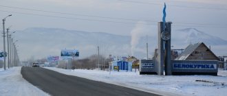
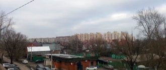
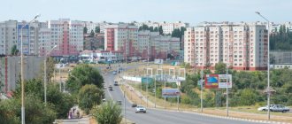
The city of Zarinsk today. The city of Zarinsk is located in the Altai Territory, 100 km northeast of Barnaul. The Zarinsky district includes 50 settlements. Geographically located on the Biysk-Chumysh Upland, on the Chumysh River (a tributary of the Ob). This is a very young city, it was founded in 1979. Large transport hub - there is a railway station.
The area of the city is 79.16 km/sq., the population is 46 thousand people.
Book a hotel in Zorinsk on Booking.com =>>
City of Zarinsk, Altai Territory
Brief information about Zarinsk
If you do not know how to get to Zarinsk, then come to Barnaul, then heading north-east from it, driving about 100 kilometers you will find yourself in the young city of Zarinsk. Why young? Because it was founded much later than all its brother cities in the Altai Territory. According to the census, more than forty-seven thousand people live in the city. Zarinsk is located on the banks of the Chumysh River. There are very harsh winters and hot summers here.
Zarinsk and its history
Once upon a time, in the middle of the seventeenth century, the first settlers appeared on the banks of the Chumysh River. Poor peasants were looking for ancient burial mounds with the hope of profiting from something useful. By the beginning of the 18th century, there were already several villages here, and in 1748 the village of Sorokino appeared on the map of the Altai Territory, which was the administrative center before the appearance of Zarinsk. In Sorokino there was a brick factory, a brewery, a school, a kindergarten, a cinema, a library, a community center, a recreation park with many carousels and children's attractions, and a veterinary hospital. They even built a city water artery so that there would be water in every yard and every apartment.
The “birth” of Zarinsk is associated with the appearance of a railway station and a village near it. But within a very short time the village began to develop and grow. New industrial and communal organizations appeared, whose activities were connected with agriculture and forestry of the entire region. When the second railroad track was laid and a bridge was built across the river in the middle of the last century, the village received a working-class classification. Then the construction of the Altai Coke and Chemical Plant began and in 1981 the Zarin residents received the first coke.
Economic features
Like other cities in the Altai Territory, the industrial sector was and is the main one in Zarinsk. Altaikoks is considered one of the giant enterprises. Not only coke is produced here, but also benzene, tar, and ammonium sulfate.
Grain is stored, cleaned and dried at the local elevator. Flour and cereals are also produced here.
The Kholod enterprise is engaged in dairy production, purchases this product from the population and processes it.
Residents of Zarinsk also have their own building materials, which are produced by the reinforced concrete products plant.
Rost, which produces bitumen, asphalt, and crushed stone, is also considered a large enterprise.
Attractions in Zarinsk
When visiting this young city, you should pay attention not only to the beautiful landscapes and buildings of large enterprises, but also to visit places that have long become the calling card of the city. These are the Ascension Church, the Museum of Local Lore and the Museum of the History of Tourism. You can put flowers at the foot of the mass grave and the eternal flame. And also visit the Salair Ridge and walk through the fir forest, or as people say, the black taiga. You should definitely visit a deposit of multi-colored clay and a relict linden grove, and drive along the Ekaterininsky tract. And also enjoy the beautiful nature. After all, here you want to pause time. And the thought arises that the creators and creators of this place followed the “all inclusive” rule.
City of regional subordination. Located on the Chumysh River 100 km northeast of Barnaul. Founded in 1970 as a workers' village. It received city status in 1979, at the same time the district center was moved here from the village. Sorokino. Population – 48.5 thousand people.
Zarinsk is the industrial and transport center of the region.
A complex of enterprises for processing agricultural raw materials has been created in the city: bakery and food processing plants, a butter and cheese plant, a timber processing plant, a printing house, and the Altaikoksohimstroy general construction trust. The development of the city's industry is facilitated by its convenient geographical location and construction areas on the banks of the Chumysh. Economic connections between neighboring districts and regions are carried out through the city: by rail - with Barnaul, Kemerovo, Novosibirsk; network of roads - with Barnaul, Biysk, Kytmanovo, Zalesovo.
Coat of arms of Zarinsk
The city has its own coat of arms, approved by Resolution of the Zarinsky Assembly of Deputies dated February 18, 2000 No. 19.
In the azure field above is a flying lark, spreading its wings; below, an emerging bezant (disk), burdened with an emerging sun inscribed in the bezant (without the image of a face); all figures are gold.
The composition of the coat of arms of the rising sun and a lark, the harbinger of its rising - dawn, harmoniously and simply speaks of the name of the city of Zarinsk. The rising sun is a symbol of light and aspiration to the future. Its rays are also a symbol of the hearth and home. Gold in heraldry symbolizes strength, greatness, intelligence, wealth and the dawn of the sun. The blue color - a symbol of peace, sincerity, honor, glory, truth and virtue - reflects the fact that Zarinsk is located on the banks of the Chumysh River.
Authors of the coat of arms: Valentina Milyaeva (Zarinsk) and Konstantin Mochenov (Khimki); artist Robert Malanichev (Moscow).
About the city
The city of Zarinsk is located on the Chumysh River, 100 km from Barnaul. Population 50.2 thousand people. The first Russian peasants began to penetrate the lands where Zarinsk now stands only at the end of the 17th century. At first, individual peasants and fugitives came here for the purpose of fishing, and at the beginning of the 18th century. Groups of “mound hunters” began to penetrate - treasure hunters in ancient mounds. Gradually, the settlers began to settle in new lands. Reliable news about Russian settlers in this territory date back only to 1716. The Russian ambassador to Dzungaria, Ivan Cheredov, wrote in a report that in 1716, nomads, along with Teleut yurts, burned “many villages” in Chumysh that belonged to Russian peasants. Thus, in 1716 Russian peasants already lived in the region. The regional archive records that in 1722 the first village of Ozerno-Titov (now the village of Ozernoye) was formed.
Before the emergence of the city, there were two villages in this place - Kamyshenka and Sorokino. One of the oldest settlements - the village of Sorokino - arose in 1748. Its name, as legends say, came from the wanderer Soroka, who allegedly was the first to settle in this place. During the years of collectivization, the commune “Dawn of Communism” turned into a collective farm with this name (1929). In 1970, a workers' settlement was founded, which in 1979 received city status. The formation of Zarinsk as a city is associated with the Altai Coke and Chemical Plant, the construction of which began in 1972.
The city of Zarinsk has its own coat of arms. In the azure field above is a flying lark, spreading its wings; below is the emerging bezant (disk), burdened with the emerging sun inscribed in the bezant. The composition of the coat of arms of the rising sun and a lark, the harbinger of its rising - dawn, harmoniously and simply speaks of the name of the city. All figures of the coat of arms are gold. The rising sun is a symbol of the sun and aspiration to the future. Its rays are also a symbol of the hearth and home. Gold in heraldry symbolizes strength, greatness, intelligence, wealth and the dawn of the sun. The blue color - a symbol of peace, sincerity, honor, glory, truth and virtue - reflects the fact that Zarinsk is located on the banks of the Chumysh.
Zarinskaya land is rich in historical and cultural monuments. One of them is the Srednekrasilovsky cave temple, located in the vicinity of the village of the same name. The temple was dug by hermit monks in the 19th century. in the upper terrace of the indigenous bank of the Chumysh. From the central entrance there was a path down the slope to a shallow well of the holy spring. The interior and underground architecture of the monument were similar to the Kiev Pechersk Lavra, both in the configuration of passages, galleries, labyrinths, and in the technique of creating domed rooms and excavation of the soil.
A special feature of the temple's architecture is the system of long galleries created by the monks, extending in the eastern direction and ending with vents. The central part of the underground structure is a complex labyrinth with a system of dead ends and connecting corridors. Among the attractions of this part of the temple are the intersection of corridors in the form of a cross and long arched galleries. Of particular interest are the niches cut into the clay walls of the temple; apparently, these are icons. There are about 12 of them. In addition to icons, there were also bas-relief images in the underground temple.
The underground temple lies in the bowels of the earth at a depth of 3-5 m, the average width of the corridors is 50 cm, the height of the tunnels is not the same, in some places you can walk at full height, in others you can only crawl. The total length of the passages is 250 meters. Currently, this is the only existing temple cave complex on the territory of the Russian Federation.
The territory of the city of Zarinsk is located within a hilly plain dissected by the Chumysh River and its tributaries. In the river valley there is a floodplain and a number of terraces above the floodplain. The floodplain rises 3-4 m above the water's edge, and on the left bank it reaches a width of 1.5-2 km. The relief of the floodplain is flat, with absolute heights of 166-170 m, with numerous oxbow depressions that are filled with water and form lakes: Topolnoye, Krivoe, Osinovoye, Soldatskoye and others. The surface of the floodplain is swampy and peat-covered in some areas. Above-floodplain terraces are well developed on the left bank of the Chumysh. The transition from one terrace to another is gradual, without clearly defined ledges. The right bank of the river in the area of the village. Sorokino is characterized by the highest absolute heights of 200-250 m; it is an elevated watershed plateau, dissected by a large ravine, the length of which is 2.5 km, depth 10-15 m.
The climate is sharply continental with harsh, long winters and moderately hot, dry summers. The coldest winter month is January, with an average temperature of -18.5 degrees and a minimum of -52 degrees. The average July temperature is +18.6, maximum +38. The amplitude of average monthly temperatures is 36-37 degrees, and extreme temperatures are 90 degrees, which makes the climate sharply continental. The invasion of cold arctic air in late spring and early autumn causes frosts. Stable frosts begin in the second ten days of November and stop at the end of March. The annual precipitation is 450 mm, of which about 70% falls during the warm period. The maximum monthly precipitation falls in July – 60 mm. During the winter months, the least rainfall occurs in February. Snow cover forms at the end of October and melts in mid-April. Relative air humidity in winter is 78-80%, in spring and summer 60-74%. The predominant wind direction is south-west, south and south-east; in winter the frequency of south-west and south-east winds sharply increases.
The city is located within the eastern wing of the Biysk-Barnaul artesian basin. Groundwater occurs in several horizons. Within the floodplain, the aquifer lies close to the surface (1-2 m). As you move away from the river, the depth increases to 20-30 meters. The Chumysh, the third longest river in the region, flows through the city, after Alei and Katun. Its length from the source to the confluence with the Ob is 644 km. Pool area 23900 sq. km. The river valley is swampy in places and overgrown with bushes. The banks are composed of loam and sandy loam soils and are subject to landslides and destruction. According to the water regime, the river belongs to the Altai type, with well-defined spring floods and summer floods. The spring flood usually begins in the first half of April. The river's food supply is mixed, with a predominance of snow. Autumn ice drift is observed annually and lasts 20 days. The river opens in mid-April. Spring ice drift is accompanied by ice jams.
The soil cover of the territory is heterogeneous. The city and its surroundings are located in the zone of leached and podzolized chernozems and dark gray forest soils. There are five main types: gray forest, podzolized chernozem, meadow-chernozem, meadow, lowland swamp.
Outcrops of parent rock are characteristic. The formation of various soils occurred depending on the nature of the relief and the level of groundwater. Gray forest soils and podzolized chernozems formed along the ridges and ridges. On the slopes of the ravines there are meadow-chernozem soils, in swampy ravines and hollows there are meadow-swamp soils. The predominant soils are chernozem type. In terms of mechanical composition, the soils are mainly represented by medium loams. The arable lands around the city are located on slopes, although of slight steepness, but of great length. And this is very dangerous with regard to the development of water erosion. Dust storms, droughts, hot winds and especially water erosion cause great damage to crop production. An important role in the fight against these phenomena is played by forest shelterbelts, which are an integral part of the farming system.
The city territory is located in the forest-steppe zone. Natural grass vegetation has been preserved only under the forest canopy and along logs, as well as in the river floodplain. On dry lands, forb-grass vegetation is most widespread. A fescue type of vegetation has formed along the bottoms of the ravines and in the floodplains of rivers. From the weeds grow wild oats, milkweed, field garlic, etc. In the spring, primroses bloom: spring adonis, cuckoo's tears, steppe peony, Asian bathwort, wood anemone, Siberian kandyk, lumbago, lungwort, etc. Early flowering plants are rightfully considered the most favorite flowers , personifying nature awakening from its winter sleep, creating a feeling of joy of life. However, they are often destroyed by collecting bouquets and damaging the above-ground and underground organs of plants. Plant recovery occurs slowly, flowering occurs in 5-15 years.
Tree and shrub vegetation is found mainly in the form of splinters of various sizes and configurations, in which Siberian poplar, maple, and pine are found here and there. Currants, viburnum, hawthorn, rowan, rose hips, and Siberian apple trees grow in the undergrowth. Along the bottoms of the dens and in the floodplains of rivers, shrubby vegetation mainly grows, consisting of various types of willows, bird cherry, currants, and sea buckthorn.
The fauna of the city's surroundings is quite diverse. The most numerous group of inhabitants are rodents: bank vole, ground squirrel, field mouse. In places remote from the city, mammals such as bear, wolf, elk, fox, hare, beaver, and muskrat are found.
Birds include the rook, magpie, hoodie, jackdaw, skylark and stonechat. Colonies of gulls nest on the lakes and the shores of Chumysh: silver gull, glaucous gull, and lake gull. Cuckoos fly into the suburbs, and semi-wild pigeons live in the area of the grain elevator. Among the reptiles you can find snakes, green and brown lizards, and in the lowlands - grass frogs and green toads.
Pike, burbot, sterlet, perch, bream, and crucian carp are found in rivers and lakes.
The composition of the entomofauna is very diverse. Some insects (mosquitoes, ticks) pose a real danger, being carriers of infectious diseases. Ten species of ticks have been identified that can be carriers of tick-borne rickettsiosis and tick-borne encephalitis.
The city has been experiencing high levels of air pollution for a number of years. According to the state report “On the state and protection of the environment in the Altai Territory in 2010,” the level of air pollution in the city in 2010, as in previous years, is assessed as high. The city's air exceeds the maximum permissible concentrations of carbon monoxide, nitrogen dioxide and phenol.
The main pollutants are oxides of nitrogen, sulfur, hydrocarbons, hydrogen sulfide, formaldehyde, hydrogen cyanide. The main share of emissions falls on the city-forming enterprise Altai-koks. A significant portion of emissions comes from cars, which pollute the city with harmful substances such as soot, lead compounds, sulfur dioxide, carbon oxides, and nitrogen oxides.
Air pollution with these substances has a direct impact on the morbidity of the population. According to the literature, the effect of sulfur dioxide, hydrogen sulfide, and coal dust on the body helps to reduce resistance to pulmonary infections, increasing the number of acute respiratory diseases. Carbon monoxide can have a direct effect on the cardiovascular system and peripheral nervous system. Exposure to high concentrations of hydrogen sulfide and dust accumulation causes heart failure.
The drinking water of Zarinsk, especially that obtained from decentralized water supply sources, has an increased content of iron, manganese and nitrates, but not enough fluorine. Poor quality drinking water increases the risk of developing diseases of the digestive, circulatory and musculoskeletal systems.
History and origins of the city
Origin of the city
The name of the city of coke chemists and builders is associated with one of the pages of the history of our state - the formation of communes. In the summer of 1920, part of the peasants of the village of Kamyshenki, Sorokinsky district, united into a commune, calling it “Dawn of Communism.” Its organizer was former partisan Ivan Bolshanin. But the communards did not have the chance to really begin their work: a kulak rebellion broke out. 14 Communards were killed. Later, the commune continued to exist, but in a new place: where the city is now, which received its name from a particle of its name - Zarinsk. The history of the pioneering Communards was not forgotten. On October 18, 1980, on the lands of the commune in memory of the communards, at the turn of the hill near the Zarinsk-Kytmanovo highway, it was opened.
City `s history
There is a legend that somewhere in the Zarinsky region, in the depths of the taiga along the ancient Catherine Highway, there is a mysterious lake, narrow, long and so deep that you can’t reach the bottom. There is nothing in its water, and animals and birds run around and around it for seven miles. It has wooden steps on one side, they go deep into the water, no one knows how they appeared.
It is interesting in the legend to mention the Ekaterininsky tract, a direct road established at the end of the first quarter of the 18th century, which went from Kuznetsk through the Salair ridge to the Beloyarsk fortress and further to the Barnaul plant. The road connected the center with the Guryev ironworks, which was one of the first in the Altai mountain district in 1726.
The tract received its name among the people, apparently, during the reign of Catherine II, since according to some information she owned the Talovsky silver mines. In documents from the early 19th century. the road is called the Barnaul-Kuznetsky or Barnaul-Salair Zemsky tract.
In 1716, Peter I issued a decree on the search for ore in the Siberian regions. Apart from the Ural factory owner Akinfiy Demidov, no one expressed a desire to build metallurgical plants there.
In 1729, the Kolyvano-Voskresensky smelter was built, in 1744 - the Barnaul copper smelter, which was later adapted for smelting silver.
The shortage of labor forced Demidov to turn to Empress Elizabeth with a request to assign peasants from nearby villages to the factories. The request was granted. Further development of industry led to an increase in the number of registered peasants, including those from distant villages. Day and night, peasant carts moved along the Ekaterininsky Highway.
The tract played a big role in the settlement and development of the area. Now along the route of the tract there are the villages of Golubtsovo, Novokopylovo, Sorokino, Khmelevka.
Altai Coke Plant
The emergence of the city is associated with the construction of the Altai Coke and Chemical Plant. In March 1968, the Council of Ministers of the RSFSR approved the task of developing a project for the Altai Coke and Chemical Plant (AKHZ) with its location in the area of the Zarinskaya station of the West Siberian Railway. The station was in a convenient geographical and transport location. The construction of a new coke-chemical enterprise was due to the growing need for coke, the development of ferrous and non-ferrous metallurgy, the chemical industry, and other sectors of the national economy. Construction began in 1972. More than 7 thousand people worked on the construction of AKHZ. At this time, the village was actively developing: new houses were built, social and cultural spheres were developing. On December 5, 1981, the first Altai coke was produced.
Altai-koks
Today Altai-koks is a large metallurgical enterprise with partnerships not only in Russia, but also in countries near and far abroad. In October 2006, the fifth coke battery (KB-5) was launched. The new KB-5 complex, with a capacity of more than a million tons of coke per year, currently has no analogues in its technological and economic indicators. KB-5 is 84 objects of both main production and servicing, environmental purposes, energy, transport, communications and utilities. In addition to the production of the main product - metallurgical coke, new production is being developed here every year: consumer goods, processing of agricultural products, modern printing.
On November 29, 1979, by decree of the Presidium of the Supreme Soviet of the RSFSR, the village was renamed the city of Zarinsk. In addition to new buildings, the city limits included the regional center of Sorokino, the workers' village of Zarinsky and the village of Mironsky.
Attractions
Zarinsky Museum of Local Lore
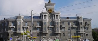
Zarinsky Museum of Local Lore. In the northern microdistrict of Zarinsk on the street. them. K. Marx, 8 is a branch of the Altai Regional Museum of Local Lore. The building is a wooden one-story house with a total area of 274 m2, built in 1910. Before the revolution, it belonged to the local merchant Makarov. Today it is a monument of regional significance. There is a memorial plaque on the building.
Three congresses were held in this building:
in March 1918 - a congress of representatives of the Chumysh volosts petitioned the Altai provincial executive committee for the construction of a railway from the Altaiskaya station to the city of Kolchugino and for the transformation of the village. Sorokino in Chumysh;
October 13, 1918 - a congress of front-line soldiers of the Chumysh volost, which adopted a resolution of no confidence in both the All-Russian and Siberian provisional governments;
in December 1919 - the third congress of the Prichernsky region (the 1st, 2nd congresses of the Prichernsky region were held in the village of Zhulanikha), at which the Chumysh partisans summed up the results of the struggle against the Kolchakites.
After the Civil War, the building was occupied by the district police department, the hall housed a store, and later the Sorokinsky Operational and Technical Communications Center, and the district state archive.
On November 4, 1978, the Zarinsky Local History Museum was opened in the building. The museum began to operate on a voluntary basis. The director of the museum was Evgeniy Semenovich Nazarov, a teacher-historian who had been involved in local history work for many years. The collection of exhibits was organized by Makar Mironovich Tokarev.
In 1987, the museum became a branch of the Altai Regional Museum of Local Lore. The museum's collections contain rich and varied material. There are permanent exhibitions telling about the history of the area, flora and fauna, and the creativity of its residents.
Memorial of Glory in Zarinsk
Zarinsky Memorial of Glory. In 1975, the Sorokinsky Republic Committee of the CPSU and the district executive committee decided to build a Memorial of Glory. Its active construction began in the 1980s. All enterprises and institutions of the city and citizens took part in the construction.
The Zarinsky Memorial of Glory was opened in honor of the 40th anniversary of the Victory, on May 9, 1985. The Eternal Flame was lit on the territory of the Memorial, the Alley of Heroes was opened, where busts were installed: Heroes of the Soviet Union - I.I. Evsevieva, A.N. Kalinina, A.A. Chirkova, I.S. Syrkina, G.I. Vakhonina, I.S. Poskrebysheva; full holders of the Order of Glory - N.I. Gupovich, G.S. Morozova and N.A. Shelepova. The museum has open access to the lists of the dead.
And today, painstaking search work is being carried out to establish the names and burial places of fellow countrymen who died during the Great Patriotic War.
The main theme of the museum's exhibitions is the Great Patriotic War. Currently, on two floors of the museum there are 14 sections reflecting the main periods of the war. Hundreds of documents and exhibits are collected here: photographs and letters from the front, personal belongings, some types of weapons. A video library is being created.
A separate stand is dedicated to Afghan soldiers and soldiers who died in the line of military duty in Chechnya.
Every year, meetings with veterans of the Great Patriotic War and internationalist soldiers are held at the Memorial of Glory.
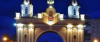
The city's railway station is called the "City Gate". It has a long history, although the city is very young. The railway connecting Altai and Kuzbass began to be built in the late 1930s. During the Great Patriotic War, construction was temporarily frozen, but already in the early 1950s. the steel line crossed the Zarinsky district. The Zarinskaya station was formed, and the settlement around it began to be called a workers’ village. It is known that at Zarinskaya station already in 1953 there were 4 tracks, and in the early 1960s there was a wooden station. With the construction of Koksokhim, the volume of freight traffic increased significantly. In the early 1980s. The modern station received its first passengers.
Station in Zarinsk
Where is Zarinsk
The city of Zarinsk is located at 53.7074 north latitude and 84.9493 east longitude at an altitude of 175 meters above sea level.
Geographic coordinates of Zarinsk in different formats
Coordinates of Zarinsk Latitude, longitude Latitude, longitude with additional letters
| In decimal format | 53.7074, 84.9493 | 53.7074N, 84.9493E | 53.7074 pp. sh., 84.9493 e. d. |
| In decimal degrees | 53.7074°, 84.9493° | 53.7074°N, 84.9493°E | 53.7074° N. latitude, 84.9493° east. d. |
| In degrees and decimal minutes | 53°42.444′, 84°56.958′ | 53°42.444′N, 84°56.958′E | 53°42.444′ N. latitude, 84°56.958′ e. d. |
| In degrees, minutes and seconds | 53°42′26.6″, 84°56′57.5″ | 53°42′26.6″N, 84°56′57.5″E | 53°42′26.6″ n. latitude, 84°56′57.5″ e. d. |
| This data can be used when working with GPS navigators and Internet mapping services Google Maps, Google Earth, Yandex.Maps, OpenStreetMap. |
Story
Zarinsk was formed by merging the station village of Zarinsky and the regional center of Sorokino on November 29, 1979 by Decree of the Presidium of the Supreme Soviet of the RSFSR.
The village of Sorokino traces its history back to 1748. By the time Zarinsk appeared, administrative and economic organizations were located in Sorokino, a number of objects were built: a brick factory, a brewery, a three-story school, a cinema "Mir", a library, a kindergarten "Teremok", a cultural center and a welfare center, a sanitary-epidemiological station, veterinary clinic, road construction department No. 2, shops, as well as a recreation park with carousels and a dance floor. One after another, twelve-apartment buildings were built in the center of Sorokino. And in 1962, a water supply system was laid.
The construction of the Altai-Kuzbass railway was completed in 1953, and a station with a railway station was built, which was named “Zarinskaya”. In the formed station village, a number of industrial and municipal warehouse organizations related to agriculture and forestry of the region arose, such as: a butter and cheese plant, a grain collection point, an elevator, a beet point, agricultural machinery, and the Chumysh rafting office. In 1958, the village received the status of a working village. And in 1961, the construction of the second railway track and electrification of the village was completed. In the same year, a bridge was built across the Chumysh River.
In March 1968, the task was approved to develop a project for the construction of the Altai Coke and Chemical Plant (AKHZ, currently OJSC Altai-koks). In the fall of 1971, a master plan was drawn up and agreed upon. In the summer of 1977, construction of the first coke battery began, and in 1981 the first Altai coke was produced.
Historical reference
The city arose by merging the regional center of Sorokino with the Zarinskaya railway station.
- The village of Sorokino on the banks of the river. Chumysh has been mentioned in historical sources since 1748. According to legend, it was founded by a wanderer nicknamed Soroka. Since the 18th century By decree of Elizaveta Petrovna, the peasants of the village were assigned to the Demidov copper smelters in Barnaul as seasonal labor.
- In 1920, not far from the regional center of Sorokino, the “Dawn of Communism” commune was formed. Soon the communards were shot with fists, but the memory of the commune was preserved by the name of the future city - Zarinsk.
- In 1953, the Altai-Kuzbass railway line was built near the village of Sorokino, and the Zarinskaya station with a workers’ settlement appeared.
- 1968-1981 – the plan for the construction of the Altai Coke and Chemical Plant, which gave rise to the city of Zarinsk, is being implemented.
- In 2000, the coat of arms of the “city at dawn” appeared: against the background of a blue sky, a golden lark soars above the rays of the rising sun - the symbolism reflects the aspiration of the residents to the future.
Interesting places in Zarinsk and its surroundings
Sights of Zarinsk.
The city of Zarinsk today. The city of Zarinsk is located in the Altai Territory, 100 km northeast of Barnaul. The Zarinsky district includes 50 settlements. Geographically located on the Biysk-Chumysh Upland, on the Chumysh River (a tributary of the Ob). This is a very young city, it was founded in 1979. Large transport hub - there is a railway station.
The Altai region is famous for its unique natural beauty and the Zarinsky district is no exception.
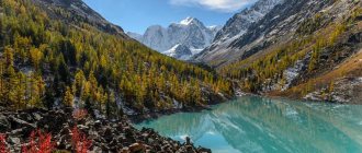
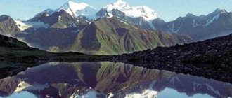
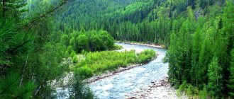
First of all, it should be noted that the Salair Ridge passes through the territory of the region. It is a spur of the Altai mountain system with a length of 300 km, with the height of arched mountain peaks up to 590 meters. The spur is a magnificent natural landscape ensemble. In addition, there are many beautiful rivers and lakes in the Zarinsky district. The rivers Chumysh, Togul and Alambay are especially interesting.
The relict linden grove is very interesting and unique. It is located on the slopes of the Salair ridge, in the eastern part of the Zarinsky district. An ancient species of linden grows on an area of 84 hectares. Experts believe that their age is more than 2 million years.
An interesting tourist site is a deposit of multi-colored clays on the right bank of the Chumysh River, on the outskirts of the village of Starokopylovo. Back in the middle of the last century, ocher was mined there on an industrial scale.
Now this interesting object is listed in the Red Book of the Altai Territory.
Located on Lenin Street, 25. It was opened in November 1978. The organization of the museum was carried out by participants of the Civil and Great Patriotic Wars - Makar Mironovich Tokarev and Evgeniy Semenovich Nazarov.
In 1984, the museum was given the status of a national museum.
Now the museum houses more than 16 thousand items, including many unique ones.
In total, the museum has 11 permanent exhibition sections. In the museum you can get acquainted with the complete history of the Zarinsky district and the life of all layers of its inhabitants.
The museum is located in a building built in 1910, and it itself is an architectural landmark.
The place where this monastery was located is located in the Zarinsky district, near the village of Zhulanikha. It belongs to the especially revered places of the Zarinsky district. The monastery was founded in 1910 and existed until 1918.
A church was erected there, underground cells and other buildings were built. In 1917, the monastery was destroyed and the monks were repressed.
Now only the remains of underground cave cells and the holy key in the place where the church stood have been preserved. The water of this spring is healing.
Notes
- ↑ 12
www.gks.ru/free_doc/doc_2016/bul_dr/mun_obr2016.rar Population of the Russian Federation by municipalities as of January 1, 2016 - Order of the Government of the Russian Federation of July 29, 2014 No. 1398-r “On approval of the list of single-industry towns”
- [www.altai-koks.ru/company/history/ History of OJSC Altai-koks]
- [demoscope.ru/weekly/ssp/rus59_reg2.php All-Union Population Census of 1959. The size of the urban population of the RSFSR, its territorial units, urban settlements and urban areas by gender] (Russian). Demoscope Weekly. Retrieved September 25, 2013. [www.webcitation.org/6GDOghWC9 Archived from the original on April 28, 2013].
- ↑ 12
www.MojGorod.ru/altajsk_kraj/zarinsk/index.html People's encyclopedia “My City”. Zarinsk - [demoscope.ru/weekly/ssp/rus89_reg2.php All-Union Population Census of 1989. Urban population]. [www.webcitation.org/617x0o0Pa Archived from the original on August 22, 2011].
- ↑ 1234567891011121314
ak.gks.ru/DBINET_DG/DBInet.cgi?pl=171205 Resident population as of January 1 - [akstat.gks.ru/wps/wcm/connect/rosstat_ts/akstat/resources/b69359804ea235f088bfb9189c529309/Volume 1. Number and distribution of population.pdf Results of the 2010 All-Russian Population Census for the Altai Territory. Volume 1. Number and distribution of population]. Retrieved March 6, 2015. [www.webcitation.org/6WpRPTbQK Archived from the original on March 6, 2015].
- ↑ 12
ak.gks.ru/DBINET_DG/DBInet.cgi?pl=171105 Population by municipalities as of January 1 (including by settlements) according to current records - [www.gks.ru/free_doc/doc_2013/bul_dr/mun_obr2013.rar Population of the Russian Federation by municipalities as of January 1, 2013. - M.: Federal State Statistics Service Rosstat, 2013. - 528 p. (Table 33. Population of urban districts, municipal districts, urban and rural settlements, urban settlements, rural settlements)]. Retrieved November 16, 2013. [www.webcitation.org/6LAdCWSxH Archived from the original on November 16, 2013].
- [akstat.gks.ru/wps/wcm/connect/rosstat_ts/akstat/resources/db0b3b8042d06d268d4bed553db9bdfa/prenumber.htm Altai Territory. Preliminary population estimate as of January 1, 2014 and average for 2013]. Retrieved May 14, 2014. [www.webcitation.org/6PZJQt0dD Archived from the original on May 14, 2014].
- [www.gks.ru/free_doc/doc_2015/bul_dr/mun_obr2015.rar Population of the Russian Federation by municipalities as of January 1, 2015]. Retrieved August 6, 2015. [www.webcitation.org/6aaNzOlFO Archived from the original on August 6, 2015].
- taking into account the cities of Crimea
- [www.gks.ru/free_doc/doc_2016/bul_dr/mun_obr2016.rar Population of the Russian Federation by municipalities as of January 1, 2016. Table “31. Population of cities and towns by federal districts and constituent entities of the Russian Federation as of January 1, 2016.” RAR archive (1.0 MB)]
- [www.tourprom.ru/country/russia/zarinsk/all_attr/ Monument to the Commonwealth with Afghanistan]
Sights of the city of Zarinsk
On the map of Zarinsk with houses you can find all the main attractions of the city and explore them in 1 day.
- The settlement museum, which displays 10 thousand exhibits: from archaeological finds to works of local artists. The museum building itself is an architectural monument of the early 20th century (Lenin St. - 25).
- The Memorial of Glory with the Eternal Flame and the Alley of Heroes; the museum building contains relics of the war years. Nearby there is a monument to internationalist soldiers who died in Afghanistan (Karl Marx Street - 8).
- Obelisk “Field of the Communards” (2 km from the city along the Zarinsk – Barnaul highway).
- The Fountain of Happiness, the Tree of Lovers, the striking clock, and the milestone in memory of Dostoevsky are located in the modern city center. (microdistricts No. 1-2, intersection of Stroiteley Avenue with Metallurgov Street).
- Church of the Ascension (Taratynov St. -1a).
- The Stroitel House of Culture is an example of 20th-century architecture, with stained-glass windows on the windows and metal sculptures on the roof (25 Party Congress Street - 7).
Sources
- https://altlib.ru/territorii/zarinsk/
- https://time-in.ru/coordinates/zarinsk
- https://delis-avto.ru/centr-rf/zarinsk-naselenie.html
- https://kudarus.ru/altay/interesnye-mesta-zarinska-i-ego-okrestnostej.html
- https://avznn.ru/centr-rf/gorod-zarinsk-altajskij-kraj.html
Economy
- The city-forming enterprise of Zarinsk is OJSC Altai-koks. It produces coke, coal tar, benzene and ammonium sulfate. The number of workers reaches 3,500 people, and 70% of products are exported to:
- India
- Germany
- Kazakhstan
- Hungary
- Slovakia.
Biysk
A new stronghold of science around an old fortress
The coat of arms of Biysk has the shape of a shield and is divided into two equal parts horizontally. In the upper part, on a green background, there is a white horse galloping to the left. At the bottom on a blue background is a mountain mine on a golden mountain.
A story that failed...
The coat of arms of Biysk was granted by a personal decree of Emperor Alexander I in 1804. The image of the mine appeared only because at that time it was a district town belonging to the Altai Mining District (Imperial Chancellery of the Kolyvan-Voskresensk Mining Plants). In fact, the mines were not developed here on a large scale. And the presence of the horse is explained by the fact that the district was formally part of the Tomsk province, so the white horse on a green background is a reference to the coat of arms of the provincial city of Tomsk (vicerious).
Naturally, Biysk has long needed its own coat of arms, which would not collect alien elements, but would become native - from the point of view of the history of the city, which was a fortress, then became a city, then a village, then again a city, then again a village, and then back to the city.
Alternative coat of arms of Biysk.
Altapress.ru.
Today Biysk, as one of the scientific and industrial centers of Southern Siberia, has the status of a science city. The city is home to the largest Russian manufacturer of dietary supplements, Evalar, and two enterprises producing explosives.
New coat of arms
A mountain of open books with an explosion at the very top and an energy bar for weight loss floating above it.
Stone-on-Obi
Saw under the anchor while the fish turned away
The coat of arms of Kamen-on-Obi is a shield with a blue anchor on a red background and on top of it two curved golden sheaves crosswise entwined with an anchor rope. The sheaves represent agriculture and the anchor is a symbol of hope.
A story that failed...
Kamen-on-Obi arose as the village of Kamen in 1751, the city - since 1915. The food industry is most developed here: Kamensky Fish Factory, Voskhod meat processing plant, butter and cheese plant, poultry factory. However, these are all relatively old productions. Among the new ones we can add one of the largest wood processing plants in the Siberian region - Kamensky LDK (in 2011, the investment project to create this site for sawmilling was included in the all-Russian priority list).
Alternative coat of arms of Kamen-on-Obi.
Altapress.ru.
New coat of arms
The fish hugs two logs entwined with a bunch of sausages.
Zmeinogorsk
The cast iron rails of fate were washed and dismantled
The coat of arms of Zmeinogorsk has the shape of a shield, in the middle of which there is a purple fortress depicted on a silver scroll on top of an intersecting golden hammer and pickaxe, and below on a black field there is a golden crystal with rays. The hammer and pick symbolize geological and mining production, and the loosely untwisted scroll symbolizes a rich and little-studied history.
A story that failed...
Zmeinogorsk was founded in 1736 after the discovery of rich silver-lead ores. To protect these riches, a fortress was built. The city developed as a mining center and remained the main supplier of gold and silver in Russia for more than 100 years. Here, for the first time, a semi-automatic line and hydraulic structures were used, replacing some of the heavy work. In 1997, the mine was flooded.
In 1899, the oldest state-owned wine warehouse (later a wine and vodka factory) was founded in the city - on the initiative of the Minister of Finance and by decree of Emperor Nicholas II. Within a few years, the company that made spirits and bottles had hundreds of stores across the country. Its story ended in 2016, when the property was sold at auction for 2.5 million rubles. In the summer of 2022, the monument to industrial architecture of the 19th century was seriously damaged due to a fire.
Alternative coat of arms of Zmeinogorsk.
Altapress.ru.
By the way, the first road in Russia with cast iron rails was built in Zmeinogorsk: with a total length of about 2 km, it passed through the river, for which a bridge with original stone supports was built. And today, even ordinary roads cause pain, especially in winter - when everything is buried in snow so much that doctors go to the sick on snowmobiles and accompanied by a tractor.
New coat of arms
Strength in the snowdrifts and intersecting shovels that symbolize perseverance. The coat of arms is crowned with a broken bottle and ski poles.
Miner
Lead was melted to a bankrupt and unprofitable state
The city does not have an official coat of arms, but sometimes they use an image that previously symbolized the Loktevsky district. The picture shows the Altai mining and processing plant.
A story that failed...
Gornyak became a city in 1969, although its history began with the Zolotushinsky polymetallic mine opened in 1751, near which a miners’ settlement appeared in 1942. The basis of the city's economy was the extraction and processing of polymetallic ores, and the largest enterprise was the mining and processing plant, which also produced copper, zinc, lead, tin and aluminum.
in the mid-90s it was declared unprofitable and went bankrupt. In addition, the mine, which occupied one of the first places in the USSR in terms of labor productivity, was flooded. A similar fate befell almost all representatives of the old large industry in the city - they were either liquidated or on the brink. Although the resource potential of the territory is diverse.
Alternative coat of arms of Gornyak.
Altapress.ru.
Rubtsovsk
The tractor ran over it twice and scattered the pasta.
The coat of arms of Rubtsovsk has the shape of a shield, in the middle of which, against the background of a solar circle, is a part of a gear, symbolizing the engineering profile. Inside the solar circle there is a scroll on which the founding year is marked. The blue ribbon dividing the shield diagonally symbolizes the water artery - the Alei River. In the upper left part, against the background of a blue sky, there is a falcon soaring over a wheat field on which a tractor is located - the brainchild of the Altai Tractor Plant.
A story that failed...
The Altai Tractor Plant appeared in 1941, when a decision was made to hastily evacuate equipment from the Kharkov Tractor Plant and the Odessa Agricultural Engineering Plant to Rubtsovsk. And the company actually began to “die” in 2007: a slow bankruptcy, which led to reorganization, and then to bankruptcy. The property was divided for a long time, the plant remained idle and was sold in parts as building material until it turned into a ruined wasteland.
Now some of the largest enterprises in the city are a timber processing plant, an agro-industrial plant producing flour, pasta, cereals and more, and a dairy plant owned by the transnational corporation PepsiCo.
Alternative coat of arms of Rubtsovsk.
Altapress.ru.
Rubtsovsk is also known for its four large correctional colonies. And a few kilometers from the city there is an abandoned airport, plans for the resurrection of which have been discussed for many years.
New coat of arms
A wheel of cheese against the background of the sky with planes flying over a field on which a broken tractor stands. There is barbed wire running through the coat of arms, symbolizing hope for life.
Aleysk
Canned beets with pasta, butter and sugar
The coat of arms of Aleysk has the shape of a blue shield, in the center of which there is a golden ear and gears, reflecting the development of industry and agricultural achievements. In the lower part there is an elevator, to which the sown fields approach in golden rays. The coat of arms was developed in Soviet times, it was made in the spirit of the era of industrialization.
A story that failed...
Aleysk was founded in 1913 on the site of the village of Maloponyushevo, which arose back in 1834, and at first it was a station village on the West Siberian Railway. Gradually, the station grew into a developed city with a large cargo-passenger hub, which contributed to the development of enterprises in the processing and food industries. Already in 1926, a mechanized butter factory was launched, which used steam engines and other innovations. The Aleysky sugar factory appeared in 1931, it was mothballed in 2007, and now there is silence there. And in 1932 they built a milling plant, where they built an elevator and a grain dryer with warehouses.
Alternative coat of arms of Aleysk.
Altapress.ru.
The city is located among large agricultural areas, which connected its economy with the processing industry. Among the largest enterprises are Aleyskzernoprodukt, which produces cereals, flour, pasta, vegetable oil and animal feed, as well as Aleysk Meat Processing Plant and Aleysk Butter and Cheese Plant.
New coat of arms
In the center there are ears of wheat curved in the shape of a dollar sign. They are complemented by sticks of sausage and cheese.
Barnaul
From a stone oven to a glass mug
The coat of arms of Barnaul has the shape of a shield. On a blue background, among silver rocks on green grass, there is a smoking red blast furnace with a golden fire inside, signifying melting. Above the stove there is a white galloping horse - a symbol of the main transport force, which means moving forward and overcoming obstacles.
A story that failed...
The Barnaul silver smelter operated until 1893 - and was closed due to a decrease in smelting volumes and the cost of metal. Later, a sawmill was located on its premises, and in 1942, a match factory evacuated from the Gomel region was opened, which was declared bankrupt in February 1998.
Real coats of arms of the cities of the Altai Territory.
Altapress.ru.
The last match was released there in 2001. Today, the monument of urban planning and architecture, despite attempts at restoration and renovation, is in a deplorable state.
At the same time, in recent years, Barnaul, having lost its powerful old industry, has experienced a real boom in the construction of shopping centers. Today their total area has probably already exceeded a million square meters, which is reflected in short parables: “Soon we will live in shopping centers.” Another feature of today’s Barnaul is the abundance of beer stores, where revenue reaches “industrial” proportions.
As for the white horse, it also ceased to be a symbol of the main transport force.
Alternative coat of arms of Barnaul.
Altapress.ru.
New coat of arms
A burning match broken in half among shopping centers and a mug of beer.
Access – around the clock
The mayor is confident that employees should always be available and mobilized to work. “You need a house to sleep there, if possible.” He says his team agrees with him.
“If a person does not answer a manager’s call within two hours, this can probably be regarded as disrespect. It makes no difference whether you are on vacation, on sick leave, or somewhere else. If a manager calls an employee knowing that he is not at work, then this is really important,” says Azgaldyan.
Crisis or temporary difficulties? What's happening in Zarinsk with the arrival of a new mayor
The players of the former team counter: they know how to work 24/7. But the new mayor’s harsh conditions were not considered justified.
“We were told to do something urgently in the evening or on the weekend, although this work was quite tolerated until 8 am the next day or Monday. Don't think, we know what it's like to work seven days a week and around the clock. Snowstorms, floods, elections, cultural events, sports - situations that require this are known to employees of all administrations. There have never been any problems with this - it’s necessary, that means it’s necessary. But the urgency of the new head’s tasks was puzzling,” says the employee.
The speakers clarified: either some kind of raids, or the preparation of documents that “endure” until the morning. At the same time, everyone has families, children, and their own non-work life.
“No one has sat at work “evenly” before, everyone worked hard, but you need to understand why,” says a former administration employee.
Ex-employees of the mayor's office say that the previous team, for example, did everything to overcome tons of paperwork and achieve the status of a priority development area for the city. At a minimum, they believe, this suggests that there were no slackers or reactionaries in the administration.