Zhukovka
(Bryansk region)
OKATO code:
15222501
Founded:
1868
Urban settlement since:
1931
City since:
1962 City of district subordination (Zhukovsky district, Bryansk region)
Center:
Zhukovsky district
Telephone code (reference phone)
| 48334***** | — |
Deviation from Moscow time, hours:
0
Geographic latitude:
53°32′
Geographic longitude:
33°44′
Altitude above sea level, meters:
170 Sunrise and sunset times in the city of Zhukovka
The Great Patriotic War
Zhukovka was occupied by Nazi troops in September 1941, and from the very first days a partisan struggle unfolded in the area.
The partisan detachment “For the Motherland” was created on Zhukovsky soil on the initiative of an underground group of communists from the Beloglavaya station. On May 1, enemy garrisons in the villages of Knyavichi and Strashevichi were defeated, and Soviet power was restored in many villages. The “For the Motherland” brigade defeated three German headquarters, 36 enemy garrisons, blew up 4 railway bridges, derailed 81 enemy trains, and destroyed more than 6 thousand German soldiers and officers.
Fascist punitive forces tortured and shot 243 people in the village of Matrenovka for contacts with partisans. The village was burned to the ground, repeating the fate of Belarusian Khatyn.
In September 1943, Soviet troops completely liberated the Zhukovsky region from the German invaders. The liberated area lay in ruins. Restoration of the destroyed economy began. Fishing artels, an industrial plant, a regional consumer union, and a railway canteen began their activities. Already in October 1943, the question arose about reviving the convoy plant.
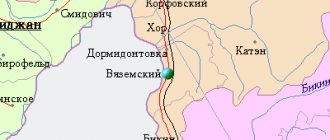
Map
| Zhukovka: maps |
Zhukovka: photo from space (Google Maps) Zhukovka: photo from space (Microsoft Virtual Earth)
| Zhukovka. Nearest cities. Distances in km. on the map (in brackets along roads) + direction. Using the hyperlink in the distance , you can get the route (information courtesy of the AutoTransInfo website) | |||
| 1 | Rzhanitsa | 16 (19) | SE |
| 2 | Dubrovka | 23 (43) | NW |
| 3 | Seltso | 30 (45) | SE |
| 4 | Rognedino | 32 (57) | WITH |
| 5 | Glinishchevo | 34 () | SE |
| 6 | And so | 34 (48) | NE |
| 7 | Zhiryatino | 34 (69) | IN |
| 8 | Kletnya | 37 (51) | SW |
| 9 | Dyatkovo | 40 (60) | IN |
| 10 | Lyubohna | 43 (70) | IN |
| 11 | Fokino | 46 (87) | IN |
| 12 | Suponevo | 52 () | SE |
| 13 | Bryansk | 52 (65) | SE |
| 14 | Vygonichi | 53 (90) | SE |
| 15 | Betlitsa (Kaluga region) | 55 (159) | WITH |
| 16 | Lyudinovo | 59 (94) | NE |
| 17 | Bolshoye Polpino | 60 () | SE |
| 18 | Ershichi (Smolensk region) | 66 (127) | Z |
| 19 | Pochep | 69 (144) | YU |
| 20 | Zhizdra | 70 (120) | IN |
| 21 | Kirov | 71 (124) | NE |
| 22 | White Shores | 71 (93) | SE |
| 23 | Desnogorsk | 74 (108) | NW |
| 24 | Roslavl | 74 (91) | NW |
| 25 | Mglin | 79 (112) | SW |
| 26 | Khvastovichi (Kaluga region) | 90 (290) | IN |
| 27 | Shumyachi (Smolensk region) | 93 (127) | NW |
| 28 | Navlya | 93 (128) | SE |
| 29 | Karachev | 95 (112) | SE |
| 30 | Baryatino (Kaluga region) | 100 (159) | NE |
| 31 | Spas-Demensk | 100 (171) | WITH |
a brief description of
The city is located on the left bank of the river. Desna (Dnieper basin), 56 km northwest of Bryansk.
Navigation (irregular) along the Desna begins from Zhukovka. Railway station.
Territory (sq. km): 13
Information about the city of Zhukovka on the Russian Wikipedia site
Historical sketch
It was founded as a village in 1868 in connection with the construction of the Oryol-Riga railway.
Until 1918, a small iron foundry, S.S., operated in Zhukovka. Radushevich.
Since October 30, 1931, the working settlement of Zhukovka.
During the Great Patriotic War of 1941-45 it was occupied by Nazi troops from September 1941 to September 1943.
City since 1962.
Economy
Leading enterprises: Zhukovsky Bicycle Plant (Desna bicycles), Zhukovsky Experimental Plant, Furniture Factory.
In the Zhukovsky district, grain crops, potatoes, and vegetables are grown. They raise cattle, pigs, and poultry.
Main enterprises
PRODUCTION OF MOTORCYCLES AND BICYCLES
JSC "Zhukovsky Bicycle Plant"
242800, Bryansk region, Zhukovsky district, Zhukovka, st.
Kalinina, 1 Offers:
bicycles
Culture, science, education
35 km from Zhukovka, in the village of Ovstug, is the House-Museum of the poet and diplomat F.I. Tyutcheva.
Museums, galleries, exhibition halls
State Memorial Historical and Literary Museum-Reserve F.I. Tyutchev "Ovstug" 242726, Bryansk region, Zhukovsky district, village. Ovstug Phone(s): call - (48334) 93-6-18 ex.bureau - (48334) 93-6-71 Website: https://musovstug.ru/
Architecture, sights
30 km southeast of Zhukovka, near the railway. station Rzhanitsa, - the village of Vshchizh, in the past an ancient Russian city, which probably arose in the 9th century. Mentioned in the chronicle under 1142. In the 12th century. was the center of an appanage principality, the possession of Prince Svyatoslav Vladimirovich. In 1238 it was destroyed by the Mongol-Tatars. As a result of excavations on the territory of the Vzhishchi settlement in the 1840s. and excavations in 1940 and 1948-49, the remains of buildings (including the foundation of a 12th century brick church) and defensive structures, as well as works of ancient Russian applied art, were found.
| Population by year (thousands of inhabitants) | |||||||
| 1939 | 10.1 | 1998 | 20.4 | 2008 | 18.5 | 2016 | 17.0 |
| 1959 | 11.1 | 2000 | 20.1 | 2010 | 18.2 | 2017 | 17.0 |
| 1970 | 16.2 | 2001 | 19.8 | 2011 | 18.3 | 2018 | 16.9 |
| 1979 | 17.6 | 2003 | 19.8 | 2012 | 17.9 | 2019 | 16.7 |
| 1989 | 19.7 | 2005 | 19.1 | 2013 | 17.6 | 2020 | 16.4 |
| 1992 | 20.1 | 2006 | 18.8 | 2014 | 17.4 | 2021 | 16.3 |
| 1996 | 20.6 | 2007 | 18.7 | 2015 | 17.1 | ||
Story
In 1867, construction of the Oryol-Vitebsk railway began. The organizer of the construction was Pyotr Gubonin. To maintain the road and refuel the locomotives with water and firewood, Gubonin settled several families here. This is how the story of Zhukovka began.
In 1871, Zhukovka turned from a stop into a station. In 1879-1880 a station with a cafeteria was built. Not far away were the lands of the landowner Zhukov (he was selling timber and building sawmills). The sawmills of Velkovsky and the Francis brothers were the first industrial enterprises of Zhukovka.
In 1878-1881, construction of the Zhukovka-Lyudinka (Kletnya) road began. We needed rails and parts for them. For this purpose, an iron foundry was organized in Zhukovka. In 1894, the Oryol-Vitebsk railway became state-owned.
On October 1, 1896, the zemstvo elementary school opened. In 1896, the Alexander Nevsky Temple opened. Now this place is where Komsomolsky Square is located. There is a version that P.I. Gubonin is buried here.
At the beginning of the 20th century, a railway school was built in Zhukovka. In 1907-1910, a three-year school was opened, a postal and telegraph office and a veterinary station appeared in the village.
In 1914, an anti-tuberculosis sanatorium began its activities (during the First World War it acted as a military hospital).
On October 1, 1929, Zhukovka became a regional center.
In 1927-1928, a year before the formation of the Zhukovsky district, more than a hundred small and handicraft industry enterprises were already operating in the Zhukovsky volost. The population was employed in brick production, metal processing, blacksmithing, mechanical engineering, the flour-grinding and cereal industries, and bakery. According to the TSB, in 1930, 4,010 people lived in Zhukovka.
On October 31, 1931, the All-Russian Central Executive Committee classified Zhukovka as a workers’ settlement.
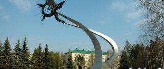
Attractions
Ovstug
- Museum-estate of the poet Fyodor Ivanovich Tyutchev
- Monument to the Poet
- Church
- Park of the 18th–19th centuries
Vshchizh
- the oldest village in the region
- Numerous burial mounds
- Church-museum
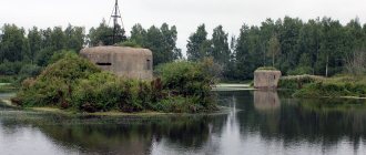
Matrenovka
— was burned by the Nazis for the connection of local residents with the partisans
- Museum
- Monument to the victims of fascism
Negotino
- an ancient picturesque village
- Water mill (reconstruction)
Foshnya
- formerly a volost center, a large village, today - a small village
- Holy spring
- Chapel
Population
| Population | ||||||||
| 2002[12] | 2009[13] | 2010[14] | 2011[15] | 2012[16] | 2013[17] | 2014[18] | 2015[19] | 2016[20] |
| 39 770 | ↘37 138 | ↘36 983 | ↘36 900 | ↘36 520 | ↘36 056 | ↘35 441 | ↘35 109 | ↘34 929 |
| 2017[21] | 2018[22] | 2019[23] | 2020[24] | 2021[4] | ||||
| ↘34 682 | ↘34 348 | ↘33 795 | ↘33 350 | ↘33 005 | ||||
Urbanization
49.35% of the district's population live in urban areas (the city of Zhukovka).
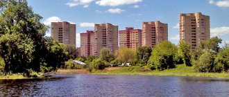
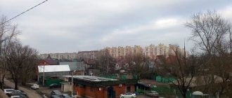
Architectural appearance of the city
Until the 1960s, the development of Zhukovka (then still a village) consisted of one-story log houses. These were standard buildings with three living rooms, a cold corridor, an entrance hall (altar) and a kitchen. Such a house had up to two wood stoves.
In the 1960s and 1970s, brick residential buildings appeared.
In the 1980s, five-story residential buildings were built. At the same time, streets appeared lined with houses for workers of the bicycle factory, DRSU, SU-868, hospitals, etc. As a rule, these are one-story houses with 2-3 apartments.
Nowadays, wooden buildings no longer predominate; most private houses are lined with brick, some are finished with siding, some have been demolished.
Private shops make a big contribution to the appearance of Zhukovka.
Notable buildings
- The water tower is a round red brick tower, the lower part is painted. Located near the train station. It was built to pump water into the station (for refueling steam locomotives). Today it is part of the city's water supply system.
- The Zhukovsky Children's Art School is the oldest brick building in the city. The School of Art has been located here since 1969.
- The houses on Karl Marx Street are residential buildings with bay windows, one of the first stone houses in Zhukovka.
- “House with a Deer” is a white five-story building with a picture of a moose laid out in brick on the end wall. Despite the fact that a moose is depicted, the name “House with a Deer” stuck. School No. 2 is located nearby, and therefore Lenin’s message to schoolchildren is posted on another wall: “Study, study and study.”
- The Alexander Nevsky Church was built in 1991-1995.
Geography
Located in the north of the region. The area of the district is 1114 km².
Rivers[5]:
| No | Name | Total length, km | River tributary (p - right, l - left) | Other flow areas in the region |
| 1 | Gum | 1187 | Dnepr (l) | Rognedinsky, Dubrovsky, Bryansky, Vygonichsky, Navlinsky, Trubchevsky |
| 2 | Vetma | 112 | Gums (l) | Dyatkovsky |
| 3 | Serizha | 29 | Gums (l) | Dyatkovsky |
| 4 | Treat | 26 | Gums (l) | Kletnyansky |
| 5 | Dobrotovka | 22 | Rosh (l) | Zhiryatinsky |
| 6 | Berezna | 21 | Vetma (l) | Dyatkovsky |
| 7 | Rzhanitsa | 14,6 | Gums (l) | |
| 8 | Tetanus | 13,2 | Treat (p) | |
| 9 | Racha | 11,4 | Gums (l) | |
| 10 | Sandbox | 10,4 | Desna (p) |
Bold
Rivers longer than 100 km are identified.
Main bodies of water[6][7][8][9]:
| No | Name | Genesis | Area, ha | Maximum depth, m |
| 1 | Pond on the Ugost River (Belogolovl village) | riverbed pond | 87 | n.d. |
| 2 | Lake Orekhovoye (Kolyanoye) | floodplain lake | 43…45 | 5,0 |
| 3 | Pond on the Vymkla River (village of Neshkovichi) | riverbed pond | 42 | n.d. |
| 4 | Lake Bechino (Vshchizhskoe) | floodplain lake | 36…40,4 | bol. 2.5 |
| 5 | Lake Bezdonnoe | karst lake | 14,5 | 22,0 |
| 6 | Lake Svyatoe (Round) | karst lake | 9,2 | 15,3 |
Bold
natural monuments of regional significance are identified.
Notes
- from the point of view of the administrative-territorial structure
- from the point of view of the municipal structure
- ↑ 1234567891011
Bryansk region. Total land area of the municipality - ↑ 123
The permanent population of the Russian Federation by municipalities as of January 1, 2022 (Russian). Retrieved April 27, 2022. Archived May 2, 2022. - Kruglikov S.A.
Ichthyofauna of the Bryansk region. - Bryansk: group, 2009. - P. 73-79. — 87 p. — ISBN 978-5-903201-65-5. - Kruglikov S.A.
Ichthyofauna of the Bryansk region. - Bryansk: group, 2009. - P. 80. - 87 p. — ISBN 978-5-903201-65-5. - Appendix to the Decree of the Government of the Bryansk Region ON AMENDING THE LIST OF FISHING SITES IN THE TERRITORY OF THE BRYANSK REGION dated June 17, 2013 No. 204-p
- ECOLOGICAL CULTURE AND INFORMATION IN THE INTERESTS OF SUSTAINABLE DEVELOPMENT. Materials of the International Forum: in 2 volumes. T. 2 / Bryan. region scientific univers. fuck them. F. I. Tyutcheva. - Bryansk, 2004. - 400 p.
- DECISION of December 16, 2009 No. 1350 ON APPROVAL OF REGULATIONS AND PASSPORTS OF SPECIALLY PROTECTED NATURAL AREAS IN BRYANSK, BRASOVSKY, BRYANSKY, VYGONICHSKY, DYATKOVSKY, ZHUKOVSKY, ZLYNKOVSKY, KARACHEVSKY, KLIMOVS KOM, KLETNYANSKY, KLINTSOVO, KOMARICHSKY, NAVLINSKY, POCHEPSKY, SEVSKY , STARODUBSKY, TRUBCHEVSKY, UNECHSKY, SUZEMSKY DISTRICTS OF THE BRYANSK REGION (as amended by Resolutions of the Administration of the Bryansk Region dated June 17, 2010 No. 608, dated November 2, 2010 No. 1096, dated October 31, 2011 No. 986, Resolutions of the Government of Bryansk region dated August 26, 2013 No. 465 -P)
- Gazette of the Supreme Soviet of the USSR. No. 26 (893), 1957
- Law of the Bryansk region dated July 28, 2020 No. 65-Z “On the transformation of municipalities that are part of the Zhukovsky municipal district in the Bryansk region, by merging them into a newly formed municipal entity with endowing it with the status of a municipal district and amending certain legislative acts of the Bryansk region »
- All-Russian population census 2002. Volume. 1, table 4. Population of Russia, federal districts, constituent entities of the Russian Federation, districts, urban settlements, rural settlements - regional centers and rural settlements with a population of 3 thousand or more (unspecified)
. Archived from the original on February 3, 2012. - The size of the permanent population of the Russian Federation by cities, urban settlements and regions as of January 1, 2009 (unspecified)
. Retrieved January 2, 2014. Archived January 2, 2014. - All-Russian population census 2010. 10. Population of the Bryansk region, urban districts, municipal districts, urban and rural settlements, urban settlements, rural settlements (undefined)
. Retrieved January 28, 2014. Archived January 28, 2014. - Estimation of the population of the Bryansk region as of January 1, 2009-2016
- Population of the Russian Federation by municipalities. Table 35. Estimated resident population as of January 1, 2012 (unspecified)
. Retrieved May 31, 2014. Archived May 31, 2014. - Population of the Russian Federation by municipalities as of January 1, 2013. - M.: Federal State Statistics Service Rosstat, 2013. - 528 p. (Table 33. Population of urban districts, municipal districts, urban and rural settlements, urban settlements, rural settlements) (undefined)
. Retrieved November 16, 2013. Archived November 16, 2013. - Table 33. Population of the Russian Federation by municipalities as of January 1, 2014 (unspecified)
. Access date: August 2, 2014. Archived August 2, 2014. - Population of the Russian Federation by municipalities as of January 1, 2015 (unspecified)
. Access date: August 6, 2015. Archived August 6, 2015. - Population of the Russian Federation by municipalities as of January 1, 2016 (Russian) (October 5, 2018). Retrieved May 15, 2022. Archived May 8, 2022.
- Population of the Russian Federation by municipalities as of January 1, 2022 (Russian) (July 31, 2017). Retrieved July 31, 2022. Archived July 31, 2022.
- Population of the Russian Federation by municipalities as of January 1, 2022 (Russian). Retrieved July 25, 2018. Archived July 26, 2022.
- Population of the Russian Federation by municipalities as of January 1, 2022 (Russian). Retrieved July 31, 2019. Archived May 2, 2022.
- ↑ 1234567891011
Population of the Russian Federation by municipalities as of January 1, 2022 (Russian). Date accessed: October 17, 2022. Archived October 17, 2022. - Law of June 5, 1997 N 13-Z “On the administrative-territorial structure of the Bryansk region”
- Decree of the Government of the Bryansk Region of August 5, 2019 N 343-p “On approval of the register of administrative-territorial units, administrative districts, settlements of the Bryansk region”
- Law of the Bryansk Region of March 9, 2005 N 3-Z “On granting municipalities the status of a city district, municipal district, urban settlement, rural settlement and establishing the boundaries of municipalities in the Bryansk Region”
- ↑ 12345678910111213141516171819202122232425262728293031323334353637383940414243444546474849505152535455565758596061626364656667686970717273747576777879808182838485
Population of the Bryansk region by municipalities by settlement as of January 1, 2013. Bryanskstat. 2013. 90 pp.
Education
There are two schools and one lyceum in Zhukovka. The oldest school in the city is Zhukovskaya Secondary School No. 1. In 2005, it received a presidential grant. In 2007, school No. 2 achieved the best results, winning the regional youth festival, KVN, Youth Party, “Leader” and subject Olympiads in the Russian language, geography, literature, history (individual students). In 2007, 15 schoolchildren from all over the region received grants of 5 thousand rubles. everyone is for an active social and sports life. Also in the city is the Zhukovsky Vocational School No. 33, which provides training in four specialties. Additional education: children's art school, youth sports school and children's creativity center.
Administrative and municipal structure
Zhukovsky district, within the administrative-territorial structure of the region, includes 10 administrative-territorial units, including 1 urban administrative district and 9 rural administrative districts[25][26].
Until 2022, the Zhukovsky municipal district included one urban and nine rural settlements[27]:
| № | Municipality | Administrative center | Number of settlements | Population (persons) | Area (km²) |
| 1 | Zhukovskoe urban settlement | Zhukovka city | 8 | ↘17 388[24] | 74,40[3] |
| 2 | Grishinoslobodskoye rural settlement | Grishina Sloboda village | 13 | ↘1530[24] | 144,87[3] |
| 3 | Zaborsko-Nikolskoye rural settlement | Nikolskaya Sloboda village | 7 | ↘1082[24] | 64,85[3] |
| 4 | Kryzhinskoe rural settlement | Kryzhino village | 9 | ↘1307[24] | 108,80[3] |
| 5 | Letoshnitskoe rural settlement | Letoshniki village | 12 | ↗1924[24] | 177,10[3] |
| 6 | Ovstug rural settlement | Ovstug village | 5 | ↘1107[24] | 77,96[3] |
| 7 | Rzhanitskoye rural settlement | village of Rzhanitsa | 4 | ↘5080[24] | 107,20[3] |
| 8 | Trosnyansky rural settlement | Trosna village | 5 | ↘1733[24] | 95,16[3] |
| 9 | Khodilovichi rural settlement | Petukhovka village | 15 | ↘1046[24] | 187,14[3] |
| 10 | Shamorda rural settlement | Shamordino village | 8 | ↘1153[24] | 77,10[3] |