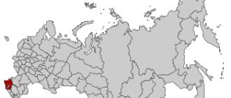
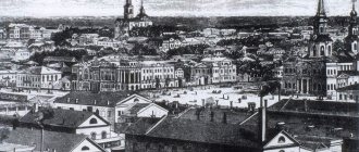
Traffic jams are real at any time of the day
Narrow streets . I was shocked when I realized that 70% of the roads in Krasnodar are single-lane. And this is not good. This applies to both the center and new buildings and roads in new residential complexes. One lane going there, the other in the opposite direction. And on the road there is immediate collapse if an accident occurs, someone boils over or stalls. There are so many traffic jams because of this. And at any time of the day. I thought it was only in the morning and evening, but no. During the day on weekdays, everything is also worth it. And the disadvantage of single-lane roads is that you can’t go around someone who is standing with a left turn signal and allows oncoming traffic to pass. And so the traffic jam behind this accumulates.
Krasnodar canyons and gorges
The gorges that appear on the sites of mountain faults only add to the beauty of the local landscapes. Waterfalls, rivers running along the bottom of canyons, lush exotic vegetation further enhance the impressions of traveling to the mountains.
Akhtsu Gorge
- Coordinates: 43.604167, 40.037778.
Not far from the village of Monastery there is a gorge that amazes with its beauty everyone who is lucky enough to see this miracle of nature. The road leading to the bottom of the gorge begins at an altitude of 800 m, among wild rocks. The view from above of the raging mountain river below is simply breathtaking.
According to scientists, the canyon and the road to it appeared as a result of the impact of numerous water flows on the rocks. The largest of them is the Mzymta River.
The path to the Akhtsu gorge can take a lot of time. Tourists can’t get enough of the fabulous landscapes; they constantly stop to take unique pictures. There is also a difficult road laid among wild rocks. However, no difficulties are scary when you manage to see such magnificent landscapes.
Canyon of the Beshenka River
- Coordinates: 44.263143, 39.203713.
The official name of the water stream running along the bottom of the canyon is the Bukepka River. Locals prefer to call this raging element the Madness. The road to the canyon and the journey through the gorge will not take much time. The entire excursion, starting from the village of Indyuk, lasts about 5 hours. The tourist route is accessible to everyone, including schoolchildren and not very prepared tourists.
Having been in the canyon, you immediately understand where the name of the river and the gorge itself came from. Although the tourist route to these places is not at all difficult, it is better to visit here in good weather. During the rain, moving along stone paths, you can get injured, which will spoil the impressions of the excursion.
Dante's Gorge
- Coordinates: 44.620530, 39.094214.
The small gorge, which has become one of the attractions of the city of Goryachy Klyuch, appeared thanks to people. The Cossacks who lived here dug a corridor through which the waters that appeared as a result of numerous precipitation and melting snow were supposed to be drained.
After several decades, the streams running down the tunnel expanded the man-made corridor, making it look like a gorge. Now Dante's Gulch has become a popular place where citizens and guests of the southern city stroll. There are gazebos, well-groomed paths and beautiful bridges spanning a man-made tunnel.
The name of this natural corner is given in honor of the famous writer who described the other world. The ten-meter walls of the crevice and the stairs leading down are overgrown with moss, which is akin to the pictures of the underworld described by Dante Alighieri.
Navalishchenskoye Gorge
- Coordinates: 43.553572, 39.895810.
Near the city of Sochi there is a gorge whose depth reaches 140 m. It was formed by the Bolshaya Khosta River, which over the course of many centuries washed away soft sedimentary rocks of the surrounding mountains.
The highest point of the Navalishchensky gorge is 250 m. The length of the tourist route laid along the mountain depression is about 1.5 km. In some places in the canyon the walls come close to each other. It seems that they want to squeeze the unruly river in a vice. However, over the many centuries of their existence, they never managed to do this.
Many plants decorating the walls of the mountain fault are listed in the Red Book of Russia. The state takes the protection of these protected areas very seriously. You can get here at any time of the year. There are equipped viewing platforms and well-groomed paths.
Gorge near the Tsypka stream
- GPS coordinates: 44.213290, 39.170920.
In mountainous areas, many natural features have the same names as nearby settlements. Sometimes it is difficult to figure out where a particular name came from. For example, the Tsypka stream gave its name to both the village located nearby and the gorge. Sometimes this is also the name given to a lake formed after a mountain collapse that blocked the narrowest part of the water flow.
The gorge of the Tsypka stream has a bizarre topography formed by the waters of a mountain stream. Moving towards the lake, travelers will encounter small waterfalls and a cave on their way, and will find an underground spring with clean water.
The lake itself, although not impressive in size, is very beautiful. The length of the tourist route leading to it is about 11 km. But this does not scare travelers; there are truly beautiful places here.
Canyon of the Psakho River
- Coordinates: 43.546021, 39.947076.
Many tourists, while vacationing in the Adler area, visit this picturesque natural area. The Psakho River Canyon was formed by numerous earthquakes that shook the planet in prehistoric times. Today it is a unique landmark of the Krasnodar region.
You can get here by car with good cross-country ability (many travel agencies offer similar tours). The difficulties of the road will immediately be forgotten just by looking at the relict gorge.
The canyon of the Psakho River is a centuries-old untouched forest, water streams running along the rocks and falling down with a roar; the beauty of exotic plants that give the canyon its unique beauty. It is in such corners that one especially feels what the expression “unity with nature” means.
Narrow sidewalks or no sidewalks
Okay, the city is not for cars. But not for pedestrians either. The photo above was taken 600 meters from the sleek Galitsky Park and Krasnodar Stadium. Narrow road - traffic jam. Narrow sidewalk . Two strollers move end-to-end. If a bike is driving behind you, it has nowhere to go.
Don't you think so in new residential complexes? Here's how YugStroyInvest is building in the Gubernsky residential complex:
I don’t understand how I can overtake a person who is walking with me in the same direction, but slowly. Apparently, only on the ground from the side.
Well, the very center. Private sector, 200 meters from Krasnaya Street (the main street of Krasnodar):
On both sides of the road there are narrow sidewalks, which are also narrowed by trees, porches, posts and other things.
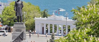
The most famous mountains and rocks of the Krasnodar region
In Kuban, 1/3 of the territory is occupied by mountains. For the most part, these are spurs of the western ranges of the Greater Caucasus. Local peaks do not amaze tourists with their height or monumentality, but they have their own beauty and attractiveness.
Mount Achishkho
- Coordinates on the map: 43.723053, 40.129444.
Having a relatively low altitude (2391 m), the Achishkho hill is popular among tourists and outdoor enthusiasts. The summit is located in the vicinity of Sochi, just 10 km from the famous Krasnaya Polyana.
To climb it and admire the beauty of the local landscapes, you don’t need any special athletic training. People often go hiking up the mountain with a tent to prolong their contact with nature, breathe in the fresh mountain air and take a break from the hustle and bustle of the resort.
Mount Chugush
- GPS coordinates: 43.797193, 40.210295.
It belongs to the mountains of the Greater Caucasus Range, located on the border of Adygea and the Krasnodar Territory. Chugush Peak, which became part of the Caucasus Nature Reserve, reaches a height of 3238 meters and is stunningly picturesque. On its slopes there are spruce-fir forests, alpine meadows and glaciers.
To visit the mountain-attraction you will need a special pass - this is a protected area. A typical climb to the top lasts two days, but minor difficulties only encourage travelers eager to admire the beauty of the mountain landscapes.
Mountain Black Pyramid
- Coordinates: 43.600000, 40.200000.
The Aibga mountain range, to which the Black Pyramid peak belongs, is located in the border zone. To visit it, it is better to get a pass. This can be done in Krasnaya Polyana.
The peak has a height of 2375 m, a hike to it will not be too burdensome. Climbing the mountain rarely takes more than 12 hours. The path to the highest point of the Black Pyramid lies through beech and fir forests and subalpine meadows.
Tourists who have completed their documents often stay here for several days. Accommodation in tents, among beautiful, sometimes virgin nature, does not leave anyone indifferent on the excursion.
Mount Sorcerer
- Coordinates: 44.662223, 37.725210.
In the Krasnodar region there are many mountains that have a very small height. These are more likely to be hills rather than peaks. But they are no less popular than the peaks of the Greater Caucasus. Mount Sorcerer rises above sea level only 440 meters, but numerous groups of tourists and novice climbers constantly climb it.
The official name of the mountain located in Novorossiysk is Myskhako. The sorcerer is the popular name of the peak, associated with one of the local legends.
They say that an evil sorcerer lived here, who sent strong winds to the coastal villages. Bora and Nord-Ost are known not only to local residents, but also to many guests of the hero city. The mountain offers a beautiful landscape view of the sea and Malaya Zemlya, where fierce battles with the Nazis took place during the Great Patriotic War.
Mount Akhun
- Coordinates: 43.550384, 39.842901.
This hill has 3 peaks - Big Akhun (663 m), Small Akhun (501 m) and Eagle Rocks (380 m). Located near the center of Sochi, the mountain comes almost close to the sea coast.
The mountain slopes are covered with deciduous forests. In some places you can find rare representatives of the region's flora - yew and boxwood. These endangered plants are protected by the state.
On Mount Akhun there is a castle built in 1936 in the style of the Middle Ages. Its towers, reaching a height of 36 m, offer an amazingly beautiful view of the Black Sea and the Greater Caucasus Mountains.
Mount Turkey
- Coordinates: 44.241331, 39.274790.
The peak received its name due to its similarity with this representative of the bird world. Its height is 859 meters. Hiking to these places is popular among novice tourists. There are many rocks on the mountain that are suitable for training athletes. Near this mountain Turkey there is also his “family” - the peaks Turkey and Turkey.
Located in the Tuapse region, this interesting corner of nature never goes unnoticed by tourists. People come here all year round. To get acquainted with the “bird family”, it is better to choose the time from March to November. During these months, the weather in the mountains is constant, and as a result, the risk of getting caught in heavy rain is minimal.
Mount Tsakhvoa
- Coordinates on the map: 43.673569, 40.574650.
Tsakhvoa Peak is the northern part of the Herzen Ridge, which belongs to the Greater Caucasus mountain ranges. The height of the mountain is 3346 m. This is the highest point in the Krasnodar region. The northern slopes of the peak are covered with a powerful glacier. Its area is about 2.5 thousand m2.
This “ice kingdom” moves down in three so-called tongues. The peak is on a par with the most beautiful places in the mountainous Caucasus. Not only trained mountain climbers come here, but also numerous fans of mountain holidays.
Urban planning is in vain
To get 4 km, I spend 20 minutes by car, because there are almost no left turns, you just need to go around a lot. Narrow streets, constant one-way streets and viaducts. There are almost no straight or long roads. The buildings are dense. Very dense. Like in Hong Kong. See for yourself:
This is some kind of trash. From the windows 20 meters to the neighboring house. You look from window to window. What's the yard like? What about parking?? Let's move on. Another area of the city. Just an anthill:
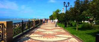
Krasnodar region: beautiful lakes
The main attractions of the Krasnodar region have always been the mountains and the sea. But in the region there are also lakes - corners with unique natural landscapes, their own beauty and attractiveness.
Atsetuk Lakes
- Coordinates: 43.525950, 40.568060.
The system, consisting of three reservoirs, is located in the vicinity of Krasnaya Polyana. It includes:
- Lake Albova is located at an altitude of more than 2 thousand meters. It has impressive dimensions. Its waters are distinguished by their purity and rich blue color. The attraction of the reservoir is a small island located in the middle of the lake mirror.
- Lake Reigarda is named after the famous explorer of the Caucasus. Its area is even slightly larger than that of Fr. Albova.
- The third reservoir of the Atsetuk system is Lake Evgenia Morozova. The deepest water basin of these places.
Excursions to the lakes are popular both among ordinary travelers and among professional climbers. There are good conditions for recreation and sports.
Lake Abrau
- Coordinates on the map: 44.698577, 37.591881.
The picturesque reservoir is located near the famous village of Abrau-Durso. The name of the settlement was formed from the names of two natural objects - Lake Abrau and the Durso River, which feeds this reservoir.
The Abrau water basin has impressive dimensions - its length is about 3 km. The widest part of the lake is 640 m of water surface.
The reservoir has some secrets that scientists have not yet been able to unravel. Researchers have not yet figured out where the waters of the lake go - it is considered to be drainless, and it is fed by the Durso River and numerous mountain springs. Another secret of the reservoir is the presence of a white line, as if drawn on the water surface. It is clearly visible not only at night, but even in winter, when the reservoir freezes.
Lake Abrau and its surroundings have a kind of calm, discreet beauty. It is surrounded by powerful mountain ranges and majestic forests. There is good fishing and excellent recreation here.
Salt Lake
- Coordinates: 45.125419, 36.859736.
It is part of the former Kuban estuary. For exactly 100 years (from 1850 to 1950) the lake served as a place for extracting table salt. Under the USSR, scientists discovered deposits of black medicinal mud here. After conducting analyses, hydrogeologists determined that the composition of bottom sediments includes hydrogen sulfide, bromine and iodine, which are especially useful in the treatment of joint diseases.
A body of water is called a lake only conditionally. Although the water pool has a fairly large area, it is very shallow. Its average depth is only 10 cm and completely dries out in summer. But this does not detract from the flow of tourists - if you cannot swim in the waters of the lake, then you can independently collect useful mud, which has a healing effect on the body.
New residential complexes
For example, the same residential complex Gubernsky, in which we lived for 28 days. They build and don’t think about parking or straight and wide streets. All with corners, detours and one lane. Well, what's the point of having a large children's playground in the center of the anthill if cars are parked and driving around in a circle? Children dart across the road, amused by their games.
Yes, there is a skatepark, outdoor exercise equipment and a large children's playground. But ideally, you need to completely close the yard from cars. After all, this yard has underground parking. But for some reason everything is like this.
Krasnodar region: the most interesting caves
The mountains that have become part of the landscape of the Krasnodar region are quite old. In their thickness there are many caves that attract both ordinary travelers and professional speleologists studying the “underground kingdom” of the region.
Great Krivenkovskaya Cave
- Coordinates: 44.185821, 39.211883.
The dungeon is located in Mount Nebeb, near the village of Anastasievka in the Tuapse region. The cave is easily accessible and passable. It is popular among vacationers. Many travelers, having visited the dungeon, compare the Bolshaya Krivenkovskaya Cave with a metro tunnel.
There are high ceilings and large distances between the walls. You can go down into the cave cavity on your own, but a visit with a guided tour will be much more interesting, as many reviews on the Internet say. In any case, a trip to these places will be remembered for a long time.
Vorontsov caves
- Coordinates: 43.613043, 39.936183.
The Vorontsov cave system ranks among the three longest underground caves in Russia. It is located in the thickness of the ridge of the same name.
The study of these underground tunnels began in the middle of the last century. In 1950-1970 Several research expeditions worked in these places. They determined the approximate age of the caves (about 120 million years ago), the length of the underground galleries (about 12 km).
The largest dungeons in the system are the Vorontsovskaya, Kabanya and Labyrinthnaya caves. There are many grottoes filled with underground water. Kudepsta and Khosta, the major rivers of the Krasnodar Territory, originate in these places.
About 400 m of Vorontsov Caves are available for tourists to explore. Despite such restrictions, you can always meet people who like walking through underground tunnels.
Great Phanagorian Cave
- GPS coordinates: 44.467388, 38.992281.
Phanagorian caves are a stalactite cave complex. However, little remains of these earthly beauties. The stalactites were dismantled “as souvenirs” by numerous visitors to these places.
The cave itself is located 12 km from the village of the same name. The entrance to it is located on the mountainside, its diameter reaches one and a half meters. Not far from the entrance, the vault of the dungeon becomes higher - you can stand at full height. Having gone deeper into the cave, tourists will find a small hill, popularly called a “climb”. It is impossible to move on without overcoming this obstacle.
It is better to take a flashlight with you when traveling. Using an additional light source, you can take some spectacular pictures that will remind you of the Great Phanagorian Cave.
Glubokiy Yar Cave
- Coordinates: 43.581730, 40.014678.
This attraction also has another name – “The Dragon’s Mouth”. Visiting it is akin to entering another reality. The entrance to the cave really resembles the open mouth of a mythical monster.
Not far from the gate to the “underground kingdom” there is a very beautiful waterfall. It falls from a height of 18 meters. To get to the cave and admire the stream flying down, you need to overcome several obstacles. This includes a cable car across a mountain river and steep picturesque paths leading up to the entrance to the dungeon.
After an excursion to this attraction, you begin to feel like a real traveler. And the emotions received here will remain in the memory of everyone who has visited these places for a long time.
Caves of Mount Turkey
- Coordinates on the map: 44.242063, 39.276442.
Scientists believe that Mount Turkey is an ancient extinct volcano that raged in these places about 175 million years ago. In the thickness of the hill there are numerous caves open to visitors.
Local dungeons are interesting because tribes of primitive people once lived here. The cave walls are covered with rock paintings and multiple serifs made by the hands of the ancient ancestors of the modern inhabitants of Kuban.
Akhshtyrskaya cave
- Coordinates: 43.520285, 39.995332.
Anyone who has visited Adler has probably heard about the Akhshtyrskaya Cave. Scientists consider it one of the most ancient sites of primitive man in the southern regions of Russia. According to historians and archaeologists, Neanderthals began to inhabit these places 70 thousand years ago.
It is interesting that this cave was discovered only at the beginning of the last century. This was done by the French researcher E. Martel.
Of the legends telling about the history of these places, the most interesting is about the meeting of Odysseus and Cyclops. Now this natural object has the status of “Unique Monument of Primitive Nature.” Access to the dungeon is very limited.
Only a small part of the cave is used as an excursion site, but the flow of tourists eager to see the places where the first tribes of people lived is not decreasing.
Honey Caves
- Coordinates: 44.152189, 40.068311.
There is one amazing place in the Krasnodar region - Bee Mountain. It is located near the abandoned settlement of Altubinal. It is not easy to get here - there is practically no semblance of a road. But if you use the services of a guide who has all-terrain vehicles, the excursion to these places will be remembered for a long time.
In addition to its unique appearance, Bee Mountain hides Honey Caves in its depths. In the summer heat, in three underground halls, bees hide honey obtained from the pollen of wild herbs. The sweet delicacy flows along the walls of the caves, creating the impression of something unreal and mystical.
Investment attractiveness of Krasnodar
Very exaggerated. Nowhere else in Russia have I seen so many empty houses and so many advertisements on windows for apartments for sale. Prices are inflated, but supply greatly outstrips demand.
A typical picture in Krasnodar in 2022: on the left the house is sparsely inhabited, on the right is a completely empty house