Home ❱
Krasnodar region
❱
Farms of Krasnodar region
❱
Slavyansky farm in Krasnodar region
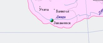
According to its status position, it belongs to the Mostovsky district of Kuban. And it is only thirty-eight kilometers away from the regional center (an urban village of the same name). Administratively, it is also subordinate to the Unarokovsky rural settlement. It’s just a stone’s throw away—five kilometers away. It’s a little far from the capital of the region, but not that far away - 127 kilometers. To overcome them, for example, in a personal car, it will take less than two hours. Of course, the farmers have relatives in different parts of Russia. They can fly to Pashkovsky airport (112 kilometers from the farm) or Maykop, even closer, come by train to Krasnodar, and then use regular buses, minibuses, taxis, and finally, where there are no special problems. Among other things, a railway passes through the Mostovskoy district.
Mostovskoy district has a special place in the region
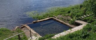
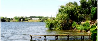
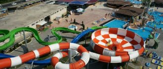
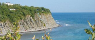
The Slavyansky farm was clearly lucky with the area. In the region, the region is considered one of the most attractive in terms of natural landscapes and beauty. Formed in 1924. It consists of two urban settlements - Mostovskoye and Psebayskoye. Plus twelve rural settlements: Yaroslavskoye, Makhoshevskoye, Krasnokutskoye, Bagovskoye, etc. And among others - Unarokovskoye. The population in the Mostovsky district is more than 71 thousand. The able-bodied person has something to do. The basis of the region's economy is the construction complex. On its territory there are huge reserves of limestone, sand and gravel mixtures, gypsum, manganese ore, brick and expanded clay, and rocks used for the production of cement. Salt is also mined and sold. Well, since from Slavyanskoye to the same town. Mostovsky is just around the corner; his farmers also work in the construction complex. Although they also have other activities related to the tourism business. After all, on the territory of the region there is a large part of the Caucasian Biosphere Reserve - the Alpine belt. The highest point of the Krasnodar Territory is located right here - Mount Tsakhvoya, 3345 meters above sea level. Many tourists want to visit the Witch Lake, where a monster supposedly lives, but its water is dead. And the reservoir itself is bottomless. And what about the natural beauty of the mountain range of nine peaks of the main Caucasian ridge, from which the rivers Urushten and Malaya Laba are born! At the headwaters of the Chistaya River lies the Pseashkho glacier. Its length is 3.1 kilometers, its area is 1.8 kilometers. It is considered the largest in the region. There are four more glaciers nearby. Smaller sizes. There are more than a thousand attractions in the area - waterfalls, dolmens, caves. Near the village of Barakaevskaya, the remains of Neanderthals were found in the Monashenskaya and Barakaevskaya caves of the Gubsky Gorge. And in the Yatirgvarta mountain range, petrogli were discovered - rock inscriptions and drawings of primitive man dating back to the third millennium BC. Eco-tourism is well developed in the area, with hiking and horseback riding routes along the Laba River in the foothills of the Caucasus, among dense forests, to thermal springs, and many guests enjoy skiing in winter. The climate here is favorable. The sun shines 170 days a year, giving people natural vitamin D, which strengthens the immune system. In summer the air warms up above 23-25 degrees. Winters are mild, ranging from minus 2-4. The regional center of Mostovskaya itself is not offended by the presence of attractions. Here rises a huge cube of red marble. It was opened in 2003 exactly on the Day of Slavic Literature - a monument to the great and mighty Russian language. By the way, some buildings in the village are heated with thermal waters. As, indeed, are the numerous greenhouses, which are also owned by the farmers of Slavyanskoe. The village of Mostovoy (now Mostovskoy) itself was formed in 1894. It is located on the left bank of the Chekhrak River, the left tributary of the deep Laba, across which five bridges were built - hence the name of the settlement. Initially there were less than four and a half thousand souls. They were mainly engaged in agriculture. Now there are more than 25 thousand. Moreover, noticeable growth began in 1959, when a little more than seven thousand people lived in it, and then more and more were added from year to year, and the prospect of growth remains. Some farmers from Slavyanskoye also settled and work in Mostovskoye. There are six schools in the village. Russian Orthodox Church and Church of Christians of the Evangelical Faith.
Links[edit]
Notes[edit]
- ^ abcdefg Reference information No. 34.01-707 / 13-03
- ^ ab "General Information". Slavyansky district. Retrieved September 25, 2022.
- ^ a b Federal State Statistics Service (2011). All-Russian Population Census 2010. Volume 1 [All-Russian Population Census 2010, vol. 1]. All-Russian Population Census 2010 [All-Russian Population Census 2010] (in Russian). Federal State Statistics Service.
- "26. The size of the permanent population of the Russian Federation by municipalities as of January 1, 2022". Federal State Statistics Service. Retrieved January 23, 2022.
- ^ abcd Law No. 775-KZ
- "On the Calculation of Time". Official Internet portal of legal information
. June 3, 2011. Retrieved January 19, 2022. - ↑
Federal State Statistics Service of Russia (May 21, 2004). The population of the Russian Federation, cities of the Russian Federation as part of federal districts, urban settlements, settlements, settlements, settlements is 3 thousand or more people. [Population of Russia, its federal districts , subjects of the Federation, districts, urban settlements, rural settlements - administrative centers and rural settlements with a population of more than 3000 people] (XLS). All-Russian Population Census of 2002 [All-Russian Population Census of 2002] (in Russian). - All-Union Population Census of 1989 Population of Union and Autonomous Republics, Autonomous Regions and Districts, Territories, Regions, Urban Settlements and Village District Centers [All-Union Population Census of 1989: Current Population of Union and Autonomous Republics, Autonomous Regions and Districts, Territories, Regions , districts, urban settlements and villages performing the functions of district administrative centers]. All-Union Population Census of 1989 [All-Union Population Census of 1989] (in Russian). Institute of Demography of the National Research University: Higher School of Economics [Institute of Demography of the National Research University: Higher School of Economics]. 1989 - via Demoscope Weekly
.
Rural settlement Unarokovskoye
As we noted above, the Slavyansky farm is part of it. Together with, in fact, the village of Unarokovskoye itself, which is home to more than 2,050 people, and more than 800 in the hamlet. The settlements are located five kilometers from each other. So their residents work both here and there. Among the large productions - Agrofirm Unarokovo LLC. She is engaged in livestock farming and crop farming, while growing products for sale. The agricultural company has 6,444 hectares of land at its disposal. Of these, 5789 are arable land. There is also Popyuk Peasant Farm LLC. The village was founded on November 5, 1894. Previously, there was an aul of Adyghe tribes. In 1887 they went to Turkey. And the lands were populated by people from the central zone of Russia. But not Cossacks, but soldiers of the Caucasian Army. At the same time, the lands were assigned to the Kuban Cossack army. They were allotted three tithes per capita, and there were 1184 of them. The peasants of Kursk, Poltava, Ekaterinoslav, Penza, Voronezh and other provinces served in the tsarist army in the Caucasus. But without giving them the status of Cossacks. There were many applicants, almost two and a half thousand. In 2012, the village celebrated its 118th anniversary. And on November 29, 2005, the current administration of the settlement was approved. By the way, the building in which it is located is a kind of local historical monument: the revolutionary committee of the village worked in it. And this was in 1918. It was led by A. Metelev, a revolutionary who is still widely known here and who at that time formed a revolutionary detachment, later transformed into the Unarokovsky infantry regiment. A little more about Alexander Denisovich Metelev. The Unarokovites were happy that there would be no tsar, and a democratic republic would appear in Russia. At the beginning of the changes, he was just 24 years old, and a fierce revolutionary came here to sort out the state of affairs. Held a rally. He criticized the Mensheviks and Socialist Revolutionaries to smithereens. He called on the villagers to fight for a better life. He was either in Unarokovsky or in St. Petersburg. And in 1918 he created a partisan headquarters in the village and formed four companies. In 1920, the civil war ended with the victory of the Bolsheviks. Which is not surprising: if in 1918 their supporters numbered over 300 thousand, then at the end of the civil war there were already five and a half million. Life in Unarokovsky was getting better. There were two primary and one higher primary schools with 300 students and 14 teachers. We have established a supply of textbooks. The children had 550 books of fiction at their disposal. And in 1935, the village got its own MTS (600 sq. meters). And there were 4 cars, 41 tractors, 49 plows, 20 cultivators, 21 seeders, 2 tobacco planting machines, 16 harvesters. The collective form of management was welcomed. Under Soviet rule, village residents lived much better than before. Therefore, it is clear that a fierce rebuff was given to Hitler’s Germany, which attacked the USSR. 553 village residents went to the front. They fought fiercely on the Kursk Bulge, for Stalingrad, in breaking the blockade of Leningrad, and liberated Kuban. Of these, 353 died a heroic death. In 1968, an obelisk with a memorial plaque with the names of the victims on it appeared in the center of Unarokovsky. And next to it is a mass grave of those who fell in the revolution and the Great Patriotic War. And Metelev's grave. After the war, three collective farms were formed in Unarokovsky. They were raised mostly by women. They grew wheat, rye, barley, corn, tobacco, and garden crops - cucumbers, tomatoes, cabbage, potatoes, strawberries. Viticulture developed. And in 1943, MTS was restored. Instead of eight, it already served ten collective farms. In 1950, three collective farms were merged into one - named after Molotov. Plus they added the collective farm of the Narkomzem farm. Five years later, the collective farm was renamed “Victory”, which existed until 2001. Today Nenarokovskoye continues to develop. In 1965, network gas was supplied to it. There is a House of Culture with 450 seats and a small hall with 100 seats. Canteen, hotel, kindergarten, two dairy farms. MTf-4 contains 400 cows and 560 young animals. The two central streets are paved, and paths to farms and brigades are provided. By the way, the villagers did not rush, as in other settlements, to rename the streets. They preserved history in their names - Roses Luxemburg, Kalinina, Kirova, Komsomolskaya, Oktyabrskaya, Chkalova, Lenina, Proletarskaya - more than two dozen in total.
Slavic urban settlement (Krasnodar region)
Early history
In ancient times, there was a Greek settlement on the territory of the city. From the 5th century BC. as part of the Bosporan kingdom. At the end of the 2nd century. BC. together with the Bosporan kingdom it became part of the Pontic kingdom. From the end of the 1st century. BC. again as part of the Bosporan kingdom as a kingdom directly dependent on Rome. From the 1st half of the 6th century. AD together with the Bosporan kingdom, the settlement became part of the Byzantine Empire.
Genoese-Golden Horde period
Genoese colony of La Copa
was one of about 40 similar colonies scattered along the Black Sea coast of the Caucasus and the lower reaches of the Kuban.
Perhaps this is the first settlement that, in the description of its location, is tied to the fork of the Kuban
and
Protoka
.
It was a trading city founded at the beginning of the 14th century. Italians. The Venetians called it Coba
;
among the names there are also: Copario
, and Copa with the article Lo (
Lo-Copa
and
Lo-Coppa
). The word la (lo) Sora is in Italian, Spanish and Portuguese and is translated as: gift, abundance, pantry; in modern meaning - a cup (for example, la Sora Mondiale - World Cup). Perhaps the name could also come from the Greek “kopto”, which means to flatten a fish.
In the XIII-XIV centuries. the territory of the North Caucasus and Kuban was under the rule of the Mongols
and was part of
the Golden Horde
, so the establishment of the Genoese colonies took place under the authority of the local khan. After the collapse of the Golden Horde, the colonies were dependent on the local Adyghe (Circassian) princes. The administrative center of all the Genoese colonies of the Black Sea and Azov regions was Kafa (modern Feodosia).
In 1449, a charter for the Genoese colonies on the Black Sea was issued in Genoa. It mentions two colonies in the Kuban region: Matrika
(modern Taman) and
Lo Coppa
, which is given a special chapter entitled “On what the consul in Lo Coppa should do.”
According to the charter, the head of Copa, the consul, elected two Greek managers and three advisers in the colony (“two Latins and one Greek”). All elected officials constituted the consul's council and were in charge of local affairs. In addition, four appraisers were selected to evaluate the goods offered for sale (mainly fish). As can be seen from the charter, the population of Kopa was engaged in fishing, searing fish and preparing caviar. The slave trade was widespread, bringing considerable income to the consul - he levied a tax of 1.33% of the price of one slave and 2.6% of the price of a slave. Among the inhabitants of the colony, in addition to the Greeks and Italians, the charter mentions the Mongols, Genoese, as well as the local residents of “ Zikhia
” -
the Circassians
(self-name -
Adygs
).
In the Ottoman Empire
At the end of the 15th century, the Northern Black Sea region was ceded by the Genoese to the Ottoman Empire, which established its dominance in this region for almost four centuries.
Following the capture of Kafa, the main stronghold of the Black Sea possessions of the Genoese, in the summer and autumn of 1475 the Ottomans began the conquest of Circassia. In addition to Tana, Matrega, Kopa was also captured. In Kop, during the defense of the city, the local Circassian (Zikh) prince died. Nevertheless, the naval forces of the Ottomans were not enough to completely capture the country - the abandoned garrisons were soon driven out by the Circassians.
In 1479, Ottoman troops made a land campaign against the lands of Circassia. According to the prominent political figure of Porta Ibn Kemal:
...in the country of the Circassians every day, proud brave men... having devastated the areas located on the coast, poured into that region like an ocean wave. In each village of the country, the Circassians captured 50–100 beauties; Many captives were enslaved. By annexing Anaba (Anapa) to Cuba (Slavyansk-on-Kuban)…
The Ottomans built the Achu fort at the mouth of the Protoka and the Kopyl fortress
four kilometers from the modern city of Slavyansk-on-Kuban.
Fort Achu was a small, insufficiently powerful Turkish fortification. It had a garrison of 300-400 people and 26-30 guns. The fort's fortifications were made of wood; the fortress walls protected either swamps or a ditch with water. During the Russian-Turkish War of 1735-1739. the fort successfully withstood a 20-day siege by Russian troops.
Turkish fortress Yeni-Kopyl
(i.e. “New Kopyl”) was built in 1747 (its remains were discovered by historian V.A. Solovyov in the area of the city stadium). Until 1777, the residence of the Kuban seraskir, the commander-in-chief of the Turkish troops in the Kuban, was located here.
A city quickly grew up around the fortress, which was called Kopyl.
, sometimes
Kaplou
.
As in the previous Genoese period, lively trade developed here. The population of Kopyl was about four thousand people. There were two mosques and five caravanserais in the city; there were storage facilities.
Kopyl became famous for its large bazaar, where barter trade predominated. Merchants from Taman, Kafa and other places brought here goods that were in great demand among the Circassians: weapons, gunpowder, lead, iron strips, braids, fabrics. The Adygs and Nogais brought wool and woolen fabric, honey, rawhide and skins to Kopyl; brought in the horses. Slaves have remained the constant “hard currency” since the times of the Bosporan Kingdom. Circassian women were especially valued and were resold to the Turkish Sultan and Crimean nobles[7].
In the Russian Empire
During the existence of the Black Sea cordon line, the future settlement was one of its strongholds under the name Kopyl (Kopyl post). In 1865 it was renamed the village of Slavyanskaya.
Recent history
1901 - the Ditsman river pier was opened (in Soviet times - River Station)
August 1904 - the Holy Dormition Church was built
1911 - the village bakery was opened
1913 - Protoka railway station opened
1926 - Tractor-Mechanical School opened
1927 - Slavic Agricultural College was created
1928 - an elevator for 100,000 pounds of grain was built
1929 - The Jupiter football team was founded. State farm Sad-Giant founded
1930 - Flow MTS was created
August 30, 1930 - above is the first issue of the newspaper Zarya Kuban
1932 - a cotton ginning, jam-making, butter-cheese, brick and fruit canning factories were built. A major bridge was built across the Protoka River
1935 - the Pishcheprom artel was founded (since 1943 - Bread Factory). Stadium named after M. Gorky opened
1939 - School of Nursing opened
1942-1943 - German occupation of the village.
1943 - Traktorozapchast enterprise was founded (now AOZT Agropromtekhnika)
1945 - Slavic motor depot Soyuzzagottrans was formed (now Avtokalonna 2096)
1946 - Slavic Autorot was formed (since 1977 - Slavic PATP)
1954 - Slavyansk Sewing Factory was founded
1956 - direct printing telegraph installed
1957 - the first meters of water supply were laid. Slavyanskraygaz was founded, and gasification of the village began. The bus went through the village.
1958 - the city House of Culture was opened
May 28, 1958 - the village of Slavyanskaya became the city of Slavyansky-on-Kuban.
1959 - MPMK-1 Savyanskaya was created
In the 1960s, a bridge was built across the channel to the Trudobelikovsky farm.
1962 - SMU-51 Trust Spetsstroy was created (now OJSC SKF DorStroy)
In the 1970s, the town included the villages of Kubris (now the Kubris microdistrict) and Sovkhozny.
1970 - the Gorelektroseti enterprise was established. A children's art school has been opened. Rice factory launched
1971 - Container plant launched
1975 - Slavyanskaya poultry farm was built
1976 - Kombirorny plant was built
1977 - a children's and youth sports school was built
In the 1980s, Zarya dachas were built, located behind the industrial zone.
On January 10, 1981, the White Rook chess club was opened
1984 - the Azov region balneological hospital was opened. A new bus station has been built. A bypass road has been built.
1991 - Slavyansk Fish Factory opened
In the 2000s, houses with 6-9 floors were built on Shkolnaya and Pobedy streets, in the Kubris microdistrict.
2004 - The Church of St. Panteleimon opens
In 2010-2012, the Slavyanskoye shopping center was built at the intersection of Kovtyukha and Pobeda streets.
2010 - high-rise buildings are built on Batareynaya and Young Partizan streets.
In 2014-2016, construction of a new building of the Slavyansk Central District Hospital will begin.
November 2022 - new Gazelle Next minibuses launched on bus routes 7, 10, 15.
In 2018-2019 The following stores are open: “DobroTsen”, “Svetofor”.