Below is a list of cities in the Kursk region. The table shows their names, the areas in which they are located, their population, and coats of arms (if any). In total, the region has 10 cities (5 urban districts) and 28 districts[1][2][3].
| Name | Municipal district/Urban district | Population, people | Based | City status | Coat of arms |
| Kursk | Urban district of Kursk | ↗443 212[4] | 1032 | 1779 | |
| Dmitriev | Dmitrievsky district | ↘6761[4] | 1779 | ||
| Zheleznogorsk | Urban district city of Zheleznogorsk | ↗99 683[4] | 1957 | 1962 | |
| Kurchatov | Urban district city of Kurchatov | ↘38 917[4] | 1968 | 1983 | |
| Lgov | Urban district city of Lgov | ↘19 533[4] | 1152 | 1779 | |
| Oboyan | Oboyansky district | ↘13 410[4] | 1639 | 1779 | |
| Rylsk | Rylsky district | ↗16 242[4] | 1152 | 12th century | |
| Suja | Sudzhansky district | ↘5648[4] | 17th century | ||
| Fatezh | Fatezhsky district | ↗5994[4] | 17th century | 1779 | |
| Shchigry | Urban district city of Shchigry | ↘15 678[4] | XVIII century | 1779 |
Story.
The city of Rylsk was mentioned for the first time
in the chronicle until 1152 as part of the Novgorod-Seversky principality.
In the 13th century, the city of Rylsk became the center of the Rylsk appanage principality, and in the 14th century the Lithuanians conquered the city for themselves. In the mid-14th century, the city was taken over by Ivan Shemyaka, who fled to Lithuania. Before this, it was owned by the Polish king Casimir IV
.
Shemyaka's son, Prince Vasily Ivanovich, of his own free will, went over to the Grand Duke of Moscow Ivan III
. Since then (1522) the city has been part of the Moscow state. Until the 17th century, Rylsk was a border town in the south of the Russian state and was one of the largest strategic points of defense against the Crimean Tatars, as well as the most important point of trade and economic relations between Russia and Ukraine.
At the beginning of the 20th century, Rylsk became an important trading city for the sale of lard, honey, grain, hemp, wax and many other goods of that time.
Ivan III
Ivan III. Engraving. | Ivan III Vasilievich. Grand Duke of Moscow. Born on January 22, 1440, died on October 27, 1505 in Moscow. He became a prince in 1462. Father - Vasily II Vasilyevich Dark. Was his youngest son. In 1450 he became co-ruler with his father, i.e. Grand Duke. He was an outstanding statesman and showed extraordinary diplomatic and military skills. During the reign of Ivan III, a centralized apparatus of power began to take shape: a command system of management was born. As a result, he compiled the Code of Laws in 1497. By the end of the reign of Ivan III, many appanages were eliminated. This was due to the struggle of Ivan III against the separatism of his brothers Andrei Bolshoi and Boris Volotsky in the mid-14th century, as well as other appanage princes. In this way he “restrained” them. Ivan fought the Kazan Khanate until 1487, when as a result of his actions it became politically dependent on Rus'. The most remarkable thing is that Ivan III managed to get rid of the Tatar-Mongol yoke, and with the entire Russian population, Ivan Vasilyevich managed to defend himself from the invasion of Khan Akhmat. It was the “Standing on the Ugra” event. For the second time, Ivan III married Sophia Paleolog (niece of the last Byzantine emperor). During the reign of Ivan III, large construction began in Moscow: the Faceted Chamber, the KREMLIN, fortresses in Tula, Ivangorod and Kolomna were built. Ivan Vasilyevich was a great ruler. Ivan III raised the authority of the entire Great Russian Empire. He established diplomatic relations with Germany, Hungary, Turkey, Iran, Hungary, Crimea, and the Papal Curia... Under Ivan III, the formalization of the full title of Grand Duke of “All Rus'” began. Ivan Vasilyevich cooperated with the Russian centralized state. He annexed to the Moscow principality first Yaroslavl in 1463, then Rostov in 1474, the Novgorod Republic in 1478, the Grand Duchy of Tver in 1485, Vyatka in 1489, Perm and Ryazan in some part. Russia received western lands after victories in wars starting in 1487 and ending in 1503. They fought with Lithuania. After which Russia received Novgorod-Seversky, Chernigov, Bryansk, Gomel. After the war of 1501-1503, Ivan III forced the Livonian Order to pay tribute for Yuryev. |
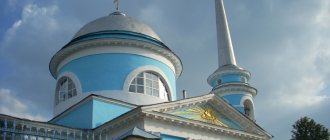
Architectural monuments
Rylsk. Assumption Cathedral. | Architectural monuments : Intercession Cathedral (1822), Assumption Cathedral (1811), Church of the Tikhvin Icon of the Mother of God (1893, its uni), Ascension Church (1866), ensemble of the Nikolaevsky (Nikolsky) Monastery (the oldest monastery in the Kursk region, mentioned from 1505) - St. Nicholas Church (1753), Holy Cross Church (1733), Trinity Church (1747). |
Shchigry
The city of Shchigry is a regional city with a district center. It is located near the large city of Kursk - 61 kilometers. The city is located between the rivers Shchigra and Lesnaya Plata. There is a railway station on the Kursk - Kastornaya line. The population of the city is 21.5 thousand people. Population chronology: 3.3 thousand people in 1897, 4.4 thousand people in 1926 and 19.8 thousand people in 1979. of Troitskoye was located on the site of the city's present location . In 1779, the village was “transferred” to the city of Shchigry of the Kursk governorate, and subsequently to the province). Since its foundation, only 1.5 thousand people lived in the city of Shchigry. By the end of the 19th century, 3 educational institutions and 2 churches + a hospital were built. The population was mainly engaged in agriculture: pig breeding and farming. As a result, there were also 2 fairs, and they sold the fruits of creativity - livestock, 4 small factories. During the Second World War, the city was occupied on November 21, 1941, but the brave Russian army liberated it exactly on February 5, 1943. Now in Shchegra they produce reinforced concrete, bricks, oil and many other plants operate. Near Shchigry there was the village of Semyonovka, the former estate of N. S. Turgenev, the brother of the writer I. S. Turgenev. In Shch.
Economy and industry of the Kursk region
The economic component of the Kursk region is represented by agriculture and iron ore mining. Grain and fodder crops are grown on agricultural lands, and animals are raised. Huge areas of land are given over to pastures for meat and dairy cattle.
Industrial enterprises, which can be viewed using Yandex maps of the Kursk region, produce:
- electrical products;
- elevator equipment;
- bearings;
- drilling rigs;
- Rubber products.
The region also has several light industry enterprises that produce linen fabrics and knitwear, but the share of their products in the overall economy of the region is not large.
The construction industry is represented by several trusts that are engaged in the construction of residential buildings and roads in the region, and produce building materials and structures.
Fatezh
The city of Fatezh is located on the Usozha River, which is a tributary of the Svapa River. The city was founded in the 17th century as a village. At the end of the 17th century the city was transformed into a district town. And after that, it’s not a pity to go to the province. The population is 5.8 thousand people. 5.0 thousand in 1897; 2.7 thousand in 1926; 3.4 thousand in 1939; 3.3 thousand in 1959; 4.7 thousand in 1979). A city in the Kursk region, located 45 kilometers from the central city of Kursk. Not far from the city stands the Zolotukhino (Oryol - Kursk) railway station, as well as the Moscow - Simferopol highway.
At the end of the 18th and beginning of the 19th centuries, grain, hemp, lard, honey, and wax were traded in Fatezh. It is noteworthy that by the beginning of the 20th century the city had 2 primary schools, a vocational school for women, 2 stone churches, 1 hospital, 29 factories and factories. Traditionally, factories in Russia are vodka factories (2 units), a mineral water factory (not real ones), an oil mill and a hemp factory, and other not very large factories. During the Second World War, the city of Fatezh, like other Russian cities, was occupied by the Nazis in 1941, and it was liberated only 2 years later - in 1943. In this not so remarkable town such remarkable people as G. V. Sviridov (composer) and A. A. Baikov were born. (metallurgist academician).
Map of the Kursk region with cities and villages
The region is divided into 5 urban districts. There are few large cities in the region. The largest is Kursk, with a population of just over 430 thousand people. The second largest is Zheleznogorsk. The map of the Kursk region allows you to view all the cities and villages in detail. The largest settlements:
- Rylsk;
- Lgov;
- Kurchatov;
- Oboyan;
- Shigry.
If we look at the sights of the region, there are them in almost every district. By zooming in on the map of the Kursk region with villages, you can see interesting monuments, nature reserves and ancient estates, as well as the places where they are located:
- With. Vinnikovo – Church of the Holy Trinity, built in the mid-19th century. made of wood;
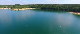
- With. Tolmachevo – natural monument “Swan Lake”;
- n. Zapovedny - an ancient stone sculpture in the form of a warrior, which is also called the Stone Woman;
- 1st Mokva - palace-estate of the Nelidov merchants.
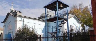
A place of pilgrimage for believers in the Kursk region is the Korennaya Hermitage in the village of Sloboda. This land has never been plowed by peasants, and on its territory there is a monastery built at the end of the 16th century. Near the monastery there are several holy springs, from which thousands of Orthodox Christians strive to touch the water.
Tim
Tim as a city in 1779 by the method of its formation from a village into a district town of the Kursk governorship. It is located 65 kilometers east of the central city of Kursk. Located in the upper reaches of the Tim , which in turn is located in the Greater Don basin. Shchigry railway stop (Kursk-Kastornaya). The population of the city is about 4 thousand people. Chronology of the city's population: 7.4 thousand people in 1897; 2 thousand people in 1926 and 3.3 thousand in 1979).
An excerpt characterizing the Cities of the Kursk Region
“I don’t need anyone, I don’t love anyone but him.” How dare you say that he is ignoble? Don't you know that I love him? – Natasha shouted. “Sonya, go away, I don’t want to quarrel with you, go away, for God’s sake go away: you see how I’m suffering,” Natasha shouted angrily in a restrained, irritated and desperate voice. Sonya burst into tears and ran out of the room. Natasha went to the table and, without thinking for a minute, wrote that answer to Princess Marya, which she could not write the whole morning. In this letter, she briefly wrote to Princess Marya that all their misunderstandings were over, that, taking advantage of the generosity of Prince Andrei, who, when leaving, gave her freedom, she asks her to forget everything and forgive her if she is guilty before her, but that she cannot be his wife . It all seemed so easy, simple and clear to her at that moment. On Friday the Rostovs were supposed to go to the village, and on Wednesday the count went with the buyer to his village near Moscow. On the day of the count's departure, Sonya and Natasha were invited to a big dinner with the Karagins, and Marya Dmitrievna took them. At this dinner, Natasha again met with Anatole, and Sonya noticed that Natasha was saying something to him, wanting not to be heard, and throughout the dinner she was even more excited than before. When they returned home, Natasha was the first to begin with Sonya the explanation that her friend was waiting for. “You, Sonya, said all sorts of stupid things about him,” Natasha began in a meek voice, the voice that children use when they want to be praised. - We explained it to him today. - Well, what, what? Well, what did he say? Natasha, how glad I am that you are not angry with me. Tell me everything, the whole truth. What did he say? Natasha thought about it. - Oh Sonya, if only you knew him like I do! He said... He asked me about how I promised Bolkonsky. He was glad that it was up to me to refuse him. Sonya sighed sadly. “But you didn’t refuse Bolkonsky,” she said. - Or maybe I refused! Maybe it's all over with Bolkonsky. Why do you think so badly of me? - I don’t think anything, I just don’t understand it... - Wait, Sonya, you will understand everything. You will see what kind of person he is. Don't think bad things about me or him.
Suja
On the Sudzha (Dnieper basin) there is a small glorious town of Sudzha , located 105 km southwest of the city of Kursk. Located on the southern edge of the Central Russian Upland. The population of this provincial town is approximately 8,000 people (Chronology of inhabitants: about 13,000 people in 1897; 3,500 people in 1959; 7,300 people in 1979). Sudzha railway station on the Lgov - Gotnya line. Sudzhanskaya Sloboda has existed since the 17th century. In the old days, it was part of the protective southern fortifications for Moscow. In 1663 there was a big fire. A year after it, the settlement was rebuilt and given the title of city . This city was well defended: a moat, an oak wall, a rampart... Soon the city became the city of the hundredth Cossack regiment. This was in the 17th and 18th centuries. The city was immediately assigned to the Kyiv province. From 1708 S. was assigned to the Kyiv province, from 1719 it was part of the Belgorod province of this province, from 1779 it was a district town of the Kursk governorate (then the province). By the beginning of the 18th century, the military significance of the city was completely lost and defense was no longer required. In order to have something to do, city residents began to trade. The settlements of Zaoleshinskaya, Goncharnaya, Zamosc, and Podol were annexed to the city. By the beginning of the 20th century, a school, 2 parish schools, a library, 8 churches, a women's gymnasium, and a zemstvo hospital were opened in the city of Sudzha. From the industrial zone there were: a saltpeter factory, an oil mill, a tannery, a vodka factory (where would we be without it?) and some others. There were four fairs. Residents of the city were engaged in beekeeping, cattle breeding, and agriculture. They sold cattle (large), as well as horses, grain, wood chips, manufactured goods and food supplies. Iron was transported from the city outside the region. At the end of the 19th century, Goncharnaya Sloboda, which had a population of 2,500 inhabitants, became famous for its pottery production throughout the Central Russian Black Earth Region. Sudzhan blacksmiths consumed 10,000 pounds of iron per year and produced axes, knives, drills, scissors, openers, and mill accessories. Residents developed such crafts as: weaving, blacksmithing, sheepskin, tailoring, pottery, and shoemaking.
At the moment, the city's factories include: a tractor factory, a butter factory, a meat processing plant, a canning factory, a cereal factory, a construction factory, and a carpet factory. The city has a local history museum. A city with sufficient cultural history. There are monuments here: Trinity Church, shopping arcades, Nativity Church, M.S. Shchepkin. (actor), and also lived such famous people: Solomatkin L.I., Gurevich M.I. (aircraft designer), M.V. Nesterov, and M.S. Shchepkin himself.
In the 20s of the 19th century, a theater was built in Sudzha, which burned down during the Second World War. The city was no exception - the Nazis occupied it on October 18, 1941, and it was liberated by Soviet troops on March 3, 1943. The city has seriously deteriorated.
Near S., in the settlements of Zamosc and Zaoleshenka, there are 5-domed churches of the 19th century. in pseudo-Russian style, with hipped 4-tier bell towers. 15 kilometers south of Sudzha, in the village of Guiva (Guevo), is the former estate of the Dolgorukov princes: on a steep slope there is a park; in the clearing there is a palace (architect V. A. Shchuko, unfinished; service buildings have been preserved). Along the Psel road, on the forest edge, there are burial mounds of the pre-Christian era. On the chalk mountains near the Psel River are the so-called Small Settlement and Bolshoye Settlement (archaeological excavations have revealed fragments of pottery and other items of the Romny-Borshchev type and the Grand Duke's era), towering above the plain is the Nikolaevsky Belogorsky Monastery, which was founded in 1671 and closed in 1788 year, in 1863 it was reopened and rebuilt in the Russian-Byzantine style).
Oboyan
Oboyan. The city is located 60 kilometers south of Kursk, on the southern part of the Central Russian Upland and on the banks of the Psel River, which is a tributary of the Dnieper, at the confluence of the Oboyanka . Moscow-Simferopol highway passes through Oboyan . The city's population is approximately 15,000 people (Chronology: 11,900 thousand in 1897; 5,700 thousand in 1926; 12 thousand in 1959; 14,500 thousand in 1979). The city was created in 1639 as a fortress on the southern borders of the Russian state, at the mouth of the Boyani River. In 1708, Oboyan was assigned to the Kyiv province. And since 1720 it was part of the Belgorod province, and since 1727 it was already a province. Oboyan received the status of a county town in 1779. Due to the advance of the state's borders to the south, the Oboyan fortress lost its significance and was completely destroyed. In 1861 there were 5,500 people in Oboyan. At the end of the 19th century, Oboyan had 1053 wooden, 4 stone churches, 409 residential stone houses, and the Znamensky Bogoroditsky Monastery, founded in the 17th century. There were also: schools (theological, parish, district), 6 stone shops, a women's gymnasium, a hospital, an almshouse and more. The main occupations of the residents were trade, transportation, gardening, etc. There were 12 factories. During the Second World War, the city was occupied by the Germans on November 16, 1941. Released on February 18, 1943. The city suffered greatly. By the end of 1945, the power plant and part of the buildings were restored. Construction began in 1947. In 1950, the highway was reconstructed; the Moscow-Simferopol highway ran through O.; There are bridges across Psel and Oboyan. 2 brick factories were rebuilt. In modern Oboyan there are factories such as: particle boards, food industry enterprises - butter and cheese making, vegetable canning and other factories); car repair shop, furniture factory. Since 1784, the island has been built up according to a regular plan; Among the surviving architectural monuments are 2-story merchant houses of the 19th century in the central part of the city, the building of a former women's gymnasium in the neo-Baroque style, and the monumental 5-domed Alexander Nevsky Cathedral in the neo-Byzantine style. The founder of domestic electrical engineering V.V. Petrov was born in Oboyan, and the Belarusian poet Y. Kolas (K.M. Mitskevich) and singer G.M. Nelepp lived. 30 kilometers from Oboyan, on the Pena River, is the village of Krasnoye - the birthplace of actor M. S. Shchepkin. The memorial complex was built in honor of the soldiers who died in the Battle of Kursk in 1943. The city was occupied during the Second World War. And then released
Near O. there is a fruit nursery state farm.
Lgov
Lgov is a city of regional subordination in the Kursk region. This city is located 85 kilometers west of Kursk (the central city). Located in the southern part of the Central Russian Upland along the banks of the same Seim . Junction of railway lines (to Kursk, Kharkov, Bryansk, Vorozhba). The population of the city is 25,500 thousand people. In 1669, on the site where the city is now located, the Olgovsko-Lgovsky monastery appeared, which was abolished in 1764. The monastery settlement, whose population was 502 people, was transformed into the district town of Lgov in 1779. At the beginning of the 18th century, Prince V.I. Baryatinsky built a tile and brick factory not far from Lgov. In the second half of the 19th century. The Kursk-Kyiv railways passed through the Lgov district in 1868, and the Bryansk-Kharkov railways in 1897. Enterprises for processing agricultural products appeared in Lgov: distilleries and sugar factories (appeared in 1889), soap factories, pottery factories, lard factories, as well as hemp oil processing. At the end of the 19th century, there was a church, a hotel, a city school in Lgov, and there were only 24 stone houses. Until 1926, Lgov remained a center with 15 volosts, then it became a district center, and since 1928 the city became the district center of the Central Black Earth Region. Since the mid-19th century, food and flavoring industry enterprises have been established in the city. During the Second World War, due to the occupation by the Germans from October 27, 1941 to March 3, 1943, Lgov suffered greatly, almost everything was destroyed. In 1954, nearby villages, including station ones, were added to the city limits. In modern Leningrad: factories—sugar, experimental in the production of automation equipment for the sugar industry, reinforcement, brick, special-purpose automobile equipment, feed mills, driver's tools, winemaking, reinforced concrete products; dairy canning plant, meat and poultry plant, etc. Center of the agricultural region. Museum of Local Lore. Lgov stretches from north to south for 12 kilometers, from west to east for 3-5 kilometers. On the territory of the city there are buildings of the former estate of the Baryatinsky princes, description: a gate to the park and an adjacent building with a semicircular apse; the so-called Shamil Tower - a gazebo in a pseudo-Gothic style; mansion with projecting portico and 2 open staircases. The writer A.P. Gaidar (about whom is written above), the poet N.N. Aseev (House Museum) were born in Lgov; writers Yu.P. German and V.V. Ovechkin lived and worked here at different times.
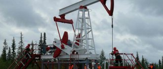
KURCHATOV is a city in the Kursk region, regional subordination, regional center, 47 km west of Kursk. Located on the western edge of the Central Russian Upland, on the river. Seym, near the Lukashka railway station on the Voronezh - Kyiv line, between Kursk - Lgov. Population 45 thousand people (1992). Arose in connection with the construction of the Kursk Nuclear Power Plant. It became a city in 1983. Modern Kurchatov is a center of nuclear energy. The city got its name in honor of the physicist I.V. Kurchatov.
ZHELEZNOGORSK is a city of regional subordination in the Kursk region, as well as a regional center, 130 km northwest of Kursk. Located on the western outskirts of the Central Russian Upland, near the terminal railway station Mikhailovsky Rudnik on a branch from Orel, on the Troena highway (on the Simferopol highway) - Kyiv. Population 90,400 people Appeared in 1957 as a village in connection with the development of the Mikhailovskoye iron ore deposit - the Kursk magnetic anomaly. It has held the city title since 1962. The city has a mining and processing plant, as well as the production of building materials.
see also
- Kursk region
- Cities of Russia
| [ + ] Cities by regions of Russia | |
| Cities of the North-West (NWFD) | St. Petersburg (and its cities) • Leningrad region (historical Staraya Ladoga) • Arkhangelsk region • Vologda region • Kaliningrad region • Karelia • Komi • Murmansk region • Nenets Autonomous Okrug • Pskov region |
| Cities of the Volga region (Volga Federal District) | Bashkortostan • Volgograd region • Kalmykia • Kirov region • Mari El • Mordovia • Nizhny Novgorod region • Orenburg region • Penza region • Perm region • Samara region • Saratov region • Tatarstan • Udmurtia • Ulyanovsk region • Chuvashia |
| Cities of Southern Russia (SFD) | Sevastopol (including Inkerman) • Republic of Crimea • Adygea • Astrakhan region • Krasnodar region • Rostov region |
| Cities of the North Caucasus (NCFD) | Dagestan • Ingushetia • Kabardino-Balkaria • Karachay-Cherkessia • North Ossetia - Alania • Stavropol Territory • Chechen Republic |
| Cities of the Urals (Ural Federal District) | Kurgan region • Sverdlovsk region • Tyumen region • Khanty-Mansi Autonomous Okrug - Yugra • Chelyabinsk region • Yamalo-Nenets Autonomous Okrug |
| Cities of Siberia (Siberian Federal District) | Altai Republic • Altai Territory • Irkutsk Region • Kemerovo Region • Krasnoyarsk Region • Novgorod Region • Novosibirsk Region • Omsk Region • Tomsk Region • Tyva • Khakassia |
| Cities of the Far East (FEFD) | Amur Region • Buryatia • Jewish Autonomous Region • Trans-Baikal Territory • Kamchatka Territory • Magadan Region • Primorsky Territory • Sakha (Yakutia) • Sakhalin Region • Khabarovsk Territory • Chukotka Autonomous Region |
| see also | Cities of the DPR, LPR, Transnistria, South Ossetia • Regions of Russia • Cities of Russia |
Dmitriev-Lgovsky
DMITRIEV-LGOVSKY is a city located 120 kilometers northwest of Kursk. Located on the southwestern edge of the Central Russian Upland on the Svapa River, which belongs to the Dnieper . The railway station is located on the Bryansk - Lgov line, and there is also a highway from Moscow to Kyiv. The population of the city is approximately 11.5 - 12 thousand people. Chronology: 3,400 people in 1897, 4,700 people in 1926. Not far from the present Dmitriev-Lgovskoye there used to be the village of Dmitrievskoye , which is now called Old Town . In 1779, the district town of Dmitriev, Kursk governorate, was formed. The city was renamed Dmitriev-on-Svape in 1784 to distinguish it from another city, Dmitrovsk , Oryol province. At the beginning of the 20th century, a women's gymnasium and a district school were opened in Dmitriev-Lgovsky. There were 473 houses in total, 6 of which were made of stone.
The city's factories: a grain mill, 2 oil mills, a flour mill, people traded willingly. Hemp, grain and timber were loaded onto the river pier. Chalk mining was carried out on the territory of the city. During the Second World War, the city was occupied by the Germans on October 8, 1941, and the Russians liberated it only 2 years later on March 3, 1943. The city received its modern name during the Second World War. Currently in the city there are such enterprises as: a canning plant, a butter factory, a meat plant, factories: hemp, Leskhozmash, and obozotstroitelny. A local history museum was built in the city a long time ago. The memorial with the Eternal Flame in memory of those killed in the Great Patriotic War is located in the center.
General information about the Kursk region
Distinctive features
. Since the first Slavs settled in the Kursk lands, this territory has become a bone of contention between stronger neighbors. First, the Pereyaslav princes fought for it with the Chernigov princes, then the Lithuanian principality with the Horde, until Moscow liberated these lands from the Catholic Lithuanians.
Now the Kursk region continues to occupy an important strategic position. Transport routes connecting Moscow with Crimea pass through Kursk. During the Great Patriotic War, the famous Battle of Kursk took place here - a battle after which the initiative in the war forever passed to the Soviet troops.
Economic activity in the region is active, trade, transport, and the service sector are developing. But they don’t forget about traditional areas - just like decades ago, they mine iron ore, grow grain, sugar beets, and vegetables. Fortunately, the local soils are rich in black soil. Also here is one of the largest nuclear power plants - the Kursk Nuclear Power Plant.
The Kursk land has given birth to many talented and famous people. These are Saint Seraphim of Sarov, writer Arkady Gaidar, author of “Timur and His Team,” and artist Alexander Deineka, and famous humorist Vladimir Vinokur. The future General Secretary of the CPSU Central Committee, Nikita Sergeevich Khrushchev, was born in the village of Kalinovka, Kursk region, and promised to show “Kuzka’s mother” to the capitalist world. Surprisingly, the parents of another famous secretary general, Leonid Ilyich Brezhnev, also came from the Kursk lands.
Kursk is the heart of the Nightingale region. Not a city, but a song!
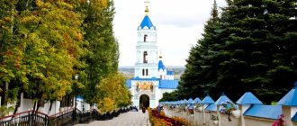
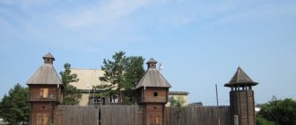
One of the symbols of the Kursk region is the Kursk nightingale - a unique species of songbird that can produce terli of particular beauty and complexity. Among the regional attractions, it is worth highlighting the Korennaya Hermitage Monastery, 30 km from Kursk, and noble estates, of which the most famous is the palace of the Baryatynsky princes in Maryino.
Monastery "Root Hermitage"
Geographical location
. The Kursk region is located in the west of the Russian Federation, in the central part of the East European Plain. In the north, the region borders with the Bryansk, Oryol and Lipetsk regions, in the south - with Belgorod and Voronezh, in the west - with Ukraine.
Located in the southwest of the Central Russian Upland, the Kursk region has a flat topography. The average height above sea level is 200 m. There are few reservoirs here, mostly artificial reservoirs. Of the more or less large rivers, five are worth noting: Seim, Psel, Svapa, Tuskar, Kshen.
Population.
Since the Kursk land had different masters in different historical eras, here we can find a mixture of very different dialects and even different groups of the peasant population: Sayans, Tsukans, Goryuns. The territory of the region was also actively populated by fugitive peasants, as well as migrants from the internal regions of the Russian kingdom, often sent to these lands on a voluntary-compulsory basis.
Now 96% of the region’s population are Russians, 1.3% are Ukrainians. In total, 1120 thousand people live in the Kursk region. The population is steadily declining every year: the mortality rate here is noticeably higher than the birth rate, and the flow of people wishing to move here from other regions is noticeably inferior to that of the neighboring Belgorod region. The male population is much smaller than the female population: 45.4% versus 54.6%. Population density is low: 37.3%.
Crime
. In the criminal ranking of regions, the Kursk region is in 48th place, and there is a trend towards a decrease in the number of crimes committed. There were no major or scandalous cases in this area. Mostly domestic crimes. Quite often, rape cases are featured in news reports, so parents of high school girls should teach their children to be careful. Corruption in government is also a common phenomenon.
Unemployment rate
in the Kursk region does not differ much from the national average. In 2012 it amounted to 5.11% (the Russian average is 5.45%). It must be said that there are not many large enterprises in the region, such as the Mikhailovsky Mining and Processing Plant in Zheleznogorsk or the Kursk Nuclear Power Plant, where new power units are now being built to replace the spent ones. But there are many medium-sized enterprises in the processing industry, primarily involved in food production. The average salary in the Kursk region is approximately 18,000 rubles, which is the average for the central regions, not counting the capital.
Kursk NPP in Kurchatov
Property value.
Housing prices in the Kursk region are pleasantly surprising. The average cost of one square meter in Kursk is one of the lowest in the Central Federal District - 38,353 rubles. This is explained by the low popularity of this region among migrants, the decline in population and the vacancy of housing stock. On the other hand, there are no such compelling reasons to neglect this city. Most likely, the reason is that the Kursk region is not yet a popular region, and its administration is not making enough efforts to create an attractive image of its fiefdom.
Climate
Kursk region - temperate continental. The average temperature here in July is +22°C, in January -7°C. The average annual precipitation is 550-600 mm per year. Peak precipitation occurs in the warm months, with more precipitation falling in the northwest of the region. There is quite a lot of snow, and it lies steadily from December to early March. The height of the snow cover reaches 20-40 cm.