Igarka is an amazing city in the Turukhansky district of the Krasnoyarsk Territory of Russia, located on the banks of the Igarsk channel of the Yenisei River, 163 kilometers north of the Arctic Circle. The distance from Krasnoyarsk to Igarka by air is 1360 kilometers. Along the Yenisei, the distance from the river mouth to Igarka is 685 kilometers, from Krasnoyarsk 1,740 kilometers. Geographic coordinates of Igarka are 67.33 degrees north latitude, 86.38 degrees east longitude.
Information about the village of Igarka
| City | Igarka |
| A country | Russia |
| Subject of the federation | Krasnoyarsk region |
| Municipal district | Turukhansky |
| Coordinates | 67°28′00″ n. w. 86°34′00″ E. d. |
| Chapter | Nikitin Evgeniy Vladimirovich |
| Based | 1929 |
| Square | 9.8 sq. km |
| Population | 5117 people (as of 2015) |
| Timezone | UTC+7 |
| Telephone code | +7 39172 |
| Postcode | 663200 |
| Vehicle code | 24,124 |
| OKATO code | 04 417 |
| OKTMO code | 04 654 117 001 |
The city of Igarka on the map of the Krasnoyarsk Territory
The city of Igarka on the map of Russia
What is Igarka?
Until recently, there was a version that Igarka got its name from the channel on which the city is located. The channel, in turn, was allegedly named after the local fisherman Yegor Shiryaev, whose name local residents changed from “Egorka” to “Igarka”.
However, none of the historical documents recorded a real person with a similar name. The fictional hero of the extremely popular novel of the 30s of the last century “Brother of the Ocean” by Alexei Kozhevnikov, written about the first builders of the city, for many years was “considered” almost the first inhabitant of these places, not only by ordinary people. This version was associated with a historical fact by some scientists and local historians.
We prefer the option that the name Igarka was first given to the Igarka River, the left tributary of the Yenisei River. Just like Moscow, which received its name from the river, the Igarsk winter hut was named after the river on which it stood. This version was first expressed by local historian Adolf Vasilyevich Vakhmistrov (Essay about him “The Yenisei conquered forever”). Judging by the materials of his research, the Igarka River was first put on the map by Pyotr Chichagov in 1725. And the toponym Igarkino winter hut belongs to the same type as the Khantay, Khetsky, Turukhansky winter huts and comes from the name of the river on which it stands.
The name
Igarsky Island was given after the construction of the city began; on A.I. Vilkitsky’s map in 1897 it was listed as Samoyedsky, and the channel was called Osetrovaya.
The presence of a deep-sea channel, protected from the winds and convenient for the placement of heavy sea vessels, served as the main argument for the justification of a unique sea city here - a port standing on the river.
The city of Igarka is located on the right bank of the Yenisei River opposite the former Staraya Igarka machine tool. The airport and a small residential village, formerly part of the Igarsky state farm, are located on the island.
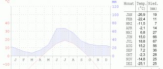
The city is built on permafrost. The climate is sharply continental. The average annual air temperature in the Igarka region is 10.5 degrees C.
During June-July there is a polar day, when the Sun practically does not set beyond the horizon, and in December-January there is twilight and polar night. The territory of the city of Igarka is a typical northern taiga of the spruce-deciduous type with some elements of forest-tundra.
The fauna of the area is quite diverse. Of commercial interest are sable, arctic fox, squirrel, muskrat, and ermine; There are fox, wood grouse, black grouse, hazel grouse and waterfowl.
The territory is replete with lakes and rivers, many of them are used as fishing ponds, numbering 43 species of fish ; sterlet, sturgeon, nelma, whitefish, omul, grayling, smelt, peled, pike, burbot, perch and others are of commercial importance.
Many mineral deposits have been explored in the region: brown coal, copper, titanium, clay for the production of ceramic bricks and stones, sand and gravel materials, mineral groundwater of the medicinal table type. But today the Lodochnoye, Tagulskoye and Vankorskoye gas condensate oil fields discovered by Igarka geologists, located to the west of Igarka, are of greatest industrial importance.
With the start of industrial development of the Vankor field , the city of Igarka has a chance for a new round of socio-economic development of the region. And here's how it all began...
Airport
Igarka Airport (UOII) is currently being equipped and certified as an auxiliary airport, including for use as a reserve, since many international transpolar routes pass over it. In the future, it is also possible to restore normal operation of the airline itself. Currently, passenger traffic at Igarka Airport is 98 thousand people per year, cargo traffic is about 1.5 thousand tons per year. The main passenger traffic consists of 4.5 thousand people on a monthly rotation shift, mostly transported on flights from Krasnoyarsk.
Accidents
Main article: Plane crash in Igarka on August 3, 2010
On August 3, 2010, while landing 700 meters from the runway near the airport in the city of Igarka, an An-24 aircraft crashed while flying from Krasnoyarsk to Igarka. There were 15 people on board the plane - 4 crew members and 11 passengers. 12 people died in the disaster.
Igar inhabitants
In historical descriptions, the term “inhabitant” refers to a resident of a locality or settlement. For the first time, the State Councilor, Chairman of the Yenisei Treasury Chamber, Ivan Semenovich Pestov, mentions the Igarans.
In the book he published in St. Petersburg “Notes on the Yenisei province of Eastern Siberia in 1831.” in the chapter “The Path to the Arctic Ocean from Turukhansk”, it is said that in the winter hut Igarskoye (between Sushkovo and Nosovskoye) there is 1 house, peasants live and have cows.
The exact number of inhabitants is no longer in the winter hut, but in the pen, is indicated in the following document known to us. In the “List of Settlements of the Russian Empire”, also published in St. Petersburg in 1864 according to information from 1859, in section II “Turukhansky Territory of the Yenisei District” on section 2 (Dudinsky) under number 568, the Igarsky state-owned machine is indicated with a position near the Yenisei River on a distance of 1374 versts from the district city (Yeniseisk), 259 versts from the quarterly site (apparently Turukhansk), with the number of houses 1, the number of residents 11 males and 9 females.
Another high-ranking tsarist official, the Yenisei district chief, ethnographer, member-employee of the Siberian department of the Russian Geographical Society, Alexander Mordvinov, who undertook a business trip to the north of the province, described in the Sovremennik magazine in 1860 what he saw at the Igarsk postal station: “Ikarskaya station turned out to be even worse than Shushkovskaya (we are talking about the Sushkovo machine). It was the only hut, cramped, literally packed with people, and so damp that water flowed down the walls. Once upon a time in Ikarki, they say, life was excellent, there were large houses and plenty of everything. The Shadrin family of peasants that existed here all moved away, the houses fell apart, and only a meager inheritance was left to the impoverished heirs.”
Two families - the Shadrins and the Gnezdilovs - are also named by other historians as permanent residents of Igarka in 1864. Doctor, ethnographer and folklorist Mikhail Fomich Krivoshapkin published the book “The Yenisei District and Its Life” in St. Petersburg, where he writes that 20 people live in Igarka (more than in Dudinka, but less than in Karasino).
The appearance of Russians so far in the North is probably connected with the decision of the Russian State Council to settle the banks of the Yenisei to Turukhansk and beyond. It is a known fact that workers of the Bogotol and Krasnorechensk factories were asked to move to the Turukhansk region : they were sent to the North on two large ships with barges. There were 3-4 families left on each of the machines. The year 1812 is considered the beginning of the mass settlement of the Yenisei North and the founding of most of the machines, although they grew numerically very, very slowly.
Thus, in the “List of Settlements of the Yenisei Province”, published in Krasnoyarsk by the Yenisei Regional Migration Administration in 1911, (according to 1903 data) there is an Igarka camp in the Dudinsky section of the Turukhansk Territory, consisting of two courtyards, with nine male souls and seven female ones.
P.F.Ocheretko
In the circumpolar census of 1926-27, there were 22 people in the Igarka camp of the Dudinsk volost . The names of the Antsiferovs, Melkovs, Popovs, Davydovs, Sultanovs, Andreevs, and Paltsins were recorded. It was these families who initially helped the captain of the Tobol steamship of the Yenisei Shipping Company, Pyotr Filippovich Ocheretko, in 1927 to choose a place for the construction of a convenient seaport. In the summer of 1928, the first batch of longshoremen arrived in the Osetrovaya Channel, who lived on the lighter and settled on the shore a year before the arrival of the builders’ landing. During that first navigation, a successful experimental shipment of 9.4 thousand cubic meters of round timber was made to three sea vessels that arrived along the Northern Sea Route - “Gungner”, “Grontheim” and “Saint-Joseph”. Naturally, the old residents of those places joyfully, as their descendants said, accepted the beginning of a new life in a harsh, cold place.
Railway
Currently it is called a dead road and is inactive.
After the war, construction of a railway began in the direction of Igarka - the famous Stalinist construction site No. 503 (Salekhard-Igarka). The line was laid in three sections at once - from the starting point at the Pur station (now within the city limits of Novy Urengoy), from Igarka and from the village of Ermakovo on the banks of the Yenisei. In the period 1947-1953, more than 200 kilometers of track were laid. A queue of permanent communication lines was installed along the entire length of the future highway. The same line ran from Igarka further north, in the direction of Norilsk.
After Stalin's death, work on the project was first mothballed and then stopped altogether. In the early 1960s, the rail track from Igarka was dismantled.
The strategy “Development of railway transport until 2030” provides for the construction of a railway (SSH) with an extension to Dudinka.
Literature
- Kinga Nendza-Schikoniovska
[magazines.russ.ru/nz/2014/97/16kn.html A city cut off from the land, people tied to the city: polar Igarka] // Emergency reserve. — 2014. — No. 5(97). - [igarka-permafrostmuseum.ru/index.php/2010-06-06-16-24-20/item/-.html Igarka is ancient, Igarka is mysterious]. - Krasnoyarsk: MVM, "Platina", 2004. - 150 p.
- [arhivsever.moy.su/publ/pro_igarku/gorodskie_dela/ocherednoj_vgljad_v_budushhee_ili_quotu_igarki_est_shansquot/4-1-0-1 Another look into the future or “Igarka has a chance”?]. Newspaper “Our Land”, No. 59 (August 21, 2009). (inaccessible link) Retrieved August 26, 2016.
Links
Wiktionary has an article "Igarka"
Baltic Sea Vyborg • Vysotsk • Kaliningrad • St. Petersburg (Bolshoi Port and Passenger Port) • Primorsk • Ust-Luga Barents Sea Varandey • Murmansk • Naryan-Mar White Sea Arkhangelsk • Belomorsk • Vitino • Kandalaksha • Kem • Mezen • Onega • Severodvinsk Bering Sea Anadyr • Beringovsky • Provideniya • Egvekinot East Siberian Sea Pevek • Chersky Kara Sea Amderma • Dixon • Dudinka • Igarka • Sabetta Caspian Sea¹ Astrakhan • Makhachkala • Olya Laptev Sea Tiksi • Khatanga Sea of Okhotsk Korsakov • Magadan • Moskalvo • Cape Lazarev • Nikolaevsk-on-Amur • Okhotsk • Poronaysk • Prigorodnoye Pacific coast of Kamchatka and Kuril Islands Petropavlovsk-Kamchatsky Black Sea Anapa • Gelendzhik • Evpatoria4 • Kerch (commercial • fishing • Kamysh-Burun • Port “Crimea”)4 • Novorossiysk • Sevastopol4 • Sochi (commercial and passenger • cargo) • Taman² • Tuapse • Feodosiya4 • Chernomorsk4 • Yalta4 Chukchi Sea Cape Schmidt ³ Sea of Japan Aleksandrovsk-Sakhalinsky • Boshnyakovo • Vanino • Vladivostok • Vostochny • De-Kastri • Danube • Zarubino • Nakhodka • Nevelsk • Olga • Plastun • Posyet • Preobrazhenie • Rudnaya Pristan • Svetlaya • Slavyanka • Sovetskaya Gavan • Uglegorsk • Kholmsk • Shakhtersk ¹ Caspian Sea is actually a lake.
² The port of Taman
is under construction, but is already open for traffic.
³ The port of Cape Shmidt
has been part of the port of Pevek since 2006. 4 Located on the territory that is the subject of a territorial dispute between Russia and Ukraine.
Notes
- ↑ 123
www.gks.ru/free_doc/doc_2016/bul_dr/mun_obr2016.rar Population of the Russian Federation by municipalities as of January 1, 2016 - [new.gramota.ru/spravka/buro/search-answer?s=200834 Question No. 200834]. Gramota.ru. Retrieved August 26, 2016.
- ↑ 12
[arhivsever.moy.su/publ/pro_igarku/gorodskie_dela/ocherednoj_vgljad_v_budushhee_ili_quotu_igarki_est_shansquot/4-1-0-1 Another look into the future or “Igarka has a chance”?]. Newspaper “Our Land”, No. 59 (August 21, 2009). (inaccessible link) Retrieved August 26, 2016. - Galina Naykhina.
[kontinentusa.com/igarka-vysokaya-mechta-i-tragicheskaya-realnost/ Igarka: high dream and tragic reality]. Continent (December 5, 2012). Retrieved August 26, 2016. - ↑ 12345678910
www.MojGorod.ru/krsnjar_kraj/igarka/index.html People's encyclopedia “My City”. Igarka - [demoscope.ru/weekly/ssp/rus59_reg2.php All-Union Population Census of 1959. The size of the urban population of the RSFSR, its territorial units, urban settlements and urban areas by gender] (Russian). Demoscope Weekly. Retrieved September 25, 2013. [www.webcitation.org/6GDOghWC9 Archived from the original on April 28, 2013].
- ↑ 123
[krasstat.gks.ru/wps/wcm/connect/rosstat_ts/krasstat/resources/5ed87c8043b9ed899ea29ed06954faf7/1.+Number+and+location+of the+population+of the Krasnoyarsk+krai.xls Number and distribution of the population of the Krasnoyarsk Territory (according to the 2002 All-Russian Population Census of the year). Sheet “5. Population of districts, urban settlements, regional centers and rural settlements with a population of 3 thousand or more people”]. Retrieved April 28, 2016. [www.webcitation.org/6h6j3VuJ7 Archived from the original on April 28, 2016]. - [www.perepis2002.ru/ct/doc/1_TOM_01_04.xls All-Russian Population Census 2002. Volume. 1, table 4. Population of Russia, federal districts, constituent entities of the Russian Federation, districts, urban settlements, rural settlements - regional centers and rural settlements with a population of 3 thousand or more]. [www.webcitation.org/65AdCU0q3 Archived from the original on February 3, 2012].
- [www.gks.ru/bgd/regl/B09_109/IssWWW.exe/Stg/d01/tabl-21-09.xls Number of permanent population of the Russian Federation by cities, urban-type settlements and districts as of January 1, 2009]. Retrieved January 2, 2014. [www.webcitation.org/6MJmu0z1u Archived from the original on January 2, 2014].
- [krasstat.gks.ru/wps/wcm/connect/rosstat_ts/krasstat/resources/20d7bd804eba60379580f5263284271d/1.10.xlsx All-Russian Population Census 2010. Results for the Krasnoyarsk Territory. 1.10 Population of city districts, municipal districts, mountains. and sat down. settlements and populated areas]. Retrieved October 25, 2015. [www.webcitation.org/6cXLrGwbE Archived from the original on October 25, 2015].
- www.gks.ru/scripts/db_inet2/passport/table.aspx?opt=465411720082009201020112012 Population of Igarka in 2008-2011
- [www.gks.ru/free_doc/doc_2012/bul_dr/mun_obr2012.rar Population of the Russian Federation by municipalities. Table 35. Estimated resident population as of January 1, 2012]. Retrieved May 31, 2014. [www.webcitation.org/6PyOWbdMc Archived from the original on May 31, 2014].
- [www.gks.ru/free_doc/doc_2013/bul_dr/mun_obr2013.rar Population of the Russian Federation by municipalities as of January 1, 2013. - M.: Federal State Statistics Service Rosstat, 2013. - 528 p. (Table 33. Population of urban districts, municipal districts, urban and rural settlements, urban settlements, rural settlements)]. Retrieved November 16, 2013. [www.webcitation.org/6LAdCWSxH Archived from the original on November 16, 2013].
- [www.gks.ru/free_doc/doc_2014/bul_dr/mun_obr2014.rar Table 33. Population of the Russian Federation by municipalities as of January 1, 2014]. Retrieved August 2, 2014. [www.webcitation.org/6RWqP50QK Archived from the original on August 2, 2014].
- [www.gks.ru/free_doc/doc_2015/bul_dr/mun_obr2015.rar Population of the Russian Federation by municipalities as of January 1, 2015]. Retrieved August 6, 2015. [www.webcitation.org/6aaNzOlFO Archived from the original on August 6, 2015].
- taking into account the cities of Crimea
- [www.gks.ru/free_doc/doc_2016/bul_dr/mun_obr2016.rar Population of the Russian Federation by municipalities as of January 1, 2016. Table “31. Population of cities and towns by federal districts and constituent entities of the Russian Federation as of January 1, 2016.” RAR archive (1.0 MB)]

