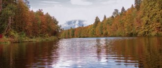
The most famous places in the Sakhalin region: TOP-3
The natural attractions of Sakhalin are surprisingly diverse; each object is worthy of the attention of tourists. However, we can especially highlight three natural monuments that better than others demonstrate the uniqueness of the region and its differences from other regions of Russia.
Tyuleniy Island
- Coordinates on the map: 48.503253, 144.629144.
The island's name speaks for itself: a rocky stretch of land in the middle of the Sea of Okhotsk is home to hundreds of seals, fur seals and sea lions. In spring, the coast of the attraction is literally dotted with gray, black and red carcasses of these amazing sea animals.
Large animals coexist quite peacefully with birds that nest on higher rocks. The island is under state protection and lies outside of water and air routes so that passing ships and flying planes do not frighten away rare mammals.
Daginsky thermal springs
- GPS coordinates: 52.045720, 143.081736.
A complex of thermal springs with an area of 9 hectares is located in the Nogliki region near Dagi Bay. About 60 springs with a temperature of 50 ° C come out of the ground at a speed of up to 3 liters per second.
Water is rich in alkali and silicic acid and therefore helps with a number of diseases from diseases of the skin and nervous system to disorders of the musculoskeletal system.
Some springs are well equipped; special baths under domes are equipped for bathing. Currently, a health resort operates next to the springs.
Volcano Tyatya
- Coordinates: 44.353707, 146.251319.
A formidable active volcano with a height of 1800 meters has been rising on the coast of the Sea of Japan for 12 centuries and has long become the hallmark of the Kuril Islands.
According to scientists, serious eruptions occur only once every thousand years. The last strong eruption occurred in 1973, when the volcano drove away local residents.
Nevertheless, the terrible giant periodically reminds of his strength, threateningly releasing clouds of black smoke into the sky and scaring away planes.
Reserves and protective zones of Sakhalin
Sakhalin nature reserves are not numerous, but they occupy a significant part of the region. Specialists work all year round to preserve the unique nature of the islands.
Kuril Nature Reserve
- Coordinates: 44.083333, 145.983333.
The reserve, founded in 1984, includes several Kuril Islands, led by Kunashir Island, as well as the adjacent marine area. The state, together with scientists, protect the unique flora and fauna both on land and under water.
The landscape of the protected area is beautiful, at the foot of formidable volcanoes, colorful valleys lie, rivers and lakes splash. History buffs will also find something to see on the islands; among the rocks and trees there are traces of ancient man and more modern structures from the time of Japanese rule.
Poronaisky Reserve
- Coordinates: 48.925278, 144.508889.
In 1988, the eastern part of Sakhalin Island was recognized as a protected area. There are more than a hundred rivers and reservoirs in the territory. Almost the entire area is covered with forests; a wide variety of trees grow here: stone birches, Sayan spruces, cedars, Erman birches, Sakhalin firs.
The wildlife of the reserve is no less diverse, with 600 species, 40 of which are endemic. The most numerous inhabitants of the reserve are birds; out of 170 species of birds, several are included in the Red Book: osprey, Sakhalin musk deer, peregrine falcon, mandarin duck, grouse, white-tailed eagle, Aleutian tern, Steller's sea eagle.
Noisy flocks nest on Cape Terpeniya, where seals and fur seals also make rookeries. Among other mammals, otters, brown bears, Asian chipmunks, reindeer and sables are especially notable.
Moneron Natural Park
- Coordinates: 46.253901, 141.233820.
A unique marine natural park was founded on the island of the same name in 2007. The entire island is one huge extinct volcano, covered with forests, grasses, rivers and ponds.
There are no human settlements on Moneron, so no one and nothing prevents animals from existing and reproducing in their natural habitat. There are many birds in the park; feathered inhabitants nest on rocks and feed on fish, which are found in large quantities in coastal waters.
Mighty mountains, volcanoes and rocks on Sakhalin
Sakhalin and neighboring islands are covered with numerous mountains and rocks. Among the peaks there are extinct and active volcanoes. The Sakhalin region also boasts the presence of a rare natural phenomenon - mud volcanoes.
Mendeleev Volcano
- Coordinates: 43.978407, 145.733319.
In 1946, the active volcano on Kunashir Island received the name of the great Russian scientist D.I. Mendeleev. Its slopes almost to the very top are covered with dense forests. The giant looks especially impressive in winter, when clouds of smoke and steam break through the sparkling snow cover on its top. At the foot of the mountain in the village of Goryachiy Plyazh a health resort with mineral thermal springs and mud baths was built.
Mud volcano Yuzhno-Sakhalinsky
- Coordinates: 47.081185, 142.578061.
The largest of the three Sakhalin mud volcanoes is located only 25 kilometers from Yuzhno-Sakhalinsk. Its height is 300 m, and its diameter is about 200 m. In some places, gray liquid gurgles in a huge circle of mud, in which small volcanoes seem to be erupting. The entire space around the craters is covered with frozen eruption products. The mud volcano is recognized as a geological natural monument.
Mud volcano Pugacheva
- Coordinates: 48.228422, 142.564689.
Between the Pridorozhnaya and Vulkanka rivers, in the middle of the taiga, an unusual desert area opens up. Trees and grass suddenly give way to swamp-like slush or hardened mud. Gentle slopes lead to the top of the small but very wide Pugachevsky volcano, or Mangutan volcano. The height of the giant cake is only 60 meters, but its diameter reaches 4 km.
A hundred years ago, until 1934, incredibly powerful mud fountains erupted here, some reaching 50 meters in height. Today the volcano only periodically seethes, then large bubbles appear on the gray-black clay surface, which soon burst, releasing gases and products of the eruption. Sometimes oil spills onto the ground. Local residents consider the mud of the volcano to be healing.
Chekhov Peak
- Coordinates: 47.005265, 142.840398.
The famous Russian writer A.P. Chekhov is the most famous person to visit Sakhalin. Anton Pavlovich made a difficult journey to the island to see with his own eyes the conditions in which the exiles and convicts lived. Everything that the writer saw and experienced during the trip was reflected in his book “Sakhalin Island”.
The highest mountain in the region, located near Yuzhno-Sakhalinsk, received the name of the prose writer. Chekhov Peak is popular among climbers and hikers. For purposeful tourists, there is a gift in store at the top - the ruins of an ancient pagan temple built by the Japanese.
Remnant Frog
- Coordinates: 46.868867, 142.888740.
A funny 8-meter rock stands out on one of the slopes of Mount Gorbunov. With its outline, the remnant resembles a giant frog sitting on a stone. The pagans considered the stone block sacred and created many legends about it.
The indigenous people believed that these places were inhabited by formidable spirits, whose peace should never be disturbed. Everyone was required to respectfully address the spirits before passing through the forest. In 1995, the state recognized the value of the stone “sculpture” and took it under its protection.
Three Brothers Rocks
- Coordinates: 50.895884, 142.117477.
Three amazing rocks rise above the water 200 meters from land. A strip of sea separates the stone giants from Cape Jonquiere. According to local legend, many centuries ago three siblings wanted to get rich and tried to steal the treasures of a terrible sorcerer.
The black magician bewitched the brothers, turning them into stones, placed the unfortunate ones in the middle of the sea, far from the shore dear to their hearts, and separated them from their families forever. Beautiful rocks have repeatedly inspired famous people; a description of the Three Brothers can be found in the works of the writer A.P. Chekhov and Jean-François de La Perouse, the famous navigator from France.
Iturup rocks
- Coordinates: 45.269275, 148.276602.
Iturup Island, like many other Kuril Islands, was a difficult land mass millions of years ago. Iturup's volcanic past is reminiscent of the black sand and pumice formations on the coast. Sprinkled with volcanic sand, like ash, the white rocks are a truly phantasmagoric sight.
No less interesting sights of Sakhalin
- Volcano Pugacheva
The mud volcano is located on the southeastern side of the island, a 2.5 hour drive from Yuzhno-Sakhalinsk. The indigenous Ainu people originally called it Maguntan.
This is a geological anomaly that consists of circles, the diameter of the largest is 4 km. Its entire surface is flat and rises 60 meters high towards the center with a mud field in the middle. At first glance, it may seem that this is not a creation of nature at all because of the ideality of the circles.
Pugachev Volcano
There is practically no vegetation near the Pugachev mud volcano; it is a clay desert in the middle of the taiga. Only rare withered plants and tree sticks are found. The volcano seethes, periodically throwing solid and liquid products to the surface.
The most famous eruption occurred in 1934, when fountains of mud reached a height of up to 50 meters and broke trees in their path. The last noticeable activity of the volcano was recorded in 2005.
Beautiful capes of Sakhalin Island
The capes on Sakhalin and other surrounding islands are different from each other and deserve special attention. Each cape is a separate masterpiece, created by the best sculptor and artist in the world - nature.
Cape Stolbchaty
- Coordinates on the map: 44.025579, 145.676193.
The amazing cape on Kunashir Island is the most amazing sight of Sakhalin. On the seashore, unusual traces of the ancient eruption of the Mendeleev volcano have been preserved: pentagonal and hexagonal basalt pillars fit tightly together, forming high cliffs.
From above, it seems as if Stolbchaty is covered with tiles, which makes it look like the creation of human hands. Experts were so impressed by the cape that they declared it a natural monument of world significance.
Cape Crillon
- Coordinates: 45.896118, 142.080860.
The picturesque cape is located in the very south of Sakhalin Island. Tourists to Crillon are attracted not only by the interesting landscape and excellent views of the sea, but also by historical sights created by human hands.
The cape is dominated by an ancient lighthouse, built at the end of the 19th century, and several modern buildings, including a meteorological station and a border post. There is also a mass grave of border guards who died during the Great Patriotic War.
Cape Giant
- Coordinates: 46.625542, 143.519961.
The stone giant looks amazing in any weather. The main decoration of the giant cape is the bizarre rocks with unusual arches and mysterious caves. The incredible beauty of the landscape is complemented by evergreen forests on the tops of the cliffs, as well as pebble beaches and foamy waves at their feet.
The smell of pine needles mixes with the sea breeze, the sound of the sea merges with the cries of birds. Birds have long taken a liking to the picturesque rocks and build nests on them, while seals and seals set up rookeries on the shore.
Cape Aniva
- Coordinates: 46.031390, 143.415343.
The rocky cape in the southeast of Sakhalin is the meeting place of the Seas of Okhotsk and the Seas of Japan. The old name for the inaccessible rocks is Nakashiretoko. At the very edge of the cape, merging with the bare rocks, stands a Japanese atomic lighthouse, darkened by time and water, built in the late 30s of the last century. Aniva attracts not only ecotourists, but also lovers of “abandonment”.
An excursion into the geography and history of Sakhalin Island
If you want to travel and get a lot of positive emotions, you don’t have to go abroad. The Far East may surprise you with its sights.
Sakhalin is the largest island in our country and a place with a unique history. Its close proximity to Asia has influenced its culture, cuisine, economy and industry. Due to its favorable geographical location, it has always been the subject of disputes between Japan and Russia.
An excursion into the geography and history of Sakhalin Island
In 1855 the island was recognized as a "joint undivided tenancy". 20 years later, Japan received the Northern part of the Kuril Islands, and Sakhalin was completely transferred to the USSR. From that time on, it became a place of hard labor and exiles began to be brought here.
At the beginning of the 20th century, Japan occupied the island and it was under their rule for 40 years. Until it was returned to the Soviet Union in 1945 (following the Great Patriotic War).
Sakhalin is surrounded by two seas - the Sea of Okhotsk in the north and east, and the Sea of Japan in the south and west. Near the island are the Khabarovsk and Primorsky territories, Kamchatka and the Japanese island of Hokkaido on the south side.
Despite the remote location of the Far East, winter on the island is much more comfortable due to the moderate monsoon climate. Summer is warm and rainy, lasting from June to September. Autumn is warm, snow lasts until about mid-May, spring is quite cold and protracted.
The most favorable months for travelers are August and September; during this period you can even swim in the sea. It is not recommended to visit Sakhalin in February, November and May due to unfavorable weather. If you want to enjoy the beauty of nature, plan your vacation in advance.
Sakhalin often experiences typhoons that come from the Pacific Ocean. The largest ones are Georgia (1970), Phillies (1981) and several at once in 2002 (Chataan and Nerry).
The island can be reached by ferry from the city of Vanino, Khabarovsk Territory, as well as from Moscow and Novosibirsk by plane; flight cancellations are rare. The time is 8 hours ahead of Moscow, so jet lag is possible.
Memorable Sakhalin lakes
Among the numerous reservoirs of Sakhalin, several unique lakes stand out, the likes of which cannot be found anywhere in the world.
Lake Goryacheye
- Coordinates: 43.872573, 145.505948.
The name of the reservoir may seem strange at first glance. However, the name “Hot” is fully justified: the lake, 62 meters deep, splashes in the basin of the Golovin volcano and warms up to unnaturally high temperatures due to hot volcanic gases.
Goryacheye receives an additional portion of heat from the neighboring Boiling Lake through a canal dug by the Japanese. Despite the temperature and other features of the reservoir, many tourists are not afraid to swim in its azure waters.
Boiling Lake
- Coordinates: 43.864332, 145.499606.
The neighbor and sibling of the Goryachee reservoir has its name for a reason: the volcano maintains the water temperature in the lake at around 80 °C, which is close to the boiling point. The pond is so hot that even approaching it is not only difficult, but also dangerous.
The chemical composition of lead-gray water adds even more danger, which includes toxic concentrations of antimony, arsenic and heavy metal salts that are no less harmful to human health.
Due to the high temperature and toxic substances, the lake is dead, there are no fish in it, and no animals live on the shores. Many years ago, the previous owners of the island - the Japanese - mined sulfur in these parts. To this day, in the vicinity of the reservoir you can find large cast-iron boilers that were used to process the substance.
Lake Busse
- Coordinates: 46.535065, 143.329968.
A vast lagoon lake near Aniva Bay received the name of the first head of Sakhalin. Despite the recharge from freshwater sources, the reservoir is salty, so its inhabitants are predominantly marine: fish, shellfish, crabs, oysters, shrimp, scallops and others. Ahnfeltia algae grows at the bottom, from which agar-agar is produced, a plant analogue of gelatin necessary for making jelly.
The main gastronomic entertainment for tourists is to pick fresh oysters with their own hands and immediately taste them without additional preparation. The raw dish is considered an exquisite delicacy worthy of the best restaurants in Paris. Entire families often vacation on the lake; many stay for several days and spend the night in tents. At night Busse looks charming, the starry sky is reflected in the water surface, the splash of water gently lulls you to sleep.
Vavai Lakes
- Coordinates: 46.611261, 143.250367.
Two lakes – Big and Small – are connected to each other, like Siamese twins. The banks of the reservoirs are overgrown with reeds, sedges and ferns. A short distance away is the natural monument Ozersky Spruce Forest. Both lakes are freshwater; many river fish swim in their waters: taimen, crucian carp, rudd, carp. The surrounding area is home to foxes and many other wild animals.
Lake Tunaicha
- Coordinates: 46.759600, 143.221262.
One of the largest lakes in Sakhalin is located in the Korsakov region, not far from the Sea of Okhotsk. Three dozen fish are found in Tunaich, and various mammals, including rare endangered species, live in the vicinity of the reservoir.
The following birds nest on the banks:
- whooper swan,
- mandarin duck,
- white-tailed eagle, etc.
The lake is relatively shallow, with a maximum depth of 34 meters. In summer, the water quickly becomes warm and local residents, tired of the cold winter, as well as visiting tourists, come to the shores of the reservoir.
Yuzhno-Sakhalinsk and all its “beauty” (99 photos)
“The author went to the May holidays and took pictures of his city. (I don’t know how things are today).” I recommend looking at the photos with comments, you will learn a lot of interesting things about the city :) I wonder where the city administration is looking?
Puddles.
Yard at the intersection of the street. Pushkin and Pogranichnaya. House of Officers, st. Komsomolskaya, a girl, a piece of a car and a hole in the road. They go around the pit like in a slalom. It also looks a lot like a waltz. Just a hole in the asphalt. That's where it's clean - the regional administration. Its employees assure that it is clean, because they clean it once a week in the form of a cleanup day. Well, with their salary, additional workload is mandatory. And it is not clear why they decided that their powers are limited only to the territory of the regional administration? Courtyard on Pobedy Ave.
One way to park is on the lawn. In winter and spring. The houses seem to be decent...
Expat carriers are buses for transporting expats. Crossroads of Emelyanov and Mira.
Touching care for people. Suddenly the façade will collapse on them. From the Dalnevostochnik Hotel. Cool little red thing, snow, garbage and facade.
City meeting. And a crumbling grate in front of him. St. Lenin.
The house is across the street from the Holiday entertainment complex. Yard Not far from the intersection of st. Popovich, etc. Mira. Stones and wheels. It's a method of spontaneous improvement. Well, at least this way... A wonderful red cat.
In the background is the pink building of the former kerosene stove. Now it's a cafe. Apparently someone fired at the former “Thanks to Hitler” store. Communist Avenue. Opposite "October".
St. Komsomolskaya. Stop "Telecentre". Lonely minibus... The sun illuminated the yard. I stood in the shadows. What kind of South Sakhalin resident doesn’t like driving fast? Komsomolskaya. This hole has already been filled in. Rubble. Beautiful view of the hills.
Puddles. The snow was melting, and there was either no storm drainage at all, or simply not working. But the storm drain hatches are visible in some places.
Victory Avenue. The building in which the Sakhalin-West bank is located. I saw sakura planted there. Or not sakura, but still beautiful. Only the cherry blossoms were cut down near the museum. Or not sakura, but still a pity.
This is either Polevaya or Stepnaya Street. Not even a street, but a whole feudal castle. Gothic view of the street. Red from the glamorous Domino cafe.
The same gothic on the street. Red. The same glamor in Domino. The vicinity of the Sakhalin Energy office.
St. Lenin. A little dirty. When it dries it will be dusty. Stones in the yard near the Three Brothers. Street near the station. Reflections of trees in puddles. The mood is dreamy.
City Hall. Almost as beautiful as the mayor.
Rope on a tree near the Lenin monument with a wonderful view of the city hall. There is only one version about the origin: the last honest official of the city administration hanged himself with this rope. According to ancient Chinese tradition. Apparently traces of falling meteorites.
Etc. Mira. 9 microns
I don't know what street it is. In my opinion, Pushkin. Hole and UAZ. Butterfly and trash. Spring came.
Beautiful holes at the intersection of Amurskaya and Khabarovskaya. Right in front of the office. By the way, I don’t know what kind of company it is.
Tile on Komprospekt. On the left is the regional administration. Etc. Victory. Not far from the former school. No. 2. Victory Avenue. Ours over
Crossroads of Pobeda and Fizkulturnaya.
View of the private sector from the street. Borderline. On yuh. Puddles in the yard on the street. Half-border. Unfinished building on the street. Organic. Crossroads st. Border, etc. of the World. Courtyard on Pogranichnaya Street. Courtyard on Pogranichnaya Street. Courtyard on Pogranichnaya Street.
Courtyard on Pogranichnaya Street.
Chekhov came - there is a monument. Nevelskoy and Kruzenshtern came - please, there are monuments. There is even a monument to La Perouse. In the village of Penza. Apparently Pushkin also came. Together with Lenin. The vicinity of the monument to Pushkin. View of the bathhouse. The connection between the bathhouse and the poet is easy to determine - just down the street. Pushkin. Where else to put a monument? Thank God they didn’t erect a monument to M.Yu. Lermontov. On the street Lermontov mental hospital. Hole on the street Pushkin. Crossroads of Pushkin and Pogranichnaya. Tank gunshot mark? A man towers over the city, pointing with a pen. One gets the impression that he is to blame for everything that is happening. Probably for this impression they hung him here.
St. Pushkin. In the area of st. A. Buyukly.
If you drive from the “chic” restaurant “Bagration” towards the “chic” store “Slavyansky”.
The streets are already being repaired. Or rather pits. In front of Michinoku Bank. View from the office windows of Sakhalin Energy. St. Anton Buyukla. Ahead is the building of the Sakhalin-Sapporo Hotel.
An ordinary house at the crossroads of the street. Zheleznodorozhnaya and Sakhalinskaya. St. Sakhalinskaya. View of the street Sakhalinskaya. Right behind the puddles.
St. Sakhalinskaya. Refueling. St. Sakhalinskaya. St. Anivskaya. On the left is the green wall of the brewery. Our pi is VO! Former failed regional party committee. Now a business center filled with expats. Housing and Public Utilities LLC calls on citizens to participate in a community cleanup. Private entrepreneurs cannot cope on their own. Sidewalk on the street Lenin between Sakhalin State University and Pedagogical College.
Unidentified street. St. Komsomolskaya. A little dirty.
The sidewalk is a stone's throw from City Hall. Near the Dalnevostochnik hotel. A. Vertinsky stayed in this hotel upon his arrival in Yuzhny. There is a feeling that the façade has not been renovated since then. Bridge over the river. I don’t remember the name, but people call her the proud name Stinky. Someone cut down the railing and threw it into the water. Construction is in full swing. Regardless of the river.
Garbage in Stinky. Bridge over Vonyuchka. Beautiful dirty sidewalk. Etc. Mira, garbage. Ahead is the Yantar micromarket.
A. Buyukly. Priming. Station attic. st. Anton Buyukla. Antique. Anivskaya street. Dirt. Railway. Visor. The building is not far from Zheleznodorozhnaya and either Telegraph or Kuznechnaya. Overall, the visor is amazing. The private sector on Zheleznodorozhnaya from the inside.
St. Railway. View of the private sector. Railway. A little dirty. Although it's always a little dirty there. Modern building. St. Anivskaya. LLC "ZhKH" The main participant in housing reform in Yuzhno-Sakhalinsk. They call themselves a service company. Such a term does not appear in the Housing Code. Very old school number 10. There is an opinion that the former school No. 10. They started to repair it, but stopped. School No. 16 is almost the same, only the view is more decent.
Tenth school. Facade. Evening horror.
Walk of Fame on Pobeda Ave. By the way, modern alley Creative advertising with a girl. Who and what is she selling to?
One of the courtyards on Lenin Street. Near Moonlight.
View of the courtyard from Pobedy Ave. Wheels and stones.
via yuzhnosakhalinsk
Which waterfalls of Sakhalin are worth seeing?
On the territory of the Sakhalin region there are more than a dozen waterfalls of varying heights and widths. The main thing that unites these wonders of nature is amazing beauty, for the sake of which people overcome kilometers of difficult roads full of obstacles and dangers.
Bird Waterfall
- GPS coordinates: 44.439449, 146.278717.
A small but picturesque waterfall is a striking landmark of Kunashir Island. On a rocky section of the area, the Ptichya River falls sharply from a 12-meter sheer wall and collapses in a noisy white stream into a small reservoir.
The name of the river and waterfall is telling: every spring birds flock to the river banks to feast on fresh salmon going to spawn.
Cheremshansky Waterfall
- Coordinates: 47.809936, 142.336046.
The 13-meter waterfall on the Zheltaya River is one of the most memorable landscapes in all of Sakhalin. On both sides of the foamy stream there are coniferous and deciduous trees. Bears often come to the rocky shores.
The waterfall is located in a remote area, several kilometers from Yuzhno-Sakhalinsk, so getting to it is not easy and sometimes dangerous, but all difficulties are more than compensated by the beauty of the natural monument.
Waterfall Ilya Muromets
- Coordinates: 45.516667, 148.888889.
Not all islands carefully hide their treasures from prying human eyes. The main attraction of Iturup Island - the Ilya Muromets waterfall - is located on the very shore and is visible to almost all passing ships, although it is not so easy to get close to it.
A stormy stream breaks off a steep cliff and noisily plunges into the Pacific Ocean. The height of the giant, named after the mighty hero, is more than 140 meters. In 1946, a miracle of nature was discovered by members of a scientific expedition; impressed by its beauty and height, scientists dubbed the waterfall Ilya Muromets.
The waterfall evokes no less admiration in winter, when the water freezes and the stream turns into a huge block of ice, threatening to collapse into the sea at any moment.
Klokovsky Waterfall
- Coordinates: 48.447272, 142.706010.
A beautiful high waterfall 200 kilometers from Yuzhno-Sakhalinsk is considered one of the most accessible on the island. There are signs leading to the waterfall, and there is an information board at the observation deck. A stream of water runs down a steep wall, breaking along the road into dozens of small streams. In winter, the waterfall turns into an ice slide, from under which streams of clean water emerge.

