Stavropol is located on a rolling plain in southwestern Russia. This is a major administrative one. The city is separated from Moscow by 1,450 km. An interesting feature of the city’s location, which can be noticed when viewing a map of Stavropol from a satellite, is that it is located at an equal distance from the Caspian and Black Seas. Also, a geographical feature of the city is its equal distance from both the equator and the North Pole.
On the western outskirts of the city there is one of the largest reservoirs in the region - Sengeleevskoye, which supplies the city with water. As the map of Stavropol with diagrams shows, the city has an elongated territorial shape from west to east. The city is surrounded by impressive forests to the south and west.
The area of Stavropol is about 170 m2, and if we take into account the boundaries of the urban district, it increases by another 100 km2. The rivers Gremuchka, Mamayka and Tashla flow through the city. There are no bodies of water in the city center - you can verify this by looking at the map of Stavropol by district.
For about 80 years, there has been an airport in Stavropol, which is located on the northeastern outskirts of the city. It receives and dispatches domestic and international flights daily.
Stavropol on the map of Russia - where it is located. Geography of the city
Stavropol on the map of Russia is located in the North Caucasus, in the southwestern part of the Stavropol Upland, on the banks of the Tashla River. The length of the city from southwest to northeast is 24 km, and from south to north – 16 km.
A peculiarity of the geographical location of Stavropol is its equidistance from the equator and the poles - the city stands on the 45th parallel.
Distance from Stavropol to major cities by road:
- Moscow – 1411 km north,
- Voronezh – 901 km north,
- Rostov-on-Don – 343 km northwest,
- Krasnodar – 299 km to the west,
- Sochi – 479 km to the southwest,
- Tbilisi – 574 km south,
- Mineralnye Vody - 165 km to the southeast,
- Volgograd – 569 km to the northeast.
The area around Stavropol is forest-steppe; in the west the city is closely adjacent to broad-leaved forests, where hornbeams, maples, ash trees, elms, and oaks grow.
The city's topography is hilly, with constant decreases and increases in altitude - from 230 to 660 meters above sea level.
The climate of Stavropol is temperate continental, with strong winds and an average annual temperature of +9.5 °C. Winter is mild and short (2.5 months), with frequent thaws, the average January temperature is -2.5 °C. Summer is hot, humid in the first half and long (up to 5 months), the average July temperature is +22 °C. There is approximately 560 mm of precipitation per year, the highest amount of which occurs in June (80 mm) and the least in February (28 mm).
The city of Stavropol in facts and figures
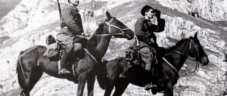
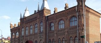
Provincial city of Stavropol. Triumphal Gate.
At the same time, a village and a civilian settlement arose here. In 1785, the civilian settlement turned into a district city of the Caucasus region, in 1822 the center of this region was moved to Stavropol, in 1847 the Caucasus region was renamed the Stavropol province, and Stavropol - a provincial city.
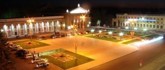
Modern Stavropol is a cultural, business and industrial center of the region, which successfully combines the delights of a cozy city with numerous squares, boulevards, parks, a vast forest area and the bustling rhythm of life of a modern urban district.
The city belongs to the category of medium-sized cities in Russia; 433.8 thousand people live in it (as of January 1, 2017), which is 15.5% of the region’s population. Population density – 1793 people per 1 sq. km.
© Photo: Dmitry STEPANOV
Stavropol is a multinational city, home to representatives of more than 100 nationalities and ethnic groups (according to VPN-2010). The bulk of the population is Russian (87.9%), there are also 4.5% Armenians, 1% Ukrainians, and 0.6% Jews and Greeks each.
The regional capital is the center of concentration of youth. The city is home to 39% of the population aged 14–35 years, while in the region as a whole it is 30.9%. The average urban household size is 2.7 people. The average age of city residents at the beginning of 2022 was 37.1 years. Stavropol residents of working age make up 63% of the city’s total population. In 2016, 2,582 marriages were registered in Stavropol, 6,282 babies were born, in 6 months of this year – 1,055 and 2,656, respectively.
Stavropol
© Photo: Eduard KORNIENKO
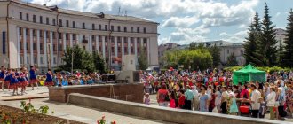
Today's Stavropol is a city for comfortable living. It has about 530 streets with a total length of more than 700 kilometers, over 28 thousand buildings, of which 23.8 thousand are residential, five museums, two theaters, 20 public libraries, 219 monuments of history, culture, architecture and urban planning. Forest areas adjacent to urban development occupy an area of 4.5 thousand hectares.
© Photo: from the archive of the newspaper “SP”
Today's Stavropol is a city for comfortable living. It has about 530 streets with a total length of more than 700 kilometers, over 28 thousand buildings, of which 23.8 thousand are residential, five museums, two theaters, 20 public libraries, 219 monuments of history, culture, architecture and urban planning. Forest areas adjacent to urban areas add special beauty and brightness at any time of the year. The area they occupy is 4.5 thousand hectares.
© Photo: from the archive of the newspaper “SP”
According to the results of the All-Russian competition for the title of “The most comfortable urban (rural) settlement in Russia” held in 2016, Stavropol took first place in the category “Urban settlements (urban districts) that are administrative centers (capitals) of the constituent entities of the Russian Federation” with the presentation of a diploma from the Government of the Russian Federation I degree.
Ermolov Boulevard in Stavropol. Triumphal Arch – Tiflis Gate
© Photo: Eduard KORNIENKO
,
Map of the city of Stavropol with roads. Transport of Stavropol
Stavropol is the transport “gate” of the Caucasus. The federal highway P216 Stavropol - Elista - Astrakhan and the regional highways P267 Stavropol - Shpakovskoye Airport, P269 Stavropol - Bataysk pass through the city.
There is 1 bus station and 3 bus stations in the city. From the Central Bus Station, located on Marshal Zhukov Street, 27, regular buses depart to St. Petersburg, Adler, Astrakhan, Volgograd, Vladikavkaz, Krasnodar, Sochi, Baku and dozens of other settlements.
Trains run at the Stavropol railway station in the directions Stavropol - Adler, Palagiada - Stavropol, Kavkazskaya - Stavropol. On the map of Stavropol with streets, the station is located on Vokzalnaya Street, 17.
Stavropol International Airport is located 14 km northeast of the city center. From there there are flights to Moscow, St. Petersburg and Rostov-on-Don.
60 bus and minibus routes, as well as 9 trolleybus routes are available to residents. The fare for buses is 21 rubles, for minibuses – 23 rubles, for trolleybuses – 18 rubles.
A little about the climate of Stavropol
It is a very green city due to the presence of many planted plants.
The climate of Stavropol is temperate continental. Summer is hot and winter is cold. Very often, the air temperature can change significantly throughout the day. This makes life here difficult for many weather-dependent people.
Average temperatures in January: from minus 9 degrees to minus 5 degrees, in July: from plus 22 degrees to plus 24 degrees.
Since the city is located in the steppe, it is characterized by strong winds, which in winter increase the feeling of cold. Five-degree frost can seem thirty degrees with a wind speed of 15-20 meters per second.
Map of Stavropol with streets
The population of the administrative center is more than 420 thousand people. As can be seen on the map of Stavropol with diagrams, the city is divided into 3 districts: Leninsky, Industrial and Oktyabrsky. The total length of city streets, alleys and avenues is more than 700 km, and in total Stavropol residents have more than 530 streets in the territory of the settlement.
Main streets of the city:
- Dovatorets;
- Bypass;
- Oktyabrskaya;
- Lenin;
- Kulakov Avenue;
- Karl Marx Avenue;
- Eastern Bypass;
- Southern bypass.
A railway runs through the northern and northeastern parts of the city outskirts, and a dead-end branch line has been built into the city. The railway station is located in the Oktyabrsky district in the territorial center of the city. On the street map of Stavropol it is marked at the intersection of Karl Marx Avenue and Vokzalnaya Street.
The city is surrounded on both sides by federal highways R-269 and R-216. To ensure that the city does not suffer from exhaust fumes, road junctions and bypass roads have been built. Intercity communication is provided by buses from the Central Bus Station. Find the address “280 Mira Street” on the map of Stavropol with house numbers and see an icon indicating a bus station.
In the city there are:
- Central Park and several Parks of Culture and Recreation;
- Stadium;
- Circus;
- Zoo;
- 2 exhibition galleries;
- Cathedral, temples, churches;
- Clinics, hospitals, maternity hospitals,
- 69 kindergartens;
- 5 orphanages;
- 4 gymnasiums;
- 7 lyceums;
- 12 schools;
- 11 colleges;
- 20 universities.
Any object can be found on the map of Stavropol with streets and houses.
Attractions
There are many places in Stavropol where you can spend your leisure time in a variety of ways, both for families with children and for young people.
Of greatest interest to tourists are:
- Art Museum
- Literary Museum
- Exhibition Hall of the Union of Artists of Russia
Locals love to walk in parks, of which Victory Park is the most popular. This place attracts parents with children, as it is famous for its various attractions.
Families with small children also love Central Park, where a petting zoo recently opened.
Alexander Square is also loved by both guests and the local population. There is a monument to the Guardian Angel here.
The recreation and entertainment complex “Gallery” is also located on the square. In which you can offer an interesting activity for children, and have a good rest yourself.
Among the clubs, the entertainment complex “New Rome” is especially popular.
There are also many restaurants, cafes and nightclubs in the city. So there is no time to be bored.
Knowing where Stavropol is located, you can safely go on a trip to see with your own eyes the beauty of the Stavropol region.
Religion
When the fortress city was founded, it came under the jurisdiction of the Astrakhan rulers, who since 1723 bore the title of “Stavropol” - after the name of the former fortress of the same name on Sulak. In 1829, the city was transferred to the newly established Novocherkassk diocese. In 1842-1843, during the organization of an independent Caucasian diocese, it became its cathedral city. In 1846, the Caucasian (then Stavropol) Theological Seminary was established in the city. In 1886 the diocese was renamed Stavropol. By the beginning of the century, there were 27 Orthodox parishes in the city.
On May 19-24, 1919, the South Russian Council of bishops cut off from the hierarchy by the civil war took place in the city, at which the Provisional Higher Church Administration of the South-East of Russia was established. Later, during the civil war, the clergy of the city and region were destroyed in large numbers. In 1922, as throughout the diocese, the Renovationists quickly gained strength, depriving the Orthodox of the majority of parishes; in 1923-1945 the Stavropol Renovation diocese operated. In the 1920s-1930s, there was a massive closure of the city’s churches; only the Assumption Church, built in 1849, operated without interruption during the Soviet period. The Stavropol Theological Seminary was able to revive its activities in 1946-1960, after which it was again forced to close.
Since the end of the century there has been a revival of church life, the restoration of old churches and the construction of new ones. The seminary was revived in 1990. Since 2012, the city has become the center of the newly established Stavropol Metropolis.
At the beginning of the century, a church, a synagogue, a church and a mosque operated in the city.
The Saints
- St. Ignatius (Brianchaninov) (+ 1867) - Bishop of the Caucasus
- St. Theophylact (Gubin) (+ 1872) - Bishop of the Caucasus
- Sschmch. Dimitry (Dobroserdov) (+ 1937) - Bishop of Stavropol
Monasteries
- St. John the Mariinsky (female)
Temples
- Alexander Nevsky
- St. Andrew the First-Called, Cathedral
- Dimitry Donskoy
- Ignatius of the Caucasus
- Joachim and Anna
- Kazan Icon of the Mother of God, Cathedral
- Ksenia of Petersburg
- Luke of Simferopol
- Nicholas the Wonderworker
- Panteleimon the Healer
- Intercession of the Blessed Virgin Mary (in 1831 moved to the village of Batalpashinskaya)
- Trinity Life-Giving
- Dormition of the Blessed Virgin Mary
Educational establishments
- Stavropol Theological Seminary