Coronavirus statistics in the Nizhny Novgorod region January 13, 2022
As of January 13, 2022, another 647 cases of coronavirus infection have been identified in the Nizhny Novgorod region. The total number of residents of the Nizhny Novgorod region with a confirmed diagnosis of coronavirus is 234,531.
221,151 residents of the Nizhny Novgorod region have recovered, that is, 94.29% of the total number of patients who were diagnosed with coronavirus are already healthy. Over the past 24 hours, 878 people who had previously been diagnosed with coronavirus were discharged.
34 people died during the day, for the entire time 10,133 people died.
As of January 13, 2022, 1,775,312 people were vaccinated with the first component of the vaccine, and 1,701,150 people completed vaccination.
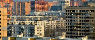
Economy and industry of the Nizhny Novgorod region
The region has traditionally developed heavy industry and mechanical engineering. Yandex maps of the Nizhny Novgorod region can become an indispensable assistant in finding the right enterprise. The region's engineering industry operates in both the civil and defense sectors. Its products account for more than 40% of all manufactured goods. Enterprises produce:
- cars;
- trucks;
- buses;
- special equipment.
Giant enterprises specialize in shipbuilding, aircraft products, and the design of instruments and machines for nuclear energy.
The Nizhny Novgorod region is a large agricultural region of the country. Farms are engaged in meat and dairy farming. Grain, sugar beets, potatoes, and onions are grown in regional fields. Off-season cultivation of vegetables has been developed using greenhouses and small farm enterprises.
In which cities and districts of the Nizhny Novgorod region coronavirus was detected as of January 13, 2022
List of districts and urban districts of the Nizhny Novgorod region where cases of coronavirus infection have been confirmed (as of January 12):
Ardatovsky - 1 197 o. Arzamas - 3,988 (+6) Arzamassky - 2,154 Balakhninsky - 8,057 (+10) Bogorodsky - 4,524 Bolsheboldinsky - 1,222 Bolshemurashkinsky - 895 Bor - 11,128 (+2) Buturlinsky - 587 Vadsky - 803 Varnavinsky district - 689 Vachsky - 1,940 (+6) Vetluzhsky - 1,845 Voznesensky - 771 Volodarsky - 3,835 (+2) Vorotynsky - 1,031 Voskresensky - 1 342 Vyksa - 4,349 Gaginsky - 1,125 (+10) Gorodetsky - 7,893 (+3) Dalnekonstantinovsky - 1,114 Dzerzhinsk - 21,747 (+13) Diveevsky - 1,478 Knyagininsky -1,028 (+1) Koverninsky - 1,612 Krasnobakovsky — 1,427 (+1) Krasnooktyabrsky — 1,105 (+1) Kstovsky — 4,315 Kulebaksky — 4,164 (+3) Lukoyanovsky — 2,104 Lyskovsky — 3,776 (+1) Navashinsky — 3,584 Pavlovsky — 6,207 (+18 ) Pervomaisky - 500 (+1) Perevozsky - 516 Pilninsky - 1,984 Pochinkovsky - 2,067 (+1) Semenovsky - 2,024 (+1) Sergachsky - 2,122 Sechenovsky - 1,439 Sokolsky - 1,063 Sosnovsky - 2,383 (+2 ) Spassky - 499 Tonkinsky - 933 Tonshaevsky - 1,672 Urensky - 3,128 Chkalovsky - 1,785 Sharangsky - 1,043 Shatkovsky - 3,192 Shakhunsky - 4,194 (+1) Sarov - 24,088 (+53) (FMBA data) Nizhny Novgorod - 90 261 (+69)
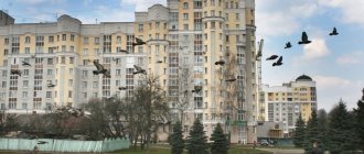
Geographical location of the Nizhny Novgorod region, relief, rivers, lakes
The region's territory is located along the banks of the Volga in the center of the East European Plain.
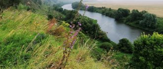
It is cut by many rivers. There are more than 9,000 of them in the region. The most significant of them are the Volga and Oka. The left bank areas of the region are characterized by swampy lowlands. There are many ravines and lakes in the region. The largest lake in the region is Pyrskoe. Forests occupy 46% of the region's territory. The online map of the Nizhny Novgorod region shows the borders with neighboring regions. These include the Kirov, Ryazan, Vladimir and Ivanovo regions. In the east, the Nizhny Novgorod region borders with Mari El and Chuvashia, in the south - with Mordovia.
Climate
The region is located in the temperate continental climate zone. On average, the region receives 600-650 mm of precipitation per year in the Left Bank part of the region and 500-550 mm in the Right Bank. The first snow in the region falls in November and does not disappear until March. In winter, the thermometer can drop to -25-28°C, and in summer it can rise above +28-30°C.
Population
The majority of the region's population is Russian. Their share in the total composition is 94.9%. They are followed by the Tatars - 1.44% and Mordovians - 0.7%. Most of the region's residents are city dwellers.
Economy
The Nizhny Novgorod region belongs to the industrially developed regions of the country. Its most famous enterprises are:
- in mechanical engineering - OJSC GAZ (Nizhny Novgorod);
- in metallurgy - Vyksinsky Metallurgical Plant;
- in aircraft manufacturing - Aircraft Building (Nizhny Novgorod);
- in the chemical industry - JSC "Orgsintez" Dzerzhinsk.
A large number of military-industrial complex enterprises are located in the region. The city of Sarov is considered the center of nuclear development. The food industry is well developed in the region.
Geography of the spread of coronavirus in Russian regions as of January 13, 2022
| Region | Revealed | New | Recovered | Died |
| Moscow | 2069957 | 5490 | 1899550 | 37670 |
| Saint Petersburg | 870526 | 1839 | 816693 | 28811 |
| Moscow region | 655865 | 1556 | 604953 | 12640 |
| Nizhny Novgorod Region | 234531 | 647 | 221151 | 10133 |
| Sverdlovsk region | 203902 | 410 | 178059 | 9686 |
| Samara Region | 202955 | 225 | 171391 | 6477 |
| Rostov region | 198232 | 391 | 180098 | 9853 |
| Voronezh region | 196845 | 242 | 168479 | 7115 |
| Krasnoyarsk region | 176557 | 265 | 161615 | 9024 |
| Perm region | 164517 | 309 | 151841 | 7618 |
| Irkutsk region | 160613 | 254 | 148269 | 7127 |
| Chelyabinsk region | 149721 | 232 | 141524 | 6355 |
| Saratov region | 135578 | 172 | 125049 | 5191 |
| Omsk region | 133375 | 215 | 125343 | 3310 |
| Volgograd region | 131785 | 172 | 122443 | 5740 |
| Stavropol region | 128640 | 352 | 109157 | 6260 |
| Khabarovsk region | 128434 | 229 | 119868 | 1283 |
| Republic of Crimea | 127909 | 94 | 119302 | 4548 |
| Arhangelsk region | 125511 | 154 | 115530 | 1549 |
| Republic of Bashkortostan | 124648 | 198 | 115538 | 4546 |
| Krasnodar region | 123690 | 353 | 102873 | 9918 |
| Altai region | 123467 | 289 | 106113 | 6902 |
| Ulyanovsk region | 121754 | 95 | 115413 | 3914 |
| Orenburg region | 109167 | 86 | 98918 | 3527 |
| Primorsky Krai | 105727 | 251 | 89213 | 1611 |
| Leningrad region | 104830 | 243 | 94790 | 3066 |
| Penza region | 104132 | 160 | 91806 | 4750 |
| Tver region | 101251 | 280 | 90842 | 2417 |
| Vologda Region | 101052 | 122 | 93143 | 3066 |
| Bryansk region | 98637 | 144 | 94306 | 3044 |
| Komi Republic | 98604 | 91 | 85211 | 2690 |
| Novosibirsk region | 98154 | 251 | 68779 | 4396 |
| Khanty-Mansi Autonomous Okrug | 97547 | 164 | 92449 | 2075 |
| Transbaikal region | 97249 | 103 | 87883 | 1941 |
| Murmansk region | 93151 | 122 | 76265 | 2831 |
| Tyumen region | 92619 | 198 | 83084 | 3559 |
| Republic of Karelia | 91577 | 152 | 87449 | 1244 |
| Kemerovo region | 88380 | 198 | 80594 | 1771 |
| Yaroslavl region | 88155 | 189 | 80734 | 2005 |
| Smolensk region | 86085 | 141 | 79047 | 2453 |
| Lipetsk region | 85521 | 123 | 79343 | 2907 |
| Kaliningrad region | 84096 | 168 | 80968 | 1315 |
| Vladimir region | 83514 | 138 | 75393 | 2986 |
| Belgorod region | 83044 | 107 | 75447 | 1821 |
| Astrakhan region | 82890 | 136 | 78639 | 2520 |
| Kursk region | 82882 | 89 | 78378 | 2101 |
| Kirov region | 81214 | 178 | 71338 | 779 |
| Udmurt republic | 79772 | 59 | 70082 | 3270 |
| The Republic of Buryatia | 77914 | 121 | 73079 | 2512 |
| Tula region | 77817 | 202 | 68824 | 4402 |
| The Republic of Sakha (Yakutia) | 77206 | 147 | 73762 | 1821 |
| Pskov region | 72408 | 86 | 68734 | 1334 |
| Oryol Region | 71850 | 147 | 67354 | 1568 |
| Ivanovo region | 69587 | 113 | 62404 | 2613 |
| The Republic of Dagestan | 67267 | 158 | 61526 | 3264 |
| Novgorod region | 66711 | 89 | 63345 | 805 |
| Kaluga region | 66700 | 136 | 62537 | 1255 |
| Tomsk region | 63429 | 110 | 54696 | 685 |
| Tambov Region | 63357 | 168 | 58328 | 1804 |
| Ryazan Oblast | 62626 | 74 | 58154 | 2661 |
| Yamalo-Nenets Autonomous Okrug | 62551 | 64 | 58491 | 968 |
| Amur region | 56444 | 172 | 49812 | 622 |
| The Republic of Khakassia | 54464 | 81 | 51652 | 2056 |
| Sevastopol | 53526 | 89 | 50800 | 1891 |
| Kurgan region | 51806 | 81 | 49397 | 1031 |
| Kostroma region | 49061 | 38 | 47526 | 1141 |
| Chuvash Republic | 47159 | 54 | 41043 | 4115 |
| Republic of Tatarstan | 43958 | 107 | 37355 | 1506 |
| Sakhalin region | 43456 | 203 | 41489 | 577 |
| Kabardino-Balkarian Republic | 43089 | 82 | 39101 | 1508 |
| The Republic of Mordovia | 41139 | 58 | 36674 | 1075 |
| Republic of Kalmykia | 34176 | 15 | 32674 | 748 |
| Karachay-Cherkess Republic | 32989 | 55 | 29351 | 919 |
| Republic of North Ossetia-Alania | 31859 | 68 | 29359 | 1014 |
| Tyva Republic | 31701 | 15 | 30728 | 322 |
| Chechen Republic | 31558 | 60 | 29747 | 962 |
| Mari El Republic | 29846 | 34 | 28168 | 956 |
| The Republic of Ingushetia | 29527 | 70 | 27636 | 489 |
| Republic of Adygea | 28098 | 60 | 23385 | 772 |
| Altai Republic | 25584 | 17 | 23408 | 533 |
| Kamchatka Krai | 24045 | 58 | 19090 | 515 |
| Magadan Region | 13779 | 15 | 13225 | 356 |
| Jewish Autonomous Region | 11842 | 20 | 10939 | 430 |
| Nenets Autonomous Okrug | 3538 | 8 | 3394 | 88 |
| Chukotka Autonomous Okrug | 2976 | 4 | 2808 | 39 |
Size and geographical location.
The Nizhny Novgorod region is one of the forty-nine regions of the RSFSR, spread across the vast expanses of our Motherland. It covers an area of about 75 thousand square kilometers. This is, for example, more than one and a half times the area of the Moscow region.
From end to end, from southwest to northeast, our region stretches for half a thousand kilometers. Its lands, sometimes forest, sometimes almost steppe, freely spread along both banks of the great Russian river Volga, going far to the north and south - to where the Vetluga flows from the north, and from the south - the main right tributary of the Volga Oka and Sura, where steppes and forest-steppes end and forests begin, first deciduous, and then mixed and coniferous. The territory of the region, thus, being at the junction of different natural zones, generally has transitional features of nature, distinguished by significant landscape diversity. The diversity of the nature of the Nizhny Novgorod region is also due to the fact that one part of it is located on the low left bank of the Volga, and the other on the high right bank, on the Volga Upland, which represents a sharp contrast in comparison with the low-lying Trans-Volga region, as the left bank of the region is commonly called. The Volga in the region is the main natural boundary: in relief and climate, and for rivers, and for soil and vegetation cover. In the European part of the RSFSR, on the Russian Plain, the Nizhny Novgorod region occupies an almost central position, being approximately equal distance, more than a thousand kilometers, from the western, northern and southern seas. The region's territory is most influenced by the western seas - the Atlantic Basin, which softens the continental climate of the country's interior.
The convenient location of the Nizhny Novgorod region in the center of the European part of the country, as well as the most important waterways - the Volga and Oka - passing through its territory, make this position very advantageous. By waterways, natural and artificial (canals), the Nizhny Novgorod region is connected with all the seas washing the European part of the country. The geographical position of the region has long been favorable to its development. The only disadvantage of the geographical location of the Nizhny Novgorod region is its comparative distance from the main bases of the most important minerals: coal, oil, chemical raw materials, iron ores. The Nizhny Novgorod region, formed in 1929 from the Nizhny Novgorod province, was determined in its modern borders mainly in 1944, when northern Povetluzhie became part of the Kostroma region.
It is surrounded by five regions and three autonomous republics, the border with which runs mostly through forests, and in the southern half also along rivers (Oka and Sura). Consequently, the borders of the Nizhny Novgorod region, which were formed mainly historically, have natural boundaries in a number of places. From the north, where the border reaches 58°06′ northern latitude (near the city of Vetluga), and the northeast, the Nizhny Novgorod region borders on the Kirov region, from the north-west - on Kostroma, from the west - on Ivanovo and Vladimir regions, from the east - with the Mari and Chuvash Republics, from the southeast and south, where the border touches 54°27′ northern latitude, - with the Mordovian Republic and from the southwest - with the Ryazan region.
Together with the Kirov region and three autonomous republics, the Nizhny Novgorod region is part of the Volga-Vyatka economic region, in which our region forms the industrial core, being the most industrially developed. The Nizhny Novgorod region is one of the most important industrial bastions of the country with highly developed mechanical engineering and chemistry, as well as forestry, pulp and paper, woodworking and other industries. As you can see, the geographical location of the Nizhny Novgorod region consists of various aspects that are important for both its physical-geographical and economic-geographical characteristics.
Leninsky district
This is an intracity district of Nizhny Novgorod with a population of 142 thousand people. Located between Avtozavodsky and Kanavinsky districts, along the Oka River. Microdistricts that are included in the Leninsky district:
- Hippodrome;
- Karpovsky;
- Red Etna;
- Molitovsky.
Also in the area there are the villages of Metallist and Instrumentalny.
Among the attractions, the Karpov Church stands out. You can take a walk in the Dubki Park and along the beach areas of the Oka River and Silicate Lake.
Avtozavodsky district
Located in the Zarechnaya part. The population of the Avtozavodsky district of Nizhny Novgorod is about 300 thousand people. It is considered the most populous region. It includes:
- microdistrict Sotsgorod 2, Sotsgorod 1, 6th, South, Northern, Monchegorsky, South-Western, Voroshilovsky;
- villages: Nagulino, Novoye Doskino, Paris Commune, Strigino, Gnilitsy;
- blocks: 52, 43 and 35.
- village of Petryaevka station.
The main attraction of the Avtozavodsky district is the Gorky Automobile Plant with the museum of the same name. You can take a break from the bustle of the city in the Avtozavodsky District Park, the Striginsky Bor forest park area and on the beaches of the Oka River and Lake Dredge.
Prioksky district
Located on the south-eastern side of the city (Nagornaya), on the right bank of the Oka River. The approximate population of the district is 94 thousand people. As part of the Prioksky district of Nizhny Novgorod:
- villages: Lyakhovo, Luch, Dubenki, Parkovy, Cherepichny;
- microdistricts: Karavaikha, Myza, Surikovsky, Shcherbinki 1 and Shcherbinki 2;
- villages: Blizhnekonstantinovo, Beshentsevo, Mordvintsevo, Olgino.
On the territory of the Prioksky district there is a recreation area "Shchelkovsky Farm", Switzerland Park, and the Botanical Garden.
Nizhny Novgorod district
It is the central urban district of Nizhny Novgorod with a population of 132 thousand people. This is the cultural center of the city.
The main attractions are located here: the Nizhny Novgorod Kremlin, the Chkalov Stairs, Bolshaya Pokrovskaya Street. The area is also home to many educational, business, cultural and public institutions.
Source
Sormovo district
This is an industrial urban area located in the Zarechnaya part of the city (in the north-west). Population is approximately 167 thousand people. The district includes the following villages and microdistricts:
- 7th, 5th, 6th, Daryino, Svetloyarsky, Cooperative;
- military town (New settlement);
- villages: Dubravny, Volodarsky, Vysokovo, Koposovo, Pochinki, Narodny, Komsomolsky, Peat enterprise;
- Sormovo center;
You may be interested in: Konstantino-Eleninskaya Tower. Description, history, purpose
Among the attractions worth noting:
- the Meteor monument opposite the administration;
- memorial "Tank T-34";
- monument to the steam locomotive SU 251-32.
You can take a walk through the Sormovsky Park of Culture and Recreation, Svetloyarsky Park, and the Koposovskaya Dubrava forest park area, which is located behind Kima Street.
Kanavinsky district
It is located in the Zarechnaya urban area on the right bank of the Volga River and the left bank of the Oka River. It has a population of more than 160 thousand people. The district includes:
- microdistricts: Gordeevsky, Meshcherskoye Lake (1, 2, 3, 4, 5 and 6 microdistricts), Sortirovochny, Red Anchor, Teplichny, Spalny, Lengorodok, Seventh Heaven, Fair, Staroe Kanavino.
- villages: Yudintseva, Berezovsky.
Among the attractions, the Nizhny Novgorod Circus, the Fair, the Nizhny Novgorod Stadium, the Alexander Nevsky Cathedral, Strelka (the confluence of Volka and Oka), the planetarium, and the steam locomotive museum stand out.