General information and history of the city
Until 1934, the city was called Verkhnedvinsk. Trade routes to countries such as Mongolia and China pass through Ulan-Ude. Convenient geography connects the point with the entire eastern Siberia.
In the depths of history, in 1666, the Russian Empire needed a Cossack fort to govern the new Siberian territories. Over time, the city turned from a small paramilitary settlement into a republican capital. At the turn of the 18th-19th centuries, after the strengthening of tsarist power in Transbaikalia, it lost its military purpose, but acquired an industrial and commercial one.
Distances in Siberia:
| Locality | Distance | Locality | Distance |
| Ulan-Ude — Bagdarin | 600 km | Ulan-Ude — New Uoyan | 978 km |
| Ulan-Ude — Zakamensk | 408 km | Ulan-Ude — Severomuisk | 1098 km |
| Ulan-Ude — Severobaykalsk | 1747 km | Ulan-Ude — Kurumkan | 408 km |
Minerals
Buryatia is the richest territory of our country in terms of mineral reserves. More than 700 deposits have been explored here. Gold, tungsten, uranium, molybdenum, beryllium, tin, aluminum are only a small part of all minerals. And the reserves of hard and brown coal will be enough for the needs of the republic for hundreds of years. It should be noted that the subsoil of this region contains about 48 percent of Russia's balance zinc reserves. The capital of Buryatia is the center of industrial enterprises for the processing of natural resources.
Climate and ecology of Ulan-Ude
Ulan-Ude on the map of Russia is located in an area with a sharply continental temperate climate. In winter the frost drops below 45 degrees. The summer heat exceeds 40 degrees. The weather changes quickly, but the dry climate prevents slush from appearing.
For a large city, the environmental situation is good. The number of cars has increased in recent years. There are several large enterprises and thermal power plants. The city differs little from the south of Russia in terms of the number of sunny days. The Siberian forests located around help keep the air clean.
Temperature in Ulan Ude by month
Ulan-Ude is listed on the map of Russia in Transbaikalia. Freshwater Lake Baikal is only 130 km away. Selenga is a river along the banks of which there is a settlement with a population of more than 400 thousand.
Geography
Buryatia is located on the eastern shore of Lake Baikal, in the very heart of Asia. The republic's southern neighbor is Mongolia. From the north, Buryatia borders on the Irkutsk region, Tyva adjoins the western part, and the Trans-Baikal Territory adjoins the eastern part. The area of the republic is about 351 thousand square kilometers. The geography of Buryatia is unique. All zones of Eurasia meet here: taiga, mountains, tundra, steppes, plains, desert. There are a lot of healing springs with mineral water in Buryatia. Local residents call them Ashans and consider them sacred places.
State of the city's infrastructure
The city's transport system includes the country's largest airport, Baikal. Charter flights have been organized to Ulaanbaatar, the capital of Mongolia. There are routes to almost all major cities of Russia.
Due to the increase in the number of cars, roads, junctions and parking lots are being built. Cars occupy courtyards and roadsides. New buildings are trying to take this problem into account, but not effectively enough.
Architectural structures and monuments
The architectural appearance of the capital took shape over more than 3 centuries. Modern buildings coexist with historical buildings. Monuments of the Russian Empire stand next to monuments from the times of the revolution and civil war. The city authorities are working to restore structures destroyed during the change of eras.
Arch "Royal Gate"
At the end of the 19th century. To commemorate the arrival of the future Emperor of Russia Nicholas in Eastern Siberia, a triumphal “royal gate” was erected in the Buryat capital.
At that time it was made of wood. Mounted on a stone pedestal: a double-headed imperial eagle on top of a structure of double semi-columns. The royal coat of arms was destroyed in the October Revolution. And before the Second World War, the arch itself was demolished.
In the early 2000s. For the 340th anniversary of the capital of Buryatia, the authorities decided to recreate the monument. The “New Royal Gate” repeats the external forms of the architects of the past, but has become taller and wider.
The building of the Buryat Opera and Ballet Theater
In 1932, a Buryat theater opened in Ulan-Ude, which was later renamed. After World War II, in the 50s. 20th century, the building of the music and drama theater was reconstructed. In March 1954, the state commission accepted the restored structure. It was called the Opera and Ballet Theater named after S. Tsydynzhapova.
On its facade there is a 5-bay arcade, which is supported by 2 athletic columns. From the height of the building there is a magnificent view: a wide river, azure hills and the expanse of the Ivolginsk valley. The main entrance with candelabra of 5 lanterns leads out onto the square.
The architecture of the theater, at the request of the capital's residents, contains elements of the national style. The auditorium, thanks to decorative inserts, acquired an extraordinary composition. Paintings and luxurious embroidered curtains create the solemnity of the perimeter colonnade.
Spire columns are cut into the decorative wall. They resemble suburgans - religious buildings of the Buryats. The building is a valuable cultural object.
Monument to the God of Trade
In the center of Ulan-Ude, on Lenin Street, on the initiative of the merchants, admirers of trade and its patron god Mercury, the architectural monument “Rod” was erected: a marble column is entwined with 2 bronze snakes.
Now “The Rod” is a popular attraction among tourists and local youth.
Monument "Beauty of the Angara"
The monument immortalizes the names of ballerina Larisa Sakhyanova and her colleague, ballet dancer, Pyotr Abasheev, and is located not far from the theater building.
The 1959 production about the love of the Angara and the Yenisei with a poetic plot and Buryat flavor won success among the audience. The ballet dancers who performed the main roles became laureates of the USSR State Prize. Russian sculptors opened the monument in 2002.
Monument “Mother Buryatia”
In 2002, above Lenin Street, on a hill in the city center, a female image of “Mother Buryatia” was installed. In 2008, it was moved to the area of the bridge over the river. This is a sculpture of a woman holding the national Buryat khadak - a long scarf. Bronze structure 8 m up.
In the new place, “Hospitable Buryatia” - as people called it, lays claim to the honorary name of the main symbol “Capital of Buryatia”. The structure is 20 m high. The arm span of the monument is 6 m. It’s as if the republic is hugging its guests.
Monument to V.I. Lenin
In the 70s last century began the construction of a monument to Lenin, for his centenary. The structure was cast at the Mytishchi stone-cutting enterprise in the Moscow region. Weight - 42 tons, height almost 8 m.
The monument is made in the shape of a head, which touches the base only in a single place. In the fall of 1971, the monument was inaugurated. There is no such large image of the head of the teacher and leader of Soviet Russia in the world. Taking the place of the “three Ilyichs” located on this site earlier, the monument has become a globally recognizable national symbol.
Monument to Geser
It is an equestrian monument. The hero of folk tales, Geser, is riding a horse, which stands majestically on a hill with all its hooves. Ulan-Ude on the map of Russia is located where at the beginning of the 2nd millennium AD. there was a Horde.
Geser is a Buryat hero who fought for the liberation of the Buryat people. To fight monstrous villains, the hero resorts to witchcraft and cunning. There is a monument on Pobeda Avenue.
Kapelman House
Kapelman is a merchant who lived in the city at the beginning of the last century. He erected a building made of stone, in which on the top floor there was a reception room for a dental technician, and the bottom floor was occupied by a tea pavilion, a cafe and a store with baked sweets.
In the year of the Battle of Borodino, the chamber of commerce and industry was located in the building. During the civil war there was an underground Baltic Bolshevik Committee. Now there is a notary and a shop in the house.
The building is an old mansion with Atlases in the facade, which faces the main street of the city. The external decoration of the architectural structure has remained unchanged since historical times.
House Radio
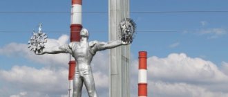
There is a corner building at the intersection of Lenin and Erbanova streets. It is called “House of Radio”. The building was built according to the design of L. Minert in 1959. The 5-story tower attracts special attention in the architecture.
Its spire ends with a 5-pointed star surrounded by a wreath of ears. There are 2 dials on the tower.
Buryatia: geographical location and climate
The Republic occupies a favorable geographical position in the system of relations between the Russian Federation and the countries of the Asia-Pacific region. In practice, Transbaikalia can be considered as the “transport gate” of Russia to the Asia-Pacific region. In the conditions of modern democratization of society, the transition to new market relations, the restructuring of economic and political life in the country, real opportunities are opening up for the regions of Siberia and the Far East, including Transbaikalia, to enter the international market with products, primarily from the manufacturing industry (and not from products of traditional mining industries). Thus, the peculiarity of the geographical location and climatic conditions provide powerful incentives for the development of the economy of the Republic of Buryatia. Geographical position
The Republic of Buryatia is located in the center of the Asian continent, between the taiga spaces of Eastern Siberia and the vast steppes of Mongolia. The capital is the city of Ulan-Ude, founded in 1666. There are 6 cities, 29 urban-type settlements, and 615 settlements in the republic. The distance by rail from Ulan-Ude to Moscow is 5519 km, and to the Pacific Ocean - 3500 km. The modern airport and the Trans-Siberian Railway, which runs through the territory of the Republic of Buryatia, create excellent conditions for transport connections not only with all regions of the country and European countries, but also with the countries of Southeast Asia. From west to east, its territory extends between 98° 40` and 116° 55` E. The northernmost protrusion of the territory of the republic reaches 57° 15` N, and the southernmost point lies on the Chikoy River at 49° 55` N. The total area of its territory is 351.3 thousand sq. km. The natural conditions of Buryatia are significantly influenced by the republic’s position in the interior of Asia and its distance from the seas and oceans. The mountainous terrain has a particularly strong influence on the formation of the natural conditions of Buryatia. The territory of Buryatia frames Lake Baikal along its southeastern coast. 2/3 of the coastline of this great lake lies in Buryatia. Baikal has a unique flora and fauna. More than 2,500 different species of animals and fish, 250 of which are endemic, inhabit Lake Baikal and the surrounding area. The unique combination of diverse landscapes in the center of Asia - from mountain tundra to steppes - together with the world's largest and oldest freshwater body of water - Lake Baikal - determines the special significance and value of the region in the structure of the planet's biosphere. From the north and west, the territory of the republic is washed by the waters of Baikal, in the east it borders with the Chita region, in the west and north - with the Irkutsk region, in the southwest - with the Republic of Tyva, in the south there is a state border with Mongolia. The Republic of Buryatia is a mountainous country that occupies a significant part of the south of Eastern Siberia and is characterized by powerful mountain ranges and vast, deep and sometimes almost closed intermountain basins. Almost the entire territory is dominated by strongly dissected mountains; flat surfaces are found only in tectonic depressions and valleys of large rivers. The area of the mountains is more than 4 times the area occupied by the lowlands. The Republic of Buryatia is characterized by a significant elevation above sea level. The lowest point is the level of Lake Baikal - 456 meters at the Pacific level, and the highest is the glacier-covered peak of Munku-Sardyk in the Eastern Sayan Mountains - 3491 meters above sea level. The southern part of the republic, represented by the Selenga midlands, covers a significant part of the Selenga River basin - the main water artery of Lake Baikal, including all its large tributaries, and is characterized by the predominance of mountains of average height - 1000-1500 meters above sea level. Lake Baikal is adjacent to the high ridges of the Baikal region with wide intermountain basins separating them. Their belt includes the highlands of the Eastern Sayan - this peculiar uplift, stretching from northwest to southeast for a distance of about 1000 km with a width of 200-300 km and rising in the central part of the ridges by more than 2500-3000 meters. The mountain ranges on the territory of the republic have the shape of elongated ridges, mainly from the southwest to the northeast, in the direction of the main tectonic faults of the earth's crust. The belt of the Baikal region mountains is continued by the Khamar-Daban, Ulan-Burgasy, Barguzinsky, Ikatsky and Baikalsky ranges. The watersheds of the Barguzin ridge represent classic alpine landforms. The Barguzin River flows between the Barguzin and Ikat ridges, along which in autumn and spring the cooled air rushes down the valley, with wind speeds reaching 25-35 meters per second. Even further north, the Baikal region continues with the Stanovoi Upland ridges: North and South Muisky, Verkhneangarsky, Delyun-Uran, Kodar. The Vitim Plateau adjoins the northeast of the Baikal region. The entire Northern Baikal region is characterized by a continuous distribution of permafrost, sometimes occurring at a depth of 0.5 meters and up to 500-600 meters thick.
Climate
The remoteness of the territory of the Republic of Buryatia from the oceans, its location in the center of the vast Eurasian continent and the mountain-basin topography have determined a peculiar and unique climate. A specific feature of the climate is its sharp and frequent spatial variability: the presence of mountain ranges of different heights and orientations, the existence of intermountain depressions and intermountain valleys, the shape and degree of orographic expression - all this strongly influences the local circulation of air masses, sharply changing the main climatic indicators, creating a mosaic - a motley picture of climate heterogeneity. The territory of the Republic of Buryatia is characterized by a sharply continental climate with large annual and daily fluctuations in air temperature and uneven distribution of precipitation across the seasons. The sharply continental climate inherent in this mountain-taiga land in the central part of the Asian continent is characterized by cold winters and hot summers. Low winter temperatures are quite easily tolerated due to dry air. The summer heat is felt only at midday, and the morning and evening hours are pleasant with their coolness. Autumn is long and quite warm - until Baikal “falls”, the air temperature in Buryatia at this time of year is often higher than in the European regions of the country. The Siberian spring begins to be felt at the end of March, but the first greenery appears at the end of April. A feature of the climate of Buryatia is the development during the cold season of the powerful northeastern spur of the Siberian anticyclone, which appears in September-October and disappears in April-May. Therefore, winter in Transbaikalia is characterized by a large number of sunny days and low air temperatures. The lowest temperatures are observed in river valleys and basins, where stagnation and intense cooling of the air occurs. The average air temperature in January is 20-30 degrees below zero, and its absolute minimum is -45 - -55. Partly cloudy, little windy or calm weather prevails with minimal precipitation per year. During this period, there is no significant precipitation and therefore the thickness of the snow cover is small. A harsh, windless winter gives way to a late, windy and dry spring with night frosts. Barometric pressure decreases during this period, and streams of cold air from the northern regions of Siberia rush into the territory. This contributes to the return of cold weather and the appearance of prolonged and strong winds. Summer is short, dry in the first half with isolated hot winds that have developed in Mongolia; in the second half (July-August) cyclonic activity gradually intensifies, resulting in humid air masses arriving from the Pacific Ocean. Wind speed increases and the bulk of precipitation falls: July and August account for 60-70% of the annual norm. The average temperature of the warmest month - July - reaches 15-20, and its absolute maximum is 30-38 degrees above zero. Autumn is short and dry with sharp daily temperature fluctuations and often early frosts. An essential feature of the climate of Buryatia is the long duration of sunshine - 1900-2200 hours, and in terms of this indicator it is not inferior to, and sometimes superior to, the southern regions of Russia. So, for example, at the famous mountain resort of Abastumani in the Caucasus - 1994 hours, and at the Riga seaside 1839 hours per year. In general, the climate is formed under the influence of three contrasting components: the dry and cold climate of the northern regions, the hot and dry climate of the Mongolian deserts and the humid climate of the Pacific Ocean.
Museums and theaters
Ulan-Ude on the map of Russia is marked as the capital of the Republic of Buryatia, in which several museums have been created to preserve the drama of events for subsequent generations, tell about the difficult destinies of outstanding people of the republic, and present the beauty and diversity of Siberian nature.
Museum of the History of Buryatia
The History Museum is located in the historical part of the city. The address of the Lenin Museum is 26. It was founded in December 1999. Various compositions from the history of Ulan-Ude are demonstrated.
Sightseeing and on-site thematic excursions are organized:
- In search of a merchant's contribution.
- Sightseeing tour of the museum.
- Excursion around Ulan-Ude.
- Around Chekhov.
- Native motives of Buryatia.
Nowadays, the historical museum provides support to young talented citizens.
Conducts classes with children:
- The mystery of the old chest.
- Quest “Winter fun”
- We meet Sagaalgan.
- Mona Lisa's smile.
Ticket prices for all museum exhibitions start from 200 rubles. Opening hours from 9:00 to 18:00, seven days a week.
Museum of Nature
Museum address: Lenin Street, 46. The institution declares its mission as environmental education. In 5 halls of the museum there are compositions on the theme “Man and Nature”. Natural samples and photographs demonstrating the biological and plant diversity of the Siberian region are presented.
The museum building is a valuable cultural heritage site of the country.
Art Museum named after Ts. Sampilov
Among the exhibitions of the institution you can see:
- graphic works and sculptures:
- collections of decorative and applied arts;
- jewelry exhibition;
- compositions with carvings and paintings on wood.
The Republican Art Museum in Ulan-Ude is located on the street. Kuibysheva, 29. Opening hours from 10:00 to 18:00. Monday is a day off. You can get to the exhibition by any type of transport, going to the Eurozone shopping center stop. There are hotels nearby. Tickets can be easily purchased on the official website of the museum.
Drama Theater named after N. Bestuzhev
On Tereshkova Street, at 9a, the majestic building of the State Russian Drama Theater named after N.A. opens up to the eye. Bestuzhev. The institution was created in 1928. In front of the graceful building is a cascade of fountains. Head of the theater Stepanov P.G. The troupe includes people's and honored artists of Russia.
The repertoire includes performances for children and adults:
- Crime and Punishment.
- Dear Pamela.
- Death of Tarelkin.
- At the bottom.
- Princess from the land of Oblivion.
- Princess Frog.
You can buy tickets for performances at the theater box office. Cash desk opening hours: from 10:00 to 18:00. No breaks or days off. To get to the Melpomene building - by buses number 16k, 31A, 137. By trams number 1, 2, 4. By minibuses number 2, 15, 19, 29, 30.
Map
| Ulan-Ude: maps |
Ulan-Ude: photo from space (Google Maps) Ulan-Ude: photo from space (Microsoft Virtual Earth)
| Ulan-Ude. Nearest cities. Distances in km. on the map (in brackets along roads) + direction. Using the hyperlink in the distance , you can get the route (information courtesy of the AutoTransInfo website) | |||
| 1 | Sotnikovo | 9 () | NW |
| 2 | Ivolginsk | 22 () | SW |
| 3 | Onokhoy | 32 () | IN |
| 4 | Turuntaevo | 41 () | WITH |
| 5 | Tarbagatai | 42 (52) | SW |
| 6 | Zaigraevo | 45 () | IN |
| 7 | Selenginsk | 53 (89) | NW |
| 8 | Kabansk | 68 () | Z |
| 9 | Kamensk | 70 () | Z |
| 10 | Mukhorshibir | 89 (118) | YU |
| 11 | Gusinoozersk | 95 (120) | SW |
| 12 | Petrovsk-Zabaikalsky | 106 (204) | SE |
| 13 | Babushkin | 118 (178) | Z |
| 14 | Elantsy (Irkutsk region) | 134 (636) | NW |
a brief description of
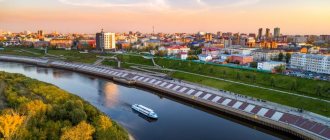
The city is located in Transbaikalia, in the valley of the river. Selenga, on its right bank, between the Khamar-Daban and Ulan-Burgasy ridges, 75 km east of Lake Baikal, 5532 km east of Moscow. The southern part of the city is crossed by the river. Uda (tributary of the Selenga). Pier (on the Selenga River). Railway junction lines and highways.
The climate is sharply continental. The average temperature in January is -24, in July +17. Precipitation is about 300 mm per year.
Territory (sq. km): 366
Information about the city of Ulan-Ude on the Russian Wikipedia site
Historical sketch
Founded in 1666 as the Cossack winter hut Udinskoye on the river. Uda for collecting yasak from the Evenks and Buryats. Hydronym Uda from the Evenki ud “calm, quiet flow.” In 1689, the Udinsky fort was erected.
Since 1690, the administrative center of western Transbaikalia. In 1735-1773 referred to as a suburb of Udinsk. Since 1775, the provincial city of Udinsk, since 1783, the district city of Verkhneudinsk, Irkutsk region, Irkutsk governorship (since 1796 - Irkutsk province). The definition of upper - in this case does not mean “in the upper reaches” (the city is located at the mouth, i.e. at the very bottom of the Uda River), but is given to distinguish it from the city of Nizhneudinsk, located in the middle reaches of the Uda River, the Angara basin (in Irkutsk region).
Since 1822 the district center of the Irkutsk province, since 1851 the center of the newly formed Transbaikal region.
The favorable economic and geographical position of Verkhneudinsk (the navigable Selenga River with a convenient pier, the highway to Kyakhta, etc.) contributed to the transformation of the city into a large trading center in Transbaikalia. Trade with China took place through Kyakhta and Verkhneudinsk.
In 1856, in the district town of Verkhneudinsk, Transbaikal region, there were 4 churches, 518 houses, 110 shops.
In 1899, the Trans-Siberian Railway passed through Verkhneudinsk.
Verkhneudinsk fair towards the end of the 19th century. had a turnover of up to 2 million rubles.
In April - October 1920, Verkhneudinsk was the capital of the Far Eastern Republic (FER). In 1921-22, the center of the autonomous region was Buryat as part of the Far Eastern Republic. Since 1923, the capital of the Buryat-Mongolian Autonomous Soviet Socialist Republic, in 1958-92. - Buryat Autonomous Soviet Socialist Republic.
In 1934, Verkhneudinsk was renamed Ulan-Ude - “Red Uda” (Ulan Buryat “red”, Ude is the Buryat name of the Uda river).
In 2009, the working villages of Zarechny and Sokol, as well as a number of rural settlements (12.5 thousand inhabitants), were included within the city limits (Sovetsky district). In addition, the village of Zabaikalsky (2.6 thousand inhabitants) is included within the Oktyabrsky district, the village of Mostovoy station (0.2 thousand inhabitants) is included within the Zheleznodorozhny district.
Municipal indicators
| Index | 1990 | 1999 | 2001 | 2003 | 2005 |
| Demography | |||||
| Number of births, per 1000 population | 16.1 | 9.9 | 11.2 | 13 | 13.8 |
| Number of deaths, per 1000 population | 9.5 | 12.6 | 13.7 | 14.3 | 14.7 |
| Natural increase (decrease), per 1000 population | 6.6 | -2.7 | -2.5 | -1.3 | -0.9 |
| Standard of living of the population and social sphere | |||||
| Average monthly nominal accrued wages, rub. | 0.327 | 1521 | 2918 | 5500 | 8676.4 |
| Average housing area per inhabitant (at the end of the year), sq.m. | 13.5 | 15.6 | 16.7 | 17.3 | 17.9 |
| Number of preschool institutions, pcs. | 144 | 75 | 73 | 74 | 75 |
| Number of children in preschool institutions, thousand people | 25.1 | 8.8 | 10.2 | 11.5 | 12.7 |
| Enrollment of children in preschool educational institutions (at the end of the year), as a percentage of the number of children of the corresponding age, % | 52 | 56 | |||
| Number of daytime educational institutions (at the beginning of the school year), pcs. | 68 | 80 | 80 | 79 | 79 |
| Number of students in daytime educational institutions, thousand people | 57.9 | 57.7 | 54.1 | 49.2 | 44.6 |
| Number of doctors, people. | 2304 | 2306 | 2390 | 2491 | 2500 |
| Number of nursing staff, people. | 4583 | 4101 | 4314 | 4978 | 4973 |
| Number of hospital institutions, pcs. | 23 | 25 | 21 | 23 | 23 |
| Number of hospital beds, thousand units | 6 | 4.8 | 4.5 | 4.6 | 4.5 |
| Number of medical outpatient clinics, pcs. | 39 | 33 | |||
| Capacity of medical outpatient clinics, visits per shift, thousand units. | 8.5 | 9.2 | 10.9 | 11.4 | 10.2 |
| Number of registered crimes, pcs. | 13868 | 15046 | 9301 | 13762 | |
| Persons who committed crimes were identified, persons. | 6602 | 5932 | 3948 | 4704 | |
| Economy, industry | |||||
| Number of enterprises and organizations (at the end of the year), pcs. | 949 | 8933 | 9726 | 7400 | 19775 |
| Number of operating enterprises by type of activity: mining (at the end of the year), pcs. | 3 | ||||
| Number of operating enterprises by type of activity: manufacturing (at the end of the year), pcs. | 138 | ||||
| Number of operating enterprises by type of activity production and distribution of electricity, gas and water (at the end of the year), pcs. | 73 | ||||
| Volume of shipped goods of own production by type of mining (in actual prices), million rubles. | 2003.7 | ||||
| Volume of shipped goods of own production by type of manufacturing (in actual prices), million rubles. | 14625.1 | ||||
| Volume of shipped goods of own production by type of production and distribution of electricity, gas and water (in actual current prices), million rubles. | 7874.1 | ||||
| Construction | |||||
| Volume of work performed by type of activity “Construction” (until 2004 - volume of work performed under construction contracts), million rubles. | 0.163 | 418.2 | 656.2 | 1442.4 | 2473.1 |
| Commissioning of residential buildings, thousand sq.m. of total area | 154.8 | 57.1 | 66.9 | 75 | 100.6 |
| Commissioning of residential buildings, apartments | 589 | 971 | 870 | 1015 | |
| Commissioning of preschool institutions, places | 90 | 0 | 0 | 0 | 0 |
| Commissioning of educational institutions, places | 1266 | 694 | 132 | 0 | 0 |
| Commissioning of hospital facilities, beds | 60 | 0 | 0 | 0 | 0 |
| Commissioning of outpatient clinics, visits per shift | 360 | 0 | 0 | 0 | |
| Transport | |||||
| Number of bus routes (in intracity traffic), pcs. | 33 | 40 | 33 | 44 | 26 |
| Number of tram routes, pcs. | 5 | 3 | 3 | 3 | 3 |
| Length of operational tram tracks (at the end of the year), km | 25.2 | 24.1 | 24.1 | ||
| Number of passengers transported by buses per year (in intracity traffic), million people. | 92.6 | 7 | 5.8 | 6 | 8.6 |
| Number of passengers transported by trams per year, million people. | 42 | 74.8 | 74.4 | 59.5 | 28.8 |
| Connection | |||||
| Number of telephone sets of the city public telephone network, thousand units. | 41 | 62 | 73 | 80.3 | 95.2 |
| Number of residential telephone sets of the city public telephone network, thousand units. | 26 | 51 | 59 | 67.2 | 80.3 |
| Number of payphones of the city telephone network (including universal ones), pcs. | 730 | 731 | |||
| Trade and services to the population | |||||
| Retail trade turnover (in actual prices), million rubles. | 6337.2 | 11206.4 | 16679.8 | 25825.9 | |
| Retail trade turnover (in actual prices), per capita, rub. | 16048 | 28450 | 43279 | 68144.2 | |
| Index of physical volume of retail trade turnover, % compared to the previous year | 112 | 113 | |||
| Index of physical volume of public catering turnover, % compared to the previous year | 100.5 | 103 | |||
| Number of stores, pavilions (at the end of the year), pcs. | 137 | 378 | |||
| Sales area of shops, pavilions (at the end of the year), sq.m. | 10856 | 23937 | |||
| Volume of paid services to the population (in actual prices), million rubles. | 0.143 | 623 | 1320.6 | 2814.6 | 6490.3 |
| Volume of paid services to the population (in actual prices), per capita, rub. | 0.4 | 1577 | 3359 | 7303 | 17125 |
| Volume of household services to the population (in actual prices), million rubles. | 0.032 | 21.9 | 42.5 | 73.4 | 208.4 |
| Volume of household services to the population (in actual prices), per capita, rub. | 0.067 | 55.6 | 108.1 | 190 | 550 |
| Investments | |||||
| Investments in fixed assets (in actual prices), million rubles. | 0.167 | 471.8 | 1110.4 | 2320.6 | 3104.9 |
| Share of investments in fixed assets financed from budgetary funds in the total volume of investments, % | 14 | 17.3 | 45.6 | 31 | |
Data sources:
- Regions of Russia. Main characteristics of the constituent entities of the Russian Federation: statistical collection. Goskomstat of Russia. - M:, 2003.
- Regions of Russia. Basic socio-economic indicators of cities. Statistical collection. Rosstat. - M:, 2005. p. 295
- Transport in Russia: Statistical collection. Goskomstat. - M:, 2003. pp. 110, 120
- Transport in Russia: Statistical collection. Rosstat. - M:, 2005. pp. 117, 127
- Regions of Russia. Basic socio-economic indicators of cities. 2006. Statistical collection. Rosstat. - M:, 2006. p. 291
Culture, science, education
Buryat Scientific Center of the Siberian Branch of the Russian Academy of Sciences with the Research Institute of Natural and Social Sciences, geological chemistry, and the department for research of biological active substances of Indo-Tibetan medicine.
Institutes: agricultural, pedagogical; East Siberian - technological and cultural.
Theatres: Buryat Opera and Ballet, Buryat Drama named after Kh. Namsaraev, Russian Drama named after A.F. Bestuzhev, dolls. Philharmonic.
Museums: history of Buryatia named after M.N. Khangalov, art named after Ts.S. Sampilov, ethnographic of the peoples of Transbaikalia, nature of Buryatia, geological.
Museums, galleries, exhibition halls
Evenki Local Lore Museum, Republic of Buryatia, Ulan-Ude, st.
Tsivileva, 9 Museum of Literature of Buryatia named after Khots Namsaraev 670000, Republic of Buryatia, Ulan-Ude, st. Sovetskaya, 27 Phone(s): 21-3722
Museum of Nature of Buryatia 670000, Republic of Buryatia, Ulan-Ude, st. Lenina, 46 Phone(s): (3012) 21-4149 21-9814 Website: https://muzeyrb.ru/
National Museum of the Republic of Buryatia 670000, Republic of Buryatia, Ulan-Ude, Profsoyuznaya st., 29 Phone(s): (3012) 213-299 Website: https://muzeyrb.ru/
Republican Art Museum named after Ts.S. Sampilova 670017, Republic of Buryatia, Ulan-Ude, st. Kuibysheva, 29 Phone(s): (3012) 21-4488 21-4393 Website: https://muzeyrb.ru/
Ethnographic Museum of the Peoples of Transbaikalia 670027, Republic of Buryatia, Ulan-Ude, village. Verkhnyaya Berezovka, 2a Phone(s) Website: https://www.emnz.ru/
Architecture, sights
Old urban areas in low riverine areas have partially preserved the regular layout of the late 18th century.
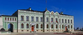
Odigitrievsky Cathedral (1714), Trinity Church (late 18th - early 19th centuries), Big and Small shopping arcades and Gostiny Dvor (1803-56, architect A.P. Losev), residential buildings in the classicist style and wooden houses decorated with carvings .
In the 20th century the foothill plain is built up. House of Soviets (1928-31, architect A.A. Ol), Buryat Opera and Ballet Theater (1947-52, architect A.N. Fedorov).
| Population by year (thousands of inhabitants) | |||||||
| 1856 | 3.4 | 1973 | 279 | 2001 | 369.6 | 2014 | 421.5 |
| 1897 | 8.1 | 1976 | 289 | 2003 | 359.4 | 2015 | 426.7 |
| 1926 | 29.4 | 1979 | 300.4 | 2005 | 352.6 | 2016 | 430.6 |
| 1931 | 44.0 | 1982 | 315 | 2006 | 347.8 | 2017 | 431.9 |
| 1939 | 125.7 | 1986 | 342 | 2007 | 343.0 | 2018 | 434.9 |
| 1956 | 158 | 1989 | 352.5 | 2008 | 340.8 | 2019 | 435.5 |
| 1959 | 175.2 | 1992 | 366 | 2010 | 377.1 | 2020 | 439.1 |
| 1962 | 196 | 1996 | 368.1 | 2011 | 404.4 | 2021 | 437.5 |
| 1967 | 227 | 1998 | 370.8 | 2012 | 411.6 | ||
| 1970 | 253.6 | 2000 | 370.4 | 2013 | 416.1 | ||
Temples of Ulan-Ude
Ulan-Ude on the map of Russia is located at the intersection of cultures and religions. Together with the Cossacks, Orthodoxy advanced across Siberia. In Buryatia, Christianity, Islam and Buddhism coexist.
Cathedral of Our Lady Hodegetria
Odigitrievsky Cathedral became the first stone structure in Verkhneudinsk. One of the church attractions of the city is located at the address: Lenin Street, 2. The Cathedral of the Icon of the Mother of God Hodegetria in the historical center of the city. Construction of the temple began in the 40s. 18th century and ended in 1785.
Hodegetria means guidebook, translated from Greek. The temple was built with funds allocated by the city's merchants. Icon of the Mother of God Hodegetria - blesses merchants and travelers. Divine services are held in the church every day, and there is a church shop.
Datsan Rinpoche Bagsha
In a place called “Bald Mountain” on the top of a hill in 2000, the Buddhist datsan “Rinpoche Bagsha” was created. The founder of the datsan is the holy reincarnation Yelo Rinpoche IV.
A complex for those who have felt their soul’s desire for a Buddhist worldview. In the evening, the view from the height of the center opens up - the Selenga River and the shimmering lights of the city.
A trip to the temple will leave memories of:
- 6 meter figure of golden Buddha;
- health promoting path;
- convenient platform for viewing.
In 2004, the Bell of Four Seals, the largest in Russia, was installed in the eastern temple. Datsan - at the last stop of taxi route No. 97. Service hours: from 9:00 to 16:00. Address: Streletskaya street, 1.
Trinity Church
In the Sovetsky district, in the central park, on Kuibysheva Street, 37, there is the Holy Trinity Orthodox Church. Built at the turn of the 18th and 19th centuries. Initially, in its place there was a church at the cemetery, made of wood. Now it is one of the most beautiful stone cathedrals in the capital.
In 1940, before the war, it was used as a warehouse where old films were stored. Only in 1991 the Holy Trinity Church was transferred to the church. It has its own church library. There is a free Sunday school. You can visit this holy place for Orthodox Christians from 8:30 to 18:30.
What was the name of the capital of Buryatia before 1934?
The city was founded in 1666 on the Uda River. And it was originally called the Udin Cossack winter hut. The location of the winter hut was very successful - at the intersection of trade routes between Russia, China and Mongolia. That is why it developed at a rapid pace. By 1689, the winter quarters began to be called Verkhoudinsky fort. A year later, the fort received city status. By 1905, construction of the railway was completed. From that moment on, industry began to develop at a rapid pace in the region. By 1913, the population reached 13 thousand people.
Where to go with children in Ulan-Ude
There are several entertainment options for children in the city, where their parents can also have a good time.
Trinity Wonder Park
The park is located in the Sovetsky district, on Korabelnaya street, 41. At the entrance you will be greeted by staff who will show you through the rooms, show you and explain everything. In the first room there are figures on the wall, repeating any movement of the guest.
If you go further, you can see:
- a chair with a seat made of nails;
- the gloomy iron throne from Game of Thrones;
- endless ribbon maze;
- amazing room upside down;
- crooked mirrors that will amuse the visitor;
- Chekhov's chamber number 6;
- a giant kaleidoscope with fancy patterns;
- a space tunnel for future astronauts;
- rooms with special effects;
- photo zones;
- 3D illusions.
The time spent in the park is unlimited. To get to the park: by any transport going to the Pioneer shopping center. You can buy tickets at the box office in the shopping center. Park opening hours on weekdays: from 11 a.m. to 9 p.m. On weekends: from 10.
Ethnographic Museum of the Peoples of Transbaikalia
In the vicinity of the city, in the Verkhnyaya Berezovka microdistrict, a museum on the ethnography of Transbaikalia has been created.
Estates serve as expositions there. Presented: home furnishings, tools, household equipment of the 19th and 20th centuries. Here you can visit the burial ground of the Xiongnu culture. Ulan-Ude is located on the map of Russia in the places where ancient peoples settled. The Huns were nomads who lived in the territory north of China. Known since the 3rd century. BC.
The museum's compositions include:
- Archaeological complex. Bronze, Iron Age. Stone grave boxes, guard posts with ancient solar symbols carved into them. Images of people and animals.
- Buryat Pre-Baikal complex. Residential huts, wooden yurts, a winter house, exhibitions of Buryat religious art.
- Soyot complex . Dedicated to the indigenous people of one of the regions of Buryatia. In 2010, the ethnic group numbered 3,608 people. Reindeer herders and hunters. Their original language has died out. In 2001, a new writing system was created based on the Cyrillic alphabet.
Museum address: Verkhnyaya Berezovka village, Muzeynaya street, 17b. Located 8 km from the city, you can get there by minibus No. 37. Museum opening hours on weekdays: from 09:00 to 18:00.
Puppet theater "Ulger"
Address: Sverdlova street, building 6. Suitable for mothers and fathers with children of preschool and primary school age.
The theater building is modest, but with comfortable seats and a wide repertoire:
- Thumbelina or lullaby for mom.
- Snow Maiden.
- Domino.
- Ruslan and Ludmila.
Performances of the project “Culture of the Small Motherland” are taking place. The cash desk is open on Monday and Tuesday. From 10:00 to 17:00. Performances are staged in Russian or Buryat languages. Before entering the hall, children are entertained by presenters in elegant costumes.
Nature of Buryatia
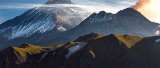
The nature of the republic is diverse and rich: dense forests, high mountains, valleys and rivers. There are a lot of plants and animals listed in the Red Book: brown bear, Barguzin sable, red deer, mountain goat, reindeer and many others (about 40 species).
Travelers will love this amazing region. There's a lot to see here. Next will be a list of 7 natural wonders of Buryatia, a must-see for every self-respecting traveler.
Seventh place – Yukhta area (Zakamensky district). Here you will see an amazing mountain ensemble. This place is located at the confluence of the Dzhida and Yukhta rivers. The rocks resemble a fortress. They acquired such a bizarre shape under the pressure of rain and winds. From the tops of the mountains you can see a beautiful panorama - a valley with steep cliffs. You can admire the views not only from the top of the rocks, but also while crossing the river.
The sixth place is the Alla River gorge (Kurumkansky district). The valley of this river is cut by ancient glaciers. It flows through narrow canyon-like gorges. According to tourists, this is the most beautiful place on the planet. Everyone, without exception, is breathtaking from the incredibly beautiful and majestic panorama and the fast-moving mountain river.
Fifth place is a waterfall in the valley of the Shumilikha River (Severobaikalsky district). It is located 10 kilometers from Lake Baikal. In order to see it, you need to walk along the ecological trail on the southern border of the Barguzinsky Nature Reserve at an altitude of one kilometer above sea level. The waterfall rushes down the bizarre rocks with a powerful roar.
The fourth place is the Garginsky thermal spring (Kurumkansky district). This source has been known since the eighteenth century. It is located in the valley of the Gargi River. The source temperature is from 25 to 75 degrees Celsius. The composition of the water is considered low-mineralized, slightly alkaline with a high content of radon. People with various ailments come here. Water heals diseases of muscles, bones, tendons, gynecological and dermatological diseases.
Third place – Slyudyanskie Lakes (Severobaikalsky district). These lakes are located 25 kilometers from Lake Baikal and are residual lakes of the Bay of Baikal. They got their name because of the mica mined in these places since the seventeenth century. They are surrounded by a pine forest, which creates an unusually beautiful view.
Second place - Mount Under Baabay (Zakamensky district). This mountain is a beautiful mountain range. An unusually picturesque view opens from the top.
The first place is Mount Barkhan-Uula (Kurumkansky district). According to Tibetan legends, Mount Barkhan-Uula is one of the five places where the main spirits live. There is a belief that a person who manages to conquer this mountain will become one with God.
Square
There are several places in the city with a unique history.
Soviet Square
The central square of Ulan-Ude is the Square of Soviets. The historical name is Nagornaya. Located in the very center of the city.
The square is surrounded by administrative buildings, a theater, architectural monuments, and the Radio House.
The monument to Lenin, made in the shape of a head on a pedestal, was included in the Guinness Book of Records.
theatre square
The square is named after the famous chamber singer, theater director, actor, teacher and writer L.L. Linhovoiny. In 1958, he sang from the stage of the Bolshoi Theater of the USSR.
On June 30, 2011, a color and music fountain was opened on Teatralnaya Square. In a single ensemble with the theater building, they form a picturesque composition.
Revolution square
You can get to the square by buses: 120, 28, 12. Minibus: 33, 70, 77, 37, 80.
In Verkhneudinsk the square was called Bazarnaya. Fairs were held, and merchant houses and shops lined the perimeter. The first building of Gostiny Dvor was built there. In 1930, the chapel, which was located in the area of the square, was demolished. At the initiative of the residents, the church was rebuilt in 2003.
During the revolution, rallies were held here. What does the monument to Fallen fighters remind us of?
Athletic facilities
There are several places in the city for sports activities and maintaining physical health:
- Stadium. At the beginning of Kirov Street there is a sports facility for 10,000 people. Sports competitions, concerts, and social events are held here.
- Physical education and sports sports complex 32,000 sq. m. Address: Ryleeva street, building 2. Accommodates:
- pool;
- Sport halls;
- premises for coaches and referees;
- sauna and hammam;
- phyto-barrel for restoring health;
- solarium to strengthen the immune system;
- massage chair for relaxation and recovery after injuries.
- Sports and tourist center. Coast of the Barguzin Bay of Baikal. Comfortable rooms, large terraces, capacity of 65,000 people. Swimming pool, sauna and massage rooms.
The Directorate of Sports Facilities is responsible for the condition of the city's sports infrastructure. It is financed by the government of the republic.
Parks, squares, gardens, boulevards and alleys of the city
To entertain residents and guests of the city, several recreational areas have been built:
- Green Park is located on Zherdeva Street, 104a. There is a Ferris wheel, a town for children, and a designated picnic area.
- The city Park of Culture named after Oreshkov is convenient for long walks. In autumn, the paths are filled with orange-yellow foliage. In winter, the park has a ski track.
- In Ulan-Ude, the memory of 11 Heroes of the Soviet Union was immortalized. The Walk of Fame on Klyuchevskaya Street, 12 is dedicated to veterans of the Patriotic War.
- Nearby on Klyuchevskaya, 23b there is Youth Square.
- You can stroll among the greenery along Karl Marx Boulevard.
Where to stay and eat
The city has many places to eat and relax. Youth clubs, children's inexpensive cafes and establishments. There is a restaurant serving Mongolian cuisine and a cafe with national cuisine of Buryatia.
- Restaurant TEMULEN on Embankment, 14. National style, Mongolian, European cuisine. The average bill is 700-1200 rubles.
- Restaurant Genghis Khan on Karl Marx Boulevard. Check from 1000–1500 rub. Chinese cuisine is available.
There is a large selection of hotels in Ulan-Ude where you can stay and spend time comfortably:
- Hotel Buryatia, Kommunisticheskaya, 47. Room cost from 1500 rubles.
- Hotel Baikal Plaza on Erbanova street, building 12. Room rates from 3,500 rubles.
- Camping, Borsoeva, 56 - 1000 rub.
- Hotel Ulan-Ude Park, Ranzhurova street. 2700 rub.
What to buy as a gift
To remember the trip or as a gift to friends, you can buy souvenirs with any national flavor or religious content:
- inexpensive souvenir keychain “Buryat buuz”, price 120 rubles;
- Mongolian flask made of genuine leather, price 3350 rubles;
- stand “Buryat yurt” at a price of 1350 rubles;
- Buddha figure - 1050 rubles;
- Chinese souvenirs from 120 rub.
In the center on Lenin Street there is a variety of shops and souvenir shops where you can buy gifts for every taste. Souvenirs are sold along tourist routes and near hotels.
The city of Ulan-Ude, which is marked on the map of Russia at the intersection of Russian, Buryat, Mongolian and Chinese cultures, has existed for more than one thousand years. By carefully studying its architecture and the fate of its famous inhabitants, you can learn many interesting facts about this settlement.
Article design: Mila Friedan
Brief historical sketch about the city
The city was founded in the 17th century. In 1666, a winter camp arose at the confluence of Uda and Selenga to collect taxes (tax in kind) from the local population. Ten years later, construction of a well-fortified fort begins here.
In the 1680s, the first caravans with various goods began to pass through the Udinsky fort, heading to China. In the next century, the village actively developed, the first stone buildings and temples appeared in it. In 1783, a city government appeared here with its mayor. In the 19th century, the city turned into a significant commercial, military, and cultural center of the entire Transbaikalia.
In 1934, the city received its modern name (from the Buryat language it can be translated as “Red Uda”). Since 1957, Ulan-Ude has been the capital of the Republic of Buryatia (formerly the Buryat Autonomous Soviet Socialist Republic).
