Many people prefer to spend their holidays abroad or in the south of Russia. But there are places in the north and east of the country that amaze with amazing views. For example, few people know how beautiful and interesting the cities of Kamchatka are. In the summer, you can spend your vacation without leaving the bounds of your vast Motherland. Kamchatka is a wonderful place for lovers of beautiful views and clean air.
The cities and towns of Kamchatka are unique and amazing. They give you the opportunity to enjoy stunning scenery without leaving your home.
Features of Kamchatka
This is a unique peninsula, it is also called the land of volcanoes and bears. Only here you can look up close at an active volcano, swim in a hot spring, and walk on frozen lava. Magnificent views of the mountains and the bay, beautiful landscapes - all this attracts tourists.
If you decide to take a boat trip, you can see various inhabitants of the deep sea, bird colonies, and visit Starichkov Island, where many waterfowl birds nest:
- kittiwake;
- red-faced and Bering cormorant;
- slaty gull;
- Pacific guillemot and spectacled guillemot;
- thin- and thick-billed guillemot;
- an ordinary old man;
- molasses;
- axe.
Attractions
There are dozens of beautiful, interesting places in the region. It will take a year to see everything.
But there are places that are especially popular with tourists:
- Avachinsky volcano;
- Avachinskaya Bay and the Three Brothers rocks;
- Valley of Geysers;
- Volcanic calderas in the Kronotsky Nature Reserve;
- Commander Islands;
- Tolbachik Volcano and Dead Forest;
- Kuril Lake;
- Blue Lakes;
- Acid lakes (Gorely and Maly Semyachik volcanoes);
- Klyuchevskaya Sopka;
- Salmon Museum;
- Kukhtiny Bati;
- Balneological resort (Paratunka village);
- Cruise on the expedition ship "Akademik Shokalsky".
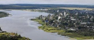
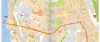
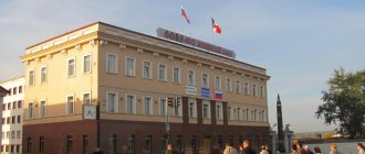
City of Petropavlovsk
Kamchatka has been developed recently, and the first settlement here was a town in Avachinskaya Bay, founded in the 18th century. Now it has become the capital of Kamchatka. The city appeared during the Second Kamchatka Expedition led by Bering and Chirikov. It took place from 1733 to 1743. The city became Petropavlovsk after the name of the first two ships that visited the bay. And from the beginning of the 20th century it received the name Petropavlovsk-Kamchatsky.
Today this city is considered the most important port in the Far East. Countless ships, boats and boats pass through it every day. Many of them offer tourists to go on excursions around the bay. There are magnificent views of the surrounding volcanoes here.
In the city itself you can see interesting sights:
- monument to Bering, the founder of the city;
- memorial complex in honor of the defense of the city in 1854;
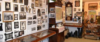
- Kamchatka State United Museum;
- Scientific Museum of the Institute of Volcanology and Seismology;
- unique salmon museum.
The first visit by Russians to the land of Kamchatka
In 1648, Fedot Alekseev Popov, together with Semyon Dezhnev Sea, went to the mouth of Anadyr on Kochs in search of new fishing areas. The ships were caught in a storm and Popov was separated from his companions. When his koch was washed to the ground, he turned out to be the first Russian explorer in Kamchatka. This became known 80 years later, when the Bering expedition rediscovered the passage between Asia and America.
In 1697, the Yakut Cossack Vladimir Vasilyevich Atlasov, together with Luka Morozko, undertook a study of the geography, climate, flora and fauna of the new land.
In 1700, he, already in Yakutsk, wrote down the information collected in detailed “skasks” (stories); At the same time he drew the first map of Kamchatka. A year later, having arrived in the capital, Atlasov presented a report on his campaign to the king. So Kamchatka was annexed to the Russian Empire.
Keys city
Kamchatka is a region where there are no large settlements. Therefore, the village of Klyuchi with a population of about 5 thousand inhabitants is called a city. It is located near the mouth of the Krutenkaya River, at the foot of Klyuchevskaya Sopka. The village of Klyuchi was founded in the place where the large Cossack fort of Nizhnekamchatsk was located. In 1731, it was burned down due to a riot raised by the Kamchadals.
Today, a volcano research station is based in this village, which operates under the leadership of the Institute of Volcanology of the Far Eastern Branch of the Russian Academy of Sciences. The city has regular bus service with Petropavlovsk-Kamchatsky. There is an airfield here, but it is used exclusively for aircraft transporting cargo. During the Soviet Union, passenger aviation also operated. Not far from the village there is the Kura missile test site. It is based in the swamps on the Kamchatka River and has been operating since 1955.
Flora of the peninsula
Features of the flora are associated with the island position of Kamchatka and its harsh winds and frosts:
- Exceptionally tall forbs, mainly grasshopper and cow parsnip. They grow more than 3 m; in such grass you cannot see a person, even if he is riding a horse.
- Elf trees made of cedar and alder are a serious obstacle for pedestrians. The branches of cedar grow downward, pressing the plant to the slopes, so it is better not to lose the path; getting out of the tangle of branches is long and very difficult.
- Forests occupy about 1/3 of Kamchatka's territory. The main species is Erman stone birch. There are more coniferous and mixed forests in the Central Lowland. White Kamchatka birch, larches, and several types of spruce grow here.
Yelizovo city
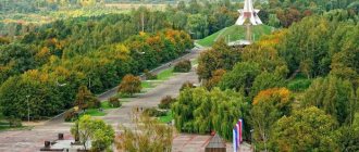
It is here that the famous monument with bears and the inscription: “Russia begins here” is located. Elizovo is considered the most important city in Kamchatka in terms of transport links, especially for air vehicles. Despite its importance, residents of Kamchatka consider this city a transfer point on the way from Petropavlovsk to the main beauties of the peninsula, which are located in remote towns and villages. The lack of popularity among tourists is due to the fact that there are practically no attractions in the city. The only thing that distinguishes Yelizovo from a typical Kamchatka city is the incredible volcanoes that can be seen on the horizon.
Due to the fact that the city is considered an intermediate point, in it and its surroundings you can find many tourist centers, hotels, hotels and hostels, which are always ready to receive a large number of tourists. Comfort in them is at a high level, so both travelers from Russia and Europeans or Japanese, who often visit this area, will be satisfied.
Rivers
Kamchatka on the map of Russia is densely indented by a network of rivers and streams flowing from glaciers in the mountains; The water in them is exceptionally clean and can be drunk without pre-treatment. There are more than 14,000 rivers here, most of them are less than 10 km long. The longest (758 km) is the river. Kamchatka, flowing in the eastern part and flowing into the Pacific Ocean near Ust-Kamchatsk.
In the upper reaches of the river they have a mountainous character, with numerous rapids and waterfalls. High flow speed (up to 4 m/s) due to erosion leads to the formation of holes and gullies at the bottom, the depth of which is much greater than the average (sometimes tens of times). In such places, the current speed is lower, and there are a lot of fish in them, especially under the upper edge.
It is convenient for the fish to rest here, since less energy is spent on overcoming the current. In the middle reaches, the rivers calm down and water content increases. Water flows often form bends around hard rocks. Where the flow speed decreases, extensive shallows, spits, and bars are formed, especially at the mouths. Alluvial material separates the channels, and old rivers are often found.
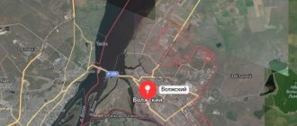
City of Vilyuchinsk
Few people manage to visit this city, because it is a closed settlement. Therefore, the only way to get to know the city is through photographs. Well, those who visited this and other cities of Kamchatka, which are intended for military personnel, will be pleased to remember these places.
Vilyuchinsk consists of three districts, which are divided among themselves:
- Primorsky is the largest; it is the so-called sleeping area.
- Seldevaya is an area where submarine docks are located.
- Rybachy is the area where the submarines themselves are based.
The city got its name from the volcano. Interestingly, Vilyuchinsky volcano is located very far away. Staying within the city limits, you can only see a small tip of this giant.
Animal world
The same geographical and climatic reasons determined the diversity of animals. The fauna of Kamchatka has island features, since communication with the “hard land” is difficult. The narrow, up to 95 km, isthmus in Parapolsky Dol is swampy and often impassable. More than 900 species live in Kamchatka. Here you can find taiga, arctic, and alpine animals.
The Kamchatka variety of brown bear is the most impressive of the Asian subspecies. The weight of record specimens, the measurements of which are documented, reaches 400 kg, and in stories there are monsters weighing 6-7 c.
There are almost no reptiles or amphibians here, only one species of newt and a recently introduced frog (apparently an accidental introduction).
In coastal waters there are several species of small seals, which the local population calls seals.
Eared seals (fur seals, sea lions) on nearby islands gather in huge rookeries for breeding. Small groups of sea otters can be seen. On the east coast, pods of killer whales are often seen coming here to feed. This is the only species included in the Red Book, which is found in almost all cold and temperate seas. Like other marine primates, killer whales have a complex social structure and an extensive “language.”
Commercial fish were occasionally studied back in the 18th century. expeditions of Bering, Krasheninnikov, Steller. Systematic research into salmon, coho salmon, and sockeye salmon as a food resource began in 1925. In the 20th century. Fishing for another 26 species of fish has been developed. Fish production in Kamchatka in 2022 increased to 5 million tons.
Villages of Kamchatka
Going to small settlements, you can see much more of the beauty of this region than in the city. That is why it makes sense to visit the largest villages of the Kamchatka Territory. The first on the list is the village of Vulkanny. It is located in the Elizovsky district. The nearest city of Petropavlovsk-Kamchatsky is only 42 km away. Geographically, it is located between the capital of the region and the city of Vilyuchinsk. The village was founded in 1955, and it served as a military camp. At that time it was called Mirny. From 1992 to 1999, the village was closed to outsiders, but now anyone can get there.
The village of Ossora was founded before the war, in 1937. It is the administrative center of the Koryak district. The name of this village comes from the Koryak language and translated means “house of pink salmon”, i.e. the area in which this fish spawns. Ossora is located in the northeastern part of the peninsula on the shores of Karaginsky Bay. It stretches for 3 km along the coast, and to the west of it is Lake Ossorskoye. The village is interesting because deposits of placer gold were found in nearby rivers.
Palana is another village in the Koryansky district. It is located on the western coast of Kamchatka, and the Sea of Okhotsk is only 7 km away. From Petropavlovsk you will have to travel 940 km, and to the nearest populated area - about 200 km (Tigil village).
The Kamchatka Peninsula and the Kamchatka River itself fascinate with their beauty. It’s difficult to say which city or town you should choose for tourism purposes. Usually the routes cover several settlements, which makes it possible to get to know Kamchatka in its entirety.
Climate and weather on the peninsula by month
The peninsular position, the surrounding seas, and the predominance of mountainous terrain are the cause of Kamchatka's extreme climatic heterogeneity and unstable weather. In summer, cold rain may fall amid the heat. In winter there are snowfalls in which a month's worth of precipitation falls in one day.
Kamchatka on the map of Russia depicting precipitation has the densest shading. No other region of Russia receives as much rain and snow as the foothills of the Eastern Range and the adjacent southeastern coast.
| Climate type | continental (Central Kamchatka Lowland) | monsoon (southeast coast) |
| Max. temperature, degrees Celsius | + 37 (Dolinovka village) | +30 |
| Min. temperature, degrees Celsius | -57 (Milkovo village) | -29 |
| Col. Precipitation, mm/year | 400 | 2500 |
| Wind speed, m/s | 40 | |
| Number of warm days per year (more than +20) | 55 (Kamchatka River basin) | 6 |
Thaws up to +5 are frequent. Spring arrives late and is usually cold and windy, with frequent rain. Along with summer, it lasts 3.5-4.5 months.
Historical places
Bystrinsky Ethnographic Museum
Address: st. Embankment, 14a, village. Esso Opening hours: Wed-Sun 10.00-18.00; Closed: Mon, Tue Phone:
The only museum on the peninsula dedicated to the ethnography of Kamchatka. The museum's goal is to restore and popularize interest in the folk traditions and customs of the Aboriginal people.
The museum's exposition is located both indoors, which is stylized as a Cossack prison, and in the open air. On the territory of the complex there was built a defense tower, an official hut, a Koryak booth - a dwelling similar in shape to the aliens’ “plate”. Visitors will be introduced to the heroes of legends and myths of indigenous peoples. Their sculptures are displayed in the museum courtyard.
Among the museum's exhibits are ancient musical instruments, shamanic drums and much more.
Tourists can try on national clothes and sit in a yurt. The slide film that accompanies the excursion tells about the cultural traditions and way of life of the Aboriginal people. The exhibition features contemporary works by indigenous artists. Creative song and dance groups often perform on the territory of the museum.
Natural Park "Bystrinsky"
Address: Elizovo, st. Zavoiko, 33 Phone: 8 (415-31) 7-24-00 Coordinates: 55°55'20.4″N 158°42'36.0″E
Tourists try to get to the natural park not only to climb one of the hundreds of volcanoes, raft down a mountain river, take a horseback riding tour through fragrant meadows, swim in mountain lakes or bask in thermal springs. This is the only place on the peninsula where the indigenous peoples of the North live, preserving their centuries-old way of life.
In order to get better acquainted with the traditions and culture of the Evens, Koryaks, Itelmens, tourists are invited to the village. Anavgay, where the ethnographic cultural complex “Menedek” operates.
Natural Park "Blue Lakes"
Coordinates: 53° 09′ 46″ N. latitude, 158° 07′ 45″ e. d.
There is a legend that on a clear day all the flowers around the lakes of the natural park turn blue. This effect is achieved due to sunlight reflected from the water.
A 15-kilometer tourist route has been laid to the lakes.
Lakes with the purest water are located at different altitudes, they are connected to each other by mountain streams. They are called Faith, Hope, Love.
Natural Park "Nalychevo"
Address of the tourist center: Yelizovo st. Zavoiko, 33 Phone:
Tourists come to the park to improve their health in one of more than 200 thermal springs. People learned about their healing properties at the beginning of the last century.
There is a legend according to which if you plunge into the spring at the same time as the sun rises, a person will not be in danger of old age.
The park got its name from the Pravaya Nalycheva River. All thermal springs are located in its pool. 7 groups of sources are divided depending on the temperature and chemical composition of the water.
To relax here, you will have to obtain written permission to visit the park and walk more than 50 km.
As a rule, tourists visit the Central Cordon with three healing hot springs and a travertine cauldron. There are tourist parking lots in this place.
Three Brothers Rocks
Coordinates: 52.893201, 158.689107
The symbol of Avacha Bay is shrouded in legends, one of them tells the story of three brothers. The courageous brothers decided to stop the sea, which was very stormy and could wash away people’s homes. They stood side by side in the sea and held the waves for several days. The sea god was angry with the daredevils and turned them into rocks. Even turning into stones, they protected their land from destruction.
The rocks are located 300 m from the shore. There is a small cave at about 10 m depth. Scuba divers found fossils in the area of the rocks, whose age is determined to be 100 million years.
Tolbachik and Dead Forest
Coordinates: 55.831553, 160.325705
The dead forest attracts those who want to see the destructive power of the volcano. The disaster began to rage in 1975. The eruption of the Tolbachik volcano lasted more than a year.
During this time, the hot lava spread over many kilometers, and meter-thick layers of volcanic dust covered almost 40 km2 of all living things. Even today, in the place where the forest once raged, there are only skeletons of trees. Today, however, moss began to emerge through the ashes.
The resulting landscape resembles the lunar surface; it is no coincidence that devices that were planned to be used in Soviet space programs were tested here.
Where to stay for a tourist, hotels, prices
In Petropavlovsk-Kamchatsky, accommodation in a double room in a middle-class hotel will cost a guest 4-6 thousand rubles. per day. There are twice as many hotels in Yelizovo, and prices are on average 20-30% lower (this does not apply to so-called facilities with a limited range of services).
Guests of Kamchatka recommend the following hotels:
- "Avacha";
- "Head of Kamchatka";
- "Bay House";
- "Three skis."
Mini-hotel on Partizanskaya, 31 offers accommodation for 3,000 rubles. At the Brusnika hostel the prices are even lower.
Other relatively cheap options:
- condominium "Russkii Dvor";
- cottage "On Chubarova 4".
A representative of one of the leading tour operators mentioned in an interview that Russian citizens know Antalya better than their own country. And not every one of them will be able to find the Kamchatka Peninsula on the map of Russia. But anyone who came here once will definitely want to return.
Article design: Mila Friedan