Cherdyn is one of the oldest cities in the Urals. Arriving in Cherdyn, it’s like being transported into a time machine into the past. Walking along the local streets, it seems that you find yourself in the 19th or early 20th century. Here, like nowhere else in the Urals, many ancient buildings have been preserved. And in many ways, the way of life.
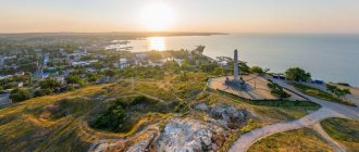
It is also often noted that Cherdyn, like Rome, stands on seven hills. “Ancient Rome lay on seven hills. Old Moscow settled on seven hills. By the same quirk of history, Cherdyn, the oldest city in the Urals, is located on seven hills of the right bank of the Kolva,” writes Professor G.N. Chagin. Each hill has a name: Vyatsky, Trinity, Resurrection, Epiphany, Monastyrsky, Posadsky and Starokladbishchensky.
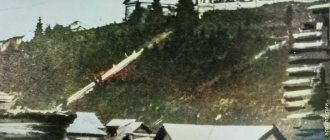
The high coast of Kolva is dissected by deep ravines, which form several high capes. The churches of Cherdyn stand on them.
History of Cherdyn
The first settlement on this site arose in the 8th-9th centuries. In the 10th-15th centuries, on Trinity Hill there was a fortified settlement belonging to the Rodanian culture.
Since the 14th century, Cherdyn became the center of a territory called Perm the Great. But she changed her location several times. It is believed that this is already its third place, and before Cherdyn was in the place of Pyanteg and Pokchi.
Roads beyond the Urals passed through Cherdyn. It had large trade relations with other countries. In exchange for valuable furs, items made of silver were also brought here. This is how the legends about Zakamsky silver were born. The wealth of these places is clearly evidenced by numerous finds of treasures. Some of them can be seen in the Cherdyn Museum.
The exact date of the city's founding is unknown. The first written mention of Cherdyn dates back to 1451 (Vychegda-Vym Chronicle). Then Moscow Prince Vasily II appointed Vereinsky Prince Mikhail Ermolich as governor in Cherdyn. This year is officially considered the birth date of the city.
Fighters for Orthodoxy persuaded the residents of Cherdyn to embrace Christianity. In 1455, this attempt ended in failure for Bishop Pitirim - he was killed by the Voguls.
In 1462, Bishop Jonah founded the St. John the Theologian Monastery in Cherdyn and founded the wooden Church of St. John the Theologian.
In 1472, Perm the Great joined the Moscow state.
In 1505, a Moscow governor was appointed to Cherdyn, after which the population of the city became predominantly Russian.
In 1535, a wooden fortress was built on Trinity Hill. It was reliably protected on three sides by deep ravines, and on the fourth side a ditch and a high earthen rampart 130 meters long were built. The fortress rampart is clearly visible even now, striking in its size. The fortress withstood 11 major attacks by the Tatars and Voguls. In 1535 Cherdyn received official city status.
But in 1595, a shorter Babinovskaya road appeared through Solikamsk. Cherdyn found itself on the sidelines and its importance began to decline.
In 1781, Cherdynsky district was formed, which existed until 1923. Cherdynsky district was the largest in the Perm province, covering a vast territory with an area of 70,790 km2.
In 1783, the coat of arms of the city of Cherdyn was approved. The symbol of the city - the moose - can be seen in the form of an art object on the square in front of the bus station. Nowadays, a brand book for the city with a moose has also been developed.
In 1792 the city was badly damaged by a devastating fire. The fortress, churches, houses burned down. Only 35 buildings remain. Cherdyn merchants participated in the restoration of the city and allocated funds for the construction of new public buildings and churches.
In 1970, Cherdyn was included in the list of 116 historical cities of Russia.
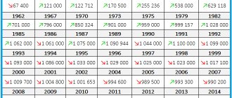
Currently, the city's population is about 4.7 thousand people. This is one of the smallest cities in the country.
Links[edit]
Notes[edit]
- ^ abcde Law No. 416-67
- ^ a b Federal State Statistics Service (2011). “All-Russian Population Census 2010. Volume 1" [All-Russian Population Census 2010, vol. 1]. All-Russian Population Census 2010 [All-Russian Population Census 2010]
. Federal State Statistics Service. - "26. The size of the permanent population of the Russian Federation by municipalities as of January 1, 2022". Federal State Statistics Service. Retrieved January 23, 2022.
- ^ abcde Law No. 1735-355
- "On the Calculation of Time". Official Internet portal of legal information
. June 3, 2011. Retrieved January 19, 2022. - Post office. Information and computing center of OASU RPO. ( Post office
).
Search for postal service objects ( postal Search for objects
) (in Russian) - ↑
Federal State Statistics Service of Russia (May 21, 2004).
“The population of Russia, the constituent entities of the Russian Federation as part of federal districts, urban settlements, settlements, settlements is 3 thousand or more people” [Population of Russia, its federal districts, federal districts, districts Urban settlements, rural settlements - administrative centers and rural settlements with a population of over 3,000] (XLS). All-Russian Population Census 2002
. - “All-Union Population Census of 1989. The current population of union and autonomous republics, autonomous regions and districts, territories, negative phenomena, urban settlements and rural district centers” [All-Union Population Census of 1989: current population of union and autonomous republics, Autonomous regions and districts , territories, regions, districts, urban settlements and villages performing the functions of district administrative centers. All-Union Population Census of 1989 [All-Union Population Census of 1989]
.
Institute of Demography of the National Research University: Higher School of Economics [Institute of Demography of the National Research University: Higher School of Economics]. 1989 - via Demoscope Weekly
. - ↑
Article about Great Perm. Archived September 29, 2006, at the Wayback Machine. - "Article about Cherdyn"
- AM Strinnholm. Svenska folk history by Fran Aldest to Narvarande Taider
, 1835 - ↑
N. M. Karamzin,
History of the Russian State
, 1815. - "Climate normals for Cerdyn'". National Oceanic and Atmospheric Administration. Retrieved January 19, 2013.
Sources [edit]
- Legislative Assembly of the Perm Region. Law No. 416-67 of February 28, 1996 “On the administrative-territorial structure of the Perm Territory,” as amended. Law No. 504-PK of July 9, 2015 “On Amendments to the Law of the Perm Region” On the Administrative-Territorial Structure of the Perm Territory “”. Came into force from the moment of publication. Published: “Zvezda”, No. 38, March 12, 1996 (Legislative Assembly of the Perm Region. Law No. 416-67 of February 28, 1996 “ On the administrative-territorial structure of the Perm Territory”
as amended by Law No. 504-PK of July 9, 2015 “
On Amendments to the Law of the Perm Region “On the Administrative-Territorial Structure ”).
Administrative-territorial structure of the Perm region" . Valid from the date of publication.) - Legislative Assembly of the Perm Region. Law No. 1735-355 of November 10, 2004 “On approval of borders and on granting the status of municipalities of the Cherdynsky district of the Perm Territory,” as amended. Law No. 175-PK of March 7, 2013 “On amendments to certain Laws of the Perm Region, Komi-Permyak Autonomous Okrug on the approval of borders and on granting the status of municipalities of the Perm Territory.” Came into force ten days from the date of official publication. Published: “Bulletin of the Legislative Assembly and Administration of the Perm Region”, No. 12, Part I, December 9, 2004 (Legislative Assembly of the Perm Region. Law No. 1735-355 of November 10, 2004 “ On establishing boundaries and assigning status to municipalities of Cherdynsky region of the Perm region").
As amended by Law No. 175-PK of March 7, 2013 “
On amendments to various laws of the Perm Region, Komi-Permyak Autonomous Okrug on establishing boundaries and granting status to municipalities of the Perm Territory
. Valid from the day that is ten days after the day of official publication.).
Sights of Cherdyn
There are many worthy attractions in Cherdyn. I'll tell you about some of them.
Symbols on the diagram:
1 – Vyatka settlement and grove in honor of the 200th anniversary of the Romanov dynasty. 2 – Trinity settlement with a rampart, Ilinskaya Church, a tower and the “Polyudov trace”. 3 – Chapel of the Image Not Made by Hands 4 – Assumption Church (Museum of Faith), next to the outpost 5 – Resurrection Cathedral and Church of the Transfiguration 6 – Church of the Epiphany 7 – Church of St. John the Evangelist, ancient burials 8 – hospital where Osip Mandelstam was kept 9 – Exhibition Hall Museum of Local Lore named after. A.S. Pushkina 10 – Museum of Local Lore named after. A.S. Pushkina 11 – Bus station in Cherdyn.
Trinity Hill
This is where Cherdyn began. This is the heart of the city, its beginning. Back in the 12th-13th centuries, the Cherdynskoye (Troitskoye) settlement stood on this site. Archaeologists have found shards of pottery and bronze rustling pendants of the Rodanian culture.
Cherdyn with a wooden fortress appeared on the site of the ancient settlement in the 15th year. The earthen rampart is clearly visible here. It amazes with its volume. When you stop nearby, think about how much earth and how much effort it took to pour it by hand in those ancient times!..
Here, built into the shaft, there is a small exhibition reproducing the chain mail of those times, spearheads, figurines of the Permian animal style, and an ancient dish.
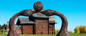
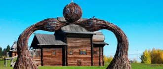
The wooden Church of Elijah the Prophet was built nearby. And on the edge of the hill, one of the towers of the fortress, Spasskaya, is reproduced.
Near it stands an improvised spear with a shield and a huge cobblestone with a huge human footprint carved on it. The trail is reproduced from what is on the top of the mountain Polyudov Kamen (Polyud). “When you stand on this stone, you need to grab the spear shaft with your hand, and follow the footsteps of the hero Polyud with your foot, and then part of his strength will always be with you,” the inscription says.
By the way, Polyud is perfectly visible on the horizon, beyond the Kolva River, resembling a giant frozen wave in shape. It is believed that when enemies approached, a signal fire was lit on Polyud, and Cherdyn was prepared for the appearance of enemies.
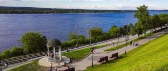
The Kolva River flows below. In the past, it was actively used by merchants as a waterway. On the banks of the river there were merchant barns and warehouses.
Vyatsky Hill
Next to Troitsky, a little to the south, is Vyatsky Hill. There was a Vyatka settlement here. Archaeologists have found the remains of metallurgical production, as well as a treasure with objects of the Permian animal style.
For the 200th anniversary of the Romanov dynasty, a grove was planted on the hill.
Temple of St. John the Evangelist
The oldest stone building in Cherdyn, erected in 1704–1718. It is interesting that the building was built by captured Swedish masons on the orders of the Tobolsk Governor-General, Prince Gagarin, who was passing through Cherdyn.
In 1751, Archimandrite Jonah of the St. John the Theologian Monastery baptized the last pagans of the Vishera region - the Mansi.
Inside the two-story church, an ancient iconostasis made by famous icon painters Dmitry and Grigory Fedorov has been preserved. This is one of three such iconostases that have survived throughout Russia.
Behind the fence, near the walls of the temple, ancient monuments and tombstones of the 19th century have been preserved over the burial places of prominent residents of the city.
Address: st. Mamin-Sibiryaka, 15.
Chapel of the Savior Not Made by Hands (or Chapel of the “Murdered Parents”)
Reminds me of those troubled times when enemies attacked Cherdyn. It stands over the grave of 85 Cherdyns who died in 1547 in a battle with the Nogai Tatars. The names of the victims are listed on the tombstone.
The inscriptions in Old Church Slavonic at the entrance read: “This chapel is consecrated in honor of the Holy Image of Gda Bg and Our Spess Isa Hsa” and “Built in memory of 85 soldiers killed in battle by the Nagai Tatars in 1547, the 6th day of the Genvar.”
The Spasskaya Chapel was lost during Soviet times and restored in 2007. Now it houses the Spasskaya Chapel Museum.
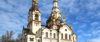
Cathedral of the Resurrection of Christ
It was built in 1750 and consecrated in 1754. Restoration is underway inside. The bell tower of the Resurrection Cathedral serves as the main high-rise dominant of the city. You can go up here and look at Cherdyn from a bird's eye view. The ascent takes place along a spiral metal staircase. In one place on the rail you can see the inscription “Demidova N.T. plant 1877."
Address: st. Mamin-Sibiryaka, 47.
The Resurrection Cathedral forms a single ensemble with the nearby Church of the Transfiguration .
Nearby is the building of the Epiphany Church (1751-1761). It lost its domes, but retained artistic ornaments on the walls. Nowadays there is a bakery here.
The Assumption Church (which now houses the Museum of the History of Faith) and the All Saints Church (1815-1817), which is in the cemetery in the northern part of the city, have also survived to this day
The Museum of the History of Faith in the Assumption Church is located at st. Uspenskaya, 59. Here you can see a collection of icons, church utensils, and learn about the churches of the Cherdyn region.
And in 2010, the chapel of the Archangel Michael, which stood above the pit of Mikhail Romanov, was transported from Nyrob to Cherdyn. There is a memorial stone in it, the inscription on which reads: “To citizens of all classes and ranks, through whose work and care the city of Cherdyn stands. Grateful descendants. 1451-2011". It stands in the park near the Museum of Faith and Outpost.
Cherdyn architectural monuments
Ancient Cherdyn was a city of wooden houses. Numerous fires destroyed almost all the old buildings, so most of the surviving architectural monuments date back to the 18th and 19th centuries, when stone construction began in the city.
House of merchant Remyannikov
- Address: st. Uspenskaya, 55.
The beautiful stone mansion of Semyon Remyannikov is located in the very heart of Cherdyn - on Uspenskaya Street. The two-story building in classical style was built in the 19th century. The house of the merchant family is connected by a stone passage gate to the shop in which Semyon Yegorovich sold shoes.
Before the Revolution, the estate also had outbuildings and a garden, but they were destroyed during the Soviet years. The Bolsheviks dispossessed wealthy owners and nationalized all their property. During the Soviet era, Gosstrakh worked in the architectural monument; today the building houses the registry office and the passport and visa service.
Women's gymnasium
- Address: st. Yurganovskaya, 60.
The building of the former women's gymnasium is easy to find on one of the central streets of the city - Yurganovskaya. The educational institution opened in the 1880s. Initially it was a two-year school, then it was transformed into a four-year gymnasium.
The school accepted girls from different classes. By 1908, the gymnasium already had 8 classes. Graduates worked as teachers in their hometown and other localities. After 1917, education again rose to a higher level, now the gymnasium was reformed into a pedagogical college.
During the Great Patriotic War, an evacuation hospital was located in the two-story building. Afterwards the building was given to a boarding school. Today, the architectural monument houses the exhibition hall of the Local History Museum.
Hospital building
- Address: Prokopyevskaya street.
Another famous architectural monument of the century before last is located on Prokopyevsky Street. The simple two-story hospital building became famous throughout the country thanks to its famous patient, the disgraced poet Osip Mandelstam.
The poet was exiled to Cherdyn for his sharp statements against the Soviet regime and the anti-Stalin epigram “We live...”. The exile morally crushed the writer; one day he could not stand the mental torment and tried to commit suicide by jumping out of a second-floor window. Years later, a plaque appeared on the building in memory of this event.
Water tower
- Address: Yurganovskaya st., 92.
The Cherdyn “water pump” is not just a practical structure, but also a beautiful example of engineering at the end of the 19th century. A huge octagonal tower with three floors was built in 1899 with charitable funds.
The author of the project was the outstanding engineer Alexander Gansberg. Initially, the red brick structure was topped with a wooden turret with a spire, but over time it was dismantled. It is noteworthy that the water supply system in Cherdyn appeared two years earlier than in the main city of the province - Perm.
In 1913, Sergei Prokudin-Gorsky, the most famous photographer of the Russian Empire, took color photographs of the town from the tower. The water tower served for more than a hundred years and only recently went to its well-deserved rest.
On topic: The most interesting places in the Perm region
How to get to Cherdyn?
Cherdyn is located in the north of the Perm region. GPS coordinates of Cherdyn (Trinity Hill): N 60º24.024´; E 56º29.219´.
You can get here by car through Perm, Berezniki, Solikamsk. There are regular buses from Perm to Cherdyn.
The distance from Perm to Cherdyn is 300 kilometers, from Yekaterinburg – 660 kilometers.
© Pavel Raspopov
UraloVed.ru
See also:
Old photos of Cherdyn
Cherdyn in literature
CM. Prokudin-Gorsky. My trip to Cherdyn
The abandoned world of the Cherdyn Mansi
The city of Cherdyn (Perm region) on the map:
Support Uraloved
Climate[edit]
Cherdyn has a subarctic climate ( Köppen climate classification Dfc
) with very cold winters and warm summers. Precipitation is moderate, with slightly more precipitation in summer and autumn than at other times of the year.
| Climate data for Cherdyn | |||||||||||||
| Month | Jan | Feb | Mar | Apr | May | Jun | Jul | Aug | Sep | October | But I | December | Year |
| Daily average °C (°F) | -17,3 (0,9) | -14,2 (6,4) | -6,4 (20,5) | 1,0 (33,8) | 8,0 (46,4) | 14,3 (57,7) | 17,4 (63,3) | 13,7 (56,7) | 7,7 (45,9) | -0,3 (31,5) | -7,4 (18,7) | −13,3 (8,1) | 0,3 (32,5) |
| Average precipitation, mm (inches) | 49,7 (1,96) | 33,8 (1,33) | 35,8 (1,41) | 44,7 (1,76) | 52,8 (2,08) | 66,5 (2,62) | 86,2 (3,39) | 72,9 (2,87) | 69,3 (2,73) | 72,5 (2,85) | 73,0 (2,87) | 59,3 (2,33) | 716,5 (28,2) |
| Average number of days with precipitation (≥ 1.0 mm) | 14,3 | 9,5 | 9.1 | 9,6 | 9.2 | 9,8 | 11.0 | 11.0 | 12.1 | 14,5 | 15.3 | 15.3 | 140,7 |
| Average sunshine hours per month | 38 | 74 | 144 | 195 | 271 | 294 | 289 | 225 | 120 | 51 | 36 | 14 | 1,751 |
| Source: NOAA (1961–1990) [13]. | |||||||||||||
