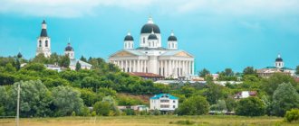
The famous bard Yuri Vizbor wrote a song called “Teberda”. It contains the following lines: “Teberda, Teberda, blue water...”. It is dedicated to the mountain river that flows through Karachay-Cherkessia. On its shore there is a resort town of the same name, and in the surrounding area lies the Teberdinsky Nature Reserve. These places are beautiful at any time of the year. People go to Teberda to relax, get medical treatment and plunge headlong into pristine nature.
These places are beautiful at any time of the year
Where is Teberda located?
Teberda is a resort located in the Karachay urban district of Karachay-Cherkessia. It is named after the Teberda River, because it is located in its valley. The metropolis has grown on the slopes of the Greater Caucasus, 100 km south of the city of Cherkessk. The Military-Sukhumi Road passes through the city.
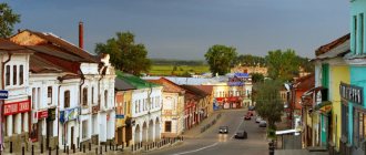
In fact, Teberda consists of 3 separate villages: Lower Teberda, New Teberda, Upper Teberda and the city of Teberda itself. All these villages are very compactly located, smoothly merge into each other, and we can consider that this is one large city, spread out in a valley and touching part of the Caucasus Mountains.
You can get to the region with amazing and healing mountain air by plane. Fly to Mineralnye Vody or Stavropol airport. The flight will take about 2 hours. And from the airport you can get to the city itself by bus or taxi. The distance from Mineralnye Vody is just over 180 km, and from Stavropol 214 km. You can also get there by rail.
It is possible to reach one of the cities by rail: Cherkessk, Mineralnye Vody, Nalchik. From the railway station you can get to Teberda by taxi or minibus.
In Teberda there is a bus station located on Dombayskaya Street, 2, where intercity flights arrive from Moscow, Rostov and other large cities of Russia. Location coordinates of the city of Teberda: latitude: 43°26′44″ N. and longitude: 41°44′41″ E.
How to get to Teberda?
The resort town of Teberda does not have its own airport. To get to the village by plane, you need to purchase a ticket to Mineralnye Vody - the nearest international airport is located here. The distance from the airfield to the city of Teberda is about 180 km. The average travel time by car is about 3 hours. You can get from the airport to your destination by taxi or public transport. An individual transfer service is also available for passengers.
To get to Teberda by train, you need to purchase a ticket to the nearest railway station Nevinnomyssk. The resort town does not have its own train station. The distance from the railway station to Teberda is about 160 km. Public transport runs from Nevinnomyssk to the village: buses and minibuses.
The city of Teberdy has its own bus station, which is located in the building with the U Alla hotel. The distance from the city center to the bus station is 2 km. Near the bus station there is the House-Museum of Krymshamkhalov.
You can get to Teberda by private car. To do this, you need to plan a route through RuDorogi.ru.
Weather in Teberda, best time to travel
Thanks to the Caucasus Mountains, which cover the valley, and the Black Sea, located in the closest proximity, a unique climate has formed in Teberda. Winter in this city is mild. The average air temperature in January (the coldest month) is about -3°C. But summer is not very warm, and one might even say cool; in July and August the average temperature is about +16°C.
Thanks to this climate, clean and healthy mountain air, Teberda is considered the best place to relax in the mountains.
In the city of Teberda there are 90 sunny warm days a year, and only 15 without sun, and 250 days the sunshine is slightly reduced due to cloudiness. There is rarely windy weather in this city. The mountain wind blowing in winter brings only warmth. The average humidity is about 70%. Winter comes from the mountains, and spring from the north.
It is precisely due to the fact that this city has unique warm air all year round that you can come on vacation at any time. For example, in winter you can go mountaineering here, and in summer you can see the sights and treat your health.
Teberda is a mid-mountain and high-mountain region, which is protected from wind and fog by rocky and side ridges. From the Black Sea, which is very close from here, hair dryers and winds bring clean air from the mountains and warm air masses. The closedness of the Teberda valley affects not only the temperature, but also the humidity. The climate is determined by mountainous terrain, fairly low atmospheric pressure, intense solar radiation, slight cloudiness, relatively warm winters and cool summers. The average temperature of the coldest month of winter, January, is -2.3 degrees, in July and August - +15.5 degrees. The duration of sunshine here reaches 2200 hours per year. All these factors include Teberda among the best mountain climatic resorts in the world.Since time immemorial, Teberda has been one of the most important trade routes leading from the Black Sea coast to the steppes of the North Caucasus. The Klukhor Pass, on which the lake of the same name is located, which is the source of the Klukhor River, one of the tributaries of Teberda, is mentioned by the Greek scientist Strabo (1st century BC). Merchants from Dioscuria, and then the Byzantines, who exported the Christian faith to the Alans through the Klukhor Pass, along with goods, used this route in the summer.
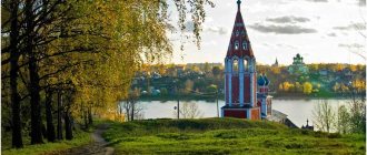
On a spur of a mountain range on the left bank of the river, 18 km from
Karachaevsk, the Sentinsky Church
. It rises above the village of Nizhnyaya Teberda (in Karachay “Synty”). It is characterized by a cross-domed architecture. The temple is a composition in the form of a “pure” cross; the building itself is made of carefully hewn blocks and sandstone slabs on lime mortar. It was perfectly preserved without a single crack. On the walls of the temple there are traces of fresco painting dating back to the 11th century. The length of the building without the apse is equal to its width - 8 m, the height from the floor to the heel of the dome is 10 m. The temple and the mausoleum next to it were built on a platform reinforced with stone masonry and following the contours of a rocky spur. On the approaches to the temple in the middle of the 18th century. A convent was built, but is no longer in operation. Numerous buildings of the monastery are well preserved.
According to historical data, near the village of Upper Teberda there are the ruins of one of the largest cities in Alanya . This city consisted of two fortresses and adjacent settlements. A magnificent caravan route paved with stone slabs divided it into two parts. Along the road there were iron smelters and blacksmith shops. The remains of fortress walls, irrigation structures, and terrace farming have been preserved in fragments.
After the invasion of the Mongol-Tatars and Tamerlane, the Teberda valley was empty. It began to be populated in the 17th century.
came from Greater Karachay. — In the valley of the Dzhamagat River (the right tributary of the Teberda), the village of Dzhamagat arose (in the same place where one of the Alan cities was located several centuries before). This village was famous for its wealth and dashing riders, whose fame spread throughout the Caucasus. Its inhabitants were engaged in livestock farming, sowing barley and wheat, and conducting brisk trade. At the beginning of the 19th century, a plague was brought to the valley from behind Klukhor, which wiped out most of the inhabitants. The epidemic stopped only in 1811, but 19 years later it broke out with renewed vigor. Therefore, the Teberda valley was abandoned by people for several decades. Rumors of a plague epidemic quickly spread in the mountainous regions of the Caucasus. These tragic events are sung in the ancient Karachay song “Emina” (“Plague”). For a long time this area was called “Adam Kyrylgan” - “place of death.” The gardens of Jamagat became wild, the roads and paths became overgrown, and only occasionally did abreks find shelter in the dense, forgotten forests.
Half a century later, new villages began to appear in the Teberda valley. The villages of Jingirik, New Teberda, Lower Teberda, Upper Teberda arose in the second half of the 19th century.
The place where the resort town of Teberda is now located is located in the middle of the Western Caucasus at an altitude of 1300-1350m above sea level and is surrounded on all sides by the Kendelenle, Muhu, Jamagat ridges,
Khatipara, Garaly-Kol…
Scientists and doctors appreciated the healing properties of the mountain air and climate of the Teberda valley, and it began to be developed with the start of construction of
the Military-Sukhumi Road .
In the 80s of the XIX century.
Several lumberjack huts appeared here. After some time, the village became widely known as a holiday and resort place .
Colonel Kuzovlev, head of the Batalpashinsky district, in 1883 was the first to build a dacha on the shore
of Lake Kara-Kol , located in the center of the city. Ten years later, next to Kuzovlev’s dacha, the house of Prince Islam Krymshamkhalov (at the moment, the Krymshamkhalov house-museum is opened on its basis).
Having a natural gift as a poet and artist, he later became a prominent educator of the Karachay people. At the beginning of 1895, Krymshamkhalov created a cultural dairy farm, built a sawmill near Krasnaya Polyana, powered by a water wheel, and the first small hydroelectric power station on the river in these places. The house of Islam Krymshamkhalov became a kind of cultural center of Teberda. It was visited by the leading intelligentsia of Karachay; the famous democratic artist Nikolai Yaroshenko often visited here, capturing the landscapes of Teberda on his canvases. His friend, the Ossetian poet and educator Kosta Khetagurov, also lived with Krymshamkhalov for a long time. The resort town of Teberda today is a center of tourism and climatic and balneological treatment. There are several tourist centers and sanatoriums located here; there are also sanatoriums designed for joint recreation between parents and children, equipped with modern equipment. But the “chief doctor” here is the cleanest air, saturated with ozone.
At the mouths of the Muhu and Jamagat , wide valleys begin, well open to the sun and warmed by it for a long time. These rivers are the left and right tributaries of the Teberda, flowing into it on the territory of the city). In the Dzhamagat Valley there are mineral water springs (Dzhamagat narzans) of excellent taste. In their properties they are close to the Narzans of Kislovodsk and are not inferior to the Makhars . The water in these springs is healing, with a high content of carbon dioxide and iron. From them the trail leads to the Epchik and descends to Duut .
Aksaut through the picturesque Mukhinskaya valley and the pass of the same name (2800 m) . The further path lies to the village of Dombay. It is separated from the Teberda resort by only 23 km, the countdown of which begins behind the barrier of the Teberda Nature Reserve .
of the Devil’s Castle clearly appear against the sky (
Shaitan-Bashi).
On the western spurs of this mountain the Shumka , first it flows along an underground channel, then at an absolute height of 1520m it falls from a 12-meter height with a waterfall, forming clouds of water dust.
The legend of Shumka waterfall
Once in the village of Teberda, a mountain woman named Shumka met a young, handsome guy, Jamal. And at first sight they fell in love with each other. But the girl’s stern father forbade her to be with Jamal, and then, under the cover of darkness, he stole the girl and took her away. They lived in the mountains, Jamal went hunting and Shumka waited patiently for him, but one day the girl’s father tracked down Jamal and threw him off a high cliff. Without waiting for her beloved, Shumka ran in search. Soon, when she climbed the rock from which Jamal was thrown, she saw him below and threw herself off. Since then, in the place where they crashed, two pine trees have grown and grown into each other. Having learned this story, local residents named the waterfall in honor of the girl - “Shumka”.
The road rushes higher and higher into the mountains, and the forest opens up towards you. Suddenly, the road is blocked by the Ullu-Murudzhu , one of the high-water tributaries of Teberda, originating at an altitude of 2800 m in the area of the high-mountain Murudzhinsky lakes .
a legend among the people about the birth of two tributaries of the Teberda, which flow into it just above Muruju.
, echoing the story of Romeo and Juliet:
A long time ago, at a time when the Teberda River was shallow, the young man Khadzhibiy and the girl Baduk fell in love with each other. The young people decided to unite their destinies. But, as often happens, the relatives were against it. Then Khadzhibiy and Baduk fled together to a nearby gorge, but cruel relatives found them there too.
The guy and the girl were separated and locked with strong bolts. But what are the prohibitions for love! Khadzhibiy and Baduk continued to see each other. Having learned about this, the relatives decided to put an end to their love.
The young people were taken to different passes and tied here to huge stones. Baduk cried, not seeing her dear one, she cried so bitterly that her tears formed the Baduk ,
which gave rise to all the Baduk lakes.
Helpless to do anything, Khadzhibiy also cried. From his tears the huge Khadzhibi Lake .
The streams formed by the tears of a young man and a girl have merged, and now they flow to Teberda. That's why this river became so full.
Teberdinsky Reserve
Teberda State Biosphere Reserve, created on January 23, 1936. It occupies the upper part of the river basin. Teberda, in the transition zone between the Central and North-Western Caucasus. A separate section is located in the gorge of the Kizgych River. The total area of the reserve is 85,064 hectares. The area of the protected zone is 36,350 hectares, with a range of altitudes above sea level from 1260 to 4047 meters.
The relief, depending on the geological structure, is not uniform - it is softer in its northern part, where chlorite shales and red-brown sandstones predominate, and sharper in the granite zone, which occupies most of its territory. Here the peaks and ridges of the mountains look like ruins, castles, and fortresses. The gorges in this part of the reserve are narrow with steep walls. There are 100 known glaciers on the territory of the reserve, which make up 10% of the entire territory. The largest of them are located on the Main Caucasus Range: these are the Alibek, Amanauz, Ptysh, Bu-Ulgen, Chotchin, and Khokel glaciers. This section of the ridge (from the top of Dzhalovchat to Klukhor-Bashi) is covered not only with glaciers, but also with eternal snow and stretches for 42.5 kilometers. It represents a continuous huge wall of mountains 3000-4000 meters high, separating the reserve from Abkhazia. Sharp peaks and ridges with steep slopes, devoid of ice and snow, rise above the surface of the glaciers.
The entire territory of the reserve is covered by a network of large and small rivers, and numerous mountain lakes are located in karas (bowls carved into the rocks by a glacier). The rivers are fed mainly by glaciers and snowfields of the Main Caucasus Range. In total, 30 rivers flow through the reserve, and all of them are tributaries of the main river - Teberda. Mountain streams in a number of places form waterfalls of different sizes, the largest of which are Alibeksky, Chuchkhursky, Khutysky. There are more than 130 lakes in the reserve. The lakes are covered with snow and ice most of the year. The largest lake is Goluboe Ullu-Murudzhinskoye, its area is 18 hectares, its depth is 52 meters. The climate in the reserve is mild, moderately humid, with cool summers and relatively warm winters. Microclimatic changes are very characteristic of the reserve: almost every gorge, slope, peak is characterized by its own microclimate.
In a relatively small area of the reserve, 1260 plant species grow, of which 235 are endemic to the Caucasus. Twenty-four plant species are included in the Red Book. The reserve is home to 43 species of mammals and 170 species of birds. Of these, 87 species are nesting. The world of reptiles is interesting, although poor, with only 3 species of lizards and 3 species of snakes. Interest in the reserve is enormous. On the central estate, in the city of Teberda, there is a museum of nature and enclosures with wild animals. For lovers of eco-tourism there are hotels, an eco-center with developed eco-routes. Tourists and excursionists who visit the reserve take with them a supply of vigor and health, and most importantly, great spiritual wealth, which is generously given by perfectly preserved nature.
The attraction of Teberda is Lake Kara-Kel.
Lake Kara-Kel is moraine in origin. This is the remnant of a relict lake, preserved in
depression among moraine ridges. Kara-Kel means “black lake”. It is named so for its color, which is due to the high content of organic substances in the water. This lake also has a peculiar legend, similar to a true story:
One day the shepherd Kara was driving his flock past the lake and was so enchanted by its beauty that he stopped. The old men sitting on the shore of the reservoir told him that a mermaid lives in the lake and she lures anyone who dares to swim across the lake into her underwater world. Kara grinned, adjusted his cloak on his shoulder, and, lashing his horse hard, swam to the opposite shore of the lake. But, having only reached the middle, he disappeared along with his horse into the abyss of water. Since then, the lake has been called after the shepherd Kara.
The age of the lake is about 10,000 years. Once upon a time, a powerful glacier, descending from the watershed ridge, filled almost the entire valley, ending where the Teberda flows into the Kuban. But as the Ice Age ended, the glacier gradually retreated, leaving behind moraine sediments.
The depth of moraine lakes is usually insignificant, ranging from 7-10 meters. The area of Lake Karakol is 2.3 hectares. Its average depth is 2.5, and its maximum is 7 meters. The lake is replenished due to precipitation and springs gushing at its bottom.
Kara-Kel is the warmest of all the lakes in the Teberda Nature Reserve: in July the water temperature reaches +20 0C. The lake is home to deep-sea trout, reaching large sizes of up to 3-5 kg. Catching it, of course, is strictly prohibited.
Turje Lake
Lake Turye, like many others in the Teberda Nature Reserve, is of moraine origin. It is located at an altitude of 3000 m above sea level between the Bilingual and Alibek glaciers. Previously, these glaciers were a single whole. Now they are diverging, and Lake Dzhuguturlukel has appeared at the site of the split. The lake is filled with water flowing from the Bilingual Glacier.
Due to the proximity of glaciers, the lake is covered with ice until mid-summer. When the ice cover does melt, the water remains very cold – 0..+3оС. Thanks to this, the lake water has an unusual bright turquoise color. A snowfield descends from the Bilingual Glacier to the lake, the melting snow of which forms amazing shapes and many streams flowing into the lake. Bright spots of green contrast sharply with the whiteness of the snow.
Often at sunrise or sunset you can see chamois or aurochs near the lake. It was the last representatives of the Caucasian mountain fauna that gave the name to the lake.
Religious buildings of Teberda
In the area of the city of Teberda and in the suburbs there are many beautiful ancient religious buildings.
Sentinsky Temple
Tourists who like to walk around historical architectural monuments will definitely enjoy an excursion to the Sentinsky complex. There is a temple and also a nunnery here. This temple is considered one of the most ancient in all of Russia. It was built by the Alans back in the 10th century. It is located in the mountains near the village of Nizhnyaya Teberda. All buildings of the complex are perfectly preserved.
The temple is made of chalk in a cross-domed style. It was built on the site where in ancient times there was a sacred place of the pagans. The height of the building is more than 10 m; you can still see frescoes from the 11th century on the walls.
Nearby is a women's Orthodox monastery built in the 19th century, but only ruins remain from it; it was destroyed in Soviet times. A little later, reconstruction work was carried out by the monks, but the buildings were not able to return to their original shape.
Shoan Temple
This shrine of Christians was built back in the 10th century and is located in the mountains. The temple was built in the Byzantine style, and today you can read inscriptions in different languages left by your ancestors.
Most of them were made in different eras in different languages. There are also beautiful patterns on the walls here - these are signs of clans who came from the North Caucasus. Alas, very soon it will not be possible to make out these patterns, as the ornament is gradually crumbling.
International Association for Assistance to the Development of the Abaza-Abkhaz Ethnic Group “Alashara”
- society
November 15, 2015
1147
In the North Caucasus, where the spurs of the Greater Caucasus Range begin, one of the most picturesque republics of our country is located - Karachay-Cherkessia. The Dombay glade, from where a grandiose panorama of the peaks of the main Caucasian ridge opens, is located at an altitude of 1630 m above sea level at the confluence of three rivers: Amanauz, Dombay-Ulgen and Alibek. Together they make up one swift Teberda River, which a little lower, about five kilometers downstream, is replenished with the waters of the Gonachkhir River with its tributary Bu-Elgen. Then it will join the Kuban River as a left tributary. The gorges of the rivers of the same name are branched, like the antlers of a deer, and are not similar to one another. There are few places in the world with such diversity and richness of nature. Warm, quiet without sharp temperature fluctuations, sunny weather, crystal clear air, picturesque terrain create excellent conditions for a good rest. Such weather conditions are due to the proximity of the Black Sea coast, which is 60-65 kilometers away in a straight line.
Few people know that the Teberda River gorge is distinguished by an amazing geographical feature that is not inherent in the neighboring gorges, and in general, in all the valleys of the high-mountainous northwestern Caucasus. This peculiarity lies in the amazing transformation of a gorge squeezed by the slopes into a spacious and free high-mountain valley expanding for kilometers in width. Its width directly in the area of the city of Teberda reaches 6 kilometers. This unique landscape feature of the high-mountainous Teberda was not left without the attention of the local autochthonous and aboriginal Abaza tribes, who gave this unique gorge the name Teberda. In the Abkhaz-Abaza dialects the name Teberda (Tybarta, TybgIarta) is translated as “Expansion”, “Spacious”. This gorge from the Amgat tributary miraculously begins to push the mountains wider and wider, and re-closes the mountain slopes at the tributary of the Bolshaya Khatipara River. From the tributary of the Amgat to the Big Khatipara, the gorge stretches for about 20-odd kilometers.
Dwelling on the pages of the history of this picturesque region, it is necessary to highlight the ancient ancient era, the Bronze Age, which includes the earliest archaeological monuments - the Teberda dolmens. The carriers of the dolmen culture, both in this gorge and directly throughout the mountainous Western Caucasus, are the most ancient ancestors of the autochthonous Abkhaz peoples, who are a continuous and indigenous ethnic massif in this mountainous area.
Y. A. Fedorov in his work “On the dolmen culture of the Western Caucasus and its bearers” (Western Moscow State University. History - 1974. - No. 4. - P. 82, 85, 86, 88, 92, 94) wrote that “... in Karachay-Cherkessia, dolmen-shaped tombs are known on the Teberda and Kyafare rivers. Consequently, the proto-Abaza ancestors of the Abaza penetrated into the North Caucasus, in particular into Teberda and Kyafar, already in the 3rd – 2nd millennium BC. e., since dolmens and dolmen-shaped tombs date back to this time.”
Here it is interesting to cite the idea of V.I. Morkovin that the dolmens known on the Teberda and Kyafar rivers could have been left by tribes that penetrated here through the Klukhorsky pass from Abkhazia. “The territory occupied by dolmen-shaped tombs,” he continues, “is close to the lands of the Abazins” (Morkovin V.I. “Dolmen culture and issues of early ethnogenesis of the Abkhaz-Adygs.” – Nalchik. – 1974. – P. 49 – 50)
Archaeologist, Doctor of Historical Sciences E. P. Alekseeva in 1988 about
In the preliminary report on the second trip to the North-West Caucasus in 1897, N.A. Bush mentions a dolmen that stood in Teberda. “This time we lived in Teberdinsky aul for four days, preparing to go on the last trip of this year and studying the life of the Karachais. In addition, we collected plants near the Teberda village and visited the Agur-dorbun cave. Dorbun is a Karachai word and means “cave”, and “agur” is apparently Abkhazian. The Teberdinians told me that this word is Abkhazian (Abaza - A.M.) and also means “cave,” but the Abkhazians of the southern slope did not understand this word when we later asked questions about the caves. The cave is small and does not represent anything special. A little lower there is a small dolmen, which the Karachais attribute to the time when the Abkhazians (Abazas - A.M.) lived here. According to them, it was about 80 years ago.”
Later, archaeological cultures from the central Caucasus (Koban culture) and others began to penetrate here. During the period of the great migration of peoples, the invasion of the Hunnic tribes pushed the Alan tribes of the Ciscaucasia to these gorges. The mixing of the aboriginal population with the alien Alan tribes formed the population of the Western Alan political entity, which built settlements and fortresses here. The location and influence of the Great Silk Road left its mark in the form of rapid economic development of the Western Alan political entity. Later, as a result of the Mongol-Tatar invasion, this gorge was again filled with indigenous peoples, in particular the Abaza tribes. Thus, when the Central Asian commander Timur came to the founding of Elbrus, the gorges of its western foot were designated as the Abaza area.
Persian author Nizam ad-Din Shami in connection with the Tatar-Mongol invasion of the North Caucasus in 1395-1396. it is written: “Timur passed through Mount Elburuz and camped in the area of Abas.” Further, the same source says that “...Timur’s troops entered the Elburuz mountains in the area of Abas.”
L.I. Lavrov claims that Timur’s campaign was carried out into the lands of the Abazas from the North Caucasus, which is quite probable.
This gorge is especially often mentioned in written sources of the 18th-19th centuries. Cartographic material of these centuries also often and in detail indicates the Teberda River and the Teberda Gorge with the local Abaza population. Thus, based on materials from archival sources, we see that Abaza villages were located in this area:
1 - aul of Prince Ali-Mirza Loov, 1831, December. Location: at the sources of the Teberda and Kardanakh rivers. Fate: burned, residents managed to escape.
2 - aul of the nobleman Khokhondukov. 1856, October. Location: r. Teberda. Fate: in December 1857, an order was issued by the commander of the Right Wing troops: “To relocate the Teberda villages from their current places of residence to Zelenchuki under the close supervision of the bailiff and cordon authorities, since they are harming the peace of the Kislovodsk cordon.”
3 - Kombordova village (correctly Kamardova). Location: Teberda River. Fate: resettled.
Also, academician, scientist, traveler P.S. Pallas, in his work on the Caucasus in 1793-1794, reports on the village “Tramkt - on the Teberda River, flowing into the Kuban on the left side, opposite the Shona or Shoana sanctuary.”
It is worth paying special attention that in the 18th and 19th centuries this gorge served as the administrative and spiritual center of the entire Lesser Abaza until the mass expulsion of the Abazas to the Ottoman Empire.
On this issue, I. Blumberg in his work “Historical, topographical, statistical, ethnographic and military description of the Caucasus” wrote: “They (Abazas) profess Islam and have mullahs who settle (sort out) their disputes according to Sharia law. In important cases, they turn to the highest court, called "megke", which usually meets in the gorge of the Teberda river. It consists of a qadi, an effendi and elders - their decision is undeniable.”
Also, according to some sources, the Abaza village of Dzhemat was located in the Teberda Gorge, which was glorified by Lermontov in the poem “Hadji the Abrek”:
The village of Dzhemat is great and rich, He does not pay tribute to anyone; Its wall is handmade damask steel; His mosque is on the battlefield. His free sons are hardened in the fires of war; Their deeds are loud throughout the Caucasus, In distant and foreign peoples, And the Russian heart has never escaped their bullet.
L.I. Lavrov in his essay “The Abazas in the Works of Lermontov” writes that “...There was an aul within the current Karachay Autonomous Region - the Abaza aul Dzhemagat. Its ruins are still shown by the Karachais in the Teberda River basin.”
Also A. Dyachkov-Tarasov in his work “In the Mountains of Big and Small Karachay” writes: “We stopped at the site of this once famous aul, inhabited by abreks from the Abkhaz warlike tribe of Tsebeldins, living on the other side of the mountains and stubbornly resisting until the 1860s Russian. About 40-50 years ago, local legend says, the village was visited by a pestilence and carried away most of the inhabitants. Indeed, beyond the Jemaat, the next day we saw a vast cemetery, fenced off out of feelings of piety by the Karachais; about a mile and a half, we saw heaps of stones, the remains of former saklyas. The fame of Jemaat daredevils has spread far.”
The work of Vasily Potto “The Caucasian War” (p. 1193) describes one episode that took place on September 11, 1828 in relation to the Abaza village, located on Teberda.
“On the night of September 10, a small cavalry detachment of several hundred line and Don Cossacks with two mounted guns set out from Batalpashinsk. At dawn we climbed a high ridge, a spur of the Greater Caucasus, and saw at the very top of it two huge cliffs forming a natural gate - but these gates, to the surprise of everyone, were blocked by a stone wall of such strange masonry that without the help of archeology it was difficult to even determine , to which era its construction belongs.
Kanivalsky ordered the Cossacks to dismount and dismantle part of the wall, if possible, without making noise. The work was indeed carried out so quietly that the Circassian (Abaza - M.A.) picket, sleeping on the other side of the wall, saw the Cossacks only when they were surrounded, and did not even have time to fire a signal shot. The entire detachment, somehow squeezing through the narrow gate, crowded at the edge of the cliff above a terrible abyss, the bottom of which, obscured by fog, could not be seen. Into this abyss, from where only the roar of the raging Teberda could be heard, the detachment began to descend along a barely noticeable, steep and dangerous path. It was still dark; the silence of the night reigned all around; the area seemed uninhabited, and yet the entire Teberda valley was dotted with people who, in a hurry to harvest grain, spent the night in the field. It seemed that fate doomed these people to death and captivity. But the sensitive ears of the mountaineers were promptly touched by a noise similar to the noise of a mountain waterfall - it was the cavalry rushing, and the accustomed ear clearly distinguished among the clatter of horses the knocking and rumble of gun wheels. In an instant, everything that was in the field disappeared into the forest, and the galloping Cossacks captured only the meager belongings abandoned by the people. Apart from these belongings and a small flock of sheep, there was no booty. From two auls of princes Biberdov and Lova, two or three people were killed and eight were captured by the Cossacks. The detachment could not achieve more, since it was necessary to quickly get home before the enemy cut off its path at the pass. Thus, the trophies of the raid were insignificant, but its important result for us was the death of the brave Abaza prince Lov, Dzhembulat’s friend and associate: a Cossack bullet, thrown into the wind, accidentally killed him at the very edge and forever saved the line from his uninvited and frequent visits. “Kesmet!” (fate!) - the mountaineers could say over his grave. Another, even more important consequence of this small and not even entirely successful raid by Kanivalsky was our discovery of the closest route to Karachay. Emanuel took advantage of this path when a month later he led troops to conquer the Karachais.”
Also at the mouth of the Teberda River stood the mausoleum of the Abaza prince Akhmed Bey Kyachev, which, judging by the inscription in Arabic, was erected over the grave in 1750. And in 1829, Bernardazzi copied this mausoleum (“Abazins” - historical and ethnographic essay, 1989, p. 32).
The famous scientist, Professor B.V. Miller, who visited the Caucasus in 1902, noted that the Abaza were evicted from the Teberda Gorge, and also that the former head of the Elbrus district, Colonel Petrusevich, created a project to populate this area.
“In his project of settling the Karachais in the Teberda River valley, which remained free after the deportation of the Medoveev tribe that inhabited it to Turkey (Abaza - M.A.), he is guided by the consideration that in this way the pacification of this area will be achieved and a limit will be put on robberies by entire organized gangs, which the neighboring tribes indulged in" (“From the field of customary law of the Karachais,” B. Miller, 1902)
Thus, the milestones of the Abaza history led to the fact that the people themselves were forced to leave this beautiful gorge, leaving only the name in the Abaza language.
Murat Adzhiev Specially for the site “Country of Abaza”,
Museums of Teberda
Museums in Teberda will tell you a lot of interesting things about the life of this region.
Museum of Islam Krymshamkhalov
Teberda, whose attractions start from Kuzovlev’s dacha, has been offering a visit to the resort since the end of the 19th century. Near this dacha, many decades ago, Prince Islam Krymshamkhalov built a house for his family. This man had a natural gift as a poet and artist; he later became an educator of the Karachay people and an important figure in the cultural history of this region.
Islam was not just an artist and writer, but also a public figure. He defended the interests of his people in various fields. He did a lot of useful things for Karachay, so after his death a museum was created in his house, because even during the prince’s life, celebrities such as the artist Nikolai Yaroshenko and the poet from Ossetia Kosta Khetagurov often visited it.
In recent years, Islam has been working on creating the alphabet of the Karachay-Balkar language, which was published on a Latin basis. In the museum you can see unique documents, photographs, household utensils, drawings and paintings by famous artists: Senin, Anisimova, Grechishkin. The museum is located in the city of Teberda on Dombayskaya Street 3, open all week except Monday from 9.00 to 18.00.
Don't miss the most popular article in the section: Metro Nizhny Novgorod. Diagram, map, description.
Museum of Minerals, Ores, Gems
Since the middle of the last century, they began to collect exhibits for this museum. Initially, it was only supposed to hold an exhibition, but in the end it turned out that there were so many exhibits that it was possible to open a museum. For 20 years, people brought unique exhibits, unusual phenomena in the world of stone.
Here you can see Ural jaspers, crystal, amethysts, chalcedony, opals, various ores, gems and others. The minerals and ores of the Urup copper pyrite deposit are widely represented. There are even rare and unique examples, such as the prismatic variety of calcite crystals. The museum is located in Teberda on Lenin Street 27, open seven days a week from 10.00 to 18.00.
Museum of Nature
Teberda, whose attractions include a nature museum located in the estate of the reserve, has buildings erected according to the design of the famous architect Krachevsky.
In order for guests to better get acquainted with the nature of the reserve, the museum was divided into 4 separate rooms:
- Introductory hall . The tour starts from a relief map on which you can see the entire reserve. The best collection of minerals, butterflies and the giant bison of the Caucasian forests is also collected here.
- Gallery with dioramas . Here you can see stuffed animals: deer, wild boars, roe deer, wolves and others.
- Hall "Forest Belt". But in this room there are stuffed birds, trout caught in the lake, cuts of tree species and a large collection of deer antlers.
- Hall of the “subalpine and alpine zones”. In this room you can see stuffed aurochs, owls, black grouse, snowcock and other birds that live in the Alpine mountains. The entire plant world is shown in the form of drawings.
Explore the surroundings
The Military-Sukhumi Road, which runs through Teberda, is considered a historical landmark. It was once called the “Turkish trail”. It has been known since ancient times. This caravan route was marked on a Venetian map drawn up in the 14th century. It appeared in its modern form at the beginning of the last century, connecting Cherkessk with Sukhum. The name speaks volumes about its purpose. Many temples and forts were built along the road.
In Teberda there is a Museum of Nature, where there is a gallery with dioramas, and the “Forest Belt” and “Alpine Belt” halls. The former house of Prince Islam Krymshamkhalov, built at the beginning of the last century, is considered a historical landmark. It can be identified by its unusual architecture, repeating the image of an Alpine chalet. Since 1931, the Museum of Mountaineering and History of Teberda has been operating in the building.
20 kilometers from the resort, on the outskirts of the village of Nizhnyaya Teberda, an ancient Christian Sentinsky temple dating back to the tenth century has been preserved. Inside, fragments of frescoes are visible on the walls. Nearby there is an equally ancient mausoleum. On the outskirts of Teberda there is a trout farm, which is eagerly visited by tourists. In addition to trout, beluga, sturgeon and sterlet are bred here. The excursion includes a tasting of fish dishes. You can buy the fish you like.
There is a nature museum in Teberda
The Jamagat Narzans are considered a popular attraction in the vicinity of the resort. They are located in the valley of the river of the same name, which is formed by the confluence of two other rivers - Goralykol and Epchik. There are three sources of carbonic-ferrous water, which has a temperature of only +6 degrees. It feels like ice. The trip to Narzan from Teberda takes about seven hours round trip. Along the way you can see the ruins of the ancient Karachay village of Jamagat.
To the west of Teberda are the Azgek lakes. They took refuge high in the mountains, in the upper reaches of the Azgek and Khadzhibey rivers. All lakes are framed by picturesque rocks, and the water has a rich blue color. Some of them are always covered with ice, since they are at high altitudes, where winter reigns all year round. It's easy to get to the nearby lakes. Hikes are organized between May and October. Travel time one way is about 5 hours. The route goes along the gorge where the Mukha River flows.
Shumka River
Hiking to the Shumka waterfall, which is a five-hour walk from the resort, is popular. They are available even for children. Along the way you can see the Devil's Mountain (3300 m) and the Devil's Castle (3150 m), as well as the peaks of Sufrudzhu and Belalakaya, which adorn the Main Caucasus Range. A 12-meter-high waterfall bubbles on the Shumka River. Its location can be easily determined by the strong noise - hence the name. The waterfall is located at an altitude of 1523 meters. The Rock of Love rises nearby.
There are trout in the Baduk lakes
Another hit is the Baduk lakes, where trout are found. The duration of the hike is about 12 hours. The lakes are scattered in a chain along the river of the same name. Their “parent” is the glacier, which, as it retreated, left behind small depressions. They subsequently filled with water. The lakes are located at altitudes from 1930 to 2000 meters. Even in the middle of summer, the water temperature in them does not rise above +10 degrees. Usually the first three lakes are visited.
Monuments in Teberda
Teberda, whose attractions are not only museums and ruins, also invites you to see beautiful monuments that tell about the courage and exploits of the people living in these parts.
Monument to Border Guards
On Lenin Street in Teberda there is a monument to the border guards who died at the beginning of the 20th century in July. There is a memorial plaque on the monument with the inscription: “Eternal glory to the soldiers of the Teberda Red Guard border detachment who died a brave death in the battles for Soviet power.”
Place of death of partisan Dima Yurchenko
This memorial was erected in memory of a 14-year-old partisan who died a heroic death while fighting in the “For the Motherland” partisan detachment. Having been ambushed in a gorge with his squad, this young hero, already severely wounded, remained to cover the retreat of his comrades and at the last moment blew himself up and the Germans surrounding him.
Architectural structures in Teberda
Unique ancient buildings can be considered the sights of the city of Teberda, but few of them have survived in these places. During the Second World War, most of them were destroyed.
Ruins of ancient Alanya
Near Upper Teberda there are still remains of the largest of the cities of ancient Alania.
Here you can still see the terraces that were built in order to grow grain in them; there are remains of irrigation structures and fortress walls. After the invasion of the Mongols and Tamerlane, these lands were empty.
Natural attractions of Teberda
Teberda is famous for its hot springs and ancient natural attractions.
Zoo
It is in Teberda that the central estate of the reserve is located, and there you can see wild animals and visit the local museum. Guides will take guests around the reserve and show the zoo, and also tell many interesting stories related to this place. Teberda Zoo is radically different from many others in Russia.
In it, animals do not live in cages, but roam freely through the hills and meadows of the reserve. Only a bear lives in the cage, which can be dangerous for visitors. The reserve has a very rich flora: more than 1200 plants, 500 species of mushrooms, 750 species of algae in the river.
Farm
This farm breeds trout and other fish species. Here you can learn how to properly breed fish, try any of the types; Caucasian chefs prepare it in front of visitors.
Jamagat Narzan
Excursions to Teberda mineral springs are considered the most popular. The springs flow in the valley of the Goraly-Kol River. The water in them helps to heal from many diseases.
There are two ways to Narzan, but tourists choose the path where the ditch to the valley was previously located and the Jamagat River flows. The springs are located at an altitude of more than 1800 meters above sea level.
Lake Kara-Kel
Just 1 km from the city there is a warm lake with a maximum depth of 7 meters. It occupies a depression between moraine ramparts and is fed by springs gushing from the bottom. In summer, the water in it warms up to +20 °C.
This lake is home to trout that can weigh up to 5 kg. But fishing is prohibited here, since the lake is located in a protected area. Deciduous and coniferous trees grow on the shores of the lake, making it a very picturesque view.
Baduk Lakes
A lake cascade of 3 mountain lakes is located between two mountain ranges. They are located on the Baduk River, between the Khadzhibey and Baduk ridges in the Western Caucasus.
Teberda, Baduk lakes, which are famous throughout Russia.
A little further up the river there are several more lakes, but they are no longer so beautiful and picturesque, so these three lakes are called Lower. These lakes are famous throughout Russia for their picturesqueness and are a natural attraction.
Teberdinsky Reserve
To get a complete picture of the local flora and fauna, you should visit the Teberda Biosphere Reserve, which was founded in 1935. It is considered a cult landmark not only of the republic, but also of Russia. The area of the protected area is more than 85 thousand hectares. On its territory there are such famous resorts as Dombay and Arkhyz. Scientists have painstakingly calculated that 32% of the reserve’s territory is occupied by forests, 20% by meadows, 9% by glaciers, 38% by rocks and 1% by water.
Teberdinsky Reserve
Despite the small percentage of water, there are 157 lakes in the mountains. They are small in size, but very picturesque. The depth of some reservoirs can reach 50 meters! All lakes are located at an altitude of more than 2 thousand meters. They were formed due to the melting of glaciers relatively recently - from 200 to 1000 years ago. By geological standards, this age is considered infantile. Some lakes are difficult to access. Only experienced tourists can climb them.
There are about three dozen streams and rivers throughout the entire area of the reserve. Some have rapids and powerful waterfalls. The largest waterways are the Teberda, Alibek, Amanauz, and Baduk rivers. Water is regularly supplied to them by glaciers, of which there are more than a hundred in the mountains. In winter there is a lot of snow. In the spring it melts, significantly increasing the water level in the rivers. During this period, the waterfalls look most picturesque.
Peony Whitman
There are 1,200 species of vascular plants growing in the valleys and mountain slopes. There are half a thousand species of mushrooms alone. There are also about five hundred species of mosses and three hundred species of lichens. Almost 300 plants are considered endemic, that is, found only here. 26 species of flora are listed in the Red Book.
You will be very lucky if along the way you come across such rarities as the Whitman peony, dwarf euonymus or yew berry. The highest ginseng plantation in Russia is located in the mountains. The healing root began to be grown here in 1959. Particularly valuable plants also include Lipsky's tulip, Kupriyanov's rye and white aspen - a mushroom similar to boletus, but absolutely white.
Zoo in the reserve
You will be even luckier if you see with your own eyes a bison, a peregrine falcon or a butterfly called a swallowtail. These representatives of the fauna are listed in the Red Book. In addition to them, another 29 species are protected. In total, the reserve is home to 46 species of mammals, 220 species of birds and 7 species of reptiles. There is a zoo in Teberda, which displays animals typical of these places.
At the visitor center of the reserve you can get information about the local flora and fauna, as well as take a virtual tour of the protected lands. There are 14 multimedia tours designed for this purpose. Hiking lovers are offered a whole bunch of hiking routes - to the Jamagat Narzans, to the Shumka waterfall, to the Baduk lakes, the Chuchkhur waterfall and others. Those who wish can go horseback riding. There is a souvenir shop. On sale are not only magnets with images of local animals, but also honey, tea, and jam made from fir cones!
Modern objects in Teberda, interesting to visit
Teberda is a small town, but there are places to buy souvenirs and traditional Karachay products.
Friday market
Every Friday there is a market in the city center where you can buy clothes and shoes. But besides this, this is where you can buy natural wool and traditional Karachay products made from natural wool: scarves, capes, socks and Teberda sweaters.
At the Friday market you can buy products such as fresh and dried meat, ayran, local cheeses, medicinal potions and vitamin jams.
Batcha Trading House
A trading house has been built on Lenin Street in Teberda, where you can buy any kind of goods. On the territory of the trading house there is a cafe where you can have a delicious meal and just relax after a long walk through small boutiques. Children will also find something to do here; a modern children's room will not let the mischievous ones get bored.
Interesting places to relax with children
When vacationing with children in Teberda, first of all you should definitely visit the zoo, located on the territory of the reserve. In it, all the animals roam the hills, and only the bear lives in a cage. It was closed so that it would not harm tourists. In Teberda you can show your children outdoor recreation.
There are a lot of beautiful and picturesque places in the city where you can relax with your children and show them how to relax in the lap of nature:
- barbecue;
- bake potatoes in a fire;
- erect a hut;
- go on a short hike with a tent to the river bank, where you can catch fish yourself and then fry it over a fire;
- rent a bike and ride around beautiful places;
- take a camera and try to make a film about the environment and animal life in the reserve.
Such a vacation will make the child forget about gadgets and improve his health, and teach him to survive in extreme conditions.
Queen of the Air
Since ancient times, the Karachais, representatives of one of the Turkic peoples of the North Caucasus, lived in the valley of the Teberda River. In 1868, a village appeared here, founded by the Ozhai Baichorov family, which numbered forty families. The aul was named Baichoralany-Kaabak, where “kabak” translated from Karachay means “village”. Later, representatives of other clans moved here. When the population finally mixed up, it was decided to rename the village Teberda.
At the beginning of the 20th century, the fate of the village changed dramatically. In 1910, a congress of Russian doctors was held, at which it was decided to create a charitable tuberculosis sanatorium in Teberda called “Queen of the Air”. Then they decided to abandon the overly romantic name, and soon the Teberda sanatorium appeared in the village. He quickly gained popularity.
Tuberculosis has been successfully treated in Teberda for a long time
The choice of location for the medical facility was not accidental. Back in the late 19th century, tuberculosis patients came here because the local air had downright healing properties. There is historical evidence of this. For example, Prince Kuzovlev is known, whose wife fell ill with tuberculosis. Treatment in Crimea and on the island of Capri did not produce results. Someone advised her to go to Teberda. And then a miracle happened. The Kuzovlevs built a house in the mountains in a pine forest, where they lived happily for 20 years.
Doctor G.M. became the local medical guru. Grechishkin, who conducted research and scientifically substantiated the healing properties of the Teberedin climate. After this, sanatoriums, tourist centers and recreation centers began to appear like mushrooms after rain. The heyday came in the 30s, when large sanatoriums “Mountain Gorge”, “Dombay”, “Dzhamagat” and “Klukhori” opened. The decline came during the war, when Teberda was occupied by the Germans. The resort was revived in the 50s, and now Teberda is one of the ten best health centers in Russia.
The main healing factor is still clean mountain air. Pine forests saturate it with evaporation of tree resin, which contains turpentine, bromides, and camphor. All these substances have disinfectant properties. In fact, the Teberda air basin is a huge open-air inhalation area. Statistics claim that over the resort’s hundred-year history, none of the sanatorium employees fell ill with tuberculosis, despite constant contact with patients.
Teberda is a great place to relax and improve your health
The discovery of mineral water, which belongs to the carbon dioxide chloride-bicarbonate type, made its contribution to the wellness treasury. Its difference is the increased content of boron, silicon and iron ions. Mineral water is used for baths and oral administration. This reduces the side effects of anti-tuberculosis drugs. Local mud is also used for treatment. These additional opportunities turned Teberda from a climatic resort into a balneological one.
Routes for exploring Teberda on your own
You can start your independent excursion from the Baduk Lakes. You can get to this place from the city center by taxi, it’s only 9 km, and then walk through the dark forest and green granite. Afterwards, you can go on foot to the famous Sentinsky Temple and find out its ancient history, because it has been standing for more than 10 centuries.
Going down the hill to the city along the road you can go to the estate of Prince Krymshamkhalov. It was from this estate that the resort town began to grow.
You can end your walk at a trout farm, where they will not only tell you how several types of fish are bred, but also feed you delicious dishes prepared in front of the tourist.
If you have more than one day, but several, then you should definitely devote time to Dombay and the cable car. Climbing it into the mountains, you can see all the beauty of the snow-capped peaks and taste delicious national cuisine in the holiday house.
“Teberda, Teberda, blue water!” Part 4
previous part 07/11/2021. Day six. “I firmly believe in my method: first you work hard, then you have a great rest.” Brad Pitt
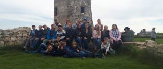
We spent the next two days under the slogan of “beach holiday”. We didn’t go anywhere far, didn’t climb mountains, didn’t get tired, didn’t get wet, didn’t admire. We leisurely relaxed under the gentle Teberda sun, walked around the Central Estate of the reserve, visited the open-air cages, and dived into the cool water of the Third Pond on the Persian Glade. It is called Persian for its bright colors, the same as the patterns on Persian carpets.
Photo 44. The third pond near the Persian glade
We swam noisily and cheerfully on Lake Karakel, located approximately in the middle of the resort town. In the evenings we played board games in the company of Zhenya and her children.
Photo 45. Our house was located next to the first pond, which the swans chose for themselves.
When necessary, we visited local grocery and hardware stores. It can be interesting and useful to rummage through the shelves of some rural stores. As a rule, you will find some unusual thing, a little thing that you won’t see on the shelves of the capital’s shopping centers. Or maybe you just won’t pay attention due to the large abundance of goods. On this trip we purchased a very convenient and correct nut cracker and an unusual, well, very useful “strainer of just the right size”! In the intervals between bathing, Lyuba, Misha and I visited the Museum of Nature, where the exhibition very succinctly, but at the same time intelligently and clearly shows all the high-altitude zones located on the territory of the reserve, presents a variety of birds and animals inhabiting the reserve, and also that interestingly, cuttings of all the main trees growing in these places. The museum is richly decorated with mountain landscapes by the Krasnodar artist P.M. Grechishkin, who worked a lot in Teberda in the sixties.
Photo 46. Teberda River, view from the observation deck of the reserve.
07/12/2021 Day seven
“It’s good that birthdays only come once a year”
This day was no different from the previous one, except that it was warmer and sunny. Everyone except me and Lyuba spent half a day on the shore of Lake Karakel. They sunbathed, swam, played. In the midst of this fun, we briefly joined the rest of the company. Well, this day was also marked as Oleg’s birthday, that is, mine. Most troublesome of all, of course, like all our family holidays, this event cost my Lyubov. Anya, and everyone else, to the best of their ability and ability, helped her in setting up the festive table. Every time I am amazed by what supernatural or magical powers Lyuba manages to create an atmosphere of home comfort in the most unimaginable conditions!
Photo 47. Birthday boy, renewed by the waters of Lake Karakel.
On this trip, I naively assumed that my birthday would pass as usual, without any culinary delights, without a large table, it seems that we even said this. Well, maybe during evening gatherings I would have to consume an extra glass. But while I was receiving countless congratulatory phone calls, WhatsApps and SMS messages throughout the day, Lyubushka was creating, inventing, composing, baking, mixing and decorating! And her assistants conscientiously cleaned, washed and cut. As a result, the table turned out to be no less formal, as if she had done all this in her own kitchen! And perhaps more creative and unusual. Thank you, dear. It was infinitely heartwarming, pleasantly unexpected, and incredibly surprising! And, most importantly, tasty and varied!
Photo 48. Fragment of the festive table.
By evening, all our Teberda relatives, except Aunt Lida, had gathered with us. A festive and family atmosphere reigned at the table. And it was good!
07/13/2021 Day Eight “To get rid of boredom, go to Baduki!”
The eighth day was another highlight of our trip to the Caucasus. It was dedicated to the ascent to the Baduk lakes, located at an altitude of about 2000 meters above sea level, in the valley of the Baduk river, covered on one side by the Baduk ridge, on the other by the Khadzhibey ridge. The lakes are considered one of the main attractions of Karachay-Cherkessia; tourist brochures often contain the lacy phrase: “Baduk Lakes are the emerald eyes of the Caucasus.” However, the beauty of the Baduk Lakes really fully justifies this phrase. Local residents call the cascade of lakes and the area around them much simpler and shorter - Baduki. A well-trodden path to the lakes begins from the suspension bridge over the Teberda River, the turn to which is located at the tenth kilometer of the Teberda-Dombay highway. We left our cars on a vast pebble bank that served as a parking lot and crossed over a swaying but reliable bridge to the bank opposite the highway.
Photo 49. Suspension bridge over Teberda.
Immediately behind the bridge there is the Baduk cordon of the Teberdinsky Nature Reserve, here we once again presented our all-terrain vehicle pass, and those who do not have such a pass pay an environmental fee (300 rubles per person). On this journey we were accompanied by the women, the most beautiful part of the Teberda family, niece Zhenya with her daughter Alisa and Vlad’s daughter Ellie. The first part of the path passed between tall fir and beech trees, slightly embellished with splashes of birch and bird cherry. Despite the sunny, hot weather and quite a climb, it was quite comfortable to walk through the forest. Or maybe we’ve simply already acclimatized and are accustomed to mountain and pedestrian loads.
Photo 50. Fabulous beech-fir forest
About forty minutes later the path led to a recently erected metal bridge over the Khadzhibey River. A little earlier, tourists were crossing along two long logs thrown over a mountain stream. Just above the bridge, two wayward and noisy rivers - Khadzhubey and Baduk - merge into a single channel.
Photo 51. Confluence of the Baduk and Khadzhibey rivers.
We rested a little on the shore and washed ourselves with clean ice water, slightly cooling our hot faces.
Photo 52. It's nice to refresh yourself with ice water!
From the river there was an immediate and serious rise in altitude.
The climb was so steep that when you looked up, your gaze rested not on the back of the person in front, but on his sneakers, or somewhere else, a little higher. The path was a narrow strip of soil, trampled by many feet passing here, with chaotic interweaving of tree roots and stone outcrops of rocks. I had to be very careful about where to take the next step and where to place my foot so as not to trip. Photo 53. What a steep climb!
It's good that it was dry. In the rain, on a wet path, it would be much more difficult to climb. Alisa and Ellie, as experienced guides who had climbed to the lakes more than once, confidently led our column, Misha did not lag behind them. Well, I, creaking and groaning, tried not to lose sight of all these young people. We overtook one group of tourists after another at a good pace. The rest of our company was slightly behind us. While waiting for them, we caught our breath on a small, relatively flat patch of the slope, where among the fir forest there was a resting place for people climbing to the lakes. Or rather, of course, I was resting, and the guys, quickly taking a sip of water from their flasks, began to actively climb onto the trunks and beautiful stones chaotically fallen around. Nearby, on the top of a huge boulder, two large fir trees rose, covering the rock with long strong roots, and behind one another, they reached out to the fertile layer of soil. Local guides call this fantastic group simply: Love. And I would add: “Love of life,” like Jack London’s story. It is necessary to spread out the roots in this way in order to hold the colossus of the trunk and crown on the stone and also in order to feed on the moisture of the earth, located much lower than the stone side of the rock!!!
Photo 54. Love of life or “if you want to live, you won’t get so excited!”
Just above the parking lot, all travelers stop in fascination at the foot of the giant trunk of a gigantic fir. How old could she be? 300-400??? The three of us barely covered half of her trunk with our hands!
Photo 55. Giant fir
And after another five minutes of ascent, the coniferous forest gave way to birch forest, the surrounding area became much lighter and more spacious. A stream babbled merrily along the path. Soon after this, we jumped out onto a stone moraine, under which the Baduk River made its way. Just at the lower edge of this stone dam the bowl of the first Baduk Lake overflows with emerald water. Carefully stepping and jumping from stone to stone, we approached the near shore of the lake through a disorderly pile of boulders. It is small, eighty meters long and only four and a half meters deep. The greenish water is so transparent that you can see right through it from the shore stones. You can see the smallest details at the bottom.
Photo 56. First Baduk Lake.
The path leading to the second lake first wound along the left bank of the first lake, then moved along a bridge to the right bank of the river. From here, following the directions of the markings painted on the mossy boulders, we climbed out onto another scree. The climb from the river went straight up and then turned sharply to the left. Without a marked trail, it would be easy to get lost and go the wrong way.
Photo 57. Stone scree.
Immediately after the scree, the path again dived into a fir forest and after a couple of hundred meters led to the second Baduk Lake. Having seen several large groups of vacationing tourists on the shore, we decided to immediately get to the third lake, and on the way back to look at the second. A short but sharp takeoff began from the second lake, which again took my breath away and added stress to the journey. Fortunately, it ended quickly enough and, having mastered it, we only had to go down to the third lake. The distance between the two lakes is direct, just a little over a hundred meters. Well, along the trail, maybe about three hundred.
Photo 58. Third Baduk Lake.
Along the near shore of the third lake there were almost continuous rubble of large stones and fallen tree trunks, through which it was often necessary to wade through on all fours. Using similar methods of transportation, we moved to the left bank of the lake, since on this side, apparently due to the inconvenient path, there were practically no excursion groups of tourists. While we were struggling along the rocks, somewhere behind us, Antosha, who was the last one, fell behind. As it turned out later, due to an unexpected meeting with a small cute animal, the breed of which we ourselves could not determine. Later, Vlad, who, by the way, is well versed in the local flora and fauna, explained that this is a dormouse, from the genus Dormouse, a rodent a little like a small squirrel, very active at night and rarely visible in broad daylight. Apparently, our team was moving so noisily along the shore that, despite its nocturnal lifestyle, the dormouse came out to inquire about those who were so unceremoniously wandering through its domain.
Photo 59. Curious dormouse.
The third lake is the largest of the entire cascade of Baduk lakes, its dimensions are approximately 330 meters by 200 meters, and its depth is up to 9 meters. They say that this lake is home to trout, but since fishing in protected areas is strictly prohibited, it is actually impossible to verify this statement.
Photo 60. The altitude is about 2000 m, there is still snow in some places.
On the slopes of the left bank there is a white snowfield that has not yet melted and, nevertheless, Alice, and after her Misha, decided on a desperate act - to plunge into the lake! The water temperature is about 7 degrees. And in fact, both of them dived! “To the madness of the brave, we sing a song!”
Photo 61. The desperate flight of a Siberian guy into the scorching waters of a Caucasian lake.
Having wiped our young heroes dry with towels, we arranged a picnic that had already become traditional with tea and sandwiches under the light rain that traditionally began at the same time as the snack. We took a couple of family photos in branded T-shirts on the shore of the lake, and then turned back.
Photo 62. Family portrait in the Baduk interior.
While we were descending to the second lake, the rain intensified, so we did not linger on its shore. They looked with half an eye and hurried down until the paths completely became soggy.
Photo 63. Second Baduk Lake.
Rain. It seemed to me that the third lake, which is the largest, also has the richest emerald color of the water, but it is possible that this impression was formed from the gray, low-running clouds that covered the sun, shading the color of the water surface. We descended to the beginning of today's route quite quickly, the young people again set the pace, but we tried to keep up with them.
Photo 64. First Badukskoe.
On the way back. In six hours of walking, we climbed only six hundred meters in height, walked only six kilometers, but at the same time we overcame steep climbs, rocky ledges, crossed several stone slides, and more than once crossed stormy rivers on and without bridges. Well, the level of pleasure we received and the degree of our admiration for the beauty of mountain landscapes cannot be calculated in any measurement system!
Photo 65. “I remember, I’m climbing, I’m somehow on Baduki!” 07/14/2021 Day Nine
On this day we took a full rest from excursions, wandered around the resort town, looked for postcards with views of Teberda to send to relatives and friends, swam in Lake Karakel. This was greatly facilitated by the firmly established, truly summer, dry and hot weather. In the evening, Antosha treated everyone to lamb shashlik accompanied by red wine and watermelons. The barbecue dinner was held in Aunt Lida’s yard, under a canopy in the barbecue area, built by Vlad’s skillful hands from local scrap materials. The central place in this intimate corner was occupied by a round table in the shape of an old tree stump with a diameter of about a meter and a half.
continued here
Hotels in Teberda
The sights of Teberda are not only temples, monuments, but also medicinal and mineral waters. It is thanks to the healing properties of the water in the springs that more than 30 sanatoriums were built in this city.
There are also several modern hotels:
- Economy Hotel Ozon. Located on Berezovaya street 15. just 500 meters from the city center. A cozy small hotel with a wide range of services and rooms equipped with modern furniture and household appliances. A room will cost 400 rubles per night.
- Camping The same ones . Located on Ordzhonikidze Street, 3 km from the center of Teberda. Rooms with modern interiors, bathrooms, comfortable beds. Free Internet. There is a restaurant on site where you can have a tasty and satisfying meal. A room per night will cost 1,300 rubles.
In addition to numerous recreation centers and hotels, you can also stay in Teberda in the private sector: residents willingly rent out rooms and houses.
Where to eat in Teberda
You can eat tasty and inexpensive food in local restaurants and cafes:
- Restaurant Emilia . Located on Badukskaya street 11. It serves European cuisine. A three-course dinner will cost 500 rubles.
- Coffee house . In the city center there is a cozy coffee shop where you can drink aromatic coffee and taste locally made desserts. Coffee with dessert will cost an average of 200-300 rubles.
Each hotel or sanatorium has its own restaurant or cafe where you can have a delicious meal. You can also visit a trout farm and try fish prepared in several ways.
How to get around Teberda
Teberda, whose attractions are located at a distance from each other, can be explored in a short time using a taxi. Mostly local residents work in taxis and set reasonable prices for their services. There is no metro in this city, but there are minibuses that start operating at 6 am and operate until 24 hours.
Teberda is a cozy small town near the Caucasus Mountains. You can spend your holidays here at any time of the year. In summer you can swim in the warm water of local lakes, see the sights, and go skiing in winter. The local population is hospitable and ready to show guests all the beauty of their region and tell about its history, which dates back more than ten centuries.
Article design: Oleg Lozinsky