The mountains of Pyatigorye are distinguished by their isolation. Pyatigorye cannot be called a single mountain system, since its peaks are located at a distance from each other, however, due to their relatively close location to each other, they are separated into a common area. All the mountains of Pyatigorye are relatively low, so conquering them is not difficult. Moreover, each mountain is interesting in its own way, and some of them have become part of nature reserves. In total, the area has 17 so-called “island mountains”, which are considered natural monuments.
Where are the mountains of Pyatigorye
All mountains can be found in the northern sector of the Caucasian Mineral Waters region. These are resorts of federal significance. They are located in the Stavropol Territory and have the status of a specially protected region. Kavminvody is considered the largest resort region of the Russian Federation.
The enchanting relief of Pyatigorye
This is a unique resort where everyone can undergo treatment procedures using mineral waters. More than a hundred mineral springs are complemented by health and medical services. On the territory of Pyatigorye there is a special economic zone intended for recreational tourism.
Pyatigorye on the map
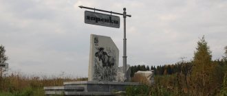
This wonderful mountainous region is home to several settlements. The most famous is Pyatigorsk. It is from here that you can get to Beshtau. Also not far from Zheleznovodsk and Lermontov there are several mountain peaks.
Pyatigorye coordinates:
- 44°06'14" north latitude;
- 43°036'00" east longitude.
Mount Snake
Another landscape natural monument and ancient volcano Kavminvod is Mount Zmeyka. In time immemorial, small volcanoes “branched off” from it, which together form a “snake tail”. As the name suggests, Zmeyka is a fairly long mountain, covering an area of about 20 km². It is the second in area after Mount Beshtau, and its height is 994 m. Nevertheless, the climb to the top of Zmeyka is not too difficult and, if you follow the trail without major stops, it will take about 2-3 hours including the descent.
What is the climate in Pyatigorye
Already in November, residents of surrounding villages and towns welcome winter. Winter here is quite mild, temperatures can drop to -5°C. However, there are also days when the thermometer reaches -20°C. Due to the predominance of easterly winds, sharp squalls are often encountered. The weather remains mostly cloudy throughout the year. In winter there is very little rainfall. Snow cover can reach a height of 10 cm. Ice and fog are not uncommon.
Spring comes to Pyatigorye closer to March. This is facilitated by air currents from South Asia. By spring, the temperature begins to rise rapidly, but jumps towards negative temperature indicators persist. In April there is no more snow, the temperature remains above 5°C. A distinctive feature of Pyatigorye is the sharp decrease in air humidity, which is observed in early May. Severe thunderstorms occur in the same month. May is usually the rainiest month.
The climate of Pyatigorye is beautiful in summer
Summer is approaching June. The temperature rises to 25°C, and westerly winds arrive in Pyatigorye. The remaining amount of precipitation occurs in June, and often the first summer month is even rainier than May. Its peculiarity is regular thunderstorms and hail. Pyatigorye is characterized by hot summers, but it will not become a hindrance for travelers, since it is as easily tolerated as possible.
Autumn also comes on time. In September the temperature gradually begins to drop, reaching 10°C by November. In the autumn, arctic winds begin to make themselves known. Autumn is generally cool and dry, with frosts in early November.
Altitude zones and age of Pyatigorsk
The approximate age of Pyatigorye is 10 million years, which corresponds to the views of many geologists who assert the duration of the processes of formation of laccoliths. Although such information is disputed by geographers, who call the age at 15 million years.
Due to the fact that the peaks in this region do not have high altitudes, they are characterized by subalpine belts, as well as forest ones. Beshtau, which is the highest mountain among others, has become characterized by a relict biogeocenosis with altitudinal zonation.
Area attractions
The region has a huge number of attractions. Each mountain is a natural monument, Beshtau stands out especially clearly, which is considered the main mountain of the Caucasian Mineral Waters. Here you can admire the Eagle Rocks, which are great for climbers of almost any skill level. Even beginners will be able to get used to it quite quickly. The north-eastern slope is fraught with an amazing attraction - the Temple of the Sun. Archaeologists believe that this Temple was built during the Scythian times. A large rocky area with large boulders is all that remains of the temple of this brave people. The place is imbued with an amazing atmosphere; it offers wonderful views of Pyatigorye.
This is what Lermontov's house looks like - one of the main attractions of Pyatigorsk
On Mount Mashuk there is Lake Proval, which has become one of the main natural attractions of the area. One of the philanthropists provided funding for the construction of a tunnel that allows you to reach the underground lake in just a minute. Lake Proval was known back in the 19th century. Travelers from different European countries arrived here, including the famous French explorer F. Gilles, who made an artistic sketch of the Proval. This place is considered holy. Its patron is St. Panteleimon. The entrance to the tunnel leading to the lake is an elaborate portal flanked by small columns and bronze lions.
On Mount Yutsa (also Dzhutsa) you can see Pyatigorsk from a bird's eye view. However, you must purchase a permit. Then it will be possible to visit the cave complex. It still contains traces of the habitation of primitive people.
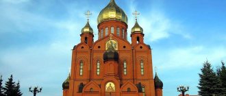
Under no circumstances should you miss the opportunity to look at Lermontov’s house. Much associated with the great Russian poet and writer is a real brand of the area. The house is a small hut, it has absolutely modest life, there is a reception room and a pantry, a small veranda. They say that Lermontov loved to sit by the window and admire the Caucasus Mountains. The house has been preserved in its original form, and Mikhail Lermontov’s personal belongings have been left intact.
What to visit?
The mountains of Pyatigorsk, the names and photos of which are given in this article, are associated by many with youth forums. Promising people who have ambitions gather here, create business projects and make plans for the future.
Mount Mashuk has an elongated shape. Therefore, walking is a difficult activity. You can climb to the peak of the mountain for a fee. This is done thanks to the cable car.
And what beauties the mountains of Pyatigorsk are endowed with! The names “Failure” and “Shameless Baths” are immediately associated with the height of Mashuk. All this is located at the foot. There are real legends about the healing properties of Lake Proval. Next to it there is a place where you can experience the effects of mineral water with a blue tint. This place is called Shameless Baths.
Flora and fauna of Pyatigorye
The flora and fauna of Pyatigorye are very rich. Oaks, beeches, ash trees and hornbeams grow here. You can see yew berries on the rocks. The subalpine zone is replete with colors provided by hawthorn and Caucasian rowan. Entire subalpine glades are open to all travelers and do not require any effort from them to conquer. However, you need to be extremely careful here, because many plants are endemic and are listed in the Red Book. Mushroom pickers can admire champignons, chanterelles and milk mushrooms.
Beautiful flora on Mount Beshtau
Flora and fauna vary depending on the specific mountain:
- Birch bark, wild pear, pedunculate oak, cherry and apple trees grow in the forest near Mount Britaya. Here you can find such treasures of the plant world as reticulated saffron and narrow-leaved peony. There is a health camp near the mountain. On the territory occupied by Dubrovka, you can have picnics without making fires.
- Typical representatives of the flora on the slopes of Byk are ash, maple, pear, and cherry. Barberry, dogwood, and hawthorn grow in the forests.
- On the territory of the Camel slopes you can find reticulated saffron, false iris, rose hips, adonis, and angustifolia peony.
- A walk through the forests of the Zheleznaya peak will bring a lot of pleasure. Trees grow on the mountain that are part of the famous Beshtaugorsky massif. On the slopes of Zheleznaya you can admire fragrant violets, Caucasian belladonnas, inhale the aroma of lindens, and admire mighty oaks.
- On Zmeyka you can see beech forests, ash trees and oaks. In total there are approximately 600 species of different trees and shrubs. The vegetation cover is gradually being restored naturally; currently, mining is not carried out on the territory of the mountain.
- The significance of Mount Baralyk is associated with relict forests. Here you can find such rare plants as Pushkinia, Steven's katran, and bract poppy.
Hiking
It is best to start your walking tour from the side of the city of Lermontov or from Zheleznovodsk. On the way to the peaks you can see picturesque mountain streams skirting the slopes of Beshtau, gigantic oaks, ash trees and beech thickets. It is worth noting that there are no coniferous forests on the slopes.
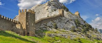
In the southern part is the Second Athos Monastery. This place is definitely worth a visit. The purest springs are also located here. You can try natural mineral water from two sources. They are located on the side of the city of Lermontov.
Mount Beshtau got its name thanks to its five peaks: Shaggy, Two Brothers, Goat Rock, Small and Big Tau. They all form one whole and create a landscape of indescribable beauty.
Minerals of Pyatigorye
Various minerals were previously mined in the region. Despite the decline in production, the area remains important for the mining industry. The wealth of natural resources is due to the presence of laccolith mountains. Their formation lasted several million years and occurred in the Cenozoic. When the magma came into contact with the crystalline shield, red granite, pyrite and amethyst were formed. One of the most common minerals is beshtaunite, which was obtained by combining magma with laccolith rocks. This stone is considered an excellent building material. However, due to regular mining, the local landscape has been destroyed.
Amethyst is one of the local minerals
On the territory of Kavminvod, natural oil and gas are extracted, there are uranium mines, and travertine, which is solidified salt, is also mined.
Features of the relief of Pyatigorye
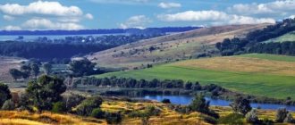
A gently hilly type of relief has become characteristic of Pyatigorye. Some of its peaks, including Mashuk, are characterized by the presence of steep slopes. The main rivers with wide asymmetrical valleys are the Podkumok and Yutsa. Pyatigorye has very interesting geological features, which at the same time contain dangers. The presence of landslides near the above-mentioned rivers directly confirms this statement. Landslides can also be found near the slopes of Mount Mashuk. The cause of landslides is associated with colluvial deposits. As a rule, they are found in the eastern sector of the region; in the center they can be found near the village of Svoboda. The occurrence of landslides is facilitated by the construction of sewer tunnels, which significantly aggravate the situation. Studies by seismologists have shown that the territory has a potential seismic hazard - earthquakes with a magnitude of up to 7 are possible here. In some areas, earthquakes with a magnitude of up to 8 can be reached.
Mount Razvalka or Sleeping Lion
A new day, a new mountain, and again the “magic” symbol from the song “fire-maned lion” stands in your way. The fact is that the second name of Mount Razvalka is “Sleeping Lion”. Indeed, the relief of this majestic mountain resembles the curve of the back of the mighty king of beasts lying down. Razvalka is the third highest mountain in the vicinity of Zheleznovodsk. In height it is second only to Beshtau and Zmeyka. Its height is 926 meters above sea level, and climbing it is very, very difficult. If you decide, be prepared for a long walk, but it’s worth it, because this is where the “permafrost” cave and the “site of an ancient man” are located.
Interesting facts about the Maikop culture of Pyatigorsk
Scientists have proven that representatives of the Maykop culture lived here (3rd millennium BC). Moreover, faience amulets were found that belonged to the ancient Egyptians. The Maykop people used cattle breeding and hoe farming to ensure their livelihoods. Anthropologists suggest that gathering also played an important role for them. Their lifestyle was predominantly sedentary, but they often had to move within a limited area. Mainly Maikop people raised sheep, pigs and horses. All animals were used for food. Grain grinders discovered during excavations show that the tribes focused on agriculture. In addition to grain grinders, hoes were also found. These tools were made from bronze, stone and deer antlers. The Maykop people developed weaving and made spindle whorls from clay. There is an assumption that they also developed trade. This is proven by the discovery of copper products, which became characteristic of the Balkan-Carpathian peoples. Turquoise and lapis lazuli were brought from Iran and Afghanistan.
Vase discovered during excavations in Pyatigorye
The Maykop people built primitive dwellings using rods, boards and posts as building materials. Clay was used to serve as a binding mixture.
The Maykop people used carts, which became typical for all representatives of the Bronze Age. They made wooden wheels and equipped them with massive bushings. Archaeologists have also discovered some rather surprising clay analogues. According to them, people needed a lot of labor to make such products. However, there is no evidence of horsemanship. Thus, carts were used exclusively for transporting various items and products.
Metallurgy became the most developed type of activity, besides agriculture, in Maikop culture. Archaeologists have established that there were many deposits in the North Caucasus in ancient times. The Maykop people were masters in metalworking. They used casting technology, processed arsenic alloys using high-temperature annealing, and inlaid bronze using silver and gold. Tinning and leaching were used for silver plating, and arsenic was used for hooks and weapons.
By modern standards, some representatives of the Maykop people were very rich people. For their burials, they ordered jewelry made of gold and silver. And these were not small coins, but large vases. Thus, as many as 14 vessels decorated with gold details were discovered. Some vessels were decorated with skillful engravings. For example, landscapes with animals were found on one, and a procession on the other. In one of the tombs, archaeologists found figurines of bulls made of silver, many different decorations on which bulls and lions were engraved. A treasure was found in one of the vessels, which contained silver, gold jewelry, and lapis lazuli beads. The Maykop people were also excellent potters, masons, and processed bones. Their funerary monuments and various architectural elements have been preserved.
Pyramids of the world. Part 14: Beshtau, Caucasian Mineral Waters.
In the previous article from “Pyramid of Nakhodka” we unexpectedly came across a strange phenomenon, a ley line at 43 degrees north latitude, running along the entire Eurasian continent from the Pacific Primorye to the Spanish Atlantic coast. On this line there are many ancient objects of interest to us, and we will certainly write about them later in a single combined publication. In the meantime, I drew attention to the seventeen mountains of the North Caucasus plain, the center and highest point of which is Beshtau. They are also located on this ley line. In this article I will try to take a closer look at them. Who knows, maybe in addition to healing mineral springs they are known for something else?
Natural objects of Pyatigorye
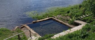
Among the mountains, gorges, caves, rivers and lakes, the mineral waters of Pyatigorye stand out especially clearly. This is a real treasure of the region, providing it with a constant influx of tourists. The temperature of local mineral waters depends on many physical factors. Most waters are hot, some are boiling, but some are cool. Hot springs pass through volcanic rocks and are heated by magma. Warm water is obtained by traveling a longer distance. It is the waters that form cracks and caves, creating unique landscapes.
There are big differences between their compositions. For example, on Mount Mashuk hydrocarbon and sulfide waters originate. The springs acquire important healing properties due to their passage through sea sediments, and in total there are about 50 mineral water springs near Mount Mashuk alone.
Bald
The day of the last rise this week is coming. We propose to conquer another remnant magmatic mountain with the funny name “Bald”. It is located in the eastern part of Pyatigorye, on the right bank of the Podkumok River, on the western outskirts of the village of Lysogorskaya. Bald Mountain has a small height of 739 m, but climbing it can be quite exciting. It will be especially interesting to start from the Mashuk side, because it was in these places that the ancient Silk Road passed more than a thousand years ago, and majestic caravans carried goods from Asia to Europe through the Caucasus ridges. You can climb the mountain from all sides, but the western and northern sides are quite steep, so it is better to choose the southern or eastern one for climbing. Here, comfortable, gentle paths lead up the mountain, so even beginners can conquer the peak. Discover the mountains and your holiday will be great!
What mountains are Pyatigorye formed from?
Beshtau is the highest mountain in the system
Beshtau is a five-domed mountain belonging to the laccoliths. This name is given to mountains that failed to become volcanoes. Beshtau has a height of 1,400 meters, which makes it the highest among the other mountains of Pyatigorsk. It is located in the central region of the region and, thanks to its picturesque surroundings, has become a natural monument of a complex level.
Beshtau is the highest peak of Pyatigorye
The Lermontovskoye deposit, where uranium ore is mined, is located here. But the main wealth remains mineral waters. Hot springs literally attract tourists who want to improve their health. Mineral waters contain substances such as:
- radon
- bicarbonate
- sulfate
- calcium
- sodium
Shaved (Dubrovka)
Dubrovka is also a natural monument of great importance. Its height is 690 meters. Climbing such a mountain is accessible to everyone. The village of Svoboda is located near Brita. The area covered by the protected area is more than 170 hectares. The most amazing part of Brita is its northeastern part, where relict and oak forests grow. Their area occupies almost 140 hectares of territory.
Bull
Mount Bull is of igneous origin and reaches a height of 817 meters. It is distinguished by its dome shape and unusual ridge, which has three peaks. It was they who gave the mountain its name - from a distance it looks like the head of a bull, menacingly putting its horns forward. There is a small forest growing on the mountain.
Camel
Another mountain with an interesting name is located on the territory of the Caucasian Mineral Waters and has a height of 885 meters. The first colonists began to settle here in the 19th century.
Mount Camel also has a rich flora
Among them were Italians and Germans. A characteristic feature of Mount Camel are two humps. Thanks to these peaks, the mountain got its name.
Jutsa First
Mount Jutsa First is famous among all lovers of hang gliding. It reaches almost 1 kilometer in height, and on its slope there is a hang gliding club. Due to its location, shape and height, Jutsa first attracts hang gliders from all over Europe and many Asian countries.
Jutsa Second
Sister Jutsa First is slightly higher - 1,190 meters. It is located in the southern part of Pyatigorye, next to the Dzhinalsky ridge. Not far from Jutsa II is the village of Etoka. The Black Mountains (Black Forest) are also located nearby. What the name of the mountain itself means is currently unknown. Locals often call it Yutsa. There is another name that may seem funny - Mount Blockhead. In common parlance, both Juts are called Bugs. Jutsa Second is distinguished by its shape resembling a cone. It extends towards the northeast. In many ways, the nature of the mountain is unique. Many rare plants grow here. There are many coniferous shrubs and petrophytes.
Iron
Mount Zheleznaya has a height of 853 meters. It offers a beautiful view from the train station. Zheleznovodsk is located next to Zheleznaya. A wonderful resort has been set up here, on the territory of which there are as many as 23 mineral springs. However, you can only use 16.
Snake
In the Turkic language the name of the mountain sounds like “Zhlan-tau”. The mountain has a height of 994 meters. Its territory is 20 square kilometers. The Kavminvod railway station is approximately 4 kilometers away. Previously, minerals needed for construction were mined here.
Mount Snake enchants with its beauty
In this regard, on the southern and northern slopes there is a large quarry, the height of which reaches almost 500 meters. However, this does not detract from the beauty of the natural world.
Golden Kurgan
With an altitude of 884 m, the Golden Mound boasts picturesque meadows that surround it on all sides. The mountain received this name due to the legend of the golden tent that belonged to Emir Timur. Of course, it is unlikely that Timur could have had such luxury, but the legend remained, which is why the name of this natural monument of the Stavropol Territory sounds so loud and beautiful. Springs and mineral waters flow directly from the cracks on the southern slope of the Golden Mound. Also on the territory of this mountain there is a source of slightly mineralized water containing hydrogen sulfide.
Kabanka
The boar is often called Dumb. It is located about one and a half kilometers from Zheleznovodsk, if you head southwest. Mount Ostraya is located nearby. Kabanka reaches a height of 767 m, is picturesque and stretches to the northeast. The mountain got its name due to its resemblance to a wild boar. If you look at it from the side, Mount Tupaia will resemble exactly this animal. Interest in the mountain is high among archaeologists, which is explained by the presence of ancient remains that have been preserved since the 4th century BC. However, archaeologists do not provide precise information about what kind of civilization lived in these places.
Dagger
Mount Dagger once reached 506 m in height, but now little remains of it. The absolute height is 335 m. Evidence has been preserved that indicates that Mount Dagger was one of the most beautiful among the peaks of Pyatigorye. The need to extract building stone led to the destruction of almost 50% of the mountain. Meanwhile, there are still deposits of semi-precious amethyst stone on the mountain. It is also of great interest for the extraction of calcite and quartz. Despite its purely industrial significance, Dagger is still a natural monument and is under enhanced protection.
Kokurtly
The height of Kokurtly is 406 m. The mountain is located in the northern part of Pyatigorye. The village of Kangli is located next to it. Cocurtla is home to endemic plants such as eastern cornflower, spiderwort, and medicinal plants. The mountain itself seems small even up close. It has a flattened shape and is more like a hill.
Bald (Baralyk)
Baralyk reaches a height of 739 m. It is located in the east of Pyatigorye and resembles a massive dome. The mountain is famous for its mineral springs. Their waters contain boric acid, selenium, hydrogen sulfide, and nitrogen. Temperatures can reach 67°C. Mineral springs are considered a significant reserve for local resorts.
Mashuk
Mount Mashuk takes its name from the legend of the girl Mashuko. However, there is a version that is associated with the presence of two words in the Kabardian language. The first means "millet" and the second means "valley". There is also a version about the Persian origin of the name. According to her, this name comes from the word “mashuke”. That is, “beloved.” Currently, the mountain is one of the most valuable objects in the region, as it has rich mineral resources, flora and fauna. It grows about a hundred species of herbs that can be used in medicine.
There is beautiful flora on Mount Mashuk
There is also Lake Proval, which got its name due to the shape of the well. There are many environmental problems that are associated with construction, as well as the sale of land. The attractiveness of the place contributes to the influx of people wishing to purchase land here for the construction of cottages. However, current departments closely monitor the activities of developers, in particular controlling deforestation.
Honey
Mount Medovaya is another remnant igneous mountain. Its highest point reaches 725 m. The mountain is located near the outskirts of Zheleznovodsk (southwest). The shape of the protrusion makes it stand out on the ground. The yellowish tint of the rocks confirms the interesting name. The surface of Medovaya is similar to a honeycomb. In the last century, building stone was also mined here. However, the nature is well preserved, and thanks to this, local residents can admire the broad-leaved forests. Medovaya is considered one of the most popular mountains in Pyatigorye thanks to the residents of Zheleznovodsk, who love to visit it for recreation.
Razvalka
Mount Razvalka, 926 m high, is located near Zheleznovodsk. It is characterized by a steep ridge 1 km long. Its southern part rises above the northern and looks like a lion's head. That’s why the locals used to call the mountain the Sleeping Lion. Now a new name has taken root, which is associated with numerous cracks breaking the ridge, which creates a feeling of lack of integrity of the peak. The northern slope of Razvalka became the source of the Grafsky spring. Cold fresh water runs from here. It is used to supply the city with water.
Mangy
The list is completed by a mountain with a very original name and excellent beauty. Its height is 874 meters. If you look at Sheludivaya from the side of Monastyrskoe Lake, which is located in close proximity to it, you can feel like a character in a fantasy work. Mount Beshtau is also located nearby. Literally 70 years ago, Sheludivaya looked like a pyramid, but the extraction of building stone changed the shape of the mountain.
View of Sheludivaya - the most beautiful mountain in the region
Pyatigorye is an amazing region that can delight a traveler who prefers outdoor recreation. The region's cities offer many interesting attractions, opportunities to improve your health and gain new experiences. Pyatigorye keeps the secrets of ancient times, and for some local residents it is considered sacred land.
Bull Mountain
Next up is the first symbol of the “golden city” – the “blue ox” or the well-known Bull Mountain. This remnant magmatic mountain, 817 m high, is located in the north-west of Pyatigorye, half a kilometer east of the Bykogorki village. It is recognized as a landscape natural monument, and previously there was a mine where uranium ore was developed. The mountain consists of three hills, from the side they really resemble a bull bowing its head. The climb to the top is smooth, without technically difficult sections and, together with the walk, will take several hours, but the views will certainly delight you.