The Eagle Shelf is a large rock ledge in the Guam Gorge at an altitude of about 300 meters above the village. Mezmay and the bed of the Kurdzhips River. The surprisingly regular shape resembles a shelf - hence the name.
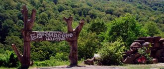
The Guam Gorge is located in the Apsheronsky district of the Krasnodar Territory, between the Guamka farm and the village of Mezmay. A trip to the Eagle Shelf with a visit to all the observation platforms nearby fits within one day.
Route to the Eagle Shelf
A couple of turns short of the asphalt road leading to Mezmay, we chose a suitable clearing for parking, refreshed ourselves and set off along the path leading towards the forest. Parking coordinates 44.210419 39.966395 Nowadays there is no longer any possibility of driving off the road to the side of the road (bump stops have been installed), so drivers park along the edge of the road.
First we walk through the fresh morning forest.
Autumn has just begun in these parts, so the echoes of summer in the form of forest blackberries, blooming mouse peas, still green leaves and the warm sun still managed to please us.
The mountain along which the route passes is called Mount Lenin. They say that if you look at it from below from Mezmay, you can see the profile of Vladimir Ilyich himself.
There is a choice on the route: you can climb the path higher, to the observation deck above the gorge, or go straight to the Eagle Shelf (we will look at a detailed map of trails and attractions later in the article).
We decided to visit the upper observation deck first. Having climbed the path as high as possible, we move along its continuation towards Guamka. From time to time you come across cool viewing platforms near the cliff; you can choose any one for a picnic with a gorgeous view.
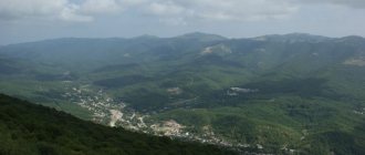
Usually, the end point is considered to be the lookout with the pine tree above the Eagle Shelf. From here you have a special view of the rocks and gorge. The trail goes further to a lookout called “Pyramid”, but today we are not going there.
Photos of the Eagle Shelf at different times of the year
One of the most popular observation points, from which you can clearly see the Guam Gorge, is located directly above the Eagle Shelf.
From here you can see the “shelf” itself and see tourists walking along it, the size of ants.
By the way, everything in the name of this rocky ledge is true - huge eagles soar in the air, their nests are located here.
In winter, the Eagle Shelf is even more attractive to avid hikers who are not afraid to walk several kilometers through deep, lush snow to watch the winter sunset on the edge of the cliff.
The Legend of Prometheus
The locals have a kind of legend that the titan Prometheus, who gave people fire and thereby angered Zeus, was chained precisely to these rocks. Every day an eagle flew to him and pecked his liver as punishment for his unauthorized act. Hence the name of the rocks - Eagle Rocks. Since Prometheus was immortal, his body was restored, and this torture was endless.
No one dared to help the titan except the beautiful Agura. She gave him water to drink and washed his wounds, thereby easing his suffering. Upon learning of this, Zeus became enraged and threw Agura off the cliff - this is how the river of the same name and waterfalls were formed.
© Uka2000 at commons.wikimedia.org
Eagles on the Eagle Shelf
To fully expand on the topic of eagles, here are a few more photos from the Eagle Shelf in December
After admiring the views of this tempting place for photo sessions from above, we return back and descend the mountain in a straight line down to a fairly wide dirt road.
There is a clearing here where jeepers and other friends sometimes stop and may come here. It is from this clearing that we enter the path that leads to the shelf itself. Next, about 1.5 km of road awaits us, and we are at our goal!
The views, of course, are unreal
The ledge in the rock itself is quite wide - you can walk and look “around the bend”, hide from the rain under the arch of rocks, brew and drink delicious herbal tea, as we did.
Despite all the gatherings and measured steps, there was still time before dark, and instead of waiting for the sunset on the shelf, an offer was made to take a ride to the thermal springs.
The thermal spring that awaited us was not a “pop” one.
We drove from Mezmay to the area of the Nizhegorodskaya village, and saw a cluster of parked cars along the highway. In a small forest nearby there is a “lake” of thermal water - a wild thermal spring (no longer exists). Water comes out of the ground. An unusual place, although not particularly attractive. And it was free (it was), unlike the pretentious thermal pools at the tourist centers nearby. But, unfortunately, at present this wild thermal spring has also been reclaimed, surrounded by a fence and a cash register installed. Now it is called “thermal spring H2O”. However, you can still have a wonderful time in the thermal pool.
Hiking in the Western Caucasus with MountainDreams.ru
The village of Mezmay is located in the Apsheronsky district of the Krasnodar Territory on the northern slope of the Main Caucasus Range at an altitude of 670 meters above sea level. Mezmay is located in a picturesque mountain basin at the confluence of the Kurdzhips and Mezmay rivers. The modern name Mezmay was formed from two Adyghe words - Maz (forest) and Mye (wild apple), which generally translates as “forest of wild apples.”
The lands on which the village lies have a rich history. Several million years ago, after the Ice Age, a huge lake of great depth was located in this area. Located between the Guam and Lagonaki ranges. It was there that the Kurdzhips River flowed. In the vicinity of the village there are historical monuments dating back to the most ancient periods of human development. In the 1990s, a perfectly preserved Neanderthal skeleton was found in one of the caves in the vicinity of Mezmay. For a long time, Circassian tribes lived here, which were replaced by Russian settlers in the second half of the 19th century.
Mezmay is a real mountain village, separated from the surrounding world by three ridges: Azish, Guam and Lagonaki. The former village of lumberjacks and a remote “bear corner” have today become very popular among tourists. This is an ideal place for those who want to forget about the bustle of the city, but at the same time not get too far away from civilization - in Mezmay there are many hotels, guest houses and campsites where you can stay overnight and during the day take walks around the local natural attractions, which there really is a lot here. Another advantage of the infrastructure is that literally in 2016 a good asphalt road was built to the village from the village of Nizhny Novgorod.
Of course, you can travel around Mezmay all year round. However, it becomes especially attractive in winter - after all, most people are often not ready to spend the night in tents in the forest on cold winter nights, but at the same time they have a strong desire to take a walk in nature and breathe in the fresh frosty air. Mezmay is ideal for a winter holiday. In winter, life in the village does not stop. Numerous hotels are open, and the private sector is always ready.
A trip to winter Mezmay is a great opportunity to appreciate all the delights of winter trekking and traveling in nature without much extreme sports and hardships:) The surroundings of Mezmay are especially beautiful immediately after a fresh snowfall. What you can do at this time of year: take one-day walks to the famous rock shelf “Eagle Rock”, to the University Falls, Isichenko Cave, to the Guam Gorge, to the Kurdzhips Canyon, to the Moon Falls in Alabaster Balka, to the Monakhova Cave and the waterfall - the list can be continued for a very long time. There is no way to get around all these attractions in one day, even with good physical fitness. Therefore, if you want to get a feel for this place, then it’s worth coming here for a few days.
Below are descriptions of walks to the most popular natural attractions of the village of Mezmay, which you can take in the company of experienced guides and guides.
Eagle Rocks are a kind of calling card of Mezmay. These rocks border the Mezmay valley on the northern side and glow dazzlingly in the sun in the morning and evening hours. There are several points on the Eagle Rocks from which amazing panoramas of the forest foothills of the Kurdzhips valley open up. Among the most interesting, it is worth noting the observation platforms “Sosna” and “Pyramid”. However, the most famous attraction of the Eagle Rocks is the so-called “Eagle Shelf”.
The Eagle Shelf natural monument is located in the Eagle Rocks rock mass at an altitude of about 1000 meters above sea level and is a long ledge in the rock, up to 5 meters deep and up to 3 meters high with an overhanging canopy. The height of the rock walls under the shelf in some places reaches 70 meters. The rocks are called “Eagles” because several families of large birds of prey (bearded vultures, vultures) that live above the shelf nest in them. Tourists inexperienced in ornithology usually call them simply eagles. Birds can be observed almost always while visiting the rocks.
The route starts from the center of the village of Mezmay. We walk 300 meters towards the Guam Gorge, where a country path goes up from the railway track to the right and up. The trail enters the forest and quickly approaches a steep section of the slope with small rock outcrops, through which the trail goes serpentine upward and gradually comes out to the edge of a clearing called Lysaya. There are several logs in the clearing where you can rest and take a break. The clearing offers a good view of the village and nearby forests. Further from the clearing our path goes upward, and very soon the path comes out onto an old portage. At the portage you should turn left, towards the shelf. Gradually the portage turns into a path. Then the trail goes through the forest and leads to rock walls. From here the trail goes along the rocks (height from 5 to 250 meters) directly to the shelf itself - the goal of our journey.
From the shelf there is a beautiful view of the Lago-Naki highlands, the Azish-Tau ridge, in good weather you can see the Main Caucasian ridge, the village of Mezmay, Mount Zauda, Ivanovo Polyany, Mount Mezmay. Below, under the shelves, two clearings are clearly visible - Romashkovaya, where daisies bloom profusely in June, and Lunnaya, where an imitation of a lunar landscape is created by several stones weighing several tons, chaotically scattered throughout the clearing. You can go back down the same way we came up.
The length of the route in both directions is 6 km. The route takes about 4-5 hours in both directions. The total elevation gain/loss is 300 m. There is no water on the route, you must take it with you.
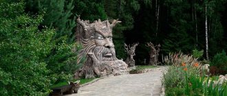
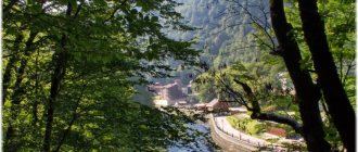
The Guam Gorge is an amazing geological and botanical natural monument and open-air museum. The Kurdzhips River cut a grandiose canyon through the limestones, about 3 kilometers long. Its rocky sides, which in some places are about 400 meters high, are overgrown with boxwood, yew, fir, beech, hornbeam, dogwood, juniper and other plants. The gorge is accessible at all times of the year. The gorge is remarkably beautiful in winter, when the waterfalls freeze and ice stalactites of incredible size and shape hang from the walls of the gorge. The narrow-gauge railway track gives the gorge a special uniqueness and romanticism. The railway from Mezmay to Guamka was built in 1928-1932. mainly by prisoners and was used for timber removal. Due to melt water, landslides, mudflows, the railway track often fails. From the side of the village of Guamka, several years ago, a section of the roadway with a length of about 2 km was restored for tourist and excursion purposes. Now an excursion train runs along this section, and the passage for pedestrians is closed while the train is operating.
The route to the Guam Gorge starts from the center of the village of Mezmay and runs along the narrow-gauge railway along its entire length. This is the main landmark. It starts from the center of the village and runs along the left bank of the Kurdzhips River to the village of Guamka. From the village of Mezmay to the beginning of the gorge, the walk is about 5 km. The excursion route directly along the gorge is about 1.5 km long in one direction and ends approximately in the middle of the canyon. Now there is a cafe here and a railway platform has been built, from which you can travel by train to the village of Guamka. A leisurely excursion to the Guam Gorge from Mezmay with photography takes almost the whole day. You should return back to Mezmay the same way.
The Guam Gorge is incredibly beautiful - water has been flowing through it for several thousand years. After the Ice Age, on the site of a large karst sinkhole in the Northwestern Caucasus, that is, in the place where the village of Mezmay is now located, there was a mountain lake. Water from the lake flowed to the plain between the Lagonaki and Guam ridges. In those days, the limestones were relatively soft, non-dolomitized, due to which they were well eroded by water. This is how the Guam Gorge was formed over several thousand years. The walls of the gorge are composed mainly of dolomitized limestones of different shades, about 100 million years old.
The length of the route in both directions is about 12 km. The route takes about 5-6 hours in both directions. The total elevation gain/loss is 300 m. There is water on the route.
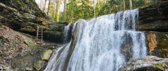
Lunar waterfalls are located in the Alabastrova gully - the left tributary of the river. Kurjips. It was named so because geologists discovered deposits of alabaster here. Along its banks, if you try, you can find traces of selenite (moon stone), a type of gypsum. The waterfalls are interesting because in good times one of them can be seen from the village itself.
The route to the waterfalls begins at the road bridge over the river. Kurdzhips on the southern outskirts of the village of Mezmay. The road crosses the bridge and bifurcates: the left branch leads to Lagonaki and Ivanova Polyana, and the right branch leads to Zavadova Polyana, to the Alabastrovaya Beam and further to the Mezmay-Kamen observation deck. When the road crosses the Alebstrovaya Balka on a bridge made of pipes, you should turn left and follow the orographically left bank of the river along the path to the waterfalls. Previously, it was easy to get to the waterfalls along the river bed, but due to the floods of recent years, it has been severely destroyed and is not very suitable for movement. After about 30 minutes, the trail leads to the foot of the first waterfall on the orographically left tributary of the river. Alabasterova. The waterfall is impressive with its power even in the dry season, and after the rains it rumbles so much that it is impossible to talk. After examining the waterfall, we move along the rocky scree to the main channel, climb over it and climb up. Here is an even more impressive waterfall cascade. It should be noted that the path to the upper cascade of waterfalls is quite difficult; they should be visited only in the dry season. We return back the same way.
The length of the route in both directions is about 6 km. The route takes about 3-4 hours in both directions. The total elevation gain/loss is 300 m. There is water on the route.
In the Kurdzhip Gorge, in that part of it that adjoins the village from the south, a whole scattering of interesting natural attractions has been collected. This is the famous Shestimetrovka, and the Isichenko waterfall, flowing from the cave of the same name, and the Sosna observation point, and the Palmovye waterfalls, and even the Palmovaya gully itself in the estuary part.
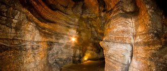
The route to the Kurdzhip Gorge starts from the road bridge over the river. Kurdzhips on the southern outskirts of the village of Mezmay. From the bridge you need to go down to the left along the path to the river. Further, the trail continues along the orographically right bank of the Kurdzhips. Near the bridge there is a “Silver” spring lined with stones at the edge of the river (it contains a very high content of silver ions). About 100 meters after the spring, the trail leads us to a small waterfall with a swimming pool called “Six Meter”, since its maximum depth is about 6 meters. From Shestimetrovka the path leads up into the thickets of boxwood, the age of which, individual plants reaches 2000 years. The trail is well paved along the entire length of the route. After a 5-minute walk along the trail, you will come to the periodically dry Sandikov waterfall, across the bed of which lies a large log. 10 minutes from the Sandikov waterfall you come to the Isichenko waterfall, which flows out of a cave, which can only be entered by swimming through the icy water in a rocky grip. Then the path leads up from the beginning of the waterfall and after 15 minutes leads to a rock grotto, conventionally called the “Site of an Ancient Man”. The sites of ancient man, about 230 thousand years old, are located in the adjacent grottoes and caves of the river. Kurjips.
From this place you can follow the lower path and visit the lower Palm Waterfall, which is at its fullest after rains and during active snow melting. to the lower tier of the periodically drying waterfall “Palmovy”, and then leads to the upper reaches of the river. Kurjips. The top trail will lead us to the “Pine” observation deck, which offers a beautiful view of the river gorge. Kurjips. The landmark of the site is a lonely pine tree on the edge of the cliff. To get to the next route from the observation deck, you need to go back about 20 meters, and you will see a path on the right leading steeply upward. From here it's a short walk to the upper Palm Falls. The waterfall offers a wonderful view of the Kurdzhip Gorge. If you go around the waterfall on the left, you can take a short excursion along the bed of Palmovaya Balka. The mouth part of the ravine amazes with its fabulous boxwood thickets and is very picturesque. You can return back the same way, or go down to Mezmay along the upper dirt road passing through the forest along the Kurdzhips gorge.
The length of the route in both directions is about 6 km. The route takes about 3-4 hours in both directions. The total elevation gain/loss is 300 m. There is water on the route.
It is best to start your walk to the Universitetsky and Chinarev waterfalls from the village of Temnolesskaya, which can be reached from Mezmay by car.
The Chinarev or Shkolny waterfall is located on the Chinarka River (the right tributary of the Mezmay River). From the outskirts of the village of Temnolesskaya to the waterfall, walk a little more than a kilometer along a dirt road. The descent to the waterfall from the road is steep and requires caution. The waterfall is very beautiful and unusual - it is located in a kind of rock amphitheater, the water falls from a height of 12 meters in a powerful stream. Along the entire perimeter of the rocks at their base there is a strong depression, forming a kind of encircling grotto. Thanks to this grotto, you can easily walk around the waterfall from the back side. In winter, the waterfall freezes into a picturesque block of ice.
If you continue from the Chinareva waterfall up the valley of the Mezmaika River, along the path along its orthographically right bank, then after a kilometer and a half you can reach the left tributary - the Gorelaya gully. In this gully, 800 meters from the mouth, there is one of the most remarkable waterfalls - the Universitetsky waterfall. The waterfall falls from a 60-meter height in several ledges and is also surrounded by an amphitheater of rocks composed of multi-colored limestones. At the bottom of the waterfall there is a small lake. In winter, both the waterfall and the lake freeze. bYou should go back the same way.
The length of the route in both directions is about 6 km. The route takes about 3-4 hours in both directions. The total elevation gain/loss is 150 m. There is water on the route.
All attractions on the map
There are two parallel paths on the route, they are marked in red and blue , one of which goes along the edge of the upper part of the rock ( red ), and the second along the rock from below, to the shelf itself ( blue ). Despite the fact that on the map they appear to be very close to each other, it is not possible to move from one to the other anywhere, unless using climbing equipment. The transition between the trails is indicated on the map - “transition” .
Let's start with the general map. Let me remind you: the red line marks the upper path, the blue line marks the lower one.
Eagle Regiment - map of attractions
We recommend starting from the upper observation decks and going through the route in this order: Parking lot - Observation point No. 1 - Observation point No. 2 - Benches - Eagle shelf
Marking the distance between points:
- Parking – Observation deck No. 1 2.4 km
- Lookout No. 1 – Lookout No. 2 1100m
- Lookout No. 2 – Benches 2.7 km
- Benches – Shelf 1190m
- Benches – Parking 1410m
The total length is about 10 km. The elevation gain from “Parking” to “Observation No. 1” is 150m. Height gain from “Bench” to “Shelf” is 100m.
Important:
- There is no transition from the upper path to the lower one, closer to the marked path - you will just waste time and run into a steep rock.
- On the route “Transition - Lookout No. 1”, of two parallel paths, choose the right one, otherwise you will run into a dead end and have to go back.
At the fork - turn right
Helpful Tips:
✅ Don’t forget to take water with you on your hike, as you won’t find any sources along the entire duration of the journey. ✅ If you want to be in relative privacy, choose non-holidays. It is advisable to come on weekdays. Some people come at sunrise for unique photos. ✅ If you arrive in the afternoon and there is a chance of returning in the dark, take a flashlight or keep your phone charged. The final part of the route runs through a fairly dense forest and at dusk it is very difficult to see there.