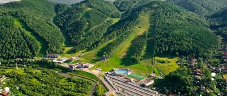
The health trail in Sochi is part of the huge Rosa Khutor ski complex, although nothing connects it with skiing. It is a network of ecological routes running along the mountainside, through a wild forest inhabited by wild animals. The trails have a circular pattern - when you leave one point, you return to it, having covered a certain distance along the way, thoroughly enjoying the beauty of nature and, at the same time, the ascent.
Of course, it may seem strange how this is connected with the ski resort in Krasnaya Polyana. But only until the moment of visiting, when it becomes clear that this is a large-scale amusement park and active recreation for every taste, which its creators took care of, having provided for everything. The health trail is part of the complex, separated into an autonomous unit, and most tourists who come to ski, but then seek variety and new experiences, pass through it.
Origin and purpose
The site was being developed at a time when ski slopes, ski lifts and places to accommodate tourists were being built at sky-high heights. All this seems to be a more important and painstaking process than trampling a path in the middle of the forest.
It is not surprising that all attention was focused on the mountain peaks, and few people were interested in what was happening at the foot of the ridges. It seems that the creation of the Health Path was a spontaneous project; there is simply too little information about it.
Initially, few people imagined the scale of the upcoming work, until construction began and a clear picture began to emerge. And the creation of the trail really became a kind of improvisation - the designers explored literally every centimeter planned for development, simultaneously marking everything on the map.
At first, these places, which seemed unsuitable for basic purposes, were of little interest, but when they decided to expand the complex and turn it into an all-season one, the data turned out to be suitable.
Location and features of the trail
There is another Health Path in Sochi, located on the other side - they are often confused with the one described, but only by name, although it is listed as a torrencourt and passes over the Black Sea coast.
The Rosa Khutor trail is located on the lower level of the complex, on the territory of the Sochi National Park, and runs along the slope of Mount Psekhako, through a dense deciduous forest represented by beeches, hornbeams, oaks, chestnuts, where reptiles and animals dangerous to human life live.
This is reminded by signs placed around the perimeter, urging you not to feed bears or run away from them if you encounter them, after which you feel some insecurity.
The health path on Rosa Khutor is a similar health path that allows tourists to plunge into the amazing natural world and touch the beauty of the unexplored mountain forests of the Caucasus. It is not known how much you will be able to improve your health while walking along it, but it is quite possible to get a lot of positive emotions.
Another important and positive feature of this attraction is that a walk through it is completely free, which is very different from other objects of the Sochi Park, where an environmental fee is charged to tourists upon entering the rest of the territory.
Important points
When planning a walk, take care of the following points in advance.
- Choose comfortable shoes with non-slip soles. Sneakers are perfect.
- Bring a water bottle with you, and if you're hungry, a snack. You won’t be able to buy all this anywhere along the entire route.
- Think about the toilet in advance. Unfortunately, it is also not provided along the entire route. If you are really impatient, you can try going down to the sea, to the beach of one of the sanatoriums (for example, the Metallurg sanatorium). As a rule, resort beaches are equipped with toilets, and access to all beaches is now free by law.
And, of course, be in a great mood, because you are in Sochi, which means life is good!
Routes Health Paths
The health path is divided according to established rules that accompany the organization of health paths - according to difficulty levels, elevation changes, and time allotted for completion. It is represented by three separate pedestrian routes that rarely intersect.
Photo: © https://sadogorodsad.ru/
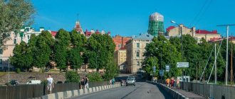
The Small Ring is the simplest and easiest route, designed for tourists without proper preparation. We are talking about something like an introductory facility with a length of only 310 m.
Small ring
Its passage is also limited in time and takes no more than 15 minutes, and is distinguished by the absence of serious changes in altitude and difficult sections to pass.
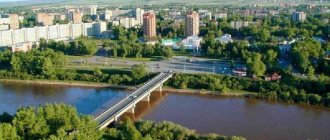
It is memorable for the picturesque views that accompany you during the short journey. In particular, it offers a beautiful panorama of the Mzymta , and the resort itself is clearly visible;
The middle ring is a more difficult route, intended for tourists who are not new to such walks, its length is a little more than 1600 m. Walking along it takes much longer, on average about an hour and a half.
Middle ring
There are small elevation changes and equally minor obstacles along the way, but it will require effort. The route of the middle ring is as picturesque as the small one, it runs along two springs with crystal clear water, passes an observation deck with views of the surrounding mountain ranges and river valley, as well as the Vysoky waterfall.
By the way, the latter fills a tiny lake called the Kupel, where you can swim if you wish, although the water here is simply icy.
The Big Ring is the longest and most difficult route with a length of almost 2000 m. It takes at least 2 hours to complete it - this is if you don’t linger anywhere for a long time, don’t take pictures against the backdrop of the surrounding beauty and don’t set aside a lot of time for a break.
Big ring
It fully lives up to its name and at the very start it begins with a sharp rise, but in the initial section it is not particularly difficult, thanks to sections in the form of terraces alternating with the rise. Almost along the entire path along the trail there are benches made from fallen trees, and some areas are paved with stone.
Equipped objects along the route have romantic names, such as “Staircase of Years” - steep, lined with tree trunks, leading to the top. It houses a Yoga Playground and a Survival School, as well as Nadezhda Falls and the Eagle's Flight attraction.
Road to Prometheus: trekking in the Agur Gorge
The equipped recreational reserve “Agur Waterfalls” is a very memorable spot on the list of those that Sochi’s tourist routes provide us with. It is located in the highland part of the Agura valley, where the river of the same name flows in steps. There are three Agur waterfalls in total; above them you can see the flow of the stream, which is the source of this reservoir. However, the route turns to the west - towards the large statue of Prometheus. By the way, few people reach it - especially after a rain, when the slopes become slippery and the mud is knee-deep. And the handrails on the last “floors” of the tract are becoming more and more dilapidated, and there are almost no makeshift steps left. You have to grab the same slimy moss-covered rocks with your hands. The total length of the trail is about 3.5 kilometers (round trip). The asphalt road to the “official entrance” (to the ticket office, souvenir shops and visual communication signs) starts from the fork of the streets Agurskoye Ushchelye and the Road to Bolshoy Akhun. Make your way to this point from the stop of the seaside highway - “Hotel Sputnik”. At the second waterfall (the most spectacular) there are many tables with benches and a food counter.
Have you visited the very heart of the West Caucasus Mountains? Now you understand: Sochi was included in the list of “5 most beautiful cities in the Caucasus and Transcaucasia” not only due to its sights and warm sea. First of all, people are attracted by the local nature. Perhaps the recreations described are a goal that a trip to the sea by car will help you realize.
1
How to get to the Health Path from Adler
The nearest stop from here is Rosa Khutor, which you can easily get to by buses No. 105, 105c, 105e, 135, 135e and 163.
By car you will have to cover the following route:
Note to tourists
- Address: Kamenka street, Rosa Khutor, Sochi, Krasnodar region, Russia.
- GPS coordinates: 43.673510, 40.298113.
The described routes in terms of active recreation, according to some tourists, have no equal, despite the efforts made during their passage. Reviews left by people who took a walk along the Health Path clearly indicate that you definitely need to go through all three routes, both in summer and in winter, when you have to spend a lot more effort, but also gain as many positive emotions. In conclusion - a video on the topic, enjoy watching!
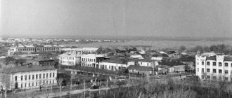
History of the path
The Sochi Health Path appeared in the 30s of the 20th century. Concrete slabs were laid in the middle of lush vegetation. The variety of flora was provided by the dachas of prominent figures of the Russian Empire. The revolution swept away the buildings of nobles and ministers, but ornamental plants and trees remained. They began to build up the area with sanatoriums and laid out a path for vacationers.
The method of spa treatment, which involves leisurely walking, gained popularity in the 19th century. In Russia, the first health paths appeared at the beginning of the 20th century. In 1901, doctor Nikolai Oblonsky built a health path in Kislovodsk.
I read on the Internet that Stalin loved to walk along the Sochi health path. Whether this is so, I cannot say. But Stalin’s dacha is not far from the health path.
For five decades, patients from Soviet sanatoriums walked along the health path. At the end of the 80s, they stopped following the path of health. In 2009, city authorities remembered and updated it. The path was cleared and straightened.
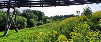
"Rhododendron Valley"
Length: 800 m
District: Krasnaya Polyana
Photo: visit-sochi.com
Above the Krasnaya Polyana resort there are three beautiful high-mountain valleys surrounded by massive rock walls, they are called Circuses. In the summer, a tent camp opens in Circus-2, which is called the “Hotel of a Thousand Stars”. But you can walk along it without spending the night: of the three eco-trails laid along it, the easiest one leads to the Medvezhiy waterfall; you can get to its beginning by the Polyana 2200 cable car, and then go down a little from the panoramic observation deck with a 360-degree view. The trail passes through stunningly beautiful rhododendron groves that bloom in June and July. The Medvezhiy waterfall itself also exists only in the summer, when the snow melts on the mountain peaks. If you want a more challenging route, you can then climb to the top of the Black Pyramid Peak to admire the 360-degree mountain panorama - or take this route on the chairlift of the same name.
"Achipsinskaya fortress"
Length: 1000 m
District: Krasnaya Polyana
Photo: Alexandra Volkova
The ruins of an ancient Byzantine fortress are one of the most interesting archaeological sites in Krasnaya Polyana. In the VI-VIII centuries, Achipse was a mighty stronghold, protecting the peace and safety of trade caravans on the Great Silk Road. Now all that remains of its former grandeur are picturesque ruins. To admire them, you need to take a simple two-hour journey along the eco-trail - the Krasnaya Polyana resort app has an audio guide specifically for this walk. If you want, you can continue your journey along the valley of the Achipse River - the marked route runs along both banks of the river, connected by hanging bridges; along the road there are benches and equipped rest areas in the shade of wild pears and chestnuts.