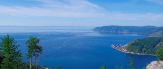
History of Sakhalin
Europeans discovered Sakhalin in the 17th century.
The first to visit the island in 1640 were the Cossacks, led by the ataman and explorer Ivan Moskvitin. Three years later, the expedition of the Dutch navigator Martin de Vries went there. However, Frieze mistakenly considered Sakhalin to be a peninsula connected to Hokkaido. Disputes about whether it was connected to the mainland or other islands continued until the mid-19th century. In 1849, Admiral Gennady Nevelskoy sailed the warship Baikal through the strait between the island and the mainland. Sakhalin was marked on maps as an island, and the strait was later given the name Nevelskoy. In 1869, those sentenced to hard labor, most often lifelong, began to be sent here. Initially, prisons were built for them only in the northern part of the island, but then settlements appeared in the south. Gradually, convicts became the main part of the population of Sakhalin.
At the end of the 19th century, Anton Chekhov came to the island. He got acquainted with the life of convicts, wrote down petitions and memories of Sakhalin residents, and conducted a population census here. Later, the writer published an artistic and journalistic book “Sakhalin Island”, in which he described in detail the local nature, the way of life of the indigenous people and exiles, and included fragments of documents, statistical data, records of scientists and travelers who had visited the island before. An entire museum in Yuzhno-Sakhalinsk is dedicated to this book: its exhibition includes exhibits related to the life and work of Chekhov (including his personal belongings). Several settlements in the Sakhalin region are named after the writer. Monuments to Chekhov are erected in several cities of the island, and the Literary and Art Museum of the Book of A.P. is opened in Yuzhno-Sakhalinsk. Chekhov "Sakhalin Island".
The indigenous population of Sakhalin are the Nivkhs and Ainu. However, today they make up less than 1% of all island residents. In addition to Russians, Koreans, Ukrainians, and Tatars live in the Sakhalin region.
"Demoted to sailors"
Be yourself at the "Edge of the World"
Sakhalin International Film Festival answered the main questions
Having gone up the Amur in boats, Nevelskoy found several Manchus here, from whom he learned that the Chinese authorities forbid them to go down to the mouth and they illegally appear here for bribes in order to profitably buy furs. The Chinese do not have any military forces in the lower reaches of the Amur, and they are also terribly afraid that the navigability of the river will become known and large ships of foreigners - the British and the French - will descend there.
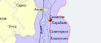
This radically changed the situation. Now the main competitor of the Russians was no longer the Chinese, but the Europeans, and the right of primacy in such matters became fundamental. Considering that after victory in the First Opium War (1840–1842), competitors received significant freedom of action, there was no time to hesitate. Therefore, in violation of the order, Nevelskoy decided to establish a post right at the mouth of the Amur, especially since he found a convenient place, which he named Nikolaevsky in honor of the current sovereign. On August 1, 1850, the Russian flag was solemnly raised over it under a gun salute. In each settlement of the Gilyaks (Nivkhs), Nevelskoy left a document in case foreigners appeared, declaring these lands Russian possession.
Sakhalin_1
Nivkh children. Sakhalin
Photo: Public domain
In the Nikolaevsky post on the Amur (a city of the same name will soon arise there, now Komsomolsk-on-Amur), there were six soldiers left with a falconet, who were ordered, after the river rose and the threat of foreigners had passed, to return to the Petrovskoye post - the “base” village expeditions in the Bay of Happiness. Dmitry Ivanovich Orlov, a naval officer, chief navigator in the Russian-American Company, a participant in Litke's circumnavigation, exiled to Siberia and deprived of ranks, rights and fortune, remained in charge of the winter quarters there. “He was a taciturn, unhurried man, small, lean, who suffered so many disasters and hardships that they were already powerless to cause him any harm. Orlov’s eyes shone with liveliness and energy...” Nevelskoy wrote about him.
Sakhalin_1
Korsakov is the first and oldest of the Russian settlements of Sakhalin
Photo: Getty Images/Universal History Archive/UIG
Sakhalin “Far Eastern hectares” will be united into a natural park
In the winter of 1851, Nevelskoy and Korsakov again went to St. Petersburg. This time, the captain’s arbitrariness caused not just anger, but a real storm - Chernyshev and Nesselrode, for direct violation of the order, demanded that he be deprived of his awards and demoted to sailor status. They suggested abandoning Nikolaevsk “out of harm’s way.” And again Nevelsky was saved by the intervention of the emperor, to whom Muravyov presented the situation in a favorable light. Nikolai called the captain’s action “valiant, noble and patriotic,” and on the report of the Special Committee he imposed a resolution that became famous: “Where the Russian flag has once been raised, it should not be lowered.”
Historical and cultural monuments of Sakhalin
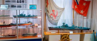
Sakhalin passed from Russia to Japan and back several times, and many monuments of Japanese culture have been preserved on the island. One of them is the building of the Local History Museum in Yuzhno-Sakhalinsk. It was built in traditional Japanese style in 1937. The modern exhibition of the museum includes more than 170 thousand exhibits: these include samples of flora and fauna, household items of the island’s indigenous inhabitants, historical documents, and ancient weapons.
Another monument of Japanese architecture is the ritual torii gate made of white marble near the village of Vzmorye. Previously, the Tomarioru Jinja Temple was located behind them, but it has not survived to this day.
At the beginning of the twentieth century, the Japanese built the Yuzhno-Sakhalinsk - Polyakovo railway line on the island. Nowadays it is not used for its intended purpose and has become a historical monument. From the Devil's Bridge, the highest in the Sakhalin region, there is a beautiful view of the surrounding area of the railway.
Climate
The climatic conditions of the island largely determine the seas surrounding Sakhalin. The mainland has no less influence. The cooling of Siberia in winter provokes gusty northern winds. As a result, the island’s climate is characterized as moderate monsoon. The average January temperature in the south is −6° C, and in the north – −24° C. In August it is +19° C and +10° C, respectively.
The north of Sakhalin is characterized by harsh continental winters. In summer, the temperature here drops due to winds from the Sea of Okhotsk. At the mouth of the Tym River there is permafrost in places. This is underground ice that penetrates hundreds of meters into the ground and exists for a long period. Winter and summer in Southern Sakhalin are comparable to the Arkhangelsk region. Spring here is much colder than autumn.
The eastern coast of the island has the harshest climate. On the western shore, the island is protected by a favorable location of mountain ranges. Winter is characterized by an abundance of snow, and summer by intense rain. Snow cover can reach up to 2 meters. Partial cyclones often provoke floods and typhoons.
Nature of the island
The flora and fauna of Sakhalin are poorer than on the mainland, but dense forests grow here and animals and plants listed in the Red Book are found. In addition, scientists have recorded a phenomenon characteristic only of this region: herbaceous plants on Sakhalin often grow to gigantic sizes. Nettle, buckwheat, bearsfoot and other herbs can reach 3-5 meters in height.
Various species of birds nest on Lake Tunaicha, and on Tyuleniy Island near Sakhalin there is a large seal rookery and huge bird colonies. In the vicinity of the highest point of the island - Mount Vaida - there are karst caves. From the top of the Zhdanko mountain range there is a view of the picturesque surroundings. At Cape Velikan you can see natural arches, grottoes and pillars that arose under the influence of wind and salty sea water. Sakhalin is home to an active mud volcano, as well as mineral and thermal springs.
The most famous places in the Sakhalin region: TOP-3
The natural attractions of Sakhalin are surprisingly diverse; each object is worthy of the attention of tourists. However, we can especially highlight three natural monuments that better than others demonstrate the uniqueness of the region and its differences from other regions of Russia.
Tyuleniy Island
- Coordinates on the map: 48.503253, 144.629144.
The island's name speaks for itself: a rocky stretch of land in the middle of the Sea of Okhotsk is home to hundreds of seals, fur seals and sea lions. In spring, the coast of the attraction is literally dotted with gray, black and red carcasses of these amazing sea animals.
Large animals coexist quite peacefully with birds that nest on higher rocks. The island is under state protection and lies outside of water and air routes so that passing ships and flying planes do not frighten away rare mammals.
Daginsky thermal springs
- GPS coordinates: 52.045720, 143.081736.
A complex of thermal springs with an area of 9 hectares is located in the Nogliki region near Dagi Bay. About 60 springs with a temperature of 50 ° C come out of the ground at a speed of up to 3 liters per second.
Water is rich in alkali and silicic acid and therefore helps with a number of diseases from diseases of the skin and nervous system to disorders of the musculoskeletal system.
Some springs are well equipped; special baths under domes are equipped for bathing. Currently, a health resort operates next to the springs.
Volcano Tyatya
- Coordinates: 44.353707, 146.251319.
A formidable active volcano with a height of 1800 meters has been rising on the coast of the Sea of Japan for 12 centuries and has long become the hallmark of the Kuril Islands.
According to scientists, serious eruptions occur only once every thousand years. The last strong eruption occurred in 1973, when the volcano drove away local residents.
Nevertheless, the terrible giant periodically reminds of his strength, threateningly releasing clouds of black smoke into the sky and scaring away planes.
Relief
The surface of the largest Russian island is entirely mountainous. These are mid-altitude mountains, low mountains and plains. The latter occupy only one quarter of Sakhalin. The north of the island is a hilly plain. While the western bank is a wide stone wall. On the east coast there is a frequent change of steep and flat land surfaces.
Mount Lopatina
There are 2 mountain systems on the island: West Sakhalin and East Sakhalin. The main peak is Mount Lopatina (1609 m). The above mountain systems are adjacent to the Tym-Poronayskaya lowland. The most popular tourist route leads to Mount Lopatina. The largest rivers of the island are Tym and Poronai, and among the lakes it is worth highlighting Sakhalin-Busse, Izmenchivoe, Tunaicha and Vavaiskoye.
Natural resources
The severity of Sakhalin's climate is more than compensated by its wealth of resources. The most significant reserves here are coal and hydrocarbons. The region ranks 7th in the country in terms of gas volume, 12th in terms of coal volume, and 13th in oil volume.
In total, 35 valuable minerals are mined on the island. Local mineral resources are rich in mercury, gold, chromium, platinum and talc. Placer gold is mined directly on Sakhalin, which is an accumulation of rock fragments formed as a result of the destruction of deposits.