The search for a territory for compact settlement of Jews began back in the 1920s. By resolution of the Central Executive Committee, the Committee for the Land Arrangement of Jewish Workers (KOMZET) was created, whose task was to organize the voluntary resettlement of Jews from towns, cities and villages to allocated lands. There was also OZET - a Public Committee that dealt with the same issues, but mainly mobilizing foreign public opinion (primarily Jewish circles) in support of plans for the resettlement of Soviet Jews. At first they were supposed to be resettled in Crimea. But since there was not enough free land there, and the influx of new settlers to Crimea provoked anti-Semitic sentiments among the local population, they decided to abandon these plans. To search for the Soviet “promised land,” scientific expeditions were sent to different places until they finally found one in the Far East.
Jewish Autonomous Region on the map. Commons.wikimedia.org
Government departments
Spurs of the Bureinsky ridge. Photo by A. A. Bykov
Lime factory in the urban village of Londoko. Photo by A. A. Bykov
Brown coal mining. Photo by A. A. Bykov
System of government bodies power is determined by the Constitution of the Russian Federation and the Charter of the Jewish Autonomous Region (1997). State power is exercised by the Legislature. assembly, governor, regional government, other bodies formed in accordance with the Charter of the region.
Combine harvester products in Birobidzhan. Photo by A. A. Bykov
Legislator meeting - a permanent representative will represent. and legislator. state body regional authorities, consisting of 16 deputies elected for 5 years. Half of the deputies are legislators. Assembly was elected by single-mandate elections. districts, half - by proportional electorate. system. The regional governor is the highest official and at the same time the executive head. authorities. Empowered by the Legislator. meeting on the proposal of the President of the Russian Federation. In the absence of the governor, his duties are performed by the vice-governor of the region. The regional government is the highest executive. state body regional authorities. The regional governor forms and heads the government.
Cities of the Jewish Autonomous Region
The Jewish Autonomous Okrug is represented by two cities. Birobidzhan is the largest settlement (population 73,623) and at the same time the administrative center.
Obluchye is the second city with a population of 8,540 people. It was founded only in 1911 in connection with the construction of the Amur Railway. It is located 159 kilometers from Birobidzhan.
Nature
Relief. Territory of E. a. O. located in the Amur region. In the north and northwest stretch the low-mountain ridges of the Khingan-Bureinsky mountain system: Small Khingan, Sutarsky, Shchuki-Poktoi, Pompeevsky, high spurs of the Bureinsky ridge. up to 1421 m (highest point of E. a. o.). Karst is developed in the mountains: sinkholes, caves, karst springs. In the south and southeast there is a lacustrine-alluvial, heavily swamped Central Amur (Amur-Sungari) lowland, descending from the mountain foothills from the heights. 150–200 m to 40–50 m in the floodplain of the river. Amur. The lowland relief is complicated by remnant low-mountain highlands. up to 831 m (Mount Chaldonka, etc.).
Geological structure and minerals. In tectonic in relation to the territory of E. a. O. belongs to the Baikal-Mongol-Okhotsk folded region of the Ural-Okhotsk mobile belt. Deposits of gold ores (Sutara river basin), rare metals (Preobrazhenovskoye, Diturskoye), iron (Kimkanskoye, Sutarskoye) and manganese (South-Khinganskoye) ores of the Malokhingansky iron ore region, tin ores (Khinganskoye and Karadubskoye) of the Khingan-Olonoysky tin ore region, and also graphite (Soyuznoye), brucite (Kuldurskoye, Savkinskoye), magnetite, talc, natural builds. materials (clays, sands, facing stones - marble, dacite, etc.). Ushumunsky section of brown coals in the north-west. parts of the Middle Amur brown coal basin; Means. peat reserves. A balneological center has been organized on the basis of the Kuldur thermal water deposit. resort.
Climate. Natural conditions are favorable for the life of the population. The climate is temperate monsoon. Winter is cold, dry and with little snow, cf. January temperatures range from –21 to –25 °C on the plains to –30 °C in the mountains. Summer is warm and humid, Wed. July temperatures range from 20–22 °C on the plains to 18 °C in the mountains. Precipitation per year ranges from 500 mm on the plains to 800 mm in the mountains. Max. amount of precipitation falls in summer.
Inland waters. The density of the river network with a total length of St. 8200 km is 0.7–0.8 km/km2 in the mountains, and 0.1–0.3 km/km2 within the Middle Amur Lowland. Basic river E. a. O. – Amur with left tributaries Bidzhan, Bira, Tunguska and others. The rivers are fed by rain, with summer-autumn floods and low winter low water. There are many small (area up to 1 km2) lakes, mainly. floodplain and above-floodplain-terrace. Swamps occupy up to 28% of the territory.
Soils, flora and fauna. Territory of E. a. O. located within the subtaiga and deciduous forest zones. The soil cover is characterized by the predominance of brown soils (typical and podzolized) on mountain slopes and podbelov on the plains; Meadow and peat-gley soils are widely developed within the Central Amur Lowland. Forests occupy St. 45% of the territory of E. a. O. Deciduous forests predominate, including secondary birch and aspen forests in places of clearings and burnt areas, primary and derivative oak forests (from Mongolian oak, Manchurian and Amur linden, with the participation of Dahurian birch). In the lower parts of the slopes of the Sutarsky and Pompeevsky ridges, areas of cedar-deciduous forests (Korean pine, Amur linden, small-leaved maple, Manchurian ash, etc.) with various shrubs and vines (Manchurian walnut, Chinese lemongrass, Eleutherococcus senticosus) have been preserved. The upper parts of the mountain slopes are characterized by coniferous forests of Ayan spruce and whitebark fir, and in some places larch forests. Means. area east of the river. Bira (in the Middle Amur Lowland) is occupied by mari (swampy larch woodlands), grass and sedge bogs. West of the river Bira in the river valley Reed meadows, sedge-reed grass and forb-reed grass meadows are common in the Amur region. Flora E. a. O. represented by St. 1100 species of plants, of which 21 species are included in the Red Book of the Russian Federation (Asian adlumia, Deutzia smootha, Pyrrhosia lingua, Chinese tribord, etc.). In E. a. O. 60 species of mammals, including commercial ones (brown bear, sable, raccoon dog, elk, musk deer, red deer, wild boar, etc.) and rare species (Amur tiger, Amur hedgehog, oriental leatherback); St. nests 170 species of birds (eg bearded partridge). St. lives in rivers. 70 species of freshwater fish, including the endangered black Amur bream and black carp; in the upper reaches of Bira and Bidzhan are spawning grounds for autumn chum salmon.
Condition and protection of the environment. On b. Part of the territory there is a moderately acute ecological situation, acute in the valley of the river. Amur, west of the river mouth. Bira, which is connected ch. arr. with soil and water pollution, forest degradation, landscape disturbance during construction and mining. OK. 25% of agricultural soils lands are subject to erosion and deflation. Emissions of pollutants into the atmosphere amount to 30 thousand tons, water intake is 20 million m3 (2003), discharge of polluted wastewater is 12.5 million m3 (2002).
A system of protected natural areas occupying approx. 12% of the territory of E. a. o., represented by the state. the Bastak nature reserve, 6 reserves of regional significance (Dichun, Zhuravliny, etc.), 25 natural monuments, including hydrological (mineral springs Starikovsky, Verkhnetulchikhinsky), geological (karst caves Ledyanaya, Pasechnaya, Kabanya Lovushka, etc.) , botanical (Thickets of Lotus, etc.).
Location
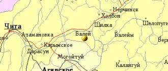
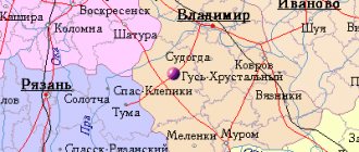
The city of Birobidzhan received such a sonorous name from the names of two local rivers flowing nearby - Bira and Bidzhan. On the banks of the first of them the center of the newly formed autonomous region was erected. Birobidzhan on the map can be found east of the Bidzhan River. It flows parallel to Bira and is located one hundred kilometers from the city. It is worth saying that these two rivers carry their waters to the mighty Amur.
Birobidzhan on the map of Russia is one of the stations of the Trans-Siberian Railway. It is distinguished by its close location to the border with China (only 75 kilometers).
Population
B. h. population of E. a. O. are Russian (89.9% – 2002 census). The rest are Ukrainians (4.4%), Jews (1.2%), Tatars, Belarusians, etc.
Characteristic of natural population decline: mortality (17.9 per 1000 inhabitants, 2005) exceeds the birth rate (11.6 per 1000 inhabitants). Infant mortality is one of the highest in the Russian Federation (15.6 per 1000 live births). The share of women is 51.7%. The share of the population under working age (up to 16 years) is 18.7%, over working age 16.2%. Wed. life expectancy is 59.3 years (one of the lowest in the Russian Federation; men - 53.9, women - 65.9). The migration outflow of the population is characteristic (54 people per 10 thousand inhabitants), mainly. outside the Far Eastern region (approx. 60.5% of emigrants). Wed. population density is low – 5.4 people/km2; b. Most of the settlements are concentrated along the Trans-Siberian Railway. Gor. us. 66.3% (2006; 66.2% in 1989).
Promised land
The newly created autonomy was a fact of the revival of the sovereign territory of the Jewish population. The emergence of this district was the reason for the intensification of immigration influx from abroad. About seven hundred people from Lithuania and Argentina, Latvia and France, Belgium and Germany, Poland, Palestine and the USA have chosen the Far East as their permanent place of residence.
All this suggests that the decision of the Soviet government caused quite a lively response in the Jewish community. And this is not surprising. The long-suffering people rejoiced at the allocation of their own territory and the existence on it of some semblance of statehood.
Religion
In the region there are 26 parishes of the Birobidzhan and Kuldur diocese (established in October 2002) of the Russian Orthodox Church of the Moscow Patriarchate, 10 Protestant communities, 2 Jewish communities (official data as of January 2007).
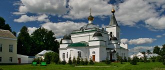
Basic Orthodox churches in the region - Nikolskaya Ts. (Birobidzhan; operating since 1999), a chapel in memory of the soldiers who died for the Fatherland (Birobidzhan, 2001), the Cathedral of the Annunciation with the relics of St. Innocent, Metropolitan of Moscow and Kolomna (Birobidzhan; 2005, the first stone church in the region).
In 1998, the European Union was registered. religious community "Freud", on its territory since 2000 a communal Jewish religion has been opened. center, Birobidzhan ev. adv. University, youth club "Haverim", cultural and educational society "Einikait", since 2004 - the first synagogue in the region, located in a specially built building.
The largest Protestant communities: the centralized religious organization Union of Churches of Evangelical Christians-Baptists of Birobidzhan, Church of Evangelical Christians-Baptists (Nayfeld village), Church of Christians of the Evangelical Pentecostal faith “Glorious Branch” (Birobidzhan), Church of Seventh-day Adventist Christians (Birobidzhan).
Historical sketch
The most ancient archaeological sites on the territory of E. a. O. belong to the 3rd millennium BC. e. and are represented by the Kondon culture. It is replaced by the Uril culture, correlated with the Ilou tribes, then by the genetically related Polish culture, left by the ancestors of the Nivkhs. In the first centuries of our era, alien tribes of the Mohe culture appeared here, developing into the Jurchen culture. In the 8th–10th centuries. n. e. territory of modern E. a. O. was the north outskirts of the state of Bohai. After its collapse, alliances of tribes were formed (Daurs, Duchers, Khitans, Manchus, Nanais, Evenks). In the 13th–14th centuries. this part of the Amur region was part of Mong. empire, in the 1640s. as a result of the campaigns of V.D. Poyarkov, E.P. Khabarov and others, it was assigned to Rus. state, which led to a clash with China. According to the Nerchinsk Treaty of 1689, the territory from the confluence of the river. No one was allowed to populate the Sungari to the Amur and further to the Okhotsk metro station, Russian. the settlers were forced to leave the developed lands of the Amur region. The re-development of this territory by the Russians began in mid. 19th century and is associated with the activities of the Governor General of the East. Siberia by N.N. Muravyov (later Muravyov-Amursky). In 1856 for the organization and protection of the military. Cossack posts were set up in warehouses - Khingan (at the mouth of the Khingan River) and Ust-Sungari (at the mouth of the Sungari River). Since the spring of 1857, the left bank of the Amur was actively populated by Cossacks of the Transbaikal Cossack Army, from which the Amur Cossack Army was formed in 1858. In 1858–60, the first 18 villages arose - Pashkovskaya, Radde, Mikhailo-Semyonovskaya, Ventselevo, Golovino, Puzino, Voskresenovka, Ekaterino-Nikolskoye, Storozhevaya, etc. Wed. The left bank of the Amur was officially assigned to Russia under the Aigun Treaty of 1858 and the Beijing Treaty of 1860, and became part of the formed Amur Region (1858) and the Primorsky Region (1860).
Significant impact on occupancy and economics. The development of the region was influenced by the construction of the Amur railway. d. (1908–16), the final section of the Trans-Siberian Railway; the stations Bira, Birakan, Obluchye, Tikhonkaya and others were opened on it. A new stage of economics. development of modern territory of E. a. O. associated with the resettlement of peasants from the center. and zap. provinces of Ros. empire (1901–14), for which lands were allocated between the Tunguska, Amur, Bira and Malaya Bira rivers. Peasant volosts were formed - Tungusskaya (1910), Uldurinskaya (1914), and Blagoslovenskaya (where the indigenous population that had lived here for a long time predominated). In 1920 Wed. The Amur region became part of the Far Eastern Republic, 11/15/1922 – 1/4/1928 it was part of the Amur province, then – the Far Eastern Territory of the USSR. In the 1920s The Committee on the Land Organization of Working Jews (KOMZET; formed in 1924 by a resolution of the Presidium of the Central Executive Committee of the USSR) considered the region as a possible place for the resettlement of Jews from the West. and center. regions of the USSR. In 1927, the committee sent one of its expeditions to the area of the Bira and Bidzhan rivers to survey the territory. prof. B. L. Brook. 28.3.1928 The Presidium of the Central Executive Committee of the USSR adopted a resolution “On assigning to KOMZET for the needs of the complete settlement of free lands in the Amur region of the Far Eastern Territory by working Jews.” In May 1928 at the station. Quiet, where the settler was formed. point, the first settlers arrived from the Ukrainian SSR, BSSR, center. regions of the RSFSR and from abroad, the largest number of immigrants arrived in 1932 (14 thousand people, of which 6.2 thousand were Jews, including 293 people from abroad). They received great help from the Americans. organizations "IKOR", "Ambidjan", "Agro-Joint" (provided funds, medicines, supplied equipment for factories, tractors, etc.), as well as societies. committees for the land organization of working Jews in Minsk, Moscow, Leningrad, Kazan, etc. During the same period, there was also a reverse outflow of immigrants.
By resolution of the Central Executive Committee of the USSR dated August 20, 1930, the Birobidzhan National National Park was formed as part of the Far Eastern Territory. district (center - a village near the station Tikhonkaya, later - the city of Birobidzhan). By resolution of the Central Executive Committee of the USSR dated May 7, 1934, it was transformed into E. a. O. The population of the region numbered 52.7 thousand people. (1934), including 7.5 thousand Jews living in 248 settlements (in nine the Jewish population predominated), including in four workers’ settlements (Bira, Birakan, Obluchye, Smidovich). Official Yiddish was the language along with Russian, documentation in the state. institutions was conducted in two languages. Operated: lime factories (Londokovsky and at the Izvestkovy junction), Tungussky, Birsky and Birakansky timber mills, Birsky timber industry enterprise, Birakan turpentine plant, several. brick factories, Sutar gold mines; Birobidzhan agricultural The station carried out work on acclimatization and selection of agricultural products. crops Since 1934, air services have been operating. line Birobidzhan - village. Amurzet, Birobidzhan - Khabarovsk. During Vel. Otech. war enterprises E. a. O. produced products for the front.
In 1948, in connection with the start of the campaign “to combat cosmopolitanism,” in E. a. O. National repressions began. attribute: alm was closed in 1949. "Birobidzhan", Heb. state theater, books in Yiddish were confiscated from the funds of the regional library, b. h. euro intelligentsia left the region. In the 1950s, with the beginning of the “thaw”, attention to the problems of the development of the Jewish people. culture in the region has resumed.
Synagogue on Lenin Street
Before the formation of Israel, the Jewish Autonomous Region was the first and only Jewish state-territorial entity with official status that actually existed in the world. In this regard, I recall an episode from “The Golden Calf”, when the American correspondent Mr. Burman, in a conversation with the Soviet journalist Palamidov, said that, as a Zionist, he was most interested in the Jewish question in the USSR. Without hesitation, Palamidov answered: we no longer have such a question. The American carefully clarified whether there were Jews in Russia, and, having received an affirmative answer, objected: since there are Jews, then there is probably a Jewish question. But the politically savvy Soviet journalist did not give up and firmly declared: there are Jews, but there is no question.
Article on the topic
Golda Meir's mission. The story of the Kyiv girl who became the “Mother of Israel” In reality, of course, there were questions. By and large, many Soviet citizens, and even more so foreign ones, had no idea how Jewish autonomy appeared on the border with China and why it existed there, if everyone knows that the historical homeland of the Jews is located in a completely different part of the world. The JAO project actually became an attempt for the Soviet government to create a Jewish national republic (since other nationalities have their own “named” republics), plus populate and develop the empty Far Eastern lands. Many Jews left this autonomy during the mass Jewish emigration from the USSR in the 1970s and 1980s. In those years, the following expression was in use: “It is better to have distant relatives in the Middle East than close ones in the Far East.” Nowadays there is a much greater chance of meeting a Jew on the streets of any more or less large city in Russia than in the “Jewish capital of Birobidzhan.” There are only one and a half thousand representatives of this ethnic group left in the entire region. The Jewish language is almost never used in the region, although Jewish culture and flavor are supported - choreographic groups work, shows and art festivals are held. The names of the streets of Birobidzhan are marked with signs in Russian and Hebrew, the signs are also bilingual, and the residents of the Jewish capital are distinguished by exceptional tolerance - on Lenin Street, not far from each other, there is a synagogue and an Orthodox church. The inscription on the government building of the Jewish Autonomous Region is in Russian and Yiddish. Photo: wikipedia.org
Farm
E. a. O. included in the Far Eastern Economic. district Industrial volumes and agricultural products are approximately equal in cost. In the structure of GRP (2004, %) the share of transport and communications is 28.9, non-market services 15.9, p. farming 13.3, construction 13.1, trade and commercial. activities for the sale of goods and services 11.1, industry 7.3, other industries 10.4. The ratio of enterprises by type of ownership (by number of organizations, 2005,%): private 58.9, state. and municipal 20.5, society. and religious organizations (associations) 11.0, other forms of ownership 9.6.
Economically active us. 91 thousand people, of which approx. 90% are employed in the economy. Sectoral structure of employment (%, 2004): trade and society. food 14.5, industry 14.4, s. agriculture 12.4, housing and communal services 10.0, education 9.6, transport 8.5, healthcare 7.0, construction 6.3, culture and art 3.2, etc. Unemployment rate approx. 8%. Cash income per capita 8.1 thousand rubles. per month (March, 2007; 74.5% of the average income in the Russian Federation); OK. 30% of us. has income below the subsistence level.
Industry. Industrial volume products 3.4 billion rubles. (2005). In the industrial structure of the industry. production (%, 2004) the leading role belongs to the construction industry. materials (22.4), as well as forestry, woodworking and pulp and paper industries (20.4); the share of mechanical engineering and metalworking is 16.3, electric power industry is 15.8, light industry is 8.2, food industry is 6.1, other industries is 10.8.
Brown coal is mined (Table 1; the Ushumunskoye deposit is developed by the Ushumunsky Coal Mine enterprise; the main consumer is the Birobidzhan Thermal Power Plant as part of Khabarovskenergo), magnesium ores (Kuldur brucite mine).
| Table 1. Main types of industrial products | |||||
| 1985 | 1990 | 1995 | 2000 | 2005 | |
| Electricity, billion kWh | 57,5 | 2,5 | 6,6 | 0,3 | 0,6 |
| Coal, thousand tons | – | – | – | 15 | 116 |
| Power transformers, thousand kVA | – | – | 1493 | 792 | 1435 |
| Commercial timber, thousand dense m3 | 243 | 436,6 | 33,8 | 22,4 | 178 |
| Cement, thousand tons | 1037 | 1073 | 272 | 250 | 309 |
| Hosiery, million pairs | 32,6 | 36,3 | 6,9 | 7 | 5,8 |
Machine-building enterprises produce electrical equipment. equipment (“Birobidzhan Power Transformer Plant”), grain, forage and rice harvesters (Dalselmash combine plant, Birobidzhan), machinery and equipment for livestock farming, etc. Harvesting and processing of wood (“Dalsoyuzprom”), lumber production , furniture (Dalmebel, etc.; all in Birobidzhan). Production of cement (cement plant, Teploozersk-type settlement), lime (lime factories in Birobidzhan and Londoko-type settlement), brick (sand-lime brick plant, Birobidzhan), reinforced concrete. products, etc.
Birobidzhan is one of the centers of light industry in the Far East: industrial and trading knitwear company "Victoria" (hosiery, knitted products), "Diamant" (knitted products), "Vostok - Holding" (footwear products), felted shoe factory "Winter". Leading enterprises in the food industry are located in Birobidzhan: a meat processing plant, a confectionery and pasta factory, Birobidzhan-Moloko, Birobidzhan-ALKO, Taiga-Vostok, etc.
One of the important factors of farms. development of the region is foreign economic. activities (main cooperation with China). The commodity structure of exports is dominated by raw materials (timber, etc.), while imports are dominated by food, machinery, equipment and vehicles. Enterprises created with the participation of China. capital, are engaged in the procurement and processing of wood, construction, agriculture. production, trade, etc. (including the Far Eastern Medical Systems plant in Birobidzhan - blood transfusion systems, blood substitutes, etc.).
Agriculture. Cost of gross output c. x-va 3.1 billion rubles. (2005), including ca. 75% comes from crop products. S.-kh. development of the territory is low - agricultural area. land 178.7 thousand hectares (about 5% of the region’s area, including arable land - more than half). The structure of sown areas is dominated by technical. culture (61.8%). They grow grain crops (22.4% of the sown area; including barley, wheat, oats, mainly in the Amur River valley; Table 2), vegetables and potatoes (12.4%; in the east of the region, in the valley of the Bira River), as well as soybeans.
Livestock farming is extensive, combining grazing and stall keeping of livestock. Basic directions – meat and dairy cattle breeding, pig breeding (Table 3, 4). Beekeeping.
| Table 2. Main types of crop production, thousand tons | |||||
| 1985 | 1990 | 1995 | 2000 | 2005 | |
| Corn | 44,8 | 63,9 | 35,2 | 19,6 | 23,2 |
| Potato | 103,7 | 140,8 | 90,9 | 98,9 | 141,9 |
| Vegetables | 27,2 | 23,7 | 13,9 | 26 | 45,5 |
| Table 3. Livestock, thousand heads | |||||
| 1985 | 1990 | 1995 | 2000 | 2005 | |
| Cattle | 92,5 | 96,6 | 56,7 | 21,8 | 15,3 |
| Pigs | 41,2 | 46,2 | 23 | 15,5 | 11,8 |
| Sheep and goats | 2,4 | 3,5 | 4,8 | 4,7 | 6,2 |
| Table 4. Main types of livestock products | |||||
| 1985 | 1990 | 1995 | 2000 | 2005 | |
| Livestock and poultry for slaughter, thousand tons | 8,5 | 10,6 | 5,3 | 3 | 2,6 |
| Milk, thousand T | 69,4 | 104,6 | 41,4 | 29,4 | 25,8 |
| Eggs, million pieces | 48,7 | 49 | 17,6 | 12,5 | 19,3 |
About 68% of agricultural land refers to agricultural lands. organizations, peasant (farm) holdings occupy 23.1%, for personal use of citizens - 6.3%. Peasant farms produce approx. 61% grain; in households – b. parts of potatoes (88.5%), livestock and poultry for slaughter, milk (approx. 84%), 66.6% vegetables; in agriculture organizations - 34.6% of grain.
Transport. The length of the railways is 513 km (2005). The territory of the region is crossed by the Trans-Siberian Railway. The length of paved roads is 1533 km. On the territory of E. a. O. The federal highway "Amur" passes through (Chita - Khabarovsk). The length of the river routes is 685 km. River navigation on the Amur and Tunguska rivers (river ports in the village of Leninskoye, the village of Amurzet, the village of Pashkovo, etc.). For international freight and passenger transportation on the river. Amur checkpoints operate: “Nizhneleninskoye” (Leninsky district), “Amurzet” (Oktyabrsky district), “Pashkovo” (Oluchensky district), where river and ferry (in winter - automobile) communication operates . Airport in the village Yellow Yar (near Birobidzhan).
Education. Scientific and cultural institutions
In the region there are (2006): 77 preschool institutions (5.7 thousand students), 207 general education institutions (over 43 thousand students), 9 primary and 5 secondary professional institutions. education, 4 universities (in Birobidzhan), including the Far Eastern State. Social and Humanitarian Academy (founded in 1989 as the Birobidzhan State Pedagogical Institute, current name and status since 2005), branches of the Modern. Humanitarian Institute (Moscow), Khabarovsk State. Academy of Economics and Law, Far Eastern State. Agrarian Institute Among scientific institutions - Institute for comprehensive analysis of regional problems, Far Eastern Branch of the Russian Academy of Sciences (1990), Eur. branch of the Institute of National problems of education of the Ministry of Education and Science of the Russian Federation. The largest library is the Birobidzhan Regional Universal Scientific Library. fuck them. Sholom Aleichem (1941). Volochaevsky Memorial Museum-Monument (1928, Volochaevka village, Smidovichi district), Region. local historian museum (1944; building 1945), Museum of modern times. art (founded in 1989 as a branch of the Far Eastern Art Museum, since 1996 an independent organization), Museum of Jewish Studies (2005).
Interesting places
The JAO district boasts unique natural monuments. A botanical monument of regional significance “Sosnyaki on Brevenchataya” was opened here. Naturally growing pine groves are especially protected here. Excursions are offered on the territory of the complex.
There is also a botanical monument “Bidzhanskie Ostryak”, named after the highest mountain – Ostryak (333 meters). This is actually a low mountain range with magnificent meadows.
“Cossack Garden” is another natural monument. This is an untouched wilderness area with many endangered species of vegetation.
The “Bidzhan outcrop” is a rocky outcrop with a unique topography. On the territory of the complex there are many unique representatives of the flora that make their way through cracks in the rocks.
And, of course, the Bastak State Nature Reserve, occupying 127,094.5 hectares.
Mass media
Information system E. a. O. takes into account the specifics of the region's population. Since 1930, the oldest socio-political books have been published. newspapers: “Birobidzhaner Stern” (more than 60 years in Yiddish, and since 1990 in Russian and Yiddish; circulation about 10 thousand copies) and “Birobidzhan Star” (in Russian, 9 thousand copies. ). All other socio-political and information publications have been published since the 1990s: “Di Vokh” (translated from Yiddish as “Week”, the first private weekly information publication, 8–12 thousand copies), “Newspaper for home” (10 thousand copies) , “Birobidzhan Week” (weekly, 4 thousand copies), official. illustrated weekly printed organ of the municipal formation “City of Birobidzhan”, “Municipal Information Newspaper” (“MIG”, 4 thousand copies).
The regional radio has been broadcasting since 1935. Nowadays it is carried out by the State. radio and television company EJSC "Bira" and Radio "Retro-FM Birobidzhan".
The decision to open E. a. in the regional center. O. studio television was adopted in 1989. Regular television broadcasting began in 1990, and daily broadcasting began in 1992.
Regional state broadcasting company E. a. O. “Bira” has been a branch of VGTRK since 2005 and includes 2 powerful stations and 20 repeaters. In the 1990s. A cable television network has been created capable of broadcasting 23 TV programs. In 2004, the Yamal-37 satellite communication transmitting station was installed. In 2004–05, a transition was made to receiving all programs in digital format.
In 1991, under the administration of Birobidzhan, a small enterprise “Bestvideo TV Company” was created, which in 1994 was reorganized into the municipal unitary enterprise “Broadcast Studio “Bestvideo””. There are electronic media and a cable television network. Leading media (2006): 6 print media, 2 radio broadcasting studios, 3 television companies; exist both at the expense of state and regional, district and Birobidzhan budgets, as well as private funds.
Culture
The Jewish Autonomous Region (Federal District of the Far East) has its own unique flavor. This is the most fertile territory of the Amur region, it is fertile soil for the development of art and culture. It is in the Jewish Autonomous Region that the oldest literary studio in the Far East is located. Through the efforts of its participants, such almanacs as “Birobidzhan” and “Forpost” were published.
Among the important cultural events in the region is the creation of the State Jewish Theater. In the 1970s, the Jewish Chamber Musical Theater opened in Birobidzhan. Soon after this, a puppet theater and a violin ensemble began to delight the audience with their performances.
Fine arts and architecture
In the 1930s–40s. buildings were erected. in the style of owls neoclassicism: station in Obluchye (1930s); in Birobidzhan - station (1935; reconstruction in the early 2000s), regional universal scientific. fuck them. Sholem Aleichem (1944, architect V. G. Gelfreich), Philharmonic building (1980s; reconstruction 2006). In the end 1990s – 2000s in the capital of E. a. O. new construction is actively underway (the village of Nikolskaya Ts., the Annunciation Cathedral, a synagogue, etc.), programs for the reconstruction of Ch. squares (ensembles with city sculptures). Among modern artists - V. A. Mizgalsky, G. S. Shtanko, D. G. Alekseytsev.