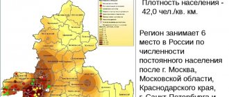
Part of the Smolensk region
Russia includes 25
urban settlements
, including[1][2]:
- 15 cities, among which stand out: 2 cities outside the districts (cities of regional significance - highlighted in orange
) - within the framework of the organization of local self-government, they form separate city districts. - The remaining 13 cities, within the framework of the organization of local self-government, are included in the corresponding municipal districts;
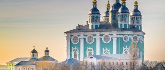
Smolensk - regional center
The annual outflow is approximately 30 thousand people. In the list of cities with problematic demographics, Smolensk ranks high. Young people en masse are trying to move closer to the capital or are leaving there to make ends meet. Smolensk residents have a choice of several higher educational institutions, about 10 state ones, and there are also specialized secondary schools. There are clearly no problems with overcrowding in the city. But people are constantly indignant at the actions of the authorities, who are deforesting and do not care about roads and housing and communal services. We have already become accustomed to constant interruptions in hot water and heating. The situation is even worse with the roads. Many people began to buy cars, which in no way contributes to comfortable traffic. Large buses are rare; they are massively replaced by minibuses, which have to be crowded into. Like large cities, during rush hour Smolensk gets up for long hours.
Smolensk used to have excellent tram service. The tracks were dismantled, but an alternative option was never provided to the population. The paradox of the municipality’s actions is to provide the city with a fleet of trams and trolleybuses, but there is no action to establish the infrastructure necessary for these types of transport. That’s why now everyone has switched en masse to minibuses.
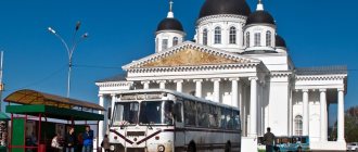
Smolensk does not have enough kindergartens, there are enough schools. Many families have little hope that their child will be able to go to kindergarten for free before going to school. Densely populated areas (Kiselevka) suffer from overdevelopment. This leads to problems in schools, which, although they have places, are overcrowded. There are few companies where you can get a job. OSRAM and the Kristall enterprise are considered the most prestigious. The latter made Smolensk famous throughout the country with its exclusive products encrusted with diamonds. Smolensk remains an important railway junction, and there is also a railway station specializing in government contracts. For the female part of the population there is a knitting factory and large retail chains.
Map
| Smolensk: maps |
Smolensk: photo from space (Google Maps) Smolensk: photo from space (Microsoft Virtual Earth)
| Smolensk Nearest cities. Distances in km. on the map (in brackets along roads) + direction. Using the hyperlink in the distance , you can get the route (information courtesy of the AutoTransInfo website) | |||
| 1 | Kardymovo | 27 (28) | NE |
| 2 | Red | 46 (55) | SW |
| 3 | Pochinok | 49 (52) | SE |
| 4 | Monasticism | 50 (56) | YU |
| 5 | Spirituality | 51 (55) | NE |
| 6 | Yartsevo | 51 (56) | NE |
| 7 | Glinka | 55 (94) | IN |
| 8 | Demidov | 63 (92) | NW |
| 9 | Rudnya | 65 (68) | Z |
| 10 | Khislavichi | 67 (82) | YU |
| 11 | Yelnya | 76 (106) | IN |
| 12 | Dorogobuzh | 81 (124) | IN |
| 13 | Safonovo | 84 (97) | NE |
| 14 | Verkhnedneprovsky | 86 (117) | IN |
| 15 | Ozerny | 91 (101) | WITH |
| 16 | Velizh | 105 (128) | NW |
| 17 | Shumyachi | 105 (132) | YU |
| 18 | Roslavl | 106 (109) | SE |
| 19 | Desnogorsk | 106 (144) | SE |
| 20 | Zharkovsky (Tver region) | 119 (328) | WITH |
a brief description of
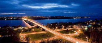
Hero city. Located in the upper reaches of the river. Dnieper (pier), between the Dukhovshchinskaya and Krasninsko-Smolenskaya uplands, 419 km west of Moscow. Railway junction lines and highways.
In 1949, Smolensk was included in the list of 20 historical cities of the USSR. The urban planning value of its heritage is assessed as world class.
The climate is moderate continental. Winter is moderately mild, the average temperature in January is -9. Summer is moderately warm, the average temperature in July is +18. Precipitation is 600 mm per year, maximum in July.
Territory (sq. km): 166
Information about the city of Smolensk on the Russian Wikipedia site
Historical sketch
It was first mentioned in the Ustyug (Arkhangelogorod) chronicle code under 862-65. It was the center of the Slavic Krivichi tribe, a large trade and craft settlement on the ancient trade route “from the Varangians to the Greeks,” and a military fortress.
Since 882 as part of Kievan Rus, from the 12th century. center of the Smolensk Principality.
Smolensk was a major center at the beginning of the 13th century. came out on top among the architectural and construction centers of Rus'. The terrible epidemic of 1230 and then the Mongol-Tatar invasion interrupted construction in the city.
In 1404-1514. was part of the Grand Duchy of Lithuania, then - in the Moscow State.
In the chronicles under the dates of the 9th-13th centuries. the name is given in the forms Smolensk, Smolinesk, Smolnesk - the stem Smol(n)- and the suffix -esk, typical of the names of ancient Russian cities, are obvious. The etymology is convincing, according to which the city was named after its location on the river. Smolnya; hydronym from Slavic smol - “black soil”. But also of interest is what was said back in the 19th century. the idea of the origin of the name of the city from the Slavic ethnonym Smolyan / Smolene.
After construction in 1596-1602. stone fortress wall (under the leadership of the architect Fyodor Kon), Smolensk became the most important Russian fortress on the western border. After the Smolensk defense of 1609-11. captured by Poland, taken by Russian troops in 1654, returned to Russia by the Truce of Andrusovo in 1667.
In 1708-13 center of the Smolensk province. Since 1713 in the Riga province, since 1719 - the center of the Smolensk province. In 1726-75. the center of the newly formed Smolensk province, from 1775 - the Smolensk governorship (from 1796 - the Smolensk province).
During the Patriotic War of 1812, the armies of M.B. united in the Smolensk region. Barclay de Tolly and P.B. Bagration. On August 4-6 (16-18) the Battle of Smolensk took place. As a result of fierce battles, the Russian command withdrew troops to the Old Smolensk Road, which made it possible to avoid a general battle and the defeat of the Russian army in unfavorable conditions. November 4 (16), 1812 Smolensk was liberated.
In 1856, in the provincial city of Smolensk, Smolensk province, there were 37 churches, 2185 houses, 177 shops. Data on the city's population in 1856 may contain an error in the source.
In the second half of the 19th century. The Riga-Oryol (1868), Moscow-Brest (1870) and Ryazan-Ural (1899) railways passed through Smolensk, contributing to the economic development of the city.
Since 1929, Smolensk has been the center of the Western Region. Since 1937 - Smolensk region.
During the Great Patriotic War of 1941-45, the Smolensk Battle of 1941 took place in the city area, which delayed the advance of Nazi troops on Moscow for 3 months. The city was occupied since July 16, 1941. It was liberated on September 25, 1943 by troops of the Western Front during the Smolensk-Roslavl operation.
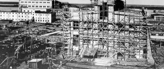
During the war years in Smolensk, all industrial enterprises were destroyed and 93% of the housing stock was destroyed. The city was rebuilt in the post-war period.
In 1979, the villages of Kolodnya (urban settlement since 1937, 12.5 thousand inhabitants, 1939; 12.8 thousand inhabitants, 1959; 14.7 thousand inhabitants, 1970; 14.7 thousand inhabitants, 1979) and Gnezdovo (5.1 thousand inhabitants, 1970; 8.1 thousand inhabitants, 1979).
Municipal indicators
| Index | 1990 | 1999 | 2001 | 2003 | 2005 |
| Demography | |||||
| Number of births, per 1000 population | 11.3 | 6.4 | 7.5 | 8.8 | 8.5 |
| Number of deaths, per 1000 population | 9.3 | 14.1 | 15.1 | 17.5 | 17.3 |
| Natural increase (decrease), per 1000 population | 2 | -7.7 | -7.6 | -8.7 | -8.8 |
| Standard of living of the population and social sphere | |||||
| Average monthly nominal accrued wages, rub. | 0.269 | 1399 | 3180 | 5355 | 7679 |
| Average housing area per inhabitant (at the end of the year), sq.m. | 14.1 | 18.1 | 18.7 | 21 | 22.4 |
| Number of preschool institutions, pcs. | 134 | 89 | 88 | 82 | 80 |
| Number of children in preschool institutions, thousand people | 20.1 | 10.7 | 10.6 | 10.5 | 10.8 |
| Enrollment of children in preschool educational institutions (at the end of the year), as a percentage of the number of children of the corresponding age, % | 78.3 | 75 | |||
| Number of daytime educational institutions (at the beginning of the school year), pcs. | 45 | 50 | 50 | 50 | 49 |
| Number of students in daytime educational institutions, thousand people | 40.1 | 43 | 39.4 | 35.4 | 30.2 |
| Number of doctors, people. | 3870 | 3921 | 3936 | 4108 | 3820 |
| Number of nursing staff, people. | 6855 | 5164 | 4425 | 4411 | 4433 |
| Number of hospital institutions, pcs. | 17 | 17 | 17 | 17 | 17 |
| Number of hospital beds, thousand units | 6.5 | 5.2 | 5.1 | 4.8 | 4.6 |
| Number of medical outpatient clinics, pcs. | 41 | 71 | 81 | 85 | 87 |
| Capacity of medical outpatient clinics, visits per shift, thousand units. | 5.9 | 8.6 | 8.8 | 8.7 | 8.9 |
| Number of registered crimes, pcs. | 4199 | 7523 | 6710 | 7603 | 11119 |
| Persons who committed crimes were identified, persons. | 2745 | 3199 | 2674 | 1809 | 2006 |
| Economy, industry | |||||
| Number of enterprises and organizations (at the end of the year), pcs. | 11232 | 13772 | 30205 | 20879 | |
| Number of operating enterprises by type of activity: mining (at the end of the year), pcs. | 2 | ||||
| Number of operating enterprises by type of activity: manufacturing (at the end of the year), pcs. | 230 | ||||
| Number of operating enterprises by type of activity production and distribution of electricity, gas and water (at the end of the year), pcs. | 61 | ||||
| Volume of shipped goods of own production by type of mining (in actual prices), million rubles. | 15.5 | ||||
| Volume of shipped goods of own production by type of manufacturing (in actual prices), million rubles. | 23782.2 | ||||
| Volume of shipped goods of own production by type of production and distribution of electricity, gas and water (in actual current prices), million rubles. | 11082.8 | ||||
| Construction | |||||
| Volume of work performed by type of activity “Construction” (until 2004 - volume of work performed under construction contracts), million rubles. | 0.164 | 726.7 | 1239.8 | 1709.4 | 2737.5 |
| Commissioning of residential buildings, thousand sq.m. of total area | 152.4 | 81 | 100.9 | 169 | 175.6 |
| Commissioning of residential buildings, apartments | 1101 | 1295 | 2199 | 2764 | |
| Commissioning of preschool institutions, places | 70 | 0 | 0 | 0 | 0 |
| Commissioning of educational institutions, places | 1296 | 0 | 0 | 0 | 0 |
| Commissioning of hospital facilities, beds | 0 | 0 | 0 | 0 | 0 |
| Commissioning of outpatient clinics, visits per shift | 1150 | 500 | 0 | 0 | 0 |
| Transport | |||||
| Number of bus routes (in intracity traffic), pcs. | 34 | 30 | 29 | 29 | 32 |
| Number of tram routes, pcs. | 10 | 7 | 5 | 5 | 5 |
| Length of operational tram tracks (at the end of the year), km | 24.6 | 24.8 | 24.8 | ||
| Number of trolleybus routes, pcs. | 2 | 2 | 2 | 2 | |
| Length of operational trolleybus lines (at the end of the year), km | 0 | 13.3 | 13.3 | ||
| Number of passengers transported by buses per year (in intracity traffic), million people. | 62.5 | 26 | 26.8 | 81.6 | 43.8 |
| Number of passengers transported by trams per year, million people. | 69 | 74.8 | 75.7 | 127.6 | 58 |
| Number of passengers transported by trolleybuses per year, million people. | 0 | 21.7 | 20.4 | 39 | 19.8 |
| Connection | |||||
| Number of telephone sets of the city public telephone network, thousand units. | 58.5 | 87.6 | 100.4 | 110.5 | 122.5 |
| Number of residential telephone sets of the city public telephone network, thousand units. | 37.3 | 65.9 | 80.5 | 88.8 | 97 |
| Number of payphones of the city telephone network (including universal ones), pcs. | 1293 | 996 | |||
| Trade and services to the population | |||||
| Retail trade turnover (in actual prices), million rubles. | 4783.4 | 8392.7 | 12577.9 | 21953 | |
| Retail trade turnover (in actual prices), per capita, rub. | 13493 | 24055 | 38941 | 68900 | |
| Index of physical volume of retail trade turnover, % compared to the previous year | 102 | 120 | |||
| Index of physical volume of public catering turnover, % compared to the previous year | 86.1 | 95 | |||
| Number of stores, pavilions (at the end of the year), pcs. | 204 | 175 | |||
| Sales area of shops, pavilions (at the end of the year), sq.m. | 26286.2 | 33481 | |||
| Volume of paid services to the population (in actual prices), million rubles. | 0.09 | 1076.1 | 1981.6 | 3946.4 | 6465.9 |
| Volume of paid services to the population (in actual prices), per capita, rub. | 0.3 | 3036 | 5679 | 12218 | 20293 |
| Volume of household services to the population (in actual prices), million rubles. | 0.031 | 170.8 | 189.3 | 222.5 | 328.1 |
| Volume of household services to the population (in actual prices), per capita, rub. | 0.09 | 482 | 543 | 689 | 1030 |
| Investments | |||||
| Investments in fixed assets (in actual prices), million rubles. | 0.17 | 517.7 | 1209 | 2487 | 2831.8 |
| Share of investments in fixed assets financed from budgetary funds in the total volume of investments, % | 87 | 11 | 15 | 3 | 9 |
Data sources:
- Regions of Russia. Main characteristics of the constituent entities of the Russian Federation: statistical collection. Goskomstat of Russia. - M:, 2003.
- Regions of Russia. Basic socio-economic indicators of cities. Statistical collection. Rosstat. - M:, 2005. p. 74
- Transport in Russia: Statistical collection. Goskomstat. - M:, 2003. pp. 110, 112, 120, 122
- Transport in Russia: Statistical collection. Rosstat. - M:, 2005. pp. 117, 119, 127, 129
- Regions of Russia. Basic socio-economic indicators of cities. 2006. Statistical collection. Rosstat. - M:, 2006. p. 74
Culture, science, education
Institutes: medical, pedagogical, agricultural, physical education.
Theatres: drama, puppet theaters.
Museums: Smolensk Historical and Architectural and Artistic Museum, sculptures named after S.T. Konenkov, Patriotic War of 1812.
Architecture, sights
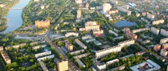
The Dnieper divides Smolensk into northern and southern parts. The central part of the city is located on hills separated by long deep ravines, behind it are modern residential areas.
The historical center of Smolensk is surrounded by powerful fortress walls with towers (1596-1600). The length of the walls is about 6.5 km, the height is about 10-12 m, the thickness is about 5 m, there were 38 towers (17 have survived).
The ensemble of Cathedral Mountain includes the Assumption (1677-1740) and Epiphany (1787) cathedrals, St. John the Baptist Church (1703-80; being restored), the bishop's house (1770), etc.
Also preserved are the churches of Peter and Paul on Gorodyanka (1146), Michael the Archangel (Svirskaya, 1194), St. John the Evangelist (1160, rebuilt in the 18th century), St. George's (1782), Resurrection (1765), Transfiguration of the Savior (1766).
Ensemble of the Trinity Monastery with the cathedral (1738-40). Spaso-Preobrazhensky Cathedral of the Avraamievsky Monastery (1755), the Church of the Ascension (1700) and Akhtyrskaya (1830) of the Ascension Monastery.
The buildings of the former governor's house (1781) and the Assembly of the Nobility (1825).
18 km north of Smolensk is the village of Talashkino, the former estate of Princess M.K. Tenisheva, who organized decorative ceramics and wood carving workshops here. In the estate there is a wooden house “Teremok” (1901, architect S.V. Malyutin), Spasskaya Church-tomb (1902, architect V.V. Suslov with the participation of N.K. Roerich), Church of the Holy Spirit (1902-03 ).
| Population by year (thousands of inhabitants) | |||||||
| 1811 | 12.4 | 1956 | 131 | 1996 | 355.7 | 2013 | 331.0 |
| 1840 | 11.0 | 1959 | 147.2 | 1998 | 355.9 | 2014 | 331.0 |
| 1856 | 9.2 | 1962 | 164 | 2000 | 353.4 | 2015 | 330.0 |
| 1863 | 23.1 | 1967 | 196 | 2001 | 350.6 | 2016 | 328.9 |
| 1897 | 47.0 | 1970 | 210.8 | 2003 | 325.1 | 2017 | 329.9 |
| 1913 | 73.1 | 1973 | 234 | 2005 | 319.3 | 2018 | 330.0 |
| 1914 | 74.1 | 1976 | 279 | 2006 | 317.9 | 2019 | 329.4 |
| 1923 | 63.7 | 1979 | 276.4 | 2007 | 317.7 | 2020 | 325.5 |
| 1926 | 71.0 | 1982 | 316 | 2008 | 316.5 | 2021 | 320.2 |
| 1931 | 86.5 | 1986 | 334 | 2010 | 314.5 | ||
| 1934 | 110.0 | 1989 | 341.5 | 2011 | 326.9 | ||
| 1939 | 156.9 | 1992 | 351.6 | 2012 | 329.9 | ||
Literature
- Krogius V.R.
Historical cities of Russia as a phenomenon of its cultural heritage. M.: Progress-Tradition, 2009. pp. 186-188 - Pospelov E.M.
Geographical names of the world: Toponymic dictionary: About 5000 units. M.: Russian dictionaries, Astrel Publishing House LLC, AST Publishing House LLC, 2001. p. 388 - Ch.
ed. Gorkin A.P. Geography of Russia: encyclopedic dictionary. M.: Great Russian Encyclopedia, 1998. pp. 541-542 - Ch.
ed. Lappo G.M. Cities of Russia: encyclopedia. M.: Great Russian Encyclopedia, 1994. pp. 425-428
Vyazma is a large railway junction
Vyaza has experienced many troubles, and is now on the verge of a demographic crisis. For more than 10 years there has been a constant outflow of people. Despite the presence of a large number of enterprises, many tend to leave because they do not see the proper prospects. The presence of tourist attractions also does not help the city develop. At the same time, there are several educational institutions that are still functioning.
On the contrary, a number of important universities have been closed in recent years. Among them are a branch of the Russian International Academy of Tourism, a branch of the Industrial University of Moscow of State Significance, and the Humanitarian University. There are kindergartens, a football club, and a dozen secondary schools. The presence of local hospitals helps the population, although there are shortages of staff and equipment.
The spread of coronavirus in Russian regions as of December 24, 2022
| Region | Revealed | New | Recovered | Died |
| Moscow | 2014708 | 2126 | 1849212 | 36277 |
| Saint Petersburg | 839762 | 2117 | 782871 | 27629 |
| Moscow region | 631742 | 1270 | 575642 | 11758 |
| Nizhny Novgorod Region | 228832 | 459 | 204338 | 9625 |
| Samara Region | 196897 | 537 | 148688 | 6150 |
| Sverdlovsk region | 194828 | 576 | 167862 | 9210 |
| Voronezh region | 191685 | 409 | 143206 | 6720 |
| Rostov region | 190614 | 552 | 168695 | 9443 |
| Krasnoyarsk region | 169329 | 600 | 153049 | 8358 |
| Perm region | 156638 | 580 | 137238 | 7332 |
| Irkutsk region | 152954 | 568 | 124783 | 6796 |
| Chelyabinsk region | 141614 | 551 | 132660 | 5839 |
| Saratov region | 130923 | 329 | 117326 | 4970 |
| Omsk region | 127690 | 420 | 109145 | 3095 |
| Volgograd region | 127206 | 324 | 116299 | 5393 |
| Republic of Crimea | 126089 | 120 | 117125 | 4181 |
| Stavropol region | 123752 | 422 | 97181 | 5935 |
| Khabarovsk region | 122030 | 460 | 108216 | 1201 |
| Arhangelsk region | 121571 | 283 | 111480 | 1495 |
| Republic of Bashkortostan | 119562 | 407 | 108679 | 4254 |
| Ulyanovsk region | 118872 | 282 | 113343 | 3680 |
| Altai region | 116255 | 479 | 94765 | 6402 |
| Krasnodar region | 115360 | 581 | 92514 | 9608 |
| Orenburg region | 106919 | 180 | 93082 | 3394 |
| Penza region | 99915 | 303 | 78467 | 4559 |
| Leningrad region | 99199 | 347 | 82395 | 2969 |
| Primorsky Krai | 98991 | 449 | 82869 | 1512 |
| Vologda Region | 98347 | 297 | 88730 | 2891 |
| Tver region | 96747 | 308 | 86190 | 2307 |
| Komi Republic | 96001 | 201 | 79964 | 2547 |
| Bryansk region | 95057 | 210 | 89943 | 2778 |
| Transbaikal region | 94759 | 229 | 82927 | 1779 |
| Khanty-Mansi Autonomous Okrug | 94666 | 185 | 87936 | 1940 |
| Novosibirsk region | 92063 | 381 | 62400 | 4140 |
| Murmansk region | 90741 | 165 | 73182 | 2728 |
| Republic of Karelia | 88645 | 221 | 84057 | 1170 |
| Tyumen region | 88143 | 291 | 74272 | 3290 |
| Yaroslavl region | 83864 | 252 | 71403 | 1793 |
| Smolensk region | 83665 | 222 | 67540 | 2315 |
| Lipetsk region | 82656 | 245 | 76109 | 2723 |
| Kemerovo region | 82602 | 347 | 74281 | 1681 |
| Kursk region | 81135 | 163 | 71823 | 1979 |
| Kaliningrad region | 80878 | 187 | 77311 | 1213 |
| Belgorod region | 80144 | 228 | 70367 | 1702 |
| Astrakhan region | 79772 | 230 | 71216 | 2349 |
| Vladimir region | 79533 | 270 | 62513 | 2904 |
| Udmurt republic | 78505 | 79 | 67012 | 3205 |
| Kirov region | 77437 | 220 | 66028 | 734 |
| The Republic of Sakha (Yakutia) | 75329 | 116 | 71029 | 1767 |
| The Republic of Buryatia | 74976 | 201 | 69377 | 2365 |
| Tula region | 73624 | 227 | 64903 | 4173 |
| Pskov region | 70208 | 157 | 63957 | 1220 |
| Oryol Region | 69221 | 205 | 61288 | 1448 |
| Ivanovo region | 66789 | 183 | 57603 | 2430 |
| The Republic of Dagestan | 65045 | 137 | 59712 | 3144 |
| Novgorod region | 64273 | 158 | 58564 | 743 |
| Kaluga region | 63992 | 195 | 59885 | 1173 |
| Yamalo-Nenets Autonomous Okrug | 61357 | 105 | 55779 | 943 |
| Tomsk region | 60819 | 163 | 46426 | 664 |
| Ryazan Oblast | 60462 | 170 | 55504 | 2424 |
| Tambov Region | 59687 | 206 | 55991 | 1652 |
| The Republic of Khakassia | 53110 | 114 | 49685 | 1908 |
| Amur region | 52743 | 247 | 42063 | 594 |
| Sevastopol | 52313 | 61 | 49314 | 1820 |
| Kurgan region | 49457 | 163 | 43505 | 978 |
| Kostroma region | 48311 | 70 | 44301 | 1083 |
| Chuvash Republic | 46013 | 87 | 40177 | 3751 |
| Republic of Tatarstan | 42060 | 97 | 35497 | 1401 |
| Kabardino-Balkarian Republic | 41311 | 95 | 37443 | 1384 |
| Sakhalin region | 41255 | 146 | 39475 | 511 |
| The Republic of Mordovia | 39839 | 94 | 33604 | 999 |
| Republic of Kalmykia | 33896 | 19 | 32333 | 722 |
| Karachay-Cherkess Republic | 31787 | 67 | 27902 | 901 |
| Tyva Republic | 31465 | 17 | 29048 | 317 |
| Chechen Republic | 30459 | 73 | 28549 | 908 |
| Republic of North Ossetia-Alania | 30440 | 78 | 27740 | 922 |
| Mari El Republic | 28991 | 75 | 25156 | 920 |
| The Republic of Ingushetia | 28127 | 80 | 26268 | 467 |
| Republic of Adygea | 26677 | 91 | 21991 | 716 |
| Altai Republic | 25111 | 35 | 22952 | 502 |
| Kamchatka Krai | 23570 | 41 | 17999 | 504 |
| Magadan Region | 13526 | 25 | 12662 | 342 |
| Jewish Autonomous Region | 11401 | 29 | 10435 | 403 |
| Nenets Autonomous Okrug | 3465 | 9 | 3247 | 85 |
| Chukotka Autonomous Okrug | 2947 | 5 | 2681 | 32 |
Roslavl is small in every sense
The population density of the city of Roslavl may surprise even residents of million-plus cities. Over 1100 people per sq. km is an impressive figure. The development of industry has led to a stable influx of qualified personnel. There are several plants and factories here specializing in the repair of wagons, production of oil and glass products.
The largest industrial enterprise is represented by an automobile component plant. The population can also find work here in the agricultural sector. Roslavl has enterprises engaged in the food and processing industries. Roslavl is a major transport hub. Each of its residents can easily use the services of railway transport, which goes to cities such as:
- Saint Petersburg;
- Smolensk;
- Sochi;
- Bryansk;
- Novorossiysk;
- Kaliningrad and others.
Buses also run between cities. In total, Roslavl has 15 routes. There are more than 50 buses available to the population, but many of them are in very poor condition. They are compensated by comfortable minibuses. There are many private carriers as well as various cargo taxi options. There are 10 secondary schools, an Orthodox gymnasium in the city, and there is the opportunity to receive additional education at a music school aimed at children. Children can also attend youth sports schools and a children's art academy.
Urban settlements[ | ]
| № | Name | District[4] | Population, people | Founding/first mention | Town status | Coat of arms | Former names |
| 1 | Verkhnedneprovsky | Dorogobuzhsky district | ↘11 115[3] | 1952 | 1956 | ||
| 2 | Golynki | Rudnyansky district | ↘3203[3] | 1963 | |||
| 3 | Kardymovo | Kardymovsky district | ↗4628[3] | 1859 | 1979 | ||
| 4 | Red | Krasninsky district | ↘4051[3] | 1165 | 1965 | Krasen | |
| 5 | Monasticism | Monastyrshchinsky district | ↘3471[3] | 1390 | 1965 | ||
| 6 | Ozerny | Dukhovshchinsky district | ↘5186[3] | 1973 | |||
| 7 | Przhevalskoe | Demidovsky district | ↘1366[3] | 1724 | 1974 | Sloboda (until 1964) | |
| 8 | Khislavichi | Khislavichsky district | ↘3755[3] | 1526 | 1965 | Hotslavichi, Khoslavichi | |
| 9 | Kholm-Zhirkovsky | Kholm-Zhirkovsky district | ↘3064[3] | 1708 | 1971 | ||
| 10 | Shumyachi | Shumyachsky district | ↘3622[3] | 1587 | 1965 |
Settlements that have lost the status of an urban-type settlement[ | ]
- Vorga has been a town since 1948. Converted to a rural settlement in 1996.
- Gnezdovo has been a town since 1963. Became part of the city of Smolensk in 1979.
- Granki - annexed to the village of Golynki in 1963.
- Desnogorsk has been a town since 1974. Incorporated into a city in 1989.
- Ekimovichi has been a town since 1968. Transformed into a rural settlement in 2004[6].
- Izdeshkovo has been a town since 1938. Transformed into a rural settlement in 2011[7].
- Kolodnya has been a town since 1937. Became part of the city of Smolensk in 1979.
- Novodugino has been a town since 1974. Transformed into a rural settlement in 2004[8].
- Oster has been a town since 1949. Transformed into a rural settlement in 2004[6].
- Safonovo has been a town since 1938. Incorporated into a city in 1952.
- Ugra has been a town since 1966. Transformed into a rural settlement in 2013[9].
Yartsevo is a small but active town
On the territory of Yartsevo there are several enterprises that provide the population with work. Local residents have access to vocational education, which is provided by the Industrial College and the Avtokadry training complex.
Now the authorities are actively focusing on the development of industrial potential. In the entire region, Yartsevo is the most promising for attracting investment. Even foreign companies are ready to invest here. For a long time it was impossible to solve the housing problem, but in recent years a positive trend has emerged. Unfortunately, at the moment the city's population is steadily declining.
Safonovo is a developing city
Safonovo also demonstrates a good level of development. Big cities are still a long way off, but the population is provided with good employment opportunities. There is an electrical machine-building plant on the territory of the city. There is a large complex for the production and development of plastics. Safonovo is an interesting example of a city that was able to begin to rapidly develop thanks to coal deposits. The population is also provided with public transport. There are railway tracks, trains, and bus services that allow you to get to Moscow and travel between districts of the city.
The Smolensk region with its small towns shows that sometimes they are the ones who are able to provide residents with a comfortable standard of living. The overall results for the region directly indicate the prospects and opportunities for development, as well as the provision of good infrastructure.
Smolensk
(Smolensk region)
OKATO code:
66401
Founded:
862
City since:
862 City of regional subordination
Center:
Smolensk region
Center:
Smolensk district
Urban areas, population as of 01/1/2021
| Zadneprovsky | Leninist | Industrial |
| Telephone code (reference phone) | |
| 4812****** | — |
| 48122***** | — |
Deviation from Moscow time, hours:
0
Geographic latitude:
54°47′
Geographic longitude:
32°03′
Altitude above sea level, meters:
240 Sunrise and sunset times in the city of Smolensk