The Rostov region belongs to the south of the European region of the Russian Federation. It has a fairly large area - 100,967 sq km. In total, 4,200,000 people live there. The territory is quite densely populated. The population density indicator is much higher than the average for Russia, here it is 41.6 people/sq. km. The Rostov region is highly urbanized, with about 68% of residents concentrated in cities. This region is characterized by the presence of a large number of small settlements. Of the 23 cities, only 7 can be called large, with more than 100,000 people. Only one can be considered a megalopolis (the capital of the Rostov region). The rest are small towns with a population of 15,000 to 50,000. The settlements are unevenly distributed throughout the region. The highest concentration is observed in the east of the region. Moreover, the vast majority of both small and large cities are located there. The Rostov region has a steadily developing economy. The main industries are: mechanical engineering, coal mining, metallurgy, and energy.
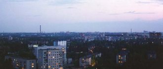
Rostov-on-Don is the region's leader in population
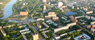
Rostov-on-Don is the capital of the Rostov region, its scientific, educational, financial and industrial center. It is also a major transport hub. This is the only metropolis in the region, which is far ahead of all other settlements. With a population of 1,130,305 people, it ranks 10th in Russia. In terms of agglomeration composition, it is 4th in the country (2,160,000 citizens). Rostov-on-Don is very important in the economic and cultural life of the country. Its unofficial names: Rostov-papa, Gates of the Caucasus, Don capital.
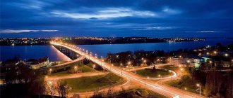
Geographically, Rostov is located on the banks of the large Don River, flowing through the European part of the Russian Federation. It divides the metropolis into two parts. Not far from it are Aksai (135,000 inhabitants) and Bataysk (about 250,000). At the moment, the situation is such that they are almost merging into a single conglomerate. The cities have strong economic and transport connections. The distance between them has been reduced to walking distance. The shortest distance between the buildings of Rostov and Aksay is 34 meters. After the metropolis absorbs its satellites and the legal recognition of this fact, the metropolis will take 3rd place in the country.
Rostov-on-Don was founded as a customs point by imperial decree (1749). The favorable geographical position contributed to the creation of trade routes through Rostov. Its port was important; trade with the Mediterranean countries was carried out from here. The city began to grow rapidly and become richer. In addition to merchants, many people flocked here to work in the port and in factories. Now Rostov-on-Don is one of the richest and economically prosperous settlements located in the south of the country. The largest production facilities in various fields are concentrated here. The most important of them:
- Rostselmash is a well-known manufacturer of grain harvesting equipment. He owns up to 60% of the Russian market;
- "Rostvertol" - an aircraft manufacturer - is the largest cigarette manufacturer in the Russian Federation;
- Gloria Jeans is the largest clothing factory, a federal chain of retail stores;
- TagAZ - automobile - manufacturer, supplier of sunflower oil.
There are many Russian and foreign banks operating in Rostov. Federal retail chains are concentrated here, generating huge trade turnover (Magnit, Sportmaster, Tekhnosila and others). Enterprises provide jobs to the entire population of the metropolis. The unemployment rate here is extremely low. The average salary is higher than in Russia as a whole. Rostov-on-Don has sea and river ports, an international airport, and a network of railways and buses. There are trolleybus, tram and electric train routes. Due to the large number of vehicles, traffic congestion occurs periodically. The city authorities are planning the construction of a metro and a high-speed tram system in order to relieve congestion on transport networks.
Population density by county
There are 9 federal districts in the Russian Federation:
- Central (CFD).
- Southern (Southern Federal District).
- Northwestern (NWFD).
- Far Eastern (FEFD).
- Siberian (Siberian Federal District).
- Ural (Ural Federal District).
- Privolzhsky (Volga Federal District).
- North Caucasus (North Caucasus Federal District).
- Crimean (KFO).
Find out what the average life expectancy of men and women in Russia is here.
Central Federal District
The leader in number among the districts was the Moscow Region. In the Moscow region in 2016 there were 74,318,647 inhabitants. For 1 sq. km of the Moscow region there are 134.91 people.
Population of cities in the Bryansk region
The population of the Bryansk region is 1,225,741 citizens. For 1 sq. km of this region is inhabited by 35.16 people.
Population density of other regions in the Central Federal District:
- Belgorodskaya - 57.13.
- Bryansk - 35.16.
- Vladimirskaya – 48.04.
- Ivanovskaya – 48.04.
- Kaluzhskaya - 33.91.
- Kostroma - 10.82.
- Kursk - 37.34.
- Lipetskaya - 48.08.
- Orlovskaya - 30.82.
- Ryazanskaya - 28.53.
- Smolenskaya - 19.26.
- Tambovskaya - 30.48.
- Tverskaya – 15.50.
- Tula - 58.66.
- Yaroslavskaya - 35.16.
Southern Federal District
The population density of the Rostov region is 41.95 people per square meter. km. The population of the Volgograd region is 2,545,937 inhabitants, and per square meter. km of area there are 22.55 people.
The Astrakhan region is characterized by a density of 20.78 people. per sq. km, and in the Republic of Adygea this figure stands at 57.94 people. per sq. km. The Republic of Kalmykia has one of the lowest density indicators - 3.73.
More than 5 million people live in the Krasnodar region. The average population density is 73.05 people per square meter. km.
Northwestern Federal District
About 1,174,078 people live in the Arkhangelsk region. The average population density in this region is 1.99 people per square meter. km.
The population of the Murmansk region is 762,173 people. For 1 sq. km there are 5.26 people living there. This is a very low figure, given that the area of this region is very large (144,902 sq. km.).
Map of the Murmansk region.
The Volgograd region is characterized by a density of 8.22 people per square meter. km, and in the Kaliningrad region this figure is 64.56. About 1,778,858 people live in the Leningrad region, and the population of the region is 21.20 people per square meter. km.
In the Novgorod region, the density is 11.30 people per square meter. km, and the Pskov region is characterized by an indicator of 11.67.
In the Komi Republic, with an area of 416,774 sq. km, only 856,831 people live. For 1 sq. km there are 2.06 people.
The population of Karelia is 629,875 people. The republic covers an area of 180,520 square meters. km. For 1 sq. km there are 3.49 people living there.
Far Eastern Federal District
The population of the Magadan region is 146,345 citizens. For 1 sq. km of the region there are 0.32 people.
In the Amur region, the average population density is 2.23 people per square meter. km. There are about 2 million inhabitants in the Primorsky Territory, and the population indicator is 11.71 people. per sq. km.
We invite you to find out which countries have the highest population density by watching the video.
In the Kamchatka Territory, the indigenous population in 2022 reached 316,120 people. Density – 0.68 people. per sq. km.
In Yakutia there are 959,690 citizens who live on 3,083,523 square meters. km. For 1 sq. km there are 0.31 people.
The Khabarovsk Territory is home to 1,334,552 people who occupy an area of 787,633 square meters. km. For 1 sq. km of the Khabarovsk Territory are home to 1.69 subjects.
Siberian Federal District
On the territory of the Krasnoyarsk Territory, per 1 sq. km there are 1.21 inhabitants. The total area of this region is striking in its size. It is equal to 2,366,797 sq. km, inhabited by only 2,866,490 individuals.
In the Voronezh region, the number of residents in 2016 reached 2,333,477 people. The area of the Voronezh region is 52,216 square meters. km, and the density is 44.69 people per square meter. km.
The population of the Republic of Buryatia is 982,285 individuals. The average density is 2.80 people per 1 sq. km.
In the Irkutsk region - 2,412,800 citizens. For 1 sq. km there are 3.11 people.
The number of indigenous residents of the Trans-Baikal Territory is 1,083,012. The population rate is 2.51 people per 1 sq. km.
Altai region
Altai Territory is a region with a very large territory (175,996 sq. km). The population in this region exceeds 2.3 million people, and the density is 14.15 people. per sq. km.
Population density of other areas:
- Kemerovo - 28.39.
- Novosibirsk region – 15.54.
- Omsk region – 14.02.
- Altai Republic - 2.32.
- Republic of Tyva - 1.87.
- Republic of Khakassia – 8.72.
- Tomsk region - 3.42.
Ural Federal District
Population density of the constituent entities of the Ural Federal District:
- Kurgan region – 12.06.
- Sverdlovsk region – 22.28.
- Tyumen region - 2.47.
- Chelyabinsk region – 39.54.
The beauty of the Ural Federal District
Volga Federal District
About 685,865 people live in the Republic of Mari El. The total territory of the Republic is 23,375 square meters. km. For 1 sq. km of the Republic there are 29.34 people.
The Samara region is characterized by a density of 59.85 people per square meter. km. Saratov region, with an area of 101,240 sq. km, has a population of 2,487,527 citizens, and the population density is 24.57 people per square meter. km.
In the Republic of Tatarstan there are 3,868,730 citizens who live on an area of 67,847 square meters. km. The population density in this territory is 57.02 people. per sq. km.
In the Udmurt Republic, the density of people living there reaches 36.07 people per square meter. km of territory. The Ulyanovsk region has an average population of 1,257,620 people, and the density is 33.82 individuals per square meter. km.
The population of Perm numbers 2,634,409 citizens who inhabit an area of 160,236 square meters. km. The average density is 16.44 people per square meter. km.
In the Republic of Mordovia, the total number of people living is 807,454, and the population density of this region is 30.90 people per square meter. km.
Population of the regions of the Volga Federal District
About 1,236,629 individuals live in the Chuvash Republic. The average density is 67.42 people per square meter. km.
The Kirov region is inhabited by about 1.3 million people, and the density of people living there is 10.78. In the Nizhny Novgorod region the density indicator is higher. It is equal to 42.55 people per square meter. km, even though the Kirov region is almost half the size of the Amur region.
On average, 2 million citizens live in the Orenburg region. The density in this region is 16.13 people per square meter. km. The Penza region is characterized by a density of 31.11. The Republic of Bashkortostan is almost 100 square meters larger than the Penza region. km, but even despite this, the population indicator in this region is 28.48 people per square meter. km.
North Caucasian Federal District
In the Kabardino-Balkarian Republic, the population is 862,254 inhabitants, and the density is 69.15 people per square meter. km. In the Karachay-Cherkess Republic, the population density is 32.77 people. per sq. km, and in the Republic of Dagestan this figure is 59.99.
In the Republic of Ingushetia, per 1 sq. km are home to 130.31 people, and in North Ossetia the dense population will be 88.11 people per square meter. km. More than 2 million citizens live in the Stavropol Territory, and the density is 42.35 people per square meter. km. In the Chechen Republic, per 1 sq. km there are 89.10 inhabitants.
KFO
Crimean peninsula
The population density of Crimea is 73.12 people per square meter. km. The Crimean Peninsula has a population of 1,907,106 people.
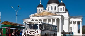
Taganrog is the sea gate of the Rostov region
Taganrog has the status of an urban district. It is located on the coast of the Azov Sea. This is an important port; there is a Russian naval base here. The number of citizens is estimated at 250,000. The predecessor of Taganrog was the Italian port of Porto Pisano (13th century). Later, a fortress was founded on this site. Its favorable location made the port a center of maritime trade. Italian and Greek merchants flocked here. With the beginning of the development of industry in Taganrog, metallurgical and machine-building complexes and power plants began to be built.
Nowadays there are automobile, aircraft, ship repair, and manufacturing industries here. Enterprises and port docks provide work for the entire working population. Taganrog is also important as a transport hub. It is connected to other cities through rail, road, and air networks. The seaport carries out cargo transportation and cruises on the Black and Azov Seas.
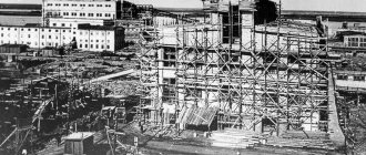
Coal mining
The Rostov region is undoubtedly one of the main coal mining regions. Although most of the mines in the region have closed recently, the Russian government still allocates part of the budget to restore and maintain the proper level of the main mining areas of the region.
Here is a list of cities in the Rostov region that currently mine such an energy-important resource as coal:
- Kamensk-Shakhtinsky;
- Shakhty;
- Belaya Kalitva;
- Donetsk;
- Gukovo;
- Novoshakhtinsk.
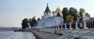
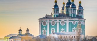
Shakhty is the Orthodox center of the region
Shakhty is the 3rd largest city in the Rostov region. It is only a few thousand behind Taganrog in terms of the number of inhabitants. It is of great importance as an educational and industrial center, as well as a cultural and Orthodox one.
For a long time, the basis of the mines' economy was heavy industry: coal mining, mechanical engineering, metallurgy. Now there has been a reorientation towards light industry sectors: energy, textile production, construction. There are food processing plants, clothing and shoe factories. A diocese of the Russian Church was created in Shakhty. There are a large number of temples and churches here. The mines have several prestigious educational institutions, many colleges, and sports schools. There is a Federation of Football and Karate-Do.
Population density of the Russian Federation by year
Table: population density of the Russian Federation by year
| Year | Population | Density (persons per sq. km) | Population growth (%) |
| 2000 | 146 662 563 | 8.57 | -0.33 |
| 2001 | 146 109 536 | 8.54 | -0.38 |
| 2002 | 145 506 821 | 8.51 | -0.41 |
| 2003 | 144 889 334 | 8.47 | -0.42 |
| 2004 | 144 313 531 | 8.44 | -0.40 |
| 2005 | 143 833 240 | 8.41 | -0.33 |
| 2006 | 143 480 487 | 8.39 | -0.25 |
| 2007 | 143 259 328 | 8.37 | -0.15 |
| 2008 | 143 151 706 | 8.37 | -0.08 |
| 2009 | 143 124 912 | 8.37 | -0.02 |
| 2010 | 143 142 380 | 8.37 | 0.01 |
| 2011 | 143 184 788 | 8.37 | 0.03 |
| 2012 | 143 249 506 | 8.37 | 0.05 |
| 2013 | 146 347 100 | 8.55 | 0.07 |
| 2014 | 146 666 900 | 8.41 | 0.22 |
| 2015 | 146 270 033 | 8.55 | 1.81 |
| 2016 | 146 330 004 | 8.60 | 0.04 |
| 2017 | 146 389 999 | 8.57 | 0.04 |
The population density during the existence of the Soviet Union was 8.61 people per square meter. km.