Geographical location of the Tver region
You need to look for the Tver region on the map of Russia in the west of the country. It occupies part of the East European Plain. From south to north the region stretches for 350 km. Its length from east to west is 450 km. There are 5 reservoirs located on the territory of the region, which are of great importance for navigation.
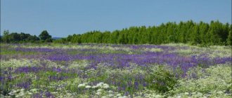
The main river of the region is the Volga. Almost 2/3 of the region's territory is its basin. Half of the region's land is covered with forests. In the region there is one of the most famous lakes in the country - Seliger. The region has virtually no mineral resources, but it has an advantageous geographical location. The region is located between Moscow and St. Petersburg.
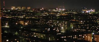
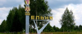
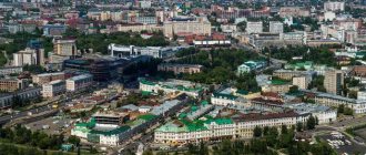
Vyshny Volochek - large, but steadily decreasing
Vyshny Volochek, located 300 km from Moscow and 119 km from Tver, closes the top three. The density index here is even lower - 868.67, so there are no congestion or crowded streets, and even tourists do not disturb its quiet life too much. In the 18th century, it was listed as one of the largest and most comfortable settlements in the Tver region: several railway lines, more than ten churches and chapels passed through it, several schools and a dozen industrial enterprises operated.
From 1885 to 1973, the population increased almost 5 times: from 15,838 to 76,000. After that, a steady decline in the number of Volochan residents began: according to data for 2022, 46,908 live here. The decrease is due to natural decline and migration to larger settlements, especially Moreover, St. Petersburg and Moscow are located quite close.
In Vyshny Volochyok there are three institutions of secondary specialized education, seven industrial enterprises, mainly light and food industries. Three of them specialize in the production of fabrics, and one makes national Russian shoes - felt boots. The sights are more diverse: the central city street, Kazansky Prospekt, is replete with remarkable houses and mansions of the 18th and 19th centuries. Near the Museum of Local Lore, where, among others, works by Repin are displayed, there are shopping arcades from the same era. Of interest are the Cathedral of the Epiphany with its miraculous icons, the Monastery of the Kazan Icon of the Mother of God for women, and the Vyshnevolotsk water system - an outstanding achievement of 19th century designers.
Transport connections of the Tver region, routes and roads
The satellite map of the Tver region clearly shows its transport network. Federal highways pass through the region:
- M10 "Moscow - St. Petersburg";
- M9 "Baltia".
In addition to them, there are more than 1,930 highways of republican and local importance in the region. Their total length is more than 16 thousand km. Public transport is well developed in the region. Cities and towns are connected by 134 intercity and 388 suburban routes.
The length of the railway track in the region is more than 1800 km. Shipping routes are laid along the Moscow Sea, Seliger, Volga and other rivers of the region.
History of the region
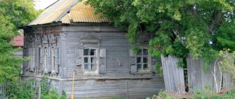
The areas of the Tver region were inhabited during the Paleolithic and Neolithic periods. Numerous excavations have shown that there were sites of ancient people here in different centuries. There have always been favorable living conditions here: flat lands, many rivers, and plenty of wood for building houses.
Tver is mentioned in chronicles of the 12th century; even then the city was considered a major administrative center, and in the 18th century the region received the status of a province. In 1931, Tver was renamed Kalinin, and the historical name was returned only 60 years later. The population of the Tver region during Soviet times decreased from 3 million to 1.6 million.
During the Great Patriotic War, this territory was occupied, the inhabitants were practically in captivity for a long time. Only in 1944 the region was liberated from the invaders. For steadfastness and resistance to the enemy, the Kalinin region was awarded the Order of Lenin.
Tver region with cities and villages
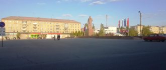
The region is divided into 5 districts, which have urban significance. These include: Vyshny Volochyok, Rzhev, as well as Kimry, Tver and Torzhok. Udomlya has regional significance, Ozerny and Solnechny are closed. There are 35 districts in the region. Largest cities:
- Tver - more than 420 thousand people;
- Rzhev - more than 59 thousand people;
- Vyshny Volochyok - more than 47 thousand people.
Several natural areas have been created in the region for the development of tourism and recreation. They included:
- Lake Seliger and the Upper Volga reservoirs connected to it into a single cluster.
- Karelian trail. The zone includes Likhoslavlsky, Rameshkovsky, Spirovsky and Maksatikhinsky districts.
- Moscow Sea. Recreation areas in this cluster are concentrated in Bolshoye Zavidovo and Konakovo River Club.
- The Vyshnevolotsk reservoir, called the “Russian Venice”.
- Central Nature Reserve "Clean Forest".
The beautiful islands of Seliger
Lake Seliger is rich in islands. Many of them played an important role in the life of the entire country and are of great importance not only from a natural, but also from a historical point of view.
Khachin Island
- Coordinates: 57.268942, 33.036542.
Spacious Khachin is the largest island of Seliger. Despite its size, its four villages are home to fewer than 20 people. The main inhabitants of Khachin are wild animals: bears, foxes, hares, wild boars, moose, badgers, muskrat. Waterfowl nest along the banks, among which the rare bittern stands out.
The island is so large that it contains 13 lakes rich in fish. Small reservoirs contain pike, perch, burbot and roach. In some, eel and tench are found, and beavers settle on the banks. There are two summer boarding houses on Khachin.
Gorodomlya Island
- Coordinates: 57.202670, 33.065800.
The second largest island of the great Tver Lake has witnessed many historical events. The first settlements appeared here several thousand years ago. In the 16th century, the island belonged to the boyar Belsky, who then granted it to the boyar Lykov. After 20 years, Lykov transferred the land of the Nilo-Stolobenskaya desert. The monks founded the Gethsemane monastery on Gorodomlya.
In the 1930s, a scientific institute for the study of foot-and-mouth disease appeared on the island. Virologists under the leadership of A.L. Skomorokhov were looking for a vaccine against a terrible disease. During the Great Patriotic War, a military hospital was located here. After the war, a machine-building plant was built, and the island itself became a sensitive facility.
Currently, Gorodomlya remains a closed island, but getting to it has become much easier. The island is covered with relict coniferous forest; among the trees, ancient monastery houses and a tall wooden church have been preserved. On Gorodomlya you can see a kind of smaller copy of Seliger: in the middle of the island there is a small lake, which in turn contains several small islands.
Klichen Island
- Coordinates: 57.180168, 33.087952.
The island with an area of about 90 hectares on Lake Seliger has the status of a natural monument. Klichen is so big that it contains a lake. From a bird's eye view, the island looks like an uneven donut. The island is covered with pine trees; among the evergreen trees there are willows, alders, junipers, birches and maples.
Centuries ago, the city of the same name, which belonged to the Principality of Suzdal, rose on the island. The Klichen fortress stood in the way of merchant ships. According to one version, the name of the town comes from the word “cry”.
When enemies attacked the island, the watchmen sent out a cry throughout the village so that the local residents would hide behind the high walls, and the warriors would rise to defend the fortress. In the 14th century, Novgorodians razed the proud and independent city to the ground.
Today no one lives on the island, but in good weather it can be quite crowded. Residents of nearby Ostashkov and tourists from other cities and regions come to Klichen to relax in silence, enjoy the wonderful pine aroma and pick berries. Raspberries, lingonberries, blueberries and strawberries grow in abundance in the pine forest.
Stolobny Island
- Coordinates: 57.234679, 33.061775.
The green island of land in the north of Seliger became famous thanks to the Orthodox monastery, which was built on it in the 16th century according to the behest of St. Neil of Stolobensky. The monastery occupies the entire territory of the small island; part of the monastery buildings is located on the neighboring Svetlitsa peninsula. A strong bridge stretches from Stolobnoye to the “mainland”, so you can get to the Nilo-Stolobenskaya hermitage by car.
The Nilo-Stolobenskaya hermitage flourished until the October Revolution, when the Bolsheviks who came to power closed the monastery and turned it into a colony for juvenile delinquents.
Later, a prisoner of war camp, a military hospital, a nursing home, a camp site and other secular organizations were located on the island. In the early 90s, the deserts were transferred to the Russian Orthodox Church and restored. Today, pilgrims from all over the country come to Stolobny to join the Orthodox shrines and enjoy the natural beauties of Seliger.
Pastime of the population
There are many monuments of historical and cultural heritage in Tver and the region. There are especially many preserved monasteries and temples, some of which are more than 500 years old. The Ascension Cathedral in Tver was built in the mid-18th century and today has the status of a bishop's courtyard. The church burned more than once and was rebuilt; today the relics of the holy martyr Thaddeus are kept here.
A real work of art is the Staritsky Holy Dormition Monastery, which is located in a picturesque location on the banks of the Volga. The monastery was founded in the 12th century, but the first buildings have not survived to this day and were destroyed in the 14th century. Almost a hundred years later, the monastery was rebuilt from scratch; it is these white stone buildings that have survived today.
The unique temple is located in the city of Torzhok; the wooden building, built in the 18th century, has stood with minimal restoration for more than 200 years. Even a painting from the mid-18th century has been preserved in almost intact condition.
Regional leaders
Igor Rudenya has recently been appointed over all districts of the Tver region. He was elected governor in September 2016, when the president nominated him to this position. In this post, he replaced Andrei Shevelev, who served as head of the region for 5 years.
The new government managed to achieve an improvement in the economic situation in the region; over the past 5-6 years, the Tver region has risen in the international economic rankings by several points. The number of investments in the region has also increased; large foreign and Russian companies have begun to invest more and more in local businesses.
Famous people
Many famous people were born and lived in the Tver region.
- Afanasy Nikitin, famous traveler, orientalist, the first Russian to reach India, author of the famous book “Walking across Three Seas.”
- Arseny Ivanovich Vvedensky is a Russian critic, literary historian, and has written hundreds of books about Russian writers.
- Khitruk Fedor Savelyevich, famous Russian animator, creator of the favorite cartoon about Winnie the Pooh.
- Mikhail Krug, singer, author and composer, became famous throughout Russia for his songs in the chanson style. Died at the hands of robbers.
In addition, more than 20 heroes of the Soviet Union were born in the region, who distinguished themselves during the Great Patriotic War. Almost all famous citizens in the city have monuments, monuments or plaques of honor.
Population
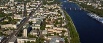
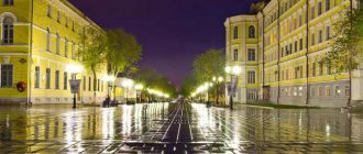
The main city of the region has a rich and glorious history. The city is located in a picturesque location, located on both sides of the Volga River. Today, the population of Tver exceeds 400 thousand. The city stands on the Upper Volga Plain, with only low hills and elevations.
The Volga has always been of great importance in the history of Tver. Merchants rafted along the river, transporting timber and other goods directly to Moscow. The widest point of the river within the city is 552 meters. The first mention of a rural settlement in these parts dates back to the 11th century. In the 13th century, the first city was completely destroyed by the Tatars, but was quickly rebuilt. There is a version that after the devastation on the left bank, the population of Tver moved to the right side of the Volga and built a new settlement here.
At the end of the 15th century, Tver became an important trade and cultural center. Here are the routes of communication between Novgorod and Vladimir. In addition, it was in Tver that unique monuments of ancient Russian literature were created: “The Tale of Mikhail Alexandrovich”, “A Word of Praise to the Tver Prince Boris Alexandrovich”. The city has preserved many churches, the Kremlin with examples of traditional Russian architecture.
Today, 419 thousand people live in Tver, a fairly high figure; over the past decades, there has been no sharp departure of residents to other regions. The highest numbers were recorded in the late 90s, when over 450 thousand people lived in the city.