The Omsk region is located in the southwestern part of Siberia. The development of this large region began in the 16th century, when the troops of Ataman Ermak came to the Siberian lands. Satellite maps of the Omsk region will help you get an idea of the location of the region, find its cities, roads and other objects. Using the online service you can find buildings, attractions, and train stations. It will prove to be an indispensable assistant when traveling and on a business trip.
The region neighbors Kazakhstan, as well as such Siberian regions as:
- Novosibirsk;
- Tomskaya;
- Tyumen
From north to south, the region is divided into 2 parts by the Irtysh River. On the map of the Omsk region with diagrams you can also find other rivers:
- Ishim;
- Tara;
- Osha;
- Om.
The southern regions are represented by steppe and forest-steppe landscapes, and in the north of the region there are vast swampy areas. The nature and wildlife of the region are unique. There are about 30 nature-protected areas in which wild animals, rare birds and fish live. In every corner of the region there are beautiful places, historical and architectural attractions, which can be found on a map of the Omsk region with districts.
Before you go to this region, research it using an online service. You can find out how to get to any locality by car - the map will indicate the desired route, which cities have rail connections and how to reach the region by air. In any area on the map of the Omsk region you can find interesting objects, monuments and nature reserves.
Omsk region
The population of the Omsk region has been decreasing every year over the past few years. The region experienced an outflow of residents to regions and republics with a more favorable climate and economic situation.
The region is located in the southwest of Siberia. The largest city is Omsk, which has a population of just over one million 100 thousand people.
The main industries in the region are construction and trade. Industry is represented by military and agricultural engineering, petrochemical and food industries. There are no large energy facilities in the region.
During the Soviet Union, especially in the 70s, the Omsk region was one of the most developed Siberian regions. For the decline in which the region is today, many blame its governor Leonid Polezhaev, who led the region from 1991 to 2012.
Experts note that the real sector of the economy is in poor condition. One of the reasons is the large outflow of qualified specialists to Tyumen and Novosibirsk, located nearby.
Today the Omsk region is developing in a cluster manner. At the same time, it does not have the prerequisites for a sharp rise, but it can achieve success through the integrated development of all of Siberia. Its key assets are land, mechanical engineering and petrochemical production.
Region area
The area of the Omsk region is more than 141 thousand square kilometers. This amounts to almost 1 percent of the entire country.
According to this indicator, the region to which this article is devoted ranks 28th in the country. Between the Republic of Bashkortostan and the Orenburg region. If we take into account only the Siberian Federal District, then in terms of area the Omsk region ranks 8th, behind the Krasnoyarsk, Altai and Transbaikal territories, the Irkutsk, Tomsk and Novosibirsk regions, and the republics of Buryatia and Tyva.
General information
The Omsk region of Russia is located in the south of Western Siberia, in the Middle Irtysh region. The area of the region is 139.7 thousand sq. km, the population is 2146 thousand people, 67% of the population lives in cities (2001). The region includes 32 districts, 6 cities, 24 urban-type settlements (2001).
The administrative center is the city of Omsk. The region was founded on December 7, 1934 and is part of the Siberian Federal District.
The Omsk region borders on Kazakhstan in the south, Tyumen in the west and north, and Tomsk and Novosibirsk regions in the east.
The surface of the region is a gently undulating plain (height up to 146 m); in the south, ridge-like hills (ridges) that stretch for several kilometers are typical. In the northern part there are vast wetlands. The main river is the Irtysh with its tributaries (the largest is the Tobol). There are many lakes in the region, mostly salty in the south, fresh in the north, the largest of which are: Ik, Tenis, Saltaim, Ebeity.
The climate is continental. Winter is long and cold, the average temperature in January is -20°C. Summer is warm and short, the average temperature in July is +20°C. Precipitation is 300-400 mm per year.
The Omsk region is located in the zones of southern taiga, mixed forests, forest-steppe and northern steppes. The soils are predominantly chernozem and meadow-chernozem, in the north - sod-podzolic. Forests occupy 24% of the region's territory. The main species: cedar, spruce, fir, birch and aspen. Mixed forests are replaced to the south by a strip of deciduous birch-aspen forests, gradually turning into forest-steppe zones. Preserved: in the forest zone - squirrel, weasel, ermine, fox, reindeer, elk, roe deer, wolf, bear; in the forest-steppe - fox, mountain hare, steppe ferret; in the steppe - red-cheeked ground squirrel. There are many ducks and geese on numerous lakes and oxbow lakes in summer. In the steppe and forest-steppe zones there are black grouse and gray partridge; in the forest - capercaillie. The shores of the lakes are surrounded by dense groves of birch, aspen, common willow, and silver poplar.
Population
The population of the Omsk region in 1959 was one million 645 thousand people. This data is provided by the All-Union Population Census. This is the first fairly accurate statistical information available for this region.
Subsequently, the population of the Omsk region systematically increased. By 1987, it had surpassed the two million mark. This figure reached its maximum in 1993. At that time, two million and almost 169 thousand people lived in the Omsk region. After this, the number of residents began to decrease every year. In 2010, the region's population was less than two million.
It was only recently possible to correct this situation. Only in 2015. The population census of the Omsk region demonstrated that then, for the first time in 12 years, there was an increase, not a decrease, in the number of residents in the region. Over the next two years, the population of the Omsk region increased slightly, but increased. In 2022, there will be a slight decline again.
[edit] Population
Main article
:
Population of the Omsk region
Population (estimated as of January 1, 2010), thousand people:[35]
- total population - 2012.1
- urban - 1394.5
- rural - 617.6
Population density (as of January 1, 2010) - 14.3 people per 1 km2.[36]
National population structure (according to the census as of October 9, 2002), percent:[37]
- Russians - 83.5
- Kazakhs - 3.9
- Ukrainians - 3.7
- Germans - 3.7
- other nationalities - 5.2
Districts of Omsk region
There are 32 districts on the territory of the Omsk region. The largest are Omsk, Tara and Tavrichesky districts.
The population of the Omsk region is more than 100 thousand people, the administrative center is in the village of Rostovka. About 45 thousand people live in the Tara district (the administrative center is in the city of Tara), and about 36 thousand people live in the Tavrichesky district (the administrative center is in the working village of Tavrichesky).
The village of Znamenskoye, Omsk region, requires special mention. This is the center of the Znamensky district. Several large Siberian rivers are concentrated in it - the Irtysh, Osha, Bolshoi Aev, Bolshoi Nyagov and Shish.
The village of Znamenskoye, Omsk Region, is a striking example of a dying settlement. If before the Great Patriotic War almost 40 thousand people lived in the area, today there are about 11 and a half thousand left. At the same time, a little more than 5 thousand people live in Znamensky itself.
Districts on the map of the Omsk region
The region is divided into 32 districts. The northern regions have large areas, while the southern ones are smaller but densely populated. The main district of the region is Omsk. Large highways pass through it, which are indicated on the detailed road map of the Omsk region, and the Trans-Siberian Railway. You can also come here by air or water transport. In the Omsk region there is the Achair outpost - this is one of the first settlements that was built by Russian people.
If you move around the map of the Omsk region with settlements, you can find areas with unique and interesting sights:
- Lake Ulzhay - in Cherlaksky district;
- natural park "Batakovo" in Bolsherechensky district;
- St. Nicholas Monastery - in the Omsk region;
- Rock "Devil's Finger" in Gorky district.
If you are traveling around the region, then in each district, using a detailed map of the Omsk region, you can create your own route and visit interesting places. For those who are on a business trip, the online service will help them find hotels, enterprises, administrative institutions, and cafes.
National composition
The ethnic composition of the Omsk region is very diverse. There are 35 nationalities recorded in the region. Most of all Russians live in the region. Their number is 85% of the total number of residents of the region.
In all districts of the Omsk region, the Russian population is represented in the absolute majority. In some, this figure exceeds 90%. The fewest Russians live in the Pavlogradsky district - only 52%. 24% of Ukrainians and 16% of Kazakhs also live here.
The Chuvash population of the Omsk region is among the ten largest diasporas in the region. According to the latest census, more than three thousand Chuvash live in this Siberian region. Also, the top ten largest nationalities include, in addition to Russians, Ukrainians, Kazakhs, Germans, Tatars, Armenians, Belarusians, Azerbaijanis and Uzbeks.
The region is also home to such rare nationalities as Finns (about 200 people), Greeks (about 500 people) and Chinese - almost 800 inhabitants.
Religious composition
Since the vast majority of residents in the region are Russians and Ukrainians, the dominant religion is Orthodoxy. On the territory of the Omsk region there are several places popular among Christian pilgrims.
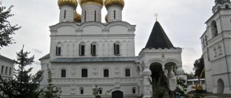
The Achair convent, founded back in 1890, stands apart. The calm life of the monastery was disrupted by the arrival of Soviet power. One of the Gulag colonies was founded on the territory of the monastery. Up to a thousand people were kept there at a time. The prisoners did not even have to be shot. They simply died from unbearable conditions, hunger and cold.
In the village of Bolshekulache there is the St. Nicholas Monastery. The first temple in these places appeared in the middle of the 18th century. At the beginning of the 20th century a stone church was built. But it was destroyed almost immediately after the victory of the October Revolution. They began to restore the building for the monastery in 1988. The work was completed in the mid-90s. Today it is one of the most revered Orthodox sanctuaries in the temple. In it you can see and worship icons and the Life-Giving Mother of God Spring.
In the Maryanovsky district, on the territory of the village of Tatyanovka, the St. Seraphim Monastery operates today. According to a legend that is still popular, it was founded by Mother Varvara. She went to live in the forests, lived in a dugout and prayed incessantly. She built the first, wooden part of the temple with her own hands. A chapel was later located in it.
Resettlement of residents of the Omsk region
The entire population of the region is distributed among 6 cities, 21 workers' settlements and rural settlements. The latter number more than one and a half thousand.
More than 55% of the population of this Siberian region permanently reside in the capital of the region, the city of Omsk. In this region, this is the highest concentration of residents in the regional center compared to all other regions.
The settlements are mainly located along key transport networks. This is primarily the Trans-Siberian Railway, which pierces the region from west to east, as well as the Irtysh River, great for these places, which flows from south to north. Thus, a kind of transport cross is obtained. By the way, he is depicted on the region’s coat of arms.
[edit] Geography
Main article
:
Geography of the Omsk region
Territory area - 141.1 thousand km2. The distance from Omsk to Moscow is 2555 km. The climate is temperate (continental). Average temperature in January 2009: −17.7° C. Average temperature in July 2009: +18.4° C.[11]
[edit] Geographical location
The Omsk region is located in the south of one of the greatest plains in the world - West Siberian. Geographers often call this region the Omsk or Middle Irtysh region. The development of human society has gone through a complex and long journey here, spanning several millennia. Since the end of the 16th century and now for the fifth century, the historical fate of Russia has been the fate of the Omsk Irtysh region. The area of the Omsk region is 141,000 km2. In terms of the size of its occupied territory, it exceeds most regions and territories of the European part of the Russian Federation, many states of Western Europe, but is inferior to most other regions of Siberia and the Far East. It can accommodate such European countries as Austria, Switzerland, Belgium, and the Netherlands combined. The area of the Omsk region exceeds the area of such significant European states as Greece, Portugal, Hungary or Bulgaria.[12]
In terms of configuration, the territory of the Omsk region is a complex polygon stretching along the Irtysh, from north to south for almost 600 km between 53º and 58º north latitude. The distance from the western border to the eastern, between 70º and 76º E, is, in its widest part, over 300 km. The Omsk region borders in the north and northwest with Tyumen, in the northeast with Tomsk, in the east with Novosibirsk regions of Russia; in the south and southwest - with the Republic of Kazakhstan. The total length of the borders exceeds 2800 km. Moreover, a significant part of this distance is the state border of Russia and Kazakhstan.[13]
The geographical location of the region determines the diversity of its natural conditions and resources and is considered quite advantageous. If we consider the territory of the Russian Federation from west to east, then the Omsk Irtysh region is located almost in the center of the country, at the intersection of important railways, highways and a large waterway - the great Siberian river Irtysh.[14]
At the beginning of the 21st century, the Omsk region consists of 32 rural municipal districts and the city of Omsk. There are five small towns in the region: Tara, Kalachinsk, Isilkul, Nazyvaevsk, Tyukalinsk. The administrative, economic and cultural center of the region is Omsk. It is almost equidistant from the western and eastern borders of the region and is located 150 km south of its geographical center, which is located in the south of the Kolosovsky district, northeast of the village. Kalmakul. The city arose at the confluence of the Irtysh and Om rivers and is a major junction of railway, road, water and air routes. Omsk is the historical capital of the Irtysh region and one of the largest Russian cities with a million population. It is a powerful center of oil refining, chemical, engineering and other industries.[15]
[edit] Relief
The Omsk region occupies a flat, slightly undulating territory, where there is a gradual slope to the northwest. The altitude of the area above sea level varies here slightly. The highest point in the region - 149 m above sea level is in the Muromtsevo district, the lowest - 41.7 m - in the Ust-Ishim region.[16]
The Irtysh crosses the Omsk region from south to north and divides it into two parts: the left bank and the right bank. These parts differ from one another in the nature of the relief. Certain differences are also present in various sections of the left and right banks of the great Siberian river. Therefore, within the region, due to the relief features, eight geomorphological regions are distinguished.[17]
The Ishim Plain occupies a significant space on the left bank and is divided into three parts. The first of them is limited in the south by the valley of the Kamyshlovka River, in the north - by the alluvial plains of paleo-rivers and terraces of the Irtysh. The second part is located south of the Kamyshlovsky log all the way to the North Kazakhstan Plain. The third, northernmost part of the plain is separated from its main part by the valley of lakes Ik, Saltaim and Tenis. The height of the Ishim Plain above sea level ranges from 135 m in the west to 105 m near the Irtysh valley in the east. The dominant landscape here is flat, with spiky, saucer-shaped depressions. These depressions are often occupied by lakes. In the north, the plains of the depressions are mostly swampy. In the southwest, ridged landforms are common, which gives the area a wavy character. Fluctuations in relative heights here range from 2 to 5 m. The relief becomes more complex in the area of the large mineralized Lake Ebeity, the slopes of which are dissected by gullies and ravines. The ancient Kamyshlovskaya valley, reaching a width of 1.5 - 4 km, cuts through the Ishim Plain along its center from west to east with a depth of up to 15 m.[18]
The Verkhneoshskaya Plain, located in the north-west of the Omsk Irtysh region, dissects the Ishim Plain, in comparison with which it is 15 - 20 m lower. This plain has an inter-ridge topography and numerous lakes, among them Ik, Saltaim, Tenis. The lowlands lying among the ridges are swampy.[19]
The Lower Irtysh Plain occupies the northern left bank of the Irtysh and includes its third floodplain terrace and lake-alluvial space. This plain is also called Kolosovskaya. Its absolute heights are 77 - 121 m above sea level, and the height above the edge of the Irtysh is up to 25 m. The plain is distinguished by a gently undulating, trough-shaped topography, a large number of depressions, lakes and lake-marsh depressions. It is slightly inclined towards the Irtysh.[20]
The North Kazakhstan Plain is located in the extreme south of the left bank of the Omsk region near the border with the Republic of Kazakhstan. The absolute heights here are 110-141 m above sea level; the maximum height, 141 m, was established in the south of the plain, near the village of Khlebodarovka, Russko-Polyansky district. The surface of the plain is flat, sometimes slightly undulating; Steppe saucers-traps are often found. The ancient Alabotinskaya valley, with absolute heights of 98 - 111 m, crosses this plain from west to east.[21]
A special place in the topography of the region is occupied by the area of river valleys of the Irtysh basin. They occupy spaces directly adjacent to the Irtysh and its tributaries. These valleys usually have a complex structure and consist of a floodplain and two or three terraces above the floodplain. The Irtysh flows in a spacious valley, expanding from top to bottom along the river up to 40 km. The floodplain is composed of clayey and loamy formations and, increasing to the north, reaches a width of 14 km. It can be clearly traced along the left bank. This is the lowest form of relief in the region. Its height above sea level gradually drops from 82 m in the south, in the Cherlaksky region, to 43 m in the north, in the Ust-Ishim region. In the low areas of the floodplain there are riverbed banks, oxbow lakes, channels, and small floodplain ridges. The surface of the high areas of the floodplain is flatter. On the right bank side of the Irtysh floodplain, near high cliffs, rows of ancient landslide bodies created a relief of pseudo-terraces. The first terrace above the floodplain runs as a continuous strip in the Sargat region and in separate fragments in other parts of the river valley. The absolute height of this terrace, well defined in the relief, is 87 m above sea level in the south, and 53 m in the north. Its surface is usually flat, with former oxbow lakes and riverbeds found in places. The more ancient second terrace above the floodplain lies in a continuous strip along the left bank of the Irtysh; on the right bank it is observed only in isolated areas. Its absolute heights decrease from south to north from 101 m to 61 m. The ledges of the terrace are steep in places and clearly defined in the relief, its surface is slightly undulating. Ridge-hollow and depression-basin relief forms, as well as lake-marsh depressions, are widely developed here. The terrace transitions into the flat part of the area gradually and almost imperceptibly.[22]
The plain of the Tobolsk continent is located on the right bank north of the Omsk region. Absolute heights above sea level here range from 106 to 123 m above sea level. There is a slow decrease from the northern border of the plain to the south, towards the Irtysh. At the same time, on the Irtysh ridge, near the Tentis River in the Tevriz region, one of the highest points of this plain is noted - 116 m above sea level. The surface of the plain is quite flat, with significantly swampy watersheds, but numerous taiga rivers flowing into the Irtysh dissect the area with gullies and ravines.[23]
The Tara-Tui (Vasyugan) plain lies on the right bank of the Irtysh, in the northeastern part of the region. Its southern border runs along the Tara River; in the north-west Vasyugan region comes into contact with the plain of the Tobolsk continent. The absolute height of the area above sea level varies here from 100 to 149 m, but the predominant heights are 120–143 m. Moreover, the height of 149 m, which is located near the Bergamak River, north-west of the village of Karaklinka, Muromtsevo district, is the highest point on earth surfaces on the territory of the Omsk region.[24]
The West Barabinskaya Plain is located on the right bank of the Irtysh, in the eastern part of the region. Its western part is occupied by the Irtyshsky ridge, rising 10–15 m above the plain. The ridge has a flat surface and expands from south to north, from 6 km in the Cherlaksky district to 30 km in Muromtsevsky. The western slope of the ridge is steep, ending towards the Irtysh, it is crossed by ravines and ravines, forming picturesque hills. The eastern slope is gentle, gradually turning into a plain. The surface of the main part of the plain is flat and recessed. The depressions in its southeast are occupied by lakes. The West Baraba Plain is cut from east to west by the Om River. The slopes of its valley are cut in places by ravines and ravines.[25]
The most common types of relief in the region are flat-recessed, flat swampy, gently ridged and curved-hollow. The flat-western relief occupies vast spaces of the Ishim and North Kazakhstan watershed plains on the left bank of the Irtysh, as well as on the Irtysh ridge and part of the West Barabinskaya Plain adjacent to the Om Valley. The depressions are round in shape, usually small in size and up to 1 m deep. Lakes arose in the larger depressions. The flat relief of the swampy spaces between the rivers of the northern part of the Right Bank of the Irtysh is formed by slightly convex raised bogs. The lowland swamps of the northern part of the left bank have a flat-hummocky microrelief. Gently ridged relief is characteristic of the parts of the Tobolsk continent, Tara-Tui continent and the Irtysh ridge adjacent to the Irtysh. The ridge-hollow relief is presented on the left bank of the Irtysh in the Sargat region, in the ancient Alabotinskaya valley, in the area of lakes Ik, Saltaim and Tenis.[26]
The relief of the Omsk Irtysh region is formed by tectonic movements of the earth's crust, climate influences, and surface waters; in the modern period, this process is actively influenced by human economic activity.[27]
[edit] Climate
A typical continental climate has formed on the territory of the Omsk region, with moderately cold winters and relatively warm summers, short transition seasons: spring and autumn, late spring and early autumn frosts, sharp temperature fluctuations during the day. Cold Arctic air masses from the north and warm ones from Kazakhstan and Central Asia, covering the region from the south, as well as humid air currents reaching its limits from the west, are the most important climate-forming factors here. The inland location of the region significantly softens the effect of oceanic air masses. Thus, cyclones that form over the seas of the Atlantic Ocean basin come to the Omsk region mainly from the southwest and northwest and are accompanied by unstable temperature conditions, rains in summer and snowfalls in winter. However, passing thousands of kilometers above the surface of the continent, they partially lose their original power. Anticyclones arise due to the influx of Arctic air from a permanent center of high pressure - the polar maximum. But air flows from the Arctic, passing over the West Siberian Plain, crossing it from north to south, although they do not encounter natural barriers, approaching the borders of the region, gradually warm up and somewhat change their qualities. Their arrival is accompanied by long, clear and quiet weather, cooling in winter and warming in summer.[28]
The energy basis of weather and climate processes is, of course, solar radiation. In Omsk, the average duration of sunshine per year is 2223 hours, which is more than in the Black Sea resort cities of Sochi and Batumi and only 140 hours less than in Rome. At the geographic latitude of Omsk on the day of the summer solstice, June 22, the duration of sunshine is 17 hours 8 minutes; on the day of the winter solstice - 6 hours 48 minutes.[29]
The average annual air temperature in the Omsk Irtysh region fluctuates around 00 °C. It increases at the latitude of Omsk and to the south of it to + 0.40 °C and decreases in the northern regions to - 0.30 °C. The central and southern regions are characterized by insufficient and unstable moisture and are susceptible to droughts and hot winds. Northern regions are characterized by sufficient and even excessive moisture. Most of the annual precipitation falls between April and October.[30]
Winter usually lasts from November to March. In the last calendar month of autumn, November-November, the temperature steadily drops below - 50 °C and freeze-up occurs on the Irtysh in the first ten days. If winter is early, then snow cover sometimes occurs in the second half of October, in the case of late winter - in early December. Severe frosts, reaching -30 - 350 °C are rare, but occur already in November. The calendar winter months of December, January and February are the harshest. Their average temperatures range from 16 to 200 °C, and sometimes maximum temperatures range from 45 to 500 °C. In the coldest month of the year, January, the lowest temperature was recorded in the northeastern regions of the region - 540 °C. However, at the turn of the 20th–21st centuries, a general warming of the climate occurred, and such low temperatures have not been observed for a long time. In March, frosts weaken and the average temperature rises to −100 °C; sometimes short-term drops in temperature to -35–400 °C are possible. In November - December every second day, and in January - March every third day snow falls. The total amount of precipitation in the winter months is significantly less than in the warm period. Snow accumulates quickly at the beginning of winter and remains until April. The highest depth of snow cover usually occurs in the second ten days of March. In the north of the region, its height reaches 30 - 40 cm in open areas and 50 - 60 in protected areas, in the south - 15 - 30 cm and 30 - 40 cm. In the north, snow falls several days earlier than in the south and disappears a little later. Soils freeze in the north up to 110 cm, and in the south up to 250, in some years up to 3 m. Ice, blizzards, frost, fog, drifting snow are common phenomena of the Siberian winter.[31]
In April, in the vast expanses of the Omsk Irtysh region, spring fully comes into its own. By mid-April, the air temperature steadily rises above 00 °C, and the snow cover melts. In late spring it can linger until the end of April, and in the north until the beginning of May. Sometimes snow falls again, but quickly melts. In May, the average air temperature rises to +120 °C, but sharp short-term cold snaps are also possible. Frosts in the air stop at the end of May, and sometimes only in the second half of June.[32]
Summer in the region is usually hot, with a lot of sunny days. June is most often the cloudiest month of summer, when the earth receives the maximum amount of heat. But the average monthly air temperature does not exceed +180 °C, which is lower than in July. This is due to the fact that a significant part of solar energy is used to heat the soil. The hottest month is July, when the average air temperature in Omsk can reach +230 °C. In the north of the region, the maximum temperature in hot years exceeds + 330 °C, in the south + 400 °C. Under such weather conditions, the soil surface heats up by more than 600 °C. In August, the average monthly air temperature drops to +150 °C, and from the middle of the month frosts begin on the soil and in the air. The average duration of the frost-free growing season is 115-130 days to the south of Omsk, and 110-115 to the north. In different years this period may shorten or increase. Summer precipitation is unstable, uneven and often showery. The daily maximum often exceeds the monthly norm. There are slightly fewer days with precipitation than in winter; the duration of precipitation in summer is the shortest of the year. In many cases, heavy rains are accompanied by strong gusts of wind, thunderstorms, and less often hail. The distribution of precipitation in the calendar year, when the largest amount falls in the summer with maximum heat saturation and duration of sunshine, is an important positive feature of the climate of the Omsk Irtysh region. Unfavorable factors are droughts, which the south of the region experiences on average once every 3 years, and the north - every 10 years or more. Sometimes in the north a situation of excessive moisture arises, which also negatively affects the growing season.[33]
Siberian autumn is usually early and cloudy; it often drags on and becomes longer than spring. In mid-September the first frosts begin, but in the case of late and warm autumn they can only occur in early October. The air temperature drops quite quickly, but short-term warmings also occur, called “Indian summer”. From the beginning of October, the temperature rarely rises above +50 °C, and by the end of the month - above 00 °C. In rare warm years, October daytime temperatures up to + 200 °C were observed, but October frosts down to - 260 °C are also known. In autumn, the amount of precipitation becomes less compared to the summer months, but air humidity increases, the wind gets stronger, and fogs occur more frequently and for a longer period of time.[34]
Fertility and mortality
They began recording such an indicator as the birth rate in the Omsk region in 1970. At that time, almost 16 newborns were born for every thousand inhabitants. This figure grew until 1985, when it amounted to almost 20 babies per thousand inhabitants. Then it began to fall sharply. By 2001, only 8.5 new citizens were born per thousand Omsk residents.
If we talk about mortality rates, they have been growing steadily since 1970. From almost 8 deaths per thousand inhabitants to 15.5 in 2005. Only in recent years have these statistics been stabilized. And mortality, although at a slow pace, is falling. According to the latest data, a little more than 13 people die every year per thousand residents of the Omsk region.
Lifespan
Life expectancy in the region was first recorded in 1990. Then it was almost 70 years. Until 1994, life expectancy declined sharply, reaching approximately 65 and a half years.
Since the mid-90s it began to grow again. In recent years, there has been an increasing trend towards an increase in average life expectancy in the Omsk region. According to the latest data, this figure is almost 70 years. It was the same in 1990, when statistics were just starting to be kept.
Today, the Omsk region is experiencing certain problems with population growth, since the number of people traveling outside the region exceeds those who choose Omsk as their new place of life.
[edit] Culture
There are 10 professional theaters in Omsk. In recent decades, the Omsk Drama Theater has gained fame in Russia, receiving the title of academic in 1983. The Omsk State Russian Folk Choir successfully conducts concert activities. The pride of the Omsk Philharmonic is the academic symphony orchestra.[38]
Omsk museums are very popular (local history museum, fine arts named after M.A. Vrubel, Liberov Center art museum). The oldest museum in the city is a local history museum, founded in 1878 by the West Siberian Department of the Russian Geographical Society, and is a major center of local history in Siberia. The Liberov Center Museum introduces visitors to the work of People's Artist of Russia A. N. Liberov.[39]
