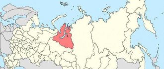
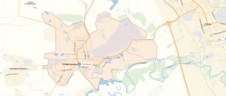
The public cadastral map of Astrakhan in the Astrakhan region is a resource of Rosreestr, which contains reference information on real estate in permanent access.
The map graphically shows land plots and capital construction projects that have undergone the cadastral registration procedure during land surveying and are included in the Unified State Register of Real Estate. In the city of Astrakhan (30th cadastral district) as of January 22, 2022, the cadastral map shows:
- 33 cadastral districts;
- 5,485 cadastral quarters;
- 156,558 land plots.
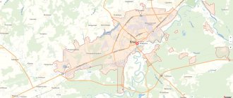
Map of Astrakhan, Astrakhan region. Detailed characteristics of the city.
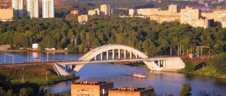
Astrakhan is a city in Russia, the administrative center of the Astrakhan region. The city is an important cultural, economic and transport center of the Lower Volga and Caspian regions, with a rich history. The online map of Astrakhan shows that several European and Asian routes intersect in the city.
- 1333 - the first mention of the settlement of Hadji-Tarkhan, which was located on the territory of the current city;
- 13-14th century – Haji Tarkhan was a major center of caravan trade between Europe and Asia;
- 1395 – Haji Tarkhan was destroyed by Emir Timur;
- 1459 - the restored city becomes the capital of the Astrakhan Khanate;
- 1556 - the khanate and the city swore allegiance to Ivan the Terrible and became part of Rus';
- 1558 - the founding of a Russian fortress, which became a powerful outpost on the southeastern border of Rus';
- 1717 – formation of the Astrakhan province and granting Astrakhan the status of a provincial city;
- 1900 – 122 thousand inhabitants live in the city;
- 1943 - the modern borders of the Astrakhan region were approved;
- 1950-1960s - reconstruction of the city, new parks and neighborhoods were built, the Astrakhan Kremlin was restored.
The population of Astrakhan is 533 thousand people. National composition of the population: Russians 78%; Tatars 7%; Kazakhs 5%; Azerbaijanis, Armenians and Ukrainians 1% each; other 7%.
Districts of Astrakhan list
- Kirovsky district
- Leninsky district
- Trusovsky district
- Sovetsky district
Astrakhan is divided into 4 administrative districts. List by alphabetical order and population size with location on the city map. You can receive free reference information through the online form.
Astrakhan was first mentioned by an Arab traveler in 1334 as the settlement of Hadji-Tarkhan - the autumn residence of the khans of the Golden Horde. In 1395 the city was sacked by Tamerlane. In 1456, Astrakhan became the capital of the Astrakhan Khanate. In 1556, the Khanate was annexed to Russia by Ivan the Terrible.
Astrakhan on the map of Russia: geography, nature and climate
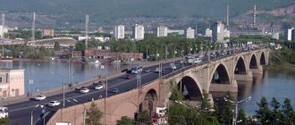
A map of the city of Astrakhan shows that the city is located in the southeast of the East European Plain , in the Caspian Lowland , on both banks of the Volga River and on its many tributaries and channels, 60 km north of the Caspian Sea .
Astrakhan on the map of Russia is located 1391 km northwest of Moscow. The distance to other major cities by road is:
- Voronezh – 998 km to the northwest,
- Krasnodar – 865 km to the west,
- Stavropol – 600 km to the southwest,
- Baku – 911 km to the south,
- Atyrau – 357 km to the east,
- Orenburg – 1659 km to the northeast,
- Saratov – 796 km to the north.
The area around the city is semi-desert, and the terrain is flat, the average height in the city is 20 meters.
The climate of Astrakhan is sharply continental and arid, with significant amplitudes of ready and daily temperatures, the average annual temperature is +11 degrees Celsius. A moderately frosty winter with unstable snow cover lasts up to 3 months, the average February temperature is -4 degrees Celsius. Summer is hot and dry, lasting at least 5 months, characterized by dry winds, the average July temperature is +26 degrees Celsius. Approximately 230 mm of precipitation falls annually; according to this indicator, Astrakhan is the driest city in Europe.
Automobile highways
The following highways run through Astrakhan:
- P22 “Caspian” is a federal highway to the Don through Volgograd, Borisoglebsk and Tambov. The road is also included in the European route E119 (Moscow - Baku - Tehran), and the Asian route AN8 from St. Petersburg to the Iranian city of Bandar Emam.
- P216 “Kalmychka” is a federal highway to Stavropol through Elista with access roads to many cities of Kalmykia and the Stavropol Territory.
- P215 - federal highway to Makhachkala via Kizlyar and Kochubey. It is also part of routes E119 and AH8.
- 12A-235 is a highway of regional significance to the border with the Republic of Kazakhstan.
Map of the city of Astrakhan with roads. Transport infrastructure.
Astrakhan is located at the junction of the most important roads and railways.
The following federal highways pass through the city:
- R-215 Astrakhan - Makhachkala;
- R-216 Astrakhan – Elista – Stavropol;
- 12Р-001 Astrakhan - Volgograd;
- R-22 “Caspian” Moscow – Tambov – Borisoglebsk – Volgograd – Astrakhan.
from the Central Bus Station to Volgograd, Vladikavkaz, Voronezh, Akhtubinsk, Moscow, Novorossiysk, Sevastopol, Rostov-on-Don and other cities. The address of the bus station on the map of Astrakhan: Henri Barbussa street, 29B. Also within the city there are 8 bus stations providing smaller bus services.
The railway station Astrakhan 1 belongs to the Volga Railway and provides train traffic in the directions Moscow - Makhachkala, Volgograd - Grozny, Astrakhan - Atyrau, Baku - Moscow, Astrakhan - St. Petersburg, as well as electric trains in the directions Astrakhan-2 - Kutum, Aksarayskaya-2 - Kutum, gas processing plant - Kutum, Astrakhan-2 - Oleynikovo. The station is located at Privokzalnaya Square, 20.
Within the borders of Astrakhan there are 8 railway stations for freight and passenger purposes.
Astrakhan International Airport is located 8 km south of the city center and provides air communication between the city and Moscow, Aktau, Izmir and Antalya. Airport location: Aeroportovsky proezd, 1, side, 2.
Currently, water transport is represented by several motor ships plying around the outskirts of Astrakhan.
81 public transport routes – buses and minibuses – are available to residents. The city's bus fleet is in satisfactory condition due to the high wear and tear of transport units. The fare on government-regulated routes is 19 rubles, and on non-regulated routes – 22 rubles.
Train Station
The main passenger railway station of the city (station “Astrakhan-I”) is located at Vokzalnaya Square, 20. A total of 8 tracks approach the station, but only 4 of them are used for passenger trains and electric trains. Both suburban (short-distance) and long-distance trains depart from the Astrakhan station. Electric trains also run between distant areas of the city.
Long-distance trains depart year-round to Moscow, Volgograd, St. Petersburg, Nizhnevartovsk, Tyumen, Makhachkala, Grozny and other Russian cities. Direct international railway connections operate with Baku, Kiev and Atyrau. During the tourist seasons, a route opens to the Sochi Imereti resort (Olympic Park station).
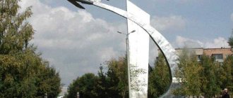
Sights of the city of Astrakhan
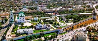
- The Astrakhan Kremlin is a fortress built in 1558 on one of the Volga islands. Inside the white-stone fortress with 7 towers are: the Assumption and Trinity Cathedrals, the guardhouse and the Cyril Chapel. Attraction address: Trediakovskogo street, 2.
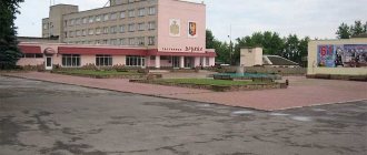
- Astrakhan Embankment is a two-kilometer embankment in the city center with beautiful fountains, ancient buildings and a magnificent view of the Volga.
- Astrakhan Planetarium , where the latest equipment offers the opportunity to see the starry sky, the movement of stars, and even watch the astronauts on the space station. Location: Admiralteyskaya street, 1/8.
- The Astrakhan Museum of City History is a small two-story house in the area of the Kremlin and the embankment, where Ilya Ulyanov, the father of V.I. Lenin, lived. Here are exhibits of various social classes of Astrakhan during the era of the Russian Empire - peasants, merchants, townspeople, nobles. Some exhibitions are dedicated to the Ulyanov family and the ethnography of the region. The address of the museum on the map of Astrakhan: Ulyanov Street, 9.
- United Historical and Architectural Museum-Reserve – Museum of Local Lore of Astrakhan , founded in 1837. The museum has exhibitions about the history, nature, ethnography of the region, as well as unique archaeological finds up to 5 thousand years old. The museum is located on Sovetskaya Street, 15.
- Museum of Culture of Astrakhan , where you can get acquainted with the life of great people who lived in the city at different times: N. Chernyshevsky, F. Chaliapin, N. Papayan, V. Barsova, M. Maksakova. The museum building is a house with a wooden veranda overgrown with wild grapes. On the map of Astrakhan with streets and houses it can be found on Chernyshevsky Street, 4.
- The Museum of Military Glory is a place where the complete history of the Russian Armed Forces from ancient times to the present day is presented. A separate exhibition tells about the exploits of fellow Astrakhan citizens during the Second World War. The museum is located on Akhmatovskaya street, 7.
- The Roman Catholic Church of the Assumption of the Blessed Virgin Mary is the third largest Catholic church in Russia, built and illuminated in 1778. The temple was built in Baroque and Classicism styles and has two bell towers. Located on Babushkina street, 81.
- The Cathedral of the Kazan Icon of the Mother of God is a beautiful brick temple in the ancient Russian style with high towers and bead paintings inside. Location: Chekhov street, 10A.
Map of Astrakhan with streets and houses
- St. Bera is a short (1.8 km) street in the historical center of the city, passing through the territory of the Kirov and Sovetsky districts. It starts from the Admiralteysky Bridge and ends at Chelyabinskaya Street. There are: the White Mosque, the Magnit and Pyaterochka supermarkets, and the local police station. The street development is mixed.
- St. Kirova is another central street, 2.2 km long, starting from the Lovers' Bridge and ending near the Cyclists Park. On this street you can find: TSUM, Library named after. Krupskaya, Bratsk Garden, City Administration, City Duma, Children's Clinic No. 1, ASMU and Basic Medical College. The area at the beginning of the street is pedestrian and is called Arbat. The street development at the beginning and end is multi-storey, and in the middle - low-rise.
- St. Communist is an important highway in the central part of the city, located in the Kirov and Leninsky districts. Opera and Ballet Theatre, Theater Park, Neftyanik Square, Oktyabr Cinema, Historical and Architectural Museum-Reserve, monument to A.S. Pushkin - this is an incomplete list of attractions located within walking distance from this street.
- St. Pobeda on the map of Astrakhan is a street in the Kirovsky district, running mostly not along residential buildings, but along service establishments: the Kirovsky market, the Kirovsky and Iceberg shopping centers, the Pobeda business center, the Astrakhan circus and the Spartak Sports Palace. . At the beginning of this short (1.6 km) street there is Victory Square.
- St. Lenina is another street in the Kirovsky district, passing through the historical center of the city. It starts at Lenin Square near the Astrakhan Kremlin and ends at Aladin Street. In the immediate vicinity of this street there are: the Administration of the Kirov District, Armenia Square and the Sea Garden, the Annunciation Monastery.
- Magistralnaya Street is one of the longest (7.2 km) arteries of the city, located in the right bank Trusovsky district, in the western part of Astrakhan. The street starts in the area of the New Bridge and ends near the non-passenger railway station Novolesnaya, turning into Sovetskaya Gvardiya Street. The street passes through the private sector interspersed with industrial zones. The old cemetery, the Dexter shopping center, the Oil and Gas Institute (AGTU) - everything that can be found nearby this street.
- Vokzalnaya Square is a square in the city center, in the Leninsky district, on which there is a railway station, a bus station and the ParkInn hotel.
- Admiralteyskaya is one of the most important streets in Astrakhan, passing through the entire historical part of the city: Swan Lake, Lenin and Oktyabrskaya squares, the Astrakhan Kremlin. The length of the street is 2.5 km.
Economy and industry of Astrakhan
The basis of the economy of Astrakhan is the fuel and energy complex, represented by the oil and gas production enterprises LUKOIL-Nizhnevolzhskneft LLC and Gazprom Dobycha Astrakhan LLC, as well as the electricity generation enterprise Astrakhanenergo OJSC.
Other important sectors of the economy are the food, engineering, petrochemical and forestry industries. The following organizations operate in these areas:
- JSC "Shipbuilding" and "Astrakhan Shipyard";
- OJSC Zheldorremmash Astrakhan Diesel Locomotive Repair Plant";
- OJSC "Astrakhan Fish Processing Plant" and "Kaspryba";
- OJSC "Astrakhan Plant of Rubber Technical Products";
- OJSC "Astrakhan Distillery"
Freight transportation, tourism and the service sector also play an important role in the city's economy.