Is it worth going to Pevek?
In general, Pevek turned out to be a very strange city for me. Nowhere have I felt so secluded and calm as here. During the season there is excellent fishing and hunting, but this is for professionals. On the other hand, the northern nature and the fading city left an impression of some kind of despondency and hopelessness. I wouldn't want to live here. But if you don’t have enough impressions, then welcome to Pevek - the northernmost port of Russia!
A few more photos from this trip! Do you think you could live in Pevek?
We travel a lot and talk about the most interesting corners of our vast homeland. For example, by clicking here you can read about our travels around Altai. And here we talk a lot about beautiful Kyrgyzstan. And of course, we couldn’t ignore Kazakhstan. And if you don’t know where to celebrate the New Year, then we will help you here too. New Year in Altai or Karelia, or maybe you want to go to Baikal. We will tell you which bases and hotels to choose and what to see in these unique places in our country.
Northern Sea Route and geology: the history of Pevek
The northernmost city and northernmost port of our country. Center for industrial development of the Arctic, headquarters of polar navigation and scientific observatory. All this is Pevek, whose story is the focus of our story.
"Fat Mountain"
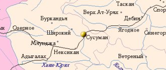
Pevek is located in the west of Chukotka, on the eastern shore of the Chaunskaya Bay. It is protected from ocean storms by the island of Big Rautan. Above the city rises Mount Peekinei, which gave it its name.
Regarding the origin of the name of the mountain (more precisely, the hill), there are different versions: it is transmitted (and, accordingly, translated!) in different sources both as “peekiney” (“thick” or “bloated mountain”), and as “pagyt-kenai” ( "scented mountain") The second name is associated with the legend of the battle between the Chukchi and the Yukaghir, after which many unburied dead bodies remained [1].
This legendary interpretation may well have a historical basis. Pevek and the entire Chaunsky region lie not far from the western border of the Chukchi settlement. Here, indeed, clashes took place between the warlike Chukchi and the Yukaghir tribes; it was from this area that the Chukchi more than once threatened the Russian forts in Kolyma.
Reindeer Chukchi. Drawing from G. Pauli’s album “Ethnographic Description of the Peoples of the Russian Empire.” 1862
For the Russians themselves, the area of modern Pevek remained in relative shadow for a long time. After Semyon Dezhnev, the dangerous sea route along the coast of Chukotka was almost never used: they preferred to get to Anadyr from Kolyma by land, through the mountains. After the Chukchi Wars of the 18th century and the liquidation of the Anadyr Party, only a few traders visited here. In order for a large (by Arctic standards) port city to arise here, two conditions were needed - mineral exploration and the construction of a shipping route. All this happened in Soviet times, or more precisely in the 1930s, the era of polar heroes.
“Pevek was small at that time...”
It was Mount Pevek, or rather the tin reserves hidden in it, that determined the vector along which the Arctic village, founded in 1933, began to develop.
In August 1933, the steamship “Lieutenant Schmidt” arrived in Chaunskaya Bay and delivered a group of Soviet workers led by Naum Filippovich Pugachev to the peninsula. The history of the village of Pevek began, and with it the history of the Chaunsky district as an administrative unit.
Naum Filippovich Pugachev, founder of Pevek.
In Oleg Kuvaev’s novel “Territory”, where Pevek is hiding under the name “Village”, Pugachev is brought out under the name of Mark Pugin.
“There was luck in this, similar to the luck of the cities of antiquity. Choose a location. Ocean-going ships could land here, and there was cassiterite, which the country desperately needed. This is how the Village began..."
In the novel, Pugin lands with his family on an empty, “wildest” shore. In fact, at the site of the future port city, by the time “Lieutenant Schmidt” arrived, people were already living: there was a small trading post here, the goods for which Pugachev brought with him. The fundamental innovation was that now representatives of the authorities arrived in Chaunskaya Bay for permanent residence. But of course there were problems. “Nowhere to live. We don’t know each other well, we don’t know the area at all, we don’t know the morals, rites and customs of the indigenous local residents, we don’t know the Chukchi language, there are no translators, there’s not a single literate person in the area,” Naum Filippovich himself wrote about the first days of the new village [ 2].
The location was really good: the closed roadstead made it possible to moor ships without major port work. There was one more circumstance. Only on the Pevek Peninsula there was sufficient fresh water, which was provided by the lake, which did not freeze to the bottom in winter. This became especially important later, when industrial work began here on the extraction and enrichment of cassiterite - tin ore. The fact that Pevek is not only a convenient port, but also the center of a rich tin-bearing region, became clear a little later.
The All-Union Arctic Institute (VAI, future AARI) in those years conducted research in the Arctic on a very wide spectrum - from geophysics to the biology of game animals. Geology occupied an important place in the work of the institute. It was the VAI geologists, led by Sergei Vladimirovich Obruchev, who made the main contribution to the discovery of the underground riches of Chukotka in the 1930s.
S.V. Obruchev, discoverer of Chukchi tin. Photo 1934
In 1932-1933 Obruchev led the Chukotka flight expedition - with the help of airplanes it was possible to draw up a geomorphological map of a huge, almost unexplored space. And in 1934, Sergei Vladimirovich organized a study of the immediate shores of the Chaunskaya Bay. The steamer "Smolensk" delivered the expedition to Pevek, where a winter house for geologists was built. The ocean coast was explored by motor boats and snowmobiles, and in many areas simply on foot. In total, Obruchev's expedition covered 5695 km!
Tin was discovered in collections collected in Chaunskaya Bay. It became obvious that the Pevek area needed to be explored further. Beginning in 1935, the Arctic Institute organized three more Chaun expeditions with a base in Pevek. Tin deposits were discovered on the peninsula itself and to the south of it. The proximity of the deposits to the sea promised good opportunities for organizing the export of raw materials.
“Pevek was not big at that time,” recalled geologist M.I. Rokhlin, member of the First Chaun Expedition of the VAI. – The buildings of the district executive committee and the district party committee are two round infill houses, very poorly adapted for the Arctic climate, a trading post tent, a frame-infill house, which housed the expedition of S.V. the year before us. Obruchev, and several dugouts. The secretary of the district party committee, N.F., lived with his family in one of the dugouts. Pugachev. The village did not have electric lighting.”[3].
The Arctic Institute was located in the system of the Main Directorate of the Northern Sea Route (GUSMP), specially created at the end of 1932 to organize shipping in the Arctic, and in fact, for its comprehensive development. In those years, the GUSMP was in charge of polar stations, aviation, and geological developments. But in 1937, a thunderstorm broke out over the geologists of the Main Northern Sea Route.
The unsuccessful navigation of 1937, when dozens of ships were forced to spend the winter on the Arctic routes, including the icebreaking steamships Sadko, Sedov and Malygin, became the reason for repression - both in the leadership of the State Service of the Russian Federation and among polar scientists. A reorganization followed, during which the Main Northern Sea Route lost the Far Eastern geology in 1938. From now on, all the minerals of Chukotka, including Pevek’s tin, were in charge of Dalstroy (“Severstroy” in Kuvaev’s novel) - a powerful territorial plant created for the extraction of Kolyma gold.
The village of Pevek on the map of the Chaunsky district. 1930s [4]
A dark page in the history of Pevek is associated with the era of Dalstroy, which widely used prison labor for mining work. Here in the first half of the 1950s. the administration of Chaunlag and Chaunchukotlag were located - two camp associations engaged in the development of mineral resources, including strategically important uranium, discovered in Chukotka in 1947. Prisoners also worked at the first diesel power station of Pevek, built during the Great Patriotic War.
East Headquarters
But the history of Pevek is not only about the mining industry, although it formed the basis of its economy. The future city immediately became an Arctic port, and then the main center for managing maritime transport in the Eastern Arctic.
The Main Northern Sea Route lost its geology, but remained the organizer of Arctic shipping until its liquidation in 1964. In the first years of its work, the movement of ships in the Arctic seas consisted of separate expeditions moving either from the west or from the east. Through flights were rare.
By the end of the 1930s. The system for controlling vessel traffic on the Northern Sea Route took the form of two Naval Operations Headquarters, each of which was responsible for its own area: one in the west, the other in the east. Linear icebreakers were subordinate to the headquarters, guiding cargo ships along the routes. The headquarters included weather forecasters, hydrologists, and ice reconnaissance pilots.
The headquarters of naval operations of the Eastern Arctic region (or “headquarters of the East”, as it was sometimes called in documents of that time), was initially located on one of the icebreakers, and then in Pevek. It was from here that the movement of ships was controlled.
The headquarters was created every year before the start of Arctic navigation. It included a scientific and operational group (SOG), which included weather forecasters and hydrologists. Here, data on weather and ice conditions was collected and processed. This data was collected for the headquarters by polar stations, scientific groups of icebreakers, aerial reconnaissance aircraft and ice patrols - special sea expeditions that worked near the ice edge.
"Lazar Kaganovich" ("Admiral Lazarev") is a steam linear icebreaker that operated in the east in the 1940s -1960s.
Having received the necessary data, the group made short-term forecasts, which the chief of staff relied on when making decisions on the timing and routes of ships. And a large long-term forecast for the entire navigation was prepared by the Arctic Institute in Leningrad.
Arctic Observatory
In 1953, the Arctic Research Observatory (ARO) was created in Pevek. There were five such observatories in total - Pevek, Tiksi, Dikson, Tikhaya (on Franz Josef Land) and Barentsburg (on Spitsbergen).
Observatories were created on the basis of existing polar stations, but their tasks were much broader - not just observations according to a specific program, but full-fledged scientific research. This is how Pavel Afanasyevich Gordienko saw the work of the ANIO, on whose initiative they were created.
Polar explorer Pavel Afanasyevich Gordienko, initiator of the creation of a system of Arctic observatories.
The scientific and operational group of ANIO Pevek compiled short-term synoptic and ice forecasts, advised navigators, and took part in the work on long-term forecasts for Arctic navigation. In the scientific and operational support of the Northern Sea Route, the work of the NOG occupied a central place.
However, the main feature of the work of the observatories was that they had to not only ensure the operation of the route, but also conduct independent research into the hydrometeorological regime of the Arctic seas. Each ANIO had its own area of scientific work. For Pevek, this area extended from Cape Navarin to the meridian 145º E.
Valery Nikolaevich Kupetsky, an oceanologist who led the scientific and operational groups of the Naval Operations Headquarters in Pevek during 23 Arctic navigations.
The main expeditionary work of ANIO Pevek was carried out in the East Siberian Sea and was aimed at studying the ice regime of the sea as a whole and its individual areas, primarily the Chaunskaya Bay and its straits (Pevek, Sredniy, etc.). If research in the East Siberian Sea was of fundamental importance, then work in Chaunskaya Bay was necessary for local organizations - for example, for laying winter ice roads.
The most extensive work on the ice of the East Siberian Sea was carried out by the AK-59 expedition led by Yu.B. Konstantinov, organized by ANIO Pevek in March-May 1959. The work area of this expedition, whose task was to study the winter hydrometeorological regime of the landfast zone of the East Siberian Sea, extended from the island. Ayon to Ambarchik and Bear Islands (the total area of the region was 32,500 km²). This and other expeditions of ANIO Pevek were very important for the study of the East Siberian Sea, the study of which until the end of the 1950s. were episodic, scattered in nature, in contrast to other Arctic seas (in which hydrological surveys were carried out annually) and the Central Arctic Basin (where the data array of the Sever hydroelectric power station and the drifting stations of the North Sea was accumulated).
The Arctic observatories worked as part of the AARI until 1964. This year the history of the Main Northern Sea Route ended, and immediately after its liquidation, the ANIO, just like the institute itself earlier, was transferred to the system of the Main Directorate of the Hydrometeorological Service of the USSR. Marine forecasters now worked as part of the Pevek territorial department of the Hydrometeorological Service.
"Battle in the Ice"
After the liquidation of the GUSMP, the system of Naval Operations Headquarters continued to operate (now they were part of the shipping companies - Murmansk Sea and Far Eastern Sea). The volume of transportation increased every year. New powerful icebreakers entered the Arctic routes, and navigation times lengthened every year. Scientists from the Arctic and Antarctic Research Institute improved ice reconnaissance and forecasting methods.
Vadim Ivanovich Abonosimov, polar captain, Hero of Socialist Labor, head of maritime operations in the Eastern Arctic region in 1973.
Pevek grew and expanded. In 1967, by decree of the Presidium of the Supreme Soviet of the RSFSR dated April 6, the former workers' village was transformed into a city of regional subordination. During these years, the population of Pevek was approximately 10 thousand people, and by the end of the 1980s. reached 13 thousand.
Pevek.
1970s (photo by A. Shatokhin, based on materials from the site https://maximov.pevek.ru ).
In 1983, navigation in the East turned out to be the most difficult in the entire history of Arctic navigation. Journalists dubbed the epic of navigating ships through the ice of the Ayon and Wrangel massifs “The Battle of the Ice.” Ice completely blocked the coastal route. The forces of both Arctic shipping companies were concentrated in the Pevek area, where many ships had accumulated and required withdrawal. The decisive role was played by the work of the nuclear icebreaker “Leonid Brezhnev” (as the “Arktika” was then called, which conquered the North Pole in 1977). Many cargo ships and icebreakers were seriously damaged, and the motor ship Nina Sagaidak sank (its crew was evacuated by helicopter) [6].
The death of the ship "Nina Sagaidak". Photo 1983
The story continues
The fate of Pevek, like a mirror, reflected the entire recent history of our country. It was founded at a time when the Soviet Union began to vigorously develop the Arctic, experienced the heyday of shipping along the Northern Sea Route in the 1970s - 1980s, and fully experienced the difficulties of the nineties - the city’s population decreased by more than half, many houses were abandoned, enterprises stopped working. But the port of Pevek with its deep-water berths retained strategic importance. Pevek is the supply center of western Chukotka; the Akademik Lomonosov floating nuclear power plant, which has no analogues in the world, recently began operating here. And as the Northern Sea Route is revived (if the ambitious ideas and plans of recent years are implemented), Pevek will also be revived!
Floating nuclear power plant "Akademik Lomonosov" in Pevek (based on materials from the site atomic-energy.ru).
Author:
M.A. Savinov, candidate of history. Sciences, researcher at the Arctic Museum and Exhibition Center (St. Petersburg).
Notes:
1. Menovshchikov G.A. Local names on the map of Chukotka. Brief toponymic dictionary. Magadan, 1972. P. 141.
2. Pugachev N.F. Chaun became an advanced area // Soviet Arctic. 1938. No. 3. P. 106.
3. Belov M.I. History of the discovery and development of the Northern Sea Route. L., 1969. T. 4. P. 85.
4. Pugachev N.F. Chaun became a forward district. P. 107.
5. Baskakov G.A., Voskresensky A.I., Gerasimova T.M., Danilov A.I., Kornilov N.A., Korotkevich E.S., Frolov I.E. Arctic and Antarctic Research Institute - the center of Soviet polar science // Problems of the Arctic and Antarctic. 1995. Vol. 70. P. 18; Smirnov V.I. Arctic research observatories // Problems of the Arctic and Antarctic. 2000. Vol. 72. pp. 362–365.
6. Dmitriev A.A., Gorbunov Yu.A., Sokolov V.T. History of navigation along the Northern Sea Route in the 20th and early 21st centuries. St. Petersburg, 2015. T. 2. pp. 263–265.
Work, study and leisure
“Many people go to the mainland to study after school, but after graduating from university they still return to Pevek. Without experience, it’s difficult to find a job and stay in a big city, but in Pevek young professionals have something to do and can gain experience,” says Anastasia.
Despite the lack of sports clubs and sections, a healthy lifestyle and sports are becoming increasingly popular among local youth. There are few other entertainment options in the city. Anastasia told Lenta.ru that several years ago a cultural and leisure complex “Iceberg” was built in Pevek, where you can play billiards, have a small dance floor for discotheques and a cinema where concerts are sometimes held.
“There are only three cafes in the city: one of them is really good, but the food there is expensive. There is nowhere else to go in Pevek. For example, I work at “Iceberg”, so I myself rarely rest there. After a hard day's work, I visit the only gym in the city. On the weekends I meet with friends. This is pretty much how my week goes,” she says.
There is no bad weather
In winter, as the indigenous people note, the air temperature can reach 45 degrees below zero Celsius. Locals wear two pairs of warm pants, pull on a lot of sweaters and warm down jackets. Strong winds often blow from the Arctic Ocean. At such moments, being on the street is simply dangerous.
“You don’t expect anything more in winter than a “southerner”! (“Yuzhak” is a strong south wind, the speed of which sometimes exceeds 50 meters per second - note by Lenta.ru
). Before it descends on the city, the air temperature rises significantly, for example, from minus 40 to 0 degrees Celsius, or even higher. This, of course, affects the condition of those who are sensitive to weather changes, but the rest enjoy the “yuzhak” as a holiday! It is gaining strength somewhere behind the hills, at this time there is absolute silence in the city. Then the drops start. And now the city is noisily covered by a huge wave of snow. When you see it for the first time, it seems like the end of the world has come. Winds of such strength sometimes cause damage. Windows, furniture, walls are shaking. One day the “yuzhak” hit us on New Year’s Eve, and Pevek was left without its main tree. But in general, the feeling when classes in schools or work are canceled is incomparable to anything! You sit by the window with a cup of tea, and outside the world seems to cease to exist,” says the girl.
Photo: Anastasia Karpenko
According to her, summer still sometimes comes to the city, but it is not at all the summer that residents are familiar with
). We sunbathed for 13 hours in a row: in the summer we have polar days, the sun does not set beyond the horizon at all. This means you can sunbathe around the clock. It was a real miracle."
But there is also a polar night - from October to January. Locals say that even after several years it is impossible to get used to it - the lack of natural light is very depressing. And in some areas of the city there is also no street lighting. They walk with flashlights. There’s no other way - it’s pitch dark there. Ice is especially dangerous at this time: in Pevek the roads are not covered with reagents or even sand. Many people catch a cold, and the city seems to fall asleep. But already at the end of January, Pevek residents celebrate Sun Day. The luminary returns to the sky.
Symbolism[ | ]
Coat of arms
In 2002, the coat of arms of the district was adopted, which was entered into the State Heraldic Register under number 957:
“In a field dissected by azure (blue, blue) and scarlet (red) there is a raised golden bezant (ball), and on top of everything there is a silver bear, standing straight and turned to the right, holding a golden druse in his right paw in front of him, with his left leaning on a golden anchor and accompanied in the upper left corner by a silver four-pointed star lying over the edge of the bezant.”
Physiographic characteristics[ | ]
Geography
Chaunsky district is located in the north-west of the district with access to the East Siberian Sea, the length of the coastline is 580 km. It occupies the Chaun Lowland and the islands of the Chaun Bay - Aion, Bolshoy Routan, Shalaurova. From east to west, the Chaunsky district stretches for 290 km, from south to north - 330 km. Cape Shelagsky is the northernmost point of the region and the entire continental Chukotka.
In the east, the Chaunsky district borders with the Anadyrsky district, in the south with the Bilibinsky district, and on the north-eastern side it borders with the Iultinsky district.
The entire territory of Chaun-Chukotka is located beyond the Arctic Circle.
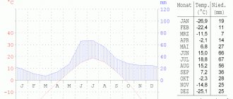
Climate
The region is characterized by long frosty winters and short (2-3 months) summers with low positive temperatures; frosts often occur even in the warmest periods (July - early August). The coldest month is January, less often - February. Stable snow cover usually sets in at the end of September. The thickness of snow in flat areas of the tundra rarely exceeds 0.5-0.7 m, but in low areas it can reach a thickness of up to 3-5 m. The annual amount of precipitation in the area is 150-200 mm.
Natural conditions
The region is entirely located in the tundra zone; wetlands predominate in the northern lowland part; lowland tundras beyond the lake and hummocky swamps encircle the Chaun Bay in a wide ring. In the southern part there are mountain ranges with a height of 1400-1700 m (the Ilirneisky ridge, the North Anyuysky and Rauchansky ridges).
Almost half of the area of lowland tundra in the region is covered by the water surface of lakes. The largest rivers are Chaun, Palyavaam, Ichuveem. Rivers are ice-free for no more than 3 months a year.
Seismicity
According to seismological monitoring data, magnitude 5 earthquakes are possible in the northern part of the Chaun region, and up to magnitude 6 in the rest of its territory[7].
Vegetable world
The main feature of the Arctic tundra of Chaun-Chukotka is the extremely small increase in phytomass and hence the meager supply of organic matter. Therefore, even on the plains the vegetation cover is not continuous, alternating with bare areas of gravelly loam. Mosses and lichens, dwarf shrubs, cotton grass, and sedges are ubiquitous. On the coastal islands, areas of relict steppes from the pre-glacial period have been preserved, where unique plant species grow.
Minerals
Rich mineral deposits - gold deposits (Mayskoye, Elveneyskoye, Sypuchaya, North-East, Dvoinoye), silver (Dvoinoye deposit), tin (Valkumeyskoye and Pyrkakay stockworks deposits), mercury (Zapadno-Palyanskoye deposit), coal (Dolgozhdnoye) , tungsten.
Protected natural areas[ | ]
- Nature reserve "Chaunskaya Guba" with an area of 210.5 thousand hectares.
- Geological natural monument "Utiny" (70 hectares) - includes single outliers-kekurs, consisting of porphyro-blastic granites on the spurs of the Veemsky ridge, their height reaches 20 m.
- Botanical natural monuments: “Aionsky” - 13 hectares, “Routan” - 19 hectares, “Pineiveemsky” - 23 hectares.
- Water natural monument Rauchuvagytkyn - 573 hectares, this is a lake of the same name of moraine genesis, the area around which has a multi-colored colorful hue[44].
Life on the edge of the earth
“Chukotka is addictive, you’ll see,” this is how, according to 29-year-old Pevek resident Anastasia Karpenko, she begins to get acquainted with those who find themselves in Russia’s northernmost city for the first time. In response, as a rule, he hears stunned exclamations: “How do you even live here?!” — or questions about when the next plane to the mainland is. This doesn't surprise her at all.
“But after living a little in Pevek, people fall in love with it. You can’t help but fall in love with such natural beauty, the peace and tranquility of this town,” she says.
Pevek residents admit that living in the city is not easy. The prices are very high here. This is due to the difficulties of delivering food to the city. “Even living here permanently, it’s not easy to get used to the high cost of the simplest food products. For example, we can treat ourselves to fruits or vegetables only on holidays. Imagine: apples cost 500 rubles per kilogram. A dozen eggs cost about 300 rubles,” says Anastasia.
Photo: Anastasia Karpenko
“In our city it is customary to go on vacation every two years. This is extremely little. As a rule, tickets are paid for by the organization you work for. A ticket to Moscow costs about 40 thousand rubles; few people in our city can afford to travel to the capital or to the south. Some have to sit for several years in a city where there is a catastrophic lack of sun and warmth. It’s very difficult,” she laments.
Settlements[ | ]
The district (urban district) includes 12 settlements, including 1 city and 5 villages[5][32], as well as 6 other settlements (urban-type settlements without permanent population), which have been at the stage of liquidation since 2007[ 33].
| List of settlements | |||
| № | Locality | Type | Population |
| 1 | Pevek | city | ↗4513[4] |
| 2 | Aion | village | ↘191[34] |
| 3 | Apapelgino | village | ↘0[35] |
| 4 | Billings | village | ↘181[36] |
| 5 | Rytkuchi | village | ↘463[37] |
| 6 | Yanranai | village | ↘194[10] |
| 7 | Fast | town | →0[35] |
| 8 | Baranikha | town | →0[35] |
| 9 | Valkumey | town | →0[35] |
| 10 | Komsomol | town | →0[35] |
| 11 | Krasnoarmeisky | town | →0[35] |
| 12 | Southern | town | →0[35] |
Abolished settlements
In the area there are several abandoned settlements from the Gulag era - Severny
,
Eastern
,
Western
[38], several liquidated in the post-Soviet era[39] - Gyrgychan, Maysky, as well as at the stage of liquidation since 2007[33] the villages of Baranikha, Bystry, Valkumey, Komsomolsky, Krasnoarmeysky, Yuzhny.
Notes[ | ]
- from the point of view of the administrative-territorial structure
- from the point of view of the municipal structure
- Total land area of the municipality
- ↑ 1234
The permanent population of the Russian Federation by municipalities as of January 1, 2022 (Russian). Retrieved April 27, 2022. Archived May 2, 2022. - ↑ 123
Law of the Chukotka Autonomous Okrug of June 30, 1998 N 33-OZ “On the administrative-territorial structure of the Chukotka Autonomous Okrug” - Charter of the city district (unspecified)
(inaccessible link). Access date: December 31, 2022. Archived October 10, 2016. - Seismological situation in the territory of the Chukotka Autonomous Okrug (unspecified)
(inaccessible link).
Main Directorate of the Ministry of Emergency Situations of the Russian Federation for the Chukotka Autonomous Okrug
(May 20, 2017). Date accessed: June 23, 2022. Archived March 11, 2022. - Resolution of the Presidium of the All-Russian Central Executive Committee of December 10, 1930 “On the organization of national associations in areas of settlement of small nationalities of the North”, SU RSFSR, 1931, No. 8, art. 98
- Law of the Chukotka Autonomous Okrug dated October 20, 2010 No. 87-OZ “On the transformation by merging settlements in the territory of the Chaunsky municipal district and amendments to the Law of the Chukotka Autonomous Okrug “On the status, boundaries and administrative centers of municipalities in the territory of the Chaunsky district of the Chukotka Autonomous Okrug”"
- ↑ 1 2 3 4 5 6
Population of the Russian Federation by municipalities as of January 1, 2015
(unspecified)
. Access date: August 6, 2015. Archived August 6, 2015. - Law of the Chukotka Autonomous Okrug dated 06/08/2015 No. 50-OZ “On the unification of settlements included in the Chaunsky municipal district and the organization of local self-government in the united territory”
- Population of the USSR on January 17, 1939. By district, regional centers, cities, workers' settlements and large rural settlements.
- HISTORY OF CHUKOTA AUTONOMOUS DISTRICT IN THE NAME OF THE PEOPLE 2011
- All-Union Population Census of 1959. The actual population of cities and other settlements, districts, regional centers and large rural settlements as of January 15, 1959 by republics, territories and regions of the RSFSR (unspecified)
. Retrieved October 10, 2013. Archived October 10, 2013. - All-Union population census of 1970. The actual population of cities, urban-type settlements, districts and regional centers of the USSR according to census data as of January 15, 1970 by republic, territory and region (unspecified)
. Retrieved October 14, 2013. Archived October 14, 2013. - All-Union Population Census of 1979. The current population of the RSFSR, autonomous republics, autonomous regions and districts, territories, regions, districts, urban settlements, village-district centers and rural settlements with a population of over 5,000 people (unspecified)
. - All-Union population census of 1989. Population of the USSR, RSFSR and its territorial units by gender (undefined)
. Archived from the original on August 23, 2011. - All-Russian population census 2002. Volume. 1, table 4. Population of Russia, federal districts, constituent entities of the Russian Federation, districts, urban settlements, rural settlements - regional centers and rural settlements with a population of 3 thousand or more (unspecified)
. Archived from the original on February 3, 2012. - Arctic countries and Antarctica
- The size of the permanent population of the Russian Federation by cities, urban settlements and regions as of January 1, 2009 (unspecified)
. Retrieved January 2, 2014. Archived January 2, 2014. - Population of the Chukotka Autonomous Okrug, urban districts, municipal districts, urban and rural settlements. Results of the 2010 All-Russian Population Census (unspecified)
. Retrieved November 25, 2014. Archived November 25, 2014. - Population of the Russian Federation by municipalities. Table 35. Estimated resident population as of January 1, 2012 (unspecified)
. Retrieved May 31, 2014. Archived May 31, 2014. - Population of the Russian Federation by municipalities as of January 1, 2013. - M.: Federal State Statistics Service Rosstat, 2013. - 528 p. (Table 33. Population of urban districts, municipal districts, urban and rural settlements, urban settlements, rural settlements) (undefined)
. Retrieved November 16, 2013. Archived November 16, 2013. - Table 33. Population of the Russian Federation by municipalities as of January 1, 2014 (unspecified)
. Access date: August 2, 2014. Archived August 2, 2014. - ↑ 12
Population of the Russian Federation by municipalities as of January 1, 2016 (Russian) (October 5, 2018). Retrieved May 15, 2022. Archived May 8, 2022. - ↑ 12
Population of the Russian Federation by municipalities as of January 1, 2022 (Russian) (July 31, 2017). Retrieved July 31, 2022. Archived July 31, 2022. - ↑ 12
Population of the Russian Federation by municipalities as of January 1, 2022 (Russian). Retrieved July 25, 2018. Archived July 26, 2022. - ↑ 12
Population of the Chukotka Autonomous Okrug by municipalities as of January 1, 2022 - ↑ 1234
Population of the Russian Federation by municipalities as of January 1, 2022 (Russian). Date accessed: October 17, 2022. Archived October 17, 2022. - HISTORY OF THE CHUKOTA AUTONOMOUS DISTRICT 2011 (unspecified)
(inaccessible link). Retrieved March 29, 2022. Archived June 19, 2022. - Information about the urban district of Pevek (unspecified)
. - Register of administrative-territorial and territorial entities of the Chukotka Autonomous Okrug (Order of the Government of the ChAO dated December 30, 2008 N 517-rp)
- ↑ 12
Law of the Chukotka Autonomous Okrug of October 25, 2007 N 138-OZ “On Amendments to the Law of the Chukotka Autonomous Okrug “On the Administrative-Territorial Structure of the Chukotka Autonomous Okrug”” - Information about the city district of Pevek 01.01.2020
- ↑ 1 2 3 4 5 6 7
Resident population as of January 1, 2015
(undefined)
. Retrieved March 31, 2015. Archived March 31, 2015. - Information about the city district of Pevek 01.01.2020
- Information about the city district of Pevek 01.01.2020
- Chaunsky itl of Dalstroy (Chaunlag, ITL Administrative post office box 14)
- Base Garant - Decree of the Government of the Russian Federation of February 2, 1998 No. 128 “On measures of social protection of the population of liquidated gold mining villages in the Chukotka Autonomous Okrug”
- Poddubny A.V. Environmental problems and sustainable development of regions, 2002.
- Romanenko F.A., Shilovtseva O.F.
The fate of Russian polar stations against the backdrop of global warming // Nature: Coll. - 2004. - No. 9. - Data on actual weather in the Chukotka Autonomous Okrug on the website of the Hydrometeorological Center of Russia
- News Agency “Sever-DV”, October 31, 2012 (unspecified)
(inaccessible link). Retrieved November 28, 2022. Archived March 4, 2016. - Museum (undefined)
(inaccessible link). Retrieved November 7, 2012. Archived January 14, 2013.
History[ | ]
Memorial plaque on Pugachev Street in Pevek.
The district was formed as part of the newly formed Chukotka National District on December 10, 1930[8].
At the origins of the founding of the district was the Soviet statesman Naum Filippovich Pugachev. Under him, the mining industry of the region began to develop at a high rate.
The collapse of the USSR greatly affected the economy and living standards of the population of the Chaunsky district. From 1991 to 2002, the population decreased by 22 thousand 321 people. Tin mining was stopped, all settlements were liquidated, with the exception of the administrative center and national villages.
From 2006 to 2010 The Chaunsky municipal district included 8 municipalities, including 1 urban and 4 rural settlements, as well as an inter-settlement area without municipal status. By the Law of the Chukotka Autonomous Okrug of October 20, 2010, the abolished rural settlement of Yanranai was included in the urban settlement of Pevek[9].
From 2010 to 2015 The Chaun municipal district included 7 municipalities, including 1 urban and 3 rural settlements, as well as an inter-settlement area without municipal status:
| № | Municipal formation 2010—2015 | Administrative center | Number of settlements | Population (persons) | Area (km²) |
| 1e-06 | urban settlement | ||||
| 1 | Pevek | Pevek city | 3 | 4915[10] | |
| 1.000002 | Rural settlement | ||||
| 2 | Aion | Aion village | 1 | 200[10] | |
| 3 | Billings | Billings village | 1 | 195[10] | |
| 4 | Rytkuchi | Rytkuchi village | 1 | 464[10] | |
| 4.000003 | Intersettlement territory | ||||
| 4.000004 | intersettlement territory | 6 |
By the Law of the Chukotka Autonomous Okrug of June 8, 2015, all municipalities of the Chaunsky municipal district - the urban settlement of Pevek and the rural settlements of Aion, Billings, Rytkuchi - were abolished and merged into the urban district of Pevek[11].
The Chaunsky district retains its status as an administrative-territorial entity[5].