According to tradition, a list of what, in the opinion of local residents, a guest of Tyumen who visits the city for the first time must do:
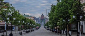
- Take an evening walk along the embankment of the Tura River from the Holy Trinity Monastery to the Chelyuskintsev Bridge and admire the sunsets.
“Tree of Happiness”
© Anna KudryavtsevaTake
a selfie on the Lovers' Bridge.- Relax in Tyumen thermal springs .
- Listen to music in the evening at the “Seasons” fountain on Tsvetnoy Boulevard and admire its changing lighting.
- Walk along the “Golden Line” of Tyumen, get acquainted with wooden architecture and the peculiarities of Tyumen carving.
- Get a storm of positive emotions at the LetoLeto water park by going down one of the most extreme slides, the Bermuda Triangle, with friends.
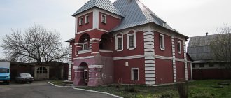
- Get acquainted with the life of merchants of the 19th century at the Masharov House museum .
- Take a boat ride along Tura and admire the views of the city from the water.
- Taste unique local cuisine at the Chum restaurant. By the way, taste all this under the shadow of a real Khanty chum, there is one there too.
- Bring your friends a souvenir with real Tyumen oil or a can of Neft vodka as a gift to your beloved boss.
Where is Tyumen?
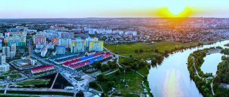
The city of Tyumen, the oil and gas capital of Russia and the administrative center of the Tyumen region, is located in the south of Western Siberia on the banks of the Tura River and the left tributary of the Tobol.
The approximate population of Tyumen is about 790 thousand people. The total area of the territory is 698 square kilometers. You can get to the city from the East and West thanks to the Trans-Siberian Railway. Nearest large cities: Kurgan, Yekaterinburg, Omsk, Tobolsk, Chelyabinsk, Yalutorovsk. The Tyumen region has borders with some regions of Kazakhstan. The climate in the city is temperate continental. The annual precipitation rate is 485 mm. Characterized by sudden changes in weather conditions, the altitude of the area above sea level is 60 meters. There are hot springs not far from the city.
Tyumen is located in the time zone MSK+2, the offset relative to Coordinated Universal Time (UTC) is +5.
Don't get lost outside Tyumen
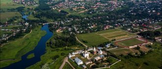
“Guide” is another step of the magazine “Your Home” towards systematizing knowledge about the Tyumen suburb, which may be useful to the buyer of a plot of land, the future resident of a country house.
When preparing summary information on the features of nature, history, and infrastructure of the tracts, we drew information from live communication with our experts during expeditions along the “Road to Home” tracts. The content of the Guide was enriched by presentations of land projects from development companies and communication with village residents. The Zatyumen website and its director Anastasia Bannova, the head of the suburban direction of the Advex-T Academy of Sciences, publicist Ayur Erbaktanov, as well as the guide of this interactive project, professor of the State Agrarian University of the Northern Trans-Urals, publicist Alexander Ivanenko helped us clarify the picture of suburban life. In the future, we plan to take the Guide beyond the magazine and present to your attention a separately published supplement.
1.
Moscow highway
Road to Yekaterinburg.
Federal highway, 4-6 lanes. Prestigious villages. Address of most new projects. Perevalovsky quarries. Educational. Dacha areas.
A.S. Ivanenko: “This federal highway runs along a plain slightly inclined to the south. The landscapes are open: the surroundings, fields, and copses are visible far away. From the south, coniferous pine forests stretch far for tens and hundreds of kilometers in all directions except the north; The Pyshma River flows about fifteen kilometers from west to east. From the north along the Tyumen-Sverdlovsk railway there are birch forests, there are a lot of mushrooms - milk mushrooms, white mushrooms. Near the station Podem there are quarries where they catch crayfish. The soils are fertile - black soil and gray forest soils. These are former fields of the Perevalovsky state farm, one of the best fields in the area. Groundwater in the Zubareva area is deep relative to the soil surface. Ecologically, the places are favorable, there are no polluting objects nearby, winds rarely blow from Tyumen.”
Main settlements: Derbyshi, Gusevo, Zubareva, Perevalovo, Ushakova, Elan, Uspenka. More details on the Zatyumen website.
Village of Perevalovo, 18th km of the Moscow highway.
Built at the end of the 17th century by the Perevalov settlers. According to local legend, five brothers - Stepan, Vasily, Evgraf, Grigory and Semyon - were exiled from Moscow and settled along the “high road” - the Moscow tract. Representatives of this family in the 18th century were among the richest people in Tyumen.
Infrastructure: trade, cafe, secondary school, cultural and leisure center, first aid station, parish of the Church of St. Nicholas the Wonderworker.
Uspenka village, 29 km of the Moscow highway.
The former village of Karmatskoye, or Big Karmaki. Founded at the beginning of the 17th century. In 1878, a brick church in the name of the Dormition of the Blessed Virgin Mary was erected here at the expense of parishioners. Since then, the village began to be called Uspenskoye.
Infrastructure: Assumption Hospital, comprehensive center for social services for the population of the Tyumen region. Kindergarten, secondary school, orphanage, House of culture and leisure, sports complex, museum.
2.
Irbitsky tract
Blessed antiquity.
High bank of Tura. Ancient villages. Church of the Intercession of the Mother of God. Hilly landscape. Active recreation center "Kuliga Park".
A.S. Ivanenko: “At different times this road was called differently: it was called Krasnopolyansky because it passed through a village called Krasnoe Polye. It was Turinsky, because it passed through the city of Turinsk, but the name “Irbitsky” turned out to be more enduring, because the road passed through Irbit. At one time there was a very stormy fair there, and all of Russia knew this city.
Moving towards Irbit, we can see Roshchino Airport. Airports are always built on high places, Roshchino was no exception. They and Plekhanovo were built, as they say, on the high ridge of the watershed, that is, on the place dividing the water flowing to Tura to the right, and to Pyshma to the left.
The wind here blows from the southwest most of the year. The nearest “stoker” (as Alexander Stefanovich calls industrial facilities, sources of harmful emissions. - Note from Zatyumen.ru) is in Tugulym, 80 km from here. Both Gorkovka and the airport remain on the sidelines. In summer, the wind is mainly northwest, which cools the area.”
Main NPs: Lugovoe, Kulakovo, Kamenka, Kuliga, Konyashina, Rechkina. Details are on the Zatyumen website.
The village of Kuliga, 34 km of the Irbitsky tract.
The former name was Kulizhskaya. Located in the upper reaches of the river. Kamenki. The word “kuliga” had different meanings in different places in Siberia: a large clearing in the forest, a low place flooded with water, a small river flowing from a swamp, and in the Tobolsk province this was the name for a small grove. If you look at the surroundings of Kuliga even now, then any of the listed meanings suits it: there are groves, and a river flowing from a swamp, and a clearing in the forest. Kuliga has always been a large village. In 1912, more than 500 people lived in it.
Infrastructure: FAP, Kamensky Center for Physical Education and Sports, which is located in Kuliga
Rechkina village, 49 km of the Irbitsky tract.
The village belongs to the Kamensk municipality. This is one of the oldest villages near Tyumen. It is mentioned in the Watch Book of Tyumen for 1623. Rechkina is beautifully located on the gentle slope of Tura and is originally built - compact and convenient. Residents have long been engaged in agriculture and cattle breeding - the surrounding area is free. The places near Rechkina are very beautiful. Near the village itself the Tura flows, bordered by thick willow trees. Near the village there is a mushroom and berry forest. This is the most remote village in the north-west of the region.
3.
Salairsky tract
Recreation and entertainment.
Tourist base "Verkhniy Bor". Hot Springs. Established cottage settlements. Dacha partnerships. Children's.
A.S. Ivanenko: “The Salair highway is almost never used for transit. It is laid along the high left root bank of the Tura River under the forest canopy. Coniferous forest grows along the southern edge of the Tarman swamp, stretching along the river from west to east for more than a hundred kilometers. From the high bank there are majestic views of the Turin floodplain; it is beautiful here at any time of the year. When the flood is high, the entire floodplain is filled with water—an endless sea of water. The soils are poor: pine forest sands, peat bogs on the edge of the swamp. Along the tract there are hot springs, recreation centers, and the Geologist sanatorium. There are mushrooms in the forest. There are no polluting factors or emissions nearby; winds blow very rarely from Tyumen. Here is the most environmentally friendly environment near Tyumen. To the south of Tura there are pine forests and fields. There are no dust storms. There are a lot of gardening associations on the outskirts of the Tarman swamp, so closer to the weekend the road is busy to capacity with transport, it is necessary to widen the route three to four times.”
Main NPs: Bereznyaki, Verkhniy Bor, Reshetnikova, Novotarmansky, Salairka. More details on the Zatyumen website.
Reshetnikova, 16 km of the Salairsky tract.
The village belongs to the Novotarman municipality. Located at the eastern end of the lake of the same name. In documents of the 19th century, it is called “non-peasant”, since its population, about 30 people, was mainly engaged in tanning leather and sewing leather goods and shoes. Now part of the working-age population of the village works in Tyumen and at the nearby recreation centers of the Verkhny Bor. There is one farm raising livestock. In connection with the expansion of the borders of Tyumen, the village of Reshetnikova has become completely suburban: the city limits pass immediately beyond the outskirts.
Salairka, 48 km of the Salairsky tract
The village belongs to the Salair municipality. Salairka was first mentioned in ancient documents of the first quarter of the 18th century. Located on the bank of the Tura, which makes a bend here. Just above the village, the Akhmanka River, flowing from the Tarman swamps, flows into Tura. Salairka translated from Tatar means “coastal village”. To the west of Salairka, in the Tura floodplain, there is a large oxbow lake Krivoye. It is deep, poorly overgrown, and large crucian carp are caught well in it. Fishing is also good on the Tour. The forests around Salairka are rich in mushrooms, blueberries, viburnum, and bird cherry. At the end of the 19th century in these places I.Ya. Slovtsov, a famous historian and archaeologist, found the skeletons of bison and woolly rhinoceros, which lived in our region in prehistoric times.
Infrastructure: secondary school, preschool education group at the school, cultural and leisure center, first aid station, sanatorium "Geologist".
4.
Velizhansky tract.
A hunting and lake paradise.
Established dacha communities. Lipovoe Lake. Road to Nizhnyaya Tavda. Hunting, fishing, berry places.
A.S. Ivanenko: “It goes directly north from Tyumen through the Tarman swamps. Built before the First World War. It was a dusty and dirty road that was constantly drowning in quagmire. In 1973, the tract was rebuilt, straightened, and a reliable embankment was made. On the left along the road in this section are garages and summer cottages, and on the right is the North-Eastern industrial center of Tyumen. Here is a workshop of a battery plant, a SIBES plant, and another 5 or 6 “dirty” industries, which are located so that the wind carries their emissions to the Tarman swamps. There are many lakes here - large and small. The largest lakes are Sundukul, Shtakul, Yantyk. The surface area of Lake Sundukul is 4-5 sq. km. It is clean, fishy, and contains mainly crucian carp.
Here in the forests you can still find linden, of which, unfortunately, there are few left in the vicinity of Tyumen. Once upon a time, linden forests were actively exterminated for economic purposes. The surrounding forests are part of the green zone of the city of Tyumen, so logging is prohibited here. Because the soils are moist, forest fires rarely occur here.”
Main NP: villages of Tyunevo, Velizhany. For more details, see the Zatyumen website.
The village of Tyunevo, 26 km from Tyumen.
According to the 1897 census, the Tyunevsky settlement was called Tyunevsky huts. The village arose at the beginning of the 20th century. In 1912, it was listed as the Tyunevsky settlement, which grew into a large settlement by the 1970s. The territory (islands in the swamps) was transferred to an oil producing organization as a subsidiary farm. People drained swamps, raised livestock, and farmed. There are many summer residents and villagers working in the city. The water from the Velizhansky water intake is famous for its purity.
Infrastructure: the village has a good eleven-year school, a kindergarten, and a community center. Post office, Sberbank, Internet. First aid station.
The village of Velizhany, 48 km from Tyumen.
In archival documents, the first mention of the village of Velizhanskoye dates back to 1774. It was this year that a wooden church was built in the village. If we take into account that the path from the first small settlement to the status of a village is not short, then the birth of the village of Velizhanskoye can be safely attributed to the beginning of the 17th century. Apparently it was built almost simultaneously with the village of Perevalovo. Named after the surname of the first settler. As in other neighboring villages, people were peasants, engaged in yam farming, and weaved carpets.
Infrastructure: hospital, school, cultural center.
5.
Tobolsk tract.
Road to the North.
Federal highway to Khanty-Mansiysk. Roadside service. Historical places. Fishing on Lake Yantyk. The gentle shore of Tura.
A.S. Ivanenko: “The Tobolsk highway is a transit federal road to Khanty-Mansiysk, and the road to Kaskara has been significantly expanded. At the exit from Tyumen, the construction of a bypass road is being completed, and a bridge is being built across the Tura. It is convenient to move to other roads. As far as the village of Kaskara, the ecology is difficult: south-west winds blow here most often, carrying the air of the city and Tyumen enterprises. The road is laid along the left low bank of the Tura, the floodplain is mostly far from the road, just beyond the village of Borki. Tura approaches the highway and again goes to the right. The landscape is flat and monotonous; here and there along the road there are forest belts to protect the road from snow drifts. Beyond the village of Turaeva, the highway crosses the Tyumen-Tobolsk railway and beyond. In the Tura floodplain there are oxbow fish lakes, and in winter they are morbid. The soils are gray forest, well cultivated - in use since 1928. This is the drained southern edge of the Tarman swamp - it begins north of the highway at a distance of 2-5 km.”
Main NP: Embayevo, Kaskara, Borki, Sozonovo.
Embaevo, 18 km of the Tobolsk highway.
The village belongs to the Embaevsky municipal formation. Founded at the beginning of the 17th century by Bukharans - immigrants from the cities of Central Asia: Bukhara, Samarkand, etc. There are beautiful places in Embayevo. Apparently, one of the first settlers was called Yembai. In the middle of the 19th century, a madrasah opened in Embaevo, training clergy, and an extensive library of spiritual literature. In addition to the subjects provided for in the program, those interested were given lessons in Russian and Persian. Teachers were even invited from Istanbul to conduct classes in certain subjects. Subsequently, the madrasah merged with the Tatar national school, which opened in the 20s of the twentieth century.
Infrastructure: kindergarten, secondary school, cultural center, children's art house, sports complex, mosques, museum of Tatar culture and history, outpatient clinic.
Sozonovo, 50 km of the Tobolsk highway.
The village belongs to the Sozonovsky municipal formation. Built at the end of the 17th century by settlers from the northern part of European Russia on the steep bank of the Tura River near the Tobolsk Highway. Then the government ordered “planting on arable land,” first of all, along highways, so that passengers and convoys could move around inhabited areas. In 2005, it won the competition “The most comfortable settlement in the region.” In 2007, the village took third place in the competition “The most comfortable settlement in the region” in the category “Villages with a population of over 500 people.”
Infrastructure:
agro, peasant farms. Kindergarten, secondary school, sports and health center, FAP
6.
Starotobolsky tract.
High bank of big water.
New land projects. Ostrich farm. Children's recreation centers. High bank of Tura. Fishing competitions.
A.S. Ivanenko: “It is laid along the right sandy high bank of the Tura River parallel to the Tobolsk Highway. This is a local dead-end road to the village of Krivodanova. Further south along Pyshma, problems arise due to a muddy road that has not yet been developed. Traffic along the highway is still light, but six to eight cottage villages are marked here, during the construction of which heavy construction equipment has every chance of breaking the thin asphalt. The road requires major renovation and expansion. The places on the highway are beautiful, dominated by open landscapes on the floodplain of the Tura River and forests. On the right, in the pine forest of Pripyshmynsky, the Andreevskaya lake system is located, from which flows the Duvan River, a tributary of the Pyshma River. At the very end of the tract, the Tura and Pyshma rivers merge. There are a lot of coniferous forests, as well as fresh air, a lot of mushrooms, which a good part of Tyumen “opens up hunting” in the fall. Dirty winds from Tyumen rarely blow here, they are carried far from here beyond Tura, there are no polluting enterprises. The villages here are Tatar, peaceful and civilized. Nice places to live."
Main NPs: Antipino, Subbotina, Esaulova, Chikcha, Yakushi, Krivodanova. See more details on the Zatyumen website.
Chikcha village, 25 km of Starotobolsky highway.
Chikchinsky (Shikchinsky) yurts are one of the oldest Tatar settlements in the vicinity of Tyumen. Local residents were engaged in cattle breeding, farming, hunting and fishing.
Infrastructure: shops, kindergarten, secondary school, cultural and leisure center, mosque, first aid station.
Yakushi village, 28 km of the highway.
These are ancient Tatar yurts Yakushevsky, or Yakushinsky. The Tatars called their settlement Yausba. In 1912, 200 Tatars and 30 Bukharians lived here.
Infrastructure: Kindergarten, branch at Chikchinskaya secondary school, club, first aid station.
7.
Yalutorovsky tract.
History and sport.
Andrew's Lake. Museum-reserve. Tourist competitions. Yacht Club. Sports complex in Borovsky.
A.S. Ivanenko: “Yalutorsky tract - New and Old Yalutorovsky tracts converge at 34 km from Tyumen (near Bogandinka). This part of the federal road is always clogged with traffic and the closer to Tyumen, the more so. In the area of the village of Borovsky, on the right, on the exhausted peat and forest burnt areas, there are many gardening partnerships, ensuring the density of traffic flow, along with all-Russian cars. Cottage developments start from Vinzili, there is, for example, the Knyazhevskoe “courtyard”, and also on the left behind Bogandinka, near the former village of Filippovka. There are forests all around, there are mushrooms and berries in the forest. The air is good."
Main NP: Borovsky, Vinzili, Bogandinskoye, Bogandinsky. For more details, see: Zatyumen website.
Bogandinsky, 38 km of the Yalutorovsky tract.
The village belongs to the Boganda municipality. The modern village grew out of a small siding on the new Tyumen-Omsk railway, which initially had two houses where servants lived. In the early 1930s, the village became a place of exile for dispossessed Ukrainians. In their homeland they did not want to join collective farms, for this in Siberia they were forced to engage in timber production in a huge forest area northeast of the Tyumen-Yalutorovsk railway.
Infrastructure:
two kindergartens, four secondary schools, an art school, a center for providing educational services for adults, a culture and leisure center, a sports center, a library and information center, pharmacies, a clinic, a medical unit, an ambulance substation
Iron bust, 38 km of the Yalutorovsky tract.
The village was called Petropavlovsky Settlement until the 1930s and was founded by settlers around 1915. The surroundings of Zhelezny Perebor are very beautiful. The village stands on a vast clearing among pine and birch forests. The fast-flowing Pyshma flows nearby. On its steep bank there is an obelisk “To the Fighters for Soviet Power who fell in the Zhelezny Perebor area in 1918.” During the Civil War, a detachment of Red Army soldiers was surrounded here. In an unequal battle with the White Czechs, 270 soldiers died. They are buried in a mass grave in a forest cemetery, about two kilometers from the village. Nowadays, private farms are being developed in the village, Sibir LLC operates and raises pigs and cattle. The village belongs to the Nizhnepyshminsky municipal formation.
Infrastructure: there is a club and a first aid station in the village.
8.
Chervishevsky tract
The path to the Southern Urals.
Biathlon. Sanatorium "Taraskul". Children's.
A.S. Ivanenko: “The Chervishevsky tract is laid to the south of Tyumen. Before the Pyshma River, it crosses the Pripyshmynsky pine forest. The tract is famous for its sanatorium area and biathlon. On the left is Lake Lebyazhye, on the right are Big and Small Taraskul, where the Taraskul children's sanatorium is located. At the exit from the forest, the buildings of the Sibir sanatorium are visible on the left. The village of Chervishevo is on the right, founded in 1950. To the right the tract goes through the villages of Druganova, B. Akiyary, Michurina, Kostyleva, Chaplyk and exits near the village of Uspenki onto the Moscow tract. From Chervisheva, to the left, the road leads to the village of Onokhino, where the Pyshmynskaya poultry farm is located, as well as to Golovina, Knyazheva. Further south, the tract rises to the highest point in the Tyumen region - 130 m above sea level. The village of Levashi, beyond it is the border with the Isetsky district. The places are clean, there are no pollutants. There are mushrooms and berries in the forest.”
Chernaya Rechka, 35 km of the Chervishevsky tract.
The village belongs to the Chervishevsky municipal formation. It is located 11 km from the village of Chervishevo, on the banks of the river of the same name, flowing from a swamp. The water in it is saturated with humic substances and therefore has a dark color. This is why the river got its name. The history of the village is peculiar: it was founded by the landowner Akulina Ugryumova, who moved from central Russia with her serfs. In the 1980s Chernaya Rechka was a tiny village of a few houses. It stood under a high ridge covered with coniferous forest - this is the watershed between the Bardyanka and Balda rivers. The village was decorated with a huge ancient pond, in which there was successful fishing. Now the Black River is unrecognizable. It has grown many times due to the construction of cottages for Tyumen residents.
Golovin, 34 km of the Chervisheskogo tract.
The village belongs to the Onokhinsky municipal formation. It stands on a beautiful place: the quiet Pyshma here makes a smooth bend, its entire bank is covered with dense forest, on the right bank there is a wide sandy beach, fields bordered by forests. Between the villages of Onokhina and Golovina, the small river Tsynga flows into Pyshma. On it in 1747 F. Golovkov built a large distillery with 11 copper cauldrons. Local grain was processed into alcohol. The villagers were engaged in crafts, weaving hair sieves. In 1982, Tyumen began building a subsidiary farm in Golovina, and the village began to renew itself. Industrial premises were erected and a street of cottages was built. We drained part of a huge swamp in the Tsynga floodplain to grow fodder crops. From the village you can drive northeast, to c. Knyazhevo and village. Bogandinsky on the Yalutorovsky tract.
Return to section
Weekly "Housing Question"
Tyumen Airport
In Tyumen there is an international airport with the official name “Roshchino”, which has the status of an airport of federal significance. The airfield was built in 1969, and the main building was reconstructed in 1998. You can get to the airport from the center of Tyumen by public transport - electric bus and bus. Approximate travel time is 40 minutes. Roshchino Airport operates 24 hours a day.
The most popular flights: Ekaterinburg, Krasnoyarsk, Moscow, St. Petersburg, Salekhard, Khanty-Mansiysk, Surgut, Talakan, Novosibirsk, Samara, Ufa, Novy Urengoy, Antalya. In total, 20 Russian airlines and 3 international airlines are served.
On the territory of the airport there are restaurants and cafes, shops, pharmacies, and a medical center. Free Wi-Fi and post office are also available. There are superior rooms and storage rooms for luggage and personal belongings.
Routes around Tyumen
One day is not enough to fully explore Tyumen, but even if you have one day left you can do a lot. We offer several options for one-day walks around the historical center.
A leisurely route in search of attractions
In the historical center of Tyumen, two main streets - Lenin Street and Republic Street - run parallel. If you move, for example, along Republic Street from Central Square towards Historical Square and reach the Holy Trinity Monastery, you can see all the main attractions:
- Frntan with a map of the Tyumen region on Revolution Square
© Anna Kudryavtsevahouses of rich Tyumen merchants of the 19th - early 20th centuries;
- Siberian cats park;
- Philharmonic;
- Kolokolnikov Estate Museum;
- monument "Farewell" to city school students who did not return from the war;
- Revolution Fighters Square with a fountain and the “Tree of Happiness” ;
- the building of the Alexander School , which is now occupied by the Agrarian University;
- monument to intelligence officer Nikolai Kuznetsov;
- Gostiny Dvor building ;
- Historical Square;
- Museum "City Duma";
- Lovers' Bridge and embankment;
- Stadium "Geologist";
- Church of the Exaltation of the Cross;
- buildings of Tyumen Industrial University;
- Holy Trinity Cathedral and monument to Metropolitan Philotheus.
On the way back, walk along Lenin Street past the Church of the Archangel Michael , the Catholic Church of St. Righteous Joseph , built by exiled Poles, the Masharov House Museum , where you can get acquainted with the life of merchant families of the 19th century, the magnificent Spasskaya Church and end the walk on Tsvetnoy Boulevard , where also a lot of interesting things.
Route through the temples of Tyumen
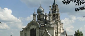
Tyumen has opportunities for pilgrimage tourism; the city has many Orthodox churches and two monasteries. The churches of Tyumen deserve the attention of architecture lovers, where else can you see such a rich collection of magnificent churches in the Siberian Baroque style!
All Saints Church
© Anna Kudryavtseva
We offer a walking route from the Diocesan Nativity of the Mother of God convent to the Holy Trinity Monastery, passing by all the Orthodox churches of the historical part of Tyumen. The length of the route is about 6 kilometers, which is quite feasible for tourists of any age in one day. You will be able to see:
- Mother of God Nativity Convent
- All Saints Church
- Church of Simeon the God-Receiver at the Syromatic and Craft Institution
- Church of the Savior Not Made by Hands
- Cathedral of the Icon of the Mother of God of the Sign
- Church of the Archangel Michael
- Church of the Exaltation of the Holy Cross
- Holy Trinity Monastery
More information in the section Temples, cathedrals, mosques Route map to monasteries and temples
Walk along the Golden Line
You don’t have to plan your routes, but follow the tourist route that already exists in the city. In many Russian cities there are tourist lines created for the convenience of tourists. The routes are laid out along the most interesting places in the city, marked with bright paint on the sidewalk and help you do without a map or guidebook. Travelers just need to find the start of the path, and then move along the drawn line, and study the history of the city from the information stands.
© Anna Kudryavtseva
A similar route has been created in Tyumen, this is the “Golden Line” - a 2-kilometer-long walking route that connects 12 wooden houses of the 19th - early 20th centuries with unique wooden carvings and an interesting history of their owners. The route begins at the upper level of the Tura embankment near house No. 1 on Semakova Street.
For the “Golden Line” there is also an audio guide “Legends and Symbols of Tyumen Carving”, which can be installed in advance on your smartphone by downloading it from izi.travel. But if you haven’t downloaded the app, don’t worry: every building along the route has a sign with information similar to the information in the mobile app. There is also a route map there.
If you are interested in wooden architecture, do not miss the opportunity to see the preserved wooden buildings of Tyumen. The beauty of the platbands, made in the characteristic Tyumen volumetric style of carving, will surprise you and will not leave you indifferent!
Do you like street art?
Since 2022, the Morphology of Streets street art festival has been taking place in Tyumen, where artists from all over Russia come to decorate the walls and fences of the city. In 2022, the festival took place for the fourth time, leaving behind dozens of bright works, an entire art quarter, as well as new unusual places for photo shoots. If you love street art, you can follow street art trails around the city and collect your own collection of photographs of street artists' work. Here are the most famous works of street art that can be seen in the central part of Tyumen:
- The work of artist Ilya Vince from Tomsk.
© Anna Kudryavtseva
We recommend starting with the art quarter on Severnaya Street, 11, where the walls of buildings are decorated with magnificent totems by artists Stepan and Alina Aifo, the work “Mixed Feelings” by Roman Salomatin (Kreemos) from Podolsk and “A Look into the Past” by Perm artist Vyacheslav Moff.
- Behind the building of the Historical Park “Russia is my history” on the wall of a transformer booth is a noteworthy work by Tomsk artist Ilia Wince. His murals usually depict scenes from the life of the indigenous peoples of Siberia and their rural life.
- A whole gallery of works from the Morphology of Streets festival is on the wall along Sacco Street, opposite the Museum of the History of Tyumen. Here are “Weasel” by Moscow artist Antonia Lev, “We are different” by Tina Prokhorova (Tinst Win) - a graphic designer and street art artist from St. Petersburg and “Fuga” by Valentin 5307 from Chelyabinsk.
- On the transformer booth behind the regional government building you can see the bright work of Tyumen artist Alexandra Melnikova.
Next to all the works of the “Street Morphology” festival there is a QR code, by reading which you can read and listen to information about the work. In addition, graffiti is plotted on the 2GIS map; you just need to type “street art” in the search bar.
You will also find approximate routes around the city in our tips:
What to see in Tyumen in 1 day in 2 days in 3 days in winter in summer
Train Station
Tyumen railway station is located at st. Privokzalnaya, 22. The station is open 24 hours a day. On October 7, 1974, a new building was opened, which includes a luggage department, a 9-story hotel building, and ticket offices. The capacity of the waiting rooms is 1.5 thousand people per day. The number of tracks is 15, platforms are 3. There is free parking for cars nearby. The railway station was founded on December 5, 1885.
The most popular long-distance train routes: Chita, Moscow, Kazan, Volgograd, Vladivostok, St. Petersburg, Ufa, Adler, Barnaul, Ulan-Ude, Krasnoyarsk, Chita, Orenburg. Suburban trains are also serviced at the station.
Tyumen bus stations
The bus station in Tyumen is located at st. Permyakova, 9, next to the large shopping complex "Fair" and a branch of the higher educational institution MIGUP. To get to the bus station building you need to use city public transport or a taxi. The bus station is open from 4:00 to 22:00, seven days a week.
Regular buses travel to the following destinations: Asbest, Bishkek, Vagai, Yekaterinburg, Golovina, Ishim, Kostanay, Kurgan, Magnitogorsk, Nizhnevartovsk, Omsk, Petropavlovsk, Tobolsk, Khanty-Mansiysk.
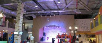
Vacation with children
In Tyumen there is a sufficient amount of entertainment on a wide variety of topics for children. A win-win option at any time of the year is Tsvetnoy Boulevard , a favorite vacation spot for city residents.
Attractions on Tsvetnoy Boulevard
© Anna Kudryavtseva
There are more than four dozen different attractions for different age categories: children's, family and extreme, as well as various entertainment events, concerts, and children's games and competitions. An excellent option is a circus, a place where a child can touch something unusual. The Tyumen Circus is located here, on Tsvetnoy Boulevard.
Your child will benefit from a trip to the City Duma Museum , where a little tourist can get acquainted with the animal world of the region, see the skeletons of a mammoth and cave bear, stuffed animals and birds, and schoolchildren will benefit from the knowledge gained in the Historical Park “Russia - My History” , because Such museums exist only in large cities of the country.
You can introduce your child to the world of art by attending performances at the Puppet Theater or the Tyumen Bolshoi Drama Theater , where the repertoire includes musicals for the whole family: “The Snow Queen”, “The Adventures of Pinocchio”, “The Frog Princess”.
Active children will be able to have fun in extreme parks, climbing walls, trampoline centers and rope parks. Children's holidays are organized in large shopping centers. Atmosfera family amusement park in the Tyumen City Mall shopping center is a rope park, trampolines, a unique labyrinth with a giant space slide that three people can go down, a tubing slide and a spiral slide, trampolines, a nerf area for exciting blaster shooting , fanwalls where you can feel like a real climber, and much more.
Tyumen Puppet Theater
© Anna Kudryavtseva
a children's active recreation park "Corn" in the Premier shopping center, a laser tag and paintball club Ernandes Military in the Arbat shopping center, a children's park in TSUM, a children's active recreation park "Khlop Top" in the Yuzhny shopping center, a children's sports and playground KidsCity in the shopping center "Goodwin", "Third Planet" in the shopping center "Favorite" and the list is not limited to this.
One of the most popular entertainment centers in Tyumen is the LetoLeto , where you can relax with the whole family at any time of the year, even with small children. Let's not forget about boat trips around Tura; this can become an unforgettable summer adventure for your child.
More information about all the interesting places where you can relax with children in the article Where to go with children in Tyumen
Automobile highways
Six highways pass through Tyumen:
- P254 “Irtysh” is a federal highway that leads to Chelyabinsk, Kurgan, Novosibirsk and Omsk. The route is part of the E30 road. The total length of the highway is 1528 km. Crosses large rivers: Ob, Irtysh, Ishim, Tobol. For 190 km the road passes through the territory of Kazakhstan.
- P402 is a federal highway that leads to Ishim, Omsk, Yalutorovsk, Abatskoye, Tyukalinsk. Connects the European part of the Russian Federation with the Far East and Siberia. The length of the highway is 632 km.
- P404 is a highway that has the status of federal significance. Connects the Tyumen region with the Khanty-Mansi Autonomous Okrug. The route leads to Tobolsk, Surgut, Khanty-Mansiysk, Nefteyugansk.
- P351 is a route that is part of the European route E22. The highway leads to Omsk, Ishim, Khanty-Mansiysk, Yekaterinburg. The total length of the route is 328 km.
- P401 is a highway that connects the western part of the city of Tyumen and Roshchino airport. Has 2 lanes in each direction. The total length of the highway is 8.2 km.
- E22 is a European route that passes through Tyumen. The road originates in the city of Holyhead - a Welsh town on the island of Holy Island. The final point of the route is the Russian city of Ishim. Passes through Izhevsk, Kazan, Manchester, Yekaterinburg, Riga, Hamburg.
Nizhnevartovsk
The coat of arms of Nizhnevartovsk was adopted on June 21, 1999. In the upper golden field there is a pipe with oil flowing out of it, in the silver field there is a green spruce; in an azure field there are two silver fish (symbolizing the wealth of the Ob River).
Nizhnevartovsk Panorama of the city | Nizhnevartovsk , a city in the Russian Federation, Khanty-Mansi Autonomous Okrug, is located in the north of Western Siberia, within the Central Ob Lowland, on the right bank of the river. Ob, 625 km east of Khanty-Mansiysk, 940 km northeast of Tyumen. River port. Railroad station. Airport. District center. Population 234.8 thousand people (2001). Founded in 1909. City since 1972. | One of the residential areas of Nizhnevartovsk |
The organizational and economic center of a large oil and gas producing region. Main enterprises: OJSC Nizhnevartovskneftegaz, Sibneftegazpererabotka, Chernogorneft. 3 departments of drilling operations, department of main oil pipelines. Automobile repair plant. Production of building materials. Food industry enterprises: dairy, sausage factories, bakeries, fisheries, poultry farms, etc. Timber industry. Nizhnevartovsk is the beginning of the oil pipelines Samotlor - Almetyevsk, Samotlor - Samara, Samotlor - Aleksandrovskoye.
Founded as a wood wharf in Nizhnevartovsk. On the contrary, on the left bank of the Ob, at that time there was the village of Vartovskoye, which in 1929 was included in the village of Vampugolsk. The rapid development of the village of Nizhnevartovskoye began with the opening in the early 1960s. and the development of oil fields (the largest is Samotlorskoye, others are Varyoganskoye, Khokhryakovskoye, Mykhpayskoye, Ershovskoye). Since 1964, the urban-type settlement of Nizhnevartovsky. City of Nizhnevartovsk since 1972.
The city has museums: local history, modern fine arts.
Educational institutions: Nizhnevartovsk State Pedagogical Institute, faculty of Tyumen State Oil and Gas University, branch of the Institute of International Law and Economics named after A. S. Griboyedov, branch of Tyumen State University.
What is Tyumen famous for?
The city of Tyumen is famous for the fact that during the Great Patriotic War the body of Vladimir Ilyich Lenin was evacuated to the city territory. The building of the Tyumen Agricultural Academy was chosen as the storage location.
The city is also famous for the fact that not far from Tyumen - in the village of Pokrovskoye (80 km from the city) - Grigory Rasputin was born. Tyumen is the first city in Siberia. The year of foundation is 1586. In addition, Tyumen is called the oil and gas capital of Russia. In the 20th century, large oil fields were discovered in the city.