Where is Kuzbass in Russia? What is this array famous for? You will find answers to these and other exciting questions in our article. We will also look at the sights of the city of Kuzbass. Where is he? More on this later in the article.
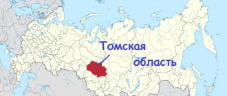
Kuzbass is located between the medium-high highlands of the Kuznetsk mountain range and the Salair mountain range, located in the southern part of Western Siberia. Its official name is the Kuznetsk coal basin. Area more than 95 thousand km².
Talking about where Kuzbass is located, I would like to say that its second name is the Kemerovo region, given that the main part of the coal basin belongs to it. The regional center of the region is the city of Kemerovo.
History of the Kemerovo region (Kuzbass)
When talking about where the Kuzbass basin is located, we need to remember its history. Representatives of the Turkic-speaking people (Shors), Siberian Tatars and Teleuts settled on the territory of the modern Kemerovo region several thousand years ago.
In those days, it became necessary to protect this region from external enemies, and at the beginning of the 17th century (in 1618) the Kuznetsk fortress was built. Around it, on the banks of the Tom River (a tributary of the Ob), the future city of Novokuznetsk grew.
Eighty years later, at a distance of 380 km from Kuznetsk, the city of Mariinsk appeared on the Kiya River. According to historical documents, these two cities are considered the oldest cities in the Kuzbass coal basin.
More than 300 years ago, the Emperor of the Russian Empire, Peter I, was informed that an expert in ore mining, the serf Mikhail Volkov, had discovered a coal deposit.
In 1821, the Honorary Member of the St. Petersburg Academy of Sciences, Pyotr Chikhachev, identified large coal deposits in the Kemerovo region, which the scientist called the “Kuznetsk coal basin.”
At the end of the 18th century, coal mining began. After some time, industrial metallurgical and silver smelting enterprises were created.
The Ural industrialist Nikita Demidov became interested in the development of Kuznetsk coal and created a whole network of metallurgical plants. A big impetus for the development of the Kuznetsk basin was the construction in 1898 of the Trans-Siberian Railway (Trans-Siberian - Great Siberian Way).
Kemerovo district
The history of the Kemerovo district of the Kemerovo region dates back to August 1924. It was then that the region developed around the city of Kemerovo.
Initially it was inhabited mainly by peasants. Today the area is gradually developing. In particular, the housing stock and cultivated areas are increasing. The population is growing mainly due to migrants from Central Asian countries.
It is interesting that now the city of Kemerovo is considered the administrative center of the region, but is not part of it.
The population of the district is now about 46.5 thousand people. Almost 94% of them are Russian. Considering that Kemerovo is not part of the district, 100% of the population are rural residents, because there are no other cities in the Kemerovo region.
The main industries are the production of non-metallic mineral resources and mining. Livestock breeding and vegetable growing are also developing.
Where is the Kuzbass coal basin located? Its development
Revolutionary events in Russia suspended the activities of Kuzbass factories. But since 1920, restoration work began at all factories, which became state enterprises.
During this period, schools, institutes, theaters were built in cities, museums and many other cultural institutions were opened. In the period from 1931 to 1939, where Kuzbass is located, eight educational institutions, modern for that time in the city, were built.
Until 1942, the regional center was the city of Novokuznetsk. By decision of the USSR government, in 1943, the Kemerovo region with the regional center of Kemerovo was created on the territory where the city of Kuzbass is located, which used to be part of the Novosibirsk region.
Now there are 20 cities in the region. Where Kuzbass is located, there are 58 mines, coal and metallurgical plants and 36 open-pit coal mining enterprises.
In addition, Kuzbass, where all the conditions have been created to be first in the Russian rankings in coal mining and fourth in steel production, has four universities, nine institutes and twenty colleges in various specialties.
Nowadays, Kemerovo and Novokuznetsk are considered large cities in terms of population and area. They are home to more than a million indigenous people.
Soviet Union
After the Bolsheviks came to power, Kuzbass first became part of the West Siberian Territory, and then the Novosibirsk Region.
The first years of Soviet power were distinguished by the transition to a planned economy. The metallurgical, coal and chemical industries are developing. A metallurgical plant, a coking plant, and new mines appear. Near industrial enterprises, workers' settlements are developing, which will soon receive the status of cities.
During the Great Patriotic War, Kuzbass became the main supplier of metal and coal in the country. 71 enterprises from the occupied areas are being evacuated here, most of which remain in their new location.
Kemerovo
On the banks of the Bolshaya Kamyshnaya and Tom rivers there is a regional center - Kemerovo - with an area of 280 km².
There was a Russian settlement on the territory of the future administrative center of Kuzbass.
Historical documents indicate that it was formed from the connection of two small villages - Shcheglovo and Kemerovo. This happened in 1734.
In connection with the development of the coal industry, the territory of the village of Kemerovo expanded, and after some time the first buildings of urban infrastructure appeared.
In 1918, the village received city status, and 25 years later the city of Kemerovo was transformed into a regional center.
Now Kemerovo is the center of the Kuzbass region with a developed chemical and food industry. The main enterprises are plants for the production of artificial solid fuel (coke).
Current situation
The modern history of the Kemerovo region turned out to be not so rosy. What happened in the region in the 90s affected the development of not only Kuzbass, but the entire country.
The regional economy finds itself in a deep systemic crisis. In conditions of shortages, industrial enterprises, including large ones, begin to close.
As a result of the privatization of state property, the state retains only part of its resources. These are railway transport, the defense complex, gold mining, veterinary and sanitary-epidemiological institutions. Printing houses, pharmacies, poultry farms, and some motor transport enterprises are subordinated to the region. Municipal authorities manage only hospitals and clinics, schools, public utilities, and residential buildings. Everything else becomes private property.
Despite the fact that the economy was in decline in the 90s, by the end of the decade the coal industry began to develop. Since 2003, oil refineries have been operating in the Kemerovo region. This has become a new industry for the region. Since 2010, coal gas production, a project for the extraction and use of methane from coal seams, has been implemented.
For more than 20 years, the region was led by Governor Aman Tuleyev, an influential politician who even ran for the presidency of Russia in the 90s. In 2022, he resigned after the shopping tragedy, when a fire killed 60 people. Now the region is headed by Sergei Tsivilev.
Novokuznetsk
The city of Novokuznetsk, which is more than four hundred years old, used to be called Kuznetsk. It is believed that the history of the city begins in 1617.
That year, a decree was signed by the first Tsar of All Rus', Mikhail Romanov, which required the construction of a wooden fortress in order to establish the power of Russia throughout Siberia.
In connection with this, the Kuznetsk fort was built. Gradually, a settlement grew around the fortress.
The inhabitants of this area were engaged in blacksmithing, making mainly weapons from mined iron. This is where, according to historians, the name of the city came from. Since the 17th century, they were called “Kuznetsk Tatars”, and their place of residence was called “Kuznetsk land”.
Since 1804, the settlement has become a county town. Then he receives an official coat of arms with the image of a forge. In 1927, the city became an all-Union construction site, thanks to which the first metallurgical plant was built.
In 1932, the villages nearby Kuznetsk were united into a single city. It officially received the name "Novokuznetsk".
Now it is a modern city with an area of more than 400 km², home to 554 thousand adults, most of whom work at the West Siberian Combine, one of the largest metallurgical enterprises in Europe. Kuzbass is considered the pearl of Siberia.
In 2011, the excursion bureau held a competition among residents of the Kemerovo region, where they had to identify seven places of interest in the Kuzbass region.
This is how the “Seven Wonders of Kuzbass” were defined. This list is the basis of the tourist route for guests and tourists of the Kemerovo region.
The path to a single-industry town
In the 60-80s, the population of Belovo exceeded one hundred thousand people. When the Soviet Union collapsed, the economy continued to work for some time by inertia, but when the redistribution of property and the restructuring of the coal industry began, giant factories began to close one after another. Food production stopped, the knitting factory, machine-building and zinc plants no longer worked.
Today, the population of Belovo, compared to Soviet times, has almost halved. According to the latest data, about 70 thousand people live here.
In 2014, by decree of the federal government, Belovo was included in the list of single-industry towns with a risk of deterioration in the socio-economic situation. Currently, mining continues here. It accounts for up to 60 percent of shipped goods of its own production. Open-pit and underground coal mining is carried out, and construction materials are produced. Almost a third of the region’s electricity is generated by Belovskaya GRES.
Using the example of Belovo and Berezovsky, one can trace the classic path of development of settlements in the Kemerovo region. In the 20th century, they went from workers' villages to cities that were actively built up, and their population grew. Now the situation in many of them is close to critical.
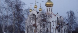
Transfiguration Cathedral
We found out where Kuzbass is located. Now let's talk about the sights of the region. In the old part of the city of Novokuznetsk (190 km from Kemerovo) there is the Transfiguration Cathedral. It is considered the oldest city building.
On the territory of the Kuznetsk fortification (ostrog), near the chapel built in 1618, a church was erected in the name of the Transfiguration of the Lord. In 1791, it was decided to build a stone religious shrine on the site of the wooden temple. In 1835 the cathedral was consecrated. Then it became the main attraction of the city.
Now the church is operational, and city guests can attend the liturgy and view the interior, restored after restoration work.
Links
- Government portal of the Kemerovo region
- "Multifunctional center for the provision of state and municipal services (MFC) of the Kemerovo region"
- Kemerovo region
- Made in Kemerovo region
Photo reviews of the region
|
|
| [ + ] Regions of Russia | |
| Regions of the North-West (NWFD) | St. Petersburg • Leningrad region • Arkhangelsk region • Vologda region • Kaliningrad region • Karelia • Komi • Murmansk region • Nenets Autonomous Okrug • Pskov region |
| Regions of the Volga region (VFD) | Bashkortostan • Volgograd region • Kalmykia • Kirov region • Mari El • Mordovia • Nizhny Novgorod region • Orenburg region • Penza region • Perm region • Samara region • Saratov region • Tatarstan • Udmurtia • Ulyanovsk region • Chuvashia |
| Regions of Southern Russia (SFD) | Sevastopol • Republic of Crimea • Adygea • Astrakhan region • Krasnodar region • Rostov region |
| Regions of the North Caucasus (NCFD) | Dagestan • Ingushetia • Kabardino-Balkaria • Karachay-Cherkessia • North Ossetia • Stavropol Territory • Chechen Republic |
| Regions of the Urals (Ural Federal District) | Kurgan region • Sverdlovsk region • Tyumen region • Khanty-Mansi Autonomous Okrug - Yugra • Chelyabinsk region • Yamalo-Nenets Autonomous Okrug |
| Regions of Siberia (Siberian Federal District) | Altai Republic • Altai Territory • Irkutsk Region • Kemerovo Region • Krasnoyarsk Region • Novgorod Region • Novosibirsk Region • Omsk Region • Tomsk Region • Tyva • Khakassia |
| Regions of the Far East (FEFD) | Amur Region • Buryatia • Jewish Autonomous Region • Trans-Baikal Territory • Kamchatka Territory • Magadan Region • Primorsky Territory • Yakutia • Sakhalin Region • Khabarovsk Territory • Chukotka Autonomous Okrug |
| see also | Regions of Russia • Federal districts of Russia • Abolished subjects • Economic regions of Russia • Cities of Russia |
Cult place “Bald Mountain”
In 1981, librarian Sergei Kuznetsov conducted excavations on the banks of the Golden Kitat River, which is located near the village of Yaya (Yaya district).
This place is a separate, rocky structure without any vegetation. It was a cult place during the Middle Ages.
During the opening of the earth, bone and iron arrowheads, bronze figurines and other objects of that time were found.
Scientists suggest that Bald Mountain was a habitat for spirits for people of the Middle Ages. Then they brought various items to the sanctuary in the form of donations.
History buffs can visit the iconic natural structure as part of excursions organized by the district tourist office.
Economics [edit]
The Kemerovo region is one of the most important industrial regions of Russia with some of the world's largest coal reserves. The south of the region is dominated by metallurgy and mining, as well as mechanical engineering and chemical production. The group and its subsidiary own enterprises for the extraction and processing of iron ore, as well as the Raspadskaya, Yuzhkuzbassugol, Siberian Holding, coal and coking coal mines. The northern part of the region is more agricultural. The region has a developed network of railways, including the Trans-Siberian Railway, which runs through the region. Prokopyevsk, Kiselevsk and Andzhero-Sudzhensk are centers of coal mining, and Novokuznetsk is a center of mechanical engineering.
Ecomuseum "Tazgol"
There is another attraction in the Tashtagol region - the Tazgol open-air ecological museum. It is located in the village of Ust-Anzas.
The museum, created in 1992 by archaeologists together with ethnographers from Kemerovo University, is located on an area of 5 hectares. Monuments of culture and life of the population of the region of past centuries are collected here.
Climate[edit]
The climate in the region is continental: winters are cold and long, summers are warm but short. Average January temperatures range from -17 to -20 °C (1 to -4 °F), and average July temperatures range from 17 to 18 °C (63 to 64 °F). Average annual precipitation ranges from 300 millimeters (12 in) on the plains and foothills to 1,000 millimeters (39 in) or more in mountainous areas. The duration of the frost-free period is 100 days in the north and up to 120 days in the south of the Kuznetsk basin.
Kuznetsk Fortress
On the territory of Novokuznetsk there is the main attraction of the city - the Kuznetsk Fortress. The fort was built in 1800 on the orders of Russian Emperor Paul I. The bastion is a complex of buildings located on an area of 22 hectares.
The peculiarity of this structure is that throughout its history the fortress did not take part in military events. After 70 years, the citadel was converted into the Kuznetsk prison.
Since 1917, the fortress buildings were used for various city institutions. And after the latest restoration, carried out on the eve of the 390th anniversary of the city, the fort is open to history buffs.
Education in Kuzbass
Despite the developed industry, there are few universities in this city on one hand. The bulk of specialists come from Kemerovo, Ugra, Anzhero-Sudzhensk and Novokuznetsk. From local universities: Kuzbass State Technical University named after T.F. Gorbachev, Kuzbass Institute of the Federal Penitentiary Service, Kuzbass Institute of Economics and Law, Kuzbass Institute for Advanced Training of Education Workers.
Kuzbass State Technical University named after T.F. Gorbachev
For admission, fairly high Unified State Exam scores are required, and graduates are practically employed locally. Local firms and enterprises are in dire need of specialists.
Lakes of Kuzbass. Photo
Where is Kuzbass in Russia? We have already found this out. Note that throughout the Kemerovo region there are hundreds of lakes, mainly floodplain reservoirs (resulting from the laying of new channels by rivers).
Among guests and indigenous residents of the region, Lake Bolshoy Berchikul (Tisulsky district) is considered the most popular for recreation.
There is a legend that says that so many gold nuggets were found here that one of the gold miners exclaimed: “There is so much gold here, take a sack (bag) and collect it!” The combination of these words gave the name to the reservoir, which is considered the largest in area in the region.
Thanks to its unique natural landscape, Bolshoy Berchikul is rightfully included in the list of “Seven Wonders of Kuzbass”.
Content
- 1 Cities of the Kemerovo region
- 2 Economy of the region 2.1 Major projects
- 2.2 News about the development of the region
- 2.3 Enterprises of the region 2.3.1 Enterprises of the mechanical engineering industry
- 2.3.2 Enterprises of the fuel and energy complex
- 2.3.3 Enterprises of the chemical complex
- 2.3.4 Metal and plastic processing plants
- 2.3.5 Light and textile industry enterprises
- 2.3.6 Wood processing enterprises
- 2.3.7 Construction industry enterprises
- 2.3.8 Enterprises of the agro-industrial complex
- 2.3.9 Food industry enterprises
- 2.3.10 Folk arts and crafts enterprises
- 2.3.11 Other enterprises
- 7.1 Photo reviews of the region
Which sources and waterfalls of Kuzbass to go to?
As in any mountainous area, penetrated by a network of rivers and streams, there are many picturesque waterfalls in Kuzbass. In some places there are also useful low-mineralized springs and springs.
Saga Waterfall
- Coordinates: 52.986627, 88.370484.
One of the pearls of the Shor National Park is the delightful Saga waterfall, formed by the Sholbychak stream. A stream of water flows through a picturesque canyon, falls from an 18-meter height and cascades into a small lake at the foot of the cliffs.
In winter, the stream freezes, turning into a white block. Sometimes Saga does not freeze completely, and then water continues to flow under the ice dome. The waterfall is recognized as a hydrological natural monument and is under state protection.
Gavrilovsky holy spring
- Coordinates: 54.254047, 85.846475.
The spring in the village of Gavrilovka has been known for more than a hundred years. According to local legend, a clean spring was found during the years of Bolshevik persecution at the site of the execution of rural priests. In the turbulent 90s, the shrine was abandoned, but at the beginning of the 2000s it was cleaned and re-consecrated.
A small brick chapel was built on a hill next to the spring, and a font and a gazebo were erected above the spring itself. The area was landscaped, an asphalt road was laid to the spring, and cedar trees were planted nearby.
St. Nicholas Spring
- Coordinates: 54.973879, 86.717231.
The holy spring near the village of Kamenny has recently become one of the pilgrimage centers in the Krapivinsky district. In 2012, students from a local school, together with adults, improved the spring, erected a fence, erected a worship cross and made a wooden font.
Then experts took samples from the spring, studied the composition of the water and found that it did not contain harmful substances, and therefore was suitable for drinking. Soon the source was consecrated in honor of St. Nicholas of Myra. A year later, a chapel was built near the spring in honor of St. Sergius of Radonezh.
Itkarinsky waterfall
- Coordinates: 55.967033, 84.979489.
Near the village of Itkara there is a clean mineral spring. Spring water runs down the high mossy bank of the Tom River in a cool, ringing stream, falls from a wooden gutter and scatters in a heap of splashes.
A visit to the waterfall is one of the most popular tourist routes. Near the unique landmark of the Kemerovo region there is a landscaped recreation area.
Politics[edit]
Regional Government building
During the Soviet period, high authority in the region was divided between three persons: the first secretary of the Kemerovo Committee of the CPSU (who actually had the greatest powers), the chairman of the regional Council (legislative power) and the chairman of the regional council. regional executive committee (executive branch). Since 1991, the CPSU lost all power and the head of the regional administration, and eventually the governor was appointed/elected along with the elected regional parliament.
The Charter of the Kemerovo Region is the basic law of the region. The Legislative Assembly of the Kemerovo Region is a permanent legislative (representative) body of the region. The Legislative Assembly exercises its powers by adopting laws, regulations and other legal acts, as well as monitoring the implementation and compliance with the laws and other legal acts adopted by it. The highest executive body is the Regional Government, which includes territorial executive bodies such as district administrations, committees and commissions that promote development and manage the day-to-day affairs of the region. The regional administration supports the activities of the Governor, who is the highest official and acts as a guarantor of compliance with the regional charter in accordance with the Constitution of Russia.
