City in Vologda Oblast, Russia
| Kharovsk Kharovsk | |
| City [1] | |
| In Kharovsk | |
| Location of Kharovsk | |
| Kharovsk Location of Kharovsk Show map of Russia Kharovsk Kharovsk (Vologda region) Show map of the Vologda region | |
| Coordinates: 59°57'N 40°12'E / 59.950°N W. 40.200 ° E. / 59,950; 40.200 Coordinates: 59°57'N 40°12'E. / 59.950°N 40.200°E / 59.950; 40.200 | |
| A country | Russia |
| Federal subject | Vologda region [1] |
| Administrative region | Kharovsky district [1] |
| City of district significance | Kharovsk [2] |
| Based | 1903 [3] |
| City status from | 1954 [4] |
| Height | 160 m (520 ft) |
| Population (2010 Census) [5] | |
| • General | 10 079 |
| • Evaluate (2018) [6] | 9 099 ( -9,7% ) |
| Administrative status | |
| • Capital from | Kharovsky district [1], city of regional significance Kharovsk [2] |
| Municipal status | |
| • Municipal district | Kharovsky municipal district [7] |
| • Urban village | Urban settlement Kharovsk [7] |
| • Capital from | Kharovsky municipal district [7], urban settlement Kharovsk [7] |
| Timezone | UTC+3 (MSK[8]) |
| Postal code [9] | 162250, 162251 |
| OKTMO ID | 19652101001 |
Kharovsk
(Russian: Kharovsk) is a city and the administrative center of Kharovsky District in Vologda Oblast, Russia, located on the left bank of the Kubenna River, 90 km (56 mi) north of Vologda, the administrative center of the region. Population: 10,079 (2010 census); [5] 11,460 (2002 census); [10] 13,083 (1989 census). [eleven]
History[edit]
In 1894, construction of a railway line between Vologda and Arkhangelsk began. [ citation needed
] It was decided that the railway should take the shortest route rather than through existing settlements, and it was eventually built through the current location of Kharovsk.
[ citation needed
] In 1894, the Kubino railway station was opened on this site, which was later renamed Leshchevo; in 1914 the station was renamed Kharovskaya [12].
Kharovskaya village
(Kharovskaya), also known as
Kharovsky
(Kharovsky)[12], founded in 1903 in connection with the construction of a glass factory. [3] In 1919, a sawmill was built. [3] Kharovsky belonged to Kadnikovsky Uyezd in the Vologda Governorate. [13]
On July 15, 1929, the districts were abolished, the provinces became part of the Northern Territory, and the Kharovsky district was formed. [4] In 1932, the administrative center of the Kharovskaya district received the status of a workers' village. [12] This was followed by the construction of a number of industrial enterprises, including a dairy plant. [3] In 1954, Kharovskaya was given city status and its current name. [4]
Kharovsk
(Vologda Region)
OKATO code:
19252501
Founded:
1903
Urban settlement since:
1932
City since:
1954 City of district subordination (Kharovsky district, Vologda region)
Center:
Kharovsky district
The city was formerly called:
| Kharovsky | 1903 | 1954 |
| Telephone code (reference phone) | |
| 81732***** | 22-2-22 |
Deviation from Moscow time, hours:
0
Geographic latitude:
59°57′
Geographic longitude:
40°12′
Altitude above sea level, meters:
160 Sunrise and sunset times of the Sun and Moon in the city of Kharovsk
Links[edit]
Notes[edit]
- ^ abcde Resolution No. 178
- ^ abc Law No. 371-OZ
- ^ abcd Encyclopedia of Russian Cities
. Moscow: Great Russian Encyclopedia. 2003. pp. 504–505. ISBN 5-7107-7399-9. - ^ a b c Information on changes in the administrative-territorial structure and network of party and Komsomol bodies of the Vologda region (1917–1991) (in Russian). Archives of Russia. Retrieved October 17, 2011.
- ^ a b Federal State Statistics Service (2011). All-Russian Population Census 2010. Volume 1 [All-Russian Population Census 2010, vol. 1]. All-Russian Population Census 2010 [All-Russian Population Census 2010] (in Russian). Federal State Statistics Service.
- "26. The size of the permanent population of the Russian Federation by municipalities as of January 1, 2022". Federal State Statistics Service. Retrieved January 23, 2022.
- ^ abcde Law No. 1127-OD
- "On the Calculation of Time". Official Internet portal of legal information
. June 3, 2011. Retrieved January 19, 2022. - Post office. Information and computing center of OASU RPO. ( Post office
).
Search for postal service objects ( postal Search for objects
) (in Russian) - ↑
Federal State Statistics Service of Russia (May 21, 2004). The population of the Russian Federation, cities of the Russian Federation as part of federal districts, urban settlements, settlements, settlements, settlements is 3 thousand or more people. [Population of Russia, its federal districts , subjects of the Federation, districts, urban settlements, rural settlements - administrative centers and rural settlements with a population of more than 3000 people] (XLS). All-Russian Population Census of 2002 [All-Russian Population Census of 2002] (in Russian). - All-Union Population Census of 1989 Population of Union and Autonomous Republics, Autonomous Regions and Districts, Territories, Regions, Urban Settlements and Village District Centers [All-Union Population Census of 1989: Current Population of Union and Autonomous Republics, Autonomous Regions and Districts, Territories, Regions , districts, urban settlements and villages performing the functions of district administrative centers]. All-Union Population Census of 1989 [All-Union Population Census of 1989] (in Russian). Institute of Demography of the National Research University: Higher School of Economics [Institute of Demography of the National Research University: Higher School of Economics]. 1989 - via Demoscope Weekly
. - ^ abc N. V. Soldatova (2006). G. V. Sudakov (ed.). Vologda Encyclopedia (PDF) (in Russian). Vologda: VSPU, Rus. p. 228. ISBN 5-87822-305-8. Retrieved November 22, 2013.
- About the first commercial and industrial establishments of Kharovskaya station (in Russian). State Archive of the Vologda Region. 2004. Retrieved November 27, 2013.
- Enterprises and organizations of the Kharovsky municipal district (in Russian). Administration of the Kharovsky municipal district. Archived from the original on May 2, 2008. Retrieved October 17, 2011.
- Kharovsky Historical and Art Museum (in Russian). Russian Network of Cultural Heritage. Archived from the original on October 7, 2013. Retrieved November 22, 2013.
- Information (in Russian). MX-SPORT.RU. Archived from the original on February 3, 2011. Retrieved October 18, 2011.
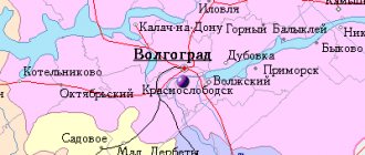
Map
| Kharovsk: maps |
Kharovsk: photo from space (Google Maps) Kharovsk: photo from space (Microsoft Virtual Earth)
| Kharovsk. Nearest cities. Distances in km. on the map (in brackets along roads) + direction. Using the hyperlink in the distance , you can get the route (information courtesy of the AutoTransInfo website) | |||
| 1 | Estuary | 44 (109) | SW |
| 2 | Syamzha | 49 (51) | IN |
| 3 | Kadnikov | 50 (75) | YU |
| 4 | Falcon | 53 (78) | YU |
| 5 | Vozhega | 58 (72) | WITH |
| 6 | Shuyskoye | 78 (161) | SE |
| 7 | Dairy | 79 (128) | YU |
| 8 | Vologda | 83 (113) | YU |
| 9 | Kirillov | 101 (253) | Z |
| 10 | Fedotovo | 102 () | SW |
| 11 | Konosha (Arkhangelsk region) | 113 (149) | WITH |
| 12 | Gryazovets | 118 (161) | YU |
| 13 | Sheksna | 125 (185) | SW |
| 14 | Lipin Bor | 127 (290) | Z |
a brief description of
Located on the Kharovskaya ridge, on the left bank of the river. Kubena, 89 km north of Vologda. Railway Kharovskaya station.
Territory (sq. km): 18
Information about the city of Kharovsk on the Russian Wikipedia site
Historical sketch
It emerged as a village during the construction of a station and bridge at the intersection of the Vologda - Arkhangelsk railway with the river. Cubens. The station was opened in 1898 and until 1904 it was called Kubino, then Leshchevo and from 1914 Kharovskaya.
In 1903, the village of Kharovsky was founded near the station during the construction of a glass factory. In 1919, a sawmill was built. In the 1930s timber mill N45, a dairy factory, and a food processing plant were built.
Workers' settlement of Kharovsk since December 31, 1932. City since October 28, 1954.
In 1962, a sleeper impregnation plant was built.
Economy
Timber processing plant "Lesdok", timber (lumber, house parts, etc.), glass (chemical bottles, battery vessels), sleeper plant, technological equipment plant (equipment for agricultural industries). Flax plant, food and bakery factories, dairy plant.
75% of the territory of the Kharovsky district is occupied by forest. Logging - Semigorsk timber industry enterprise.
They grow grain crops, flax, and perennial herbs. Meat and dairy cattle breeding.
Deposits of peat, brick and ceramic clays, glass sands, gravel, tuff.
Main enterprises
FORESTRY, WOOD PROCESSING AND PULP AND PAPER INDUSTRY
JSC "Lesdok"
162200, Vologda region, Kharovsky district, Kharovsk, st.
Krasnoe Znamya, 25 Offers:
lumber, door and window blocks, molded products, industrial wood
Museums, galleries, exhibition halls
Kharovsky History and Art Museum 162250, Vologda region, Kharovsky district, Kharovsk, st. Svobody, 20 Phone(s): 2-1967
Architecture, sights
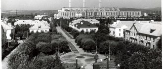
Kharovsk is predominantly built up with 3- and 5-story buildings.
In the village of Kumzero there is the Church of Frol and Laurus (17th century).
In the Kharovsky district there are protected natural monuments: Azletsky forest (752 hectares), Pustoramensky forest.
| Population by year (thousands of inhabitants) | |||||||
| 1926 | 0.5 | 1996 | 12.9 | 2007 | 11.0 | 2015 | 9.4 |
| 1939 | 7.4 | 1998 | 12.6 | 2008 | 10.9 | 2016 | 9.3 |
| 1959 | 11.3 | 2000 | 12.4 | 2010 | 10.6 | 2017 | 9.2 |
| 1970 | 14.1 | 2001 | 12.4 | 2011 | 10.1 | 2018 | 9.1 |
| 1979 | 12.9 | 2003 | 11.5 | 2012 | 9.8 | 2019 | 8.9 |
| 1989 | 13.1 | 2005 | 11.2 | 2013 | 9.6 | 2020 | 8.8 |
| 1992 | 13.2 | 2006 | 11.1 | 2014 | 9.5 | 2021 | 8.7 |
Kharovsky district is located in the central part of the Vologda region. In the north it borders with Vozhegodsky, in the east with Syamzhensky, in the west with Ust-Kubinsky and in the south with Sokolsky districts. Distance to region center - 89 km by train. d. The district includes 1 urban and 11 rural settlements (since 2010, the Shevnitskoye rural settlement has been merged with the Razinsky rural settlement). The regional center is the city of Kharovsk .
The population of the district in 2010 was 17,927 people. The area of the district is 3560 sq. km.
For a long time, the territory of the Kharovsky district remained a blank spot on the archaeological map of the Vologda region. Unlike other Vologda lands, flint arrowheads and spears, slate axes and adzes, and ancient pottery have never been found in the Kharovsky region. There are no medieval fortified settlements - fortifications or spectacular burial mounds - mounds and hills.
Only in 1988 - 1989, archaeologist A. V. Kudryashov, who examined the banks of the Kubena and City , the mouth of the Vondozh , the eastern part of Lake Kumzer , discovered 13 archaeological sites dating back to different archaeological eras, including one of the most interesting in the region - multi-layered settlement of Borovikovo .
Currently, about 40 archaeological sites are known on the territory of the Kharovsky district.
Excavations show that the earliest settlements appeared in the 7-5 millennium BC. By the 16th-17th centuries, there were already several large settlements on the territory of the present Kharovsky district . The peasants were engaged in farming, hunting and fishing, and erected churches.
The Kubeno-Zaozersky region in the 13th century was part of North-Eastern Rus' and was associated with the Rostov, Belozersky and Yaroslavl principalities. The emergence of the possessions of the Yaroslavl princes here is apparently explained by the marriage in 1278 of Prince Mikhail Glebovich Belozersky (son of the first Belozersk prince Gleb Vasilkovich) to the daughter of the Yaroslavl prince Fyodor Rostislavich Cherny. In the same year, during the political struggle, Prince Mikhail Glebovich lost, and in 1286 he regained part of the Belozersk possessions. After the death of Prince Mikhail Glebovich in 1293, Prince Dmitry Borisovich of Rostov .
In the 14th century, the area located south of Lake Kubenskoye was developed by the Grand Dukes of Vladimir, who came from the Tver and then Moscow houses.
The first mention of the region's population dates back to the 14th century. Written sources about the region have existed since the 15th century. Mentions of the famous monasteries of the Kharovskaya land - Katromsky and Semigorodny Hermitage - go back to the 16th century. In the 17th-18th centuries, the territory of the modern Kharovsky district was part of the Vologda district. Starting from the provincial reform of Catherine II and until the beginning of the 20th century, Kharovskaya land was part of the Kadnikovsky district.
The Seven-City Hermitage was located not far, 20-25 versts from two ancient holy monasteries: Kharovskaya Glushitskaya and Sosnovskaya Glushitskaya, founded at the beginning of the 15th century by the Monk Dionysius of Glushitsky. The hermitage was called Semigorodnyaya from the Semigorodskaya volost that was here, and the volost itself was called from seven villages, which were located on seven small mountains and with their fields were separated from each other by fences. Therefore, in ancient times, the church in the desert was called the “Temple of the Most Pure Mother of God on Seven Mountains.” During its five-century existence, the Seven-City Hermitage experienced varying degrees of external well-being and experienced many adversities.
The territory of the modern Kharovsky district is located in the basins of the Sit, Vondozh, Nizhnyaya Kizma, Katroma rivers and the Kubena in its lower reaches. These lands formed the central part of the former Kadnikovsky district, which included such volosts as: Azletskaya, Kumzerskaya, Shapshinskaya, Shevnitskaya, Petryaevskaya, Vasyanovskaya, Pustoramenskaya, Kuzovlevskaya, Mikhailovskaya, Leshchevskaya, Ilyinskaya, Ioanno-Slobodskaya, Katromskaya, Mityukovskaya.
At the end of the 19th and beginning of the 20th centuries, the bulk of the population of this territory were peasants.
Most of all, crafts that were associated with forests developed here; they were actively involved in cutting, rafting and exporting timber. But at the end of the 19th century, they began to feel a shortage of forest reserves, as the forest was actively cut down.
A new stage in the development of the region began with the construction of the railway to Arkhangelsk.
On June 11, 1894, Alexander III approved the construction of a one-way narrow-gauge line from Vologda to Arkhangelsk
The construction of the Vologda-Arkhangelsk narrow-gauge road took place in difficult conditions. The line was laid across the area through impassable swamps, swamps, tundra; there were almost no settlements. When laying the upper structure, the tracks, the laid rails, along with the entire embankment, fell into the swamp. Sometimes entire trains loaded with ballast sank under the water.
The appearance of Kharovsk on the map of the country is associated with the construction of the railway and the formation of the station. According to the original version, the railway line was supposed to run from Morzhenga through the Semigorodny Monastery, then to Sudova to Mogilenskaya. and then to Punduga. Then the monastery lands and arable lands would have been affected, but the abbot of the monastery did not give permission to use the territory adjacent to the monastery. The railway was laid according to the second, approved and now existing option.
On August 1, 1896, Kubino station was opened to traffic.
On October 22, 1898, constant traffic was opened along the entire Vologda-Arkhangelsk-Pristan line.
On January 1, 1904, the original Kubino station was renamed Leshchevo, and on April 18, 1914 it became known as Kharovskaya. Under her, a village grew, which for a long time was also called Kharovskaya, then Kharovsky, Kharovsk. On December 31, 1932, Kharovsk was classified as a workers' settlement, and on October 28, 1954 it was reorganized into the city of Kharovsk .
At the present stage of development of the region, the basis of the industrial potential is formed by enterprises of the forestry and woodworking industries. The production of milk and meat is the main task of agricultural enterprises. In the course of reforming the national economy, trade, communications, and small and medium-sized businesses related to timber procurement and processing are developing most successfully.
The climate of the region is temperate continental.
The largest bodies of water are lakes Katromskoye, Kumzerskoye, Chivitskoye , and the Kubena .
The main natural wealth of the region is forests, which occupy 281.7 thousand hectares or 79% of its territory. Game animals: elk, wild boar, bear, marten, beaver.
The network of specially protected natural areas of the district includes a landscape reserve, two landscape natural monuments and a nature reserve. In addition, regional legislative acts established the Nizhne-Kubensky zoological (hunting) reserve and 23 protected swamp areas (cranberry swamps) in the region.
The following protected natural reserves are located in the area:
“Azletsky forest” (located in the north-west of the region, 53 kilometers from the city of Kharovsk. In close proximity to it is the village of Timonikha),
“Bor Berezhok” - Pustoramensky pine forest (located on the left bank of the Kubena River, on a kama hill near the village of Nikolsky Pogost.),
Bor Kozlikha
Nizhne-Kubinsky (on the territory of the district there was the Kharovsky zoological (hunting) reserve. In 1997 it was liquidated, and in the western part of the region a new one was created - Nizhne-Kubinsky with an area of 19.1 thousand hectares. The richest game lands are located within the reserve.)
In addition, 20 cranberry bogs with a total area of 15 thousand hectares are under protection. The largest of them are Severnoye and Matyushinskoye
The Kharovsky district has connections with the regional center via the Vologda-Syamzha-Kharovsk (172 km) and Vologda-Sokol-Kharovsk-Vozhega highways (119 km).
The Northern Railway railway runs from north to south through the district; within the district its length is 90 km. The district center is also a railway station.
Among the attractions of the area are:
The Seven-City Hermitage is a historical monument from the 15th century.
On the sloping, low-lying right bank of the Kubeny River in the town of Berezhok, 15 kilometers from Kharovsk a church in the name of the Transfiguration of the Lord has long operated . It probably received the name Berezhetskaya from its geographical location, since it was located on the very bank of the river.
Official website of the district: www.haradm.ru