This term has other meanings, see Kaltan (meanings).
| City Kaltan Coat of arms |
| A country | Russia, Russia |
| Subject of the federation | Kemerovo regionKemerovo region |
| Urban district | Kaltan urban district |
| Coordinates | 53°31′00″ n. w. 87°16′00″ E. long / 53.51667° north w. 87.26667° E. d. / 53.51667; 87.26667 (G) [www.openstreetmap.org/?mlat=53.51667&mlon=87.26667&zoom=12 (O)] (Z)Coordinates: 53°31′00″ N. w. 87°16′00″ E. long / 53.51667° north w. 87.26667° E. d. / 53.51667; 87.26667 (G) [www.openstreetmap.org/?mlat=53.51667&mlon=87.26667&zoom=12 (O)] (I) |
| Chapter | Goldinov Igor Fedorovich |
| Based | 1946 |
| City with | 1959 |
| Square | 32.36 km² |
| Center height | 225 |
| Climate type | sharply continental |
| Population | ↘21,186[1] people (2016) |
| Density | 791 people/km² |
| Agglomeration | Novokuznetsk agglomeration |
| Names of residents | Kaltanets, Kaltanians |
| Timezone | UTC+7 |
| Telephone code | +7 38472 |
| Postcode | 652740, 652741 |
| Vehicle code | 42, 142 |
| OKATO code | [classif.spb.ru/classificators/view/okt.php?st=A&kr=1&kod=32415 32 415] |
| Official site | [kaltan.net/net] |
Audio, photo and video
on Wikimedia Commons
K: Settlements founded in 1946
Kaltan
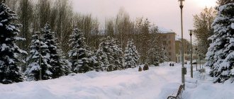
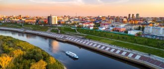
- a city of regional subordination in the Kemerovo region, the administrative center of the Kaltan urban district, is considered one of the cleanest and greenest cities in the region.
Physiographic characteristics
The city of Kaltan, like the entire Kemerovo region, is located in the Krasnoyarsk time zone.
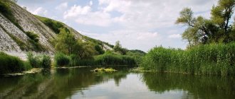
The offset relative to UTC is +7 00. Relative to Moscow time, the time zone has a constant offset of +4 hours and is designated in Russia as MSK+4. Geographical location The city is located in the south of the Kemerovo region, 30 km from Novokuznetsk, in the floodplain part of the Kondoma River, which flows into the Tom River. A section of the Novokuznetsk-Tashtagol main railway passes through the city, which provides a connection to the railway network of the Russian Federation. The Osinniki-Kaltan regional highway connects the city with Novokuznetsk and other cities of the region, Tashtagol and the Altai Territory, the northern and eastern regions of Siberia. The relief of the area is hilly, rugged, with absolute elevations of up to 230 m. The area is classified as earthquake-prone. The seismicity of the area is 6 points. To the west of the city of Kaltan there are deposits of coal seams. The strata are complex in structure, with a thickness of 1.1-3.03 m. The total predicted resources of coal seams are 26 million tons. The Kaltan brick loam deposit is located on the eastern border of urban development.
A map of the city of Kaltan (and a directory of organizations) can be found on the 2GIS program website - [novokuznetsk.2gis.ru].
How to get to the city
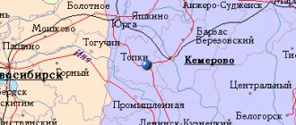
Considering that the city is located next to Novokuznetsk, in most cases it is necessary to focus on transport that comes specifically to this city. By plane: to the airports of Kemerovo (airport), Novokuznetsk (Spichenkovo). Every day flights from Moscow and some other cities; By train: to Novokuznetsk station. Trains arrive from many cities in Russia; From the city of Novokuznetsk you can get by taxi, by train (schedule [www.vokzal-nk.ru/electric-trains], direction to Mundybash) to stops 417 km, Kaltan or 412 km, or by bus (route 103a, departs from Novokuznetsk bus station ). Depending on the type of transport, the trip will take from 30 minutes to an hour.
Climate
The average annual air temperature is +0.80 °C. On average there are 280 sunny days a year. The average duration of the frost-free period is 123 days. The city is located in a zone of sufficient moisture: on average, about 600 mm of precipitation falls, with about 450 mm falling during the warm period. The duration of snow cover is about 160 days. The average depth of soil freezing in the city is about 190 cm. The predominant wind direction is south and south-west. The average annual wind speed is 2.3 m/sec. At the same time, the frequency of calm weather is 25%.
Kaltan
origin of name
Kaltan local historians do not give an exact answer to the question of how the name of the city appeared. There are a huge number of versions of the explanation of the toponym. In V.I. Dahl’s dictionary you can find the following interpretation of the word “kaltan”: young Siberian summer sable. According to another version, kaltan in the Shor dialect means “black stone” (most likely, black stone means coal). The third version translates the name of the city as “unreasonable winter frosty wind.” This interpretation may also be quite plausible, given local climatic conditions. Another interpretation of the toponym: kaltan is a piece of land devoid of forest, located on a hill.
Background
The territory of the modern city was populated in waves. In addition to the Shors, other tribes and nationalities lived here, who came to this land at different times. Presumably, each new people who settled on the territory of present-day Kaltan changed the toponym in their own way, since the existing name was too difficult for them.
The history of the city originates from the village of Upper Kaltan, where the Kaltan redoubt was located. It was erected on the right bank of the Kondoma after the construction of the Kuznetsk fort was completed. From the 17th to the 19th centuries, the area where the city is located today was part of the Kuznetsk fortified line. Until the twentieth century, the Shor ulus was located on the territory of present-day Kaltan.
In ancient times, the Shor tribes lived in the valleys of the Kondoma and Tom rivers. The Shors constantly suffered from oppression from tribes that came from Khakassia. In 1607, Russian settlers came to the territory of today's Kemerovo region. The Shor tribes greeted the Russians very kindly, seeing in the unfamiliar people a force that would protect them from oppression. However, the Shors refused to accept foreign culture. The tribes were engaged in collecting forest gifts, hunting and fishing. Agriculture was practically not practiced.
Some time after the Russians settled on the Shor lands, the Shors decided to move a little east of the foreigners. In the new place, the tribes founded several settlements, the names of which included the word “kaltan”: Nizhny Kaltan, Red Kaltan, etc. Since in the new place the Shors also continued to fight the raids of the Khakassians, they decided to join the Russian state. According to the royal decree signed in 1618, the Kuznetsk fort was erected. The fortification was located on the mountainous right bank of the Tom River, not far from the Aba River and the mouth of the Kondoma. Kuznetsk at that time was already one of the southern outposts of the Russian state. By the 1640s, the Kuznetsk fortification line was created, which had a length of 300 km. There were more than three dozen fortresses and redoubts on this line.
Upper Kaltan
Upper Kaltan turned out to be one of the most convenient places for the Cossacks to settle. This territory was already inhabited by the Shors. By 1884, more than four dozen houses had been built in Kaltan. The village was governed by the sotsky and the headman, who were elected at a general meeting. The headman collected taxes, appointed village residents to public works, distributed land and hayfields, supervised the collection of pine nuts, etc. A church was built in the village, thanks to which Kaltan became a village. Cossack children had the opportunity to learn to read and write thanks to political exiles.
Ore deposits were discovered in the village of Telbes. And not far from Sarbala, coal was found in Tailep Mountain. Since the ironworks in Guryevsk needed coal, local residents floated coal there by river (in summer) or transported it by sleigh (in winter). The Biysky (Kuznetsky) tract passed through Kaltan, which also passed through Ashmarino, Tailep and Sary-Chumysh. Thanks to the discovery of coal and the emergence of the Kuznetsk tract, the number of traders and artisans increased sharply. By 1913, more than a hundred houses had already been built in the village of Kaltan. The settlement was divided into Upper and Lower Kaltan.
After the revolution of 1917, a partnership for joint cultivation of the land was organized in Kaltan. Then the communes “Sadovaya” and “Bednyak” appeared here, as well as the industrial artel “Gra”, the collective farms “Pamyat Ilyich” and “Red Dawn”. Despite the presence of natural resources, industry on Kaltan land began its development only in the post-war years. Industrial development required huge amounts of electricity. It was economically unprofitable to supply energy to a region remote from the center.
Industrial development of Kaltan
In 1946, Kaltan received the status of a workers' village. In the same year, a decision was made to build a power plant, and a site was selected for the construction site. The thermal power plant was to be built as the largest in Siberia. The first industrial current was obtained at the end of April 1951. The electric generator and turbine had a power of 100 thousand kW. In Siberia it was the first turbine with such power. In 1956, the construction of the YuK GRES was completely completed, which made it possible to build and expand local industrial facilities: the ferroalloy and aluminum plants of Novokuznetsk. The opportunity arose to build new chemical plants and mines. In addition, residential buildings and agriculture needed electricity.
After a power plant appeared in the village, the Kaltan administration began improving the workers' village. In Kaltan, the construction of new comfortable houses, kindergartens, shops, social and cultural institutions, hospitals, canteens, schools, etc. began. Thanks to the Yuzhno-Kuzbass State District Power Plant, new enterprises appeared: the plant of boiler-auxiliary equipment and pipelines (KVOiT), Yuzhno-Kuzbass Kuzbass Production Plant (YUK PK), brick factory and others. SK PK was supposed to provide construction materials not only to SK GRES, but also power plants under construction in the Urals, Siberia and the Far East. Lumber, floor slats, window and door units, bricks and precast concrete were delivered to the power plant. Nowadays, YUK PK is engaged in the production of hollow-core floor panels, reinforced concrete vibrating racks for supporting high-voltage power lines and other products in demand in the domestic and foreign markets. At the end of the 90s, the company began producing a new thermal insulation material - penoizol. The KVOiT enterprise produces: chemical water treatment pipelines, steeply curved bends, welded bends, flange connections, turned transitions, supports and hangers, battery cyclones, tees, etc.
Mines and cuts
In May 1949, Kaltan became an urban-type settlement. In the early 50s, the Shushtalepskaya mine began operating in the village, the planned production of which was 600 thousand tons of coal annually. The mine ensured the development of the villages of Permanent and Malyshev Log, and also supplied coal to the YuK State District Power Plant. Over time, the Northern Kandysh mine separated from the Shushtalepskaya mine and became completely independent. Fuel for local needs was extracted at Northern Kandysh. In 1998, a restructuring was carried out, as a result of which, on the site of the Shushtalepskaya mine, the Kondomskoye mine was created (currently closed). At the end of the 90s, the Zapadny open-pit mine appeared on the site of the Northern Kandysh mine.
The Kaltansky open-pit mine became an independent enterprise in 1982. Thermal coal of grade "T" ("skinny") was mined here. At the end of the 70s, coal production at this mine was more than seven hundred thousand tons. In the 1990s, there was a downward trend in the amount of coal mined. Currently, thanks to the presence of new, more advanced equipment, more than a million tons of coal are mined at the open-pit mine annually. In 2003, a railway line was built for transportation.
Kaltan city
In 1959, the working village of Kaltan was transformed into a city. In 1993, Kaltan became a city of regional subordination. And in January 2006, the settlement received the status of an urban district.
Today's Kaltan has a modern urban infrastructure, developed industry and an equally developed structure of social institutions. Industrial enterprises of various industries - coal mining, electric power, etc. - ensure the life of the city. A section of the main railway connecting Tashtagol and Novokuznetsk and providing a connection with the railway network of the Russian Federation passes through Kaltan.
Also, the Osinniki-Kaltan regional highway passes through the city. It connects the city with the Altai Territory, the eastern and northern Siberian regions and Tashtagol. After the construction of the highway between Gorno-Altaisk and Tashtagol was completed, the route, which had the status of regional significance, becomes transit and acquires the status of federal significance. It connects Western Siberia with Mongolia, the Altai Mountains and China. In 2005, the bridge over the Condoma River was reconstructed, which should significantly improve transit communications.
Population
| Population | ||||||
| 1959[3] | 1967[4] | 1970[5] | 1979[6] | 1989[7] | 1992[4] | 1996[4] |
| 26 627 | ↗28 000 | ↘27 951 | ↘24 955 | ↗25 369 | ↗25 800 | ↗26 500 |
| 1998[4] | 2000[4] | 2001[4] | 2002[8] | 2003[4] | 2005[4] | 2006[4] |
| ↘26 400 | ↘26 100 | ↘25 900 | ↗25 951 | ↗26 000 | ↘25 300 | ↘25 000 |
| 2007[4] | 2008[9] | 2009[10] | 2010[11] | 2011[12] | 2012[13] | 2013[14] |
| ↘24 900 | ↘24 800 | ↗24 890 | ↘21 892 | ↗21 934 | ↘21 933 | ↘21 864 |
| 2014[15] | 2015[16] | 2016[1] | ||||
| ↘21 784 | ↘21 349 | ↘21 186 | ||||
Economy
Industrial enterprises
- Southern Kuzbass Power Plant
- KVOiT Plant (Boiler-auxiliary equipment and pipelines)
- Kaltan metal structures plant
- South Kuzbass Production Plant (YKPK)
- Kaltan brick factory
- Branch "Kaltansky coal mine" of OJSC Management Company "Kuzbassrazrezugol"
- Branch "Alardinskaya Mine" of OJSC "OUK "Yuzhkuzbassugol"
- Branch "Energoset o. Kaltana"
- LLC "Razrez "Korchakolsky"
Trade enterprises
- Shopping center "Maria-Ra"
- Supermarket "Solnyshko"
- Supermarket "Chibis"
- Supermarket "Blizhny"
- Supermarket "Brighter"
- Chain of food stores "Kolbasnaya Lavka"
- "Euroset"
- "Svyaznoy"
- TOC "Bonus"
- Shopping center "Phoenix"
- "El Dorado"
- "Pelican"
- "Watercolor"
- "Hippopotamus"
By Order of the Government of the Russian Federation dated July 29, 2014 N 1398-r (as amended on May 13, 2016) “On approval of the list of single-industry towns”, included in the list of single-industry towns in the Russian Federation with the most difficult socio-economic situation
.[17]
Notes
- ↑ 12
www.gks.ru/free_doc/doc_2016/bul_dr/mun_obr2016.rar Population of the Russian Federation by municipalities as of January 1, 2016 - [docs.cntd.ru/document/990309084 Law of the Kemerovo Region of December 17, 2004 No. 104-OZ On the status and boundaries of municipalities]
- [demoscope.ru/weekly/ssp/rus59_reg2.php All-Union Population Census of 1959. The size of the urban population of the RSFSR, its territorial units, urban settlements and urban areas by gender] (Russian). Demoscope Weekly. Retrieved September 25, 2013. [www.webcitation.org/6GDOghWC9 Archived from the original on April 28, 2013].
- ↑ 12345678910
www.MojGorod.ru/kemerovsk_obl/kaltan/index.html People's encyclopedia “My City”. Kaltan - [demoscope.ru/weekly/ssp/rus70_reg2.php All-Union Population Census of 1970 The size of the urban population of the RSFSR, its territorial units, urban settlements and urban areas by gender.] (Russian). Demoscope Weekly. Retrieved September 25, 2013. [www.webcitation.org/6GDOiMstp Archived from the original on April 28, 2013].
- [demoscope.ru/weekly/ssp/rus79_reg2.php All-Union Population Census of 1979 The size of the urban population of the RSFSR, its territorial units, urban settlements and urban areas by gender.] (Russian). Demoscope Weekly. Retrieved September 25, 2013. [www.webcitation.org/6GDOjhZ5L Archived from the original on April 28, 2013].
- [demoscope.ru/weekly/ssp/rus89_reg2.php All-Union Population Census of 1989. Urban population]. [www.webcitation.org/617x0o0Pa Archived from the original on August 22, 2011].
- [www.perepis2002.ru/ct/doc/1_TOM_01_04.xls All-Russian Population Census 2002. Volume. 1, table 4. Population of Russia, federal districts, constituent entities of the Russian Federation, districts, urban settlements, rural settlements - regional centers and rural settlements with a population of 3 thousand or more]. [www.webcitation.org/65AdCU0q3 Archived from the original on February 3, 2012].
- [www.gks.ru/bgd/regl/b08_14t/IssWWW.exe/Stg/s/09-00.htm Cities of the Kemerovo region (number of inhabitants - estimate as of January 1, 2008, thousand people)]. Retrieved June 1, 2016. [www.webcitation.org/6hwJBGYKL Archived from the original on June 1, 2016].
- [www.gks.ru/bgd/regl/B09_109/IssWWW.exe/Stg/d01/tabl-21-09.xls Number of permanent population of the Russian Federation by cities, urban-type settlements and districts as of January 1, 2009]. Retrieved January 2, 2014. [www.webcitation.org/6MJmu0z1u Archived from the original on January 2, 2014].
- [kemerovostat.gks.ru/wps/wcm/connect/rosstat_ts/kemerovostat/resources/ff43230040e572408ffeef367ccd0f13/1.6.pdf All-Russian Population Census 2010. Kemerovo region. 1.6. Population of urban districts, municipal districts, urban and rural settlements, urban settlements, rural settlements]. Retrieved July 26, 2014. [www.webcitation.org/6RMInOgkU Archived from the original on July 26, 2014].
- www.gks.ru/dbscripts/munst/munst32/DBInet.cgi?pl=8112027 Kemerovo region. Estimated resident population as of January 1, 2009-2016
- [www.gks.ru/free_doc/doc_2012/bul_dr/mun_obr2012.rar Population of the Russian Federation by municipalities. Table 35. Estimated resident population as of January 1, 2012]. Retrieved May 31, 2014. [www.webcitation.org/6PyOWbdMc Archived from the original on May 31, 2014].
- [www.gks.ru/free_doc/doc_2013/bul_dr/mun_obr2013.rar Population of the Russian Federation by municipalities as of January 1, 2013. - M.: Federal State Statistics Service Rosstat, 2013. - 528 p. (Table 33. Population of urban districts, municipal districts, urban and rural settlements, urban settlements, rural settlements)]. Retrieved November 16, 2013. [www.webcitation.org/6LAdCWSxH Archived from the original on November 16, 2013].
- [www.gks.ru/free_doc/doc_2014/bul_dr/mun_obr2014.rar Table 33. Population of the Russian Federation by municipalities as of January 1, 2014]. Retrieved August 2, 2014. [www.webcitation.org/6RWqP50QK Archived from the original on August 2, 2014].
- [www.gks.ru/free_doc/doc_2015/bul_dr/mun_obr2015.rar Population of the Russian Federation by municipalities as of January 1, 2015]. Retrieved August 6, 2015. [www.webcitation.org/6aaNzOlFO Archived from the original on August 6, 2015].
- [government.ru/media/files/41d4f68fb74d798eae71.pdf Order of the Government of the Russian Federation dated July 29, 2014 N 1398-r “On approval of the list of single-industry towns”]
History[edit | edit code]
In 1859, the list of populated places in the Tomsk province mentions the village of Kaltanskaya with 128 inhabitants. In 1949, the village of Nizhny Kaltan was renamed into the workers' village of Kaltan [2] On July 29, 1959, by decree of the Presidium of the Supreme Soviet of the RSFSR, the workers' village of Kaltan was renamed into a city with subordination to the Osinnikovsky City Council. The city acquired the status of regional subordination in 1993. On December 17, 2004, in accordance with the Law of the Kemerovo Region No. 104-OZ[3], the municipal formation of the Kaltan urban district was formed.
Excerpt characterizing Kaltan
- Here, brother, we have such a mess for the second day. The regimental adjutant came in and confirmed the news brought by Zherkov. We were ordered to perform tomorrow. - Let's go, gentlemen! - Well, thank God, we stayed too long. Kutuzov retreated to Vienna, destroying behind him bridges on the rivers Inn (in Braunau) and Traun (in Linz). On October 23, Russian troops crossed the Enns River. Russian convoys, artillery and columns of troops in the middle of the day stretched through the city of Enns, on this side and on the other side of the bridge. The day was warm, autumn and rainy. The vast perspective that opened up from the elevation where the Russian batteries stood protecting the bridge was suddenly covered with a muslin curtain of slanting rain, then suddenly expanded, and in the light of the sun objects as if covered with varnish became visible far away and clearly. A town could be seen underfoot with its white houses and red roofs, a cathedral and a bridge, on both sides of which masses of Russian troops poured, crowding. At the bend of the Danube one could see ships, an island, and a castle with a park, surrounded by the waters of the Ensa confluence with the Danube; one could see the left rocky bank of the Danube covered with pine forests with the mysterious distance of green peaks and blue gorges. The towers of the monastery were visible, protruding from behind a pine forest that seemed untouched; far ahead on the mountain, on the other side of Ens, enemy patrols could be seen. Between the guns, at a height, the chief of the rearguard, a general, and a retinue officer stood in front, examining the terrain through a telescope. Somewhat behind, Nesvitsky, sent from the commander-in-chief to the rearguard, sat on the trunk of a gun. The Cossack accompanying Nesvitsky handed over a handbag and a flask, and Nesvitsky treated the officers to pies and real doppelkümel. The officers joyfully surrounded him, some on their knees, some sitting cross-legged on the wet grass. - Yes, this Austrian prince was not a fool to build a castle here. Nice place. Why don't you eat, gentlemen? - Nesvitsky said. “I humbly thank you, prince,” answered one of the officers, enjoying talking with such an important staff official. - Beautiful place. We walked past the park itself, saw two deer, and what a wonderful house! “Look, prince,” said the other, who really wanted to take another pie, but was ashamed, and who therefore pretended that he was looking around the area, “look, our infantry have already climbed there.” Over there, in the meadow outside the village, three people are dragging something. “They will break through this palace,” he said with visible approval. “Both,” said Nesvitsky. “No, but what I would like,” he added, chewing the pie in his beautiful, moist mouth, “is to climb up there.” He pointed to a monastery with towers visible on the mountain. He smiled, his eyes narrowed and lit up. - But that would be good, gentlemen! The officers laughed. - At least scare these nuns. Italians, they say, are young. Really, I would give five years of my life! “They’re bored,” said the bolder officer, laughing. Meanwhile, the retinue officer standing in front was pointing something out to the general; the general looked through the telescope. “Well, so it is, so it is,” the general said angrily, lowering the receiver from his eyes and shrugging his shoulders, “and so it is, they will attack the crossing.” And why are they hanging around there? On the other side, the enemy and his battery were visible to the naked eye, from which milky white smoke appeared. Following the smoke, a distant shot was heard, and it was clear how our troops hurried to the crossing. Nesvitsky, puffing, stood up and, smiling, approached the general. - Would your Excellency like to have a snack? - he said. “It’s not good,” said the general, without answering him, “our people hesitated.” – Shouldn’t we go, Your Excellency? – said Nesvitsky. “Yes, please go,” said the general, repeating what had already been ordered in detail, “and tell the hussars to be the last to cross and light the bridge, as I ordered, and also to inspect the flammable materials on the bridge.” “Very good,” answered Nesvitsky. He called to the Cossack with the horse, ordered him to remove his purse and flask, and easily threw his heavy body onto the saddle. “Really, I’ll go see the nuns,” he said to the officers, who looked at him with a smile, and drove along the winding path down the mountain. - Come on, where will it go, captain, stop it! - said the general, turning to the artilleryman. - Have fun with boredom. - Servant to the guns! - the officer commanded. And a minute later the artillerymen ran out cheerfully from the fires and loaded. - First! - a command was heard. Number 1 bounced smartly. The gun rang metallic, deafening, and a grenade flew whistling over the heads of all our people under the mountain and, not reaching the enemy, showed with smoke the place of its fall and burst. The faces of the soldiers and officers brightened at this sound; everyone got up and began observing the clearly visible movements of our troops below and in front of the movements of the approaching enemy. At that very moment the sun completely came out from behind the clouds, and this beautiful sound of a single shot and the shine of the bright sun merged into one cheerful and cheerful impression. Two enemy cannonballs had already flown over the bridge, and there was a crush on the bridge. In the middle of the bridge, having dismounted from his horse, pressed with his thick body against the railing, stood Prince Nesvitsky. He, laughing, looked back at his Cossack, who, with two horses in the lead, stood a few steps behind him. As soon as Prince Nesvitsky wanted to move forward, the soldiers and carts again pressed on him and again pressed him against the railing, and he had no choice but to smile. - What are you, my brother! - the Cossack said to the Furshtat soldier with the cart, who was pressing on the infantry crowded with the very wheels and horses, - what are you! No, to wait: you see, the general has to pass. But furshtat, not paying attention to the name of the general, shouted at the soldiers blocking his way: “Hey!” fellow countrymen! keep left, wait! “But the fellow countrymen, crowding shoulder to shoulder, clinging with bayonets and without interruption, moved along the bridge in one continuous mass. Looking down over the railing, Prince Nesvitsky saw the fast, noisy, low waves of Ens, which, merging, rippling and bending around the bridge piles, overtook one another. Looking at the bridge, he saw equally monotonous living waves of soldiers, coats, shakos with covers, backpacks, bayonets, long guns and, from under the shakos, faces with wide cheekbones, sunken cheeks and carefree tired expressions, and moving legs along the sticky mud dragged onto the boards of the bridge . Sometimes, between the monotonous waves of soldiers, like a splash of white foam in the waves of Ens, an officer in a raincoat, with his own physiognomy different from the soldiers, squeezed between the soldiers; sometimes, like a sliver of wood winding along the river, a foot hussar, an orderly or a resident was carried across the bridge by waves of infantry; sometimes, like a log floating along the river, surrounded on all sides, a company or officer's cart, piled to the top and covered with leather, floated across the bridge. “Look, they’ve burst like a dam,” the Cossack said, stopping hopelessly. -Are there many of you still there? – Melion without one! - a cheerful soldier walking nearby in a torn overcoat said winking and disappeared; another, old soldier walked behind him. “When he (he is the enemy) begins to fry the taperich on the bridge,” the old soldier said gloomily, turning to his comrade, “you will forget to itch.” And the soldier passed by. Behind him another soldier rode on a cart. “Where the hell did you stuff the tucks?” - said the orderly, running after the cart and rummaging in the back. And this one came with a cart. This was followed by cheerful and apparently drunk soldiers. “How can he, dear man, blaze with the butt right in the teeth…” one soldier in an overcoat tucked high said joyfully, waving his hand widely.
History of the city Kaltan
Kaltan traces its history back to ancient times. Initially, the territories along the valleys of the Tom and Kondoma rivers were occupied by Turkic-speaking tribes or Shors. Probably from them the modern name of the city came to us. Of course, the word “kaltan” has no direct translation. Most likely it was distorted over time. The territories were settled in waves and each new settler changed the name to a more euphonious and convenient one. Translated from Shor, the word “kal” means bald or naked, and the word “tan” meant mountain. If you connect it, you get Bald Mountain. Although today there are a number of theories that explain the name of the city. It’s not for nothing that they call it a mystery toponym. According to one version, his name can be translated as “black stone,” which is also quite logical. After all, these lands contain large deposits of coal.