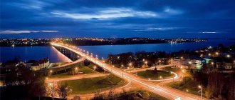
Interesting travel route
On the Internet you can find articles, personal observations, the entrance to the river, the beginning of the journey, described by lovers of recreation in protected areas.
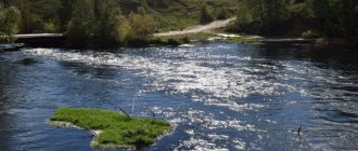
Travelers tell a lot of interesting things about Vetluga. For example, the channel is winding, often changing direction, which gives rise to many oxbow lakes that form lakes everywhere, especially in the Kirov region.
Speaking about the settlements located along the river bed in the Kirov and Kostroma regions, it is worth noting that mainly numerous forests grow around it. Moreover, the forests are dense, as historical materials about the village of Vetluzhsky and its lands tell.
In the north-eastern part of the city of Kostroma is the city of Sharya, it is surrounded by forests stretching to the banks of the river. Vetluga. This place is interesting as a small regional center, which is also a railway point on the road to Galich.
It is famous as a center for wood processing, and at the same time many references are associated with it in Soviet times, because of the factories and factories operating here. Also in such towns, you can see unusual museums, remains of temples and sculptural compositions.
Recommended reading: rivers of Belarus.
It’s good, at the planning stage of such a river rafting, ask your friends to meet you at a pre-agreed site.
If we consider other settlements, then the city of Vetluga (Nizhny Novgorod region) is located on the Vetluga River.
Attractions
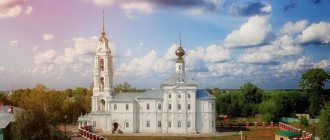
- The church in honor of the Great Martyr Catherine was built in 1850 according to a standard design by the architect Konstantin Ton[21].
- Trinity Cathedral (built in 1805)
- Shopping arcade building (built in 1900)
- Museum of Local Lore.
Ancient settlements discovered near the city of Vetluga:
- Chertovo - 7 km downstream from the city (Ananyinskaya culture),
- Odoevskoye - 30 km upstream from the city (Ananyinskaya culture),
- Spasskoye - 6 km upstream from the city (ancient Mari settlement).
The source of the river and a little history of these places
In the Kirov lands, Vetluga is represented by its headwaters. The source of the Vetluga River is the confluence of the Bolshaya Bystraya and Bystra rivers, a settlement located in these parts is the village of Bystri (Shabalinsky district).
We recommend reading: The deepest river in Russia and the world on the map
But according to some sources, the real source of Vetluga was the confluence of the Bystraya and Matyuga rivers; it is located near the ancient village of Kruglyzh.
The places where the Vetluga River begins are unusually picturesque, as can be judged by looking at numerous photographs of the Matug and Bystraya rivers. The very confluence of these two rivers is marked with a memorial stone. In the Kirov region there are not only the sources of the Vetluga River, but also springs.
These areas are famous thanks to the Kruglyzh Church, which was located here until the 1930s. Most often it is called the Church of the Sign. The parish consisted of 97 settlements.
The inhabitants of Suzdal, who came by water back in the 12th century, more precisely along the upper reaches of the Vetluga River, gradually began to populate these places. The edges here are so beautiful that villages developed in this protected area; houses were not built in a long street, but were built in a circle.
Turning to archival sources, we find confirmation that initially two churches were built, and the village was called not Kruglyzhi, but Znamenskoye.
The main page of many archives contains unique photographs of the parish, priests and natural landscapes on which the Church of the Mother of God of the Sign (Kruglyzhsky) was erected from wood. The years of its foundation are the 1700s. The village of Kryglyzhi is one of the oldest preserved places in the area. There were also two schools in the village. One is at the church, the second is common.
Team Nomads
Vetluga (mar. Yur) is a city (since 1778) in the Nizhny Novgorod region of Russia. Administrative center of the Vetluzhsky municipal district. The city is located on the right, elevated bank of the Vetluga River, at the confluence of the Krasnitsa River, 47 km north of the Uren railway station on the new Trans-Siberian line. The P157 Uren-Kotlas highway passes through the city. The settlement was founded in 1636 (according to other sources - in the 13th century). Received city status in 1778. The city was the administrative center of the largest county in Povetluzhye.
VETLUGA RIVER - GEOGRAPHY, RAFTING - HERE!
VETLUZHYE - HISTORY, PEOPLES, MARI - HERE!
THE BIG KAKSHA RIVER IS HERE!
GEOGRAPHY OF THE NIZHNY NOVGOROD REGION - HERE!
THE SOURCE OF THE VETLUGA RIVER IS HERE!
VETLUGA REGION - TOPONYMY, ARCHEOLOGY, HISTORY!
ARTICLES AND LINKS ABOUT VETLUGA REGION - HERE!
ARTICLE ABOUT THE GALICIAN TRACT - WENT THROUGH VETLUGA!
Vetluga city
According to the 1897 census, 120.8 thousand people lived in the county.
including Russians - 98.2%; Mari - 1.6%. The county town of Vetluga had a population of 5,179 people.
Mari settlement in the area of the modern city The city of Vetluga is one of the ancient settlements on Vetluga. It is believed that in this place in the 13th century the ruler of the Mari Vetluga principality (located in the west of the Mari region) founded the city of Jur. The exact time of foundation and location of the city is not known. Most historians believe that it was located in the left-bank low swampy part of Povetluga on the banks of the Yuryevka River (a tributary of the Vetluga River) near the location of the modern city of Vetluga. According to another version, the city of Jur was located on the right (high) bank of the Vetluga, exactly at the location of the modern city.
Vetluga Mari princes: Bai - Mari kuguz (ruler) of the Vetluga principality in the 1280s.
He became a prince in 1280 after the death of Prince Kay. He continued the policy of strengthening the cities of Povetluga and confrontation with the Galich princes. Kai is the Cheremis prince of the Shangon principality (Vetlya-Shangon kuguzstvo). At the beginning of the 12th century, Kai, fearing Russian squads, turned Shanga into a fortified city, and built for himself another new city, Khlynov Vetluga. At this time, the Galician prince Konstantin Yaroslavich, by force of arms, tried to force the Vetluga Cheremis to submit to Galich and pay tribute with “Zakamsky silver.” But the Cheremis defended their independence. Kai died in 1280 while defending the principality from another raid by the son of Prince Konstantin Yaroslavich, Vasily.
The city of Vetluga, the Mari settlement of Yur
It is known that in the 1280s, Kuguz Bai strengthened the village of Yur, which already existed at that time. At that time, the city was one of the main fortified points of the principality.
A very important land-water route from the Northern Dvina to the Volga basin passed through Povetluzhye from north to south. A large land road from Kostroma to Mari lands also passed through the city from west to east
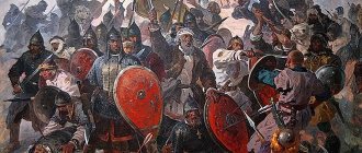
In the 14th century, the Vetluga kuguz Osh Pandash united the clan nobility, attracted the Tatars to his side and, during the nineteen-year war, defeated the Galich-mer prince Andrei Fedorovich. In January 1468, the army of Galician princes under the command of Prince Semyon Romanovich Yaroslavl, acting on the orders of the Grand Duke of Moscow Ivan III Vasilyevich, conquered the city. “He sent Prince Semyon Romanovich to Cheremis, and with him many children of the boyars of his court; and having copulated, they all left Galich on Nikolin’s day, December 6, and walked through the forests without a path, and the winter was very cold.
The same winter of January 9, on the Epiphany of the Lord, the army of the Grand Duke came to the land of Cheremis, and did a lot of evil to that land; I cut people off, took some into captivity, and burned others; and their horses and every animal that could not be taken with them was cut up; and what was their belly, they took everything, and conquered all that land, and burned the rest, but they didn’t reach Kazan in one day, and, returning, they came to the Grand Duke, all in good health.”
Yur was destroyed and burned completely. The surrounding area was devastated and remained sparsely populated for several decades. Gradually it was populated by Russian settlers, who founded several villages near this place.
Church of the Holy Great Martyr Catherine
History of the city of Vetluga In the first half of the 17th century, the right bank of Vetluga was already inhabited by Russians, where, among other villages, there was the village of Shulepnikov, Vetluga volost, Kostroma governorate. In 1606, patrolmen Ivan Sytin and Mikhail Tyukhin witnessed the Voskresensky churchyard and the village of Shchuplikova at this site (in later documents - Shchuplino, Shchulepnikovo). In 1637, the village was granted by Tsar Mikhail Fedorovich to Princess Mstislavskaya. With the construction of the church in the first half of the 18th century, the village received a new name: Upper Resurrection. In 1778, the village was purchased by the actual Privy Councilor of Kostroma Governor-General Alexei Petrovich Melgunov for 8,600 rubles, along with all the property and the population, consisting of 82 men (only the male population was counted). By Decree of Catherine II of September 5 (18), 1778, the village was transformed into the district town of Vetluga (Kostroma Governorate, Unzhenskaya Province). Melgunov himself asked for city status for his former village.
But among the people there is another legend about how Verkhneye Voskresenskoye became the city of Vetluga. Allegedly, the village residents, having decided to turn it into a city, sent a delegation to beat the Mother Empress about this. Potemkin received them and promised to satisfy their request on the condition that they, in their village costumes and bast shoes, would dance the “Russian” in front of Catherine. The residents of Vetluga danced on the palace parquet floor, the queen, having had a good laugh, signed a decree on the founding of the city of Vetluga. Since then, the expression “Vetluga lapotniks danced Vetluga” has come into use.
Chapel of St. Nicholas the Wonderworker in Vetluga (1910)
Economy Non-standard equipment plant, logging center, bakery.
Education Vetluga Forestry Agrotechnical College Forestry Agrotechnical College, medical school.
Trinity Cathedral
Sights Trinity Cathedral The church in honor of the Great Martyr Catherine, built in 1850 according to a standard design by the architect Konstantin Ton. Trinity Cathedral (built in 1805) Shopping arcade building (built in 1900) Museum of Local Lore.
Ancient settlements were discovered near the city of Vetluga: Chertovo - 7 km downstream from the city (Ananyinskaya culture), Odoevskoye - 30 km upstream from the city (Ananyinskaya culture), Spasskoye - 6 km upstream from the city (ancient Mari settlement ).
Forestry technical school (college)
Born in the city of Vetluga: Lavrov, Nikolai Vladimirovich (1805-1840) - Russian opera singer-baritone. Participated in many productions of the Bolshoi Theater in Moscow. Lebedev, Yuri Isakovich (b. 1951) - ex-mayor of the city of Nizhny Novgorod. Muranov, Alexander Igorevich (b. 1971) - Russian lawyer (advocate and legal scholar). Rozanov, Vasily Vasilyevich (1856-1919) - Russian religious philosopher, literary critic and publicist. Slashchev, Alexander Nikolaevich (b. 1918) - honorary resident of the city of Vetluga, front-line soldier. Solovyov, Vladimir Sergeevich (1919-1975) - Soviet automobile designer, first chief designer of the Volga Automobile Plant. Ugodchikov, Andrey Grigorievich (1920-2007) - Doctor of Technical Sciences, Honored Worker of Science and Technology, one of the leading mechanics of the Soviet Union and Russia. Honorary Professor of Nizhny Novgorod State University named after. Lobachevsky. Honorary member of the International Academy of Sciences of the Higher School. Member of the National Committee of the Russian Academy of Sciences (Russian Academy of Sciences) for Theoretical and Applied Mechanics. Shevyakov, Lev Dmitrievich (1889-1963) - scientist in the field of mining, academician of the USSR Academy of Sciences. Shevyakov, Nikolai Lvovich (1868-1942) - Russian architect and teacher, one of the masters of Moscow Art Nouveau. The most important buildings: the Metropol Hotel, Ivanovo Hall in Pashkov House.
Shopping arcades in Vetluga
Also associated with the city of Vetluga: Gusev, Pavel Fedorovich (1868-1949) - a famous surgeon and health care organizer, a pioneer of secondary medical education in Povetluga. Korolenko, Vladimir Galaktionovich (1853-1921) - during his exile in Nizhny Novgorod, he traveled a lot around the region. He leaves wonderful lines about the Vetluga River in his stories, for example, “The River Is Playing.” Luginin, Vladimir Fedorovich (1834-1911) - founder of the first savings and loan partnership in Russia in the village. Rozhdestvensky, Vetluzhsky district. He donated a lot of money for the development of Vetluga. The name of this man was known throughout the world. Friend of Leo Tolstoy, Herzen, Turgenev, Chernyshevsky. A wonderful chemist. Fluent in four foreign languages. Pavlov, Platon Vasilyevich (1823-1895) - professor-historian, public figure, exiled to Vetluga from St. Petersburg in 1862. Pisemsky, Alexey Feofilaktovich (1820-1881) - Russian writer, spent his childhood in Vetluga, where his father was a mayor . Pugovkin, Mikhail Ivanovich (1923-2008) - famous actor in 1944-1945. studies at the Blagoveshchensk Higher Tank Command Red Banner School in Vetluga. In the book published for the 50th anniversary of the school, there is a portrait of him with the caption: “Cadet M.I. Pugovkin, who has done a lot for the development of amateur artistic performances of the school, is now a People’s Artist of the USSR.” Raevsky, Fedor Nikolaevich (1897-1991) - major general of tank forces, head of the Second Gorky Tank School in Vetluga. Rozov, Viktor Sergeevich (1913-2004) - writer and playwright, spent his childhood years in Vetluga. Yuryshev, Nikolai Nikolaevich - Lieutenant General (during the war he tested the Katyusha guards mortars), awarded the Order of Lenin, Orders of the Patriotic War, I and II degrees.
bed of the Krasnitsa river in Vetluga
RIVER KRASNITSA Krasnitsa is a river in Russia, flowing in the Vetluzhsky district of the Nizhny Novgorod region. The mouth of the river is located 392 km along the right bank of the Vetluga River. The length of the river is 18 km, the drainage basin area is 83.8 km². The source of the river is southeast of the village of Poteshikha and 9 km north of the city of Vetluga. The river flows southwest, then southeast. It flows into the Vetluga within the city limits of Vetluga. According to the state water register of Russia, it belongs to the Upper Volga basin district, the water management section of the river is Vetluga from the source to the city of Vetluga, the river sub-basin of the river is Volga from the confluence of the Oka to the Kuibyshev reservoir (without the Sura basin). The river basin is the (Upper) Volga to the Kuibyshev reservoir (without the Oka basin) [2]. According to the geoinformation system for water management zoning of the territory of the Russian Federation, prepared by the Federal Agency for Water Resources[2]: Water body code in the state water register - 08010400112110000042414 Code for hydrological knowledge (HI) - 110004241 Basin code - 08.01.04.001 Volume number for GI - 10 Issue for GI - 0
memorial to fallen soldiers
HOW OLD IS THE CITY OF VETLUGA Author: Komissarov V.A. The territory where the city subsequently arose is located in the middle reaches of the Vetluga River. Currently, it is not easy to determine the first settlement that gave rise to the further development of the city of Vetluga. However, it is known from the chronicle [*] that the Venerable Barnabas with the monks, moving from Yakshan down the river, at the fourth camp (camp) restored the Church of the Resurrection of Christ destroyed by the Mari, in which he held services throughout the year. This settlement became known as Voskresensky Stan.
When did the Mari begin to destroy the Povetluga churches? Historical information: During the reign of the (Yuma-Yakshan) Mari prince Koja Eraltem, the city of Yakshan was founded (1240) and churches were built. In 1417, the Cheremis prince Keldibek gathered an army, captured and plundered the city of Ustyug. The valuables of the monasteries and Ustyugans were taken away and divided among the nobility. At the same time, the captive Ustyug residents, including priests, were brought to Shangu and Yakshan. Among them was the Monk Barnabas. The city of Vetluga, the Mari settlement of Yur
Back in 1238, after the Swedes destroyed the Karelian and Novgorod churches, Novgorod monks came to Yakshan, and with them was the hermit Kiy, a monk named Nicholas, from the Karelian St. Nicholas Monastery. They founded the Karelian monastery on the banks of the Vetluga, which was called Yakshangsky (later Kazhirovsky). The monastery became revered by the local population. Under Kildibek, the Monks Macarius and Tikhon found refuge in it and conducted services. After some time, Keldibek fell in love with the priest, gave freedom to the Monk Barnabas and allowed him to serve in a famous monastery. There he received recognition and became revered among the ministers of the church. In 1434 , after the Galich prince Vasily Kosoy, together with his brothers Dmitry the Red and Dmitry Shemyakia, kill the Cheremis prince Keldibek in inter-princely disputes, the Mari begin to destroy Russian settlements, incl. churches.
From the chronicle you can read the following: “For this, the Cheremis, encouraged by the priests, began to destroy Russian settlements on Vetluga and destroyed the Nikolaev monastery. The monks Barnabas, Macarius and Tikhon were forced to look for other places to live. From the devastated Nikolaev monastery (Kazhirovo), three preachers on a small boat went down the Vetluga River.” They stopped along the banks of the Vetluga River and erected wooden crosses in their camps. Then they set up a semblance of a throne and performed church services. The local population, mostly Cheremis, were baptized, accepted the Orthodox faith and, as best they could, helped the monks with food and clothing, and built wooden churches.
“Then (after 1 year) the monks went down the river to the next camp (camp). So, the first camp was the Church of the Exaltation of the Holy Cross on the banks of the Vetluga (in the current Pyshchug volost - as amended in 1890). The second camp was in the place where it is now in the Shangsko-Gorodishchenskaya volost (the village of Zubovkoye). The Church of the Nativity of the Blessed Virgin Mary was founded here. The third camp was in the Rozhdestvenskaya volost, and here the foundation of the Church of the Nativity of Jesus Christ was laid. The fourth camp and where the city of Vetluga is now, the Church of the Resurrection of Jesus Christ was restored here.” Knowing the time of residence in previous camps, we can say that in the Resurrection camp the Monk Barnabas led his worship from 1437-1438. If during his time the church, which was ruined at that time, was restored, then we can rightfully assume that the foundation of the city of Vetluga was before the mentioned dates (1437). It seems that we can name the approximate date of the origin of the city of Vetluga as 1437. However, when was the church built? Historical events described by I. Khersonsky and D. Dementiev (local historians) indicate that in 1290. Mari prince Bai visits the city of Veliky Ustyug and is baptized. Bishop Tarasy baptized the Mari prince under the name Ivan. From that time on, he promoted the spread of Christianity among the Mari and built churches. Under him, new cities were built and old cities were strengthened, including the city of Yur (on the Yuryevka River). It can be assumed that there was also a church there. But where is that city? There was not a trace of him left on Yuryevka.
At the same time, walking and examining the terrain on both banks of the river, we can conclude that fortress cities could not be built on the left bank of the Vetluga River, which is flooded in the spring - there is a wide lowland there. This is supported by the fact that the water level in the river at that time was higher, and spring floods were wider than at present. But the fortress city of Jur existed for more than a hundred years and people lived in it. In this regard, we can conclude: - the city of Yur was on the right bank of the Vetluga, opposite the confluence of the Yuryevka River with the Vetluga; - the Church of the Resurrection of Jesus Christ (on the fourth churchyard of St. Barnabas) was located in the possibly ruined city of Jur. It follows from this that the origins of the city of Vetluga are connected with the city of Jur, built before 1290. The probability of repeated destruction of Mari settlements, including the city of Yur, located on the right bank of the Vetluga, is quite high, because Since the time of A. Nevsky, the right bank has been considered Novgorod land.
Historical facts can testify to the number of devastations in the city of Yur: - the invasions of the Novgorod Ushkuiniki, which devastated the settlements of Povetluzhye in 1374 and 1392; - military campaign of the Galich princes (Vasily Kosoy with Dmitry the Red and Dmitry Shemyaka) in 1434. And yet the city was restored. Its last destruction occurred in 1468. As D. Dementyev describes this in the essay “Brief information about the Kazhirovskaya Hermitage”, the Galich army conquered the Mari fortress cities - Vetlya-Shangon (Shanga) and Vetlya-Yur, located on Vetluga. One of the Russian chronicles tells us about this campaign: “The Grand Duke sent to fight against Cheremis... Prince Semyon Romanovich and with him the boyars’ children, his courtyard and all together went from Galich to Nikolin. Day of December 6, the forests were without a path, and the winter was cold for Velma. That same winter, on the 6th of January, at the Baptism of the Lord, the army of the Grand Duke came to the land of Cheremis, and did a lot of evil to that land, cutting off people, killing some, and burning others, and burning their horses and every animal that could not be taken with them. , then cut everything off, and what about their bellies, then took everything and conquered their land ... " “And there was great human slaughter, and the barbarian land was watered with blood; cronyism and wilds, and lakes and rivers paved with Cheremis bones.” [Khersonsky, p.279]
In this regard, it is clear that the city was burned, and the population was either killed or captured. At the same time, even livestock was destroyed. In this case, there is no need to talk about survival. The fear that was sown did not allow the Mari to restore this city. As a result of the military campaign, Povetluzhye came into the possession of the Moscow Principality. That is why the surroundings of the destroyed city of Jur were depopulated for several decades. And only the villages on the right bank of the Vetluga (at a distance of 20 km from Vetluga, on the Nuzhna river) Yurikha, Yuryupino (Uryupino) remind of the former stronghold of the Mari principality. In them, as a reminder of the city and the Varnavin camp, the inhabitants still talk about (June 24). In the village of Yuryupino, the Monk Barnabas is considered its patron.
Unfortunately, these large villages currently have a deplorable, dilapidated appearance and are practically disappearing. Young residents of Vetluga no longer know about them. In the forest region, the main building material, both in the past and today, is wood. Perhaps for this reason, there are practically no traces of the location of the burned cities of Povetluga described in historical materials. However, new settlements were most often created near the destroyed cities, or on their foundations. That's what happened here too. Considering that the new settlement was Russian (the Cheremis left these places), its name became inextricably linked with the name of the church located there (the Resurrection of Jesus Christ) - the Resurrection Camp, or the Resurrection Pogost, as later historical documents testify to it. “Resurrection Camp”, and in it there is a churchyard on the river on Vetluga, and on the churchyard there is a church of the Resurrection of Christ, a wooden dumpling, warm, with a meal. And in the church there are images, and candles, and books, and vestments, and church vessels, and bells, and the entire church building of the parish people. Yes, in the churchyard there are churchyards: in the yard there is the priest Gerasiy Vasiliev, in the yard there is the sexton Ivanko Ivanov, in the yard there is the sexton Mironko Markov, in the yard there is the marshmallow maker Marfitsa Samoilov’s daughter, and 3 cells of the poor, fed from the Church of God”...[1] Near the graveyard there was “the village of Shchuplikovo on the Vetluga River, and there are peasants on it; in the yard of Stepanko Fedorov, in the yard of Ivanko Ivanov, in the yard of Senka Kuzmin.” During the patrol of 1628, the village of Shuplikovo (in later documents - “Shchuplino”, “Shchulepnikovo”), together with the Voskresensky churchyard, was called “the village of Voskresensky. The village of Shulepnikovo is also mentioned in a document dating back to 1636-1637. This is a deed of gift from Tsar Mikhail Fedorovich to Princess Mstislavskaya. Documents (church and parish books) say that in the 17th century a wooden church was built in the village of Shulepnikovo. Then, in connection with the construction of the church, the village was renamed the village of Verkhnee Resurrection. On September 5, 1778, by the highest Decree of Empress Catherine II, the village was given the status of a district town of Vetluga in the Kostroma province and a coat of arms was approved. “In the first part of the shield is part of the Kostroma coat of arms: in a blue field there is a galley stern with three lanterns and lowered ladders; in the second part, in the silver field, there is a willow tree bush, signifying the name of this city.” And yet, how old is the city of Vetluga?! If the city is located on the basis of another city of Jur, then Vetluga is more than 720 years old.
Vetluzhsky district NGO
VETLUZHSKY DISTRICT Vetluzhsky district is a northern district of the Nizhny Novgorod region. It is separated from the regional center (the city of Nizhny Novgorod) by a distance of 250 kilometers. It is 45 kilometers away from the Gorky Railway (Uren station), and 60 kilometers from the Northern Railway (Sharya station). The area is connected to the railway stations by the Uren-Vetluga-Sharya highway. Vetluzhsky district borders the Kostroma region. The area is located in the middle reaches of the Vetluga River. The area of the region is about 3000 square kilometers. This is a flat taiga forest area. Forests occupy 75% of the area of the region, 9% are meadows, 1.5% are water bodies and only 11% are arable land.
RELIEF The territory of the district is located in the northern part of the Nizhny Novgorod region. Terrain: from calm to rugged with a maximum slope of up to 6%, there are small ravines. The low-lying region with excessive moisture is rich in lakes and swamps. The soils in the area are sandy loam, soddy-podzolic and loamy. CLIMATE The region is located in a temperate continental climate zone, often with cold, snowy winters and moderately hot, short summers. The longest season is winter. The period with negative air temperatures lasts 4-4.5 months. Winter in the Vetluzhsky district is snowy and cold. The average monthly air temperature in December is -10.7 degrees, in January -13.0 degrees, in February -11.8 degrees. Minimum temperature: December -46 degrees, January -46 degrees, February -45 degrees. In the winter months, precipitation falls 150-170 millimeters, with a snow cover of about half a meter thick in the fields, and up to 1 meter in the forest and other places protected from the wind. A stable snow cover is formed in the second ten days of November, the duration of occurrence is 150-165 days. In the summer months, the average monthly temperature in June is +15.6 degrees, in July +18 degrees, in August +15.6. The maximum temperature in June is +35 degrees, in July +36 degrees, in August +36. The average annual air temperature is +2.5 - 2.8 degrees. The total annual precipitation is about 600 millimeters. The duration of the period with an average daily temperature above 0 degrees is 195-200 days.
VEGETATION The area is characterized by high forest cover. About 70% of the territory is covered by forest. The forests are pine, spruce-pine, pine-spruce and small-leaved. On gently undulating plains and gentle slopes under conditions of normal atmospheric moisture, grass and forb moistened dry lands were formed. On flat and poorly drained plains, under conditions of temporary excess moisture, cereal and forb meadows formed. In the floodplains of rivers, dry, fresh, wet and damp short-term and long-term meadows have developed. In deep depressions of river floodplains and deep watersheds, under conditions of excessive ground moisture, swampy meadows have spread. The riverbed sands are usually covered with willow thickets.
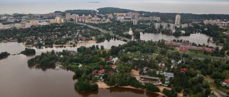
HYDROGRAPHY In the region, open water sources are the rivers Vetluga, Vol, Nuzhna, Krasnitsa, Bolshaya and Malaya Kaksha, Yuryevka, as well as many lakes. The Vetluga River flows through the region from east to west and divides the region into approximately two equal parts. The river valley is wide, up to 6 kilometers. In the spring, when the snow melts, the river floods for 10-15 days, flooding the floodplain. The Vol, Krasnitsa, Bolshaya and Malaya Kaksha, Yuryevka rivers flow into the Vetluga River, and the Nuzhna River into the Vol River. During high water, the Vetluga floodplain is flooded for several kilometers. Groundwater lies at a depth of 2 to 10 meters. FAUNA The fauna of the Vetluzhsky region is quite rich and consists of representatives of the taiga fauna. Many animals have not only been restored to the fauna, but have also received commercial value. ANIMALS Ungulates: elk, wild boar. Carnivores: bear, wolf, lynx, fox, marten, mink, otter, ermine, weasel, raccoon dog, weasel. Rodents: beaver, muskrat, white hare, brown hare, water vole, small mouse-like animals. Insectivores: hedgehog, mole, shrew. Licensed species: elk, wild boar, bear, beaver, wolf. Prohibited: otter.
BIRDS Grouse: black grouse, capercaillie, hazel grouse. Ducks: mallard duck, teal, wadder teal, gray duck, wigeon, shoveler, pintail. Anseriformes: bean goose, greylag goose, white-fronted goose, lesser white-fronted goose. Raptors: osprey, golden eagle, goshawk, sparrowhawk, buzzard, field harrier, meadow harrier, kite. Falcons: kestrel, hobby. Cygnids: swan, gray crane, gray heron. Owls: common owl, Ural owl, long-eared marsh owl, hawk owl, eagle owl. Pochards: Goldeneye, Tufted Duck, White-eyed Duck, Red-headed Duck. Red Book: osprey, golden eagle, swan, gray crane. FISH Predatory: asp, pike, pike perch, catfish, perch, burbot. Sturgeon: sterlet, thorn (a cross between sterlet and sturgeon). Others: bream (4 subspecies), ide, roach, carp, crucian carp (2 subspecies), tench, sabrefish, bleak, dace, ruffe, chub, rudd, gudgeon.
SPECIALLY PROTECTED NATURAL AREAS. 1. CEDAR GROVE IN THE 2nd QUARTER OF MOUNTAIN FORESTRY. Taken under protection by decision of the regional executive committee No. 237-r dated April 17, 1976. Area 1.2 hectares. Located on the lands of the Vetluzhsky forestry enterprise. Cultures of Siberian pine (cedar).
2. PARK S. BELYSHEVO. Taken under protection by decision of the regional executive committee No. 56 dated February 14, 1984. Area 17.0 hectares. Located on the lands of the Belyshevsky rural administration. An ancient park with a system of ponds.
3. BELYAEVKA PARK. Taken under protection by decision of the regional executive committee No. 56 dated February 14, 1984. Area 2.0 hectares. Located on the lands of the branch. Ancient decorative park of regular style.
4. PARK OF VETLUZHSKY ANTI-TUBERCULOSIS SANATORIUM. Taken under protection by decision of the regional executive committee No. 56 dated February 14, 1984. Area 7.0 hectares. Located on the lands of the Vetluzhsky anti-tuberculosis sanatorium. Architectural and park ensemble of the first half of the 19th century.
5. PARK D. VOLYNTSY. Taken under protection by decision of the regional executive committee No. 56 dated February 14, 1984. Area 2.0 hectares. Located on the lands of the Volyniv rural administration. Ancient manor park.
6. PARK S. STRELITSA. Taken under protection by decision of the regional executive committee No. 56 dated February 14, 1984. Area 16.0 hectares. Located on the lands of the Strelitz rural administration. Ancient manor park.
7. AREAS OF SWAMPY FOREST NEAR R.P. THEM. M.I. KALININA. Taken under protection by decision of the regional Council of People's Deputies No. 47 of March 15, 1994. The passport was approved by the same decision. Area 20.0 hectares. Located on the lands of the Vetluzhsky forestry enterprise. An area of raised pine-sphagnum bogs and sphagnum pine forests, which are a place where cloudberries grow.
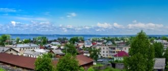
FROM THE HISTORY OF VETLUGA REGION Essays by D.I. Stogov August 20, 1996 There are truly wonderful places on the Russian land. It seems like nothing special: fields, forests, meadows, small towns and villages. But something mysterious, something that makes you amazed, that makes you transform, throwing all the destructiveness of modern civilization into the dark abyss, exists in our outback. This “something” fills the soul of a Russian person with the boundless joy of life, with the true consciousness of what a great and beautiful land he lives and works on. There are many such corners in Great Rus'. And one of them is Vetluga. This is a small Russian town located in the northeast of the Nizhny Novgorod (from 1932 to 1990 - Gorky) region, surrounded on all sides by dense coniferous forests and practically cut off from the whole world. Founded more than two hundred years ago, it can rightfully be called the capital of the Vetluzh region. Years passed, life changed. Once upon a time this town was the only one in this part of the modern Nizhny Novgorod region. Then, after the construction of the Moscow-Vladivostok and Gorky-Kotelnich main railways, quite large industrial centers arose, such as the city of Sharya (on the Moscow-Vladivostok railway), Uren, Shakhunya (on the Gorky-Kotelnich railway ) and others. Subsequently, they began to surpass Vetluga both in population and economic importance, because The “capital of Povetluzhye” was deprived of railway connections (the nearest railway station, the Uren station of the Gorkovskaya railway, is 47 kilometers away). However, today no one can dispute the role of the city of Vetluga as the historical and cultural center of the Vetluga region. There are a number of monuments from the 19th and early 20th centuries, a church, a local history museum, etc. Before we move on directly to the story about the city itself, let’s define what we mean by the concept “Vetluzhsky region”. As a rule, in local history literature this is the name given to part of the territory of modern Kirov, Kostroma, Nizhny Novgorod regions and the Mari Republic (Mari El Republic), where one of the largest tributaries of the great Volga, the Vetluga, flows. This river originates in the Kirov region, in its southwestern part, and flows into the Volga on the territory of the Mari Republic near the city of Kozmodemyansk. It was she who was mainly the most important factor in shaping the characteristics of the history and modern life of the Vetluga region. Interesting legends about the origin of the name of this river, which later gave its name to the city. They are passed on to Povetluzhie from generation to generation. The first Slavic tribes came to the Mari river Ener (the ancient name of the river Vetluga, more precisely, Enger - this is the river from the Mari) and, struck by the abundance of grassy meadows, the greenery of branches bending towards the river surface, they called the river Vetluga, combining two symbols - meadows and willow Another legend says that a Russian girl, the beauty Luga, fell in love with a young shepherd, but the Tatar Murza, who stood at the head of the hordes that enslaved Povetluga, wanted to take the beauty for himself. Proud Luga chose death over shame and threw herself into the river under a spreading willow. There are other interpretations of this name. One of the legends, for example, tells how the wife of the Mari prince Lug, realizing that she was going to be sold into slavery by the Novgorod ushkuiniki, who had captured her husband, threw herself into the waves. The Mari word “vet”—a woman—and the name of Princess Luga formed the name of the river. It seems that the first legend is more plausible. In addition, given that the Mari in ancient times called the river Ener, there is every reason to believe that the word “Vetluga” is of Slavic origin and most likely means “willows and meadows.” Let's move on to the city now. This is what they write about it in atlases and reference books for the Gorky region: “The economic and cultural center of one of the northern regions of the region. Center of developed forestry and food industries. The boulevards, squares, and steep wooden stairs going down to the Vetluga River give the city special beauty and originality...” In general, judging by the above reports, this town is a typical regional center. So in principle it is. However, having visited this city, you will immediately feel its face, its originality, its dissimilarity from other similar settlements. The history of the city also deserves special attention, which, in fact, will be discussed further.
____________________________________________________________________________________________
SOURCE OF INFORMATION AND PHOTO: Team Nomads Gorodetskaya I. L., Levashov E. A. Russian names of residents: Dictionary-reference book. - M.: AST, 2003. - 363 p. — ISBN 5-17-016914-0.. — P. 70. USSR. Administrative-territorial division of the union republics on January 1, 1980 / Compiled by V. A. Dudarev, N. A. Evseeva. - M.: Publishing house "Izvestia of the Soviets of People's Deputies of the USSR", 1980. - 702 p. — P. 118. Vetluzhsky district until 1917 https://www.proshkolu.ru/user/vladikom/file/459796/ AUTHOR of the article Komissarov V.A. Arkhipov G. A. Fortifications and villages of Povetluzhye and Gorky Trans-Volga region (on the history of Mari-Slavic contacts) // Settlements and dwellings of the Mari region. Archeology and ethnography of the Mari region. - Yoshkar-Ola, 1982. Vol. 6. Vesnin K.V. A brief history of the village of Matveevskoye. Vetluga, district town // Encyclopedic Dictionary of Brockhaus and Efron: In 86 volumes (82 volumes and 4 additional ones). - St. Petersburg, 1890-1907. The city of Vetluga, Nizhny Novgorod region Website of the regional newspaper "Vetluga Land" Website of Vetluga secondary school No. 1 History of the coat of arms of Vetluga A selection of materials on the history of Vetluga Vetluga region - collection (all in one) Komissarov V. Early Povetluga. https://vetluga.h1.ru https://www.photosight.ru/ Wikipedia website. Photo by Viktor Ostashev, Restored photos from 1910: Prokudin-Gorsky
The city of Vetluga, the Mari settlement of Yur.
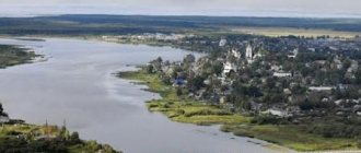
Vetluga River in the Nizhny Novgorod region
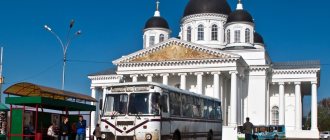
In the Nizhny Novgorod region, the river is represented in the form of 103 different reservoirs, including large and small rivers. On the river are the cities of Vetluga and Voskresenskoye, as well as the working village of Krasnye Baki. All of these are quite large settlements with an ancient history of settlement.
On the site of the village of Krasnye Baki, there was once a Mari village, which was destroyed in the 1320s, and then in the mid-1550s a village was created, essentially consisting of two small adjacent villages called “Big Barrels” and “Small Barrels” .
And then later they were transformed into a village with the single name Boki. But since the population in this area placed great emphasis on pronouncing the letter A instead of O, the name of the village began to be pronounced as Baki. This place was of strategic importance in the past. It was an important trade route between Vyatka and N. Novgorod.
The workers' settlement is one of the largest regional settlements. Not far from these places is Lake Svetloyar, which is not only an ecologically clean place, but also an excellent source of clean water. The unique properties of the water from this lake are confirmed by local residents, who store it for a long time, and the effect and taste do not change.
We recommend reading: The longest and largest rivers of Belarus on the map
The water here is always clear and never overgrown with mud. Some people perceive such places and wonders as anomalous zones. But since water has had such properties for centuries, the only possible definition is the special atmosphere and miraculous environment in these parts.
You can call this one of the best places here that are worth seeing and visiting. The lake itself is located on territory belonging to the reserve. Therefore, if vacationers come here, it is forbidden to light fires and set up tents here. There is an area especially for tourists with tents located near these places. These rules must be strictly followed.
na_fone_odoevskogo_hrama.jpg
In Konevo we visited the library and learned about the history of the village. We joyfully visited the spring and the chapel in honor of the Mother of God, Joy of All Who Sorrow. It was interesting to go to the village school, located on the site of the former temple in honor of the Entry of the Blessed Virgin Mary. It is symbolic that an elementary school classroom is located in the altar of the lost temple. Centuries-old larches remind of the former greatness and culture of our people. At the end of the excursion around the village of Konevo, we were attracted by the slotted platbands of Evgeniy Vasilyevich Sokolov and his amazing cooperage products delighted us with their skill and skill. We express our deep gratitude to the head of the rural settlement, Elena Alekseevna Varentsova, and the head of the Konevsky sector of the Povetluzhye ICCC, Lyubov Nikolaevna Bebneva, for the warm welcome on Konevskaya land.
The land of Sharya is warm and hospitable. Along with the beauty of its native nature, magnificent and picturesque landscapes, the Sharya land is rich in its people. Good nature, sincerity, love for our Motherland and people are brightly deposited in our hearts. I would like to sincerely thank the administration of the Sharya municipal district in the person of Nikolai Serafimovich Glushakov and personally Andrei Yuryevich Smirnov for their care and acquaintance with the Sharya region.
Natural features of the pool
To find out the details of the river route where the Vetluga River flows, you need to open a map of Russia. The river has a mostly flat bottom, sand, but in some places there may be silt. In the upper reaches the river flows quickly, and in the lower part it flows much slower. Speed on average up to 7 km/h. During high water, this speed reaches 10.
The shores have completely different topography, but in most areas there are sandy shores that allow you to have a good rest. The right side is steeper, there are areas with cliffs, and when approaching populated areas, the banks of the Vetluga are meadow.
The forest growing along the right bank is mainly coniferous. The left side is low, sloping, there are many bushes, and there are numerous meadows. Many good beach areas in the lowlands. The depth of the river is generally 2-3 meters. If you compare the two banks, the left one is not high.
River length by region:
- Kirovskaya is just over 160 km.
- Kostroma 298 km.
- Nizhny Novgorod 323 km.
- In the Republic of Mari El 100 km.
Climate
The climate is temperate continental. Winter is cold and snowy, summer is warm.
| Vetluga climate (normal 1981–2010) | |||||||||||||
| Index | Jan. | Feb. | March | Apr. | May | June | July | Aug. | Sep. | Oct. | Nov. | Dec. | Year |
| Average temperature, °C | −11 | −10,1 | −3,5 | 4,5 | 11,5 | 16,3 | 18,7 | 15,6 | 9,9 | 3,5 | −4,1 | −8,9 | 3,5 |
| Precipitation rate | 49 | 35 | 34 | 36 | 48 | 81 | 84 | 76 | 61 | 65 | 57 | 56 | 682 |
| Source: [meteo.ru/it/178-aisori FSBI “VNIIGMI-MTsD”] | |||||||||||||
Shipbuilding and shipping
Historically, the first steamships on the river appeared at the end of the 19th century. Throughout the 20th century, shipping was actively developing, barges and passenger ships (light, like rockets) appeared.
The river is important as a shipping route connected to the Volga, so navigation continues throughout the permissible season. There are a lot of light cargo ships.
For tourist trips, in these places you can use a kayak, travel on rafts, or ride on an inflatable boat. The percentage of those who raft on the river increases every year. After all, you can go to places with unique nature and ecology. The area of the river basin requires long walks.
Ecological state of the river
The main sources of water pollution are trees and eroded soil. To prevent the river from being washed away due to the destruction of the banks, it is necessary to monitor and save their condition.
We recommend reading: River in Nizhny Novgorod: list, names of all rivers flowing in the city
In general, the pollution situation is not critical and the river is in good condition. The water is considered satisfactory, but it is necessary to monitor the water quality in the river annually.
The presence of a wide variety of fish also indicates a good environmental component.
u_dt_gornica.jpg
Now the village is behind us, only the top of the temple is visible. Beautiful places began to open up to us, places where, it seemed, a rare fisherman or mushroom picker who knew this area could sail by boat. “Yes, there is beauty here, we have been to many places, but everything here is special,” our interlocutors share their impressions.
Here and there you can hear the splashes of large fish chasing small fish under the playing sun. Having sailed for some more time, examining the area, we noted that many trees stood on the crumbling banks only on their own roots, leaning only slightly on the shore, but still holding on to life without falling into the river. Such beauties are very etched in the memory. The impression one gets is that there are many places on this earth where no human has set foot for many centuries. Throughout the entire journey, the feeling remains that the same old boat or merchant ship will sail towards us. It seems that time has stopped, modernity is already far away, and only the camera reminds us of what time it really is now. There is only you, the river, the forest and the boat. And the conversation is interesting, exciting and fun. The boat, however, systematically cut through the waves under the pressure of the oars in strong male hands, crashing into the mirror-like surface of the water, moving forward and forward.
Fishing on Vetluga
Fishermen here mainly catch bream, ide, asp and other small fish. Amateurs gather both for winter fishing and in the summer.
Excellent ecology and protected areas make it possible to fish in silence. An ideal place for those who prefer active recreation and at the same time seek privacy.
Fishing is possible in winter or any other season. Spending most of the year in the city, this type of holiday will be the best vacation. Part of the river may have a high flow rate, while another part may be slower.
The river differs significantly in the upper and lower reaches. Therefore, before such a trip, it is necessary to choose the best parking place in advance. You should stock up on food, medicine and roughly calculate how long you will be traveling. For safety, you should once again repeat the rules of conduct and analyze certain situations that may arise.
ATTENTION: during the Vetluga rafting season you should be careful when turning. The fact is that in addition to tourist rafts, timber is rafted along it. And it is necessary to maintain a distance when maneuvering so as not to be hit by rafts.
v_troickom_hrame.jpg
In the village of Odoevskoye we were warmly received at the Church of All Saints. Many thanks to Daria and Anton Tikhomirov, Galina Vasilyevna Vinogradova! Daria Gennadievna introduced in detail the history of the temple. The upper limit of the temple was especially memorable for its light and acoustics. The excursion to the holy spring of Cosmas and Damian left an unforgettable impression on my soul. We also visited the ancient Odoevskoye settlement, where Daria shared local legends and traditions with us. And finally we visited the House of Creativity “Gornitsa”. The head, Galina Aleksandrovna Kalashnikova, together with Lyudmila Borisovna Smirnova, conducted an educational tour through the halls of the museum and spoke with sincere love about the village. We express our heartfelt gratitude for preserving historical memory, spiritual values and folk traditions.