For other places with the same name, see Gornyak (locality).
City in Altai Krai, Russia
| Miner Miner | |
| City [1] | |
| Coat of arms | |
| Location Gornyak | |
| Miner Location Gornyak Show map of Russia Miner Gornyak (Altai region) Show map of Altai Territory | |
| Coordinates: 50°59'N 81°28'E / 50.983°N Latitude 81.467°E / 50.983; 81.467 Coordinates: 50°59'N 81°28'E. / 50.983°N 81.467°E / 50.983; 81.467 | |
| A country | Russia |
| Federal subject | Altai region [1] |
| Administrative region | Loktevsky district [1] |
| City of district significance | Miner [2] |
| Based | 1751 [3] |
| City status from | 1969 |
| Height | 270 m (890 ft) |
| population size (2010 Census) [4] | |
| • General | 13 918 |
| Administrative status | |
| • Capital from | Loktevsky district [1], city of district significance Gornyak [1] |
| Municipal status | |
| • Municipal district | Loktevsky municipal district [2] |
| • Urban village | Miner [2] |
| • Capital from | Loktevsky municipal district [2], urban settlement Gornyak [2] |
| Timezone | UTC+7 (MSK+4[5]) |
| Postal code [6] | 658420 |
| OKTMO ID | 01625101001 |
Miner
(Russian: Gornyak) is a city and the administrative center of Loktevsky District in Altai Krai, Russia, located 360 km (220 mi) southwest of Barnaul, the administrative center of the region.
Population: 13,918 (2010 census); [4] 15,779 (2002 census); [7] 15,833 people (1989 census). [8] Previously known as Zolotukha
(until 1942). It is located next to the border between Kazakhstan and Russia.
Miner
(Altai region)
OKATO code:
01225501
Founded:
1942
Urban settlement since:
1946
City since:
1969 City of district subordination (Loktevsky district, Altai Territory)
Center:
Loktevsky district
Telephone code (reference phone)
| 38586***** | 32-20-9 |
Deviation from Moscow time, hours:
4
Geographical latitude:
51°00′
Geographical longitude:
81°28′
Altitude above sea level, meters:
270 Sunrise and sunset times in the city of Gornyak
The city of Gornyak, Altai Territory - presentation
The city was founded in 1969, the administrative center of the Loktevsky district of the Altai Territory. Population 15.4 thousand people. The city is located in the southwest of the Altai Territory on the Zolotukha River (a tributary of Alya) 360 km from Barnaul near the border with Kazakhstan. The Lokot Ust-Kamenogorsk Ridder railway line runs through the city. Lokot Ust-Kamenogorsk Ridder
History Zolotushinsky mine was opened in 1751. Mining continued until the mid-19th century and was resumed in 1939. In 1942, in a steppe, swampy area, three kilometers south of the Zolotukha River, a miners’ settlement appeared at the Zolotushinsky mine under construction, called the working village of Gornyak. In 1946, the working settlement of Gornyak was given the status of an urban-type settlement. In 1954, Gornyak became a regional center. Regional organizations moved from the village of Lokot. 1942 1946 1954 Lokot The village received city status in 1969. 1969 The name Gornyak is due to the mining profile of the village.
Economy For a long time, the basis of the city's economy was the extraction and enrichment of polymetallic ores. The largest enterprise in this industry: the Altai Mining and Processing Plant, which was engaged in the extraction and enrichment of ore, the production of copper, zinc, lead, and tin. Nowadays, the Neverovsky crushing and screening plant, the Loktevsky lime plant, and small food production facilities operate in Gornyak.
Economy In the Loktevsky district, agricultural enterprises grow: wheat, buckwheat, peas, sunflowers, oats, beets, carrots, cabbage, potatoes. They raise sheep, pigs, cattle, and birds. The area contains deposits of polymetals, limestone, and granite. The city's land resources amount to 2809 hectares.
Economy The city has a railway station, Neverovskaya, which, according to some sources, received its name from one of the first settlers in these parts, the exiled Pole Anton Neverovsky (), a participant in the Polish uprising of 1863, who lived in the Mariinsky district of the Tomsk province from 1864 to 1870 s, when he returned to his homeland in Galicia. According to another version, the station is named after Ivan Zakharovich Neverov (), holder of the Order of the Red Banner (posthumously), who died in battle during the conflict on the Chinese Eastern Railway.
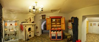
Sights The city has a local history museum and a memorial (created in 1983) in honor of fellow countrymen who died on the fronts of the Great Patriotic War. Later, a memorial was also created in honor of fellow countrymen who died while fulfilling their international duty.
Thank you for your attention.
Map
| Gornyak: maps |
Miner: photo from space (Google Maps) Miner: photo from space (Microsoft Virtual Earth)
| Miner. Nearest cities. Distances in km. on the map (in brackets along roads) + direction. Using the hyperlink in the distance , you can get the route (information courtesy of the AutoTransInfo website) | |||
| 1 | Staroaleiskoe | 36 (42) | IN |
| 2 | Zmeinogorsk | 53 (67) | IN |
| 3 | Rubtsovsk | 60 (160) | WITH |
| 4 | Kurya | 87 (123) | NE |
| 5 | Novoegorevskoe | 93 (197) | NW |
| 6 | Uglovskoe | 96 (251) | NW |
| 7 | Pospelikha | 111 (181) | WITH |
| 8 | Krasnoshchekovo | 115 (153) | NE |
| 9 | Newcomer | 134 (225) | WITH |
| 10 | Wolf | 136 (244) | NW |
| 11 | Shipunovo | 146 (263) | NE |
| 12 | Charyshskoe | 151 (441) | IN |
| 13 | Mikhailovskoe | 152 (516) | NW |
| 14 | Ust-Kalmanka | 178 (338) | NE |
a brief description of
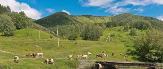
Located on the northwestern spurs of Altai, south of the Kolyvan ridge, in the steppe area in the extreme southwest of the region, 3 km from the river. Zolotukha (left tributary of Alei), 4 km from the railway. Neverovskaya station, 360 km southwest of Barnaul.
Territory (sq. km): 28
Information about the city of Gornyak on the Russian Wikipedia site
Historical sketch
Founded in the 18th century. like the village of Zolotukha.
The Zolotushinsky (polymetallic) mine was opened in 1751. Mining operations continued until the mid-19th century and were resumed in 1939.
In 1942, on the site of the ancient village of Zolotukha, a miners’ settlement of the Zolotushinsky mine under construction, named Gornyak, was formed. Since 1946 PGT Gornyak. City since 1969
The name Gornyak is due to the mining profile of the village.
Economy
Extraction and enrichment of polymetallic ores (JSC Altaipolymetal). Neverovskaya crushing and screening factory (production of construction lime).
Light and food industry enterprises: JSC - “Gornyatsky Bakery Plant”, “Gornyatsky Dairy Plant”, a branch of the Rubtsovskaya Garment Factory, etc.
In the Loktevsky district, wheat, buckwheat, peas, sunflowers, oats, beets, carrots, cabbage, and potatoes are grown. They raise sheep, pigs, cattle, and birds.
Deposits of polymetals, limestone, granite.
Culture, science, education
Museum of Local Lore.
Memorial in honor of fellow countrymen who died on the fronts of the Great Patriotic War of 1941-45 (1983).
Museums, galleries, exhibition halls
Loktevsky Museum of Local Lore 658420, Altai Territory, Loktevsky district, Gornyak, st. Abashkina, 7-a Phone(s): (38586) 31943
Architecture, sights
30 km from Gornyak there is a complex of memorial places reflecting the history of mining production in the 18th-19th centuries: Loktevsky silver smelting plant (1782-1892), Loktevsky copper mine (1727-1896), etc.
22 km from Gornyak (near the villages of Lokot and Sovetsky Put) is a complex of settlements and burial mounds (2nd millennium BC - 1st millennium AD).
| Population by year (thousands of inhabitants) | |||||||
| 1959 | 13.9 | 2000 | 16.0 | 2010 | 15.0 | 2017 | 13.0 |
| 1970 | 16.6 | 2001 | 16.1 | 2011 | 13.9 | 2018 | 12.7 |
| 1979 | 16.0 | 2003 | 15.8 | 2012 | 13.6 | 2019 | 12.4 |
| 1989 | 15.8 | 2005 | 15.6 | 2013 | 13.5 | 2020 | 12.3 |
| 1992 | 15.9 | 2006 | 15.6 | 2014 | 13.2 | 2021 | 12.1 |
| 1996 | 16.6 | 2007 | 15.5 | 2015 | 13.1 | ||
| 1998 | 16.2 | 2008 | 15.4 | 2016 | 13.0 | ||
Gornyak (Altai Territory)
Miner:| Staroaleiskoe | 36 (42) | IN | |
| 2 | Veseloyarsk | 41 (198) | NW |
| 3 | Zmeinogorsk | 53 (67) | IN |
| 4 | Rubtsovsk | 60 (160) | WITH |
| 5 | Kurya | 87 (123) | NE |
| 6 | Novoegorevskoe | 93 (197) | NW |
| 7 | Uglovskoe | 96 (251) | NW |
| 8 | Pospelikha | 111 (181) | WITH |
| 9 | Krasnoshchekovo | 115 (153) | NE |
| 10 | Newcomer | 134 (225) | WITH |
| 11 | Wolf | 136 (244) | NW |
| 12 | Shipunovo | 146 (263) | NE |
| 13 | Charyshskoe | 151 (441) | IN |
| 14 | Mikhailovskoe | 152 (516) | NW |
a brief description of
Located on the northwestern spurs of Altai, south of the Kolyvan ridge, in the steppe area in the extreme southwest of the region, 3 km from the river. Zolotukha (left tributary of Alei), 4 km from the railway. Neverovskaya station, 360 km southwest of Barnaul.
Territory (sq. km): 28
Historical sketch
Founded in the 18th century. like the village of Zolotukha.
The Zolotushinsky (polymetallic) mine was opened in 1751. Mining operations continued until the mid-19th century and were resumed in 1939.
In 1942, on the site of the ancient village of Zolotukha, a miners’ settlement of the Zolotushinsky mine under construction, named Gornyak, was formed. Since 1946 PGT Gornyak. City since 1969
The name Gornyak is due to the mining profile of the village.
Economy
Extraction and enrichment of polymetallic ores (JSC Altaipolymetal). Neverovskaya crushing and screening factory, Kaltsit company (production of construction lime).
Light and food industry enterprises: JSC – “Gornyatsky Bakery Plant”, “Gornyatsky Dairy Plant”, a branch of the Rubtsovskaya Garment Factory, etc.
In the Loktevsky district, wheat, buckwheat, peas, sunflowers, oats, beets, carrots, cabbage, and potatoes are grown. They raise sheep, pigs, cattle, and birds.
Deposits of polymetals, limestone, granite.
Culture, science, education
Museum of Local Lore.
Memorial in honor of fellow countrymen who died on the fronts of the Great Patriotic War of 1941-45 (1983).
Museums, galleries, exhibition halls
Loktevsky Museum of Local Lore 658420, Altai Territory, Loktevsky district, Gornyak, st. Abashkina, 7-a Phone(s): (38586) 31943
Architecture, sights
30 km from Gornyak there is a complex of memorial places reflecting the history of mining production in the 18th-19th centuries: Loktevsky silver smelting plant (1782-1892), Loktevsky copper mine (1727-1896), etc.
22 km from Gornyak (near the villages of Lokot and Sovetsky Put) there is a complex of settlements and burial mounds (2nd millennium BC - 1st millennium AD).
