Mednogorsk
(Orenburg region)
OKATO code:
53415
Founded:
1933
City since:
1939 City of regional subordination
Telephone code (reference phone)
| 35379***** | 31-9-20 |
Deviation from Moscow time, hours:
2
Geographic latitude:
51°24′
Geographic longitude:
57°35′
Altitude above sea level, meters:
350 Sunrise and sunset times of the Sun and Moon in the city of Mednogorsk
Private advertisements in Mednogorsk, in the Orenburg region and in Russia
To add an advert
Orenburg
Brake lever adjustable machine. MAZ 5440, 544069, 643068 rear. left right...
Orenburg
Retraining courses remotely
Orenburg
Free premises, 500 m²
Orenburg
Breaking out of binge drinking, coding, addiction treatment
123ru.net
- minute-by-minute news with a daily archive. Only here we have all the main news of the day without political censorship. “123 News” - absolutely all points of view, sober analysis, civilized debates and discussions without mutual accusations and insults. If you don’t like it, don’t want to hear it, don’t read it, read it, be mutually polite and correct in your statements. Remember that not everyone's point of view coincides with yours. Respect the opinions of others, even if you defend your views and your position. 123ru.net is a news observer. We do not impose our vision on you, we give you a snapshot of the events of the day without censorship and without cuts. News as it is—online with minute-by-minute archives for all cities and regions of Russia, Ukraine, Belarus and Abkhazia. 123ru.net - live news live! A quick search from 123ru.net is not only the opportunity to be the first to know, but also the advantage of reporting breaking news instantly in any language in the world and being heard right away. You can add your news at any moment - here.
Map
| Mednogorsk: maps |
Mednogorsk: photo from space (Google Maps) Mednogorsk: photo from space (Microsoft Virtual Earth)
| Mednogorsk. Nearest cities. Distances in km. on the map (in brackets along roads) + direction. Using the hyperlink in the distance , you can get the route (information courtesy of the AutoTransInfo website) | |||
| 1 | Kuvandyk | 18 (15) | NW |
| 2 | Novotroitsk | 54 (114) | SE |
| 3 | Guy | 60 (129) | IN |
| 4 | Orsk | 64 (100) | IN |
| 5 | Akyar (Republic of Bashkortostan) | 67 (68) | NE |
| 6 | Belyaevka | 80 (114) | Z |
| 7 | Energetik | 91 (177) | NE |
| 8 | Zilair (Republic of Bashkortostan) | 93 (157) | WITH |
| 9 | Saraktash | 94 (141) | NW |
| 10 | Novoorsk | 97 (145) | IN |
| 11 | Isyangulovo (Republic of Bashkortostan) | 112 (128) | NW |
| 12 | Baymak | 140 (173) | WITH |
| 13 | Tulgan | 143 (170) | NW |
| 14 | Akbulak | 144 (328) | Z |
a brief description of
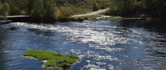
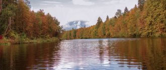
Located in the Southern Urals, in the valley of the river. Blyava (Ural basin), 224 km southeast of Orenburg. Railway station.
Territory (sq. km): 354
Information about the city of Mednogorsk on the Russian Wikipedia site
Historical sketch
In 1933, construction of a copper-sulfur plant began (in connection with the development of the Blavinsky copper-pyrite deposit), which was served by the N10 siding of the Orenburg Railway. The workers' settlements that emerged during construction, which laid the foundation for the modern city, were at first called settlements of the N10 settlement. Then their name changed with the change in the name of the crossing: them. Pyatakov (in honor of the Soviet party and statesman G.L. Pyatakov, 1890-1937), after his arrest again the crossing point N10, since 1938 the Medny crossing point.
In 1939, the villages of the Medny junction were transformed into the city of Mednogorsk.
In the 2000s. The village of Rakityanka entered the city boundaries (PGT 1939-1999, 7.1 thousand inhabitants, 1939; 6.8 thousand inhabitants, 1959; 5.0 thousand inhabitants, 1970; 4.0 thousand inhabitants, 1979, 3.2 thousand inhabitants ., 1989) [check information about the year of inclusion!].
Economy
The city's leading enterprise is the copper-sulfur plant (production of blister copper and sulfuric acid).
, reinforced concrete products, brewing, dairy.
Main enterprises
NON-FERROUS METALLURGY
JSC "Mednogorsk Copper and Sulfur Plant"
462250, Orenburg region, Mednogorsk, st.
Zavodskaya, 1 Offers:
blister copper, copper cathode, sulfuric acid, steel
ELECTRICAL INDUSTRY
OJSC "Uralelektro"
462250, Orenburg region, Mednogorsk, st.
Motornaya, 1 Offers:
Electric motors, magnetic starters, electric vacuum cleaners
| Population by year (thousands of inhabitants) | |||||||
| 1939 | 19.6 | 1996 | 33.7 | 2007 | 30.0 | 2015 | 26.2 |
| 1959 | 36.8 | 1998 | 33.5 | 2008 | 29.8 | 2016 | 25.9 |
| 1967 | 39 | 2000 | 33.1 | 2010 | 29.8 | 2017 | 25.6 |
| 1970 | 38.0 | 2001 | 32.9 | 2011 | 27.3 | 2018 | 25.3 |
| 1979 | 34.9 | 2003 | 31.4 | 2012 | 27.0 | 2019 | 24.9 |
| 1989 | 34.1 | 2005 | 30.4 | 2013 | 26.6 | 2020 | 24.6 |
| 1992 | 34.2 | 2006 | 30.2 | 2014 | 26.5 | 2021 | 24.3 |
Cities
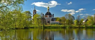
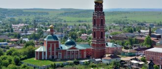
The city of Mednogorsk is a city of regional subordination in the Orenburg region of Russia. Population 29.7 thousand people (as of the end of 2011). The city of Mednogorsk with five rural settlements subordinate to its administration occupies 0.4 thousand km?. Mednogorsk is located on the Blyava River (Ural basin), 224 km from Orenburg. Founded in connection with the development of the Blavinsky copper-pyrite deposit and the construction of a copper-sulfur plant. Mednogorsk is called a garden city; it is one of the greenest cities in the Orenburg region. Mednogorsk is the most mountainous of all the cities in the Orenburg region. The houses are located on the slopes of the hills, climbing almost from the bank of the Blyava River to the peaks, to the television repeater tower, which has become the high-altitude landmark of the city.
Education in the city of Mednogorsk
The city has a number of secondary specialized, general education and preschool institutions. There are no institutions of higher professional education in the city, so future students go to other cities to enroll.
Economy of the city of Mednogorsk
LLC "Mednogorsk Copper and Sulfur Plant" OJSC "Uralelectro" Mednogorsk Thermal Power Plant (Capacity 14 MW electric and 100 Gcal/h thermal) Bakery Brewery Dairy Plant Service Center Technoservice
History of the city of Mednogorsk
On January 1, 1915, the first and only tunnel was opened on the Orenburg-Orsk railway line. At the same time, a trackman's booth was erected approximately on the site of the current station. Shortly before the revolution of 1917, English entrepreneur Leslie Urquhart founded the Tanalyk Corporation, which was engaged in the development of copper deposits in Bashkiria. One day they came across copper pyrite outcrops in the area of the Blyava River. But soon a revolution began, and the company had to curtail its activities in Russia.
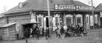
This deposit was discovered for the second time in 1929, and in February 1934, an electric locomotive transported the first set of trolleys with ore from the adit - the Blyaviisky mine produced its first products for testing. The workers' settlements that emerged during the construction of the copper-sulfur plant (MSZ), which laid the foundation for the modern city, were at first called junction No. 10, then named after. Pyatakov, since 1938 - Medny crossing. On April 8, 1939, a Decree of the Presidium of the Supreme Soviet of the RSFSR was signed on the allocation of a city of regional subordination to Mednogorsk. MSZ, which expanded the list of products, became known as the Mednogorsk Copper and Sulfur Plant (MMSC). In October 1941, the Tula Arms Plant was evacuated to Mednogorsk, and a month later the production of weapons for the front began - rifles of the SVT-40 system and Shvak aircraft guns. Since January 1945, there has been a reduction in the production of military products. The former plant No. 314 became the Mednogorsk Electrotechnical Plant (1954-1992), and then the Uralelectro enterprise.
| Coat of arms of the city of Mednogorsk - In an azure field, there is a golden mountain shifted to the left with two increasing peaks, burdened with a left narrow scaly curved band in the color of the field and on top of it a scarlet stone (heraldry, with four angular and four rounded ends) and accompanied at the head by a golden hammer, a safety belt which is wrapped around the handle. The coat of arms can be reproduced with a status crown of the standard standard for municipalities. Mednogorsk, the most mountainous of the cities in the Orenburg region, located in the spurs of the Guberlinsky Mountains, is called the “primordial copper land.” Copper has been discovered here since ancient times, which was used to make tools. The city was formed in 1939 from workers’ settlements that appeared in connection with the start of construction of a copper-sulfur plant in 1933. Thus, the golden mountain (golden color indicates copper) clearly symbolizes the name of the city - Mednogorsk (copper mountains). The mountain geological hammer and golden mountains represent the mining industry, as well as the copper-sulfur plant, which is a city-forming enterprise and the basis for the well-being of local residents. The scarlet stone symbolizes minerals and ore, as well as industry - the basis of the city's economy. The curved azure band indicates the Ural River, in the basin of which the city is located, and the Blyava River, which flows here, playing an important role in the lives of the townspeople. Azure (blue) color is a symbol of spirituality, nobility, honor, dignity, lofty aspirations, as well as clear skies and water resources. Scarlet (red) color is a symbol of courage, strength, labor, perseverance and beauty. Gold (yellow) color is a symbol of wealth, stability, respect, as well as copper. The coat of arms was approved by the Decision of the Mednogorsk City Council of Deputies No. 401 of August 26, 2008. | Flag cities Mednogorsk — The place in the Southern Urals where the city of Mednogorsk is located is rightly called the “primordial copper land.” Archaeological monuments dating back centuries indicate that here ancient steppe tribes discovered and used copper to make tools. The modern city also owes its origin to copper: since 1933, when the construction of the copper-sulfur plant began, workers' settlements began to appear, and already in 1939 they were transformed into the city of Mednogorsk. Mednogorsk is the most mountainous of all the cities in the Orenburg region. It is located west of Orsk in the spurs of the Guberlinsky Mountains. Copper and mountainous terrain give the city its name. They are also depicted in the coat of arms, making the coat of arms public. There is no copper color in heraldry and gold, which is similar in color, reflects in the coat of arms not only copper mountains, but also, as a symbol of wealth, stability, respect, allegorically symbolizes the copper-sulfur plant as a city-forming enterprise. The image of a geological hammer complements the symbolism of mining and shows the antiquity of this activity in these places. Traditionally, the symbol of ore and minerals is depicted with a stone in the center of the coat of arms as the basis and foundation of life and allegorically symbolizing industry as the basis of the city’s economy. Red color is a symbol of labor, courage, strength and perseverance, beauty and celebration. The Ural River, in the basin of which the city is located, and the Blyava River flowing here are also reflected in the coat of arms, since they play a very important role in the life of local residents. Blue color is a symbol of honor, nobility, spirituality, lofty aspirations, and also symbolizes the expanses of water and the endless sky. Approved by the Decision of the Mednogorsk City Council of Deputies (#402) dated August 26, 2008. |
Collective farms of the Mednogorsk region in 1960
In the meantime, here’s a little information about the collective farms that operated in the Mednogorsk region in 1960 and their central estates:
- Named after the XXI Congress of the CPSU in the village of Churaevo,
- collective farm "Druzhba" in the village of Kuruil,
- collective farm "Testaments of Lenin" in the village of Chebotarevo,
- collective farm "Red Banner" in the village of Krasnoznamenka,
- collective farm named after Lenin in the village of Krasno-Sakmarsk,
- collective farm "May 1" in the village of Pervomaisk,
- "Victory" in the village of Ibragimovo.
The remaining settlements were united into state farms, which are listed above - “Priuralsky”, “Industry”, “Ilyinsky”, “Kuvandyksky”.
In July 1962, everything returned to normal, the Mednogorsk district was again renamed Kuvandyksky, and the final delimitation of borders occurred in 1965, when the village councils of the Khalilovsky district, previously belonging to the Novopokrovsky municipal district, again returned to their borders but under the name Kuvandyk district. That is, the territories we are accustomed to turned out to be, the Kuvandyk district was created in the form in which it exists now.
Population[ | ]
| Population | ||||||||
| 2002[9] | 2003[10] | 2004[10] | 2009[11] | 2010[12] | 2012[13] | 2013[14] | 2014[15] | 2015[16] |
| 33 648 | ↘33 600 | ↘33 100 | ↘31 868 | ↘29 120 | ↘28 802 | ↘28 364 | ↘28 141 | ↘27 775 |
| 2016[17] | 2017[18] | 2018[19] | 2019[20] | 2020[21] | 2021[2] | |||
| ↘27 505 | ↘27 117 | ↘26 750 | ↘26 325 | ↘25 991 | ↘25 610 | |||
Composition of the urban district[ | ]
| № | Locality | Type of settlement | Population |
| 1 | Blyava | village | 133[12] |
| 2 | Blyava | station | 18[12] |
| 3 | Blyavtamak | village | 946[12] |
| 4 | Idelbaevo | village | 202[12] |
| 5 | Kidryasovo | village | 210[12] |
| 6 | Mednogorsk | city, administrative center | ↘24 321[2] |
| 7 | Rysaevo | village | 319[12] |
The most beautiful Orenburg caves
The Orenburg region has prepared pleasant surprises for speleologists: in the local mountains there are several caves accessible to travelers. Many of the grottoes have a complex structure, so tourists should take care of their safety before visiting them.
Cave Gift
- Coordinates: 51.456516, 56.597183.
The largest gypsum cave in the region is located in a mountain near the village of Dubensky. The length of the underground labyrinth is 660 meters. “The Gift” consists of several rooms and three levels, the entrance is located at the top. In some places you can come across stalactites and stalagmites.
The halls are always cool; in summer the temperature stays at around 12°C. Visitors to the cave must have suitable equipment: helmet, warm clothing, flashlight. It is safer to travel through the tunnels accompanied by an experienced guide.
Yumaguzinskaya cave
- Coordinates: 51.605182, 57.607272.
The most famous cave in the Orenburg region is hidden in the depths of Mount Beloshapka, located near the village of Yumaguzin. Being at the foot of the mountain, it is difficult to notice the low entrance, buried in thickets of tall grass. Those brave souls who decide to make their way through the inconvenient underground corridor will be rewarded - a spacious hall with ancient fossilized plants and animals on the walls.
Cave "Mosaic"
- Coordinates: 51.375222, 57.090065.
“Mosaic” is one of the many gypsum caves of the Kzyladyr field. Getting into it is not easy: the entrance is low, in winter the underground corridors and rooms freeze, and in the spring they are filled with floods. Tourists usually visit the grotto in dry weather in the summer.
There are beautiful stains on the walls of the cave, and in places there are small stalactites and stalagmites. Amateur speleologists need to wear a helmet to avoid injuring their heads on sharp protrusions, and warm clothing, since the temperature inside does not rise above 14 °C even in the heat.
Holy Caves
- Coordinates: 51.997561, 53.893381.
The caves in the village of Pokrovka have a long history. At the end of the 19th century, Orsky Cossack Zakhary Kartsev settled here, on the banks of the Samara River. The hermit dug a cave for himself, improved the spring that babbled nearby, and spent all his days in fasting, labor and prayer.
People who thirsted for spiritual achievements and salvation were drawn to the righteous man. They also dug caves and settled near Zechariah. Gradually, a community of Christians leading a monastic lifestyle emerged. Over time, the monastery received official status, and Zachary took monastic vows with the name Zosima. Cells and a temple were built in the caves, then the brethren began to build buildings on the surface of the earth.
After the October Revolution, the monastery was closed, and the above-ground buildings were dismantled into bricks. In the 90s, monasticism in Pokrovka began to revive, believers restored the buildings, but the entrance to the caves was found only in 2002.
Today, the grottoes again enter the boundaries of the St. Nicholas Convent; you can get into the dungeon through the Church of the Nativity of John the Baptist. The cold, cramped cells are filled with icons and candles. The nuns themselves conduct tours of the holy caves and talk about the history of the monastery.
You may also be interested in interesting places in individual cities of the Orenburg region - Orsk and Orenburg
Mednogorsk district, settlements in 1960
This territorial unit included most of the Kuvandyk district, although some village councils nevertheless went to the Khalilovsky district, and the Zyanchurinsky and Novopokrovsky districts were liquidated accordingly.
So, below is a list of settlements by village council as written in the 1960 directory.
Blavinsky village council . Blyava village, Alchimbaevo village, Blyava railway station, railway booth 240 km, railway barracks 227 km, Pervonadezhdinka village, railway crossing 211 km, Usergen village, Khersonka village.
Zhanatan village council. The village of Central estate of the Kuvandyksky state farm, the village of Zhanatan, the village of farm No. 2 of the Kuvandyksky state farm, the village of farm No. 3 of the Kuvandyksky state farm, the village of farm No. 4 of the Kuvandyksky state farm, the village of farm No. 5 of the Kuvandyksky state farm.