By the beginning of the 21st century. Almost half of the population of world civilization lived in cities. Cities play a leading role in the economic, socio-political and socio-cultural life of countries and peoples of the world. Cities produce 4/5 of the value of all goods and services produced in the world. Thus, modern world civilization is, first of all, an urban civilization. The main direction in the development of society is its urbanization. The peculiarities of the concentration of population and economic life in cities, the spread of their influence on the agrarian environment constitute the core of the historical process in Modern and Contemporary times. Understanding the essence of modernization of society is impossible without identifying the main stages of urbanization.
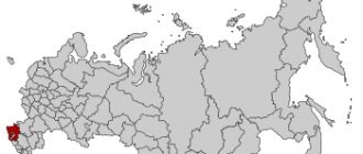
The cities of the Urals occupy a special place in the history of Russia. And today they play an important role in the economic, socio-political and socio-cultural development of the country.
Of the 1040 cities in Russia, 140 are located in the Urals, of the 13 million-plus cities, 4 are Ural cities (Ekaterinburg, Perm, Ufa, Chelyabinsk).
How did the formation of the Ural cities proceed in historical dynamics? Their formation and development can be divided into three large stages. The first covers the pre-industrial era (XV-XVII centuries), when 33 cities arose in the Urals1. At the time of their formation, these were mainly settlements, small villages and fortresses, which became an outpost for the development of the vast expanses of the Urals and Siberia, and did not play the role of industrial and administrative centers.
The second stage of urbanization of the Urals began with the beginning of Peter the Great’s modernization in the first quarter of the 18th century, when such fortress factories as Kamensk-Uralsky, Nevyansk, Yekaterinburg, etc. were founded. This stage continued until the start of capitalist modernization of Russia in the second half of the 19th century. It turns out that such cities make up the majority in the Urals. There are 73 of them, and 65 of them arose in the 18th century. These were mainly factory cities, where the industrial power of the “backbone of the state” was built.
The third stage of development of the cities of the Urals, urbanization of the region covers the period from the last third of the 19th century. until the end of the 1920s. This is the era of capitalist modernization of Russia, wars, revolutions, restoration of the national economy, the eve of the “Stalinist industrial revolution.” At this stage, 16 new cities arose on the map of the Urals, the birth of which is associated, as a rule, with the development of new mineral deposits (for example, Asbest, 1889), the construction of a railway (Bogdanovich, 1883) or the construction of new large factories ( Serov, 1899).
Of course, the process of urbanization in the region accelerated sharply during socialist industrialization. However, few new cities emerged in the “Stalin era,” as in the subsequent decades of Soviet power. From the late 1920s to 1989 15 cities2 appeared on the map of the Urals, starting with Magnitogorsk in 1929 and ending with the city of Dyurtyuli (Bashkortostan) in 1989. All of them, with rare exceptions, arose as a result of the development of newly discovered mineral deposits (for example, Kachkanar, 1956) or the construction of new large industrial enterprises (Magnitogorsk, 1929). The process of urbanization of the Urals in the twentieth centuries. was mainly due to the growth of the population of cities that arose in the pre-industrial era (XV-XVII centuries) and during the period of pre-capitalist modernization of Russia (XVIII - first half of the 19th centuries).
Historical sites and museums
Arkaim (settlement, Mountain of Love, Mountain of Reason, Mountain of Revelation, Mountain Shaman and Mountain of Ancestors)
Coordinates: 52.642172, 59.543212 Phone: 8 904-800-40-56 Website: https://www.arkaim-center.ru Cost of excursions: 50-250 rubles
Arkaim is an ancient settlement of the Bronze Age. It was discovered by chance: two schoolchildren from an archaeological group noticed the unusual relief.
The ancient city looks like a circular fortress with residential and utility rooms, workshops, a central square, and a sewer system.
It is not known how many years people lived in the city, but after a strong fire no one else settled here.
Arkaim is surrounded by mountains, which were important in the lives of the townspeople. Religious ceremonies were held on Mount Shamanka. Mountain of Love was a symbol of a happy family life. The Mountain of Reason, according to legend, bestowed clarity of mind and knowledge. The Mount of Revelation was considered the main place of power. And the Mountain of Ancestors is also called the Mountain of Repentance - a place where people could admit their imperfections.
Leaning Nevyansk Tower
Address: Sverdlovsk region, Nevyansk, Demidov Square, 3 Phone: +7 34356 4‑45-09, +7 906 811‑48-21 Website: https://nevyanskmuseum.rf Opening hours: Tue-Fri 9:00 -19:00; Sat 9:00-20:00; Sun 9:00-19:00
The tower, built in memory of the commissioner of the Nevyansk plant N. Demidov, has a strong slope.
This is probably the result of a construction error. The tower was completed already tilted, maintaining the center of gravity. Thus, the structure has a saber shape.
For that time, the tower had a modern device: it was equipped with a lightning rod long before its invention by Benjamin Franklin.
Ganina Yama
Location: Ekaterinburg, Shuvakish Phone: +7 343 219‑08-48, +7 953 007‑18-45 Website: https://ganinayama.ru Opening hours: 6:00-21:00 Mon-Sun
This place was discovered in the mid-19th century as an iron mine. But it became known as the burial place of the bodies of members of the royal family killed in 1918.
Now there is a monastery complex consisting of several churches and additional buildings.
Didinsky tunnel
Location: village. Didino, Pervouralsk, Sverdlovsk region
Abandoned railway tunnel. It was built in 1918 and operated for 77 years.
Svyato-Kosminskaya hermitage
Address: Sverdlovsk region, Kostyleva village, st. Central, building, 16a Phone: +7 (34389) 21-501, 21-503
In pre-revolutionary times, there was a chapel on this site. The modern monastery was built in the early 2000s.
This is a monastery open to pilgrims. There is a hotel attached to the complex.
Geographical position
The Ural region is located not only on the border between Europe and Asia. It also lies between the two main plains of Eurasia. The north of the region is occupied by mountains. And in the south flows the Ural River, flowing into the Caspian Sea.
List of economic regions with which the Ural region borders:
- West Siberian;
- Povolzhsky;
- Northern;
- Volgo-Vyatsky.
In the south there is the border with Kazakhstan.
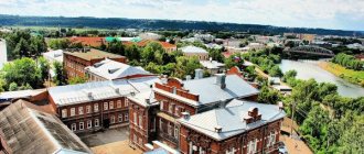
Nizhny Tagil is a cultural and industrial center of the Urals
The central place in the economy of Nizhny Tagil is occupied by industry related to metallurgy. The city is famous for the construction of carriages, design bureaus, and production of metal structures, thermal insulation products, and industrial ventilation. On its territory there are various factories engaged in the following activities:
- production of knitted products;
- oil refining;
- furniture production;
- ice cream production;
- release of flanges.
Despite the fact that a number of enterprises have gone bankrupt in recent years, the city remains a major industrial center directly related to the defense industry.
The authorities of Nizhny Tagil are striving to develop tourism, with the main emphasis being on nature. The region where the city is located is picturesque and worth a visit. The list of parks is significant, the main one of which is the Bondin Central Park of Culture and Recreation. There are many museums at the disposal of travelers, most of which are dedicated to nature. The most interesting souvenirs that you can bring are trays. This is due to the development of lacquer painting, which has historical roots. Lovers of religious architecture will appreciate the large number of Orthodox churches and parishes. Now Nizhny Tagil constantly hosts exhibitions, most of them focused on defense and military equipment. Medicine, which is aimed at maintaining the working capacity of the population, is of great importance, because many city residents are factory workers. The large cities of the Urals are an example of industrialization on a national scale. They are not as large in area as many megacities, but they provide the region with significant income.
Where is the Urals located on the map of Russia
The Urals are located simultaneously in the Asian and European sides of the world. The mountains stretch from the very North to the southern Kazakhstani regions, and their length is 2500 km. The mountains themselves are a system of massifs and ridges of different heights, the peak reaches 1700 m, and the lowest point 600 m.
The Urals are divided into:
- Southern Urals (Bashkortostan, Kurgan, Chelyabinsk and Orenburg) . Here the steppe gives way to forest.
- Middle Urals (Sverdlovsk and Perm) . There is taiga and forest everywhere.
- Northern, Subpolar and Polar Urals (Nenets Autonomous Okrug and Komi Republic) . In these areas, the taiga gives way to tundra.
The area of the Urals is 781.1 thousand km2, which is 4.5% of the area of Russia.
Characteristics of the Ural economic region
The position of the Urals can be briefly described. It is located in an advantageous region in terms of economics. Nearby are areas with reserves of raw materials, on the other side are areas of greatest production and consumption.
It is also economically beneficial to maintain trade relations with Asian countries. Therefore, in Russia the Urals rank second in economic importance.
The area of the Urals is 824,000 km².
Regions and districts that are part of:
see also
- Sverdlovsk region
- Cities of Russia
| Cities by regions of Russia | |
| Cities of the North-West (NWFD) | St. Petersburg (and its cities) • Leningrad region (historical Staraya Ladoga) • Arkhangelsk region • Vologda region • Kaliningrad region • Karelia • Komi • Murmansk region • Nenets Autonomous Okrug • Pskov region |
| Cities of the Volga region (Volga Federal District) | Bashkortostan • Volgograd region • Kalmykia • Kirov region • Mari El • Mordovia • Nizhny Novgorod region • Orenburg region • Penza region • Perm region • Samara region • Saratov region • Tatarstan • Udmurtia • Ulyanovsk region • Chuvashia |
| Cities of Southern Russia (SFD) | Sevastopol (including Inkerman) • Republic of Crimea • Adygea • Astrakhan region • Krasnodar region • Rostov region |
| Cities of the North Caucasus (NCFD) | Dagestan • Ingushetia • Kabardino-Balkaria • Karachay-Cherkessia • North Ossetia - Alania • Stavropol Territory • Chechen Republic |
| Cities of the Urals (Ural Federal District) | Kurgan region • Sverdlovsk region • Tyumen region • Khanty-Mansi Autonomous Okrug - Yugra • Chelyabinsk region • Yamalo-Nenets Autonomous Okrug |
| Cities of Siberia (Siberian Federal District) | Altai Republic • Altai Territory • Irkutsk Region • Kemerovo Region • Krasnoyarsk Region • Novgorod Region • Novosibirsk Region • Omsk Region • Tomsk Region • Tyva • Khakassia |
| Cities of the Far East (FEFD) | Amur Region • Buryatia • Jewish Autonomous Region • Trans-Baikal Territory • Kamchatka Territory • Magadan Region • Primorsky Territory • Sakha (Yakutia) • Sakhalin Region • Khabarovsk Territory • Chukotka Autonomous Region |
| see also | Cities of the DPR, LPR, Transnistria, South Ossetia • Regions of Russia • Cities of Russia |
Content
2 Large cities 250-500 thousand people
- 2.1 Nizhny Tagil
3 Large cities 100-250 thousand people
- 3.1 Kamensk-Uralsky
3.2 Pervouralsk 4 Medium-sized cities 20-100 thousand people
- 4.1 Serov
4.2 Novouralsk 4.3 Verkhnyaya Pyshma 4.4 Asbest (city) 4.5 Polevskoy 4.6 Revda 4.7 Krasnoturinsk 4.8 Berezovsky 4.9 Lesnoy 4.10 Verkhnyaya Salda 4.11 Kachkanar 4.12 Krasnoufimsk 4.13 Alapaevsk 4.14 Rezh 4.15 Irbit 4.16 Tavda 4.17 Sukhoi Log 4.18 Artyomovsky 4.19 Bogdanovich 4.20 Kushva 4.21 Zarechny (Sverdlovsk region) 4.22 Karpinsk 4.23 Severouralsk 4.24 Kamyshlov 4.25 Nevyansk 4.26 Krasnouralsk 4.27 Sredneuralsk 4.28 Sysert 4.29 Nizhnyaya Tura 4.30 Kirovgrad 5 Small towns up to 20 thousand people
- 5.1 Nizhnyaya Salda
5.2 Turinsk 5.3 Ivdel 5.4 Degtyarsk 5.5 Talitsa 5.6 Aramil 5.7 Novaya Lyalya 5.8 Verkhniy Tagil 5.9 Nizhniye Sergi 5.10 Mikhailovsk (Sverdlovsk region) 5.11 Verkhnyaya Tura 5.12 Volchansk 5.13 Verkhoturye 6 See also
Data by year
If we compare the data on the population of the Sverdlovsk region by year, we can see that since 1959 the number of residents has changed relatively little. So, in the named year, just over 4 million people lived in the region, whereas in 1970 more than 4 million 300 thousand people already lived here. The maximum number of inhabitants was recorded between 1979 and 1994. starting from 1995 the number of people begins to gradually decrease:
- 1995 – 4678975;
- 1996 – 4660022;
- 1997 – 4641304;
- 1998 – 4625057;
- 1999 – 4607587;
- 2000 – 4577515;
- 2001 – 4545942.
As you can see, Perestroika and the 1990s. did not have a significant impact on the population. The minimum number of residents was recorded in 2011 – 4,297,227 people. The current demographic situation can be compared with 1970, as discussed above, although in terms of the number of newborns, 2022 is still inferior to 1970. In 1970, 14.5 babies were born per 1000 people, and in 2022, slightly more than 13. By comparison, in 1979, almost 17 babies were born. The decreased birth rate is observed against the background of increasing mortality. If in 1970 about 8.4 people died per 1000 thousand people, then in 2022 this figure almost doubled.
Important! Most people died between 2000 and 2004. Per 1000 people in 2003
there were 17.3 deaths with 10.4 newborns.
Parks, entertainment and more
Ski centers of Ekaterinburg
- GRK "Uktus" - Ekaterinburg, st. Winter, 27/1. There are five ski slopes ranging from 400 to 1200 meters in length. The height difference is from 50 to 100 meters. Equipment rental - from 100 to 500 rubles.
- VGC "ZimaGor" - Ekaterinburg, Sibirsky Trakt, 2. The cost of classes with an instructor will cost from 500 to 14,400 rubles. To ski independently, you need to purchase passes from 3 thousand rubles.
- Mount Deciduous - EKAD, 23 km. Offers 4 tracks with a height difference of 70.5 meters, length from 150 m to 8 km (ski). Rental of various equipment - from 70 to 500 rubles per hour.
- GLC "Park Iset" - Verkhnyaya Pyshma. 3 tracks for skiing, snowboarding and tubing. Equipment rental - from 100 to 1350 rubles.
Hot Springs
- “Baden-Baden Emerald Coast” - Sverdlovsk region, Rezh, st. Lenina, 118. Equipped complex with thermal pools.
- "Spring" - Sverdlovsk region, Tavda, st. Zavodskaya, 80. Hotel complex with an open-air thermal pool.
- “Watercolor” - Sverdlovsk region, Turinsky district, Vodoistochnik village. Mineral hot water was discovered in the 50s. while searching for oil.
- “Baden-Baden Forest Tale” - Chelyabinsk region, village of Etkul. In addition to a swimming pool with mineral water, there are water attractions, recreation areas, and a cafe.
- "Thermal Baths Alexandria" - Chelyabinsk region, village of Pechenkino. The basis of the complex is Lake Gorkoye.
- “Verkhniy Bor” - Tyumen region, Tyumen, 11 km of Salairsky tract, 1. The complex consists of three thermal bowls on the shore of Lake Krivoye.
- “Sosnovy Bor” - Tyumen region, Tyumen, 27 km. Yalutorovsky tract, page 1. Hot spring enriched with minerals.
- "Avan" - Tyumen region, village. Kamenka, st. Mira, 4, building 2. The water temperature in the pools remains at 45 degrees in both summer and winter.
- “Sovetsky” - Tyumen region, Tyumen district, 35 km of the Salairsky tract. The water temperature is kept at 38-46 degrees.
- "Yar" - Tyumen region, Tyumen, Yar village, st. Source, 6, building 1. The closest open-air hot spring to Tyumen.
- "Baden-Baden" - Kurgan region, Ketovsky district, European village. The complex includes a children's and two adult areas. The water temperature does not exceed 40 degrees.
- “7 and I” - Kurgan region, Kurgan, Karbysheva street, 33B, building 2. In addition to hot mineralized water, there are massage facilities.
Mini-zoo "Noah's Ark"
Address: Tyumen region, Ishim, st. Kurganskaya, 83 Phone: +7 34551 2‑63-60, +7 908 870‑32-69 Opening hours: Mon, Wed, Fri, Sat, Sun 13:00-18:00 Cost: 100 rubles
The zoo opened in 2014. The collection of animals is small: a white camel, a tame fox, a mink, several poultry and a pelican.
Almost all inhabitants can be petted or picked up.
Reindeer farm in Visim
Address: pos. Visim, Sverdlovsk region Telephone: Cost: 50 rubles, children under 7 years old - free
The nursery contains sika deer, deer, Yakut horses, goats, pigs, as well as several species of birds.
Animals can be fed: what products can be checked with the farm staff.
If you have not yet chosen where you will live and want to save money when booking, we recommend using the RoomGuru service. Firstly, it contains hotels, apartments and guest houses from many different booking systems, so you won’t miss out on a worthwhile option. Secondly, you can immediately compare prices for one place in different services and book where it is cheaper (this is not always Booking!).
Content
Cities of the Rostov region: list by population
2 Large cities 250-500 thousand people
- 2.1 Nizhny Tagil
3 Large cities 100-250 thousand people
- 3.1 Kamensk-Uralsky
3.2 Pervouralsk 4 Medium-sized cities 20-100 thousand people
- 4.1 Serov
4.2 Novouralsk 4.3 Verkhnyaya Pyshma 4.4 Asbest (city) 4.5 Polevskoy 4.6 Revda 4.7 Krasnoturinsk 4.8 Berezovsky 4.9 Lesnoy 4.10 Verkhnyaya Salda 4.11 Kachkanar 4.12 Krasnoufimsk 4.13 Alapaevsk 4.14 Rezh 4.15 Irbit 4.16 Tavda 4.17 Sukhoi Log 4.18 Artyomovsky 4.19 Bogdanovich 4.20 Kushva 4.21 Zarechny (Sverdlovsk region) 4.22 Karpinsk 4.23 Severouralsk 4.24 Kamyshlov 4.25 Nevyansk 4.26 Krasnouralsk 4.27 Sredneuralsk 4.28 Sysert 4.29 Nizhnyaya Tura 4.30 Kirovgrad 5 Small towns up to 20 thousand people
- 5.1 Nizhnyaya Salda
5.2 Turinsk 5.3 Ivdel 5.4 Degtyarsk 5.5 Talitsa 5.6 Aramil 5.7 Novaya Lyalya 5.8 Verkhniy Tagil 5.9 Nizhniye Sergi 5.10 Mikhailovsk (Sverdlovsk region) 5.11 Verkhnyaya Tura 5.12 Volchansk 5.13 Verkhoturye 6 See also
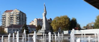
Ekaterinburg is a diverse metropolis
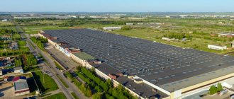
Ekaterinburg occupies an important position and is considered one of the largest centers in the world, the basis of which is the industrial sector. The city's gross product is constantly growing, and by 2025 it is expected to reach $40 billion, according to calculations by the research organization McKinsey Global Institute. The volume of Yekaterinburg's economy is so large that its pace is ahead of many large cities, equal to Moscow and St. Petersburg.
The industry of Yekaterinburg has developed since the 18th century. The main type is heavy engineering. The city still retains its specialization, with more than 200 enterprises located on its territory. Moreover, some of them work for the needs of the defense complex. The metropolis has acquired considerable importance as a tourist center. The flow of tourists is growing every year, which is due to the large number of attractions. There are several architectural monuments here, among which the most famous are:
- Sevastyanov's House;
- Rastorguev-Kharitonov estate;
- Tarasov's estate.
The historical center has amazing beauty. Yekaterinburg can safely be called the capital of the Urals, because the list of leisure ideas here is unusually large.
Climate
The Urals are remote from the seas and oceans, so its climate is continental. The region is characterized by sharp temperature changes, sometimes even within a day.
This is due to constantly alternating warm and cold air currents. The wind from the Arctic often brings frost, and the dry southern wind brings warmth. The movement of winds from the west is hindered by the Ural Mountains.
The average temperature in winter varies from -17℃ to -20℃. The average temperature in summer is +19℃. There is a lot of precipitation, especially in mountainous regions.
The Urals are located in the following climatic zones:
- arctic;
- subarctic;
- moderate.
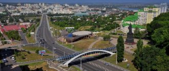
Kurgan is a developed industrial city
The industry of a large city remains in first place. It is more attractive to specialists from various industries than to tourists. Although the city is notable in terms of tourism. Mechanical engineering and metalworking are the main types of industry; in recent years, great emphasis has been placed on the development of the production of medical equipment.
Kurgan is also becoming one of the important pharmaceutical centers; the Velpharm enterprise plans to produce over 60 different drugs. There are 6 research institutes located on the territory of Kurgan. Design bureaus occupy a central place in the engineering sector. It was thanks to the Kurgan physician Ilizarov that a unique and universal treatment method was obtained, which makes it possible to treat pathologies of large joints without serious surgical intervention, use a non-transplantation method of treatment to replace bone defects, and treat complex fractures regardless of location. This technique is used in many countries around the world. Kurgan can be called a city of monuments - their list is really long. Museums, cultural parks, theaters and libraries will help diversify cultural leisure. Orthodox churches are of significant value; there is also a Muslim cathedral mosque in Kurgan.
see also
- Sverdlovsk region
- Cities of Russia
| Cities by regions of Russia | |
| Cities of the North-West (NWFD) | St. Petersburg (and its cities) • Leningrad region (historical Staraya Ladoga) • Arkhangelsk region • Vologda region • Kaliningrad region • Karelia • Komi • Murmansk region • Nenets Autonomous Okrug • Pskov region |
| Cities of the Volga region (Volga Federal District) | Bashkortostan • Volgograd region • Kalmykia • Kirov region • Mari El • Mordovia • Nizhny Novgorod region • Orenburg region • Penza region • Perm region • Samara region • Saratov region • Tatarstan • Udmurtia • Ulyanovsk region • Chuvashia |
| Cities of Southern Russia (SFD) | Sevastopol (including Inkerman) • Republic of Crimea • Adygea • Astrakhan region • Krasnodar region • Rostov region |
| Cities of the North Caucasus (NCFD) | Dagestan • Ingushetia • Kabardino-Balkaria • Karachay-Cherkessia • North Ossetia - Alania • Stavropol Territory • Chechen Republic |
| Cities of the Urals (Ural Federal District) | Kurgan region • Sverdlovsk region • Tyumen region • Khanty-Mansi Autonomous Okrug - Yugra • Chelyabinsk region • Yamalo-Nenets Autonomous Okrug |
| Cities of Siberia (Siberian Federal District) | Altai Republic • Altai Territory • Irkutsk Region • Kemerovo Region • Krasnoyarsk Region • Novgorod Region • Novosibirsk Region • Omsk Region • Tomsk Region • Tyva • Khakassia |
| Cities of the Far East (FEFD) | Amur Region • Buryatia • Jewish Autonomous Region • Trans-Baikal Territory • Kamchatka Territory • Magadan Region • Primorsky Territory • Sakha (Yakutia) • Sakhalin Region • Khabarovsk Territory • Chukotka Autonomous Region |
| see also | Cities of the DPR, LPR, Transnistria, South Ossetia • Regions of Russia • Cities of Russia |
Story
The Sverdlovsk region became a subject of the Russian Federation relatively recently. But this territory was inhabited in ancient times. Archaeologists have found multiple sites of ancient man, indicating that the first people lived in these lands back in the Paleolithic era, as well as the Iron Age.
In 1780 and 1796, two provinces were formed - Tobolsk and Perm and 6 counties were allocated. As a separate administrative unit, the Sverdlovsk region was formed after its separation from the Ural region in 1934. In 1938, another division was made, as a result of which the territory received an almost modern appearance. During the Second World War, more than 200 enterprises were evacuated to the Sverdlovsk region and continued their work here. During the Soviet era, the country's largest metallurgical, pipe and copper smelting plants were built here. The construction of these major giants contributed to the influx of workers.
see also
- Sverdlovsk region
- Cities of Russia
| Cities by regions of Russia | |
| Cities of the North-West (NWFD) | St. Petersburg (and its cities) • Leningrad region (historical Staraya Ladoga) • Arkhangelsk region • Vologda region • Kaliningrad region • Karelia • Komi • Murmansk region • Nenets Autonomous Okrug • Pskov region |
| Cities of the Volga region (Volga Federal District) | Bashkortostan • Volgograd region • Kalmykia • Kirov region • Mari El • Mordovia • Nizhny Novgorod region • Orenburg region • Penza region • Perm region • Samara region • Saratov region • Tatarstan • Udmurtia • Ulyanovsk region • Chuvashia |
| Cities of Southern Russia (SFD) | Sevastopol (including Inkerman) • Republic of Crimea • Adygea • Astrakhan region • Krasnodar region • Rostov region |
| Cities of the North Caucasus (NCFD) | Dagestan • Ingushetia • Kabardino-Balkaria • Karachay-Cherkessia • North Ossetia - Alania • Stavropol Territory • Chechen Republic |
| Cities of the Urals (Ural Federal District) | Kurgan region • Sverdlovsk region • Tyumen region • Khanty-Mansi Autonomous Okrug - Yugra • Chelyabinsk region • Yamalo-Nenets Autonomous Okrug |
| Cities of Siberia (Siberian Federal District) | Altai Republic • Altai Territory • Buryatia • Trans-Baikal Territory • Irkutsk Region • Kemerovo Region • Krasnoyarsk Region • Novgorod Region • Novosibirsk Region • Omsk Region • Tomsk Region • Tyva • Khakassia |
| Cities of the Far East (FEFD) | Amur Region • Jewish Autonomous Okrug • Kamchatka Territory • Magadan Region • Primorsky Territory • Sakha (Yakutia) • Sakhalin Region • Khabarovsk Territory • Chukotka Autonomous Okrug |
| see also | Cities of the DPR, LPR, Transnistria, South Ossetia • Regions of Russia • Cities of Russia |