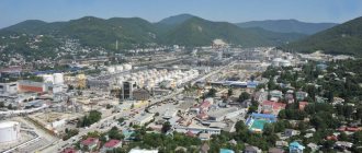
The futuristic flourishes of the architecture of the Chechen capital take the lion's share of tourists' attention, imagining a kind of Caucasian metropolis. This is undoubtedly true, but the rest of the territory of mountainous Chechnya is more like a medieval open-air museum. There are no wide avenues or urban landscapes here: here the ancient tower cities of the Vainakhs argue among themselves for a place in the sun, and the picturesque mountain crevices dictate their laws to the residents.
The easiest and most convenient way to travel through the mountains of Chechnya is as part of jeep tours. There are many road routes across the republic that are convenient for individual and group tourism. “Travel with the Russian Geographical Society” project offers to attend the active tour “Five Days in Chechnya” with the operator RussiaDiscovery or go on an independent adventure along the route developed by the “Visit the Caucasus” foundation. Let's talk about the five most historically and picturesquely rich destinations for active recreation in Chechnya.
Kezenoy-Am. Sea in the Caucasus mountains
Direction: east What to see: mountain lake, sports complex, medieval village of Khoy, Aldam Gezi fortress
abdullah_bersaev_ozero_kezenoy_am_v_utrennih_luchah_osennego_solnca.-566722.jpg
Even in summer, the lake water warms up only to 18 degrees.
Photo: Abdullah Bersaev, participant in the photo competition of the Russian Geographical Society “The Most Beautiful Country” The widest and deepest lake in the North Caucasus is hidden in the palms of the mountains at an altitude of one and a half kilometers above sea level. Like many things here, its origin is shrouded in ancient legends, reminiscent of the myths of the Great Flood. They tell how an angel who descended to earth to test the mountain people was disappointed by their ignorance and cruelty. In anger, he caused an earthquake with downpours: the village perished, and in its place was left a clean and bottomless pool. Some of these legends actually happen: Kezenoy-Am, which means “blue lake”, was formed as a result of a landslide about seven centuries ago, and the depth of some of its crevices is still unknown. For its beauty and grandeur, the locals call Kezena-Am the Andean Sea, in honor of one of the indigenous peoples of these mountains. It is difficult to say whether there was once an aul on the site of the lake; one thing remains indisputable: the healing properties of air and water attract travelers from everywhere.
A sports and training complex, a hotel, houses for families have been built on the shore, and a variety of leisure activities are provided. In winter, the water in the lake freezes, providing access to fishermen and ski enthusiasts.
In the mountains around Kezenoy-Am you can find many abandoned settlements of Nakh teips - ancestral medieval settlements characteristic of the Chechens and Ingush. The division into clans has been preserved to some extent today: such a community protects members of an ethnic group from outside influence and generally contributes to the preservation of national identity. Initially, each teip had its own name, inherited from the ancestor, its own mountain, a tower erected by the ancestor, a leader with a council of elders and a set of rules, and even its own deity. The cult of tower complexes, the main element of Vainakh architecture, has acquired impressive proportions: similar military buildings from the early Middle Ages can be found in almost every mountain village. Construction was preceded by special magical rituals, and the towers themselves were decorated with paintings of ritual petroglyphs.
12 year battle
Mount Tebulosmta is associated with a legend about the confrontation between local tribes and the Tatar-Mongols, which lasted 12 years. Indeed, in the 13th century, a decade and a half before the conquest of Kievan Rus, the horsemen of Jebe and Subedei invaded the territory of the Caucasus. The 12-year siege of a mountain in the Caucasus by nomads was mentioned by the Franciscan monk Plano Carpini, who traveled to the khan’s court. According to the testimony of eastern authors, the Alans resisted the steppe inhabitants, but it is more likely that these were the ancestors of the Chechens. An old resident of the village of Gelestanzhid, Arzgiri Khazitov, in the middle of the 20th century, telling a legend, said that the sight of enemy hordes frightened people so much that they decided to wait out the invasion high in the mountains. According to another hypothesis, this was a tactical maneuver: the Chechens planned not to sit on the mountain, but to attack the Mongols, making rapid descents.
First, the mountaineers sent a reconnaissance detachment of 12 young warriors to the top under the command of the experienced hunter Idig. But almost all of them died as a result of an avalanche. Only the second detachment was able to reach the top, after which the remaining members of the tribe left along the beaten path to the top. The journey took about a month. But people still had to adapt to life in the highlands. Tradition says that the Chechens built fortifications right on the top. This probably means the zone at the very edge of the glaciers - they could hardly have settled higher.
A month later, hordes of Mongols approached the mountain. At night, the Chechens came down and threw stones at the aliens. “The first siege lasted a month,” said Khazitov. “But then the snow fell, and the enemies went south. The next year, with the onset of summer, they came again. And again they failed to capture the mountain on which the brave Chechens settled. This went on for twelve years. And only when the brave men had no water, no food and not a single arrow left, the enemy captured Tebulosmta.” The most interesting thing is that the legend mentions the names of Mongol military leaders - Subed, Menga and Sarta. These are distorted names of the real-life Subedei, Mengu and Sartak.
03_harachoyskaya_boevaya_bashnya-_ivan_kuznecov-520716.jpg
Once feared, the battle towers now hide like silent ghosts in the mist of the mountains.
Photo: Ivan Kuznetsov, participant in the photo competition of the Russian Geographical Society “The Most Beautiful Country” The lake is divided almost in half by the border of two republics - Chechnya and Dagestan, on both sides - a scattering of ancient villages. On the Chechen side, the most famous is the city of Khoy guards: ruins with 11th-century petroglyphs and military signal towers have been preserved here. According to legend, it was here that the few who escaped the earthquake in Kezenoy-Am moved to this place.
Translated from Chechen, “khoy” means “guard,” which was probably due to the part of the Great Silk Road that passed here, as well as the advantageous strategic position on a steep cliff directly above the gorge on the right bank of the Ansalta River. In addition to the towers, almost every hut-house had narrow windows in the style of loopholes, from which it was convenient to defend in case of a threat. Today the village has received the status of a historical and architectural complex; they are trying to restore it and make it a center of attraction for tourists. Among the monuments, two towers, a mosque and a madrasah have been preserved.
10 kilometers south of Khoy there are the ruins of the Aldam-Gezi fortress in the village of Kezenoy, which dates back to the 12th century. The castle complex consists of a citadel, a mosque and a tower of Daoud. Petroglyphs depicting hunting scenes and ritual ornaments can be seen on the rock ledges and stonework. The ruins of old buildings are lost in the tall grass among the mountain passes, but the abandoned appearance will not last long - the fortress is also planned to be restored.
Argun Gorge. Business card of the Chechen Republic
Direction: southwest What to see: Shatoi village, Nihaloi waterfalls, Ushkaloi towers, Itum-Kali, Phakoch castle, Tsoi-Pede necropolis
CHECHNYA. Legends of Mount Tebulosmta (Video)
CHECHNYA.
The peak of Tebulosmta is the highest point in Chechnya and the entire Eastern Caucasus. Its height is 4492 m. The name of the mountain is Georgian (Tebulos-mta), but it is believed that it is based on the name of the once existing Chechen village of Tebula. According to another version, the name was formed from the names of the ancestors of the Chechen people. In Chechen the peak is called Tula-lam. There are other names for the mountain - Dakokh-korta and Bashlam.
There is a legend associated with Mount Tebulosmta
about the confrontation between local tribes and the Tatar-Mongols, which lasted twelve years. Indeed, in the 13th century, a decade and a half before the conquest of Kievan Rus, the major Mongol military commanders Jebe and Subedei, on the direct orders of Genghis Khan, invaded the territory of the North Caucasus. The twelve-year siege of a mountain in the Caucasus by nomads was mentioned back in the 13th century by the Franciscan monk Plano Carpini. But the old-timer with. Elistanzhi Arzgiri Khazitov, in the middle of the 20th century, telling a legend, said that the highlanders decided to sit high in the mountains - it was a tactical maneuver: the Chechens planned to attack the Mongols, making rapid descents. “At first, the mountaineers sent a reconnaissance detachment of twelve warriors to the top under the command of the hunter Idig, but almost all of them died as a result of an avalanche. Only the second detachment was able to reach the top, after which the rest of the tribe followed the beaten path to the top. The journey took about a month.”
Tradition says
that the Chechens built fortifications right on the top.
This probably means the zone at the very edge of the glaciers - they could hardly have settled higher. “A month later, hordes of Mongols approached the mountain. At night, the Chechens came down and threw stones at the aliens. The first siege lasted a month, Khazitov said. Soon snow fell and the invaders fled south. The next year, with the onset of summer, they came again. Once again they failed to capture the mountain. This went on for twelve years. And only when the brave men had no water, no food and not a single arrow left, the enemy captured Tebulosmta.” Note.
The legend mentions the names of Mongol military leaders - Subed, Menga and Sarta. These are distorted names of the real-life Subedei, Mengu and Sartak.
Interesting fact.
In 1967, scientist and publicist N. Krasnov published an article in the magazine “Around the World” in which he mentioned that while climbing Tebulosmtu at an altitude of 3 thousand meters, a group of climbers discovered a broken spear and several arrowheads. There is nothing incredible about this. Science knows, for example, the mummy of the “ice” man Ötzi, who froze in the Alpine mountains about 5275 years ago. So it is possible that the bodies of the ancient warriors will eventually be found and lowered down. Moreover, there is very great interest in Mount Tebulosmta in Chechnya. Chechen climbers conquered Tebulosmta for the first time in 2022. This was done by instructors from the Russian University of Special Forces from Gudermes. New ascents and new discoveries are likely to follow soon.
L. Gudaev
checheninfo.ru
04_pyat-day-v-chechne-15_1612961728.jpg
Several hundred architectural monuments of the Middle Ages have been preserved in the gorge.
Photo courtesy of the tour operator RussiaDiscovery The canyon of the Argun River has collected many Nakh monuments under its slopes: ancient defensive towers and tower settlements that once protected caravans traveling from Georgia to Chechnya, family tombs and castles. All historical artifacts were united into the Argun Museum-Reserve, which included almost all the lands of Southern Chechnya. The road, almost 150 kilometers long, laid at the bottom of the gorge between steep cliffs, delighted poets. In former times, military installations could be seen here at almost every turn right up to the border with Georgia, which is why this place was nicknamed the Gorge of Towers.
The first object of the reserve is located opposite the old village of Shatoy - a five-story battle tower 20 meters high. Once upon a time there were two towers here; according to legend, they were built by two brothers who could not share their beloved, and the younger one pierced the older one with an arrow. It is his tower that still stands today. It is surrounded on four sides by machicolations—mounted loopholes.
In the most picturesque place among the mountains you can find a cascade of 12 Nihaloi waterfalls - a small mountain stream literally cuts through a stone wall and falls like a picturesque veil from a height of more than 30 meters. To see the most beautiful waterfalls, you need to ford the river. In winter, the water freezes, turning into fabulous sheets of ice.
A little further away, in one of the narrowest places of the gorge, the Ushkaloy twin towers have grown into its slopes - four-story guards, covered on top by the Selin-Lam rock, guarding the gorge for a thousand years. Here they collected a toll for passage, and also reported on the enemy’s advance.
Mount Amir-Kort
It is also located in the Nozhai-Yurt region, on the very border with Dagestan. The height of the mountain is just over one kilometer. As the legends say, the mountain got its name from the mythical warrior Amir, who was the Caucasian prototype of Prometheus. Mount Amir-Kort has a very rich flora and fauna. On its picturesque emerald slopes live wild boars, chamois, golden eagles, and beautiful and rare plants grow.
01_pyat-day-v-chechne-16_1612961729.jpg
One of the battle towers of the Tsoi-Pede necropolis.
Photo courtesy of the tour operator RussiaDiscovery A little to the south, where the mountains part as if in a sign of truce, lies the small village of Itum-Kali, famous for the medieval castle preserved here. Several ancient towers, a mosque and an apiary have been preserved in the village; there is a local history museum in the fortress. The castle is well preserved; moreover, it was recently restored, and now it reminds of the traditional life of the highlanders. The citadel, surrounded by a high wall, contains towers, a water mill and residential buildings dating back to the 10th century. Traditionally, petroglyphs can be found on stone walls. During the reconstruction, a stylized mosque with a greenish minaret was erected here. The museum exhibits utensils, photographs, paintings, national costumes and weapons.
Perhaps the most mystical attraction of these mountains is the medieval necropolis of Tsoi-Pede, upstream of the Argun River, in the upper reaches of the Malkhistinsky Gorge. This is not just a cemetery, but a real city of the dead: the entrance here is guarded by two pagan altars with ritual symbols of swastikas and solar circles, behind them are about 40 crypts dating from the 5th to 14th centuries. It is interesting that these crypts in their structure resemble ancestral towers, only much smaller in height. Tsoi-Pede is the largest burial ground in the Caucasus after the Ossetian Dargavs. On the territory there are a pair of battle towers that control the gorge, with symbols unusual for these places. The name Tsoi-Pede itself translates as “city of the deity” - even in the pre-Islamic period, fire and the sun were worshiped here. According to legends, warriors from all over the area gathered in this sacred place once a year, and the last one to arrive would face execution. Today this place is located in the border zone, so you won’t be allowed here without a Russian passport.
Veduchi. Mecca for skiers
Direction: south What to see: all-season resort, ski slopes, instructor school, year-round ski lifts
About the mountainous regions of Chechnya
The highest and most beautiful mountains are located in the south of Chechnya - this is part of the Caucasus ridge.
Most of them are very difficult to reach, but those who succeed will be rewarded with the opportunity to see magnificent landscapes and be alone with nature. There are several mountain systems in Chechnya that were formed from the rapid flow of rivers. The four mountain ranges of the Caucasus Mountains run almost parallel. These are the Black Mountains, and the Pasture, Side, Rocky ridges.
The Black Mountains are covered with black soil, they are low, up to 1200 meters. Forests, fruit trees, flowers, herbs grow in the fertile land, and cattle graze on water meadows.
The ridges that are located to the south are much higher. The Pastishchny Ridge runs through the central part of the republic. And along the southern border of Chechnya, in the territory of Itum-Kalinsky and Sharoysky districts, stretches the Side Range, the peaks of which are the most inaccessible and highest. This part of the Chechen mountains is especially appreciated by climbers, and it is here that the most beautiful places are found.
aleksandr_anpilov_ot_zakata_do_rassveta._veduchi-440981_veduchi.jpg
Panorama of the slopes of the resort.
Photo: Alexander Anpilov, participant in the photo competition of the Russian Geographical Society “The Most Beautiful Country” The all-season tourist and recreational complex is a Mecca under construction for all lovers of ski holidays. It is located a two-hour drive from Grozny, through the Argun Gorge, on the slopes of the Daneduk ridge. The resort infrastructure is being created jointly with French companies, the same ones that participated in the construction of Arkhyz. The plans are to create a worthy competitor to the overcrowded Dombay and Elbrus regions during the season. The final completion of all work here is planned for 2025, but most of the facilities have already been put into operation. Snow lies here from November to April.
A year-round four-seater chairlift with a detachable clamp for 850 meters will take you to the northern part of the slope, to the beginning of the “blue” route, about a kilometer long and with drops of up to two hundred meters, with an artificial snow system and lighting. For beginner skiers, there is a baby lift on the training slope; for young athletes, there is a children's park with a travelator - a belt lift. Those wishing to improve their skills will be offered to contact the school of instructors “PikVeduchi”; all equipment can also be rented.
aleksandr_safronov_pervye_luchi_solnca_v_gorah_kavkaza_-497409_veduchi.jpg
In the district, the highest points of the republic are the four-thousanders Maistismta, Komito, Diklosmta and Tebulosmta.
Photo: Alexander Safronov, participant of the Russian Geographical Society photo competition “The Most Beautiful Country” However, the uniqueness of the Veduchi resort is that it has the world’s longest all-season ski slope with artificial turf Neveplast, made in Italy, which is also suitable for beginners.
The records will not end there: by the 2022/23 winter season, guests will have eight kilometers of slopes, two more cable cars - a chairlift and a gondola type 3S, which will connect two opposite slopes and will transport tourists over the gorge in modern wind-resistant cabins with the feeling of floating in the air , there are only 10 of these in the world so far. In total, by 2025 there are plans to create 19 tracks of varying difficulty levels.
Two hotels have already been opened on the territory - the three-star Edelweiss and the Chechenski, stylized as the medieval towers, with restaurants, a swimming pool and a hammam. There is plenty of entertainment here even in the summer: the center offers ATV rentals, a bike park with two tracks of different difficulty levels, as well as an all-season extreme hill for tubing.
Galanchozh. Cradle of the Chechen people
Direction: west What to see: mountain lake, army turned into stones, Terloi gorge, tower complexes Nikaroy, Motsaroy, Oshni tract, Kirda tower
pavel_zhigalov_gornoe_ozero.-532559_galanchozh.jpg
Depending on the lighting, the surface of the lake is painted in green-blue watercolor tones.
Photo: Pavel Zhigalov, participant in the photo competition of the Russian Geographical Society “The Most Beautiful Country” Galanchozh is a historical region in the southwest of Chechnya, the most remote, and therefore unpopular among tourists. According to legend, this is where the ancestral home of the Chechens is located: from these places came the indigenous teips, who later formed the Chechen people. At an altitude of 1500 meters, at the foot of Mount Verg-Lam lies a picturesque lake of a regular oval shape, surrounded by alpine meadows and green slopes of the Old Caucasus. Many legends have developed around Lake Galanchozhskoe, describing its origin, the edifying meaning of which boils down to the triumph of nature over the limitations of human passions.
Not far away, on the slopes of the Pasture Ridge, a stone army stood on eternal guard - a group of pointed remains, lined up like hundreds of soldiers before an important battle. And here local folklore comes to our aid, telling about a group of warriors who received the task of kidnapping the most beautiful girl in the mountains, who turned out to be a witch and turned them into stone idols.
Bald Mountain
In Chechnya, it is most famous among the rest due to the fact that it became a site of military operations. In 1995, on April 18, the Rosich special forces diverted the attention of a group of militants numbering several thousand, thereby saving an operational brigade from death, carrying out an assault on Bamut at height 444. The mountain is located in the Achkhoy-Martan region, near the village of Bamut. In an overgrown clearing, in a grove, not far from the village, there is a cross to the officers executed here. It is not marked on any map.
abdullah_bersaev_kamennoe_voysko-400739_galanchozh.jpg
Soldiers of the stone army.
Photo: Abdullah Bersaev, participant in the photo competition of the Russian Geographical Society “The Most Beautiful Country” Deeper in the mountains, in the Terloi Gorge, is located the best-preserved Nikarai tower complex, dating back to the 14th century. Two battle towers, a mosque, residential buildings and an old cemetery are located on a narrow rocky ridge, in the interfluve, and are closed on three sides by mountain ranges. Petroglyphs in the form of solar signs have been preserved on the arched vaults of the buildings. The complex terrain makes the complex as picturesque as it is difficult to visit.
The Terloi Gorge is rich in tower settlements. Here, in the Bara River valley, are the ruins of at least ten medieval settlements. One of the largest, the village of Motsaroy, is also interesting for its tower complex. According to local history researchers, the village was once a Christian center: one of the origins of the name Motsaroy is translated as “priest of the Christian church.” Later, with the advent of Islam, a mosque was built here. There are five towers preserved in the village - one military and four residential.
Half a kilometer to the south is hidden the dilapidated Oshni tract with the ruins of a tower complex. The place is interesting because of the ancient mosque from 1745, which was reconstructed several years ago, and a road was built to the settlement.
The ruins of ancient settlements can also be seen in the neighboring complexes - Kenakh, Goroy, Baroy, Eltpharoy. At the very beginning, the gorge is closed by a lonely dilapidated Kirda tower, which was used as a sanctuary.
Sharoy. The most ancient castle
Direction: southeast What to see: Sharo-Argun gorge, Tazbichi village, tower complexes Dyorsky, Etkalinsky, Khakmadoysky, Khimoysky, historical and architectural complexes Shikaroy and Sharoy
Confirmations of the legend
In 1967, scientist Nikolai Krasnov published an article in the magazine “Around the World” in which he mentioned that while climbing Tebulosmtu at an altitude of 3 thousand meters, a group of climbers discovered a broken spear and several arrowheads. Another participant, the writer Oleg Dzhurgaev, later spoke about the details of the expedition: “Here we found the corpses of people - Chechens and Mongols, with clear signs that they had died in battle.” There is nothing incredible about this. Science knows, for example, the mummy of the “ice” man Ötzi, who froze in the Alpine mountains about 5275 years ago after a skirmish with enemies. So it is possible that the bodies of the ancient warriors will eventually be found and lowered down. Moreover, there is very great interest in Mount Tebulosmta in Chechnya. Currently, the state television of the republic is completing the filming of the film “Contemplating the Wind,” dedicated to the confrontation between the Chechens and the Tatar-Mongols.
Chechen climbers conquered Tebulosmta for the first time in 2022. This was done by instructors from the Russian University of Special Forces. More ascents and new discoveries are likely to follow soon.
ramzan_davletmirzaev_sharoyskie_bashni-529504_sharoi.jpg
Sharoy towers at sunset.
Photo: Ramzan Davletmirzaev, participant in the photo competition of the Russian Geographical Society “The Most Beautiful Country” The highest mountainous region of Chechnya with picturesque cliffs along the Sharo-Argun River. The road leads here through the pass from Itum-Kali, from where magnificent views open up. The first complex on the way is the two Dyor towers of the village of Tazbichi, recognized as cultural heritage sites. The one that is closer to the highway is open to tourists: you can climb to the very top - from there you can see a panorama of the Argun Gorge. Translated from Persian, Dyor means “mountain pass” - the path that the towers guarded.
In the eastern part of the village there is another complex - Etkali, consisting of a restored battle tower and an ancient mosque with a minaret, also made in the usual form of a tetrahedral tower. The peculiarity of the Etkala monument is that, in addition to its military function, it was included in a bunch of signal watchtowers: from its top the message was transmitted to the Haskali and Khelda towers, and through them to the Bekhaili citadel.
The Khaskala battle tower, visible higher up the slope, is the oldest of the structures of the signal system, designed to provide warning in the event of an attack by nomads. The smoke from the fire lit at the top was visible throughout the area, and the warning was picked up by neighboring signal towers.
On a high cape formed by the tributaries of the Sharo-Argun River, the fortified settlement of Shikaroy, known today as the Shikaroy architectural complex, consisting of two dozen residential towers, is located in a dense ring. The combat ones have not survived to this day. It is interesting to explore the underground stone buildings with vaulted ceilings.
ramzan_davletmirzaev_senokos-529503_sharoi.jpg
It's haymaking time.
Photo: Ramzan Davletmirzaev, participant in the photo competition of the Russian Geographical Society “The Most Beautiful Country” The largest (and oldest in the republic) in these places, the Sharoi architectural complex is a real medieval fortress of seven military and 25 residential towers with defensive stone fortifications. The scale of the construction corresponded to the important political and economic role played by the settlement, erected at the intersection of the main routes from the Argun Gorge to Georgia and Dagestan. The citadel underwent extensive reconstruction and opened to the general public this summer. Inside the complex it is also planned to recreate the traditional life of the Chechen people. There is also an ancient mosque on the castle grounds. The nearby Khakmadoy and Khimoy settlements with the ruins of towers are also planned to be restored.
The ancient settlements are connected by the picturesque Sharo-Argun Gorge. The road here is carved into the rocks and squeezed on both sides by a canyon with a raging mountain river. Waterfalls add color to the picture, among which is the largest in the republic, Nokhchi-Keloysky.
Julia Gopius
Mountain strewn with crystal
From the point of view of geologists, Mount Tebulosmta belongs to the mountain range east of the Argun River, which is composed of Jurassic deposits - sandstones, clayey and slate shales. Meter-long blocks of rock crystal are found here. Although Tebulosmta is slightly lower than Elbrus (5642 m) and Kazbek (5033 m), it is also covered with a glacier. The name of the mountain is Georgian (Tebulos-mta), but it is believed that it is based on the name of the once existing Chechen village of Tebula. According to another version, the name was formed from the names of the ancestors of the Chechen people. In Chechen the peak is called Tula-lam, there are other names - Dakokh-korta, Bashloam.