Medium-sized cities 20-100 thousand people
Belogorsk (Amur region)
There are also other settlements with this name, see Belogorsk
Population 65,315 (2020). Railway junction at the intersection of the Trans-Siberian Railway with a branch to Blagoveshchensk.
Free
Population 54,017 (2020).
Tynda
Population 33,177 (2020). A large railway junction, the intersection of the Baikal-Amur and Amur-Yakut railways.
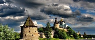
Zeya (city)
See also Zeya.
Population 22,984 (2020). The center of electric power industry - the large Zeya hydroelectric power station is located in the city.
Cities of the Amur region on the map
Using a map of the Amur region with cities and villages, you can find the following settlements:
- The main city of the region is Blagoveshchensk . It has an interesting layout and architectural appearance. Neighborhoods appear on the territory of the city.
- Tynda is considered an important railway junction . This city is considered the main point of the Baikal-Amur Mainline. It is located on the coast of the Tynda River. In the vicinity of the city there is taiga.
- One of the key cities in the region is Svobodny . Detailed maps of the Amur region allow you to find a settlement on the Zeya River. Geographically, the city is located in a zone of mixed forests. Near the city there are numerous lakes: Bolshanka, Zmeyka and Bardagonskoye.
- Taking with you a map of the Amur region with cities in good quality, you can find Belogorsk . This urban district contains only two settlements.
- Zeya is located on the Amur-Zeya Plain , in the foothills of the Tukuringra ridge. Important industries in the city are timber and gold mining.
- Shimanovsk is located on the Bolshaya Pera River . There is a Shimanovskaya station in the city, which belongs to the Trans-Baikal Railway. Near the city you can find a federal highway.
- Zavitinsk is considered one of the important cities . The city has a rectangular layout. It is divided into two parts. This is the railway district and the central one. There is a federal highway not far from the city.
Small towns up to 20 thousand people
Shimanovsk
Population 18,566 people (2020).
Raichikhinsk
Population 16,784 (2020).
Zavitinsk
Population 10,215 (2020).
Skovorodino
Population 8,943 (2020).
Tsiolkovsky
This name has other meanings, see Tsiolkovsky. See also Uglegorsk.
Population 7,188 (2020). A closed city for personnel serving the Vostochny cosmodrome. It received city status in 2015, and it included the former closed urban settlement of Uglegorsk.
Districts of the Amur region on the map
Using the capabilities of the map of the Amur region by district, you can find the central districts of the region.
- The region includes the Belogorsky district. The Khabarovsk-Chita highway passes through it, as well as an important railway line of the Trans-Siberian Railway.
- Mikhailovsky district also belongs to the Amur region. The village of Poyarkovo is considered its center.
- Tambov district is considered one of the central regions. Armed with a road map of the Amur region, you can quickly find it. There are more than 25 settlements in the region.
- The Skovorodinsky district borders the Trans-Baikal Territory. It includes more than 35 settlements.
- The Ivanovo district is located in the southwestern territory. It has a developed agricultural industry.
- Blagoveshchensk district is located on an area of three thousand square kilometers. In the western part the region borders with China. There are many rivers in the area. This is the Amur and its tributaries. This is all visible with a map of the Amur region in detail. There are more than 27 settlements in the region. Agriculture is an important economic sector.
- Magdagachinsky district is located in the northwestern part of the region.
- In the southeast is the Mazanovsky district. It is located in the center of the area. Using Yandex maps of the Amur region, you can see that the area is located in the vicinity of the Selemdzha River. The Zeya River is also nearby. The area is rich in mineral resources. Iron ore and gold are mined in the area. There are also deposits of sand, clay and limestone.
Searching for districts on the map of the Amur Region is quick and easy.
Urban settlements
- Magdagachi
Population 9,895 (2020).
- Progress
Population 9,517 (2020).
- Seryshevo
Population 9,438 (2020).
- Arhara
Population 8,508 (2020).
- Novobureysky
Population 6,688 (2020).
- Fevralsk
Population 4,560 people (2020).
- Erofey Pavlovich
Population 4,438 (2020).
- Talakan
Population 4,139 (2020).
- Bureya
Population 4,021 (2020).
- Urusha
Population 3,262 (2020).
- Ushumun
Population 1,899 (2020).
- Novoraichikhinsk
Population 1,842 people (2020).
- Sivaki
Population 1,568 people (2020).
- Ekimchan
Population 986 people (2020).
- Tokur
Population 816 people (2020).
Map of the Amur region with cities and villages
A map of the Amur region with districts gives an idea of the location of the most significant cities in the region. These include:
- Blagoveshchensk, the capital of the region, located in the very south near the river. Amur;
- Svobodny – located on the Trans-Siberian Railway, is the center of the Vostochny Cosmodrome;
- the city of Zeya, located at the confluence of the Gilyuy River and the Zeya River (originally it was a gold mining center, currently it is also the center of the Zeya Hydroelectric Power Station);
- Belogorsk is the agricultural center of the region (Trans-Siberian);
- Raichikhinsk is a mining town that provides coal mining at the deposit of the same name;
- The city of Tynda is the nodal center of the BAM.
Among the settlements that do not have the status of a city, but have special economic importance, it should be noted the village of Talakan, which performs the functions of servicing the existing Bureyskaya hydroelectric power station, as well as the construction of the Nizhnebureyskaya hydroelectric power station.
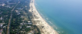
Most of the region's population is concentrated in the southeastern part, which has the most favorable transport and natural conditions.
see also
- Amur region
- Symbols and landmarks of the Amur region
- Cities of Russia
| [ + ] Cities by regions of Russia | |
| Cities of the North-West (NWFD) | St. Petersburg (and its cities) • Leningrad region (historical Staraya Ladoga) • Arkhangelsk region • Vologda region • Kaliningrad region • Karelia • Komi • Murmansk region • Nenets Autonomous Okrug • Pskov region |
| Cities of the Volga region (Volga Federal District) | Bashkortostan • Volgograd region • Kalmykia • Kirov region • Mari El • Mordovia • Nizhny Novgorod region • Orenburg region • Penza region • Perm region • Samara region • Saratov region • Tatarstan • Udmurtia • Ulyanovsk region • Chuvashia |
| Cities of Southern Russia (SFD) | Sevastopol (including Inkerman) • Republic of Crimea • Adygea • Astrakhan region • Krasnodar region • Rostov region |
| Cities of the North Caucasus (NCFD) | Dagestan • Ingushetia • Kabardino-Balkaria • Karachay-Cherkessia • North Ossetia - Alania • Stavropol Territory • Chechen Republic |
| Cities of the Urals (Ural Federal District) | Kurgan region • Sverdlovsk region • Tyumen region • Khanty-Mansi Autonomous Okrug - Yugra • Chelyabinsk region • Yamalo-Nenets Autonomous Okrug |
| Cities of Siberia (Siberian Federal District) | Altai Republic • Altai Territory • Irkutsk Region • Kemerovo Region • Krasnoyarsk Region • Novgorod Region • Novosibirsk Region • Omsk Region • Tomsk Region • Tyva • Khakassia |
| Cities of the Far East (FEFD) | Amur Region • Buryatia • Jewish Autonomous Region • Trans-Baikal Territory • Kamchatka Territory • Magadan Region • Primorsky Territory • Sakha (Yakutia) • Sakhalin Region • Khabarovsk Territory • Chukotka Autonomous Region |
| see also | Cities of the DPR, LPR, Transnistria, South Ossetia • Regions of Russia • Cities of Russia |
Natural features
The geographical location and climate of the region influence the natural zonation. The satellite map gives an idea of the relief and vegetation of the region.
The region is divided into four physiographic regions:
- Stanovoy (far north with spurs of the Stanovoy Range)
- mountain systems of the north (Tukuringra, Soktohan ranges, etc.);
- Zeya-Bureya Plain (a flat area located between the Bureya and Amur rivers and the spurs of the Lesser Khingan on the border with the Jewish Autonomous Region);
- Amur-Zeya Plain (territory located between the Zeya, Bureya and Amur rivers).
The mountainous part of the region is covered with coniferous forests with a predominance of larch, spruce and fir. On the mountain plateaus and in the lowlands of the northern part, tundra communities have formed on permafrost.
The southeastern part of the region is mostly plowed. On the outskirts of its eastern part, relict coniferous-deciduous forests with the dominance of Mongolian oak, flat-leaved and Daurian birch, Amur velvet, Manchurian ash, and Korean cedar have been preserved.
Urban settlements[ | ]
Among the 15 urban-type settlements (working settlements) the following stand out[1][2][3]:
- 1 urban settlement corresponding to the category of regional subordination - highlighted in orange
- forms a city district within the framework of the organization of local self-government; - 1 urban-type settlement subordinate to an urban-type settlement of regional subordination,
- 13 urban settlements as part of districts (within the framework of the organization of local self-government they are included in the corresponding municipal districts or municipal districts).
| № | Name | district / town of regional subordination[5] | municipal district/mun./city district[6] | population (persons) |
| 1 | Arhara | Arkharinsky district | Arkharinsky municipal district | ↘8437[4] |
| 2 | Bureya | Bureya municipal district | Bureya municipal district | ↘3942[4] |
| 3 | Erofey Pavlovich | Skovorodinsky district | Skovorodino municipal district | ↘4368[4] |
| 4 | Magdagachi | Magdagachinsky district | Magdagachinsky municipal district | ↘9804[4] |
| 5 | Novobureysky | Bureya district | Bureya municipal district | ↘6572[4] |
| 6 | Novoraichikhinsk | Progress | r.p. Progress, GO | ↘1804[4] |
| 7 | Progress | Progress | r.p. Progress, GO | ↘9383[4] |
| 8 | Seryshevo | Seryshevsky district | Seryshevsky municipal district | ↗9575[4] |
| 9 | Sivaki | Magdagachinsky district | Magdagachinsky municipal district | ↘1523[4] |
| 10 | Talakan | Bureya municipal district | Bureya municipal district | ↘4046[4] |
| 11 | Tokur | Selemdzhinsky district | Selemdzhinsky municipal district | ↘796[4] |
| 12 | Urusha | Skovorodinsky district | Skovorodino municipal district | ↘3245[4] |
| 13 | Ushumun | Magdagachinsky district | Magdagachinsky municipal district | ↘1859[4] |
| 14 | Fevralsk | Selemdzhinsky district | Selemdzhinsky municipal district | ↘4500[4] |
| 15 | Ekimchan | Selemdzhinsky district | Selemdzhinsky municipal district | ↘965[4] |
Former town[ | ]
- Berezovka has been a town since 1981. Converted to a rural settlement in 1991.
- Varvarovka - transformed into a rural settlement in 1996.
- Vozzhaevka has been a town since 1980. Converted to a rural settlement in 1995.
- Gluboky - transformed into a rural settlement in 1968.
- Ekaterinoslavka has been a town since 1964. Converted to a rural settlement in 1991.
- Zavitaya is a town since 1936. Transformed into the city of Zavitinsk in 1954.
- Zlatoustovsk has been a town since 1942. Transformed into a rural settlement in 2010[7].
- Kivdinsky has been a town since 1929. Converted to a rural settlement in 1982.
- Kirovsky has been a town since 1940. Converted to a rural settlement in 1968.
- Koboldo has been a town since 1958. Converted to a rural settlement in 2012.
- Lukachek has been a town since 1942. Converted to a rural settlement in 1974.
- Maisky has been a town since 1939. Converted to a rural settlement in 1997.
- Nevers has been a town since 1934. Transformed into a rural settlement in 2001[8].
- Ogodzha has been a town since 1958. Converted to a rural settlement in 2012.
- Oktyabrsky has been a town since 1939. Converted to a rural settlement in 1995.
- Poyarkovo has been a town since 1963. Converted to a rural settlement in 1992.
- Raichikhinsk has been a town since 1934. Incorporated into a city in 1944.
- Solovyovsk has been a town since 1934. Converted to a rural settlement in 1996.
- Srednebelaya - town since 1981. Converted to a rural settlement in 1991.
- Srednyaya Nyukzha has been a town since 1933. Until 1938 it was called Blyukherovsk. Converted to a rural settlement in the 1950s.
- Stoiba has been a town since 1942. Transformed into a rural settlement in 2008[9].
- Taldan has been a town since 1950. Transformed into a rural settlement in 2001[8].
- Takhtamygda has been a town since 1957. Transformed into a rural settlement in 2001[8].
- Tygda has been a town since 1958. Converted to a rural settlement in 1993.
- Tyndinsky has been a town since 1941. Transformed into the city of Tynda in 1975.
- Shimanovsky has been a town since 1929. Transformed into the city of Shimanovsk in 1950.
- Shiroky - converted into a rural settlement in 2009.
- Uglegorsk - transformed into the city of Tsiolkovsky in 2015[10][11].
- Yasny - transformed into a rural settlement in 1979.
Cities[ | ]
Among the 10 cities, the following stand out[1][2][3]:
- 7 cities corresponding to the category of regional subordination ( highlighted in orange
), which form urban districts within the framework of the organization of local self-government, - highlighted in gray
in the list - forms a city district within the framework of the organization of local self-government; - 2 cities corresponding to the category of district subordination (within the framework of the organization of local self-government they are included in the corresponding municipal district and municipal district).
| № | Name | district / mun. district/city of regional subordination/ZATO[5] | municipal district/mun./city district[6] | population (persons) | founding/first mention | city status | coat of arms |
| 1 | Belogorsk | Belogorsk | Belogorsk, GO | ↘64 502[4] | 1860 | 1926 | |
| 2 | Blagoveshchensk | Blagoveshchensk | Blagoveshchensk, GO | ↘225 757[4] | 1856 | 1858 | |
| 3 | Zavitinsk | Zavitinsky municipal district | Zavitinsky municipal district | ↘9957[4] | 1906 | 1954 | |
| 4 | Zeya | Zeya | Zeya, GO | ↘22 714[4] | 1879 | 1906 | |
| 5 | Raichikhinsk | Raichikhinsk | Raichikhinsk, GO | ↘16 479[4] | 1932 | 1944 | |
| 6 | Free | Free | Svobodny, GO | ↘52 918[4] | 1912 | 1912 | |
| 7 | Skovorodino | Skovorodinsky district | Skovorodino municipal district | ↘8745[4] | 1908 | 1927 | |
| 8 | Tynda | Tynda | Tynda, GO | ↘32 894[4] | 1907 | 1975 | |
| 9 | Tsiolkovsky | Tsiolkovsky (ZATO) | Tsiolkovsky (ZATO), GO | ↗7193[4] | 1961 | 2015 | |
| 10 | Shimanovsk | Shimanovsk | Shimanovsk, GO | ↘18 513[4] | 1910 | 1950 |