Team Nomads
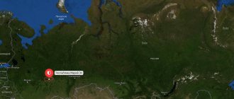
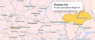
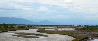
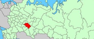
Mari El is a republic in the Middle Volga region, next to Chuvashia and Tatarstan. The main territory of the region lies in the forested Trans-Volga region (the left bank of the Volga), and a small part on the right bank is the Gornomariysky district of the RME. There are only 14 districts and four cities in the republic - Yoshkar-Ola (the capital of Mari El), Volzhsk, Zvenigovo and Kozmodemyansk. The area of the region is almost 24 thousand square meters. km.
THE MOST INTERESTING ARTICLES ABOUT MARI EL - HERE!
ATTRACTIONS OF MARI EL - HERE!
ANOMAL AREAS OF MARI EL - HERE!
NATURAL MONUMENTS OF MARI EL - HERE!
SPRINGS AND SOURCES OF MARI EL - HERE!
HIKING, RAFTING AND TRAVELING AROUND MARI EL - HERE!
Each district of the republic stands out in some way from other districts, and each district of Mari El has its own attractions and interesting objects - which we have been talking about for many years on the pages of our website. Let us remind readers that detailed information can be obtained about each RME district by clicking on the TEG of that district under the text of the article. Our site will display a complete list of articles about the region: lakes and rivers, settlements, natural and geological monuments, springs and springs, historical and cultural places.
This article makes an attempt to summarize information about different areas of Mari El and briefly present the main attractions of each area.
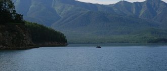
Zvenigovsky district of RME (Provoy kundem) is one of the largest in area (about 12% of the territory) - this is the homeland of the Nomads (Krasnogorsky village). Stlitsa - the city of Zvenigovo on the left bank of the Volga. Such famous rivers as Bolshaya and Malaya Kokshaga, Ilet and Yushut flow through the region. Zvenigovsky district is one of the record holders for lakes; all lakes can be viewed by section in the left column of the menu on the website (Mushan-er, Shardarier, Bolshoy and Maly Marier, Puzier, Lisichkino and others). In addition to lakes, there are other natural monuments in the area: springs, forest tracts, a small part of the Vyatka shaft (Katay Mountain). The most conceptual tourist place of Mari El is located in the Zvenigovsky district - this is the confluence of Ilet and Yushut. There are also sacred groves in the area, for example, in the village of Ismentsi, in Kushnur, near the village of Ozerki. The village of Kokshamary (on B. Kokshag) stands out as outstanding figures of the Mari people. There is one Chuvash settlement - Chuvash-Otary.
Morkinsky district (Morko kundem) is one of the most mysterious areas of the republic. here are preserved legends and traditions about a mysterious creature - Ovda (Obdasola), there are mysterious groves where wishes come true, there are ancient fortresses (Karman-Kuryk), the Drunken Key is known far beyond the borders of the republic, the highest point of Mari El is located here - Mount Chuksha, here many sacred groves and sacred trees (Onapu). In the village of Shorunzha there is a real center of the world of the Finno-Ugric peoples, where ethnographic festivals, performances of folklore groups, pagan prayers and filming are held. There are a large number of springs and springs in the area, and in many places there are picturesque lakes. Mysterious black stones were discovered in the village of Kozhlaer.
Gornomariysky district (Kyryk mary kymdem) is a district that is noticeably different from all other districts of the republic. Firstly, it is located on the right bank of the Volga, and secondly, it is inhabited by mountain Mari, who have a unique language and culture. Thirdly, there are special natural and cultural monuments, a huge number of archaeological monuments. The pearl of Mari El is the city of Kozmodemyansk with a huge open-air museum complex, with windmills, an art gallery, the Benderiad festival, and architectural monuments. The Mari guslars are a particular pride of this region. There are also many springs and springs in this area, some of which are presented on our website.
Sernursky district (Shernur kundem) is one of the classic Mari regions of the republic. It is believed that it is in the Sernur region that the religious, ritual and cultural traditions of the Mari people have been most fully preserved. In the Sernur region, the largest number of sacred groves is kyusoto (for example, near the village of Orekhovo there are five sacred groves at once), while in many groves prayers are held today, and World Prayers (Tunya kumaltish) are periodically held, when Maris from all over the country gather . In the north of the region there is the residence of the Mari Father Frost - Yushte Kugyza (the northernmost point of Mari El is located here - the border with the Kirov region). The mineral springs in Eshpoldino and the Maryan-pamash spring are known throughout the republic. The unique Nemda River flows through the area, on which the main sanctuaries of the Mari people, as well as natural monuments, are located. The Timin rocks near Sernur are interesting.
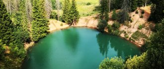
Volzhsky district (Yulser kundem) is the southernmost district of Mari El, bordering both Tatarstan and Chuvashia. The area of the area is almost a thousand square meters. kilometers. The Sotnur Highland is noteworthy - the southern part of the Vyatka rampart; there are many lakes and springs on karst breaks and failures. The one hundred wonders of Russia include the uniquely beautiful Sea Eye lake, and the miraculous Petyalsky springs and the Petyalsky Temple are very popular (even in Kazan). Famous lakes are Puzhan-er, Cheldovi, Elan-er, Shem-er. The largest lake, Mari El, is located on the territory of the Volzhsky region - Yalchik. The Maple Mountain tracts are unique in their natural composition - these are the Pugachev Oak, the mysterious Lake Konan-er, the Green Key, the Boiling Square, the Klenovogorsk oak grove,
Yurinsky district (Yurny kundem) - known far beyond the borders of Mari El for the fact that in the village of Yurino there is a castle of Count Sheremetev , which is shrouded in legends and traditions. Yurino is located at the confluence of the Vetluga River and the Volga, and is a place where tourists often come, because in the entire Volga region there is no castle so interesting in its architecture! Yurinsky district is the westernmost in Mari El - it borders on the Nizhny Novgorod region, it is in the interfluve of Vetluga and Kerzhenets that the most untouched corners of nature, numerous lakes (including the legendary Svetloyar), huge swamp complexes and habitats of rare animals and birds are located. There are also many archaeological monuments in the Yurinsky district; tribes of the Permian-Azelinsky culture lived here in ancient times, and then the Finno-Ugric peoples came.
Sovetsky district is a district in the central part of Mari El. Area approximately 1400 sq. km., population - about 28 thousand people. Part of the area is located on the plain, and the eastern part approaches the Vyatka shaft. There are many healing and beautiful springs in the area - the legendary Kugenersky spring, the Kazan spring (Shabashi), Viyan pamash, Rongo pamash, the spring of Friendship of Peoples, the source of the Small Kundysh and other springs. There are sacred groves in the area where Mari prayers are held - the Vich Parnya grove near the village of Shuarmuchash, and there is also a sacred place at the source of the M. Kundysh. The area was once famous for the Fokinsky Distillery, where they made a wonderful balm using unique local water. The Kundushtur lake, Mountain glade, Peschanka lake, and Abasnur lakes are very picturesque.
Paranginsky district (Paranga kundem) is the most Tatar-populated region of Mari El; Paranginsky Tatars who fled to these regions in the 16th and 17th centuries live compactly here. In Paranga, Sabantuy and Peledysh Pairem are celebrated simultaneously. The area of the area is approximately 800 square meters. km., and the population is about 18 thousand people. The legendary Ilet River, a famous rafting tourist route in neighboring republics, has its source in the area. There are many natural monuments located here: Relict forests, the Vyatsky Val tracts, Shiy Pamash in Olory, the source of the Buy River, the Nolya River and others. The watershed of the Volga River and the Vyatka River (along the Vyatka shaft) passes through the area.
Orsha district (Orshanke kundem) - known for the deepest lake in Mari El (and not only in Mari El, but also in the Volga region, and even in the European part of Russia) - this is Lake Tabashi (Zryv) with a depth of almost 60 meters. Nearby there is an interesting anomalous zone, about which there is an article on the website. In the area along the Sernur (Urzhum) tract there are many ancient villages with ancient churches and holy springs. Well-known springs are in Upsha, the Inexhaustible Chalice in Bolshaya Orsha, the Vladimirsky spring in Malaya Kuchka, the source of Malaya Kokshaga in Kuglanur and other springs. There are interesting museums in the area - the Orsha Museum of Local Lore, the Harmony Museum in the village of Kuchka, the Mayorov-Shketan Museum in Old Kreshcheno.
Novotoryalsky district (U Toryal kundem) is one of the traditional Mari districts of Mari El, the Vyatsky shaft passes here and the legendary Nemda river flows, collecting numerous tributaries. The area is famous for its healing springs and springs: the spring of St. Panteleimon in the village of Bakhtino, Viy Pamash (spring of strength), Red Key, Shiy Pamash, spring in Old Toryal and others. There are many sacred groves (kyusoto), for example, in the Savaran-oto grove the all-Mari world prayer Tunya kumaltysh was held. The White Grove near the village of Nursola (Cathedral Kyusoto) is also popular. There are natural monuments and archaeological sites in the area. New Torjal is famous for its local history museum and the museum of retro technology.
Medvedevsky district (Medvedevo kundem) is the most central district of Mari El, which is adjacent to the capital of the republic, the city of Yoshkar-Ola. The second largest area in the RME is 2800 sq. km., and the first in terms of population - 68 thousand people. The Bolshaya Kokshaga nature reserve with a unique composition of flora and fauna is located here. The area is one of the most lacustrine in the region: lakes Churkan, Shchuchye, Shush-er, Svetloe, Bolshoi and Maly Martyn, Shap, Solenoye, Koshe-er, Kapsino, Karasye, Gusinoye, Igiryer, Lesnaya Skazka, Orier, Shilma, Olanga, Shirenga and others. Archeological monuments have been found in the area (Pelenger mounds) and the most interesting archeological museum in the village operates. Medvedevo.
Mari-Tureksky district (Mari Turek kundem) is the easternmost district of Mari El, here is the border with Tatarstan and the Kirov region, and the easternmost point of the republic is located here. This is the only region of the RME where Udmurts live compactly (the village of Karlygan). The area is located on the Vyatka watershed (and a small part of the Volga basin). The rivers Buy, Urzhum, Ireka and others are tributaries of the Vyatka. There are many springs on the slopes of the Vyatsky shaft - Buiskie springs, the source of Peter and Fevronia in Mari-Turek, the Nikolsky spring (the village of Nartas), the Ivskaya Vershina spring, the Lyaminsky spring, the sources of the Buy and Urzhumka rivers and others. The Kholodny Klyuch reserve on the Nolya River operates in the area.
Kuzhenersky district (Kuzhener kundem) is the most spring-filled and most beautiful region of the republic. It is located right along the Vyatka ridges, which runs through the entire Mari Republic from north to south. There are real mountains here - Kamennaya Mountain, Tumerskaya Mountain, Shurginskaya Mountain, Ashnak tract, the Vizimbir tract with springs and a guest bath complex is famous throughout the republic. There are even spring valleys here, for example, on the Nolka River, the Shoi-Shudumar springs. The area is famous for its adits for the extraction of millstones (the village of Gornyak, Nolkin Kamen) - Gornoye Zadelye. The Nemda and Yushut rivers have their sources in the Kuzhenersky district. Interesting springs are the Silver Spring near the village of Fomichi and the Fox Mountain spring.
Kilemarsky district (Kilemar kundem) is the largest district in Mari El by area - more than 3 thousand square meters. km. One of the most remote and sparsely populated areas of the RME, about 11 thousand people live here. The Kilemarsky district is a record holder for lakes and swamps; such swamps are known as the Kuplong swamp (the largest in the RME), Poshkit kup, Kuzhu kup (kup - in Mari: swamp), Madara swamp. Lakes of the region: Tsinglok, Madarskoye, Bryukhan, Togashskoye, Borovskoye, Molevoye, Lake Krasnoye, Ubsh-er, Shukshi-yar, Kum-yary, Yuksy-yar, Sham-yar, Izi-yar, Vas-yar, Pos-yar, Mo-yar, Vizimyar lakes and others. The Bolshaya Kokshaga, Bolshoy Kundysh, Rutka, and Arda rivers flow through. On the Rutka River stands the wooden Monastery of the Mother of God of St. Sergius.
Yoshkar-Ola - I would like to separately introduce the capital of the Mari region. From Mari it is translated as Red City. Population: 274 thousand people. It is the center of culture of the Finno-Ugric peoples. Previously called Tsarevokokshaysk (Krasnokokshaysk). The city has theaters, educational institutions, numerous museums, and exhibition halls. The Malaya Kokshaga embankment was designed in a very unique way in the style of Western Europe. The National Museum of Mari El is unique in its exhibition - those who are interested in the life of the Mari people should definitely visit here. In the city of Yoshkar-Ola, a real Kremlin was made of red brick, churches and cathedrals were reconstructed, and in the suburbs of the capital there is a kyusoto - Oak Grove.
Festivals and holidays on ethnographic themes are constantly held in Yoshkar-Ola.
______________________________________________________________________________________________________________ SOURCE OF INFORMATION AND PHOTO: Team Nomads.
Publishing house Yoshkar-Ola, 2004. 320 p. — (History of villages and hamlets of the Republic of Mari El). — 1500 copies. — ISBN 5-87898-267-6. Natural monuments of Mari El. Sights of the Mari region.
Website of the Mari Diocese https://www.mari-eparhia.ru/ https://www.12rus.ru/ The most beautiful places in Mari El. Geography of Mari El.
Ministry of Natural Resources Mari El.
Atlas of lakes of Mari El.
Administrative-territorial division of the Mari Autonomous Soviet Socialist Republic
The section presents information from reference books on the administrative-territorial division of the Mari Autonomous Soviet Socialist Republic for 1952-1986: lists of districts and cities of republican subordination; lists of village, town and city councils; lists of settlements indicating the position relative to administrative centers and railway stations, the predominant nationality of the residents; lists of collective farms, state farms and forestry enterprises. The directories were published by the Presidium of the Supreme Council of the Mari Autonomous Soviet Socialist Republic.
Read about the preparation of this section in the Editorial Blog >>.
Summary table of districts
| Item no. | Area | 01.05.1952 | 01.04.1955 | 01.05.1969 | 01.01.1974 | 01.01.1978 | 01.01.1986 |
| 1 | Volzhsky district | Volzh 52 | Volzh 55 | Volzh 69 | Volzh 74 | Volzh 78 | Volzh 86 |
| 2 | Gornomariysky district | Horn 52 | Horn 55 | Horn 69 | Horn 74 | Horn 78 | Horn 86 |
| 3 | Elasovsky district | Elas 52 | Elas 55 | — | — | — | — |
| 4 | Zvenigovsky district | Link 52 | Link 55 | Link 69 | Link 74 | Link 78 | Link 86 |
| 5 | Kazansky district | Kaza 52 | Kaza 55 | — | — | — | — |
| 6 | Kilemarsky district | Kiele 52 | Kiele 55 | Kiele 69 | Kiele 74 | Kiele 78 | Kiele 86 |
| 7 | Kosolapovsky district | Koso 52 | Koso 55 | — | — | — | — |
| 8 | Kuzhenersky district | Kuzhe 52 | Kuzhe 55 | Kuzhe 69 | Kuzhe 74 | Kuzhe 78 | Kuzhe 86 |
| 9 | Mari-Tureksky district | Marie 52 | Marie 55 | Marie 69 | Marie 74 | Marie 78 | Marie 86 |
| 10 | Medvedevsky district | Medv 52 | Medv 55 | Medv 69 | Medv 74 | Medv 78 | Medv 86 |
| 11 | Morkinsky district | Mork 52 | Mork 55 | Mork 69 | Mork 74 | Mork 78 | Mork 86 |
| 12 | Novo-Toryalsky district | Novo 52 | Novo 55 | Novo 69 | Novo 74 | Novo 78 | Novo 86 |
| 13 | Orsha district | Orsha 52 | Orsha 55 | Orsha 69 | Orsha 74 | Orsha 78 | Orsha 86 |
| 14 | Paranginsky district | Couple 52 | Couple 55 | Couple 69 | Couple 74 | Couple 78 | Couple 86 |
| 15 | Pektubaevsky district | Pect 52 | Pect 55 | — | — | — | — |
| 16 | Semenovsky district | Seme 52 | Seme 55 | — | — | — | — |
| 17 | Sernursky district | Sern 52 | Chamois 55 | Sern 69 | Chamois 74 | Chamois 78 | Chamois 86 |
| 18 | Sovetsky (Ronginsky) district | Rong 52 | Rong 55 | Owl 69 | Sove 74 | Sove 78 | Sove 86 |
| 19 | Sotnursky district | Hundreds 52 | Hundreds 55 | — | — | — | — |
| 20 | Khlebnikovsky district | Bread 52 | Bread 55 | — | — | — | — |
| 21 | Yurinsky district | Yurin 52 | Yurin 55 | — | Yurin 74 | Yurin 78 | Yurin 86 |
| 22 | Yoshkar-Ola city | Yoshk 52 | Yoshk 55 | Yoshk 69 | Yoshk 74 | Yoshk 78 | Yoshk 86 |
| 23 | Volzhsk city | — | — | Volzh 69 | Volzh 74 | Volzh 78 | Volzh 86 |
| 24 | City of Kozmodemyansk | — | — | — | — | — | Goat 86 |
The color scale shows the percentage of settlements associated with the site base
Sources:
| Item no. | Source |
| 1 | Mari ASSR. Administrative division as of May 1, 1952. Yoshkar-Ola, 1952 |
| 2 | Mari ASSR. Administrative division as of April 1, 1955. Yoshkar-Ola, 1955 |
| 3 | Mari ASSR. Administrative division as of May 1, 1969. Yoshkar-Ola, 1969 |
| 4 | Mari ASSR. Administrative division as of January 1, 1974. Yoshkar-Ola, 1974 |
| 5 | Mari ASSR. Administrative division as of January 1, 1978. Yoshkar-Ola, 1978 |
| 6 | Mari ASSR. Administrative division as of January 1, 1986. Yoshkar-Ola, 1986 |
Lay low in Yoshka: Mari chic, undercogs and paganism
You can get to Yoshka by train: the journey from Moscow will take about 15 hours, a ticket for a reserved seat carriage costs approximately 1,500 rubles, and a compartment ticket costs twice as much. By air it is also possible, but more difficult. The only airport in the republic exists rather conditionally: on paper it exists and even has federal significance, but in reality it has been impossible to fly to it for three years now, and this is not the first time it has closed. You can still get there by air, because very close to the Mari capital are Cheboksary (a little over an hour by car) and Kazan (a little more than two) with their very live airports.
Yoshka, of course, is a city of contrasts. I once wrote something like this about Astrakhan, but there St. Petersburg modernism and Indian farmsteads contrast with wooden slums and panel houses, and in Yoshka the same huts and Khrushchev houses surround a much stranger (and in its own way impressive) spectacle.
Mari El is united with Mordovia not only by a common Finno-Ugric heritage, but also by the presence of eccentric ex-governors with surnames starting with the letter “M” - Merkushkin and Markelov. Mordovian Merkushkin limited himself to the construction of the MSU (Mordovian State University) building - a smaller glass copy of the main building of the Moscow namesake - in the center of Saransk. Residents of Mordovia are still arguing whether this building is the best or the worst in the city.
For the residents of Yoshkarolina, their former ruler Markelov provided more topics for conversation: the center of the Mari capital almost half consists of copies of famous and not so famous buildings from other cities and countries. One of my acquaintances once joked that Markelov wanted to share his impressions of his trips with his friends, but could not master the Instagram interface. He had to spend the entire budget of the republic on the construction of what he saw outside Yoshkar-Ola, in its very center, in full size.
This is how copies of the Spasskaya Tower of the Moscow Kremlin, the Tsar Cannon and St. Basil's Cathedral appeared in Yoshka, as well as the Italian Park, Arkhangelskaya Sloboda and - drum roll - the Bruges embankment. Since 2010, the bank of the Malaya Kokshaga River has been decorated with an ensemble of houses in the Flemish style. Here, as in Saransk, the city’s population is divided into two camps: some say it’s beautiful, others say it couldn’t be uglier. Let's leave these debates to the aesthetes: regardless of your stylistic preferences, one cannot but agree that there is nothing like this anywhere else in Russia, and it is at least strange, interesting and worthy of a visit. Toponymy in this area is also new and ambitious: Tsargradskaya and Patriarchal squares, Kremlevskaya street.
By the way, despite Markelov’s significant contribution to the development of the republic and its image, he did not end very well. His current situation can be summarized with a headline from Komsomolskaya Pravda: “The arrested ex-head of Mari El was building Venice in Yoshkar-Ola for his beloved, and she fled to London with someone else.”
Visiting travel bloggers pay a lot of attention to all these new buildings and quite a bit to everything else. In fact, there are other, less obvious attractions in the Mari capital. It’s worth going to the Gulag People’s Museum on Sovetskaya, smelling the lilacs in the cozy and free botanical garden, and looking at the monument to Grace Kelly and Prince Rainier at the city registry office, which apparently symbolizes love and family happiness.
Another unobvious source of pride for local residents is the meme “Yoshkar-Ola is the birthplace of Yoshka the cat.” The cat, like Grace Kelly, deserved a monument: in 2011, a composition was installed on Lenin Square - Yoshkin the cat sitting on a bench. By the way, it is customary for him to rub his paw for luck. Two years later, the Yoshkina Koshka cafe opened on nearby Gagarin Avenue, and a monument to her was erected next to it, and now the cat has a girlfriend. The Yoshkin Kot hostel in Stalin on Lobachevsky Street was also named after the ubiquitous cat. By the way, you can spend the night there for only 450 rubles.
It’s worth visiting the National Museum of the Republic, just don’t confuse it with the city’s historical museum, where there’s nothing to see except old photographs. The National Museum has a good and detailed ethnographic exhibition, stuffed animals, a lot about Mari paganism and touching paintings in the style of ethnic socialist realism.
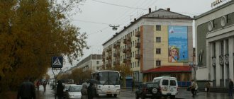
The geography of Yoshka is extremely simple: there is an old center with Stalinist buildings, remnants of merchant modernism and carved huts, a new center described above, and everything else. The rest is the private sector and panel microdistricts, named either by numbers (First, Second, Third) or by adjectives (Vostochny, Sportivny, Pribrezhny, Vashsky, Orsha). On the edge of the city there is a new microdistrict with the epic name Integral. Soviet toponymy is interspersed with a Mari national component: the city has Chavaina Boulevard, Yivana Kyrli, Orai and Shketan streets. All these are Mari writers.
The small republic produced a disproportionate number of writers, poets and playwrights. They mostly wrote in their native language, but a lot was translated into Russian: the Soviet government spared no money on promoting small cultures, languages and literatures, so they printed and translated a lot.
It got to the point of absurdity: in 1988, the government financed the printing of one short Mari poem by Sergei Chavain about the love of nature, translated into forty-five languages - from Abkhazian to French. With the publication of such an extravagant tome, the Mari celebrated the centenary of the birth of their beloved poet. Mari prose is also worth reading - on the Internet it is easy to find a Russian-language edition of Shketan’s novel “Erenger” with several short stories in addition. In these works, the early kondovy scoop is intertwined with ancient beliefs, forest spirits, simple rural life and stories of love and jealousy.
In general, the presence of the titular nation here is felt much more vividly than in Saransk, although the Mordovians in Mordovia and the Mari in Mari El constitute approximately 40% each. In Yoshka, not only the street names are duplicated in Mari (this seems rather pointless - the signs usually have something like “Sovetskaya Street / Sovetsky Urem”), but also the signs of private establishments: you will quickly remember that the store in Mari is kevyt .
The melodious and slightly hissing Mari speech is easy to hear on the street or on public transport. There are not very many Mari in Yoshka itself - Russians make up more than two-thirds of the population, and there are also Tatars and Chuvashs, but the villages of the republic are inhabited mainly by Mari, who often go to the city and speak their native language there.
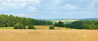
Mari villages are a different story. Among the wide fields, dense forests and Volga floods of the republic, there are villages where they still believe in the god Kugu-Yumo, the spirits of the dawn and other natural phenomena, pray in sacred groves and make sacrifices to the pagan gods.
This is not modern neo-paganism, but a real Mari traditional religion, miraculously preserved and surviving waves of semi-violent Christianization of the peoples of Russia. The Mari are called the last pagans of Europe, and for this they are known abroad. About this you can watch a good film “Heavenly Wives of the Meadow Mari”, based on the book by Kazan writer Denis Osokin. The film, by the way, is entirely in the Mari language, with only Russian subtitles.
Alongside spirits, groves and victims in Mari villages are low-profile Zhiguli cars and rural discos with bassboosted pop music in the same Mari language and cheerful villagers in embroidered shirts and felt boots. Not only old people, but also teenagers sway to such music - and then sometimes they fight to it. There is also Mari rap, however, I was able to find only one composition in this genre - “Mari rap”. “U” in Mari means “new,” so there must be some old-school Mari rap somewhere.
It’s really worth devoting at least a day to local villages if you find yourself in Mari El. The republic is, in principle, small, and getting to any point of it is not difficult. If you have a couple of free days, you can go to the regional center of Kozmodemyansk, where for some reason there is disproportionately more historical architecture than in Yoshka, its own special pre-revolutionary merchant charm and Khrushchev buildings with drawings and inscriptions lined with bricks on the walls. In the summer, Kuzma, as the locals call this city, hosts the Benderiad festival of satire and humor. Ostap Bender is respected no less here than in Elista, where a monument to him is erected, surrounded by twelve chairs. Residents of Kuzma firmly believe that it is their city that appears in literature under the name Vasyukov, where Bender gave local chess players a simultaneous game session.
Before exploring the expanses of the region, it is still worthwhile to finish getting acquainted with its capital. After walking around the gingerbread district of Markelov with a mini-Kremlin and a “copy” of Bruges, you can lay low right there: go to the flower coffee shop Flobar or the Kitchen gastrobar with local craft beer on Voskresenskaya Embankment. A little further towards the old part of the center there is a good and cheap burger restaurant “Ketchup”.
It is also worth trying the dishes of Mari cuisine - Podkogol and Koman Melna are fighting for the title of its most famous representatives. Podkogoli are similar to Russian dumplings, but differ in shape and a wider range of fillings (not only meat - from berries to pike).
In the cozy tavern “Teplaya Rechka” in the city center, an assortment of four types of podkogoli will cost 355 rubles. They also offer koman melna, they are also called three-layer pancakes. They actually consist of three thin layers: rye flour, oat flour and oatmeal or flakes. There are also completely authentic places where locals, not just tourists, enjoy podkogos and pancakes in a cozy dining atmosphere. These are, for example, “Sandal” on Proletarskaya and “Mari” on Podolsky Kursantov Street. Locals who are already tired of their native Mari cuisine recommend going to Maniloff. Despite the pretentious name of the restaurant, there is shawarma for 200 rubles, and it is considered the best in the city.
This is how the small republic lives - with United Russia eclecticism, undercoats, humor and sacrifices to the pagan gods, and the old Mari catch crucian carp in Malaya Kokshaga, bending over with fishing rods on the edge of the Bruges embankment. In general, come to Mari El!
History of Yoshkar-Ola
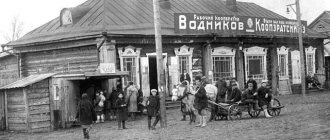
Yoshkar-Ola was first mentioned on November 1, 1584 in the discharge book - the main document of the “Discharge Order” of 1475 - 1598. However, archaeological excavations indicate that people have lived in the vicinity of these places since the Mesolithic era (12 thousand years BC). The area around the modern city has always been surrounded by rich forests, which allowed the local population to engage in hunting and gathering, and use the forest as building material. Deforestation areas were plowed up and used for farming and cattle breeding. Beekeeping and fishing were developed. At the settlements, many items made of bone are found, mainly related to hunting (arrowheads of various shapes, harpoons, hoe tips), fragments of pottery, and jewelry.
Between the 13th and 15th centuries, the territory of modern Yoshkar-Ola was inhabited by indigenous Mari and was part of the Golden Horde, and then, until the middle of the 16th century, it was the northern periphery of the Galician Daruga of the Kazan Khanate, through which trade, economic and military-political relations were carried out between Kazan and northeastern Russian lands. In particular, it is known that this area was crossed by the Galician Road, which ran northwest from Kazan towards the city of Galich, an important medieval city in northeastern Rus'.
As part of the Kazan Khanate, the Mari did not have cities; they lived in small settlements - “ilems”.
The long-term military rivalry between the Russian principalities and the Golden Horde, and subsequently between the Russian state and the Kazan Khanate, ended in October 1552 with the defeat of the Kazan Khanate by the troops of Ivan the Terrible, and the annexation of the Middle Volga region, including the Mari region, to the Russian state. The founding of the city of Tsarevokokshaisk is directly related to this. Already in mid-October 1552, part of the local population was sworn to allegiance to the Russian Tsar and pledged to pay him yasak. But already in December, the Mari rebelled in many places, refused to submit to the new orders of the Moscow government, and in the spring of 1553, a broad national liberation movement, called the “Cheremis Wars,” unfolded throughout.
To suppress the uprising, Moscow troops were sent to the lands of the Meadow Mari under the control of the governor “on a sortie.” And it is characteristic that an important point of their deployment was the “Oshla volost” (the Oshla River flows into Kokshaga near the city), and along with it, Kokshaga, Managa and other surrounding areas are mentioned for the first time in chronicle reports. Along with them, the Mamich-Berdeeva volost is also called after the leader of the rebellious movement. Perhaps it was also located on Malaya Kokshaga, near the mouth of Oshla, including the site of the future city. Here Mamich-Berdei even tried to proclaim an independent “kingdom” with an invitation to rule the Nogai prince, but when trying to persuade the “mountain Cheremis” to join a joint war with Moscow, he was captured and sent to Moscow for reprisals.
The Cheremis wars took place in three waves: 1552-1557, 1572-1574, 1582-1584. During the second of them, Ivan the Terrible decided not to limit himself to temporary military resource bases and military strongholds on the newly annexed territory and indicated that “cities and forts should be established there.” So, in 1574, the city of Kokshazhsk (Kokshaysk) was built between the mouths of the Bolshaya and Malaya Kokshaga, and control over a significant part of the Lugovaya Side was established - the uprising ended. But a few years later it became restless again in the center of the Mari land. Troops were sent here many times, but it took a long time to suppress the resistance. Then they decided to build fortified cities in the hinterlands at a distance of a day's march for foot troops (this was then 50-60 miles) in order to finally pacify the rebels. This was carried out after the death of Ivan the Terrible, during the reign of Fyodor Ioannovich. “The righteous sovereign himself,” it is said in the chronicle, “having examined them, and seeing them, and expecting treason from them in the future, sent his governors and ordered to build cities throughout the Cheremis land,” and thereby strengthened Moscow rule here.
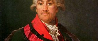
In the summer of 1584, troops of Russian governors ascended the Malaya Kokshaga from Kokshaysk, defeated the main forces of the rebels and on the Malaya Kokshaga, in its middle course on the right bank in the most convenient area, which they had already mastered since the time of the first Cheremis war, founded a fortress and reported this to Moscow. And the first documentary mention of the Tsarev city on Kokshag “in Cheremis” appeared in the “Rank Books”. “On the 1st day of the summer of November 7093, the Sovereign Tsar and Grand Duke Fyodor Ioannovich of All Rus' ordered that three regiments of governors be sent to the new Tsarev city with an outfit and supplies. In the large regiment the governor was Prince Ivan Ondreevich Nogotkov and the head was Prince Grigory Velskoy. In the advanced regiment, the governor was Prince Ivan Vasilyevich Gagin the Great. In the guard regiment, Prince Pyotr Shekhovskoy. And how the governors will bring supplies and outfit to the city, and Prince Ivan Nogotkov and Mikhail Alexandrov’s son Nagovo will be governors in the city of Tsarev; Zvyage Voeikov was among the mayors...” Another chronicle message states: “Summer 7092. The same year, in Cheremis, the Tsarev city.” According to the Byzantine calendar then in use, “from the creation of the world,” the year 7092 covered the time from September 1, 1583 to August 31, 1584 . Consequently, November 1 is the date of the first mention of the city, which was built before August 31. Since there were several Tsar cities, for clarification they began to write Tsarev city on Kokshaga or Tsarev Kokshaysky, and through this form the name Tsarevokokshaysk was established in the first half of the 17th century. A district was assigned to the city, which for a long time was called “Tsaregorodsky” (hence the surname Tsaregorodtsev, common in these parts).
The founding of Tsarevokokshaisk was part of the government's policy of colonization of newly acquired lands. From the city's built-up area and in a circumference of at least five miles, the indigenous residents were evicted further away or left themselves without waiting for forced expulsion. “Tsarev City on Kokshag” (from which the official name of the city was later formed for a long time - Tsarevokokshaisk) was founded in 1584 under Tsar Fyodor Ioannovich after the death of Ivan the Terrible. Initially, Tsarevokokshaisk was a typical military fortification, surrounded on four sides by earthen ramparts with wooden walls. Over time, the city ceased to fulfill its military function, turning into a craft and trade center. Craftsmen, traders, and peasants began to settle here, and the city’s boundaries also expanded beyond their former limits, forming a suburb and a settlement. Agriculture became the main occupation of the population. Hops were grown in the vicinity of the city. Fur, timber and distillery industries flourished. But the bulk of the population was still made up of military personnel.
Tsarevokokshaisk for a long time remained a military-administrative center in the depths of the Mari region. The city housed the district administration and a military garrison consisting of Russian archers and servicemen, who more than once had to suppress spontaneous unrest of the local population. For example, the rebellious peasants of the Volga region and Vyatka side (Russians, Tatars, Chuvash, Mari) captured Tsarevokokshaisk in the winter of 1609. To pacify the rebels, a royal punitive detachment arrived from Kazan, which brutally dealt with the rebels. The Tsarevokokshais took part in the militia of Kuzma Minin and Dmitry Pozharsky. They were sent to strengthen Russian influence on the Don and the Kalmyk steppes. Legends have been preserved that the Tsarevokokshais also took part in the military campaigns of Peter I.
With the creation of the Tsarev city on Kokshag, the Russian population also appeared here. Next to the fortress there was a settlement where traders and artisans lived, mostly arriving from the central regions of the Russian state. In the middle of the 17th century. The villages located in the vicinity of Tsarevokokshaisk, now included within the city (Varaksino, Lapshino, Gomzovo, Berezovo, Kozhino, Markovo, Pakhomovo, Shiryaykovo, Zhukovo, Knyazhna), belonged to the royal okolnichy prince V.G. Romodanovsky. In the second half of the 17th century. after his death, they came under the control of the palace administration, that is, the state treasury. Of the non-Russian population, newly baptized service people lived in the city and its environs—Tarkhans, of whom the name of the urban microdistrict “Tarkhanovo” still reminds us. Having emerged as a fortified city, Tsarevokokshaisk became the center of the county more than 300 years ago. City and county in the 17th century. was governed by a voivode appointed by the Discharge Order and subordinate to the order of the Kazan Court. He led the armed forces, performed legal functions, and collected tribute from the Mari population.
Under Peter I, Tsarevokokshaisk was assigned to the Kazan province, which included the entire Volga region from Nizhny Novgorod to Astrakhan. In 1775, a decree was issued according to which only the Middle Volga region was included in the Kazan province. Tsarevokokshaisk became the district center of the newly transformed Kazan province. In the 18th century the city changed somewhat: stone houses appeared, 5 churches were built: Trinity (1736), Entry of Jerusalem (1754), Ascension (1756), Resurrection Cathedral (1759), Tikhvin (1774). The “Economic Notes of Tsarevokokshay Uyezd,” compiled at the end of the 18th century, indicated that the Resurrection Cathedral housed a storeroom for storing the collected state monetary treasury; The city police and prison were located in a government building near the Trinity Church. In the 18th century, the first industrial enterprises appeared in the city, and there was a boom in stone construction (before that the city was entirely wooden). The city began to host the Alexander-Elizabeth Fair. At the same time, merchant dynasties formed in the city. In 1835, the first regular plan of Tsarevokokshaisk was created. On March 1, 1835, Emperor Nicholas I inscribed with his own hand: “Be it according to this.” According to this plan, the city developed further, gradually turning into a trade, economic and cultural center of the Mari region, although its population was only about 2000 people.
From the middle of the 19th century, Tsarevokokshaisk became a place of political exile. Participants of the Polish uprising of 1863 were exiled here. In terms of the level of secondary education, Tsarevokokshaisk during this period occupied first place in the province, ahead of Kazan itself: there were five schools for two thousand people. But at the same time, there was no developed industry in the city. In 1837, a local historian, the district police officer, Baron Alexander von Keller, wrote in essay notes: “... there are no factories or factories... there are various craftsmen: carpenter - 1, shoemakers - 2, tailors - 2, coppersmith - 1, tinsmith - 1 , dyers - 2.”
Almost half a century later, in 1876, another local historian, teacher I. O. Deryuzhev, stated: “With the exception of the baker, butcher, shoemaker and a few other artisans engaged in such work, without which no accumulation of people could exist at the smallest degree education of the population, not a single branch of industry is known to the urban population.” Only at the end of the 19th century a small distillery was built in Tsarevokokshaisk, employing 70 workers.
By the beginning of the 20th century, Tsarevokokshaysk remained a quiet provincial town. The basis of the economy was agriculture, the most numerous class was the peasantry. On February 17, 1919, Tsarevokokshaysk was renamed Krasnokokshaysk. On June 18, 1920 it became part of the Vyatka province. On November 4, 1920, the Decree of the All-Russian Central Executive Committee and the Council of People's Commissars of the RSFSR was adopted on the formation of the Mari Autonomous Region, and on November 25, Krasnokokshaysk became its administrative center.
On January 25, 1928, Krasnokokshaysk received the Mari national name - Yoshkar-Ola (“Red City”). In December 1936, the Mari Autonomous Region was transformed into the Mari Autonomous Soviet Socialist Republic and the city of Yoshkar-Ola became its capital. During the Great Patriotic War, it was decided to evacuate some factories in Yoshkar-Ola, which gave a powerful impetus to industrial and socio-economic development; the city began to be actively built up in the western and southern directions, and then in the part beyond the river. The construction of a high-voltage power line (1959) and a gas pipeline (1967) from Zelenodolsk was of great importance for the economic growth of the city.
In the 1950-1960s, ensemble development of the central area of the city was carried out, which was a great achievement of Yoshkar-Ola architects. Development gradually took shape along the street. Institutskaya (now Leninsky Prospekt), which became the main street of the city. New buildings of the city administration, the government house, and the Yoshkar-Ola hotel were erected here. In the 1970s-1980s, the largest urban development project in Yoshkar-Ola was implemented - the development of the left bank of the Kokshaga and the creation of a new Zarechny residential area - the Sombathey microdistrict. One of the most memorable dates in the history of Yoshkar-Ola is the awarding of the city in 1984 with the Order of the Red Banner of Labor “For the successes achieved by the city’s workers in economic and cultural construction, and in connection with the 400th anniversary of its founding.”
In 1990, the city of Yoshkar-Ola was included in the number of historical cities of Russia. In 2010, he was removed from the list. On July 16, 1997, the State Registration Chamber of the Republic of Mari El registered the charter of the municipal formation of the city of Yoshkar-Ola, which defines the legal, territorial, economic and financial foundations of city government, the role of city residents and self-government bodies in the implementation of democracy, consolidates the powers, system and structure of self-government bodies cities.
On July 10, 2003, the State Assembly of the Republic of Mari El approved the republican target program for the socio-economic development of the city of Yoshkar-Ola for 2003-2008, entitled “Capital”. Its goal was “to create a high-quality urban environment, understood as a set of favorable conditions for the life of the population and the activities of economic entities,” which gave a new impetus to the development of the city. Now in the city, work is actively underway to restore and reconstruct the few surviving buildings and churches, new houses are being built, and favorable conditions are being created for the life of Yoshkarolin residents.
See also:
→ Merchant houses
→ Monuments in Yoshkar-Ola
→ City tours
→ Sights of Yoshkar-Ola
→ Museums of Yoshkar-Ola