District in Pskov region, Russia
| Sebezhsky district Sebezhsky district | |
| District | |
| Location of Sebezhsky district of Pskov region | |
| Coordinates: 56°17'N 28°29'E / 56.283°N Latitude 28.483°E / 56.283; 28483 Coordinates: 56°17'N 28°29'E. / 56.283°N Latitude 28.483°E / 56.283; 28 483 | |
| A country | Russia |
| Federal subject | Pskov region [1] |
| Established | August 1, 1927 |
| Administrative center | Sebezh [2] |
| Region [3] | |
| • General | 3,100 km 2 (1,200 sq mi) |
| population size (2010 Census) [4] | |
| • General | 21 674 |
| • Evaluate (2018) [5] | 19 161 ( -11,6% ) |
| • Density | 7.0/km2 (18/sq mi) |
| • Urban | 65,7% |
| • Rural | 34,3% |
| Administrative structure | |
| • Settlements [2] | 1 Cities, 2 Urban settlements [6], 424 Villages |
| Municipal structure | |
| • Municipally registered as | Sebezh municipal district [2] |
| • Municipalities [2] | 3 urban settlements, 6 rural settlements |
| Timezone | UTC+3 (MSK[7]) |
| OKTMO ID | 58654000 |
| Web site | https://sebezh.reg60.ru/ |
Sebezhsky district
(Russian: Sebezhsky district) is an administrative [1] and municipal [2] district (rayon), one of twenty-four in Pskov Oblast, Russia. It is located in the southwestern part of the region and borders the Rossony and Verkhnedvinsk districts of the Vitebsk region in Belarus in the south, Zilupe, Ludza and the municipalities of Cibla from Latvia in the west, Krasnogorodsky and Opochetsky districts in the north, Pustoshkinsky and Nevelsky districts in the east. The area of the district is 3,100 square kilometers (1,200 sq mi). [3] Its administrative center is the city of Sebezh. [2] Population: 21,674 (2010 census); [4] 25,473 people (2002 census); [8] 26,926 (1989 census). [9] The population of Sebezh is 29.4% of the total population of the region. [4]
Geography[edit]
Most of the district lies in the Velikaya River basin. The Great River itself crosses the northeastern part of the area. The largest tributary of the Velikaya in the area is the Issa (left). Rivers in some areas in the south of the region flow into Belarus and empty into the Daugava.
The landscape of the area is a hilly plain of glacial origin. [10] There are many lakes throughout the area. The largest are lakes Sebezhskoe, Orono (both in close proximity to the city of Sebezh), Necheritsa and Sviblo. To protect the lakes and surrounding landscape, Sebezhsky National Park was created in the southwest of the region. This is the only national park in the Pskov region.
The area produces sand, clay and peat. [10]
Sebezhsky district is located in the southwest of the Pskov region. The district borders in the north with Krasnogorodsky and Opochetsky, in the east with Pustoshkinsky and Nevelsky districts of the Pskov region, in the west with the Republic of Latvia and in the south with the Republic of Belarus. The district is divided into 9 municipalities, including 3 urban and 6 rural settlements. There are a total of 424 rural settlements, of which, according to the 2002 census, 79 villages had no population, and 104 villages had between 1 and 5 people living. The administrative center of the district is the city of Sebezh , located on the coast of 2 large lakes - Sebezhskoye and Orono .
The area of the district is 3.1 thousand. sq. km. The population as of January 1, 2010 was 21,674 people.
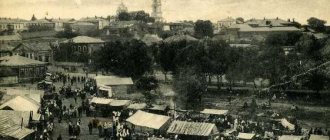
The first chronicle mention of Sebezh dates back to 1414, when the Lithuanian prince Vitovt, approaching Sebezh, gave the order: “Take the city behind the shield and burn the fortress.”
During the Northern War (1700 -1721), Russia made a decisive attempt to reach the shores of the Baltic Sea. Peter I chose Sebezh as one of the strongholds for the offensive .
Being a border city , Sebezh was repeatedly captured by the Lithuanians, Poles, French, and Germans, and only in 1772 finally came under the jurisdiction of Russia.
As a result of the first partition of Poland, Russia's longtime rival was defeated, and the original Russian lands were returned to Russia. On May 28, 1772, two provinces were formed from the annexed provinces - Pskov and Mogilev. On July 22, 1773, the town of Sebezh became a county town in the Polotsk province of the Pskov province, and on March 22, 1777, “to equalize the counties of the Belarusian provinces... a new distribution was made,” and Sebezh county became one of the 11 counties of the Polotsk province.
The Sebezhsky district was formed as part of the Velikoluksky district of the Leningrad region by a resolution of the Presidium of the All-Russian Central Executive Committee dated August 1, 1927.
By decree of the All-Russian Central Executive Committee of January 29, 1935, the region was included in the Kalinin region. By decree of the All-Russian Central Executive Committee of February 5, 1935, the district was included in the newly formed Velikoluksky Okrug. By decree of the All-Russian Central Executive Committee of May 4, 1938, the district was included in the Opochetsky district of the Kalinin region. By decree of the Presidium of the Supreme Soviet of the USSR of August 22, 1944, the region was included in the Velikiye Luki region. By decree of the Presidium of the Supreme Soviet of the RSFSR dated October 2, 1957, the region was included in the Pskov region.
In October 1959, the previously separate Idritsky district was liquidated and transferred to Sebezhsky .
Today, the district's economy is assessed by the activities of the following industries and areas: Electrical engineering (State Enterprise Establishment YAL 61/3 is an electrical industry enterprise that produces high-voltage fuses), forestry and woodworking, food and processing, light industry, etc. One of the features of the district's economy is the fact that in connection with the formation of the state border, new areas of employment have appeared: customs, border, migration and customs clearance structures serving them.
Sebezhsky district is located in the temperate continental climate zone.
The river network in the region is distributed unevenly between two basins: the larger northern part of the territory belongs to the Velikaya , the smaller southern part belongs to the Western Dvina (tributaries of the latter). The river network is relatively dense, but small rivers predominate; often they are only channels connecting numerous lakes.
In the northern half of the region, the main river arteries are the Velikaya, Vet and Issa .
Of the numerous tributaries of the Velikaya , the most significant in the eastern part of the region is the Nevedryanka , flowing from Lake Mogilno ; Idrica River with the Livica flowing from Lake Liva . Not far from the sources of the Veti of the Issa the Losma River, originates in Lake Ostrovno .
The lakes are relatively rich in fish. They are home to up to 20 species of fish: mainly bream, pike perch, ide, pike, asp, perch, tench, crucian carp, silver bream, burbot, bleak, rudd, etc. Crayfish are also caught.
Swamps are widespread in the area, mostly shallow, low-lying ones. Large tracts of swamps are concentrated in the north-west, in the interfluve of the Issa and Vet and in the south-west of the region.
The Moscow-Riga highway ( M-9 ) runs through the area.
In 1996, the Sebezhsky National Park . On its territory there are 86 lakes, connected by rivers and channels, which form a single network and have access to the Baltic Sea.
Near the town of Sebezh there is a recreational area - Ugorinsky Bor .
The attractions of Sebezh include beautiful forests and reservoirs, of which there are more than 360, the Church of the Holy Trinity , the source "Holy Water ", a memorial complex dedicated to the Guards 150th Idritsa-Berlin Division, Petrovsky Val , the foundation stone at the site of the installation of a memorial structure dedicated to a native of Sebezh Z. E. Gerdt, the bell tower of the Church of the Nativity of Christ (1841).
Also among the attractions of Sebezh one can note the building of the church , built in the 17th century during the reign of Polish magnates, and Castle Hill , on which the fortress stood until the second half of the 16th century, until the campaign of False Dmitry.
Estate G.R. Derzhavina . d. Prihaby. Gavrila Romanovich Derzhavin took possession of the estate “PRIHABY” in 1777.
Church of St. Nicholas the Wonderworker , village of Zarodische (in 2008, the Zarodische Church, and now the Church of St. Nicholas the Wonderworker, turned 410 years old).
The Chapel of the Kazan Icon of the Mother of God is located in Ugorinsky Bor.
Not far from Sebezh , where the borders of Russia, Belarus and Latvia meet, the Mound of Friendship . This is a monument to the courage and heroism of the partisans - Russians, Belarusians and Latvians, who fought together against the Nazis.
Official website of the district administration: www.sebezh.reg60.ru
History[edit]
Sebezh was first mentioned in 1414. It was described as a fortress that protected Pskov from the south, and was captured by Polish troops. It is unclear whether the fortress was identical to the currently existing Sebezh, since it was also mentioned that the fortress was founded by the Russians in 1535 on the current site of the city. Subsequently, this area was located on the border between Russia and the Grand Duchy of Lithuania and changed hands several times. In the 18th century it belonged to Poland until 1772, when the territory was transferred to the Russian Empire during the First Partition of Poland. To accommodate the transferred areas, the Pskov province was created in 1772. In 1773, Sebezh was chartered and became the seat of the Sebezh district in the province of Polotsk, Pskov province. In 1777 it was transferred to the Polotsk governorship [11]. In 1796, the governorship was abolished and the territory was transferred to the Belarusian Governorate; from 1802 to the Vitebsk province. After 1919, Vitebsk Governorate was part of the RSFSR. [12] In 1924, Sebezhsky district was transferred to the Pskov province.
On August 1, 1927, the districts were abolished and the Sebezhsky district was formed with the administrative center in the city of Sebezh. It included parts of the former Sebezh district. The akimats were abolished, and the district also became part of the Velikiye Luki Okrug in the Leningrad Region. On June 17, 1929, the district was transferred to the Western Region. On July 23, 1930, the districts were also abolished, and the districts were directly subordinated to the region. On January 29, 1935, the district was transferred to the Kalinin Region, and on February 5 of the same year, the Sebezhsky District became part of the Velikoluksky Okrug of the Kalinin Region, one of the districts adjacent to the state border of the Republic of the Soviet Union. On May 4, 1938, the area was transferred to the Opochinsky Okrug. On February 5, 1941, the district was abolished. From 1941 to 1944, the Sebezh region was occupied by German troops. On August 22, 1944, the district was transferred to the newly formed Velikolukskaya Oblast. On October 2, 1957, the Velikolukskaya region was abolished, and the Sebezhsky district was transferred to the Pskov region. [13]
On August 1, 1927, the Idritsa district with the administrative center in the village of Idritsa was also established. It included parts of the former Sebezh district. The district was part of the Velikoluksky district of the Leningrad region. On June 17, 1929, the area was transferred to the Western Region. On July 23, 1930, the districts were also abolished, and the districts were directly subordinated to the region. On January 1, 1932, the Idritsky district was abolished and divided into Sebezhsky and Pustoshkinsky. On June 1, 1936, it was recreated as part of the Velikoluksky district of the Kalinin region; On May 4, 1938, the area was transferred to the Opochinsky Okrug. On August 22, 1944, the area was transferred to the Velikiye Luki region. On October 2, 1957, the Velikolukskaya region was abolished, and the Idritsky district was transferred to the Pskov region. On October 3, 1959, the Idritsky district was abolished and annexed to the Sebezhsky district.[13]
Sebezhsky district
The Sebezhsky district was formed as part of the Velikoluksky district of the Leningrad region by a resolution of the Presidium of the All-Russian Central Executive Committee dated August 1, 1927.
By decree of the All-Russian Central Executive Committee of January 29, 1935, the region was included in the Kalinin region. By decree of the All-Russian Central Executive Committee of February 5, 1935, the district was included in the newly formed Velikoluksky Okrug. By decree of the All-Russian Central Executive Committee of May 4, 1938, the district was included in the Opochetsky district of the Kalinin region. By decree of the Presidium of the Supreme Soviet of the USSR of August 22, 1944, the region was included in the Velikiye Luki region. By decree of the Presidium of the Supreme Soviet of the RSFSR dated October 2, 1957, the region was included in the Pskov region.
The area of the district is 3.1 thousand. sq. km. (5.8% of the total territory of the region).
In 1996, the Sebezhsky National Park was created. On its territory there are 86 lakes, connected by rivers and channels, which form a single network and have access to the Baltic Sea. Every year, 11 thousand people can relax on the territory of the National Park. Human.
The city of Sebezh is located on the coast of 2 large lakes - Sebezhskoye and Orono, and has an excellent recreational area - Ugorinsky Bor, which is located in the extreme south, but outside the city limits.
Sebezhsky district is one of the most beautiful areas of the region.
Deposits of peat, brick clay, construction sand and sand and gravel material have been identified and explored in the area.
History The first chronicle mention of it dates back to 1414, when the Lithuanian prince Vitovt, approaching Sebezh, gave the order: “Take the city behind the shield and burn the fortress.” Being a border city, Sebezh was repeatedly captured by the Lithuanians, Poles, French, and Germans, and only in 1772 finally came under the jurisdiction of Russia.
The territory of Sebezhsky district is located in the southwest of the region, 180 km. from Pskov. In the north it borders with the Krasnogorodsky and Opochetsky districts, in the east - with the Pustoshkinsky and Nevelsky districts, in the west - with the Republic of Latvia, in the south - with Belarus.
Population The population as of January 1, 2008 was 22,789 people, including urban - 13,524 people, rural - 9,265 people.
Social policy The area has a developed social infrastructure. There are 18 children's educational institutions in the field of education. There are health care institutions: a district hospital, 23 medical and obstetric stations, a house of mercy.
The cultural sphere is represented by: a centralized library system, including 23 libraries; club system, including 21 clubs and leisure centers, a children's art school, and a wonderful local history museum.
Attractions The attractions of Sebezh include beautiful forests and reservoirs, of which there are more than 360, the Church of the Holy Trinity, the source “Holy Water”, a memorial complex dedicated to the 150th Guards Idritsa-Berlin Division, Petrovsky Val, the foundation stone at the site of the memorial building, dedicated to the native of Sebezh Z.E. Gerdt, the bell tower of the Church of the Nativity of Christ.
Economy Today, the district’s economy is assessed by the activities of the following industries and areas:
Electrical; Forestry and woodworking; Food and processing; Light; Printing; Production of building structures; Services sector; Trade and catering; Agriculture; Transport and communications; Healthcare; Social Security; Culture; Education. The most significant enterprises include:
State enterprise establishment YaL 61/3 is an electrical industry enterprise that produces high-voltage fuses. OJSC Sebezhskaya RAV Tekhnika is a logging and wood processing enterprise. OJSC Sebezh Crushed Stone Plant - production of building structures. Competitive products produced in the Sebezh region are:
Electrical products (high-voltage fuses), which are sold in Russia and the CIS countries. Reinforced concrete structures, manufactured mainly by order of the Oktyabrskaya Railway. Woodworking products are in demand in the Baltic countries and Western Europe. Hosiery products, medical stockings and sewing products are sold in many regions of Russia. Entrepreneurship in the Sebezh region was formed thanks to conditions favorable to their development:
geographical location of the area; the presence of developed transport arteries; sufficient supply of natural resources; positive attitude of the district administration towards the development of entrepreneurship. One of the main conditions for the development of entrepreneurship is the saturation of the market with goods and services. The following priority directions have been chosen in the development of entrepreneurship:
Wood processing Provision of various types of services Production and processing of agricultural products Development of tourism Recently, there has been a tendency towards the development of private trade. Moreover, many private shops are located in the countryside. Private entrepreneurs have opened a network of food and industrial stores and public catering establishments. Among them, the stores “Magnit”, “Lel”, “Expert”, “Treshechka”, “Koleso”, “Dom”, “Master Plus” enjoy special authority.
In recent years, small wood processing enterprises have been created (Voronets LLC, TEK LLC, Woodland LLC, Sever LLC).
An important role in the production of agricultural products is played by Piterproduct LLC (production and processing of milk), N.N. Baranovskaya Farm (production of meat and milk) and Vet LLC (production of grain, rapeseed, potatoes, vegetables).
One of the features of the region’s economy is that, in connection with the formation of the state border, new areas of employment have appeared: customs, border, migration and customs clearance structures serving them, security companies that provided jobs and additional cash income for the population.
Economics [edit]
Industry[edit]
In the area there are enterprises in the electrical (capacitor production), construction, forestry, textile, and food industries. [15]
Agriculture[edit]
The main branches of agriculture in the region are livestock farming with meat and dairy products and the production of potatoes and vegetables. [15]
Transport[edit]
The M9 highway, connecting Moscow and Riga, crosses the region from east to west, bypassing Sebezh. Another road connects Sebezh with Opochka and Polotsk. Since 2002, the entire section from Opochka to Polotsk is paid. [16] There are also local roads.
The railway connecting Moscow and Riga also crosses the area, with Sebezh being the main station in the area.
Culture and recreation[edit]
Trinity Church in Sebezh
There are 30 cultural heritage monuments of federal significance in the region, as well as 94 objects related to the cultural and historical heritage of local significance. [17] Monuments under federal protection are the Trinity Church (formerly Catholic) in the city of Sebezh, as well as twenty-nine archaeological sites.
In Sebezh there is the Sebezh Regional Museum, founded in 1927 and representing local collections. [18]
Links[edit]
Notes[edit]
- ^ ab Law No. 833-oz.
- ^ abcdef Law No. 420-oz.
- ^ a b About the area (in Russian). Portal of municipalities of the Pskov region. Retrieved August 15, 2012.
- ^ abc Federal State Statistics Service (2011). “All-Russian Population Census 2010. Volume 1" [All-Russian Population Census 2010, vol. 1]. All-Russian Population Census 2010 [All-Russian Population Census 2010]
. Federal State Statistics Service. - "26. The size of the permanent population of the Russian Federation by municipalities as of January 1, 2022". Federal State Statistics Service. Retrieved January 23, 2022.
- Urban-type settlements may include workers' settlements, resort settlements, holiday villages, as well as urban-type settlements themselves.
- "On the Calculation of Time". Official Internet portal of legal information
. June 3, 2011. Retrieved January 19, 2022. - ↑
Federal State Statistics Service of Russia (May 21, 2004).
“The population of Russia, the constituent entities of the Russian Federation as part of federal districts, urban settlements, settlements, settlements of 3 thousand or more people” [Population of Russia, its federal districts, federal districts, districts, urban settlements, rural settlements - administrative centers and rural settlements with a population of more than 3,000 people] (XLS). All-Russian Population Census 2002
. - “All-Union Population Census of 1989. The current population of union and autonomous republics, autonomous regions and districts, territories, negative phenomena, urban settlements and rural district centers” [All-Union Population Census of 1989: current population of union and autonomous republics, Autonomous regions and districts , territories, regions, districts, towns and villages performing the functions of district administrative centers. All-Union Population Census of 1989 [All-Union Population Census of 1989]
.
Institute of Demography of the National Research University: Higher School of Economics [Institute of Demography of the National Research University: Higher School of Economics]. 1989 - via Demoscope Weekly
. - ^ a b Geographical characteristics (in Russian). Portal of municipalities of the Pskov region. Retrieved August 15, 2012.
- History of the area (in Russian). Administration of Opochetsky district. Retrieved August 16, 2012.
- (locality) / TSB / Oblast (locality) / Oblast (locality)Check |url=value (help) (in Russian). Great Soviet Encyclopedia . Retrieved January 14, 2013.
- ^ ab Gerasimenok, T. E.; N.V. Kolomytseva, I.S. Pozhidaev, S.M. Fedorov, K.I. Karpov (2002).Territorial division of the Pskov region (in Russian). Pskov. ISBN 5-94542-031-X.CS1 maint: multiple names: list of authors (link)
- Order of the FSB of the Russian Federation dated June 2, 2006 No. 242 “On the border zone on the territory of the Pskov region”; Order of the FSB of Russia dated April 21, 2007 No. 201 “On amendments to the order of the FSB of Russia dated June 2, 2006 No. 242” On the border zone on the territory of the Pskov region “. Russian newspaper
.
2006
. - ^ a b Economics (in Russian). Portal of municipalities of the Pskov region. Retrieved August 16, 2012.
- Pskov region Toll roads (in Russian). ASMAP. Archived from the original on July 14, 2014. Retrieved October 16, 2012.
- Monuments of history and culture of the peoples of the Russian Federation (in Russian). Ministry of Culture of Russia. Retrieved June 2, 2016.
- Sebezh Museum of Local Lore (in Russian). Sebezh Museum of Local Lore. Retrieved August 19, 2012.
Administrative subordination includes:
Cities:
- Sebezh city
Work villages:
- Workers' village Idritsa
- Workers' settlement Sosnovy Bor
Villages:
- Village Masenkovo
- Village of Aleksandrovo (Boyarinovskaya volost)
- Andripolye village
- Berezka village
- Borisenki village
- Village Boyarinovo
- Bubnovka village
- Village of Glembochino
- Village Glubochitsa
- Grechukha village
- Village of Gritkovo
- Village Dvorishte (Dubrovskaya volost)
- Village Dedino
- Village of Dolostsy
- Dubrovka village
- Village Zharkovo
- Zhuki Village
- Village Zasitino
- Village Zaturje
- Ivana village
- Village Ilovo
- Village Isakovo
- Village of Karely
- Kitskovo village
- Village of Klevino
- Village Knyazevo
- Kozonovo village
- Village of Kortenki
- Village Krekovo
- Village Kuznetsovka
- Village Livica
- Village of Luzhki
- Village Malinovka
- Malkovo village
- Village Mikulino
- Morozovka village
- Village Mostishche
- Mylenki village
- Osyno village
- Prihaby village
- Epimahovo village
- Sutoki village
- Tehomici Village
- Tomsino village
- Ulyanovshchina village
- Village of Hroshki
- Village Tsynki
- Seagull Village
- Cherneya village
- Yamischi village
- Village Aguryanovo
- Aksenovo village
- Village Alatovichi
- Village of Alexandrovo
- Anninskoe village
- Aprosovo village
- Arestovo village
- Village Astashkovo
- Village Afanasyeva Sloboda
- Achromea village
- Village Ashkovo
- Village Ashnarovo
- Village of Bolshoye Nizhneye
- Baidakovo village
- Baidakovo village
- Baikino village
- Village of Baklanitsa
- Bolbuki village
- Balyki village
- Village Baranovshchina
- Village Barlovo
- Badgers Village
- Badgers Village
- Village Belogurovo
- Village White Keys
- Belkino village
- Village Belchaninovo
- Village Berezavets
- Village Bolozhevo
- Bolotniki village
- Village Big Nails
- Village of Bolshoye Drozdovo
- Village Bolshoye Krupovo
- Village Bondarevo
- Bondari village
- Borki village
- Boroviki village
- Village Borodulino
- Boshkino village
- Brod village
- Village Brusnichno
- Village of Bubny
- Village Budani
- Village Budkevshchina
- Bucatino village
- Village Bulavchino
- Burachki village
- Village Butynki
- Village of Bychkovo
- Village of Valtrevo
- Varaksino village
- Village Vasilkovo
- Village Veremeevo
- Village Verino
- Village Vershintsevo
- Village Vlazovichi
- Voitekhovo village
- Volovniki village
- Volosnya village
- Village Voluevo
- Vorontsovo village
- Village Vulkovo
- Village Vygorodka
- Vyselki village
- Village Galuzino
- Village Gasporovo
- Village Gasporovo
- Village of Gvozdy
- Village Gelenchino
- Glazkovo village
- Glapti village
- Village Glotovo
- Village Glubokoe
- Village Glukharevo
- Village Glukhovka
- Village Govyadovo
- Village Goyshino
- Village Goncharovo
- Gorbovo village
- Hunchback Village
- Goreliki village
- Village Gorelovo
- Gorka village
- Village Gornaya
- Village Gorushka
- Greblo village
- Village Grechukhino
- Village Grebeltsy
- Village Grinevo
- Grishino village
- Grishmany village
- Village Groshevo
- Village Grudinino
- Village of Grumada
- Village Dirty
- Village Gusevo-1
- Village Gusevo-2
- Village of Guta
- Village Dashkovo
- Village of the Palace
- Village Dvorishte
- Maiden Village
- Village Demikhovo
- Village of Divina
- Village Dmitrovo
- Village Dolgarevo
- Village Dolgovo
- Dorbyshi village
- Dorozhkovo village
- Village Drozdovo
- Village Drozdtsy
- Village Dubrovo
- Village Dylnovo
- Village Emelyantsevo
- Village Ermolova Gora
- Village of Janville
- Village Zheglovo
- Zheludy village
- Village Zhuki (Dubrovskaya volost)
- Village Zabelye
- Zabolotniki village
- Village Zavarzino
- Zagady Village
- Village Zalesye
- Village Zalesye
- Village Zalinevo
- Village Zalosemye
- Village Zamkova-Morozovka
- Village Zamosc
- Village Zamosani
- Village Zamosica
- Village Zamoshe
- Zanogi village
- Village Zarodische
- Zarodishchi Village
- Village of Zaselikhi
- Village Zastarinye
- Village Zashevenie
- Village Zaschepki
- Village Calls
- Village Zentsovo
- Village Zuevka
- Village Zuevo
- Zooey Village
- Idrija village
- Village Izotovo Bobrovo
- Village Ilyichino
- Kazinka village
- Kozihi village
- Kalnyshi village
- Village Kamenets
- Village Kapanovo
- Village Kapustino
- Village Karpino
- Village of Kitovo
- Village of Klesino
- Village Klin
- Village Klishino
- Village Kovalevka
- Village Kovalevo-Sizhenye
- Kozeltsy village
- Kozlovo village
- Koklino village
- Komary Village
- Village Kostelishte
- Kostino village
- Kostuchikha village
- Village Koshnevo
- Village Krasikovo
- Red Water Village
- Village of Krasnye Borki
- Village Red Stump
- Village of Krasny Poselok
- Village of Krementsi
- Village Kuzmino
- Village Kuzmino
- Village Kurilovo
- Lavrovo village
- Village Ladeevo
- Levnovo village
- Village Leokhnovo
- Leshani village
- Village Litvinovka
- Village Litvinovo
- Village Litvinovo
- Village Litvinovo
- Loguny village
- Village Loino
- Loma village
- Village Lopatino
- Village Lopatino
- Village Lopatovo
- Lopuhi village
- Luzhi village
- Village of Luzhki
- Village Maloye Nizhneye
- Village Magorevo
- Village Maksimkovo
- Village Maksimkovo
- Maksyutino village
- Malachi village
- Malachi village
- Village Malinovka
- Village Maloe Krupovo
- Village of Malye Gvozdy
- Village Malyuzino
- Matysovo village
- Village Mashikhino
- Mezhentsy village
- Village Mill
- Village Mill
- Village Mill
- Metishchi village
- Midino village
- Village Mironovo
- Village of Mikheevo
- Village Mogili
- Village Mogilno
- Village Mogilno
- Village Morozovo
- Morskoe village
- Motygino village
- Village Paved
- Village Matskovo
- Village Nepadovichi
- Village Nishcha
- Village Novikovo
- Village of New Lukovo
- Village Housewarming
- Village Novoselye-2
- Village Noglovo
- Ovinishchi village
- Ovsyanki village
- Village Ovchinnikovo
- Village Oderevo
- Village Olisovo
- Village Olkhovets
- Village Olshanik
- Orekhovka village
- Osetki village
- Osinniki village
- Village Ostrovno
- Village Ostrovno
- Village Pavlovo
- Village Peschanka
- Pilyuki village
- Piskuny village
- Village Plavlivo
- Village Pligovka
- Pogorelovo village
- Poddubie village
- Village Podkolenkovo
- Podklyuchishchi village
- Village of Poleikovichi
- Village Polozovo
- Village Popovka
- Posin village
- Prasni village
- Village of Pripeshi
- Village Pier
- Village of Prosni
- Village Proshkovo
- Village Prudishte
- Village Ptushkino
- Village Puzyrevo
- Village of Purgeli
- Village Pustoshka
- Pustynki Village
- Pityuli village
- Village of Putzni
- Village Puchnino
- Pyzhiki village
- Village Raikovo
- Village Repshino
- River Village
- Village of Rzhavki
- Village Rodionovo
- Village Rubezhnik
- Village Rudnya
- Village Rukovo
- Village Rybno
- Village Rybolovka
- Village Ryabikovo
- Savkino village
- Village Safonovo
- Village Sviblo
- Village Svidershina
- Selivanovo village
- Village Selishche
- Selishchi village
- Selyava village
- Village Semenovo
- Village Sidorkovo
- Village of Simanovo
- Village Skokovo
- Violin Village
- Village Slyazhevo
- Village Slyazhino
- Village of Smagino
- Village Sovrashina
- Somino village
- Village Staklino
- Staritsa village
- Village Old Lukovo
- Village Old Pond
- Steymaki village
- Village Stoyaki
- Sundukovo village
- Sutoki village
- Village Syltanovo
- Village Taraschino
- Village of Tarasy
- Village of Carts
- Village Weavers
- Village Tolkachevo
- Village Fat Woman
- Fatty Village
- Tomsino village
- Trubino village
- Village Turkovo
- Tyabuty village
- Ugarinka village
- Village Ukleino
- Village Ukleynitsa
- Village Usadishte
- Usovo village
- Utuga village
- Fedkovo village
- Village of Fomino
- Village Frolovshchina
- Village of Khanevo
- Village Harmanovo
- Khlyusty village
- Khodyki village
- Khodyuki village
- Kholoe village
- Village Celovnica
- Cheremushnitsa village
- Village of Cherepovo
- Black Mud Village
- Chernovo village
- Village Black Stream
- Chertovo village
- Chukhovo village
- Village Shakolevo
- Shalai village
- Shvara village
- Shevino village
- Shikenevo village
- Sheklaki village
- Hornets Village
- Shkigino village
- Shkigino village
- Shuni village
- Village of Jesters
- Village of Jesters
- Village Shushkovo
- Yazviny village
- Village Yakovlevo
- Yalovki village
- Village Yasenovets
- Yaskino village
- Antisovo village
- Village Bezgribovo
- Borki village
- Yalovki village
- Avseikovo village
- Makei village
- Village Nesterovo
- Village Skovronkovo
- Village Armanovo
- Village Klyushevo
- Village Korshaninkovo
- Village Khodotovo
(C) 2015-2018 Rus.Bz - interactive online maps of Russian cities. Contacts: