The area of the Chelyabinsk region includes territories where mining sites, large plants and factories are located. This is one of the main regions on which the economy of the Urals is based. But the main wealth of the region is its hardworking residents. Let's find out what the area of the Chelyabinsk region is in square meters. km and population, and also find out the value of these indicators for individual areas.
Geographical location
Before we find out what the area of the Chelyabinsk region is and how many residents live in this region, let's find out where this federal subject is located.
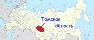
This region is part of the Ural Federal District and is located in the southern part of the Urals. In the west it borders with Bashkiria, in the north with the Sverdlovsk region, in the east with the Kurgan region, and in the south with the Orenburg and Kostonay regions of the Republic of Kazakhstan, that is, in this place the border of the Chelyabinsk region is at the same time the state border of the Russian Federation.
A significant area is occupied by the Ural Mountains, which have a certain influence on the climate, but not so much as to speak of this region as an area of altitudinal zonation. The climate type is characterized as moderate.
The administrative center of the region is the city of Chelyabinsk.
Chelyabinsk region
The region was formed on January 17, 1934 from the southern regions of the abolished Ural region. It borders in the north with Sverdlovsk, in the east with Kurgan, in the south with Orenburg region, in the west with the Republic of Bashkortostan. In the southeast lies the state border of the Russian Federation with the Republic of Kazakhstan.
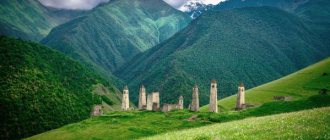
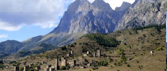
The territory of the Chelyabinsk region consists of mountainous and flat parts. The mountainous part is located on the eastern slopes of the Middle and Southern Urals. Only a small part of the region’s territory in the west, the so-called Gorno-Zavodskaya zone, extends onto the western slopes of the Middle and Southern Urals. The eastern and southern parts of the region are occupied by the West Siberian Plain.
The conventional border between Europe and Asia is drawn mainly along the watershed ridges of the Ural Mountains. Not far from the Urzhumka station of the Southern Ukrainian Railway (8 km from Zlatoust), on the Uraltau pass, there is a stone pillar. On one of its sides it is written: “Europe”, on the other: “Asia”. The cities of Zlatoust, Katav-Ivanovsk, Satka are located in Europe. Chelyabinsk, Troitsk, Miass - in Asia, Magnitogorsk - in both parts of the world.
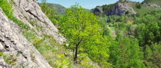
The Chelyabinsk region is located in three natural zones: mountain forest (fauna of mountain taiga, deciduous and mixed forests), forest-steppe and steppe (fauna of the steppe and valleys of large rivers). This is what determines the diversity of natural landscapes, ranging from mountain tundras and dark coniferous taiga, mixed and broad-leaved forests to feather grass steppes. The Ural Mountains, being an important climatic boundary, cause significant differences in the nature of the vegetation of the European and Asian slopes. The number of plant species reaches almost 1500, of which 210 are the most common. In terms of species diversity of vegetation, the Chelyabinsk region surpasses all other regions of the Urals, second only to Bashkiria.
The flat Trans-Ural spaces of the Chelyabinsk region are almost equally divided between the forest-steppe and steppe zones. The approximate border between them is the Uy River. In the northern part of the forest-steppe zone, the vegetation cover alternates between pine (sometimes with larch), spruce-pine and birch-pine forests with dry meadows and areas of meadow steppe. The southern part of the subzone is a forest-steppe. Meadow and forb-grass steppes alternate here with forests, pine-birch groves and birch groves.
The flora of the region contains about 150 species of medicinal plants, widely used in official and folk medicine.
Due to the diversity of natural conditions of the Chelyabinsk region and the long history of the formation of faunal complexes of the Southern Urals, the animal population of the region is quite diverse. Here there is a mixture of European and Asian species, and representatives of polar and desert fauna meet. The animal population of the forest and steppe natural zones have their typical representatives, but the population of the forest-steppe zone is mixed. The fauna of the region includes endemic and relict species.
The species richness of the fauna of the region consists of 80 species of mammals (33 species of rodents, 18 species of carnivores, 13 species of insectivores, 10 species of chiroptera, 3 species of lagomorphs and artiodactyls). The avifauna numbers 287 species, of which 224 nest (179 migratory and 45 resident species), 28 species are found on migration, 12 vagrants, 14 species with unclear residence status. The region is home to 10 species of reptiles and 11 species of amphibians. About 40 species of fish live in the reservoirs of the region, and their number is constantly growing due to the acclimatization of new species. Among invertebrate animals, we note that 409 species of spiders and 88 species of mollusks live in the region. The most numerous group of organisms on our planet are insects; the probable species richness of this group in the Chelyabinsk region is about 15 thousand species.
The most typical large animals for the forest and forest-steppe zones of the region are the elk and the Siberian roe deer.
In the mountain forest zone there are such large predators as brown bear and lynx. Among the valuable fur-bearing animals in this zone are the black ferret, weasel, otter, pine marten, furry weasel, European mink, ermine, common fox and others.
Bird species typical of the taiga are capercaillie, hazel grouse, crossbills, nutcracker, waxwing, great owl, woodpecker and the very widespread finch. In the strip of mixed and deciduous forests, the most common chicken birds are black grouse and gray partridge.
In the forest areas of the steppe zone, such as the Dzhabyk-Karagai forest, large animals can be found the same representatives as in the mountain forest zone: elk and Siberian roe deer.
Large predators of the steppe zone are the wolf, the common fox, and the corsac fox.
Rodents are most widespread in the steppe zone. They are represented by many families and species: ground squirrel, marmot, jerboa, hamster, water rat and many different species of mice.
Of the birds, the most characteristic of the zone are the bustard, little bustard, gray partridge, quail, lark and predatory steppe eagles, kites, hawks, etc. In addition, the steppe zone is the kingdom of Orthoptera, here they are most diverse.
The area of the land
The time has come to determine the area of the Chelyabinsk region in thousand km2. We will also compare the territory of this region with other subjects of the federation. So, the total area of the Chelyabinsk region is 88.5 thousand square meters. km. Of these, about 0.3% are water surfaces (rivers, lakes, ponds, reservoirs).
The Chelyabinsk region ranks 36th in terms of area among all federal subjects of Russia. That is, in size it is approximately in the middle of the list, but still closer to its beginning.
Population
After we know the area of the Chelyabinsk region (km2), we should determine the population of the region. The number of people living in this region currently amounts to 3500.7 thousand people.
This is already the tenth indicator in the country among all subjects of the federation, that is, the population of the region is quite large.
What are the largest cities in the 74 regions (174 and 774)
- Chelyabinsk - 1,198 thousand people.
- Magnitogorsk - 418 thousand people.
- Zlatoust - 167 thousand people.
- Miass - 151 thousand people.
- Kopeysk - 147 thousand people.
Total area of the region: 88,529 square kilometers.
Best drive type
What age car are you buying?
Traffic jams in Chelyabinsk, according to Yandex, reach 5 points.
Motorization in 74 regions (174 and 774) of Russia: there are 0.253 cars per person according to 2013 data. This means: one car for about four people.
The population density of 74 regions (174 and 774) is 39.56 people/km². (according to the 2022 census).
Motorists from the Chelyabinsk region began to be issued new license plates in 2022. The difference from the old ones is that instead of the region code “74” and “174” there is now a new one - “774”.
Demographic dynamics
How has the population occupying the area of the Chelyabinsk region changed over time? Let's look at this issue.
Up until 1991 inclusive, the number of residents of the region only grew. It was in 1991 that it reached its historical maximum - 3706.4 thousand people. From 1992 to 2011, there was a decrease in numbers, although in some years there was a slight temporary increase. Such periods were 1995, 1998 and 1999. In 2011, the total number of residents in the region fell to 3475.6 thousand people, but since 2012 a gradual increase began. In 2016, the population reached 3500.7 thousand people. The trend of increasing the number of residents in the Chelyabinsk region is observed to this day.
Ethnic composition
Now let's find out what nationalities live in the region.
The majority of the region's population is Russian. Their share of the total population is 83.8%. They are followed with a significant lag by the Tatars - 5.4%, and the Bashkirs - 4.8%. There are even fewer Ukrainians – 1.5%, and Kazakhs – 1.1%. In addition, representatives of such nationalities as Belarusians, Germans, Mordovians, Armenians and many others live in the Chelyabinsk region, but their share in the total population of the region is less than 1%.
Territory and population of districts of the Chelyabinsk region
The Chelyabinsk region consists of 27 districts. We will now consider the area of the territory and the population in them.
The area of the Agapovsky district is 2600 km2. It is home to a population of 33.4 thousand people. The majority are Russians. Tatars, Ukrainians, Bashkirs and Kazakhs also live.
The territory of the Argayash district is 2700 km2. Population: 40.9 thousand people. Most of them are Bashkirs. Then come the Russians and Tatars.
Ashinsky district occupies an area of 2900 thousand km2. The population is 60.4 thousand inhabitants.
Bredinsky district is the largest of those that include the Chelyabinsk region. The area of this administrative unit is 5100 km2. Number of residents – 26.0 thousand people.
The area of the Varna region is 3900 km2. Population – 25.4 thousand people.
The Verkhneuralsky district covers an area of 3,500 km2. At the same time, the population is 35 thousand people.
Yemanzhelinsky district has an area of only 113 km2. Its population is 51.3 thousand people.
The area of the Etkul district is 2500 km2 with a population of 30.7 thousand people.
The area of the territory and the number of people living in the Kartalinsky district are respectively 4700 km2 and 47.3 thousand people.
Kasli district has a territory of 2800 km2, but at the same time has a population of 33.1 thousand people.
The territory of the Katav-Ivanovsky district is 3400 km2. Population – 30.8 thousand people.
The area of the Kizilsky district is 4400 km2. At the same time, the population is 23.4 thousand people.
The total territory of the Korkinsky district is only 102 km2. This is the smallest district in the region, but the population here is 60.4 thousand people.
The territory of the Krasnoarmeysky district is 3800 km2 with a population of 42.2 thousand people.
The area of the districts of the Chelyabinsk region not listed above is as follows:
- Sosnovsky – 2100 km2;
- Uvelsky – 2300 km2;
- Plastovsky – 1800 km2;
- Chebarkul - 2900 km2;
- Nyazepetrovsky – 3500 km2;
- Kunashsky – 3100 km2;
- Nagaibaksky - 3000 km2;
- Oktyabrsky – 4400 km2;
- Kusinsky – 1500 km2;
- Satkinsky – 2400 km2;
- Troitsky – 4000 km2;
- Chesmensky – 2700 km2;
- Uysky - 2600 km2.
Map of the Chelyabinsk region by district
The Chelyabinsk region is located in the Ural Federal District of the Russian Federation at a distance of 1919 km from Moscow. It lies in the center of Eurasia, on the territory of the Southern Urals, on the border of Europe and Asia, so the settlements of the region are located in different parts of the world.
About 3,485,272 people live in the Chelyabinsk region, of which 82% are urban residents. The administrative center, the city of Chelyabinsk, has a population of 1 million 143 thousand people. Other large cities: Magnitogorsk, Miass, Zlatoust, Kopeisk, Ozersk, Troitsk, Snezhinsk, Satka, Chebarkul, Kyshtym. Chelyabinsk region. Online map (The dotted line indicates the boundaries of the area on the map)
The area is 88.5 thousand km2. It borders with the Sverdlovsk, Orenburg, Kurgan regions, Bashkortostan and Kazakhstan. The climate is moderate continental. Winter is cold and long. The average monthly temperature in January is -17 C. Summer is warm, especially in the southeast. The average monthly temperature in July is +19 C. Since the region is located in the center of the continent, there is not much precipitation - from 300 mm on the plains to 600 mm in the mountains. The length of the growing season is 130-150 days. More than 25% of the territory is covered with forests. In the northern part there are pine and aspen-birch forests, the center is forest-steppe, the southern part is steppe. The mountains are dominated by spruce-fir forests of larch, linden, pine, and oak. There are a lot of rivers in the region, but mostly they are low-water, since their headwaters are located here. They belong to the Tobol, Kama and Ural basins. The largest, which in the region are more than 200 km long, are Miass, Ural, Uy, Ay, Uvelka, Gumbeyka, Ufa. And there are even more lakes here, which is why the region is called the “land of lakes.” There are 3170 of them, 98 of which have an area of more than 5 km2. The largest lake with an area of 68 km2 is called Uvildy. . In 2013, a meteorite fell to the ground near Lake Chebarkul.
Districts of the Chelyabinsk region:
|
|
|
Map of the Chelyabinsk region by district
Cities and towns:
|
|
|
There are reserves of iron, copper, nickel, titanomagnetite, aluminum ores, as well as placer and ore gold. They also mine brown coal, graphite, kaolin, magnesite, talc, and mineral construction raw materials (especially cement and magnesite). There are mineral waters and healing muds. The soils are located zonally: in the forest zone, gray forest podzolized; in the forest-steppe there are light gray podzolized forest soils and chernozems; There are various black soils in the steppe.
Largest cities
In addition, 16 settlements in the region have the status of urban district. We will talk about the largest of them below.
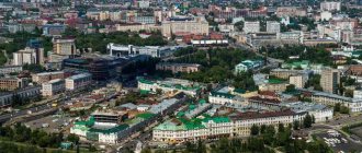
The administrative center of the Chelyabinsk region and the largest city in the region is Chelyabinsk. This settlement was founded in the first half of the 18th century on the site of the Bashkir village of Chelyaby. Currently, the city is located on an area of 530 km2 and has a population of 1192 thousand people. It is the only millionaire city in the region. The majority of the population is Russian. Among the national minorities, the majority are Tatars, Ukrainians and Bashkirs. Chelyabinsk is a large industrial city, where metallurgy and mechanical engineering are especially developed.
The second city in terms of population is Magnitogorsk. 416.6 thousand people live here. This locality is also known for its well-developed industrial sector of the economy.
Zlatoust is the third largest city in the Chelyabinsk region. 169.1 thousand people live here.
Another city, Miass, has 151.4 thousand inhabitants.
The smallest city in the Chelyabinsk region is Kopeisk. 146.1 thousand people live here. Ozersk is home to 79.5 thousand inhabitants.
The total area of Troitsk in the Chelyabinsk region is 129 km2. At the same time, the population in this locality is 75.8 thousand inhabitants.
general characteristics
Although the Chelyabinsk region is in the middle of the list of Russian regions in terms of territory size, the density and population size here is nevertheless higher than that of most other subjects of the federation. The majority of residents are Russians, and among other nationalities the most numerous are Tatars and Bashkirs.
The largest city in the region is its administrative center - Chelyabinsk. It is home to more than one million people.
The Chelyabinsk region is a large industrial and mining region. Iron ore and other minerals are mined here on an industrial scale, and industries such as mechanical engineering and metallurgy are also developed.
Natural resources
The Chelyabinsk region is located mainly on the eastern slopes of the Southern Urals. In the north-west - in the mountain-forest zone of the Urals.
The Chelyabinsk region is located at the junction of two parts of the world - Europe and Asia. Two sections of the conventional “Europe-Asia” border pass through the region: mountainous - about 150 km along the eastern slope of the Ural ridge and water - about 220 km along the Ural River. The main part of the region's territory lies in Asia, and only a small part of it in Europe.
The region extends from south to north for 490 km, from west to east - 400 km.
Resource Map
Legend
The Chelyabinsk region has rich and diverse natural resources, including a number of unique deposits: one of the world's largest Satka magnesite deposits, Europe's largest Koelginskoe deposit of white marbles, Russia's only Zhuravlinolozhskoe deposit of kaolin clays used for the production of fine ceramics, porcelain, earthenware, paper. Mineral resources are concentrated in more than three hundred mineral deposits, the most industrially important of which are deposits of iron and copper-zinc ores, gold, quartz, titanium-magnetite ores, manganese and chromium, kaolin, barite, phosphorites, and glauconite. The Chelyabinsk region is a monopolist in Russia in the extraction and processing of graphite (95% of the all-Russian volume), magnesite (95%), talc (70%), and metallurgical dolomite (71%). The region has practically unlimited reserves of building and facing stones with a wide range of colors - granite, marble (including some that is not inferior in quality to the famous Carrara).
In accordance with the time zone, time in the Chelyabinsk region is 2 hours ahead of Moscow time.
The Chelyabinsk region, located in the depths of the European continent, is characterized by a continental climate with long cold winters, relatively short but warm summers and very short transitional autumn and spring seasons. Since the Chelyabinsk region is located in three natural zones - mountain-forest, forest-park and steppe, each of them has its own climatic characteristics.
The peculiarities of the continental climate are associated with the location of the region in the depths of Eurasia, at a great distance from the seas and oceans. The formation of the climate is significantly influenced by the Ural Mountains, which create an obstacle to the movement of western air masses from the Atlantic.
The winter season in the Chelyabinsk region lasts five months - mainly from November to March, but in mountainous areas it begins 1-2 weeks earlier and ends 1-2 weeks later than in the forest-steppe zone, and on the main and watershed ridges , having a height of up to 1000-1300 meters, the snow cover disappears only in May. In mountainous regions, winter is snowy and milder than in the steppe regions, where less snow falls.
In summer, low pressure prevails in the region. With the entry of air masses from Kazakhstan and Central Asia, hot and dry weather sets in.
Average temperature:
- January - from minus 15 to minus 17° C,
- July - from plus 16 to plus 18° C.
The average annual precipitation is 350 mm per year on the plain and 600 mm per year in the mountains. The duration of the growing season is 130-150 days.
The western foothills of the Ural Mountains gradually turn into the East European Plain, while the eastern slopes descend steeply, adjacent to the flat West Siberian Plain-lowland. Therefore, in the Southern Urals you can find all the natural, climatic and geographical zones of Russia.
The northwestern territory of the region is crossed by the Ural Mountains, the highest peak is 1406 meters above sea level. In the east, hilly terrain alternates with valleys. In the mountainous area, surrounded by forests and lakes, there are many picturesque natural landscapes.
On the tops of mountains there are zones of tundra and forest-tundra. Then there are zones of taiga, mixed and deciduous forests. Further south extend the forest-steppe, steppe and semi-desert zones.
The relief of the Southern Urals is very diverse. It was formed over millions of years. Within the Chelyabinsk region there are various forms of relief - from lowlands and hilly plains to ridges, the peaks of which exceed 1000 m. The profile of the mountainous part is varied - from steep eastern slopes to the relatively flat western part. The main ridges: Taganay, Zigalga, Urenga, Nurgush, Bolshaya Satka. They are covered with stone deposits. There are 113 karst fields in the region, in the depths of which caves lurk and underground rivers roar. The most extensive karst plateaus are Shalashovsko-Minyarskoye (Asha district) and Shemakha (Nyazepetrovsky district). On the Sim River, near the village of Serpievka, there is the famous Ignatievskaya Cave, it is also called the “art gallery of the Stone Age.” There are a total of 320 caves in the region, almost all of them are unique and declared natural monuments.
The mountain rivers of our region are picturesque. Starting on the slopes of mountains, they cut deeply into intermountain valleys or cut through ridges. Rocky shores, fast currents, rocky riverbeds and clear water attract many tourists in spring and summer.
Geographers consider the Chelyabinsk region to be a lake region. It is decorated with more than three thousand lakes. The deepest lakes are Uvildy, Irtyash, Turgoyak, Chebarkul, Zyuratkul and Bolshoi Kisegach. Their depths reach 30-40 m. The smallest depths are 70 cm. Such lakes are mineralized (steppe zone).
Many lakes in Trans-Urals have balneological properties. In terms of the variety of therapeutic muds (from organic to sapropel silts), the Chelyabinsk region ranks 1st in Russia. Lakes in the foothills (Svetlenkoe, Akachkul, Sabanay) are organic; their muds are widely used in the resorts of Uvildy and Bol. Kissegach, Elovoe. Lakes Tauzatkul, Gorkoye, Podbornoe (Uvelsky district) are famous for their mineral muds; Salty, Sweet (Oktyabrsky district); Big and Small Shantropay (Etkul district).
The region is home to more than 60 species of mammals and 232 species of birds. The most common species are wolves, foxes, moose, roe deer, squirrels, moles, hedgehogs, beavers, marten, mink, ferret, badger, rodents, ducks, geese, cranes, woodpeckers, seagulls, finches, less often - bear, lynx, roe deer, sika deer , wood grouse, swans. Hunting is organized for game species of animals and birds.
There are over two hundred protected areas in the region.
On the eastern slopes of the Ural Mountains there is a mineralogical museum, in which more than 260 minerals and 70 rocks were found, the natural landscape and historical and archaeological museum-reserve Arkaim - one of the settlements of the “Country of Cities”, the discovery of which is recognized as the most important archaeological event of the twentieth century, national parks "Taganay" and "Zyuratkul". The network of ski sports complexes - Abzakovo, Zavyalikha, Adzhigardak - is actively developing.


