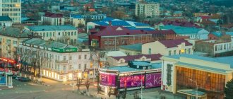
Elabuga is an ancient and beautiful city on the banks of the Kama River, which flows in Tatarstan. Here you can find many historical attractions. Tourists flock here to appreciate the unusual architecture of the buildings and see with their own eyes the natural beauty of the flowing river.
There are few cities where you can find so many historical buildings. From military fortifications to church buildings, there is a lot to see here.
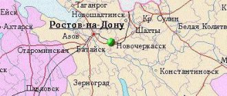
The city is located 200 km away. from the capital of Tatarstan, just at the confluence of the Toyma River and the Kama River, where a wide floodplain is formed. This is the center of the Elabuga region, forming an urban settlement and entering the Nizhne-Kama (Naberezhnye Chelny) agglomeration.
You can sign up for an excursion in one of the large Russian cities located in relative proximity to Yelabuga
From Yoshkar-Ola
From Kazan
From Cheboksary
The area of the city is slightly more than 40 km2, and the population exceeds 70 thousand people, so it cannot be called a very large urban center. At the same time, the good socio-economic development of this place is due to its favorable location, right at the intersection of important trade and economic routes. Thanks to this, historically many merchants, representatives of the clergy, artisans and other people came to Elabuga and contributed to the development of the city.
History of the development of Yelabuga
The year of foundation of the city is considered to be 1780, but in fact people lived in this place for over 100 years, since already in 1010 a large urban settlement was formed here, which is confirmed by a number of written sources. Despite this, scientists have not yet been able to establish a more precise date of settlement, however, there is information that the first settlements in this area could have been as early as the 5th century BC. This is confirmed by excavations of the Ananyinsky burial ground, where scientists were able to discover several artifacts.
In the first half of the 17th century, the first Christian monastery was built here - Trinity, which marked the beginning of a new era in the formation of the city as the spiritual center of the region. Just on the site of the modern city at the end of the 16th century there was a settlement of Trekhsvyatskoye, which numbered several thousand people. With the beginning of active construction of churches, the settlement gradually began to transform and in 1780 this place officially received the status of a county town at the behest of Empress Catherine II.
A very significant road ran here from Volga Bulgaria to the northern part of Russia, right up to the Arctic Ocean, so there were always many merchants in the city. Thanks to the skill of the architects, interesting stone buildings from the 17th-19th centuries have still been preserved here, which are of great interest to modern tourists. By the beginning of the 19th century, the city had turned into a large industrial zone, and 100 years later, in the 20th century, Elabuga became a leading city in the production of vehicles and spare parts. Today it is the largest industrial city, where several plants and factories operate, the production of agricultural machinery is established, and the oil industry is well developed.
Sights of Yelabuga
As you can already see, the history of the city goes back centuries, so it is not surprising that here you can find many ancient monuments - silent witnesses of those distant times. By the way, tourists will find it useful to know that they can build their own route for sightseeing, since the city is small in area.
It should be noted that from the river side there is an amazingly beautiful view of the city, not only in the daytime, but also in the dark. For this reason, many tourists come to the city by boat, taking excursions from nearby cities, including Kazan.
Embankment Street
It is best to start your walk from Naberezhnaya Street, which was founded in the second half of the 18th century and is considered the oldest. It is located at a considerable height, so it offers a beautiful view of the entire city, the river and distant forests.
St. Nicholas Church
This architectural structure was named in honor of St. Nicholas the Wonderworker and was originally made of wood. After the fire, it was rebuilt, but from stone, and in this form it has been well preserved to this day. A little later, the Church of the Epiphany was also erected next to it, and after some time they began to be considered a single architectural complex.
The heyday of St. Nicholas Church was the 70s. XIX, when its walls were richly painted by the artist V.V. Vereshchagin. Fortunately, most of these paintings are well preserved, and visitors to the church can admire them. In the St. Nicholas Church there are various icons, the most famous of which are the icons of the Wonderworker Nicholas and the Saint.
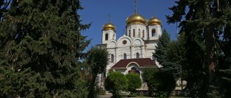
Spassky Cathedral
The church building was built at the beginning of the 19th century and today is an architectural symbol of the city of Elabuga. The majestic five-domed temple, made in the Russian classical style, reaches a height of 57 meters, and therefore is clearly visible from different parts of the city. The temple enjoyed special respect and veneration among all residents of the city, especially since its interior decoration was painted by such famous Russian artists as I.A. Bruni and V.V. Vereshchagin. During the construction of the temple, the merchants Chernov, Shishkin, Girbasov and Stakheev provided great financial assistance, so the church, even at the time of its construction, looked very beautiful and rich, was decorated with precious stones, gold and silver.
Unfortunately, after the revolution of 1917, the temple was destroyed, and its rector and church servants were shot. Miraculously, the icon of the miraculous image of the Savior Not Made by Hands, which currently adorns the Pskov Cathedral, survived. In the early 90s of the twentieth century, the cathedral was transferred to the Yelabuga deanery. In 2007, a major reconstruction was completed, as a result of which the temple was returned to its original appearance, so today many tourists arriving in Elabuga strive to visit this institution. By the way, every year the Spassky Cathedral takes part in the bell ringing festival.
Damn town
This is the most famous monument of Elabuga, representing the only evidence of the former greatness of Volga Bulgaria.
Here a tourist can see a whole complex of ditches, fortress walls and ramparts, but the main symbol of the place is the tower of the “Devil's Settlement”. It is a hollow stone building with a domed metal roof, which also has windows characteristic of buildings of that time.
It should be noted that the building was preserved in this form thanks to the assistance of the merchant I.V. Shishkin, who in 1867 organized work to recreate the original image of the tower. So the original masonry remains only on the north side and can be found by looking at the rough stones.
Jamig Mosque
A modern building, erected in 1992 and today the most famous monument of Islamic culture, built according to the design of the architect F. Sh. Galiev. The characteristic features of the stand include the rich decoration of the temple, the presence of a large number of carpets, and a large crystal chandelier. Services are held here every day and hundreds of Muslims seek to take part in prayers.
Climate and ecology
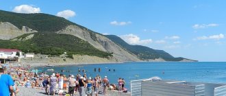
The amazing city of Elabuga is located in the temperate continental zone. Summer here is usually hot, but the authorities have provided places where people can endure the heat. So, a 20-minute drive away there is a specially equipped beach located on the banks of the Kama River. Rain in the summer is rare in these parts, but in autumn and spring, on the contrary, the weather is rainy. In winter the weather is frosty.
The ecology in these areas is relatively clean, since there are no large objects that could pollute. On the contrary, the Lower Kama National Park was built here, the purpose of which is to preserve natural beauty.
Other interesting places
House Museum of I. I. Shishkin
Grave of M. I. Tsvetaeva
Monument to N. A. Durova
We also recommend visiting the Museum of Local Lore, the monument to I. I. Shishkin, the Exhibition Hall of the Museum-Reserve, the House of N. A. Durova, the Al-Qadir Mosque and the Diocesan School.
What else can you visit in Elabuga?
While in the city on vacation, you should definitely visit the “1000th Anniversary of Yelabuga” Square, which was founded in honor of the city’s millennium in 2007. The park is located in a picturesque place, not far from the Devil's Settlement, and everything is decorated very beautifully.
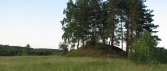
There are plenty of benches and benches, well-equipped pedestrian and bicycle paths, and outdoor lighting installed. Natural monuments also include Krasnaya Gorka and Svyatoy Klyuch, where there is a spring with clean water.
In conclusion, it is worth noting that in Elabuga there is no trolleybus or tram service, and there is also no airport. Most often, people come here by excursion buses, private cars and by boat on the Kama River. Thanks to the beautiful architecture, there is something to see in Yelabuga and you can have a great time in your free time.
Where is Elabuga located on the map of Russia? In what field? How many km from Moscow?
Elabuga is a small but picturesque town with a cultural and historical heritage. It carried through the centuries the atmosphere of a merchant city, in which there were wooden mansions, as well as ancient streets and shady alleys. In addition, the city of Elabuga is characterized by the presence of steep mountains and fields that are surrounded by greenery. Here you can see landscapes familiar to most from the paintings of Ivan Shishkin; poignant poems by the famous Russian poetess Marina Tsvetaeva, which recalled the last days of her life spent in these parts; house-museum of the cavalry girl Nadezhda Durova; as well as stone structures of the Stakheev dynasty, which still stand today.
The appearance of this corner of Russia consists of many small stories of both its residents and guests.
general description
The Kama River stretches for 1805 kilometers. Its pool is 507,000 sq. km. According to the official hypothesis of hydrologists, the reservoir is the left branch of the Volga. Its path lies through 5 regions - the Udmurt Republic, the Kirov Region, the Perm Territory, as well as the republics of Bashkortostan and Tatarstan. The “artery” flows north for a long time before turning south, and in the very lower reaches – to the west. It falls from one of the lateral Ural massifs and runs along the foothills of the main Urals. To the north of the Bashkir Cis-Urals and to the south of the Northern Uvals it comes out onto a plain, immediately flowing into the Volga. The “wall” of the Volga Upland acts as the right bank of the river mouth. It reaches its maximum width at the confluence with the Mesha River - 30 kilometers. Average values are 1.5 – 2 kilometers. In this regard, it is superior to the Volga, since it is fed by a superior number of deep branches (before the Ice Age, it was the Kama that flowed into the Caspian Sea). The largest rivers of the Kama basin are Vishera, Chusovaya, Belaya, Vyatka, Ik, Lysva, Kosva and Yayva. The highest flow rate of Kama water is 1750 cubic meters per second. Food is predominantly snow, but rainfall is also important. The share of ground recharge of the described basin is not significant.
The Kama River appeared much earlier than the Volga. After all, the Verkhnekamsk Upland is part of the Ural Mountains. Those are recognized by geologists as the most ancient on the territory of our Fatherland (they already existed in the first half of the Quaternary period). By the way, before the construction of the Kuibyshev “sea” the length of the reservoir was 2030 kilometers. Even the Udmurt word “kam” (from which the hydronym is derived) is translated as “main river”. The navigability of the presented water stream was highly appreciated several thousand years ago. The first description of the Kama River was given in birch bark documents from the Novgorod Land. This state formation of a republican type made the peoples living on the Upper Kama its tributaries, collecting furs from them. The Novgorodians entered the Kama through the Volga, and entered the Volga bed along the waterway already known in the 9th century - “To the Khazars”.
Slovenes met here the descendants of the ancient Finno-Ugric population - the Udmurts and Komi-Permyaks. However, to the south, on the Bashkir and Tatar shores, the Bulgars also lived (the Khazars and the Turkic Khaganate never managed to gain a foothold here). Like the Bashkirs, the “people of the country of Bolgars” once came from the Eurasian steppe and only here they received genes into their blood from the tribes of the Abashevo and Andronovo cultures, highly developed in all respects, as well as from the nation of the northern branch of the Sarmatians - the Sobers (Siberians). The Bulgars opposed themselves to all the Turks, quickly moving from the stage of a robber-nomadic formation to the stage of a creative ethnos. On the eve of the Horde conquest, the Bolgar state had strong diplomatic relations with the Udmurt principalities (where tribal relations were disintegrating), as well as most of the ancient Russian principalities. And all of the listed nationalities successfully rafted across the reservoir - for trade or military purposes. In the first third of the 13th century, the Kama River was in the zone of the first Mongol-Tatar raids. The Tatars conquer the Bulgars, trying to radically erase all signs of their rich culture. But all its deep layers are preserved, and progressive Tatars today like to call their country Bolgar. Quite fair. At the beginning of the Late Middle Ages, the entire Kama movement became part of the powerful Kazan Khanate. And then, in turn, it was defeated in 1552 by the troops of the Moscow state. The river basin (with the constantly migrating Udmurts, Tatars and Bashkirs) is part of two huge Russian governorships, and our ancestors established most of the fortresses in the Kama Cis-Urals over the next 200 years. The Bashkirs, who had the same origin, had a completely different fate. These people did not adapt well to the Moscow and later Russian Empire. Although in 1557 Bashkarda joined Greater Moscow voluntarily. Almost the entire “Bashkort” constantly sided with the enemies of the tsarist government. Even during the time of the Horde, the Bashkirs were completely devoted to the Genghisids. Later examples of conflict are support for Razin, the uprisings of the Yaik Cossacks, as well as participation in the Pugachev War, during which the Kama banks were also affected. After all, more than once there were raids on the industrial towns of Catherine’s Russia. The wasp is first on this list.
The Pugachevites at one time founded a base in the village. By the way, both the Bulgars and the Bashkirs called the Kama Chulman - “a river for people.” But then it turned out that the same applies to steamships. A new type of shipping conquered the river valley from 1817. It was then that in the town of Pozhva, according to the design of engineer Sobolevsky, two technical inventions with water wheels were finalized and launched. This event further pushed the economic development of the local provinces. During the Civil Conflict, several military dramas took place in the Bashkir section of the current with the participation of Vasily Chapaev’s division. The Second World War did not affect the Kama shores. And in the post-war years, the energy use of the Kama River made it possible to obtain the most stunning (for that time) economic results. From 1949 to 1958, a hydroelectric power station was built in Perm, the power of which reached 483 Megawatts (now 552), and the annual electricity production was 1834 million kilowatts per hour! The height of the dam is 35 meters. In addition, the Kama water system includes several reservoirs.
Kama River Basin
Beyond Kuliga, the Kama River runs through a continuous spruce-alder forest to the north, only occasionally touching small edges. The terrain creates a noticeable bias towards the water course. There are also minor bends. The flow of the Kama River in the Afanasyevsky district of the Kirov region gradually forms a stable channel 70-80 m wide. There is no longer a low edge, since now the river “body” is sandwiched by the hills of the Verkhnekamsk Upland. The settlements are very small. At Afanasyevo the river descends into a slightly swampy lowland. In the Verkhnekamsk region the floodplain goes only through swamps.
But in the Gainsky district of the Perm Territory, the Kama River basin smoothly takes a north-eastern azimuth. The Perm land meets the reservoir with pine forests. At the same time, the stream spreads over a flat lowland up to 300 meters wide, often forming fields and eriks. From the village of Gayny (in which there is a museum of Komi-Permyaks named after Sozonov), it moves (with a southern trough) to the east. And in Bondyuga it generally turns to the south, flowing around the mountain range. Its slopes up to 30 meters high “pursue” the Kama from the western side. With this orientation, the reservoir goes through the Cherdynsky district (absorbing Vishera) and the beginning of the Perm district (absorbing the water of Usolka). The width of the river is already up to a kilometer, and in the Solikamsk region some bays are up to 2 km. One side continues to remain high, sometimes dropping to only 10 meters. In the area of Bereznyaki and below, the flow of the Kama River “sucks in” a whole series of tributaries, expanding in places up to 7 kilometers, and the Kama reservoir between the Dobryansky and Ilyinsky districts already has a width from 4.5 to 12 kilometers. The forest becomes mixed. The reservoir, constantly narrowing, goes all the way to Perm. Here the Kama passes through a hydroelectric station and the Chusovaya River flows into it. And then its width for a long time does not exceed 1.5 km - until the confluence with the Ocher, where a 3-kilometer branch is formed. We are still talking about the vastness of the Perm region. At the historical settlement of Osa, the river enters the area of the same name, where the forests again become spruce-alder-birch. The right bank remains high. Having walked a little to the west, the reservoir again hurries south, acquiring a width of 5 km at the turn. Before Elovo it is already 6 km. Between Udmurtia and the urban district of Tchaikovsky (Perm Territory) the standard reaches 7. This is the dam of the Votkinsk hydroelectric station. And 19 kilometers from the right bank you can see the beautiful Votkinsk itself - the industrial symbol of Udmurtia. In Bashkortostan (left bank), the Kama River basin becomes 1.5-2 kilometers wide, and on the Udmurt-Bashkir border it absorbs the Belaya River, forming a floodplain measuring 16 by 25 kilometers (with dozens of oxbow lakes, lakes, water meadows and eriks). The high coast already resembles small mountains. From the thicket the reservoir emerges into the forest-steppe. In Tatarstan (where it is no longer the northern, but the southern taiga that dominates), the Kama is expanding again. This time up to 12 km. This refers to the Nizhnekamsk “sea”, located within 3 districts of the republic. Behind the “factory city” of Nizhnekamsk is the branch of Vyatka. In the lower reaches, the stream spreads throughout the valley, forming “shoots.” The channel is no more than 1200 m in diameter, and sometimes narrows to 450 m. In Elabuga there are Tanaevsky floodplain meadows and forests. During the May discharge of water, even the trees are covered to the very top. In the final section, the flow of the Kama River coincides with the lands of the administrative units of Tatarstan already indicated in the previous section, absorbing Mesha.