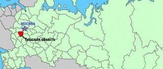
The Sverdlovsk region is a subject of the Russian Federation, part of the Ural Federal District, bordering the Perm Territory, the Komi Republic and the Khanty-Mansi Autonomous District, the Tyumen, Kurgan, Chelyabinsk regions and Bashkiria. On an area of 194,307 square kilometers (17th largest among the constituent entities of the Russian Federation) occupied by the region, there are 47 cities and 26 urban-type settlements.
Cities of the Sverdlovsk region: Alapaevsk, Aramil, Artyomovsky, Asbest, Berezovsky, Bogdanovich, Verkhny Tagil, Verkhnyaya Pyshma, Verkhnyaya Salda, Verkhnyaya Tura, Verkhoturye, Volchansk, Degtyarsk, Yekaterinburg, Zarechny, Ivdel, Irbit, Kamensk-Uralsky, Kamyshlov, Karpinsk, Kachkanar, Kirovgrad, Krasnoturinsk, Krasnouralsk, Krasnoufimsk, Kushva, Lesnoy, Mikhailovsk, Nevyansk, Nizhny Sergi, Nizhny Tagil, Nizhnyaya Salda, Nizhnyaya Tura, Novaya Lyalya, Novouralsk, Pervouralsk, Polevskoy, Revda, Rezh, Severouralsk, Serov, Sredneuralsk, Sukhoi Log, Sysert, Tavda, Talitsa, Turinsk.
For ease of use, we provide a detailed list in the table below:
| City | Based | Square | Population |
| Ekaterinburg | 1723 | 468 km² | 1 495 066 |
| Alapaevsk | 1639 | 95 km² | 36 951 |
| Aramil | 1675 | 21.8 km² | 15 791 |
| Artyomovsky | 1665 | 47 km² | 29 754 |
| Asbestos | 1889 | 74.5 km² | 62 285 |
| Berezovsky | 1748 | 74 km² | 60 334 |
| Bogdanovich | 1885 | 23 km² | 29 309 |
| Verkhniy Tagil | 1716 | 31.3 km² | 10 428 |
| Upper Pyshma | 1854 | 60 km² | 74 262 |
| Verkhnyaya Salda | 1778 | 72 km² | 41 026 |
| Verkhnyaya Tura | 1737 | 15 km² | 8862 |
| Verkhoturye | 1598 | 9 km² | 8525 |
| Volchansk | 1900 | 63 km² | 8458 |
| Degtyarsk | 1914 | 19 km² | 15 326 |
| Zarechny | 1955 | 27.6 km² | 28 171 |
| Ivdel | 1831 | 50 km² | 15 244 |
| Irbit | 1631 | 64.2 km² | 36 128 |
| Kamensk-Uralsky | 1701 | 144 km² | 163 990 |
| Kamyshlov | 1668 | 52 km² | 25 582 |
| Karpinsk | 1759 | 83 km² | 25 599 |
| Kachkanar | 1957 | 317 km² | 37 687 |
| Kirovgrad | 1661 | 10 km² | 18 577 |
| Krasnoturinsk | 1758 | 71, 9 km² | 55 910 |
| Krasnouralsk | 1925 | 21.7 km² | 22 304 |
| Krasnoufimsk | 1736 | 127 km² | 37 444 |
| Kushva | 1735 | 50 km² | 26 787 |
| Forest | 1947 | 360 km² | 49 259 |
| Mikhailovsk | 1805 | 21 km² | 8720 |
| Nevyansk | 1701 | 17 km² | 22 900 |
| Nizhniye Sergi | 1743 | 19.9 km² | 8891 |
| Nizhny Tagil | 1722 | 298.5 km² | 344 656 |
| Nizhnyaya Salda | 1760 | 590, km² | 17 229 |
| Nizhnyaya Tura | 1754 | 1939 km² | 19 091 |
| New Lyalya | 1903 | 20 km² | 11 596 |
| Novouralsk | 1941 | 31.9 km² | 79 638 |
| Pervouralsk | 1732 | 66 km² | 119 365 |
| Polevskoy | 1718 | 57 km² | 60 012 |
| Revda | 1734 | 111 km² | 60 761 |
| Dir | 1773 | 33 km² | 36 420 |
| Severouralsk | 1758 | 35 km² | 25 157 |
| Serov | 1893 | 94 km² | 95 141 |
| Sredneuralsk | 1931 | 83.8 km² | 23 889 |
| Sukhoi Log | 1710 | 1684 km² | 33 048 |
| Sysert | 1732 | 20 km² | 21 029 |
| Tavda | 1910 | 148 km² | 32 338 |
| Talitsa | 1732 | 64 km² | 15 486 |
| Turinsk | 1600 | 28 km² | 16 999 |
Features of the Sverdlovsk region
Appearing on maps in 1934, the Sverdlovsk region received its name from the regional center - the city of Sverdlovsk, into which Yekaterinburg was previously renamed (in honor of the revolutionary Yakov Sverdlov). After the collapse of the Soviet Union, the city returned its historical name, but the region still retains its name.
Sverdlovsk region in numbers:
- area 195 thousand sq. km (17th largest in the country),
- the length of the region from north to south is about 660 km,
- between the extreme western and eastern points - about 560 km,
- population 4.3 million people (5th place among other regions),
- population density 22.21 people/sq.km,
- The annual budget of the Sverdlovsk region for 2022 is 286 billion rubles.
There are 47 cities in the Sverdlovsk region: Yekaterinburg, Alapaevsk, Aramil, Artyomovsky, Asbest, Berezovsky, Bogdanovich, Verkhny Tagil, Verkhnyaya Pyshma, Verkhnyaya Salda, Verkhnyaya Tura, Verkhoturye, Volchansk, Degtyarsk, Zarechny, Ivdel, Irbit, Kamensk-Uralsky, Kamyshlov , Karpinsk, Kachkanar, Kirovgrad, Krasnoturinsk, Krasnouralsk, Krasnoufimsk, Kushva, Lesnoy, Mikhailovsk, Nevyansk, Nizhny Sergi, Nizhny Tagil, Nizhnyaya Salda, Nizhnyaya Tura, Novaya Lyalya, Novouralsk, Pervouralsk, Polevskoy, Revda, Rezh, Severouralsk, Serov, Sredneuralsk, Sukhoi Log, Sysert, Tavda, Talitsa, Turinsk. There are also 26 workers’ settlements and urban-type settlements and 1,841 rural settlements in the region. The urban population predominates - 84.97%.
The five largest cities: Yekaterinburg (1,483 thousand people), Nizhny Tagil (352 thousand), Kamensk-Uralsky (167 thousand), Pervouralsk (122 thousand), Serov (96 thousand).
In the south, the Sverdlovsk region borders on the Republic of Bashkortostan, the Chelyabinsk and Kurgan regions, in the west - on the Perm Territory, in the northwest - on the Komi Republic, in the east - on the Tyumen region and the Khanty-Mansi Autonomous Okrug.
The conventional border of two parts of the world – Europe and Asia – runs through the entire territory of the Sverdlovsk region from north to south. There are several dozen obelisks “Europe – Asia” installed here.
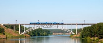
The Sverdlovsk region is an important transport hub - railway, road and air routes of all-Russian importance pass through it, including the Trans-Siberian Railway. The density of the railway and road networks exceeds the national average. Yekaterinburg is home to a large international airport – Koltsovo.
Geography of the Sverdlovsk region
The Sverdlovsk region occupies a territory that geographically belongs to the Middle and partly to the Northern Urals, as well as the Cis-Urals (part of the East European Plain) and the Trans-Urals, the western edge of the West Siberian Plain.
The highest point on the territory of the Sverdlovsk region is Mount Konzhakovsky Stone with a height of 1569 m. The lowest absolute height is 45 m on the Tavda River on the eastern border of the region.
In total, 18,404 rivers and streams flow in the Sverdlovsk region with a total length of over 68 thousand km. Of them:
- rivers up to 10 km long – 17,370, total length over 34 thousand km;
- rivers from 10 to 200 km long – 1027, total length over 26 thousand km;
- rivers more than 200 km long – 17, total length over 8 thousand km.
Most of the rivers belong to the Ob-Irtysh basin, the largest of which are Tavda, Tura, and Iset. Rivers of the Volga-Kama basin flow in the south and southwest, including Chusovaya and Ufa. Sections of the Tavda, Tura, Lozva and Sosva rivers are navigable.
The longest river in the Sverdlovsk region is Tura (795 km). However, the Tavda River together with its tributary Sosva (1152 km, the length of the Tavda alone is 719 km) is usually called this. The fact is that in geography, when determining the significance of a river, it is customary to consider it from its source, and not from the point of confluence of other tributary rivers, the names of which arose as a result of historical factors. The Tavda is the largest river system in the region - its basin area is 44% of the region's area. It also leads in water content. The volume of annual runoff of Tavda on the border of the region is 15.3 cubic meters. km. This is more than half the annual flow of all rivers in the region!
Rivers of the Sverdlovsk region by basin area (percentage of the region's area):
- Tavda – 44%,
- Tura – 37%,
- Ufa – 6.2%,
- Chusovaya – 5.6%,
- Iset – 3.6%,
- Sylva – 2.6%,
- Kosva – 1%.
In the Sverdlovsk region there are more than 2.5 thousand lakes with a surface area of 1100 square meters. km. The largest lake in the Sverdlovsk region is Pelymsky Tuman with an area of 65.7 square meters. km. This is followed by lakes Bolshaya Indra (32.2 sq. km), Vagilsky Tuman (31.2 sq. km). The deepest lake is Bottomless, 49 m deep (according to other sources, 51 or 53 m).
134 reservoirs with a water volume of more than 1 million cubic meters were built on rivers. m, as well as about 1200 ponds. The largest reservoirs: Beloyarskoye, Volchikhinskoye and Reftinskoye. About 15% of the region's territory is occupied by swamps. Most of them are in the northeast.
The climate of the Sverdlovsk region is temperate continental in the west, and continental in the east. Winters are cold and long, summers are moderately warm. The average January temperature is from −16 to −20 °C, the average July temperature is from +16 to +20 °C. Average annual precipitation is 350 mm in the southeast, 500 mm in the north and up to 650 mm in the mountains.
Due to its location at the junction of two large natural regions, the nature of the region is diverse.
The territory is located mainly in the taiga zone, only in the southeast and southwest does it give way to forest-steppe landscapes. Altitudinal zones can be traced in the mountains. The mountainous part is dominated by dark coniferous taiga, in the Trans-Urals - pine forests, in the lowlands in the north - spruce taiga with an admixture of cedar, in the south - a strip of aspen-birch forests and pine forests. In the Cis-Ural region there are areas of forest-steppe and broad-leaved forests. Forests occupy, according to various sources, from 65% to 70% of the total area of the region. The soils are predominantly podzolic, podzolic and peat-bog, soddy-podzolic.
There are 66 species of mammals, 228 species of birds, 6 species of reptiles, 9 species of amphibians and 48 species of fish.
Marriages and divorces
The number of marriages is noticeably decreasing when compared with the second quarter of the last century and the number of divorces is increasing. Thus, in 1955 there were 12.4 marriages per 1000 inhabitants, in 1980 – 10.6 marriages, and in 2022 – 6.4 marriages. The percentage of divorces in the same 1955 was 0.9, and in 2022 it is 4.4; out of 6.4 marriages, more than half break up. In 2022, the situation has not improved, the indicators are approximately the same.
A little history
Man appeared on the territory of the Sverdlovsk region a long time ago. Numerous archaeological sites have been found here, the oldest of which date back to the Paleolithic. The most important event in the world of archeology was the discovery of the Shigir idol (discovered in 1890). This is the oldest wooden sculpture in the world, 11 thousand years old. It can be seen in the Museum of History and Archeology of the Urals in Yekaterinburg.
Russians began to actively populate the territory in the 17th century. The first Russian settlements were Lozvinsky town, Pelym, Verkhoturye, Turinsk.
At the beginning of the 18th century, rapid economic and industrial development of the territory began, and numerous factories and settlements began to appear. The first factories were Nevyansky, Kamensky, Uktussky, Alapaevsky.
Soon the Irbit Fair arose in Irbit, which, thanks to its convenient location between Central Russia and Siberia, became second in terms of trade turnover after the Nizhny Novgorod Fair.
At first, this territory was administratively subordinate to Tobolsk. In the 18th century, the Perm province was created. As a result of the reforms of 1780 and 1796, the territory of the modern Sverdlovsk region belonged to the Ekaterinburg, Verkhoturye, Krasnoufimsky, Kamyshlovsky and Irbit districts of the Perm province, as well as to the Turin district of the Tobolsk province. The chief director of the mining factories of the Ural ridge was located in Yekaterinburg. It was a kind of state within a state.
After the revolution of 1917, the Yekaterinburg province existed for some time. In 1923, the huge Ural region was formed. On January 17, 1934, it was divided into three regions, one of which was the Sverdlovsk region. At first it included the territory of the modern Perm Territory and part of Udmurtia, but did not include several areas classified as Omsk and Chelyabinsk regions.
On October 3, 1938, the Perm region was separated, and 5 districts of the Chelyabinsk region and one district of the Omsk (now Tyumen) region were transferred to the Sverdlovsk region. In June 1942, the Kamensky and Pokrovsky districts, previously belonging to the Chelyabinsk region, were transferred to the Sverdlovsk region. Since then it has acquired modern shape.
The Sverdlovsk region is a multinational region. Russians predominate (about 90%). There are many Tatars in the southwest of the region (region-wide, they are about 4% of the total population); in the Krasnoufimsky, Nizhneserginsky, and Achitsky districts there are Tatar villages and villages. There (as well as in the Artinsky district) there are Mari villages.
Forecast
In general, the forecast for improving the demographic situation and population growth is not very favorable; fewer people are still born than die or leave the region. The population decline is significantly influenced by the unfavorable economic situation in the world, environmental problems, difficulties with local employment, and the desire of young people to study in the capital.
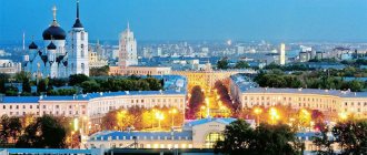
The Sverdlovsk region is one of the largest in terms of population, almost 1.5 million people live in Yekaterinburg alone, but still this region is experiencing demographic problems common to all of Russia.
Industry
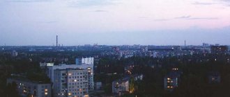
The Sverdlovsk region is one of the largest industrial centers in the country. In terms of industrial production, it ranks second in Russia after the Moscow region. More than 2.5 thousand mining and processing enterprises operate here.
The region's industry began to actively develop in the 18th century. But even greater growth occurred during the Soviet era. During the first five-year plans, old factories were reconstructed, and new huge enterprises were built. During the Great Patriotic War, more than 200 enterprises were evacuated to the Middle Urals. Many of them remained here.
The region's subsoil is rich in minerals. Here, for the first time in Russia, gold, emeralds, platinum, malachite, and a number of gems were discovered. Currently, iron, copper, nickel, chromium, manganese, titanium, vanadium, gold, platinum, silver, asbestos, bauxite, precious and semi-precious stones, rare earth elements, etc. are mined from mineral resources.
In the city of Berezovsky, on whose territory the country's first large gold deposit was discovered, the longest operating gold mine in the world is located. And in the Nizhny Tagil district in the 19th century, the richest platinum placers were discovered. Thanks to this discovery, Russia took first place in the world in the extraction of this metal.
A semi-precious strip runs along the eastern slope of the Ural Mountains, on the territory of which dozens, if not hundreds of mines of precious and semi-precious stones have been found. Rubies, sapphires, beryls, amethysts, topazes, tourmalines, etc. were found here.
The largest emerald deposit in Russia is located in the Sverdlovsk region. Previously, the Middle Urals were famous for their malachite, a valuable ornamental stone. It was mined at the Gumeshevskoye deposit in Polevskoye and at Mednorudyanskoye in Nizhny Tagil. Ural malachite can be seen in the Hermitage, St. Isaac's Cathedral, some palaces, and also in museums. However, all the malachite was quickly worked out.
In the city of Asbest there is the world's largest Bazhenov deposit of chrysotile asbestos. The size of the active quarry amazes tourists who come here: length 11.5 km, width about 2 km, depth 350 m.
Among the industries, ferrous and non-ferrous metallurgy is the most developed (31 and 19% of the total industrial production). The main industrial centers: Yekaterinburg, Nizhny Tagil, Pervouralsk, Kamensk-Uralsky, Serov, Novouralsk, Asbest and other cities. Electricity is generated by the Beloyarsk NPP, Reftinskaya, Sredneuralskaya, Verkhnetagilskaya, Nizhneturinskaya, and Serovskaya State District Power Plants. Moreover, Reftinskaya GRES is the largest thermal power plant in Russia operating on solid fuel.
At the same time, due to the large number of industrial enterprises, the Sverdlovsk region (along with the neighboring Chelyabinsk region) traditionally occupies the last lines of environmental ratings as a result of serious environmental pollution. Recently, even the once cleanest northern rivers were poisoned by the UMMC company. The most polluted city in the region is Nizhny Tagil.
Main characteristics of the population composition
There are more women than men in the Sverdlovsk region by 7.6 percent. The male population is smaller for many reasons: harmful working conditions, environmental problems in the region, bad habits.
In recent years, the proportion of children has been decreasing. On the contrary, the proportion of elderly residents is growing, especially in rural areas.
Tourism in the Sverdlovsk region
Numerous and varied attractions of the Sverdlovsk region attract tourists. There are interesting places to suit every taste.
Of the natural attractions, the mountains are very interesting. The highest of them are located in the north of the region, including the main peak of the region - the Konzhakovsky stone. In the central and southern parts the mountains are low, but also beautiful and interesting, and also easily accessible. It is worth noting the mountains Kachkanar, Shunut, Volchikha, Azov Mountain, Merry Mountains, and Sinaya. In the vicinity of Yekaterinburg, the bizarre granite rocks of Chertovo Gorodishche, Petrogrom, and Seven Brothers are very popular.
Thanks to the terrain, there are many ski centers. The largest of them are located on the Belaya, Ezhovaya, and Volchikha mountains. A ski jump complex has been built on Mount Dolgaya in Nizhny Tagil, where world-class competitions are held.
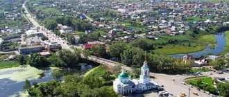
Among the architectural and historical attractions, it is worth noting the Nevyansk Leaning Tower, covered in dark legends. And in the city of Verkhoturye, the Verkhoturye Kremlin was recently rebuilt - the only one in the Urals and considered the smallest in Russia.
The Sverdlovsk region is fertile ground for the development of industrial tourism. The only full-cycle metallurgical plant-museum in Russia (and, apparently, in the world) is located here (in the city of Nizhny Tagil). And in Polevskoye the Severskaya blast furnace has been preserved - the only example of industrial architecture of the 19th century in a good state of preservation in Europe. Also among the museums, the most interesting are the Yeltsin Center, Sverdlovsk Regional Museum of Local Lore, and the House-Museum of P.I. Tchaikovsky in Alapaevsk, museum-reserve of wooden architecture in Nizhnyaya Sinyachikha.
Foreigners who come here generally associate the Sverdlovsk region with the place of the assassination of the last Tsar and with the border of Europe and Asia. Business tourism is widely developed in Yekaterinburg. One of the unique brands of Ekaterinburg, which has no analogues, is the numerous buildings in the constructivist style.
In addition to Yekaterinburg, it is worth visiting Nizhny Tagil, Nevyansk, Irbit, Verkhoturye and others. The longest operating narrow-gauge passenger railway in Russia begins in Alapaevsk. And near the village of Sloboda on Chusovaya there is the only astronomical observatory in the Urals - Kourovskaya.
Water tourists go rafting along the picturesque rivers: Chusovaya, Serga, Iset, Rezh, Kakva, Sosva, Ivdel, Tagil, Ufa, Neiva, Pyshma, Shishim, Serebryanka, Sulem. Of these, the Chusovaya River is the most beautiful. There are numerous rocks along the banks of the rivers. Extreme enthusiasts are attracted to the Revun rapids on Iset.
On the territory of the region there are caves, sinkholes, arches and other forms of karst relief. Among the most popular caves: Smolinskaya, Druzhba, Arakaevskaya.
In the Sverdlovsk region, the Olenyi Ruchi, Chusovaya River, and Bazhovsky Places natural parks, the Pripyshminskie Bors national park, the Denezhkin Kamen and Visimsky nature reserves, as well as the Rezhevskoy natural and mineralogical reserve have been created.
On the website of the Uraloved project you will find detailed descriptions of the sights of the Sverdlovsk region, as well as the most interesting settlements. It is convenient to plan routes using a general map of the attractions of the Urals. On the YouTube channel of the Uraloved project you can watch videos from our trips to places in the Sverdlovsk region. I wish you interesting travels around the Urals! Thank you for your attention!
Pavel Raspopov
SourcesWikipedia Kapustin V.G., Kornev I.N. Geography of the Sverdlovsk region. – Ekaterinburg, 1997. Rundqvist N.A., Zadorina O.V. Sverdlovsk region. From A to Z: Illustrated encyclopedia of local history. — Ekaterinburg, 2009.
Ethnic composition of the area
The population of the Sverdlovsk region is represented predominantly by Russians. There are 90 percent of them. Other ethnic groups represented in the region are the Tatars (3.54%), the second largest nationality. The Tatar population lives mainly in Yekaterinburg (65%). Each of the following ethnic groups has less than one percent of the population: Ukrainians, Bashkirs, Maris, Azerbaijanis, Germans.
The Bashkir population of the Sverdlovsk region lives compactly in the Mikhailovsky, Krasnoufimsky, Nizhneserginsky, Artinsky, Kamensky districts. In the last half century, the number of representatives of this nationality has doubled (from 14 to 31 thousand people).
Germans are the fourth largest ethnic group. They were resettled here from the Volga region during the years of Stalin's repressions. They live in the cities of Krasnoturinsk, Karpinsk, and Ivdel. Ukrainians in the Sverdlovsk region are descendants of Ukrainian residents who moved here in the 18th century.