This article is a draft for the Russian location. You can share your knowledge by improving it ( How? or What?
) according to the recommendations of the relevant projects.
| Zelenokumsk (RU)Zelenokumsk | |
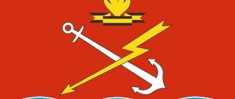
| Heraldry | Flag |
| Administration | |
| A country | Russia |
| Economic region | North Caucasus |
| Federal District | North Caucasus |
| Federal subject | Stavropol region |
| Mayor | Alexey Kobernyakov |
| Postal code | 357910 — 357916 |
| OKATO code | 07 250 501 |
| Approximate | ( 7) 86552 |
| Demography | |
| Population | 34,113 hubs (2020) |
| Density | 1,421 people / km2 |
| Geography | |
| Contact Information | 44°24′N, 43°52′E |
| Height | Min. 140m Maximum. 180m |
| Square | 2,400 Ha = 24 km2 |
| Timezone | UTC 04:00 |
| Different | |
| Fund | 1762 |
| Status | City since 1965 |
| Location | |
| Geolocation on the map: Russia | |
Geolocation on the map: European Russia
| Zelenokumsk |
Geolocation on the map: European Russia
| Zelenokumsk |
Zelenokumsk
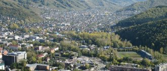
(in Russian: Zelenokumsk) is a city in Stavropol Krai, in Russia, and the administrative center of Sovetsky District. Its population was 34,113 inhabitants in 2022.
Population
Censuses (*) or population estimates[2]
Demographic evolution
| 1939 | 1959 | 1970 | 1979 | 1989 | 2002 |
| 10 700 | 11 503 | 29 691 | 32 053 | 35 323 | 40 340 |
Demographic changes continued (1)
| 2010 | 2012 | 2013 | 2014 | 2015 | 2016 |
| 35 839 | 35 802 | 35 772 | 35 625 | 35 639 | 35 568 |
Demographic changes continued (2)
| 2017 | 2018 | 2019 | 2020 | — | — |
| 35 646 | 35 501 | 34 690 | 34 113 | — | — |
Map
| Zelenokumsk: maps |
Zelenokumsk: photo from space (Google Maps) Zelenokumsk: photo from space (Microsoft Virtual Earth)
| Zelenokumsk. Nearest cities. Distances in km. on the map (in brackets along roads) + direction. Using the hyperlink in the distance , you can get the route (information courtesy of the AutoTransInfo website) | |||
| 1 | Soldato-Alexandrovskoe | 19 (23) | SW |
| 2 | Newly established | 26 () | SW |
| 3 | Abundant | 32 () | SW |
| 4 | Chernolesskoye | 36 (92) | WITH |
| 5 | Krasnokumskoe | 40 () | SW |
| 6 | Podgornaya | 43 (46) | SW |
| 7 | Praskovey | 44 () | NE |
| 8 | Georgievsk | 44 (53) | SW |
| 9 | Soviet | 45 () | YU |
| 10 | Budennovsk | 45 (53) | NE |
| 11 | Georgievskaya | 46 () | SW |
| 12 | Alexandria | 48 (50) | SW |
| 13 | Kindly | 50 () | SW |
| 14 | Novoselitskoye | 51 (115) | NW |
| 15 | Deceased | 53 () | NE |
| 16 | Novopavlovsk | 53 (79) | YU |
| 17 | Stepnoe | 57 () | IN |
| 18 | Lysogorskaya | 60 () | SW |
| 19 | Levokumka | 61 (70) | Z |
| 20 | Kursk | 62 (70) | SE |
| 21 | Mineral water | 63 (72) | Z |
| 22 | Andzhievsky | 65 () | Z |
| 23 | Edission | 67 () | SE |
| 24 | Maryinskaya | 68 () | SW |
| 25 | Karagach (Kabardino-Balkarian Republic) | 69 () | YU |
| 26 | Konstantinovskaya | 71 () | SW |
| 27 | Cuba (Kabardino-Balkarian Republic) | 71 () | SW |
| 28 | Inozemtsevo | 72 (87) | SW |
| 29 | Zolskaya | 73 () | SW |
| 30 | Chill | 73 (120) | YU |
a brief description of
Located in the Ciscaucasia, on the Stavropol Upland, on the river. Kuma, 265 km east of Stavropol. Railway station.
Territory (sq. km): 508
Information about the city of Zelenokumsk on the Russian Wikipedia site
Historical sketch
It arose in 1762 as the village of Vorontsovo-Aleksandrovskoye on the lands of Count Alexander Vorontsov through the resettlement of peasants from the village of Vorontsovka and the settlement of Aleksandrovka, Voronezh province, named after the name and surname of the owner.
In 1963, the village was renamed Sovetskoye. The city of Zelenokumsk since October 9, 1965, was formed from the village of Sovetskoye (11.5 thousand inhabitants, 1959) and the village of Novogrigorievskoye (9.9 thousand inhabitants, 1939; 10.7 thousand inhabitants, 1959).
Name by location on the river. Kuma; The definition of green has a purely conditional meaning.
Economy
(low-voltage equipment), "Stroymash", auto repair, experimental mechanical. Weaving factory.
Food industry enterprises: factories - dairy and food products, etc.
In the Sovetsky region, wheat, corn, peas, sunflowers, vegetables, grapes, etc. are grown. Production of milk, wool, and meat. Pig farming.
Deposits of sand and gravel mixtures, loams.
Museums, galleries, exhibition halls
Zelenokumsk Museum of Local Lore 357900, Stavropol Territory, Zelenokumsk, sq. Lenina, 74 Phone(s): (86552) 21-246
Architecture, sights
In the village of Otkaznoe, 20 km west of Zelenokumsk, there is the Church of St. Nicholas the Pleasant (1902, brick; in operation since 1992).
| Population by year (thousands of inhabitants) | |||||||
| 1939 | 10.7 | 1996 | 38.8 | 2007 | 40.2 | 2015 | 35.6 |
| 1959 | 11.5 | 1998 | 39.5 | 2008 | 40.5 | 2016 | 35.6 |
| 1967 | 29 | 2000 | 40.0 | 2010 | 40.6 | 2017 | 35.6 |
| 1970 | 29.7 | 2001 | 39.8 | 2011 | 35.8 | 2018 | 35.5 |
| 1979 | 32.1 | 2003 | 40.3 | 2012 | 35.8 | 2019 | 34.7 |
| 1989 | 35.1 | 2005 | 40.3 | 2013 | 35.8 | 2020 | 34.1 |
| 1992 | 36.1 | 2006 | 40.1 | 2014 | 35.6 | 2021 | 33.7 |
Notes and links
- Distances in a straight line or distances in a great circle.
- “Censuses and population estimates since 1897”, on pop-stat.mashke.org - (RU) “Federal Statistical Office, All-Russian Population Census 2010
”, on www.ru - (RU) “Resident population by municipality formations of the Russian Federation in the 1st January 2012 "[rar], on gks.ru - (RU)" Number of resident population in the municipalities of the Russian Federation in the 1st January 2013 "[rar], on gks.ru
Zelenokumsk
(Stavropol region)
OKATO code:
07250501
Founded:
1762
City since:
1965 City of regional subordination
Center:
Sovetsky district
City was formerly called:
| Vorontsovo-Alexandrovskoe | 1963 | |
| Soviet | 1963 | 1965 |
| Telephone code (reference phone) | |
| 86552***** | 21-1-68 |
Deviation from Moscow time, hours:
0
Geographic latitude:
44°25′
Geographic longitude:
43°53′
Altitude above sea level, meters:
145 Sunrise and sunset times of the Sun and Moon in the city of Zelenokumsk
Education
- Kindergarten No. 1 “Swallow”[33]
- Kindergarten No. 3 “Thumbelina”[34]
- Kindergarten No. 4 “Beryozka”[35]
- Kindergarten No. 5 “Snowflake”[36]
- Kindergarten No. 6 “Teremok”[37]
- Kindergarten No. 7 “Ogonyok”[38]
- Kindergarten No. 10 “First of May”[39]
- Kindergarten No. 14 “Ivushka”[40]
- Kindergarten No. 15 “Cheburashka”[41]
- Kindergarten No. 23 “Golden Key”[42]
- Kindergarten type No. 25 “Firefly”[43]
- Kindergarten No. 33 “Rodnichok”[44]
- Kindergarten No. 35 “Kolobok”[45]
- Kindergarten No. 39 “Skvorushka”[46]
- Kindergarten No. 40 “Topolek”[47]
- Secondary school No. 1[48]
- Secondary school No. 2[49]
- Secondary school No. 3[50]
- Secondary school No. 12[51]
- Secondary school No. 11[52][53]
- Secondary school No. 13[54]
- Secondary school No. 14[55]
- Evening (shift) secondary school No. 2[56]
- Multidisciplinary technical school[57]
- Children's music school[58]
- Children's art school[59]
- Children's and youth sports school[60]
- Children's and youth sports school for football[61]
- Center for Extracurricular Activities[62]
Monuments
Monuments of history and culture
- Monument to soldiers who died in battles with the Nazi invaders in January 1943 for the liberation of the village. Vorontsovo-Alexandrovsky. 1947[66]
- Fire of Eternal Glory to those who died during the Civil and Great Patriotic Wars. 1975[67]
- Monument to fallen defenders in local wars. 2003[68]
- Memorial to the soldiers of military unit 3673 who died in the Chechen wars (town No. 2 on the territory of military unit 6814)
- Memorial plaque for the evacuation hospital and graduates of secondary school No. 1 who fell in the battles of 1941-1945
- Monument to V.I. Lenin (central square)
- Monument to V.I. Lenin (near the Palace of Culture)
- Monument to V.I. Lenin (in the management of the Pension Fund
- Monument to V.I. Lenin (in the courtyard of JSC VELAN)
- Obelisk to Hero of the Soviet Union Y. S. Ardintsev
- Monument to Peter and Fevronia. 2012[69]
Monuments of urban planning and architecture
- Kashchenko's house. Now it houses a children's music school and a registry office[70]
- Shopping arcades. Now it is the Museum of Local Lore
Private advertisements in Zelenokumsk, Stavropol Territory and Russia
To add an advert
Stavropol
Repair EMOTRON FDU VFX VSA VSC CDU CDX DSV FDU40 FDU48 VFX48 CDU48 NGD …
Stavropol
Repair Vipa System CPU 100V 200V 300S 500S SLIO ECO OP CC TD TP 03 PPC …
Stavropol
carousel machine 1512,1531m
Stavropol
Drug treatment clinic Elysium - Treatment of alcoholism and drug addiction
123ru.net
- minute-by-minute news with a daily archive. Only here we have all the main news of the day without political censorship. “123 News” - absolutely all points of view, sober analysis, civilized debates and discussions without mutual accusations and insults. If you don’t like it, don’t want to hear it, don’t read it, read it, be mutually polite and correct in your statements. Remember that not everyone's point of view coincides with yours. Respect the opinions of others, even if you defend your views and your position. 123ru.net is a news observer. We do not impose our vision on you, we give you a snapshot of the events of the day without censorship and without cuts. News as it is—online with minute-by-minute archives for all cities and regions of Russia, Ukraine, Belarus and Abkhazia. 123ru.net - live news live! A quick search from 123ru.net is not only the opportunity to be the first to know, but also the advantage of reporting breaking news instantly in any language in the world and being heard right away. You can add your news at any moment - here.
Religion
Russian Orthodox Church
- In 1998, priest Gennady (Litomin), with the blessing of Metropolitan Gideon, began construction of an Orthodox church, which (like the first church in Zelenokumsk) was named in honor of Peter and Paul. The Orthodox Church of Peter and Paul, built in 1791, later became a chapel of the Kazan Cathedral, which was destroyed in 1938.
- Orthodox Church of the Kazan Icon of the Mother of God - st. Krupskaya, 107
- Chapel in honor of the holy passion-bearer Tsarevich Alexei at the children's hospital[63]
Protestantism
- The Seventh-day Adventist prayer house is located at 91 Zavodskaya Street.
- The prayer house of Evangelical Christian Baptists is located at the address: Zavodskaya Street, 162/a.
The city of Zelenokumsk is the administrative center of the Sovetsky district of the Stavropol Territory and the municipal formation of the city of Zelenokumsk . Located in the south-eastern part of the Stavropol Territory, between the Stavropol Upland and the Caspian semi-deserts, at the crossroads where Europe meets Asia, 70 km from the Caucasian Mineralnye Vody region (Pyatigorsk, Kislovodsk, Mineralnye Vody).
Population 42 thousand people. The area of the city is 2369 hectares.
In 2010 the city will celebrate its 229th anniversary.
By decree of Catherine II in 1788 A.R. Vorontsov was demarcated land in Georgievsky district “... below the village of Otkazny, on the right side of the Kuma River.” The count received more than 15 thousand acres of the Kumite steppes. Even earlier, there was a settlement here, founded in 1781 by retired soldiers. The soldiers obediently vacated the count's allotment, moving to neighboring farms and villages. In 1789, the first 48 peasants from the count’s Voronezh estate were resettled to Vorontsov’s “Caucasian Village”. At first it was called the Alexandrovskaya settlement, later the name Vorontsovo-Alexandrovsky was established behind it.
By 1844, there were already 3,558 souls in the “Caucasian village” of the Vorontsovs. A large stud farm, five mills, and 16 leather workshops operated successfully.
At the beginning of the twentieth century, the main production was the cultivation of grain and the development of livestock farming. The largest trade in bread was launched by the Kashchenko and Sons trading house.
In 1918 in the village. Vorontsovo-Aleksandrovskoye became the center of a revolt of strong, wealthy peasants and traders from the villages of Vorontsovo - Aleksandrovskoye, Novogrigoryevskoye, Soldato-Alexandrovskoye, Starodubskoye, Tomuzlovskoye and Chernolesskoye. After the establishment of the power of the “White Army” in the spring of 1919, the inhabitants of the village of the district were liberated from Denikin’s troops, and Soviet power was established in the settlements.
In the fall of 1941, the Rostov Artillery School was transferred to the village. His cadets learned the basics.
On August 17, 1942, the Nazis entered the village. The dark days of the occupation continued for almost five months.
January 10, 1943 p. Vorontsov-Aleksandrovsok was completely released.
The village of Vorontsovo-Aleksandrovskoye was renamed the village of Sovetskoye by the Decree of the Presidium of the Supreme Soviet of the RSFSR dated June 5, 1963.
In 1965, by the Decree of the Presidium of the Supreme Soviet of the RSFSR dated October 9, 1965, the village of Sovetskoye was transformed into a city of regional subordination and given the name the city of Zelenokumsk .
Today Zelenokumsk is a large regional center. Its industrial potential consists of 11 industrial enterprises in various industries: mechanical engineering, instrument making, food and processing industries, construction materials, service enterprises, trade, transport, as well as three agricultural enterprises.
The leading role among them rightfully belongs to JSC VELAN, which produces unique devices used in the mining industry and the military-industrial complex, and JSC Tsigel is the leading enterprise in the Stavropol Territory for the production of sand-lime brick. The Zelenokumsk land gives people the fruits of its vineyards. OJSC "Yantar" has specialized in wine production for many decades.
The Zelenokumsky Museum of Local Lore operates in the city .
Telephone code: +7 86552 Official website of the city: www.mo-zelenokumsk.ru

